Introduction
Oakly Park has a very large landscape park, and a garden in the vicinity of the house.
Terrain
The park lies on ground rising from the River Teme, which forms its northern boundary.
The first reference to the park at Oakly is in the late 15th or early 16th century, when it was called a 'new park.' Both Saxton and Speed show a park at Oakly, and in 1617 it is recorded that the park kept more sheep and cattle than deer.
The park reputedly originally comprised 900 acres, and while there is no record for its reduction to less than half that size, there is evidence for alteration between 1752 and the late 19th century. The boundaries of the park shrunk during this period, mainly in its northern reaches. On Rocque's 1752 map of Shropshire, the north-west extent of the park lies beyond the River Teme, and its north-east is defined by the Onny River. But in 1808, Baugh's map of the county indicates a reduction in both of these northern areas.
There were considerable changes in the late 18th century at Oakly, but who was mainly responsible for them is uncertain. Capability Brown was called in by Lord Clive in August 1772, and while his proposals were acceptable, Clive's death in 1774 may have prevented their execution. William Emes did work at Oakly in 1774, but the nature and extent of his involvement is unclear.
The reductions in the park's size that took place in the 18th century were apprently remedied by the second decade of the 19th century. At this time it is probable that the estate in the north-west spread well beyond the Teme and, in the north-east, beyond the Onny towards and up to the main Bromfield-Ludlow road. By the late 19th century the boundary in the north-west had moved again, however, and lay to the east of the Teme.
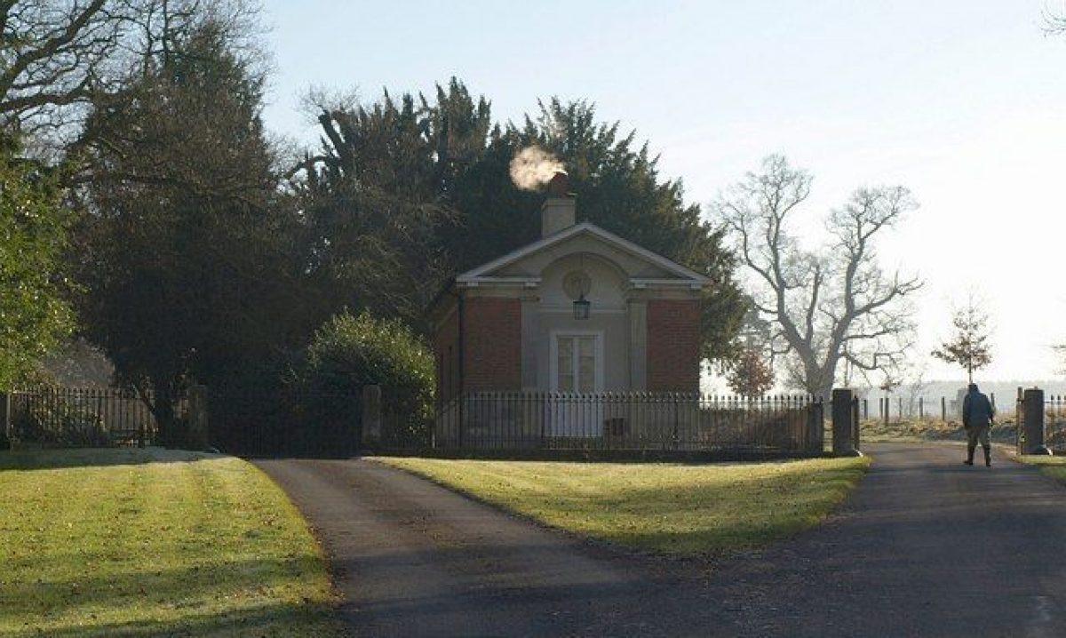
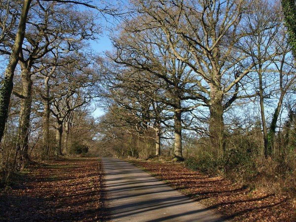
In the late 19th century the park had two lodges: in the north-east was a neo-Classical lodge of 1826-7, designed by C.R. Cockerell. The second lodge was sited in the south-east, on what was the lower Ludlow-Bromfield Road. It would appear that the main tree-lined avenue through the park is aligned north-west to south-east along this former road.
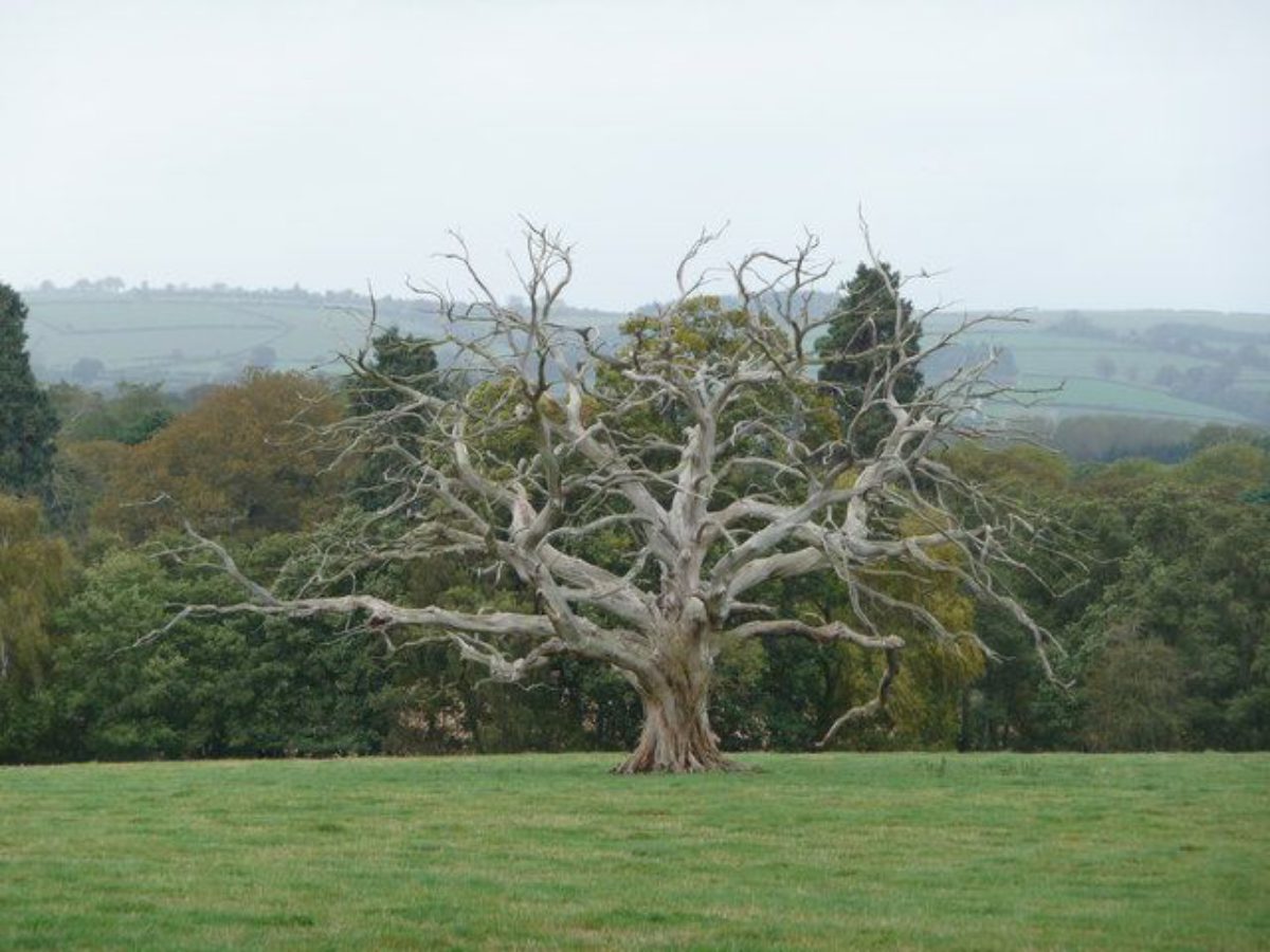
The park featured many mature oaks, some of considerable age and size, which were in 1891 called 'Druid Oaks' and may have given the park its name. It also had various features including several pheasantries, a maze, and the 'cricket pool.' There was also a tree-lined ride called 'The Duchess Walk,' which ran from the wooded area in the south-west to the pheasantry in the south-east. Cockerell created formal gardens at Oakly to accompany his alterations to the house, adding a conservatory and an adjacent parterre garden with a central fountain. Both date to 1824. The gardens were fully complete by 1838, when they were described as having a small rosarium, an artificial rocky glen, a shell grotto, and walks along the river bank. The kitchen gardens lay east of and separate from the house. The garden survived in the 1990s, but the conservatory is lost.
The following is from the Register of Parks and Gardens of Special Historic Interest. For the most up-to-date Register entry, please visit the The National Heritage List for England (NHLE):
www.historicengland.org.uk/lis...
Gardens of 1820s, and pleasure grounds and park improved c 1780 by William Emes, associated with a country house.
DESCRIPTION
LOCATION, AREA, BOUNDARIES, LANDFORM, SETTING
Oakly Park lies c 3km north-west of Ludlow, south of the village of Bromfield on the main A49 Ludlow to Shrewsbury road. The park lies on ground rising from the River Teme, which forms its northern boundary. South of the park the ground continues to rise, to the wooded slopes of Lower Whitcliffe and Bringewood c 2km to the south which form the main feature of the view south across the parkland. The area here registered is c 160ha.
ENTRANCES AND APPROACHES
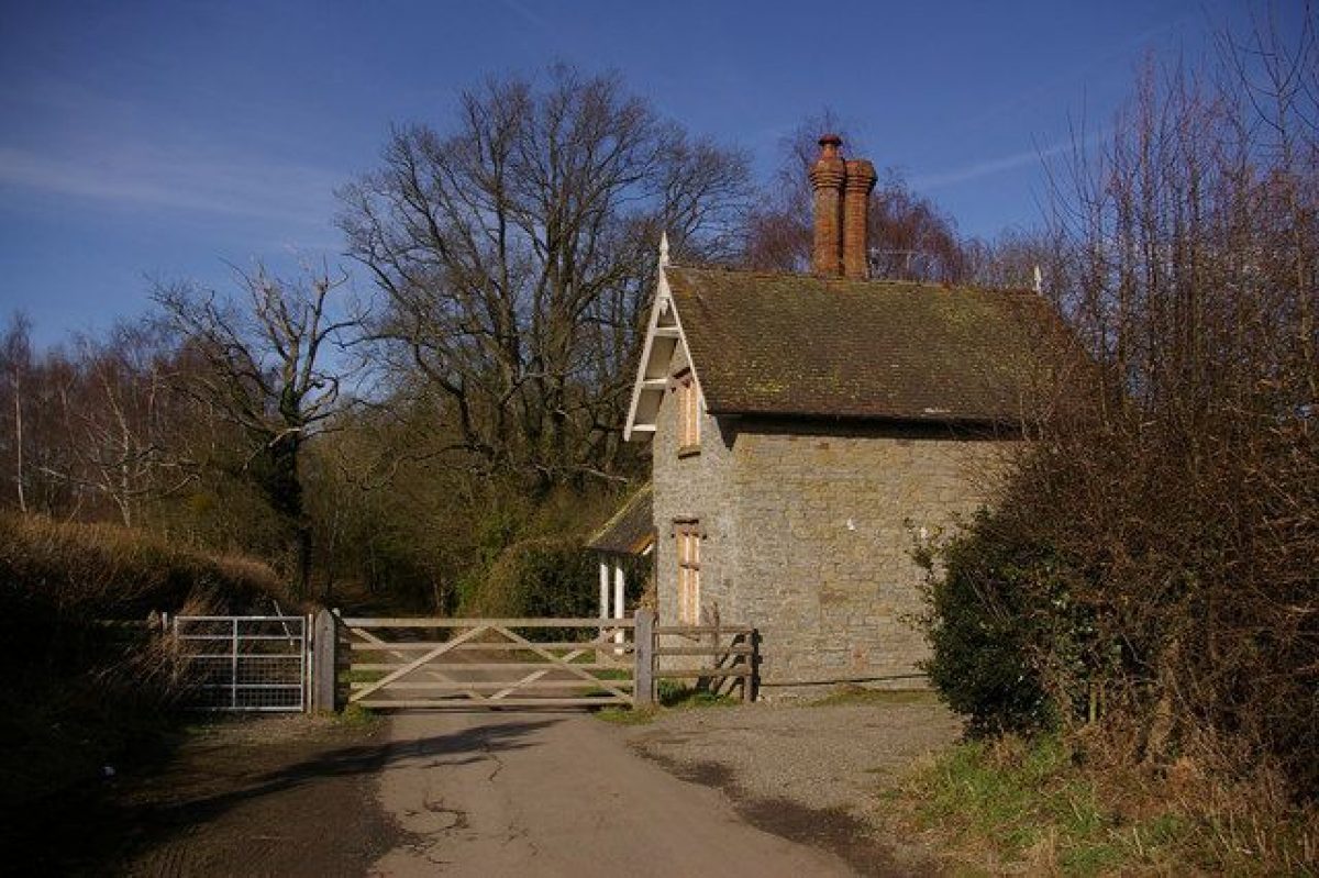
Oakly Park is approached from Bromfield, via an estate road to the simple, classical, Bromfield Lodge (listed grade II) by C R Cockerell of 1826-7. This has railings and a gate (also listed grade II) to either side. The gate to the east stands at the head of a 500m long drive which passes along the edge of the woods above the River Teme before arriving at the gravelled forecourt on the west side of the house. The west gate serves the main estate road through the park. At the south end of that road, 300m north of Priors Halton, is a back lodge.
PRINCIPAL BUILDING
Oakly Park house (listed grade II*) probably originated as the hunting lodge rebuilt in 1552-3. That house, on a bluff above the River Teme, was rebuilt in the early C18 and subsequently altered by William Baker (d 1771) in 1748-58, by John Hiram Haycock (d 1830) in the 1780s and again by C R Cockerell (d 1863) in 1820. The entrance side is on the west, and here Cockerell added a one-storey screen with two symmetrical porches in antis. To the south Cockerell added a flat, one-storeyed attached portico of pilasters with a heavy balcony above. A conservatory or orangery to the east designed by Cockerell in 1824 was largely demolished in the 1930s.
The brick stables (listed grade II) 200m south-east of the house were built in the 1780s by J H Haycock. They were later converted for use as a separate family house.
GARDENS AND PLEASURE GROUNDS
To the west of the house, overlooking rising parkland, is the gravelled forecourt. South of the house, and extending for c 150m, is a lawn with a small number of mature specimen trees. To the east of the house is the East Parterre and Orangery Colonnade (elements listed grade II). The Parterre, c 30m square, is gained via steps down from the gravel terrace along the east side of the house. It has a central, cast-iron fountain (in 1838 scoffed at for being painted to resemble marble), surrounded by petal-shaped, box-edged beds ('The Coffins'). Along the east edge of the Parterre is a balustrade with cast-iron balusters (again presumably marbled originally) and a stone rail. The Colonnade, along the north side of the Parterre, comprises copies (with one original) of the main piers of a greenhouse (the curved iron roof of which was made by Jones & Clark of Birmingham) which stood here until demolished in the 1930s. This, and the other architectural features of the East Parterre, were designed in 1824 by Cockerell. The Coffin beds, too, may be of c 1824; certainly they were present by c 1850 (CL 1956, 382). From the Parterre there is a striking, tree-framed view to Titterstone Clee Hill 12km to the east.
A gravel path runs beneath the east balustrade of the East Parterre, leading north to a gate which gives access to the walks on the slope leading down to the River Teme. To the south the path drops into the Rockery, a roughly circular quarry garden probably of a similar date to the East Parterre, and certainly present by 1838 when it was praised by a correspondent to the Gardener's Magazine. On the north side of the Rockery is a collapsed grotto, said in 1838 to have been made by Lady Harriet Clive. Rising on the west side of the Rockery is a slightly raised shrubbery, also noted in 1838. A path leaves the east side of the Rockery via a megalithic, pedimented doorway.
The pleasure grounds include two substantial areas of ornamental woodland with walks. One takes in the land sloping down to the River Teme, at its steepest below the house, between Bromfield Bridge and the kitchen garden. About 1791 a bridge was built across the river, to serve the pleasure grounds. It is unclear whether this occupied the same site as the present footbridge, 350m north-west of the house. As well as mature coniferous and other specimen trees there are a few ancient oaks, notably near the stables. One at least, on the west side of the stables, is a survivor of the Druid Oaks, the veteran trees commented on and photographed (Stamper 1996, 84) at Oakly in the C19. In the late C19 there was a maze c 200m south-east of the bridge; this no longer survives. The second area of ornamental woodland is Brick Kiln Covert, otherwise known as The Pinetum, which extends around and south-east of a pool 150m south of the stables first mapped in the 1770s. Much of Emes' energies during the period 1774-81 when he was employed at Oakly were concentrated on its 'pleasure grounds'; the distribution of mature specimen trees suggests these included the woodlands as well as the immediate surrounds of the house. Estate accounts show that during Emes' employ trees were planted and flowering shrubs purchased from the Birmingham nurserymen Brunton & Co (by 1789 Brunton & Forbes & Hunter). South of the house Emes may have laid out a flower garden; the 1838 correspondent noted the 'variously shaped beds, filled with showy flowers'. These beds no longer survive.
PARK
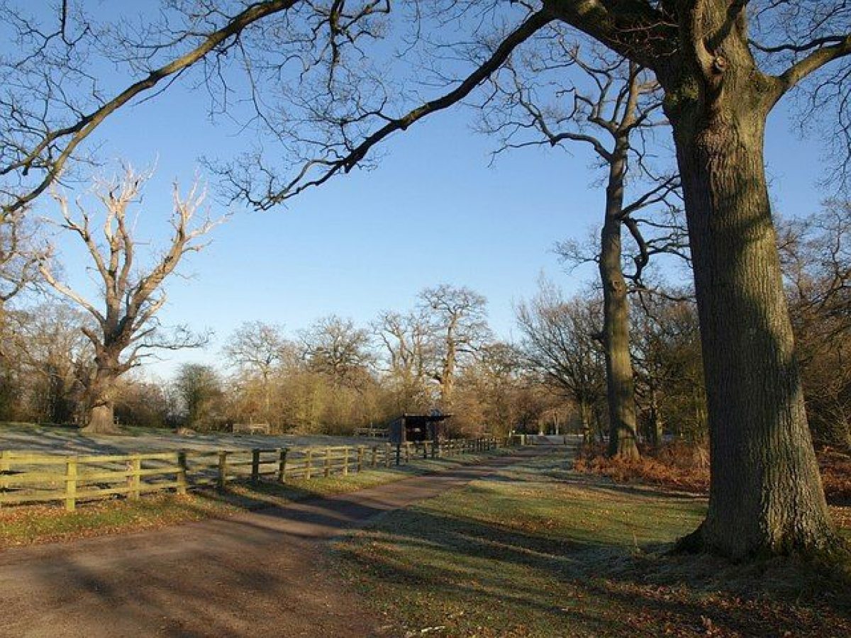
As the park is approached across Bromfield Bridge there is a view of Bromfield church (the Foxes' old house), the river, the ornamental woodland on the south bank of the Teme, and Bromfield Mill, a substantial and scenic stone and brick complex (listed grade II) whose restoration was anticipated in 1998. The main road south-east through the park from the Bromfield Lodge was lined with an avenue by 1733; veteran oaks 250m south-east of the Lodge may be survivors of this original planting. Long sections of the avenue in the middle of the park were replanted in the late C19. Some 400m south of Pheasantry Covert (present by 1770s) an estate road (tree lined in 1770s but not now) leads to the eastern end of Duchess Walk, a straight, 1km long avenue along the south-west boundary of the park established in the mid C18 and replanted with oaks in the late C19. Hospital Coppice, possibly so-named after one element of a Second World War camp in the park, on the north side of Duchess Walk, was present by the 1770s. The central and western parts of the park are divided into arable fields; within these and in their boundaries there are only a very few parkland trees.
The south bank of the Teme west of Bromfield Bridge is also wooded, including High Trees on the west edge of the park where trees and shrubs were being planted in the early 1780s. Near Cricket Pool (Crickets Pool in 1733), and presumably filled from it, is an icehouse, now blocked.
In the Middle Ages the park was part of the chase attached to Ludlow Castle. Some reorganisation of boundaries may have taken place in the late C15 as in 1490 Richard Sherman was appointed Keeper of the 'New Park' of Oakly (Faraday 1991, 30). In 1552-3 the Crown pulled down the old hunting lodge in the park and replaced it with a substantial glazed and tiled lodge which absorbed 220 loads of timber and 160 of stone. In 1617 Sir Charles Foxe kept 'more sheep and cattle than deer' in the park (Stamper 1996, 7). In the later C17 or early C18 the park was provided with avenues. In 1733 there were two, one flanking the main road south-east through the park and the other (no longer extant) parallel with it, 500m long, and ending at Park Pool (at the eastern tip of the registered area). By the 1770s when a second estate map was drawn there were about eight avenues, including a patte d'oie radiating south from the house. Between the two dates the park was also enlarged to the south and west, from 143ha in 1733, taking in closes and strip fields north of Priors Halton and Lady Halton, while Rocque's county map of 1752 (unlike any other) shows the park embracing Yeld Bank and other land north of the Teme. By the time the second estate map was produced it had apparently been decided to landscape the park, which Clive's friend Professor John Mainwaring reckoned 'rude and savage' (Stroud 1975, 172). Lancelot Brown (d 1783) visited Lord Clive at Oakly in 1772, but in the event it was William Emes who was employed as improver; he began work several months before Clive's death in 1774. An unusual item for which Emes was paid, in 1774, was bringing sheep from Leicester.
KITCHEN GARDEN
The brick-walled kitchen garden lies in the north-east corner of the park, 400m east of the house on relatively low and frost-prone ground on the south bank of the River Teme. The main brick-walled compartment is believed to have been constructed c 1820, and occupies what in the 1770s was a paddock outside the east boundary of the park. It seems therefore to have been among the improvements at Oakly which followed R H Clive's inheritance. The main compartment is rectangular and measures 160m long from east to west and 80m wide. The walls are c 6m tall, and have protruding slate hood-moulds along their tops. Nailed to the south wall are several lead fruit labels of the 1840s. Against the west half of the north wall, which was heated, are a lean-to vinery and fig house, both probably built c 1900 but re-using older wooden superstructures. Nearby to the east is a free-standing mist house. In the centre of the garden is a small, circular pool. The garden remains in production, for fruit, flowers and vegetables.
Abutting the north-east corner of the garden is a substantial brick gardener's house of c 1820 with later additions. Extending west from this, along the back of the north wall, is a range of brick sheds including fruit and root stores, boiler room, and gardeners' privy. To the south of the main compartment is another, c 100m square. This is now an orchard with rough grazing; historically the area was known as the Melon Ground.
Adjoining the west side of the main compartment is a hard tennis court, swimming pool and associated facilities, built in the 1960s.
REFERENCES
Gardener's Magazine 14, (1838), pp 212-13
Country Life, 119 (1 March 1956), pp 380-3; (8 March 1956), pp 426-9; no 12 (22 March 1990), pp 152-3
D Stroud, Capability Brown (1975), p 172
M Faraday, Ludlow 1085-1660 (1991)
Trans Woolhope Natur Fld Club 47, (1992), pp 210-36 and pls
P A Stamper, Historic Parks and Gardens of Shropshire (1996), pp 7, 28, 54-5, 64, 84-5
Maps
Oakly Park, 1733 (3424), (Shropshire Records and Research Centre)
J Rocque, Map of Shropshire, 1752 Oakly Park, c 1770 (DP 587), (Shropshire Records and Research Centre)
OS 6" to 1 mile:
1st edition surveyed 1884, published 1885
2nd edition surveyed 1902, published 1903
OS 25" to 1 mile:
1st edition surveyed 1883-4, published 1887
2nd edition surveyed 1902, published 1904
Archival items
Shropshire Records and Research Centre holds papers including late C16 and C17 leases etc relating to Oakly Park (20/6/127(47) and account books 1771(5 (552/9/295/4(12).
The Public Record Office holds an account for building the royal hunting lodge in Oakly Park 1552-3 (E101/478/24) and Ashby's papers (C109/71(8).
The National Library of Wales contains the Powis papers; these have not been searched.
Description written: September 1998
Register Inspector: PAS
Edited: February 2000
- Visitor Access, Directions & Contacts
- History
The following is from the Register of Parks and Gardens of Special Historic Interest. For the most up-to-date Register entry, please visit the The National Heritage List for England (NHLE):
www.historicengland.org.uk/lis...
HISTORIC DEVELOPMENT
Until the Dissolution Bromfield was a Benedictine priory. In 1541 the manors of Great and Little Bromfield, and Oakly Park, were leased to Charles Foxe (d 1590), who converted the chancel of the priory's church and its conventual buildings into a house. He acquired the Bromfield freehold in 1563-4 and that of the park some time later. Foxe's daughter took both Bromfield and Oakly Park in marriage to Matthew Herbert. His grandson, Richard Herbert, restored the chancel to the church and made the park's lodge, rebuilt by the Crown in 1552-3, his main residence. Richard's grandson Henry Arthur Herbert was created Lord Herbert of Chirbury in 1743 and after marrying Barbara Herbert, niece of the last Marquess of Powis, inherited Powis Castle and in 1748 was made Earl of Powis. Oakly, for which he now had no need, was sold in the 1760s to Lord Clive on his second return from India. In 1772 Lancelot Brown, who was already working for Clive at Claremont (Surrey, qv), visited him at Oakly, but perhaps for reasons of economy it was William Emes (d 1803) who by the time of Clive's suicide in 1774 was 'directing, planning, and laying out' there (Stamper 1996, 54), as well as at Clive's other Shropshire estate, Walcot (qv). Clive's widow lived on at Oakly until her death in 1817, when it passed to her grandson Robert Henry Clive who brought in C R Cockerell to remodel the house and lay out a formal terrace garden to its east. After R H Clive's death in 1854 the house was used for almost a century as a dower house and there were few changes during that time. In the later C20 there was a good deal of internal restoration work and re-ordering. Oakly Park remains (1998) in private hands.
Period
18th Century (1701 to 1800)
- Associated People
- Features & Designations
Designations
The National Heritage List for England: Register of Parks and Gardens
- Reference: GD2134
- Grade: II*
Features
- Country House (featured building)
- Description: Oakly Park is an early-18th century house sited immediately above the River Teme. It was altered and added to around 1800, and remodeled again in 1820 by C.R. Cockerell. The house is of brick, in the Georgian classical style. There is a beautiful oval entrance hall by Cockerell, and a large staircase hall with a glazed circular dome.
- Earliest Date:
- Latest Date:
- Shell Grotto
- Description: A shell grotto made by Lady Clive was present in the gardens in 1838.
- Earliest Date:
- Latest Date:
- Ornamental Fountain
- Description: An ornamental fountain was sited in the centre of the parterre near the house.
- Earliest Date:
- Latest Date:
- Riverside Walk
- Description: There were walks along the river bank in 1838.
- Earliest Date:
- Latest Date:
- Hunting Lodge
- Description: There were two lodges in Oakly park, one to the north-east and one to the south-east. The lodge to the north-east was in the neo-Classical style, built by C.R. Cockerell.
- Earliest Date:
- Latest Date:
- Avenue
- Description: The main tree-lined avenue of the park was aligned north-west to south-east along the lower Ludlow-Bromfield road.
- Earliest Date:
- Latest Date:
- Pheasantry
- Description: There were several pheasantries in the park in the late-19th century.
- Earliest Date:
- Latest Date:
- Maze
- Description: There was a maze in the park in 1884.
- Earliest Date:
- Latest Date:
- Drive
- Description: There was a tree-lined ride called 'The Duchess Walk,' which ran from the wooded area in the south-west to the pheasantry in the south-east.
- Earliest Date:
- Latest Date:
- Key Information
Type
Park
Purpose
Ornamental
Principal Building
Domestic / Residential
Period
18th Century (1701 to 1800)
Survival
Part: standing remains
Hectares
160
Civil Parish
Bromfield
- References
References
- Stroud, D. {Capability Brown}, (London: Faber, 1975): 172. Capability Brown (Country Life article)
- {The Gardener's Magazine} vol. 14, (1838): 212-213. The Gardener's Magazine
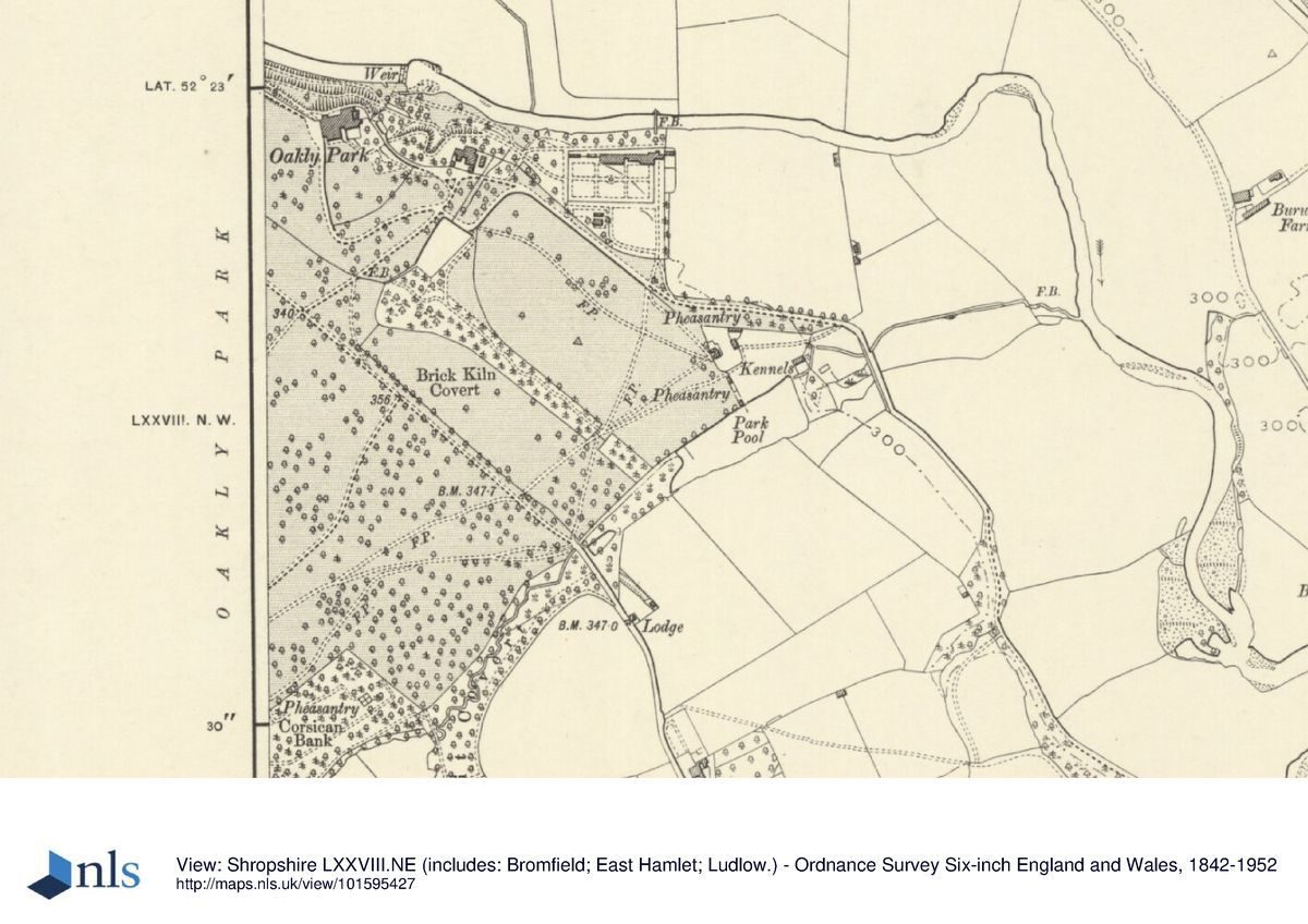
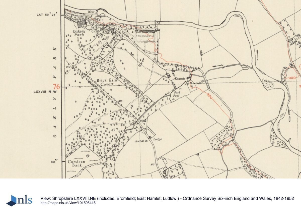
- {Ordnance Survey County Series Six Inch}, Shropshire, LXXVIII.NE, LXXVIII.NW, (Southampton: Ordnance Survey, 1884, 1887) Ordnance Survey County Series Six Inch
- {English Heritage Register of Parks and Gardens of Special Historic Interest}, (Swindon: English Heritage, 2008) [on CD-ROM] Historic England Register of Parks and Gardens of Special Historic Interest
- Leach, F. {The County Seats of Shropshire}, (Shrewsbury: Eddowes' Shrewsbury Journal Office, 1891): 211, 213. The County Seats of Shropshire
- Newman, J. and Pevsner, N. {The Buildings of England: Shropshire}, (London: Yale University Press, 2006) The Buildings of England: Shropshire
- Stamper, P. A. {Historic Parks and Gardens of Shropshire}, (Shrewsbury: Shropshire Books, 1996): 7, 28, 54-5, 64, 84-5. Historic Parks and Gardens of Shropshire
- Rocque, J. (1752), {Map of Shropshire}. Map of Shropshire, 1752
- Baugh's 1808 Map of Shropshire
- Greenwood's Map of Shropshire, 1827
- Speed's Map of Shropshire (1611)
- Saxton's Map of Shropshire, 1577
- {Ludlow Festival Exhibition: The Art and Architecture of Oakly Park}, (1991): 16. Ludlow Festival Exhibition: The Art and Architecture of Oakly Park