
Introduction
Montacute House has formal garden enclosures of 4.8 hectares. There is also a park of around 106 hectares remaining from 121 hectares of parkland. There are several phases of activity: late-16th century, early-18th century, around 1786 and again in the mid-19th century by Mrs Phelips and Mr Pridham.
Terrain
The site is undulating, with the park to the east of the house being predominantly level, while the ground to the south rises sharply towards a ridge of high ground. To the west the ground rises more gently.
The following is from the Register of Parks and Gardens of Special Historic Interest. For the most up-to-date Register entry, please visit The National Heritage List for England (NHLE):
Mid-19th-century formal gardens developed within the framework of late 16th-century formal gardens, surrounded by a park developed in the 18th and 19th centuries from mediaeval and 16th-century origins.
Location, Area, Boundaries, Landform and Setting
Montacute is situated c 5km west of Yeovil, to the south of the A3088 road which was constructed in the late C20 on the course of a mid C19 railway line. The c 110ha site comprises c 4ha of formal gardens and pleasure grounds, and c 106ha of parkland and ornamental plantations. To the north the site is enclosed by a minor road which leads north-east from Lower Town, while to the north-east it is bounded by the late C20 A3088 road which follows the course of the mid C19 railway line.
A small area of parkland to the north-east of the road, which was detached by the railway and thereafter reverted to agricultural use is not included within the registered site. To the east the site adjoins agricultural land, while to the south the boundary is formed by a track known as Fernhill Lane. The south-western boundary adjoins a further minor road, New Road, which until the late C20 was the A3088 road from Ilminster to Yeovil. This road assumed its present course in the early C19 when an earlier route north-east through the park was stopped-up. To the west the site adjoins properties in the village of Montacute.
St Michael's Hill to the west of the house, and Park Covert and Old Park to the south-south-west are included within the site here registered. These areas, which formed part of the mediaeval deer park and which were subsequently ornamented in the C18 and C19, principally adjoin agricultural land, and the village of Montacute to the east and north respectively. The site is undulating, with the park to the east of the house being predominantly level, while the ground to the south rises sharply towards a ridge of high ground. To the west the ground rises more gently, with St Michael's Hill forming an isolated, conical outcrop. There are significant easterly views across the park from the house and formal gardens, while from Park Covert there are views northwards across the village, house, park and gardens. From St Michael's Hill there are panoramic views in all directions, while the mid C18 folly tower is said originally to have been visible from contemporary follies at Newton Surmaville (qv), and Chilton Cantelo (CL, 1952).
Entrances and Approaches
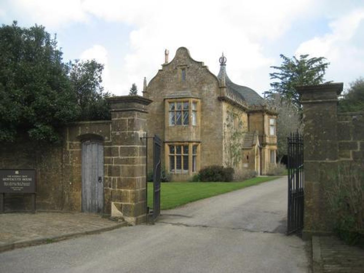
In the early C21 the principal visitors' entrance to Montacute is from the village street to the south-west, at a point c 130m east of the parish church. A tarmac drive leads north-north-east from the village for c 50m, passing to the east of a two-storey, late C16 style stone lodge (listed grade II*). Perhaps incorporating late C16 material, this building assumed its present form in the mid C19 (listed building description). Continuing north-north-east, the drive allows access to the late C20 car parking areas situated within the walls of the former kitchen gardens which lie to the east of the drive, while c 80m north of the lodge and to the west of the drive, stands the mid C19 stable block (listed grade II). This single-storey, late C16-style Ham stone structure is `U' shaped on plan, and occupies the site of a stable block built by Edward Phelips V in the late C18 as part of his scheme for re-ordering the approach to the house, but appears to have been rebuilt in the mid C19 by William Phelips, perhaps re-using earlier material. The stables are said to stand close to the site of Thomas Phelips' C16 house, which was demolished soon after the present mansion was completed. The drive continues beyond the stables to reach a carriage turn below the west façade of the house.
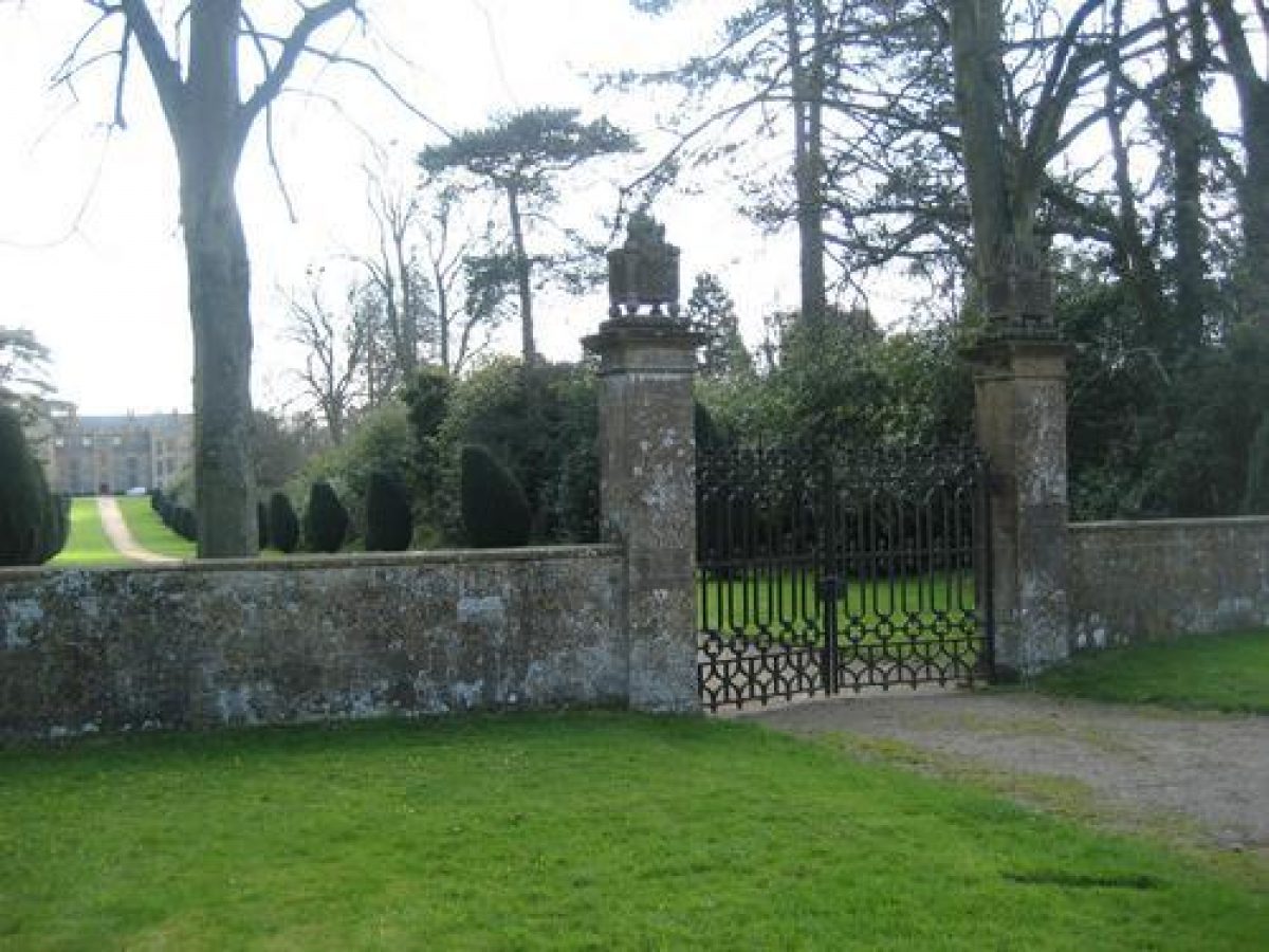
The principal C19 entrance is from the village street to the north-west, and comprises a pair of late C16 strap-work style cast-iron gates supported by a pair of square stone piers surmounted by carved stone flaming braziers, the symbol of the Phelips family (all listed grade II). The gateway is flanked by stone wings walls which terminate in further lower stone piers (listed grade II). Beyond the entrance, a straight gravel drive extends c 300m south-east between grass verges planted with an avenue of clipped Irish yews, behind which is a further avenue of Wellingtonias and predominantly evergreen shrubbery, to reach the carriage turn to the west of the house. The west drive assumed its present form in the mid C19 as part of the improvements made by Mr Pridham for William and Ellen Phelips, replacing a sweeping drive and shrubbery screening the house from the public road, which is shown on a parish plan of 1825 and the Tithe map (1838). This drive had been formed by Edward Phelips V in 1787 when he transferred the entrance to the house from the east to the west façade. The area to the west of the house, previously known as Boys Court, comprised an approximately rectangular enclosure bounded to the west by the C16 stables, a mill and two mill ponds (Donne, 1782). These features were removed by Edward Phelips as part of his late C18 scheme.
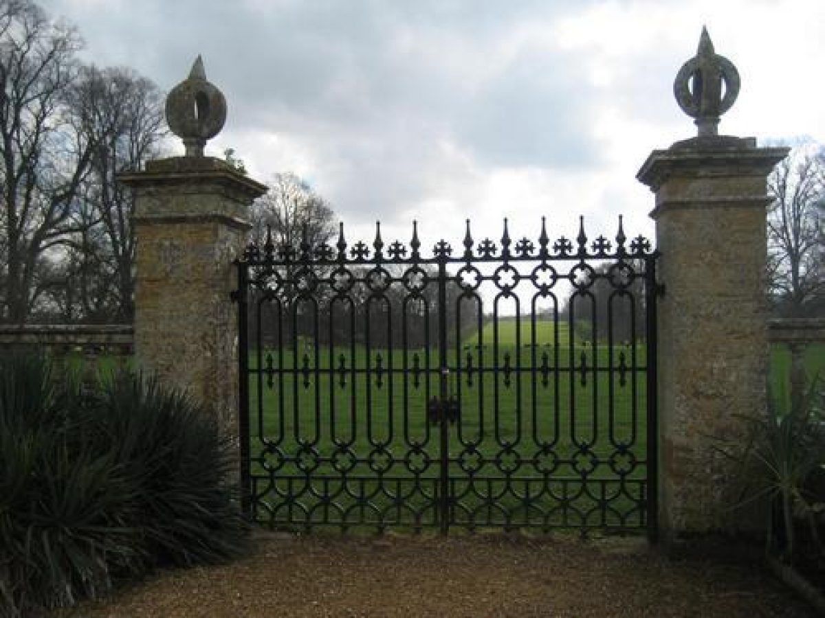
A further entrance is situated to the south-east of the house, adjacent to the junction of New Road and Fernhill Lane, comprising a pair of timber carriage gates supported by a pair of square Ham stone ashlar piers surmounted by carved representations of the Phelips' family crest. The carriage entrance is flanked on each side by a single timber pedestrian gate supported by lower square piers (all listed grade II). The drive, in the early C21 a track, leads north-north-west, passing a two-storey, C16-style stone lodge (listed grade II). Known as New Lodge or Odcombe Lodge, this building is shown on the 1825 parish map. The former drive leads c 480m north-west through an avenue of oaks, before turning west-north-west to approach a gateway situated between the East Court and the Bowling Green through an avenue of limes. The 1825 parish map, the Tithe map (1838) and the 1888 OS show this approach, which appears to have been formed in the late C18, and which fell into disuse in the C20.
In the C17 the principal approach to the house was from a public road which ran north-east across the park c 160m south-east of the house. The course of this road, which was diverted in the early C19, survives as a hollow way within the park. From the road a drive led north-east, passing through a walled outer court, to enter the East Court, then the forecourt, through a gatehouse. The gatehouse was removed between 1672, when it was described in a survey, and c 1782 when Donne drew his plan of Montacute.
Principal Building
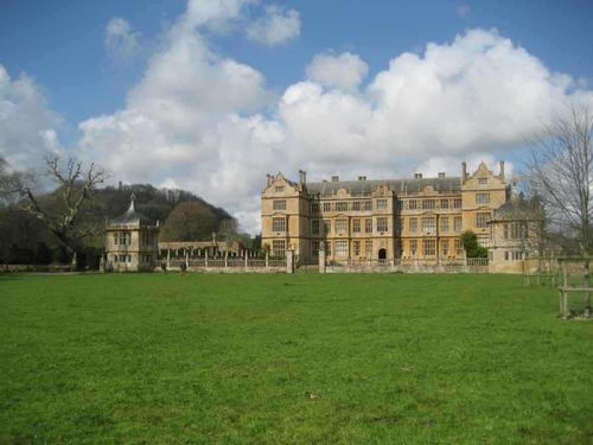
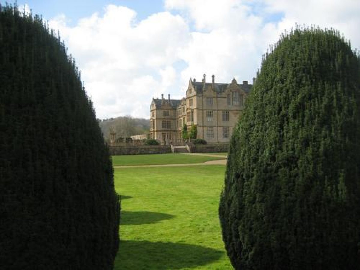
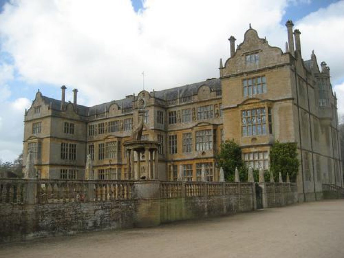
Montacute House (Scheduled Ancient Monument; listed grade I) stands towards the western boundary of the site. Constructed in Ham stone ashlar under slate roofs, the house comprises three storeys with an attic and basement, and is `H' shaped on plan. The house is lit by stone mullion and transom windows, while the parapet is enlivened by obelisk finials, and some of the gables are of 'Dutch' form. The east façade, built as the entrance front, has projecting outer bays with square bay windows, and a projecting central bay with an arched entrance. The west façade, the entrance front since the late C18, has projecting bays to the ground and first floors flanking outer projecting wings, and a centrally-placed porch with an arched entrance. The north and south facades are of similar, simpler design, with a centrally-placed Dutch gable lit by a segmental oriel window at second floor level.
The house was originally built for Sir Edward Phelips in 1598-1601, probably to the design of William Arnold (listed building description). The west front was constructed in 1785-7 for Edward Phelips V, perhaps to his own design. This work incorporates major fragments of Clifton Maybank House, Dorset, which had been built in 1546-64, and which was demolished in the late C18 (listed building description).
Gardens and Pleasure Grounds
The formal gardens are situated principally to the east, north and south-east of the house, with further areas of informal pleasure ground to the west.
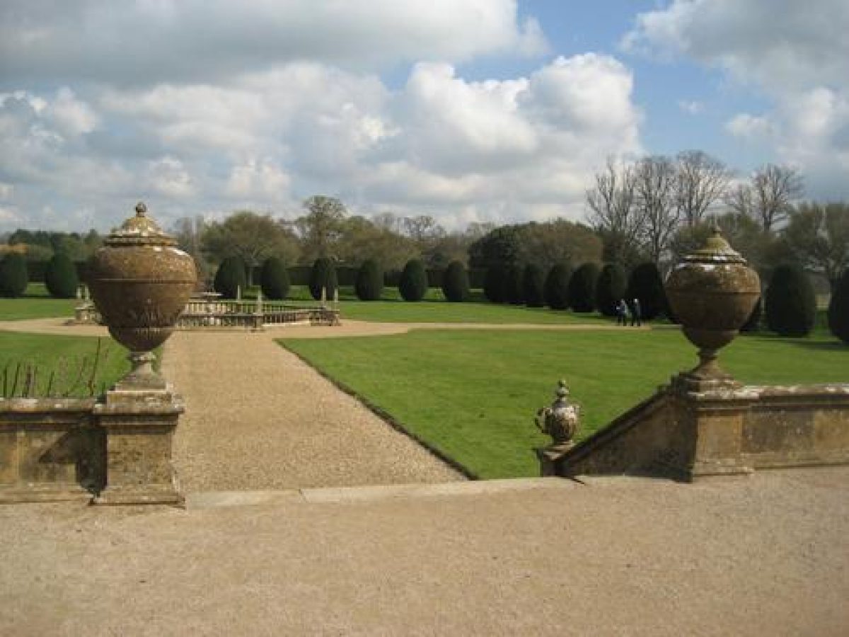
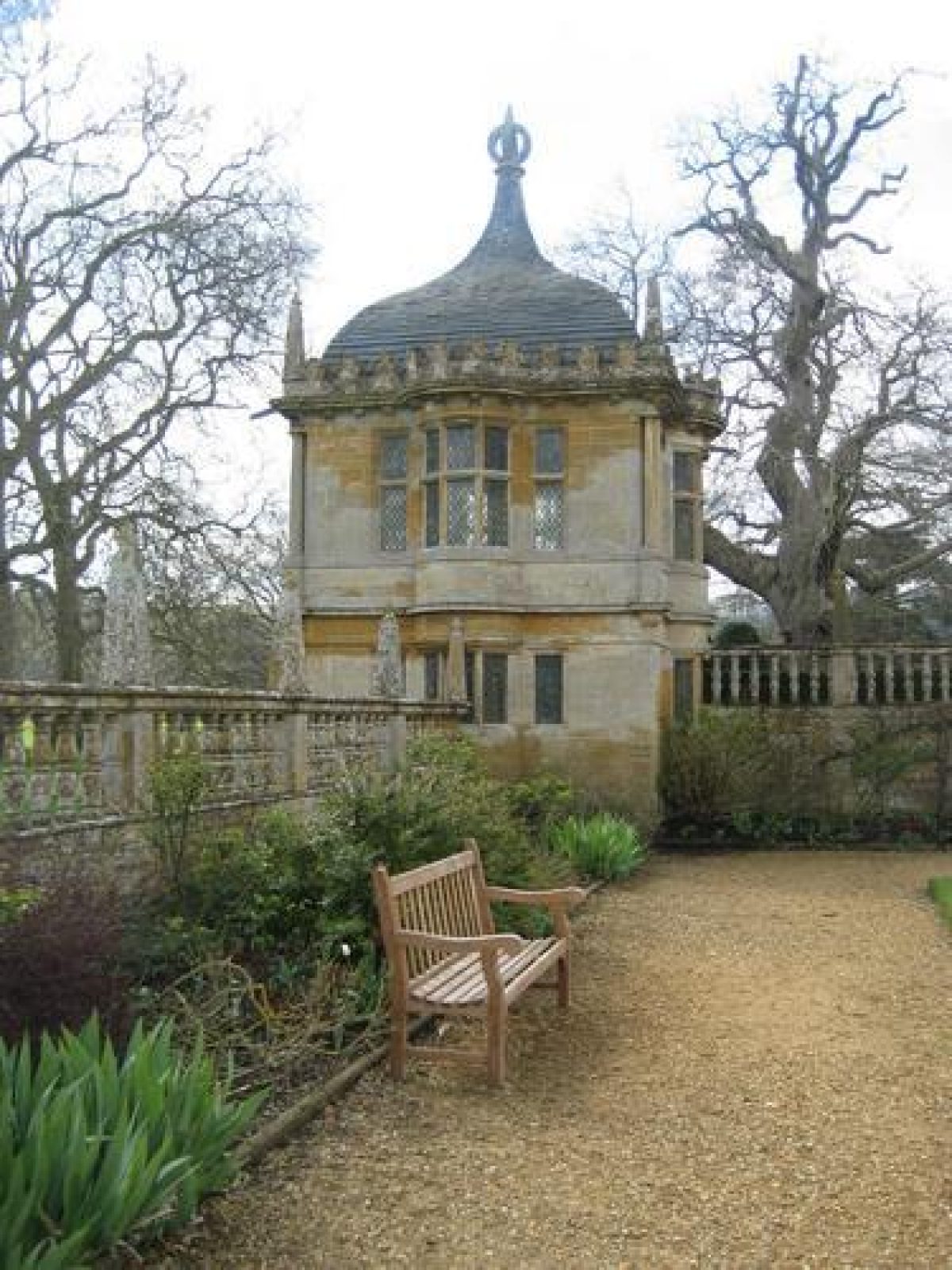
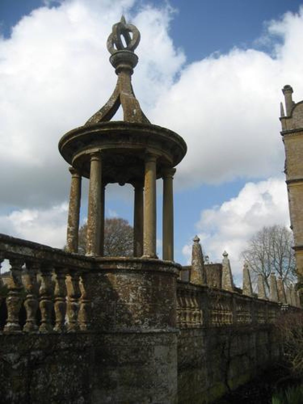
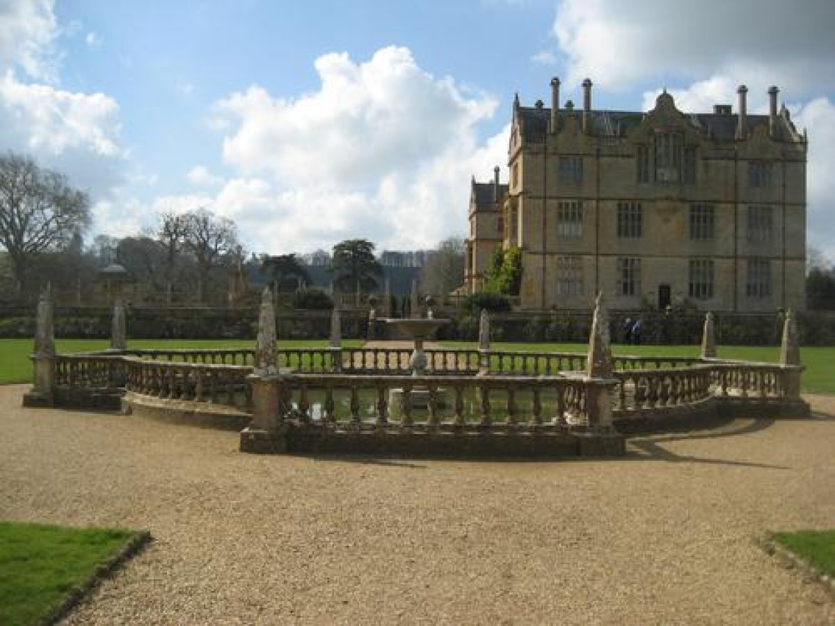
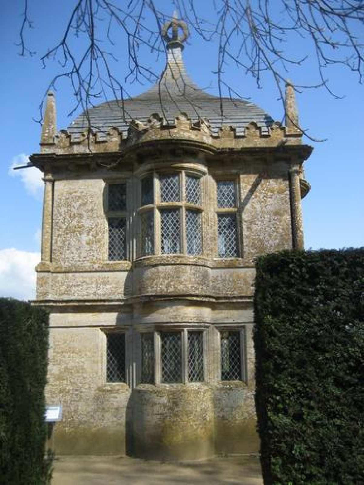
A stone flagged terrace extends below the east façade of the house between the projecting wings of the building. The terrace supports four stone Doric columns on plinths and surmounted by lanterns, while further columns terminate short sections of stone balustrade to the north-east and south-east of a broad flight of stone steps which descends from the terrace (all listed grade II) to the formal garden known as the East Court. The Court is enclosed to the north, east and south by stone walls surmounted by balustrades and obelisk finials (listed grade I), with the central point of the north and south walls being marked by a gazebo (listed grade I) comprising an open ogee finial supported by columns. The north-east and south-east corers of the court are marked by more substantial, two-storey, square-plan pavilions (listed grade I) surmounted by ogee roofs and obelisk finials. The pavilions are lit by oriel windows on the ground and first floors. The central point of the east wall of the court is marked by a pair of C19 cast-iron gates supported by a pair of stone piers surmounted by open-work finials.
The East Court served, until the late C18, as the entrance court to the house, and was entered through a gatehouse which stood at the centre of its eastern side. This was removed, probably as part of Edward Phelips V's improvements, before Donne drew his survey in c 1782. With this exception, and other minor alterations, the East Court walls and pavilions remain substantially as constructed in the late C16. The interior of the court is largely laid to lawn, with mixed borders beneath the north and south walls separated from the lawn by gravel walks. The present colour scheme for the East Court borders was devised by Mrs Phyllis Reiss of Tintinhull House (qv) c 1951, replacing an earlier scheme commissioned by the National Trust in 1945 from Vita Sackville-West. At about this time the mid C19 layout of the court with panels of lawn planted with clipped Irish yews separated by broad gravel walks (CL, 1898) was simplified, the mid C19 central pool having been removed earlier by Lord Curzon (guidebook).
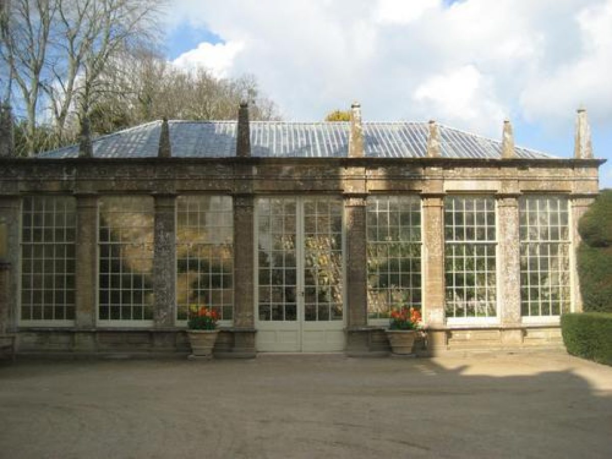
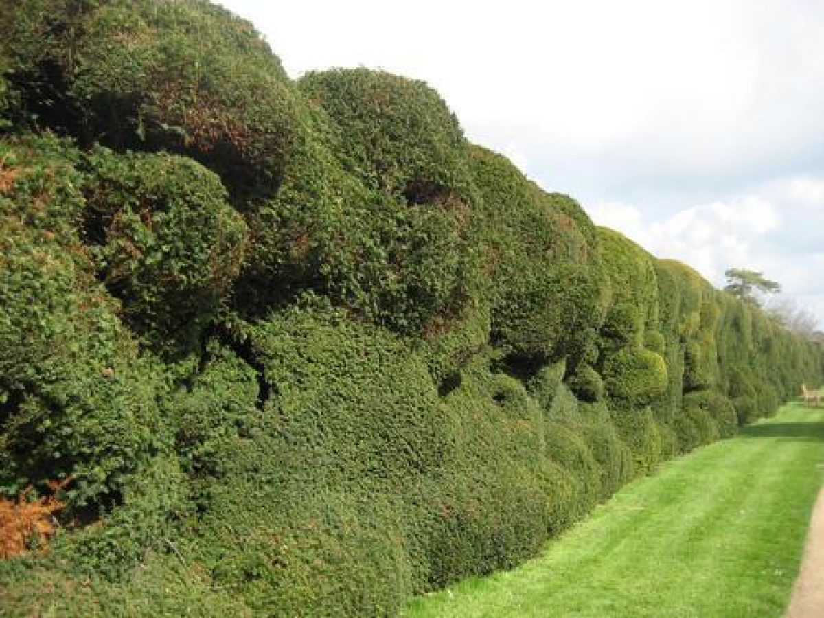
A pair of wrought-iron gates at the north-west corner of the East Court leads to a broad gravel terrace which is terminated to the west by the mid C19 Orangery (listed grade II), and to the east by a balustrade affording views across the park. To the north, the terrace is edged by a low stone wall surmounted by urns, which retains the walk above the level of the North Garden, which is reached by a flight of stone steps (all listed grade II). The North Garden is rectangular on plan, and is encircled on all sides by grass banks which rise to gravel walks approached by stone steps placed at the centre of each side of the garden (listed grade II). To the north and west the garden is enclosed by yew hedges, while further clipped Irish yews are planted in a single row at the foot of the perimeter slopes. The lower area of the garden is laid to lawn, divided into four quarters by cruciform gravel walks which converge on a central, quatrefoil-shaped fountain pool enclosed by stone balustrades surmounted by obelisk finials (listed grade II). A gap in the yew hedge at the north-west corner of the garden leads to the icehouse.
The North Garden assumed its present form in the mid C19, when Mr Pridham designed a formal parterre for William and Ellen Phelips within an enclosure which corresponds to the North Garden described in a survey of 1667 (guidebook), and which is likely to have been contemporary with the construction of the house. The parterre, which is recorded in a late C19 photographs (guidebook), was simplified c 1901, and in the mid C20 Vita Sackville-West and Graham Stuart Thomas provided plans for the border of roses on the south side of the garden. The C17 garden was enclosed by raised walks which correspond to those which survive today, with a banqueting house at its north-eastern corner, which may relate to some surviving stonework north-east of the garden. By the late C18, Donne shows a mount and a pond in the North Garden; these features do not, however, appear on the 1825 Parish Map.
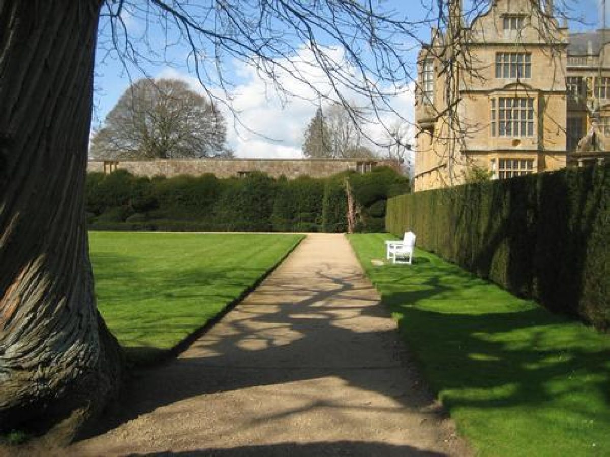
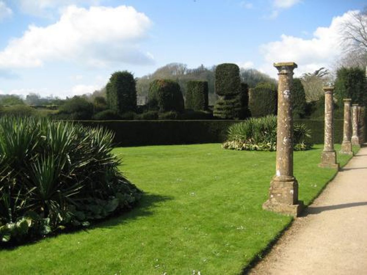
A gate at the south-west corner of the East Court leads to a grave walk which extends beneath the south façade of the house, and which is terminated to the east by a pair of gates leading to the park. To the south the walk is enclosed by a yew hedge. A further walk extends southwards on axis with the gate from the East Court. Known as the Yew or Fig Walk, it is enclosed to the west by a stone wall planted with mid C20 fan-trained fig trees, and to the east by a high yew hedge. To the east of the hedge, an approximately rectangular area of lawn, known as the Cedar Lawn, retains a pair of mature specimen cedars at its southern end, while an arcaded summerhouse (listed grade II), probably of C19 construction but incorporating C16 or C17 architectural fragments perhaps removed from Barrington Court (qv) stands at its south-west corner. To the east of the Cedar Lawn, the Column Garden comprises an further lawn with four stone Doric columns to the north and two large beds of yuccas, and specimen clipped yews. The site of the Cedar Lawn and Column Garden corresponds to Pig's Wheatie Orchard on Donne's Survey (c 1782); this area was subsequently converted into a bowling green and is shown as such on the 1825 Parish Map.
To the west and south-west of the house, adjoining the west and south drives, is an area of lawns planted with specimen trees and shrubs. This appears to have assumed its present form in the early or mid C19.
Park
The park is situated to the east of the house, with further areas to the south and west of the house separated from the core of the site by the village of Montacute.
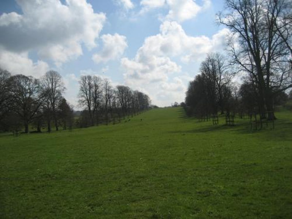
The east park remains pasture with scattered specimen trees. An avenue of limes extends east-south-east across the park on axis with the east façade of the house, while a further avenue of ash c 200m south-east of the house leads north-north-east along the line of a pronounced hollow way which corresponds to the course of a public road diverted in the late C18. An oak avenue (replanted late C20) lines the south-east drive leading to New Lodge. The park is enclosed to the south by a stone wall which is partly screened by boundary planting, while the course of the former railway, now the A3088 road to the north is similarly screened from the park. The park incorporated extensive areas of ridge and furrow.
The east park appears to have been commenced when Edward Phelips constructed the house in the late C16 (National Trust, 1998). The original park seems to have been extended piece-meal over an extended period, with its eastern half remaining in agricultural cultivation as late as 1838 (Tithe map). The park reached its present extent in the mid C19 under William and Ellen Phelips, and has changed little since. Samuel Donne's plan (c 1782) shows that the park contained ponds to the north-east and south-west of the lime avenue, c 300m south-east of the house. The east drive was carried across the ponds on a bridge or causeway which is shown in an engraving of 1784 (Collinson, 1791) to have had balustrades and obelisk finials matching those of the East Court. The engraving also shows a grotto containing a female figure at the southern end of the south-western pond; it is not known whether this feature ever existed, and no trace of it remains above ground today. The ponds are shown on the Parish Map (1825) and the Tithe map (1838), but had been removed by 1888 (OS), probably as part of the alterations made by William and Ellen Phelips in the mid C19.
The southern area of detached park comprises a north-facing slope enclosed to the east and south by a mixed ornamental plantation, Park Covert. A shrubbery walk, known as the Ladies' Walk winds through this woodland affording extensive views to the house, park and village. The slope below the plantation, known in 1838 as Lower Park (Tithe map) remains pasture with scattered specimen trees. This area formed part of the monastic deer park, the southern boundary of which probably corresponded to Park Lane c 150m south of Park Covert. The Ladies' Walk appears to have been developed in the late C18 or early C19 (National Trust, 1998).
The western area of park is detached from the remainder of the site by the village of Montacute to the east, and the site of the Priory to the south-east. This area comprises St Michael's Hill, and the more level ground from which the steep hill rises. St Michael's Hill is planted with mixed plantation, and is crowned by a stone folly tower (listed grade II), which was erected in 1760 by Edward Phelips V on the site of a Norman motte and bailey castle and the medieval chapel of St Michael (Scheduled Ancient Monument), elements of which may be incorporated into the present structure (National Trust, 1998). The slopes of the hill were originally planted at the same time, and Donne's plan (c 1782) shows a winding walk ascending the hill past a summerhouse or bower. The ground at the foot of the hill remains pasture, with a group of mature cedars to the north-east extending the axis of the west drive into the park. This area formed part of the monastic deer park (National Trust, 1998).
Kitchen Garden
The kitchen garden is situated c 150m south of the house, and comprises two compartments enclosed by Ham stone rubble walls c 3m high (all listed grade II); the north and east walls of the south compartment are faced on the inner side with brick. The northern compartment is approximately trapezoid-shaped on plan and has C20 entrances cut in the south and west walls, while the southern compartment is approximately triangular-shaped on plan. The southern compartment has two arched opening, possibly re-set, in the west wall, and a C20 opening in the north wall connecting with the northern compartment. A small pyramidal-roofed bothy stands in the north-east corner of the southern compartment. Both compartments are now (2003) laid to grass and planted with a variety of specimen trees, and are used as car parking areas. The walled gardens correspond to enclosed areas shown on Donne's plan (c 1782).
Maps
- S Donne, plan of Montacute, around 1782 (Somerset RO)
- Map of the Parish of Montacute, 1825 (Somerset RO: DD/SAS/H/528)
- Tithe map for the parish of Montacute, 1838 (Somerset RO)
- Tithe map for the parish of Odcombe, 1838 (Somerset RO)
- Pridham, plan of North Garden, around 1848 (private collection)
- H Inigo Triggs, Montacute in Somerset, 1900, published in Formal Gardens in England and Scotland (1902), pp 11-12
- OS 6”: 1 mile: 1st edition, surveyed 1886, published 1888; 2nd edition, revised 1901, published 1904
- OS 25”: 1 mile: 1st edition, published 1888; 2nd edition, published 1904; edition of 1938
Illustrations
- J Bonnor, Montacute, 1784, engraved view published in J Collinson, History and Antiquities of the County of Somerset 3 (1791)
- Pridham, perspective of North Garden, New Garden Green House, Montacute 1848 (private collection)
- Inigo Thomas, views of north garden and East Court published in R Blomfield, The Formal Garden in England (3rd edition, 1901), pp 93, 124
- Late 19th- and 20th-century photographs of the gardens published in Country Life (issues as above)
- Four postcard views of Montacute, around 1950 (private collection)
Archival items
- Phelips family archive, including deeds, plans, accounts (Somerset RO: DD/PH)
- Montacute Park and Garden Survey, National Trust 1998 with addenda 2000 (copy on file)
Description written: April 2004
Edited: October 2021
- Visitor Access, Directions & Contacts
Telephone
441935823289Access contact details
The gardens are open throughout the year from Wednesdays to Sundays. In addition, they are open on Mondays at high season.
For more information about opening hours visit the National Trust website.
Directions
The site is south of the A3088 in Montacute village, 4 miles west of Yeovil.
Owners
The National Trust
Heelis, Kemble Drive, Swindon, SN2 2NA
- History
The following is from the Register of Parks and Gardens of Special Historic Interest. For the most up-to-date Register entry, please visit The National Heritage List for England (NHLE):
11th Century
In 1067, the Count de Mortain, who had been granted land including Montacute, built a castle on St Michael's Hill, or Mons Acutus. This structure was short-lived, and by 1192 the site of the castle had been granted to the Cluniac priory which had been founded at the foot of the hill around 1102.
16th Century
The prior enclosed the hillside as a deer park, in which use it continued until the Dissolution in 1539. By the mid-16th century a small town had grown up around the priory. The Phelips family became established in the town, and in 1587 Thomas Phelips conveyed his Montacute estate to his youngest son, Edward, (knighted 1603, died 1614) who was a successful lawyer serving as Speaker of the House of Commons, and later as Master of the Rolls. In 1598-99 Edward Phelips began to build a new house at Montacute adjacent to the site of his father's home. The new mansion was completed around 1601, and stood in an area of formal gardens which appear to have been contemporary with the house (National Trust, 1998).
17th Century
The park to the east developed over a more extended period as the Phelips family was able to buy or exchange land with their neighbours. Sir Edward acquired the former priory estate together with the lordship of the manor in 1608; and by 1630, Gerard noted the existence of a 'Parke' as well as spacious courts and gardens at Montacute (guidebook). Following Sir Edward's death in 1614, the estate passed to Sir Robert Phelips, a politician, who furnished the house in extravagant style. His son, Col Edward Phelips suffered financial ruin during the Civil War and was forced to sell much of the contents of the house in 1652.
In 1668, Col Edward Phelips passed the estate to his son, Sir Edward Phelips IV, who died the following year leaving an inheritance disputed between three daughters. This dispute was finally resolved in 1750 when Edward Phelips V, another successful lawyer, took possession of the estate, which had been neglected for nearly a century. Edward Phelips was responsible for significant changes to the house and its setting, building a folly tower on St Michael's Hill in 1760, and forming a new entrance to the west in 1785-7. The former entrance court to the east was converted to garden by 1812 (National Trust, 1998).
18th Century
Edward Phelips died in 1797, and was succeeded by the Revd William Phelips, who in turn died in 1806, leaving the estate to his son, John. At John Phelips' death in 1834, Montacute was inherited by his eleven-year old son, William. The house was let until William Phelips came of age and married Ellen Helyer of Coker Court, Somerset in 1845. Ellen Phelips brought with her to Montacute a gardener from Coker Court, Mr Pridham, with whose advice she and her husband renovated the gardens. Mr Pridham provided designs for an elaborate parterre for the North Garden, and the orangery which were constructed within the surviving framework of the late 16th-century garden.
19th Century
Mr Pridham also laid out the west drive and avenue, and probably remodelled the East Court, while improvements were made to the park in the mid-19th century. The railway line was constructed to the north of the house in 1853, forming a new northern boundary to the park.
By 1860, William Phelips was suffering from mental illness, and in 1875 the management of the estate passed to his son, William Robert Phelips. During the late 19th century the estate declined (National Trust, 1998), but the gardens came to be seen as an exemplar of the Tudor style, and were described and illustrated by Reginald Blomfield in The Formal Garden in England (1892), and by Country Life (1898) and H Avray Tipping in Gardens Old and New (1908). In 1911, Montacute was let to Lord Curzon (1859-1925), the former Viceroy of India (1898-1905), who with his mistress, the popular novelist Elinor Glyn (1864-1943), undertook essential repairs to the house and made minor alterations to the gardens.
20th Century
When Lord Curzon died in 1925, the estate was offered for sale. It was finally purchased in 1931 by E E Cook, who passed the property to the National Trust.
During the Second World War, Montacute was requisitioned by the army. Following restoration of the property to the National Trust, in 1945 Vita Sackville-West (1892-1962) was invited to provide planting schemes for the East Court; these were subsequently replaced around 1951 by schemes devised by Mrs Phyllis Reiss (died 1961) of neighbouring Tintinhull House (see description of this site elsewhere in the Register). Further mid- and late 20th-century changes to the gardens were made with the advice of Graham Stuart Thomas (died 2003).
21st Century
Montacute remains the property of the National Trust.
Period
- Post Medieval (1540 to 1901)
- Tudor (1485-1603)
- Associated People
- Features & Designations
Designations
The National Heritage List for England: Register of Parks and Gardens
- Reference: GD1437
- Grade: I
Style
Formal
Features
- Pavilion
- Description: There are two 'pudding houses'.
- Herbaceous Border
- Hedge
- Description: Patterned yew hedge
- Specimen Tree
- Description: Sweet chestnuts with twisted bark.
- Tree Avenue
- Description: Oak avenue
- Tree Avenue
- Description: Lime avenue
- Folly
- Earliest Date:
- Latest Date:
- House (featured building)
- Earliest Date:
- Latest Date:
- Key Information
Type
Estate
Purpose
Ornamental
Principal Building
Domestic / Residential
Period
Post Medieval (1540 to 1901)
Survival
Extant
Hectares
110
Open to the public
Yes
Civil Parish
Montacute
- References
References
- {English Heritage Register of Parks and Gardens of Special Historic Interest}, (Swindon: English Heritage, 2008) [on CD-ROM] Historic England Register of Parks and Gardens of Special Historic Interest
- Pevsner, N., {The Buildings of England: South and West Somerset} (Harmondsworth: Penguin, 1958), pp. 245-8 The Buildings of England: South and West Somerset
- Collinson, J., (Vol 3, (1791), pp 314) History and Antiquities of the County of Somerset
- Blomfield, R., (3rd edition 1901), pp 94, 103, 111, 185 The Formal Garden in England
- Avray Tipping, H., (1908), pp 89-100 Country Homes and Gardens Old and New
- Taylor, C., (1998), pp 48-9 arks and Gardens of Britain A Landscape History from the Air
- National Trust (2000) Montacute House, guidebook
- Vol 15, (4 June 1904, pp 810-29) Country Life
- Vol 118, (20 October 1955, pp 850-3); (27 October 1955, pp 960-3); (3 November 1955, pp 1020-4) Country Life
- Vol 3 (16 April 1898, pp 464-6); (23 April 1898, pp 496-8) Country Life