Introduction
Brympton d'Evercy has early formal gardens and pleasure grounds of around 9 hectares. There is also a park of around 36 hectares. The grounds were laid out in the late-17th century, then altered and added to around 1723, 1860 and 1910.
Nineteenth- and 20th-century gardens developed within the surviving framework of a late 17th-century formal garden.
Terrain
The ground to the north of the house rises to a level plateau extending to the northern boundary, while the ground to the south of the stream similarly rises to the southern boundary of the site.
The following is from the Register of Parks and Gardens of Special Historic Interest. For the most up-to-date Register entry, please visit The National Heritage List for England (NHLE):
Location, Area, Boundaries, Landform and Setting
Brympton d'Evercy is situated c 2.5km west of Yeovil, to the south of a minor road leading south-west from Houndstone Bridge to Odcombe. The c 45ha site comprises c 5ha of gardens and pleasure grounds, and c 40ha of parkland. To the north the site is bounded by the minor road leading from Houndstone Bridge to Odcombe, while to the east a variety of hedges and fences separate the site from agricultural land. The west boundary is marked to the north by the track known as Parson's Lane, while the southern end is formed by Pound Lane, a partly tree-lined track leading south from Brympton church to join Camp Lane.
On Knyff's early C18 view of Brympton d'Evercy, Pound Lane is shown lined by a double avenue, with a short section at its southern end passing through a triple avenue (Beeverell 1707). Neither this feature, nor a single avenue on the eastern boundary, survive today (2002), although some trees were marked in these locations on the OS map of 1930. The southern boundary is formed by hedges and fences which separate the site from Leaze Plantation, Leaze Cottages (now known as Keepers Cottage) and agricultural land. The cottages correspond to agricultural buildings shown on Knyff's early C18 view (ibid).
The site is crossed from west to east by a small stream which flows through a shallow valley c 100m south of the house. The ground to the north of the house rises to a level plateau extending to the northern boundary, while the ground to the south of the stream similarly rises to the southern boundary of the site. There are views to the south across the park to woodland on the southern boundary, south-west towards East Chinnock Hill, and east and south-east towards Yeovil.
Entrances and Approaches
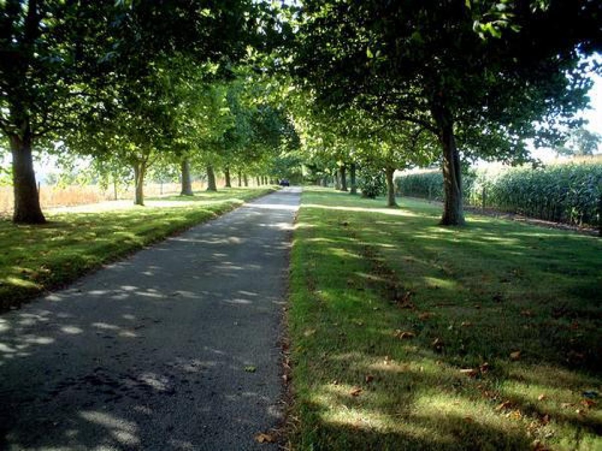
Brympton d'Evercy is approached from the minor road leading from Houndstone Bridge to Odcombe to the north, at a point opposite High Leaze Farm and c 200m south-west of Houndstone Bridge. An entrance comprising C18 stone quadrant walls and stone piers surmounted by ball finials (listed grade II) leads to a tarmac drive which extends c 500m south through an avenue of London planes. This avenue, known as Brympton Avenue, is adjoined on each side by parkland, and was replanted in the late C20 on the line of a late C17 avenue shown in Knyff's view (ibid), and on the 1838 Tithe map. The drive then divides, with one branch leading south-east to reach Home Farm to the east of the house, and the other leading west, along the north side of the gardens, before turning south along the line of Pound Lane.
After c 150m the drive reaches the entrance to the forecourt to the west of the house. The forecourt is separated from Pound Lane by stone walls and balustrades, while the entrance is flanked by rusticated stone piers surmounted by vase finials, which support a pair of wrought-iron gates (all listed grade II). The walls and balustrades were probably erected by Lady Georgiana Fane in the mid C19 to replicate a late C17 feature shown by Knyff (ibid). A gravelled drive extends between panels of lawn to reach a carriage turn below the west façade of the house. To the north-west of the entrance to the forecourt, a gateway gives access to a service drive leading to the early C18 stables (listed grade II*) which stand on a raised terrace c 100m north-west of the house.
The present (2002) arrangement of drives broadly corresponds to that shown by Knyff in his early C18 view, and by the Tithe map (1838). It appears however that until the late C19 the Brympton Avenue drive served only the Home Farm, while a second drive, continuing the line of Pound Lane north along the north-west boundary of the park through Parson's Avenue, provided access to the house.
Principal Building
Brympton d'Evercy, or Brympton House (listed grade I) stands on an artificially levelled terrace towards the centre of the site. Constructed in Ham stone ashlar under hipped slate roofs set behind parapets, the house comprises two and three storeys. The west or entrance façade is irregular in plan with a gabled bay to the south, a symmetrical central section with a centrally placed single-storey entrance porch, and an irregular block to the north. The present entrance porch was constructed in the early C18 by Thomas Penny or Francis Fane when the original porch was relocated to the north side of the forecourt where it serves as a two-storey garden house (listed grade II) with an alcove seat at the lower level (CL 1927).
The south or garden façade is designed in Classical style with tall transom windows surmounted by alternate segmental and pointed pediments set beneath a roof balustrade which supports a series of urns. To the north of the house a sunken courtyard is enclosed on three sides by the house and service quarters. Brympton House was constructed by successive members of the Sydenham and Fane families at various dates, with most of the visible work dating from the C15, C16, late C17, and early C18. The distinctive garden façade, said to be related to a similar structure at Hinton St George (ibid), dates from c 1670.
Immediately south-west of the house and adjoining the parish church of St Andrew (listed grade I) stands the C15 Dower House or Chantry House (listed grade I). This two-storey buttressed stone structure was built by Dame Joan Sydenham.
Gardens and Pleasure Grounds
The gardens and pleasure grounds are situated principally to the south of the house, with further areas of garden to the north-west and west.
The forecourt to the west of the house is mainly laid to lawn with mixed shrub and herbaceous borders extending below the walls of the Chantry House and churchyard which enclose the forecourt to the south, and below a stone retaining wall which forms its enclosure to the north. This wall retains a terrace which is approached from the forecourt by flights of stone steps to the north-west of the house and to the south-east of the stables. The terrace is laid to grass with a beech hedge to the north separating it from an area known as The Arbour. It leads west to an area of lawn adjacent to the stables, on which stands an early C20 dovecote (listed grade II) supported by a stone column; the dovecote was illustrated in Gertrude Jekyll's Garden Ornament (1918). Early C20 photographs show the terrace laid out with a series of rose beds (CL 1927); these were removed by Mrs Clive in the mid C20.
To the north, The Arbour comprises a south-facing sloping lawn planted with young standard fruit trees which replace vines planted by Mrs Clive in the early C20 (Bond 1998). To the north of the lawn a low stone wall retains a terrace walk approached by a centrally placed flight of semicircular stone steps. The walk is flanked by mixed borders, that to the north backed by a high stone wall. A centrally placed opening closed by wrought-iron gates and flanked by stone piers with ball finials leads to an area of lawn and shrubbery, while a line of mature pines extends behind the wall. The shrubbery garden contains plants and ornaments from Richard Ponsonby Fane's early C20 garden in Kyoto, Japan (ibid). The Arbour partly corresponds to the site of a walled enclosure shown by Knyff (Beeverell 1707) and on the Tithe map (1838), but assumed its present form under Mrs Clive in the early C20.
A gravelled terrace extends below the south façade of the house, terminated to the east by a pedimented temple (listed grade II). This structure is said to have been built by Mrs Clive with materials relocated from Yeovil Town Hall (Bond 1998). A mixed border adjoins the terrace to the north, while to the south it is enclosed by a stone balustrade surmounted by stone urns and vases (all listed grade II).
A wide, centrally placed flight of stone steps, and further flights of stone steps (listed grade II) at the south-east and south-west ends of the terrace descend to the bowling green or lawn, which is enclosed to east and west by brick and stone walls (listed grade II). The walls correspond to those shown in Knyff's view (Beeverell 1707), but may be a mid C19 rebuilding (listed building description). Gravel walks extend along the east and west sides of the lawn, that to the east screened by a mature yew hedge, while the lawn slopes gently south towards a large elliptical-shaped pond, the banks of which are retained by rubble-stone walls (listed grade II).
A stone-arched boathouse is recessed into the western end of the pond, while a small island covered with ornamental planting is situated towards the western end of the pond. The pond occupies the site of a late C17 wilderness, the central feature of which was a circular grove (Beeverell 1707). Although usually ascribed to Lady Georgiana Fane's mid C19 campaign of improvements (Bond 1998), the pond is shown in approximately its present form on the Tithe map (1838), suggesting an earlier date of construction.
To the south of the pond there is a further area of lawn with mixed ornamental planting to the south-east and south-west framing a vista across a stone-walled ha-ha which separates the garden from the south park. To the south-west of the pond a canalised stream extends to the western boundary of the garden which is formed by a stone wall fronting Pound Lane. South of the stream, C20 tennis courts are enclosed by clipped conifer hedges, while to the north a group of mature yews screens the kitchen garden. The canal appears to correspond to a feature shown on Knyff's view (Beeverell 1707). A further canal, now (2002) an overgrown ditch, extends east of the pond through an area of ground which is in today in agricultural use.
Park
The park comprises two discrete areas situated to the north and south of the house. The north park slopes gently from north to south and is now (2002) in arable cultivation with scattered specimen trees. Brympton Avenue, replanted in the C20 with London planes, crosses the centre of the park from north to south, while a further avenue, Parson's Avenue, extends parallel to the western boundary of the park. Mature oaks and limes are underplanted with groups of ornamental shrubs.
The south park ascends gently from the ha-ha separating the park from the gardens towards the wooded southern boundary of the site. The south park is in mixed agricultural cultivation and retains groups of specimen trees.
The present park corresponds approximately to the disposition of parkland shown in Knyff's view (ibid), although extensive areas of formal tree-planting and a lateral avenue shown by Knyff in the north park had been removed by the late C19 (OS 1888).
Kitchen Garden
The kitchen garden is situated to the south-west of the house, west of the pond and immediately south of the churchyard. The garden is today (2002) laid to grass and used as a paddock. To the west it is enclosed by stone walls which separate it from Pound Lane, while to the east, brick walls separate it from the south lawn. The northern boundary of the garden is formed by a stone wall which separates it from the churchyard. This wall retains traces of C19 lean-to glasshouses, together with an octagonal stone chimney.
To the south the garden is bounded by the western canal and a group of mature yews. The garden retains a central circular dipping pool, while timber doors survive in the walls to the north-east, south-east, and north-west. The site of the kitchen garden corresponds approximately to an area of productive garden shown on Knyff's view (Beeverell 1707). A large rectangular pond shown by Knyff in the eastern half of the garden does not survive.
Other Land
An area of paddock and orchard, together with C19 and C20 agricultural buildings, to the east of Brympton House corresponds to a formal orchard shown by Knyff in his view of Brympton (ibid).
Maps
- Tithe map for Brympton d’Evercy parish, 1838 (M5062/1), (Somerset Record Office)
- OS 6" to 1 mile: 1st edition published 1888; 1930 edition
Description written: November 2002
Edited: November 2021
- Visitor Access, Directions & Contacts
Telephone
01935 862528Website
https://www.brymptonhouse.co.uk
- History
The following is from the Register of Parks and Gardens of Special Historic Interest. For the most up-to-date Register entry, please visit The National Heritage List for England (NHLE):
13th - 15th Century
In 1220, Thomas d’Evercy purchased land at Brympton. This estate remained in the hands of his descendants until 1325 when Sir Peter d’Evercy died possessed of `a certain capital messuage, with gardens and closes adjoining’ (Country Life 1927). The property subsequently passed through several hands before being sold in 1430 to John Stourton, who acquired it as part of the dowry for his daughter Joan, who in 1434 married John Sydenham (CL 1927). Joan Sydenham outlived her husband, and at her death the estate passed to her grandson, John Sydenham II.
17th - 19th Century
Brympton remained the property of the Sydenham family until 1722, and during this period successive owners rebuilt and developed the medieval manor house. In particular, in the late 17th century, Sir John Posthumous Sydenham (died 1696) built a new garden or south façade in a style influenced by Inigo Jones and John Webb, and perhaps inspired by similar work at Hinton St George (see description of this site elsewhere in the Register), his wife’s family home (CL 1927). This façade, together with formal gardens comprising a terrace, bowling green, wilderness, and ponds, is shown in an early 18th-century view by Knyff (Beeverell 1707).
In 1722 Brympton was sold to Thomas Penny, Receiver General for Somerset, who in 1731 sold it on to Francis Fane, the lawyer son of a wealthy Bristol merchant. Fane was succeeded by his brother Thomas, who in 1761 inherited unexpectedly from distant relations the Earldom of Westmorland. Lord Westmorland’s grandson, the tenth Earl, left Brympton to his younger daughter, Lady Georgiana Fane, in 1857. Lady Georgiana was responsible for constructing the present south terrace and for extensive tree-planting on the estate (Bond 1998). Lady Georgiana died in 1875, leaving Brympton to her nephew, Sir Spencer Ponsonby, who assumed the additional name of Fane. In the late 19th century, Reginald Blomfield (1856-1942) referred to the gardens at Brympton in The Formal Garden in England (1892).
20th Century
In the early 20th century Brympton was inherited by Sir Spencer’s granddaughter, Violet Ponsonby-Fane, who had married Capt. Edward Clive. Widowed at an early age, Violet Clive spent some thirty years at Brympton collecting plants and developing the gardens in a style which may have influenced Vita Sackville West at Sissinghurst, Kent (see description of this site elsewhere in the Register) (Brown 1990). Mrs Clive constructed a temple at the east end of the south terrace from salvaged architectural material, and planted a vineyard to the north of the house. Material from a garden belonging to her brother, Richard Ponsonby Fane, in Kyoto, Japan was also incorporated into the garden at Brympton (Bond 1998).
After the Second World War, Brympton was let to a school. In 1974 its owners, Charles and Judy Clive-Ponsonby-Fane resumed residence in the house and undertook a programme of restoration in the grounds.
The property was sold in the late 20th century and today (2021) remains in private ownership.
- Features & Designations
Designations
The National Heritage List for England: Register of Parks and Gardens
- Reference: GD1483
- Grade: II*
Style
Formal
Features
- Stream
- Lake
- Key Information
Type
Garden
Purpose
Ornamental
Principal Building
Domestic / Residential
Survival
Extant
Hectares
45
Open to the public
Yes
Civil Parish
Brympton
- References
References
- Jekyll, G., {Garden Ornament} (London: Country Life, 1918), p. 58 Garden Ornament
- {English Heritage Register of Parks and Gardens of Special Historic Interest}, (Swindon: English Heritage, 2008) [on CD-ROM] Historic England Register of Parks and Gardens of Special Historic Interest
- Holme, C. (ed), {The gardens of England in the southern and western counties} (London: The Studio, 1907), plates 31 & 32 The Gardens of England in the southern and western counties
- Bond, J., {Somerset Parks and Gardens} (Tiverton: Somerset Books, 1998), pp. 34, 39, 52, 65, 115, 140, 149 Somerset Parks and Gardens
- Pevsner, N., {The Buildings of England: South and West Somerset} (Harmondsworth: Penguin, 1958), pp. 107-8 The Buildings of England: South and West Somerset
- Nicholas Pearson Associates {Brympton D'Evercy Historic Landscape Survey / Management Plan} (1997) Brympton D'Evercy Historic Landscape Survey / Management Plan
- Beeverell, J., (1707), p872 Les delices de la Grande Bretagne et de l'Irlande
- Brown, J., (1993), p126 Sissinghurst Portrait of a Garden
- Blomfield, R., (3rd edition 1902), pp 87, 184 The Formal Garden in England
- 22 (30 November 1907), pp 774-80; 61 (7 May 1927), pp 718-26; (14 May 1927), pp 762-9; 62 (3 December 1927), Country Life, 22