Introduction
Langdon Court Hotel has formal terraced gardens dating from the late-17th to the early-18th century, with informal gardens occupying about 4 hectares. These were originally set within parkland and woodland of about 46 hectares. The house is now a private hotel, and the grounds are open only to guests.
Terrain
The site occupies the valley of a stream, with the house and formal gardens standing on high ground, and the parkland occupying the valley itself and the south-facing slopes to the north.The following is from the Register of Parks and Gardens of Special Historic Interest. For the most up-to-date Register entry, please visit the The National Heritage List for England (NHLE):
www.historicengland.org.uk/listing/the-list
A late 17th and early 18th century terraced formal garden and other landscape features associated with a 16th century country house which was remodelled in the early 18th century, set within a wider landscape which includes parkland and ornamental woodland. The site remains substantially unchanged from the mid 19th century.
Location, Area, Boundaries, Landform and Setting
Langdon Court is situated c 1.5km north-west of the village of Wembury and the coast, and c 9km south-east of Plymouth. The c 50ha site comprises c 4ha of formal and informal gardens and shrubberies around the house, and c 46ha of parkland and woodland. It occupies the valley of a stream which flows south to the sea at Wembury, with the house and formal gardens standing on high ground to the south-west of the valley, and the parkland occupying the valley itself and the south-facing slopes to the north. To the south and south-east the valley is wooded, with Church Walk Wood forming a projecting finger of plantation running south towards Wembury. The site is bounded to the south and south-west by minor roads, and to the east by a stream; other boundaries are formed by traditional Devon hedge banks. The wooded boundary to the north and east of the former deer park and the pasture which comprises the New Great Park to the west merge with an agricultural landscape beyond the site, while Church Walk Wood is continued south by Ashey Plot and Coleshill Brake.
Entrances and Approaches
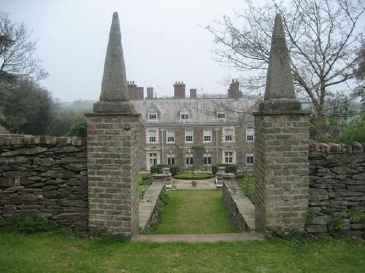
The site is today entered from a minor road which forms the west site boundary c 190m west of the house. Langdon Lodge (listed grade II), a late C19 Tudor-style thatched and timbered cottage with ornamental bargeboards, stands on the opposite side of the road to the entrance, which is flanked by stone concave wing walls and stone gate piers with ball finials. The tarmac drive curves north-east and east through evergreen shrubbery to arrive at a carriage court on the north side of the house. Two double pairs of C17 stone gate piers with pyramidal obelisk finials (listed grade II*) stand to the south-east and south-west of the house flanking a carriage way which was probably formed in the late C19. The gate piers themselves appear to have been relocated from the bastion above the formal garden where they are shown on the early C18 painting of the site. A similar carriageway to the north of the house enables vehicles to reach the C20 car park which has been formed on a terrace below the lawn to the east of the house.
A further drive leads east across the park to enter woodland c 270m east of the house, known as The Rookery, through stone gate piers with ball finials. Continuing south-east, the drive, now a footpath, crosses a minor road after c 350m, and turning south runs for a further 800m through Church Walk Wood before reaching a gateway onto another minor road c 400m north of Wembury church. A single stone gate pier with a ball finial survives on the lane to mark the southern end of Church Walk, and a carriage drive continues south-west of the lane through Ashey Plot and Coleshill Brake allowing views to the church and the sea. This drive may have led to a boathouse and landing stage on the coast c 2km south-west of the house. The network of carriage drives through the park and woodland to the north and east of the house was established by 1840 (Tithe map).
Principal Building
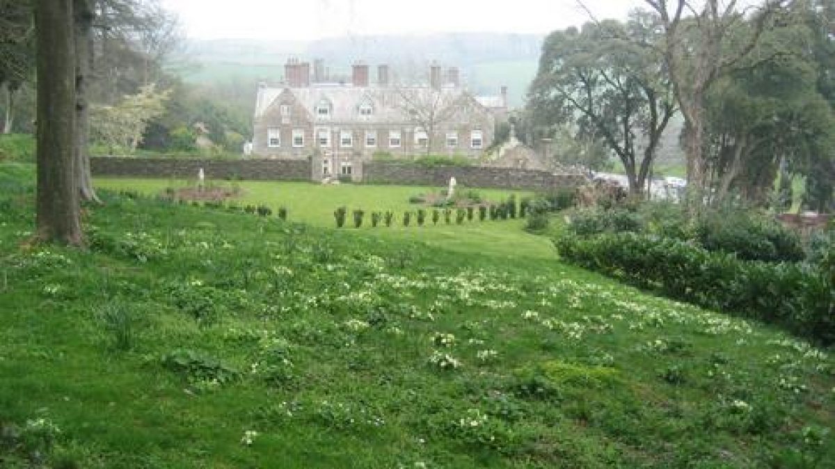
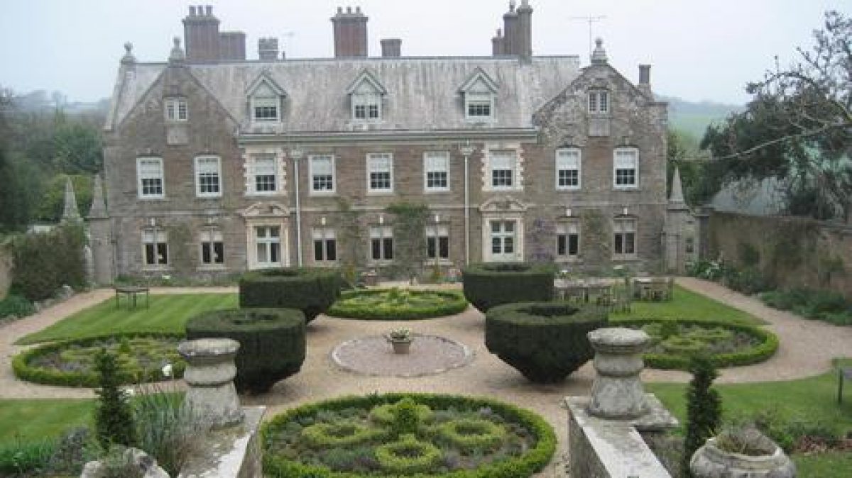
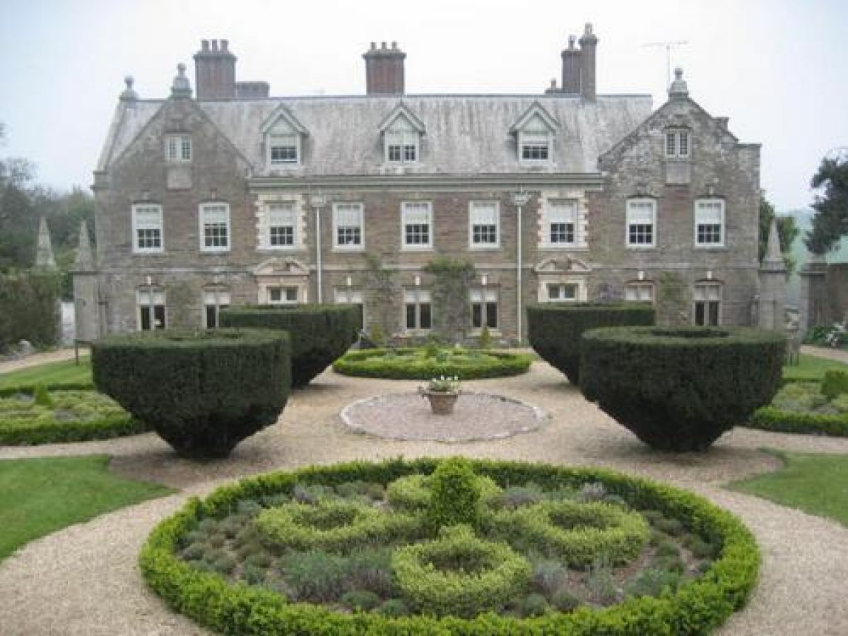
Langdon Court (listed grade II*) stands on a level terrace from which the land drops away to the north and north-east. It is believed that a medieval house on the site was rebuilt c 1577 for Vincent Calmady, and further remodelling for Josias Calmady from the late C17 resulted in the present square plan with a small central courtyard. The two-storey house is constructed in rough ashlar under slate roofs, and has generally symmetrical facades with the exception of that facing north. The west facade has gables at each end with sundials, while the south or garden facade is the most elaborate with rusticated window architraves, mask keystones and broken segmental pediments to the ground-floor doorways. The east facade appears to have been largely rebuilt in the C19 and has a central two-storey gabled porch, while the north facade, also altered in the C19, has a late C19 crenellated tower at the north-west corner.
Gardens and Pleasure Grounds
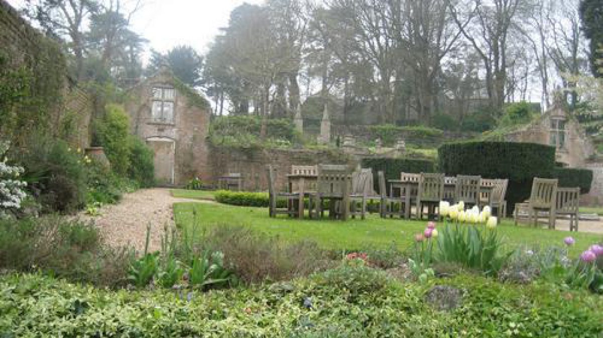
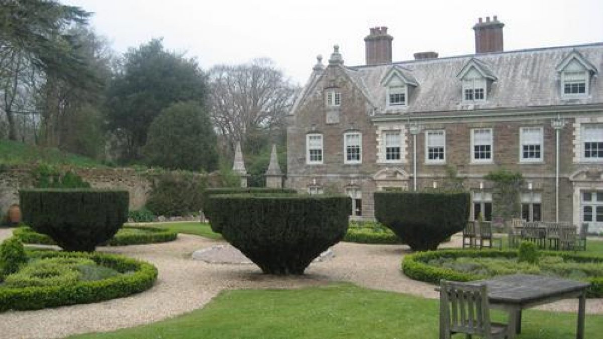
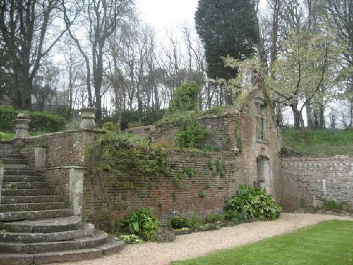
The formal gardens lie to the east and south of the house, with informal shrubberies to the west, south and south-east. Two terraces descend below the east facade, the upper comprising lawns enclosed by low stone parapet walls with low piers surmounted by ball finials, possibly those shown in this location in the early C18 painting, marking the corners. A stone-flagged path aligned on the porch is connected to the lower terrace, now (1998) the car park, by a flight of stone steps. This arrangement is not shown on the Tithe map (1840), and appears to be a late C19 scheme based on the early C18 painted view of the house. To the south two deep terraces enclosed to east and west by high brick-faced stone walls (listed grade II*) ascend the slope. These walls extended north to abut the walls of the house until the late C19 when the carriageway by the house was constructed. A late C17 stone-lined and covered conduit below the terrace retaining wall conveys water from the hillside to the south-west to feed the complex of late C17 or early C18 ponds in the valley to the east.
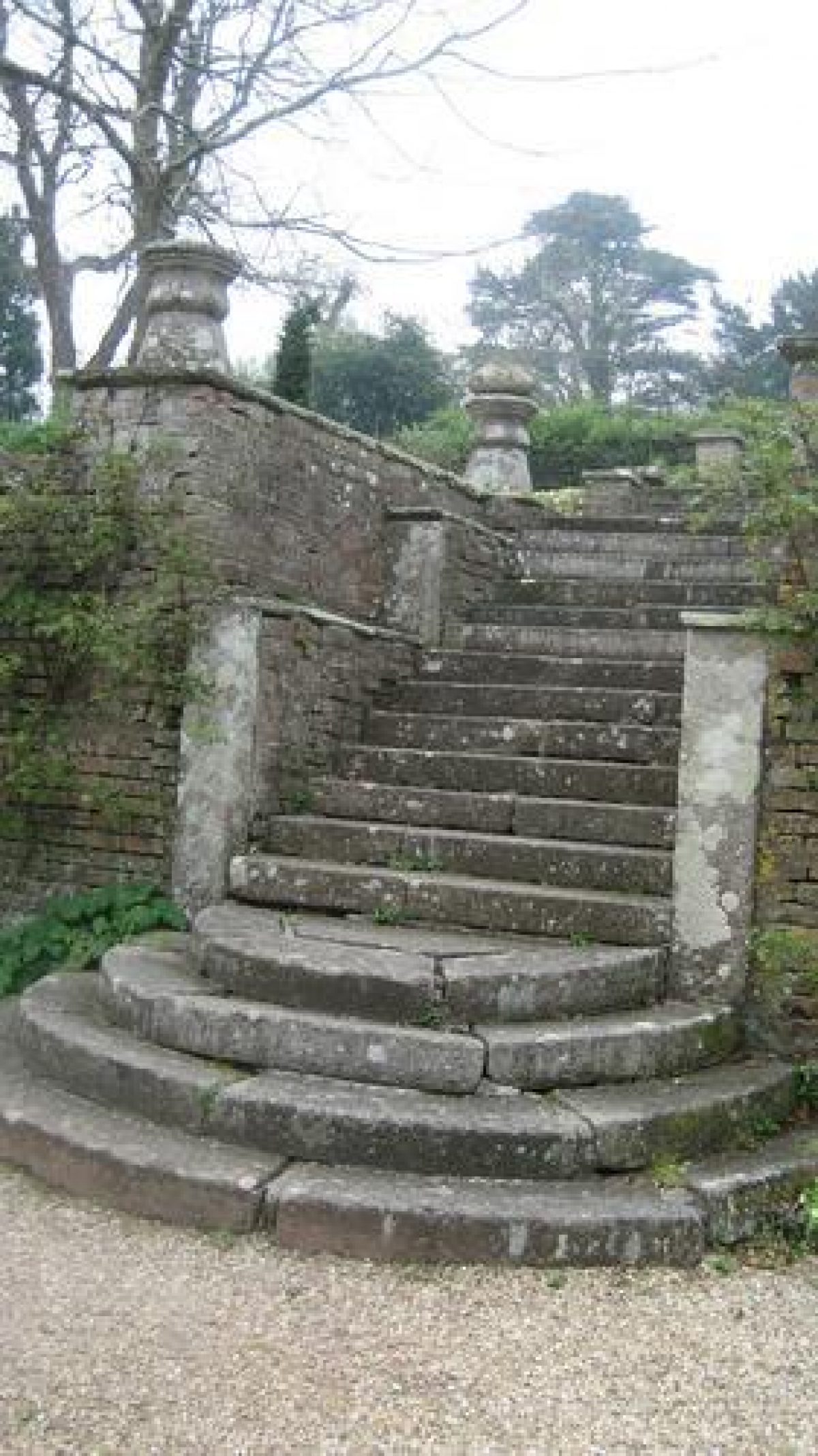
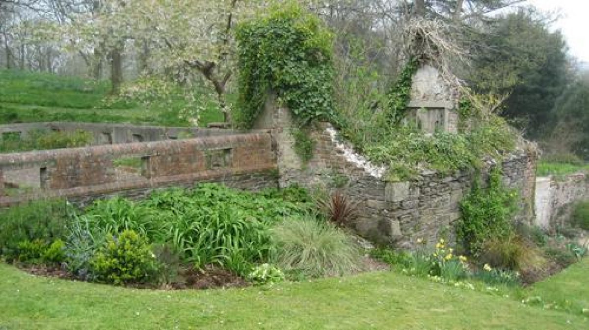
Stone steps (listed grade II*) placed axially to the facade of the house ascend from the late C19 carriageway below the house to the first terrace, which is laid out with a central, circular, stone-lined pond flanked by four mature Irish yews, shaped quarter lawns and further symmetrically arranged circular flower beds. To the south-east and south-west a pair of two-storey late C17 or early C18 pavilions (listed grade II*) with brick facades and arched mullioned first-floor windows are built into the retaining wall of the upper terrace. The pavilions are now (1998) in a semi-derelict state with the south-west building, which was converted to house the boiler for a late C19 glasshouse on the upper terrace, being roofless. Both pavilions and the garden walls are included on the Buildings at Risk Register (1998). The arrangement of the lower terrace and pavilions corresponds closely to that shown on the Tithe map (1840) and the early C18 painting, where the pavilions are shown with ogee roofs.
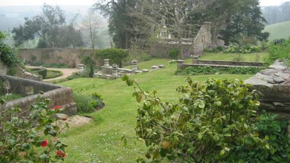
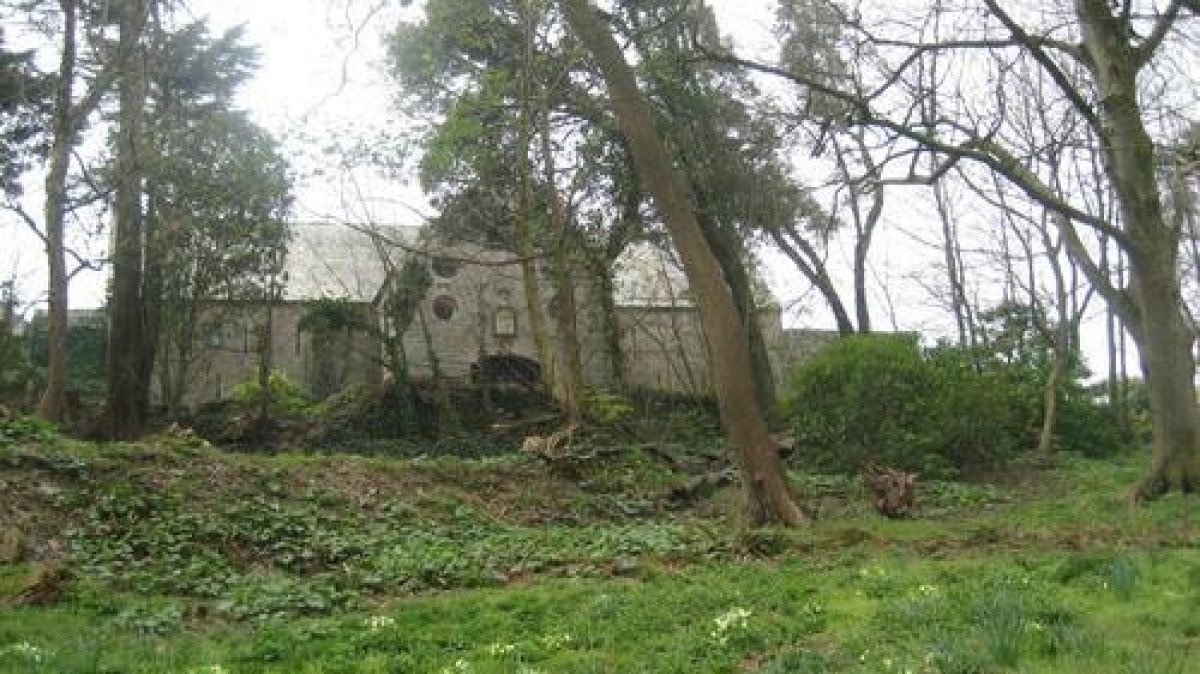
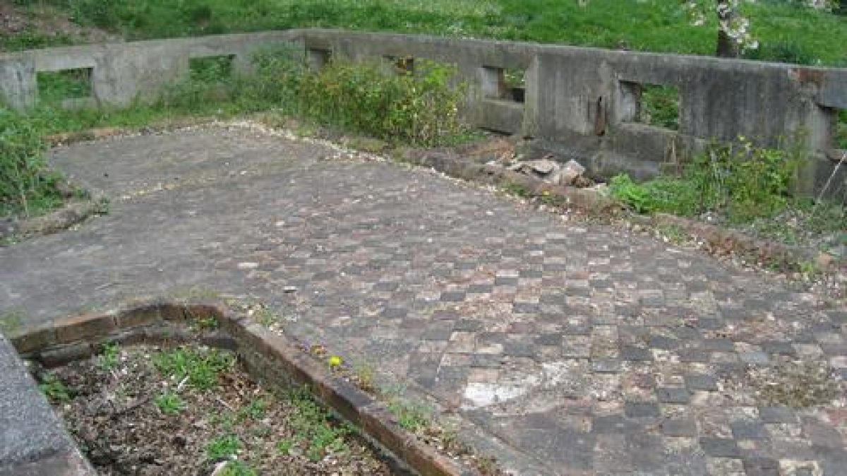
Further axial stone steps rise to the second terrace which is enclosed by a stone wall to the south and low walls to the east and west, and which is now laid to grass. At the north-west corner of the terrace are the low brick walls which supported a late C19 glasshouse or conservatory, from which the early Poole-tiled floor and flower beds also survive. The axial walk is continued by further stone steps which ascend between brick piers surmounted by stone obelisk finials to the third terrace, a level grassy area enclosed to the north by stone walls with decorative brick coping, which accommodated a fountain in the late C19. To the south-east, c 80m from the house, are the brick remains of a further early C18 garden building of unknown origin and purpose which retains traces of internal painted plasterwork, dressed stone around the doorway, a pair of ocular-shaped windows (now bricked up), and a stone-carved cherub's head on the adjacent wall. A straight terraced walk planted with mature ilex oaks and aligned on a former group of cedars in the deer park returns north from this structure to the house, passing on the east or outer side of the terraced garden walls. Paths, now largely overgrown, lead from the upper terrace north-west, west and south through areas of C19 predominantly evergreen shrubbery which is planted below deciduous trees.
Some 300m north-west of the house the former stables and carriage house and a former thatched barn have been converted to separate private houses, and a late C20 bungalow has been built. Approximately 100m south of the house an extensive C19 rockery composed principally of white crystalline rock lies parallel with the site boundary. The remains of the cross-shaped barn shown in the early C18 painting survive adjacent to the rockery. A semi-circular bastion or terrace north-east of the Tithe Barn (listed grade II) is shown in the early C18 painting, ornamented with gates and the stone piers now to the south of the house which acted as the culmination of the axial vista through the formal terraces. This is now (1998) a horse exercise area and lies outside the registered site. Some 130m south-east of the house a further area of shrubbery and mixed trees lies beyond the late C19 tennis lawn which has a low rustic timber pavilion to the north-west.
A further area of early C18 pleasure grounds lay across the valley c 260m north-east of the house. From this a rectangular stone-lined fishpond c 100m long survives in an overgrown state to the north-east of the kitchen garden, together with a further rectangular fishpond c 200m long in the wooded valley 400m north-east of the house. Two early C18 square ponds 270m north-east and 130m east of the house have not survived, although marked on the 1915 OS map.
Park
Lying to the north and north-east of the house, the parkland comprises the C17 or early C18 deer park c 500m north-east of the house, the Great New Park, probably of early C18 origin, c 270m north of the house, and the deep valley which runs c 350m east-north-east from the house to the site boundary which is formed by a stream. The deer park is enclosed by Park Wood, a belt of woodland to the north and east, with prominent groups of pines on the skyline to the north. An area of beech wood c 800m north-east of the house (outside the registered site) appears to have been established in the mid C19 in a narrow valley which runs east from Park Wood towards Spirewell Farm.
This woodland is significant in the views east from the house. Already under the plough by 1840 (Tithe map), the deer park remains mainly arable farmland today, with a single cedar surviving from a group of three on the south-west-facing slope 480m from the house. These trees were aligned on the unidentified garden building 80m south-east of the house (V Lorimer pers comm, 1998). Separated from the deer park by a finger of woodland which follows the stream valley south-south-east from a ridge of high ground forming the north boundary of the site, the Great New Park remains pasture with few trees.
The park in the valley east-north-east of the house also remains pasture, with a scatter of mature deciduous trees including a significant group of mature beech and oak pollards below the east drive c 100m from the house. A further area of parkland occupies high ground south of the east drive, and is enclosed by stone-walled woodland, The Rookery, to the east and the pleasure grounds to the west.
Kitchen Garden
Some 130m north of the house, the late C17 or early C18 kitchen garden is enclosed by stone and brick-faced concave walls c 3m high to the north and east, with lower walls to the south. A late C20 bungalow has been built at the west end of the enclosure and C20 agricultural buildings have replaced the glasshouses adjacent to the north wall. The interior of the garden is largely laid to grass with late C20 garden planting associated with the new house; the round-ended rectangular pond at the east end of the garden survives from the complex geometric layout shown on the Tithe map (1840). The remains of late C19 or early C20 glasshouses and frames survive in a separate enclosure to the north-west of the kitchen garden, and mature standard fruit trees survive from Orchard Close (Tithe map, 1840) which separates the kitchen garden from Home Farm 130m to the west.
Other Land
Church Walk Wood c 750m south-east of the house appears to have been established in the early C18, but much of the present planting is C19 and C20. This area has been in separate commercial ownership since c 1950 and the Church Walk has been used as the principal road through a development of holiday chalets which have been constructed in the mainly deciduous woodland. Church Walk led to Wembury church, and also to points on the coast from which an ornamental structure on the Great Mew Stone c 1km out into Wembury Bay could be seen. This circular, conical-roofed structure has distinctive ocular-shaped windows and other architectural details which echo those of the garden structure 80m south-east of the house (V Lorimer/R Soans pers comm, 1998). The Great Mew Stone is included in the registered site.
REFERENCES
J P Neale, Views of the Seats of Noblemen and Gentlemen ... I, (1818)
J B Burke, A Visitation of the seats and arms ...I, (1852), p 227
Trans Devonshire Assoc 42, (1910), p 522
J Harris, The Artist and the Country House (1979), p 131
B Cherry and N Pevsner, The Buildings of England: Devon (1989), p 895
T Gray, The Garden History of Devon An Illustrated Guide to Sources (1995), p 137
Maps
G S Lee, Tithe map for Wembury parish, 1840 (Devon Record Office)
OS 6" to 1 mile: 1st edition surveyed 1860, published 1886
2nd edition revised 1912, published 1915
Illustrations
Oil painting of Langdon Court, early 1700s (City Museum and Art Gallery, Plymouth) [copy at Langdon Court]
Archival items
A Survey and reference of the estates of Charles Holmes E Calmady esq and Pollexfen his wife ? in the years 1788, 1799 (601/1), (Devon Record Office)
Sale particulars, 1872 (Z18/82), (Devon Record Office)
Sale particulars, 1927 (1271/1), (West Devon Record Office)
Sale particulars, 1928 (1096/319), (West Devon Record Office)
Description written: November 1998
Amended: June 1999
Edited: July 2000
- Visitor Access, Directions & Contacts
Access contact details
This is a hotel, access is limited, please contact before visiting.
Directions
South-east of Plymouth http://www.langdoncourt.com/contact/
Owners
Geoffrey Ede
- History
The following is from the Register of Parks and Gardens of Special Historic Interest. For the most up-to-date Register entry, please visit the The National Heritage List for England (NHLE):
www.historicengland.org.uk/listing/the-list
HISTORIC DEVELOPMENT
Langdon Court has medieval origins, and was acquired by the Calmady family in 1564. The present house is a rebuilding of about 1577 which was further remodelled in about 1693 (date on house) for Josias Calmady whose descendants, many serving as Naval officers, continued to own the estate until the late 19th century. An anonymous painting dated stylistically to about 1700-1710, now in the City Museum and Art Gallery, Plymouth (copy hung in hotel), shows extensive formal gardens, significant elements of which form the basis of the surviving landscape. A deer park north-north-east of the house which is partly enclosed by stone walls was established by the early 18th century. The 1840 Tithe map indicates a landscape the details of which correspond closely to the features shown on the early 18th century painting. Further development appears to have taken place from the mid 19th century, and may have coincided with the extensions and alterations made to the house in 1877 following the death of the last of the Calmady family in 1876. The layout shown on the 1st edition Ordnance Survey map (1886) reflects both the surviving elements of the early 18th century landscape, and the 19th century developments, all of which correspond closely to what remains today (1998). Langdon Court remained a private house in the early 20th century, with King Edward VII being entertained on several occasions.
Following the Second World War the estate was divided and sold, the house becoming initially a children's convalescent home and subsequently an hotel.
- Features & Designations
Designations
The National Heritage List for England: Register of Parks and Gardens
- Reference: GD1686
- Grade: II
Features
- House (featured building)
- Description: The house was re-built in about 1577 and was further remodelled in about 1693 and again in 1877.
- Earliest Date:
- Latest Date:
- Shrubbery
- Stream
- Plantation
- Hedge
- Description: Traditional Devon hedge banks.
- Key Information
Type
Estate
Purpose
Ornamental
Principal Building
Commercial
Survival
Extant
Hectares
50
Open to the public
Yes
Civil Parish
Wembury
- References
References
- {English Heritage Register of Parks and Gardens of Special Historic Interest} (Swindon: English Heritage 2008) [on CD-ROM] Historic England Register of Parks and Gardens of Special Historic Interest
- Pevsner, N {The Buildings of England: Devon} (Harmondsworth: Penguin, 1952) The Buildings of England: Devon