
Introduction
Saltram House has an 18th-century landscape and gardens of 15 hectares, set within a larger park, woodland and agricultural estate.
Terrain
Generally, the site slopes west to the Laira from high ground at Hardwick Wood.The following is from the Register of Parks and Gardens of Special Historic Interest. For the most up-to-date Register entry, please visit The National Heritage List for England (NHLE):
An 18th century garden and parkland landscape developed from the mid 18th century, with advice on garden structures from Lord Grantham, and from about 1770 with advice from the landscape designer Nathaniel Richmond.
Location, Area, Boundaries, Landform and Setting
Saltram lies c2km south-west of Plympton and c2km east of Plymouth, on the east bank of the Laira or River Plym some 1.5km north of Plymstock. The c 180ha site comprises some 15ha of gardens around the House, and c 130ha of parkland, woods and agricultural land. Bounded to the north-west by the Laira and to the north by fences and hedges separating the site from C20 houses and sewage works, similar late-C20 fences enclose the south-western boundary which adjoins Chelson Meadow. The latter was reclaimed from the Laira by the first Earl in 1806 for use as a race course. Since the mid-C20 it has been used as a land-fill site and is not included in the registered site. To the south and south-east a soft boundary is formed by agricultural land enclosed by hedges and ornamental plantations including Sellar Acres and Pomplhett Plantation, the latter being bounded to the south by C20 disused quarry workings. Hardwick Wood and further parkland to the north-east, bisected by the cutting accommodating the late-C20 A38 dual carriageway, are bounded by late-C20 housing.
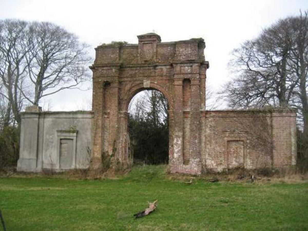
Generally, the site slopes west to the Laira from high ground at Hardwick Wood, and in the C18 and C19 significant vistas were created from the House, the Castle and the wider park to the river and Plymouth. Some of these views were recorded in a series of late C18 paintings by William Tomkins (d 1792). A further important vista was created from Saltram house to the Arch at Boringdon in 1783. The Arch (not included in the registered area but listed grade II* and part of Scheduled Monument 33780), stands c 2km north-north-east of the house, and was built for Lord Boringdon to a design by Robert Adam (1728-92). It served as an eye-catcher from Saltram House and provided a sudden and dramatic view of Saltram when approached from the north via the former drive that led from Boringdon House. The Arch is constructed in brick, stone and stucco, flanked by paired pilasters, it has single storey screen walls to each side and a single storey lodge (now ruinous) attached to the rear. The Arch stands within a plantation laid out in the late-C18 and retains several mature trees.
Entrances and Approaches
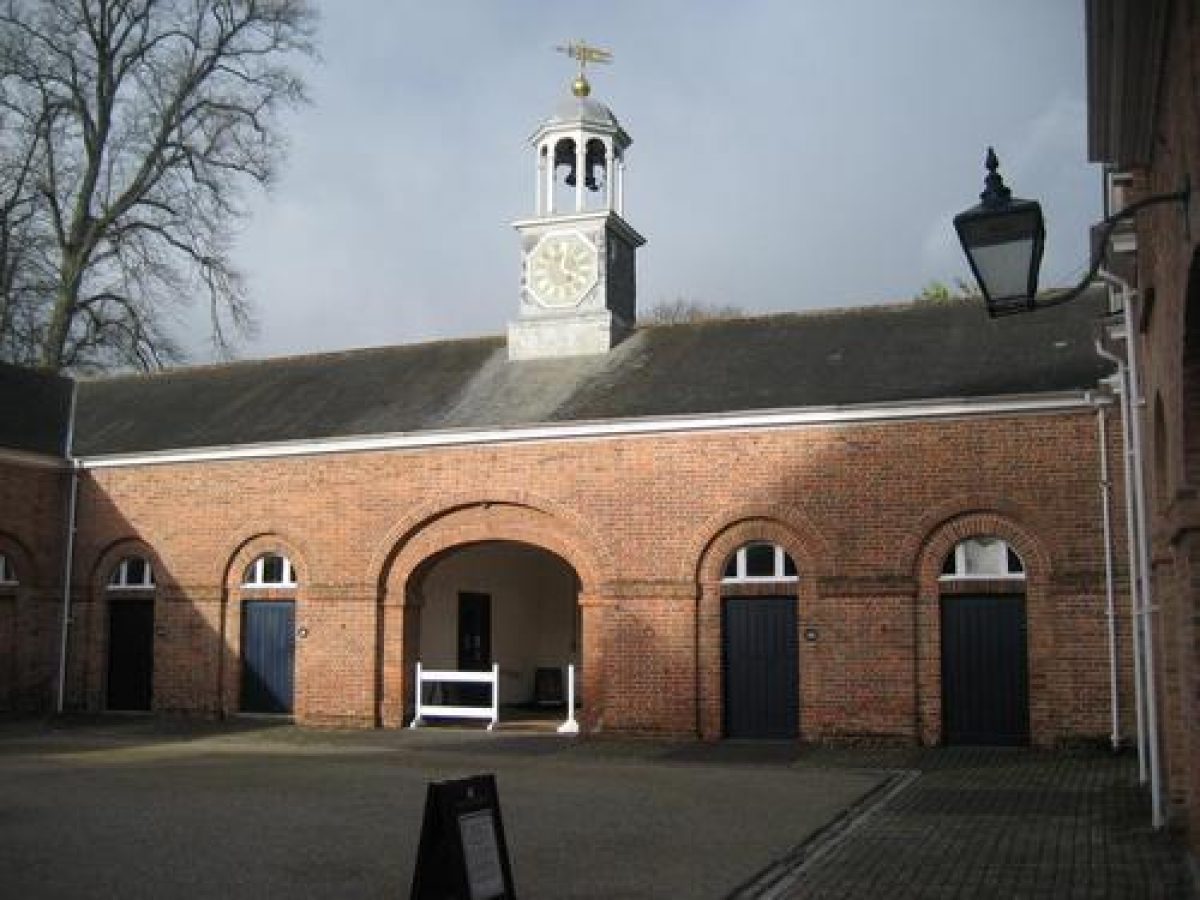
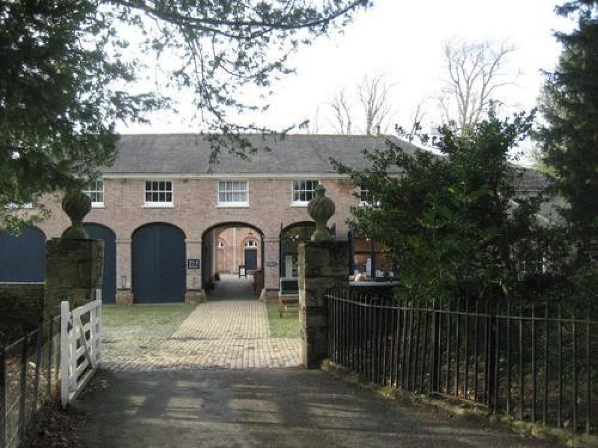
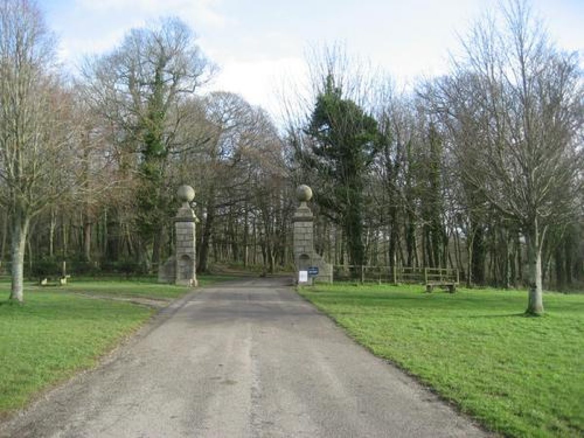
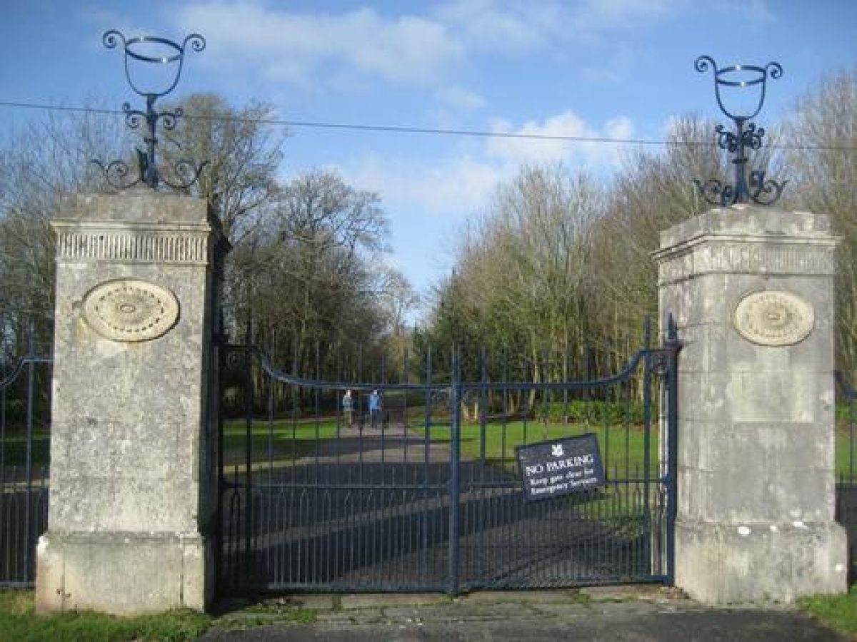
The site is approached from Merafield Road which forms the east boundary of the park, at a point c 570m north-east of the House. The entrance is flanked by a pair of C18 rusticated granite gate piers with ball finials from which white-painted timber gates are hung. Low convex wing walls support white-painted pale fences which extend north and south to rusticated granite piers with plain pyramidal caps (all listed grade II). Some 20m south-west of the entrance Merafield Lodge, a late-C19 two-storey stone lodge stands within the site. The tarmac drive enters the site, turning south-west and south to pass over the A38 dual carriageway on a late C20 concrete bridge, before sweeping north-west through the park and descending south to approach the mid C18 brick stables (listed grade II*) 60m south-east of the House. A further drive leads north-east through the pleasure grounds to a gravelled carriage court south of the House. A service drive continues north from the stables to the offices north of the House.
Until the mid-C18 the principal approach to Saltram was from a tidal crossing from Crabtree to Blaxton Ponit c 0.5km north-north-west of the house (guidebook 2005). This approach was replaced by Lord Boringdon in c 1770 when he constructed the Longbridge or north drive across Plumpton Marshes, which were reclaimed to form parkland (guidebook 2005). The course of this drive, disrupted by the late-C20 A38 road, continues c 670m north from the stables to the boundary of the site. The late C18 Stanmer Lodge which stood at Longbridge was demolished in c 1899, and its successor was removed in c 1986. The remnant of a further drive leads north-east from the north drive through an area of parkland north of the kitchen garden, to a former entrance at Cott Hill c 1km north-east of the house, marked by an early-C19 picturesque stone lodge with a thatched roof and trellis porch (listed grade II).
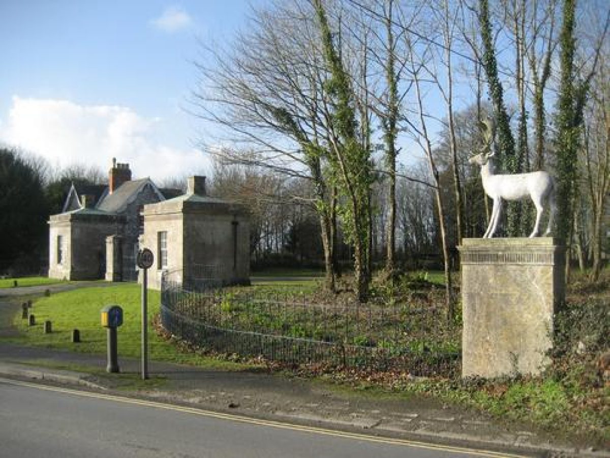
The late-C18 and early-C19 eastern approach survives as a tarmac drive extending c 430m south-east from the stables through the park to a pair of C17 rusticated granite gate piers with large ball finials (listed grade II). These were removed from Boringdon in the early C19 to Chelson Meadow, and re-erected in their present position c 1970. Beyond the gate piers the drive turns south-south-east, running c 700m through ornamental woodland to reach Stag Lodge, a pair of late-C18 single-storey stone lodges designed by Robert Adam with associated gate piers and wrought-iron gates (all listed grade II). Originally built at Merafield, these were moved here in the early-C19. A mid-C19 two-storey stone and slate-roofed lodge cottage stands c 10m south-west of Stag Lodge. A further drive from the east, first laid out in c 1800, survives in the form of a track leading through Hardwick Wood from Hardwick Lodge (now mostly a late-C20 private dwelling), c 1.5km east of the house. Formerly, before the park was bisected by the late-C20 A38 road, this drive linked up with the eastern drive on the site now occupied by the Boringdon gate piers.
Principal Building
Saltram House (listed grade I) was remodelled for John and Lady Catherine Parker c 1743. William Kent's plans for rebuilding were rejected in favour of a simplified scheme by an unknown architect. Elements from the C16 and C17 house survive within the present structure. Although differently composed, the east, south and west facades are all symmetrical, pale rendered and comprise three storeys. The south or entrance front has a central pediment containing an early-C19 Coade stone coat of arms and later earl's coronet, while the front door is contained within a Doric porch of 1820 by Foulston. The east facade has flanking pedimented wings, while the central block has a monumental ground-floor Venetian window.The west or garden front is Palladian in style with a central block linked to tall pedimented pavilions by two-storey wings. The pavilions each have a pair of ground-floor niches containing statues by Cheere, while the central block has a prominent central stone doorcase flanked by a pair of C18 sphinxes. In 1768 Lord Boringdon commmissioned Robert Adam to make internal changes to Saltram house which included the formation of a library (1769-70), later converted into a dining room (c 1780), from which Adam's Arch at Boringdon (1783) served as an eye-catcher (see also above).
Gardens and Pleasure Grounds
The gardens lie principally to the north and west of the House, with further small areas of pleasure ground to the east. The carriage court south of the House adjoins lawns which are separated from the park by a late C20 ha-ha. To the east, shallow stone steps rise to a gravelled terrace walk below the House which leads to a path passing through evergreen shrubs to offices on the north side of the House. The terrace is ornamented with stone urns, and below it a lawn slopes east to the drive and is separated from the park by iron fencing. The stables to the south-east are screened by ornamental shrubs, and there are further shrubs and specimen trees to the north-east.
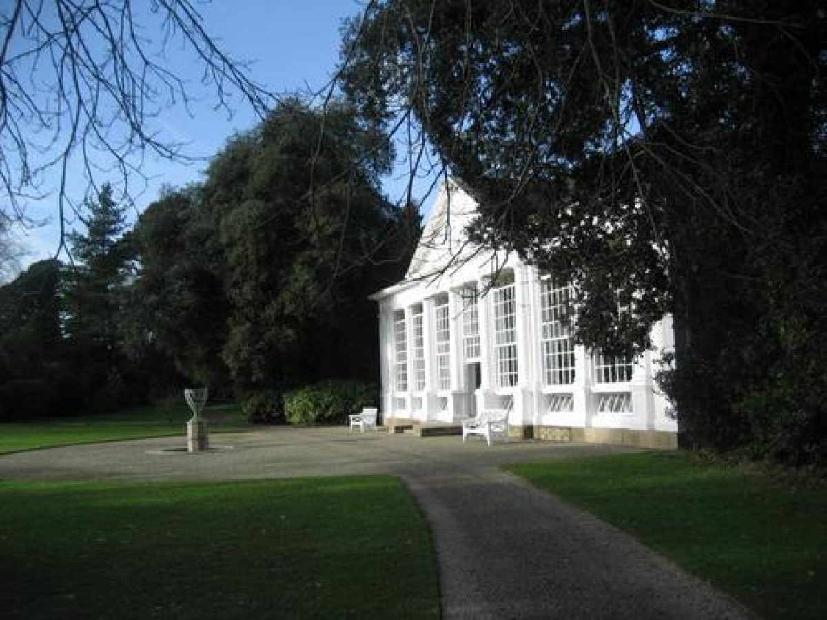
From the carriage court gravel walks lead north-west and north into the gardens. The House is separated from a lawn to the west by a gravel walk and four Irish yews and a pair of marble urns on stone pedestals which survive from the late-C19 formal garden. To the north and south the lawn is flanked by ornamental trees and shrubs. The Chapel (since 1998 a gallery), built in 1776 by the estate carpenter Mr Stockman (listed grade II), stands c 50m north-west of the House. This is a single-storey rendered building with a south facade comprising four gothic windows and a gothic door separated by buttresses. It has a castellated parapet and a hipped slate roof. Some 270m north-west of the House, the late-C18 Orangery (listed grade II*) is a substantial wooden structure on a granite base with a large pediment surmounting three tall sash windows separated by Doric columns, flanked on each side by two further tall sashes separated by pilasters. The design of the Orangery may be related to Adam's contemporary Temple Greenhouse at Croome Court, Worcestershire (qv). Restored after a fire in 1932, the Orangery now (1998) contains a collection of citrus plants.
East of the Orangery the late-C18 Orange Grove comprises an elliptical shrubbery enclosure with wide gravel walks for standing citrus trees outside during the summer, surrounding a central, circular, stone-edged pool. A path leading north-west from the Orange Grove enters the Melancholy Walk, a grass terrace leading c 300m west through woodland with a classical temple, now known as Fanny's Bower (listed grade II*) but possibly the Temple of Jupiter in the C18, some 140m west of the Orange Grove. The small temple may survive from the mid-C18 garden (Fretwell 1990/91), and comprises a pediment supported on granite Tuscan columns. Its interior contains a simple wooden bench seat from which there are views north and north-east across the park. The Melancholy Walk was ornamented in the mid-C18 with statues and pillars, but few survive (late-C20).
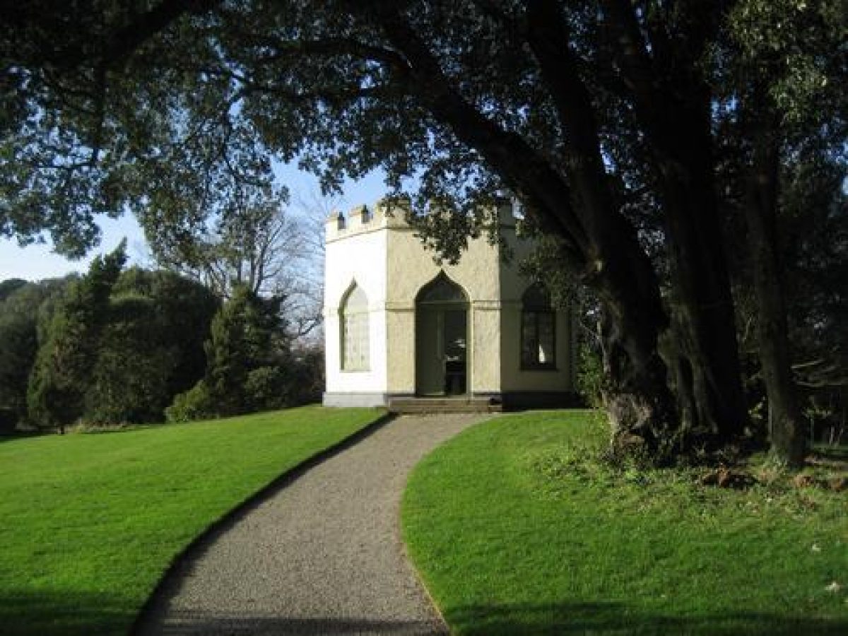
Areas of late C19 and C20 mixed ornamental planting and mature trees adjoin walks leading west and south-west to the Castle (listed grade II*), a late-C18, octagonal, single-storey structure situated on a mound planted with ilex oaks near the western extremity of the garden. The rough-cast building has four ogee-headed gothic windows set in the angle walls, and a similar door in the east facade, while the flat roof is concealed behind a castellated parapet. The interior of the Castle retains late-C18 plasterwork and a chimneypiece from a design by Kent, copied from Inigo Jones. From the Castle windows there are extensive views to the south and south-west across the park to Pomphlett Plantation and its meadows.
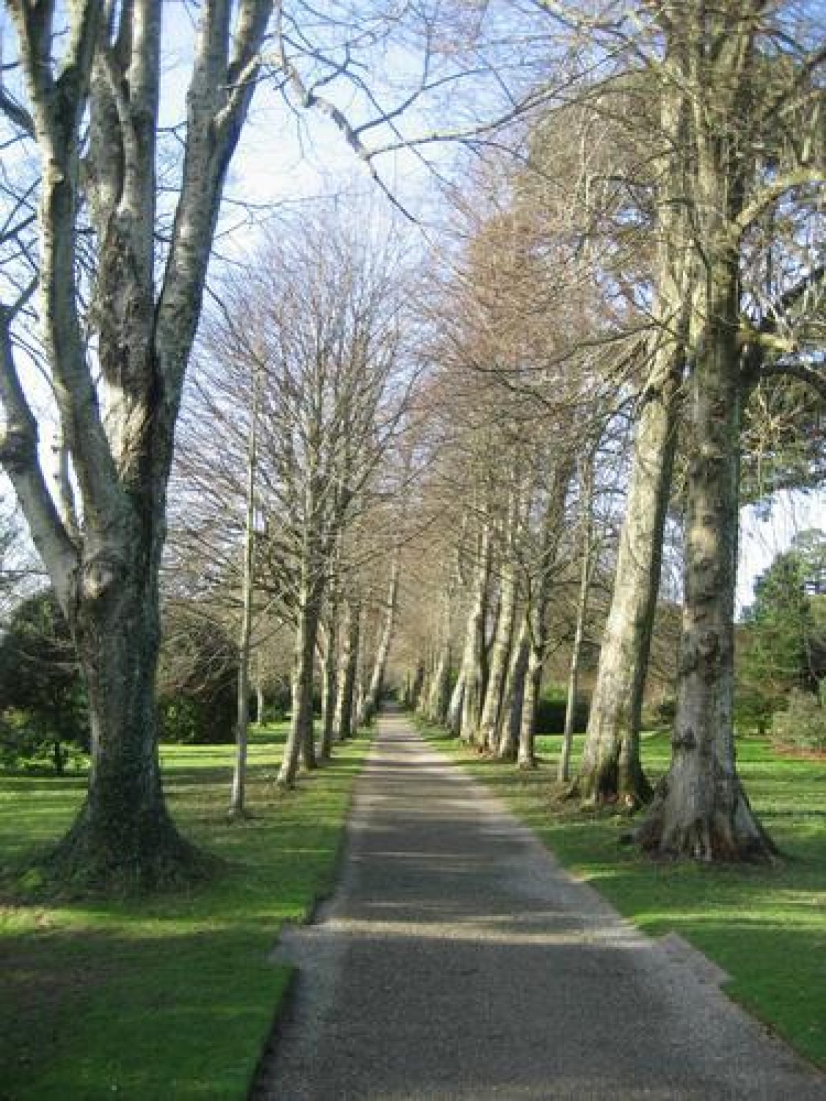
Walks west of the Castle have been planted out in the late-C20, but formerly led to a gothic-arched gate set in a stone wall separating the gardens from walks leading west through Saltram Wood to Saltram Point, Point Cottage (listed grade II), the boathouse and the remains of a salt-water Bath and the Bath Seat (listed grade II). This gateway has been blocked in the late-C20. East of the Castle a straight gravel walk passes c 350m through a late-C19 avenue of lime trees on the south-west boundary of the garden to return to the south-west corner of the west lawn.
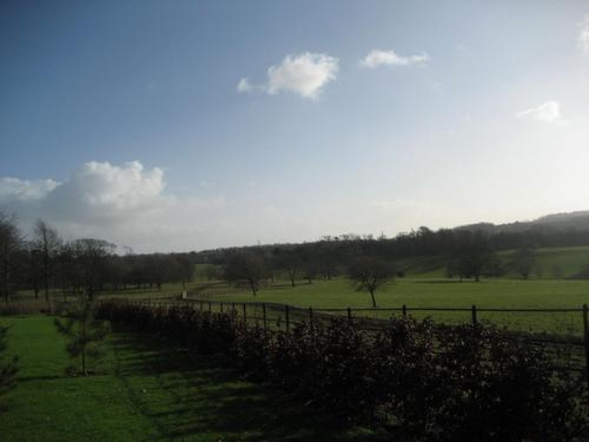
Park
Lying to the north, east, south and south-west of the House, the parkland slopes from the north-east to the Laira allowing westerly views from the higher ground and to the east is bisected by the cutting of the A38 road. Largely pasture, there is a scatter of ornamental trees to the north, east and south of the House, while to the south-west the park is divided by fences into grazing enclosures. Beyond a drive running west towards Saltram Point some 200m south of the House, the park is again divided by fences, with small areas of woodland and scattered trees. The Belt, an early-C19 plantation and carriage drive, separates the parkland from cultivated land to the south, with a further area of parkland, now (1998) under cultivation, lying to the west of the Stag Lodge Drive c 800m south-east of the House. The drive to Saltram Point crosses the park in a westerly direction, following a natural valley, and enters woodland c 800m south-west of the House.
From the C17 or C18 quay at Saltram Point the drive turns north and north-east, following the river shore with woodland on the steep slope to the south. The mid-C18 Amphitheatre (listed grade II*) lies some 600m north-east of Saltram Point and c 720m north-west of the House, to the south of a grassy bastion which projects into the river. Built into the exposed rock face, the Amphitheatre comprises a rusticated triple arcade with mask keystones approached by a flight of wide stone steps. Now roofless and lacking the urns which formerly ornamented the parapet, the Amphitheatre is flanked to each side by three small grottoes. A painting of this feature by William Tomkins (1770) shows small cannons on the bastion which served as a landing-place for visitors arriving by water. A statue of a gladiator shown on the bastion in Tomkins' painting is said to have been stolen in the early-C19 (guidebook 1998). The riverside drive continues c 800 north-east to join the north or Longbridge drive 300m north of the House.
The eastern part of the park is occupied by parkland north and west of the former kitchen garden and by Hardwick Wood, now separated from the main body of the park by the A38 road. The wood occupies a high ridge of ground and contains the remnants of a series of ornamental walks (as first shown on the OS drawing of 1785), which were laid out by Lord Boringdon, probably as part of the landscape improvements of c 1770 with advice from Nathaniel Richmond. In c 1800 the first Earl of Morley created a new entrance drive now surviving as a track (see above). The walks and drive offer a series of extensive views northwards to the Triumphal Arch and beyond to Dartmoor, and, in the late-C18 and early-C19 westwards to Saltram, as depicted in a view of 1797 painted by the Revd John Swete.
To the south and south-west of the main body of the park lies an area of further parkland on a high ridge (included within the Register boundary as an 'outlier'), which is formed by a north-facing slope retaining mature parkland trees which is bounded to the south by Pomphlett Plantation. Pomphlett Plantation (and its associated parkland to its north) were first landscaped by Lord Boringdon in the late-C18. Formerly they contained part of a circuit ride around Saltram (connecting to Wixenford Bottom), in order to view the estate and they were landscaped to give the visual impression that the park extended right up to the ridge. Now detached from the main body of the park, the mature plantation and its associated parkland continue to offer important reciprocal views of Saltram.
Kitchen Garden
Some 670m north-east of the House, the late-C18 walled kitchen garden was developed as a housing estate, Romilly Gardens, in c 1984 and is not included in the registered site boundary. Brick boundary walls and some internal walls (all listed grade II) survive within the development, as does the gardener's house (with later alterations) on the northern boundary. Wall-trained fruit trees remain on the west wall visible from the road. The kitchen garden was moved to this location in 1771, replacing an earlier garden nearer the house (guidebook, 2005).
REFERENCES
G Lipscombe, A Journey into Cornwall (1799), pp 320-322
D C Webb, Observations and Remarks (1812), p 75
Gardeners' Chronicle, ii (1903), pp 413-414
Country Life, 59 (23 January 1926), pp 124-133; (30 January 1926), pp 160-170; 141 (27 April 1967), pp 998-1001; (4 May 1967), pp 1160-1164
Lady Rockley, Historic Gardens of England (1938), pp 166-167
Saltram, guidebook (National Trust 1975)
D Jacques, Georgian Gardens The Reign of Nature (1983), p 85
Saltram, guidebook (National Trust 1988)
B Cherry and N Pevsner, The Buildings of England: Devon (1989), pp 710-714
K Fretwell, Saltram Park and Garden Survey (National Trust 1990/91)
Saltram House Garden Guide, (National Trust 1993)
C Morris (ed), The Illustrated Journeys of Celia Fiennes 1685 - c 1712 (1995 edn), pp 200-201.
T Gray, The Garden History of Devon An Illustrated Guide to Sources (1995), pp 196-199.
Saltram, guidebook (National Trust 1998)
Saltram, guidebook (National Trust 2005)
Maps
- B Donn, A Map of the County of Devon, 1765
- Tithe map for Plympton St Mary parish, 1840
- OS Surveyor's drawing, 1784-1786
- OS Old Series 1" to 1 mile, published 1809
- OS 6" to 1 mile: 1st edition surveyed 1869, published 1886
Illustrations
- W Tomkins, A view north-west across the park at Saltram, 1770; The amphitheatre and Laira, 1770; The River Plym and Saltram Wood (1771); Two views of Mount Edgcumbe and Plymouth Sound from Saltram (late C18), oil paintings (National Trust).
- J Swete, Saltram from the east, 1797, watercolour (Devon Record Office: 654M/F13/53).
- W Angus, Seats of Nobility and Gentry in Great Britain and Wales (1787), pl. 21.
- J Britton and E W Brayley, The Beauties of England and Wales 4, (1809).
- P Rogers, two views of Saltram: from the south-west and from the north-east, c 1813 (National Trust).
- R Ackerman, Repository 6, (1825), pl. 1.
- W W Gendall, Views of Country Seats ... II, (1830), p 41.
Archival items
- Family and Estate accounts, late C18 and early C19 (69, V1(4) and V5(10), (West Devon Record Office)
- Parker and Robinson correspondence, late C18 (430), (West Devon Record Office)
- Parker correspondence, late C18 and early C19 (1259), (West Devon Record Office)
- Morley Papers including correspondence and Journals of third Earl, late C18 and late C19 (Add MSS 48218-48301), (British Library)
- Planting diaries 1886-1894, and two others to 1921 (National Trust, Saltram House)
- Robert Adam's designs for Saltram and Boringdon are held at the Sir John Soane Museum and include the following: vol 46:171 (Castle in cottage style); vol 49:62 (Boringdon arch); vol 51:90 (Stag Lodge); vol 51:91 (Stag Lodge).
Description written: December 1998
Amended: May 1999; July 1999
Edited: July 2000
Revised: September 2007
- Visitor Access, Directions & Contacts
Telephone
441752333500Access contact details
The house is open between March and October, the gardens and park throughout the year. Please see: http://www.nationaltrust.org.uk/place-pages/289/pages/opening-times-calendar
Directions
Saltram House is 3.5 miles east of Plymouth city centre, following signs for Plympton from the A38.
Owners
The National Trust
Heelis, Kemble Drive, Swindon, SN2 2NA
- History
The following is from the Register of Parks and Gardens of Special Historic Interest. For the most up-to-date Register entry, please visit the The National Heritage List for England (NHLE):
www.historicengland.org.uk/listing/the-list
HISTORIC DEVELOPMENT
The Mayhowe family owned Saltram Wood, a quay and other buildings in the 16th century. These were sold in about 1614 to Sir James Bagg, Controller of Customs and MP for Plymouth, and by 1638 there was a 'great mansion house' and gardens at Saltram (guidebook 1998). In 1660 the estate was given by Parliament to Henry Hatsell, and at the Restoration it passed to Sir George Carteret.
Celia Fiennes described Saltram in 1698 as a 'very large house...[which] look'd very finely in a thicket of trees like a grove' (Morris 1995). It was sold in 1712 to George Parker who owned an estate at Boringdon about 1.5 kilometres north-east. On his death in 1743 the estate went to John Parker (1703-1768), and his wife, Lady Catherine Poulett. By the late 1740s Saltram was the Parkers' principal residence, and in 1749 Lady Catherine's brother, second Earl Poulett of Hinton House, Somerset, brought Charles Hamilton of Painshill, Surrey to Saltram. Hamilton may have advised on the landscape (Fretwell 1990/1991). The mid 18th century landscape appears to have been limited to the gardens and pleasure grounds, as Donn does not indicate a park on his county map (1765).
John Parker II, created Lord Boringdon in 1784, succeeded in 1768, and with his wife, Theresa Robinson, made significant changes. Robert Adam (1728-1792) was commissioned to make alterations to the house (1768), while from about 1770 improvements were made to the garden and the park was developed under the supervision of Nathaniel Richmond (1724-1784) who received payments in 1770 and 1772-1774. Richmond, who also worked for Theresa's Parker's brother at Stanmer Park, Sussex, produced plans for plantations, designs for the Castle (unexecuted), and plans for the Orangery (modified). Other improvements in the 1770s included a new kitchen garden (1771), and construction of the Castle (1773) to designs by Thomas Robinson (later Lord Grantham), Theresa Parker's brother.
Agricultural improvement was regarded as part of the landscape improvement. A triumphal arch at Boringdon (Robert Adam 1783) acted as an eyecatcher from Saltram. Some of these developments are recorded in a series of paintings by William Tomkins (1770-1771), and on the Ordnance Survey surveyor's drawing (1784- 1786) (Fretwell 1990/91), which also shows that the disposition of the garden and central areas of the park was established by that date.
John Parker II died in 1788 and was succeeded by his son, who was still a minor. Saltram was let to Lord Lansdowne, and later to King George III. From the mid 1790s the park was extended, new plantations formed, and a new eastern approach with associated lodges built. Chelson Meadow south-west of the park was reclaimed from the Laira in 1806-1807. These schemes, shown on the Tithe map of 1840, meant that John Parker III, created Earl of Morley in 1815, left considerable debts at his death in 1840.
Saltram was let for twenty-three years and little was done to the grounds until the third Earl returned with his wife, Margaret, daughter of R S Holford of Westonbirt, Gloucestershire in 1884. In 1903 the Gardeners' Chronicle noted significant improvements in the garden, which had been reclaimed from a 'wilderness of laurels' and planted with rare trees and shrubs, some obtained from Westonbirt, and others from A G Mitford of Batsford, Gloucestershire. Under the fourth Earl (succeeded 1905, d 1951), and the fifth Earl (d 1962), few changes were made, except for removing the late 19th century formal garden below the west front (1956-1957).
In 1957 the House, garden and part of the park were acquired by Her Majesty's Treasury in lieu of death duties, and were passed to the National Trust, which undertook restoration of the garden buildings between 1957 and 1960. In 1970 the A38 dual carriageway was constructed through the park east of the House, and Plymouth City Council acquired Chelson Meadow, converting it into a rubbish tip. The former kitchen garden, which remained outside the National Trust property, was developed for housing in about 1984. Storm damage in 1990 led the National Trust to commission an historical survey of the site which has been used to inform recent management.
- Associated People
- Features & Designations
Designations
The National Heritage List for England: Register of Parks and Gardens
- Reference: GD1690
- Grade: II*
Features
- Mansion House (featured building)
- Description: The mansion house was first built some time between 1614 and 1638. Robert Adam made alterations to the house in 1768.
- Earliest Date:
- River
- Description: The Laira or River Plym.
- Plantation
- Description: Plantations including Sellar Acres and Pomplhett Plantation.
- Triumphal Arch
- Description: The Arch is constructed in brick, stone and stucco, flanked by paired pilasters. It served as an eye-catcher from Saltram House, but is not included in the registered site.
- Earliest Date:
- Latest Date:
- Gardens
- Parkland
- Woodland
- w
- Key Information
Type
Estate
Purpose
Ornamental
Principal Building
Domestic / Residential
Survival
Extant
Hectares
180
Open to the public
Yes
- References
References
- {English Heritage Register of Parks and Gardens of Special Historic Interest} (Swindon: English Heritage 2008) [on CD-ROM] Historic England Register of Parks and Gardens of Special Historic Interest
- Pevsner, N {The Buildings of England: Devon} (Harmondsworth: Penguin, 1952) The Buildings of England: Devon
- Nicholas Pearson Associates {Saltram Park Historic Landscape Survey/Restoration Plan} (1999) Saltram Park Historic Landscape Survey/Restoration Plan
- Fretwell, Katie {Saltram: park and garden survey} (1991) Saltram: park and garden survey