Introduction
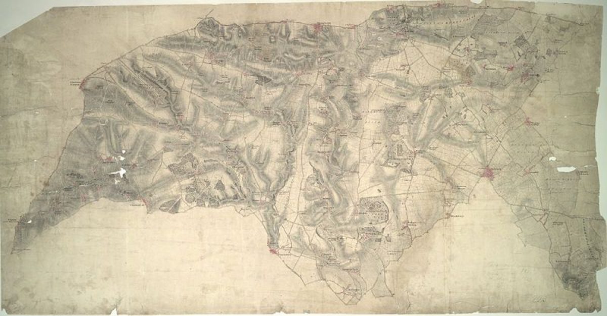
The site consists of pleasure grounds within a park, occupying about 305 hectares surrounding a country house. The park was laid out by Lancelot Brown in the early 1750s, overlying the earlier work of Thomas Greening.
The following is from the Register of Parks and Gardens of Special Historic Interest. For the most up-to-date Register entry, please visit the The National Heritage List for England (NHLE):
www.historicengland.org.uk/listing/the-list
Pleasure grounds and park surrounding a country house, laid out by Lancelot Brown in the early 1750s, following involvement in the 1740s by the then Royal Gardener, Thomas Greening.
DESCRIPTION
LOCATION, AREA, BOUNDARIES, LANDFORM, SETTING
Kirtlington Park lies at the east edge of the village of Kirtlington, 13km north of the centre of Oxford. The c 300ha site is bounded to the west by the village, and on the other sides by agricultural land. A short section of Akeman Street passes through the northern part of the park as a public lane. The setting is largely agricultural and rural, with several other substantial landscape parks lying close by, including Middleton Park (qv) adjacent to the north, and Blenheim (qv) to the south-west.
ENTRANCES AND APPROACHES
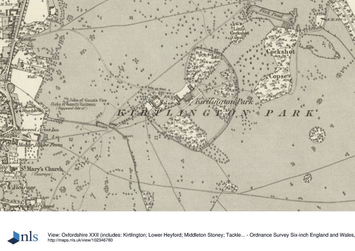
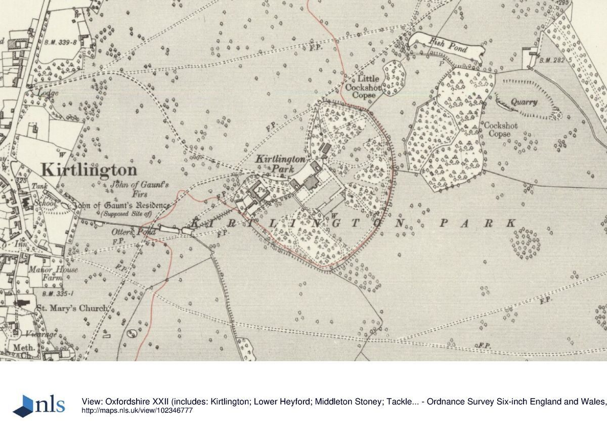
The main entrance to the estate is via the lodge standing c 800m north-west of the mansion, towards the north end of the village of Kirtlington. From here the north-west drive crosses the north park, leading south-east to a carriage sweep on the north-west front of the mansion, overlooking the north park. The disused north arm of the drive continues north-east from the mansion through the park to a second lodge which stands north-west of Park Farm, c 900m north-east of the mansion. From here the north drive crosses Akeman Street, continuing north-east through a plantation known as The Bushes, over Gallos Brook, terminating at the A4059, 2km north-east of the mansion.
PRINCIPAL BUILDING
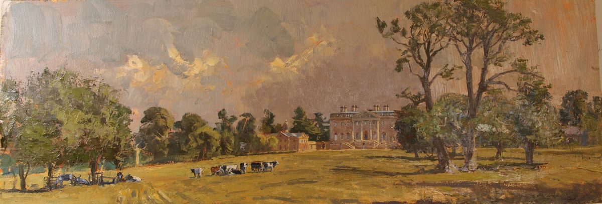
The mansion (William Smith and John Sanderson 1742-6, listed grade I) lies at the centre of the park. Stone-built in the Palladian style, it is of three storeys, with flanking corridors linking the principal block with two wings. A door at the centre of the south-east, garden front, at first-floor piano nobile level, leads out onto a landing from which a balustraded double stone staircase leads down to the garden.
The stone stable court (mid C18, listed grade II) lies 100m west of the mansion. Three ranges of two-storey stables and a coach house surround a stable court, with a courtyard wall screening the fourth, north-east side of the block and providing access via a gateway with stone piers set into the centre of the wall.
GARDENS AND PLEASURE GROUNDS
The mansion stands ringed by its pleasure grounds, as shown on Brown's plan of 1752 (Stroud 1975), at the centre of the park. Below the south front is a level terrace walk with formal lawns beyond. Clear vistas extend from each of the main façade across lawns, into the parkland, cutting through the otherwise wooded pleasure grounds. Except to the north-west, the ornamental grounds are divided from the park by an encircling ha-ha, also part of Brown's landscaping.
PARK
The park is enclosed by a wooded belt, particularly noticeable down the eastern boundary where a ride runs through the strip of woodland known as the Long Plantation. The heart of the park is planted up with a number of clumps and parkland trees.
In the park, some 500m north-east of the mansion, is a rectangular fishpond. This is one of several pieces of water, the largest being the fishpond on the southern edge of the park, 800m south-east of the mansion. A row of smaller ponds, including Otters' Ponds, lie beyond the stable court, c 300m south-west of the mansion.
In 1279 Kirtlington Manor is described as having a new park. In 1750 the 'old park', an area of 75 acres (c 34ha), was taken into Sir James Dashwood's new park, the new park comprising 496 acres (225ha).
REFERENCES
Country Life, 31 (13 April 1912), pp 350-3
Victoria History of the County of Oxfordshire 6, (1959), pp 219-31
N Pevsner and J Sherwood, The Buildings of England: Oxfordshire (1974), pp 676-8
D Stroud, Capability Brown (1975), p 69
Maps
R Davis, A New Map of the County of Oxford ..., 1797
Enclosure award, Kirtlington parish, 1815 (Oxfordshire County Record Office)
A Bryant, Map of the County of Oxford ..., surveyed 1823
OS 6" to 1 mile:
1st edition published 1884
2nd edition published 1900
3rd edition published 1923
OS 25" to 1 mile: 1st edition surveyed 1875
Description written: May 1999
Register Inspector: SR
Edited: January 2000
- Visitor Access, Directions & Contacts
- History
The following is from the Register of Parks and Gardens of Special Historic Interest. For the most up-to-date Register entry, please visit the The National Heritage List for England (NHLE):
www.historicengland.org.uk/listing/the-list
HISTORIC DEVELOPMENT
The Chamberlayne family purchased the Kirtlington estate in 1623. On the death of Sir Thomas Chamberlayne in 1682, the Chamberlayne estates passed to Robert Dashwood (cr Bt 1684) who had married Penelope, daughter of Sir Thomas, earlier the same year, the main residence being Northbrook House. In 1741 Sir James Dashwood (d 1779), who succeeded from his grandfather Sir Robert (d 1734), commissioned designs for a new mansion on his estate, to be set in a clearing made in what had previously been known as the Great Wood, a wood of oak and Spanish chestnut. The house was ready for occupation by 1746 and in 1750 Northbrook House was demolished.
A scheme for the grounds was supplied in the mid 1740s by the then Royal Gardener, Thomas Greening, some parts of which were carried out. A plan survives showing this scheme to have been focused on the land west of the house. In 1751 Sir James signed a contract with Lancelot Brown (1716-83) for the landscaping of the grounds, and work proceeded over the next four years. The two surviving plans show Brown's plans for the pleasure grounds and for the north park (Stroud 1975).
The Dashwoods held Northbrook and Kirtlington until 1909, when the estate was bought by the Earl of Leven and Melville. It has since passed through a series of hands, having been split into a number of ownerships.
Period
18th Century (1701 to 1800)
- Associated People
- Features & Designations
Designations
The National Heritage List for England: Register of Parks and Gardens
- Reference: GD2308
- Grade: II
The National Heritage List for England: Listed Building
- Reference: Kirtlington Park
- Grade: I
Features
- Lawn
- Terrace
- House (featured building)
- Earliest Date:
- Latest Date:
- Brook
- Description: Called Gallos Brook
- Fishpond
- Description: Large rectangular fishpond
- Pond
- Description: Several ponds one called Otter's Pond
- Key Information
Type
Park
Purpose
Ornamental
Principal Building
Domestic / Residential
Period
18th Century (1701 to 1800)
Survival
Extant
Hectares
305
Open to the public
Yes
Civil Parish
Kirtlington
- References
References
- {English Heritage Register of Parks and Gardens of Special Historic Interest}, (Swindon: English Heritage, 2008) [on CD-ROM] Historic England Register of Parks and Gardens of Special Historic Interest
- Stroud, D., {Capability Brown} (London: Faber, 1975), p. 69 Capability Brown
- Pevsner, N. and J. Sherwood, {The Buildings of England: Oxfordshire} (Harmondsworth: Penguin, 1974), pp. 676-8 The Buildings of England: Oxfordshire