Introduction
Kiddington Hall originated in the 17th century. The park was landscaped between 1740 and 1760 by Lancelot Brown. Formal gardens were laid out in about 1850 by Charles Barry to complement the present building, which was completed at that date. The site occupies about 90 hectares (75 hectares registered).
Terrain
Hilly ground bisected by the valley of the River Glyme.www.historicengland.org.uk/listing/the-list
A country house surrounded by a mid C18 landscape park by Lancelot Brown, with formal gardens of c 1850 by Charles Barry.
DESCRIPTION
LOCATION, AREA, BOUNDARIES, LANDFORM, SETTING
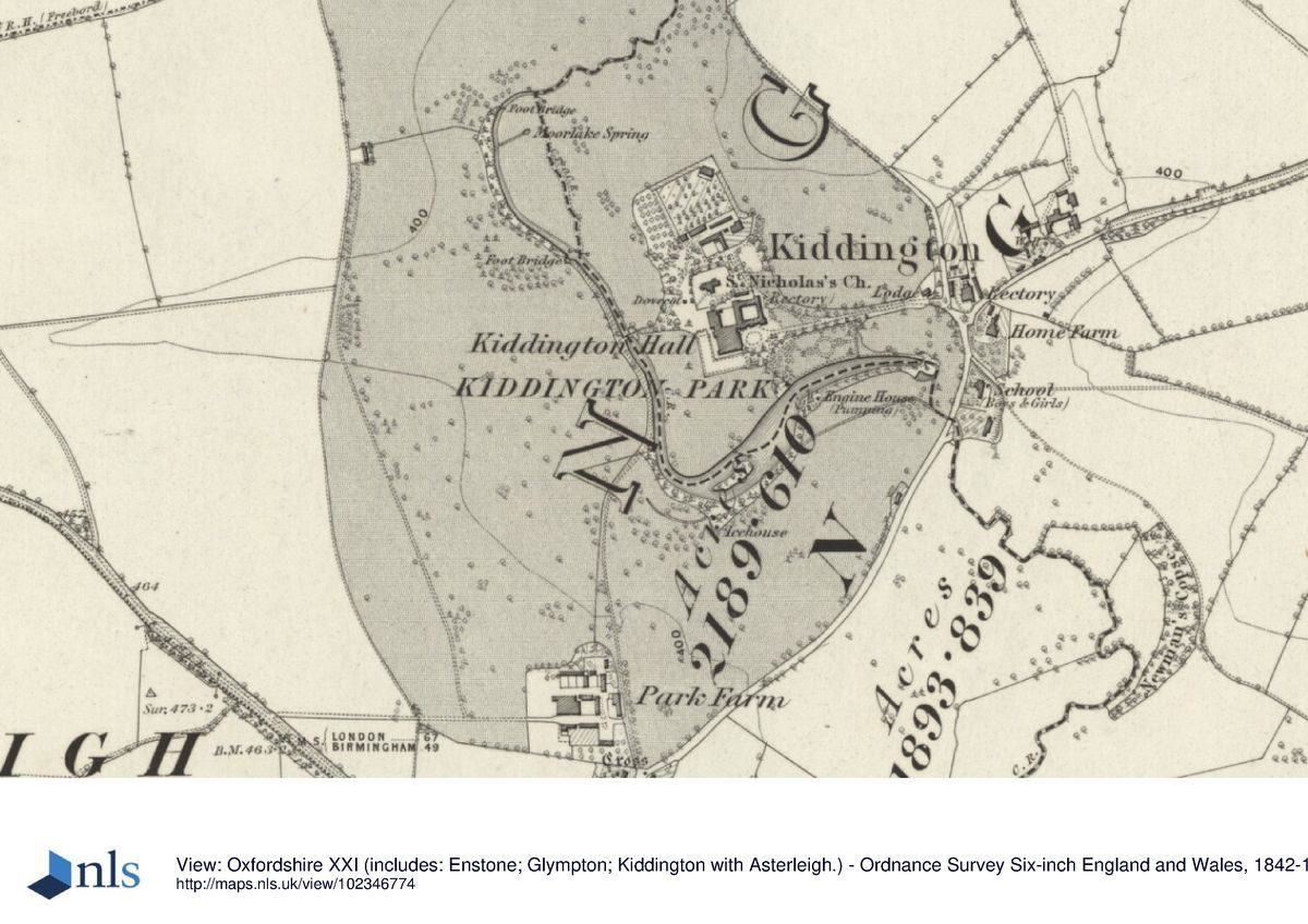
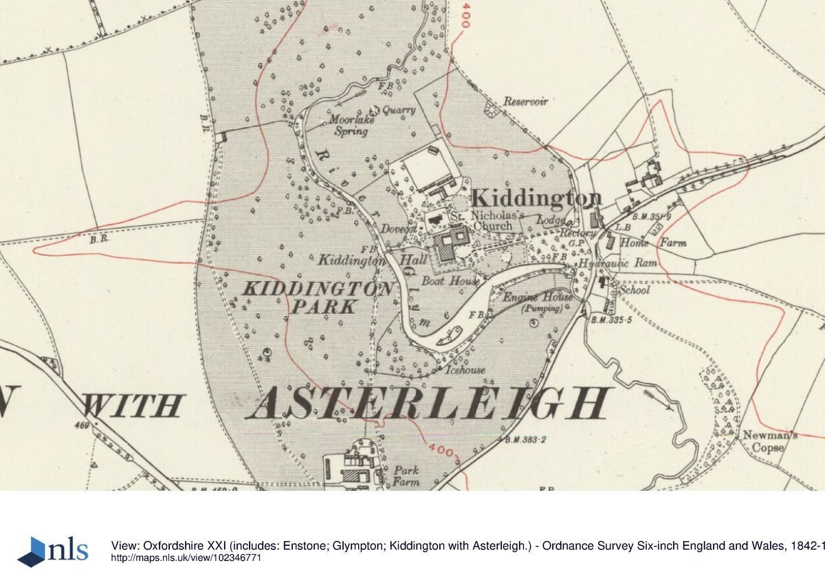
Kiddington Park lies c 7km north-west of Woodstock, at the west edge of Kiddington village, sited on hilly ground bisected by the valley of the River Glyme which enters the site at the north boundary and leaves at the east. The c 75ha site is bounded largely by agricultural land, the boundary marked to the south-east by the lane between Over Kiddington and Kiddington, and to the north-east by the lane from Kiddington to Radford. The setting is agricultural and wooded, with several hamlets close to the park, and views extending south-east and west out of the park. Kiddington lies at the centre of a group of landscape parks including Sandford Park (qv), Ditchley Park (qv), Glympton Park and Blenheim (qv).
ENTRANCES AND APPROACHES
The main approach enters the park at the south end of Kiddington village street, where it joins the lane from Over Kiddington to the south. The drive enters off the street 250m east of the Hall, passing between two stone gate piers (probably Barry c 1850, listed grade II) flanked by low stone walls, with, adjacent to the north, a single-storey stone lodge (probably Barry c 1850, listed grade II). The drive continues west, flanked by informal lawns planted with specimen trees and beyond this parkland, rising up to the entrance to the forecourt. This is marked by a pair of narrow, stone gate piers with delicate gothic detailing standing 50m east of the Hall, linked by short lengths of iron railing to two further gate piers flanked by stone walls. The rectangular, gravel forecourt, defined to the south by tall yews within the pleasure grounds and to the north by the south wing of the stable block, is bounded to the west by the east front of the Hall with its central door set into a three-bay porch.
A spur leaving the drive 100m from the Hall curves north-west to the parish church lying 50m north of the Hall, and the kitchen garden beyond.
A second, south drive enters the park from the north end of Over Kiddington, 500m south-west of the Hall. This passes Park Farm to the west, with elevated views across the park to the north-west and north-east, then continues north as it descends the hillside between the remains of a beech avenue, being screened from the Hall by woodland to the east. At the bottom of the hill, 350m south-west of the Hall, it emerges into the park with a clear view north-east across the lake up the smoothly contoured and open hillside to the west and south fronts, and north and east along the two arms of the lake. The drive continues northwards as a track across the park, reaching a footbridge (formerly the site of a ford) which crosses the north end of the lake some 100m west of the Hall. The drive reappears beyond the footbridge, rising up the hillside to the north-east and curving around the north side of the churchyard to join the north end of the spur to the church from the east drive. The south drive formerly ran next to the west bank of the north arm of the lake (OS 1881) and, with its dramatic views of the Hall and lake, may have been the main approach in the C18 (although it is not shown on Davis' map of 1797), rather than the east drive which appears to have been a continuation westwards of the village street (Davis, 1797).
PRINCIPAL BUILDING
Kiddington Hall (Barry c 1850, possibly incorporating 1673 core, listed grade II) stands towards the centre of the park, sited on an eminence overlooking ground sloping away to the west, south and east. The two-storey stone Hall, built in Classical style on a square plan, adjoins a service block to the north with a loggia attached to the west side, linked to the north-west corner of the Hall by a small vestibule with an apse to the rear. The west-facing, ten-bay arcaded loggia (Barry c 1850), formerly an orangery, has lost the window frames which formerly filled the arcades and its former cast-iron and glass roof has been replaced by a solid roof, but it retains a balustraded parapet and an internal arched recess at the north end.
The stable block (Barry c 1850, listed grade II) surrounds a square courtyard, entered off the north side of the forecourt via a tall, gabled archway surmounted by a wooden clock tower in the centre of the south range.
GARDENS AND PLEASURE GROUNDS
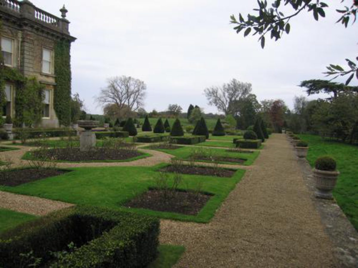
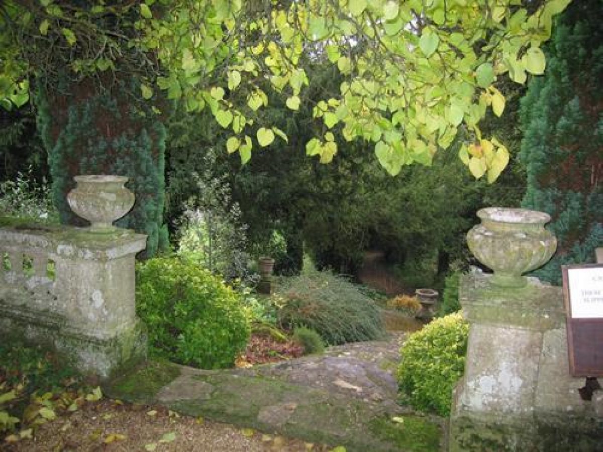
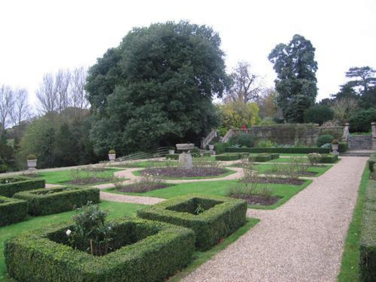
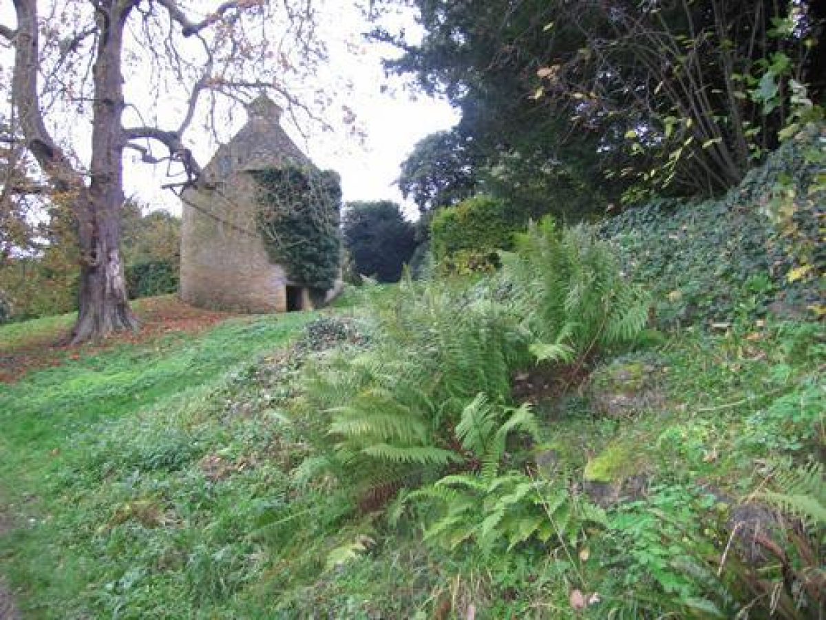
The formal gardens lie close to the Hall on the west and south (garden) fronts, consisting of terraces laid out by Barry c 1850 (listed grade II). They are entered from the loggia north of the Hall which opens onto a square lawn. The lawn lies above the terrace adjacent to the main west and south fronts, surrounded by a gravel path, with stone walls to the north and west. A lych gate lies at the east end of the north wall, giving access to the adjacent churchyard and parish church. The south boundary of the lawn is marked by a stone balustrade standing above a stone retaining wall, broken towards the west and east ends by balustraded stone steps leading down to the west arm of the main terrace which extends along the garden fronts. The terrace is laid to lawn, divided by a network of paths laid out in geometric patterns, with small flower beds in some of the panels. The terrace is linked to the garden fronts by a slightly higher gravel terrace or podium running parallel, onto which two garden doors open from the south front. The outer boundaries of the main terrace are defined by a stone ha-ha standing above the park which runs down away from the terrace. A rock garden lies west of the upper lawn, approached through a gap in the stone wall flanked by small piers. The rock garden is traversed from here via a flight of steps which divides into two part way down, rejoining towards the bottom, adjacent to the path which was the former south drive. To the north of the rock garden, standing adjacent to the churchyard at the top of the slope, is a circular stone dovecote with a pyramidal roof (C17, listed grade II), reached via a grass path running north from the upper lawn; the path continues, giving access to the walled garden.
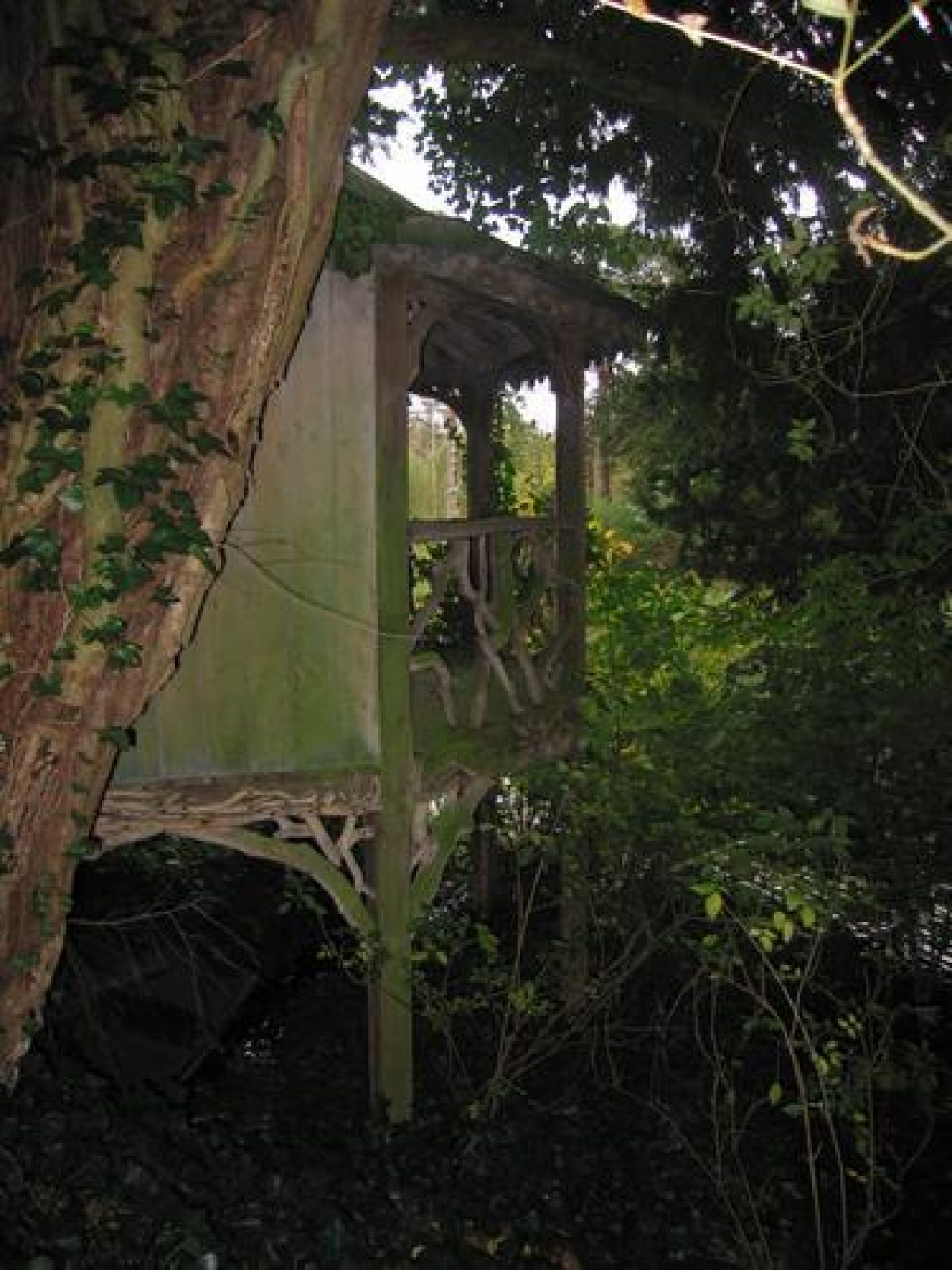
An informal path runs east from the east end of the main terrace into a small wooded pleasure ground, containing mature yews and other evergreens. The line of the ha-ha continues south-east from the end of the terrace down to the edge of the lake, separating the park to the west from the pleasure grounds to the east. A boathouse (c 1850, listed grade II) stands 75m south-east of the Hall on the north bank of the lake, at the south end of the pleasure ground. Timber-framed with a pyramidal roof, it is of octagonal plan, with two storeys, in rustic style. The path through the pleasure ground continues east towards the Dower House gardens, situated c 100m east of the Hall. The Dower House gardens were formerly the site of a C19 formal rose garden, with walks of linked circles, largely enclosed by conifers, running down to a path along the north bank of the lake (OS 1881). The area is still bounded to the north and east by stone walls which enclose the 1950s Dower House, built at the east end. It is largely laid to lawn with a swimming pool.
PARK
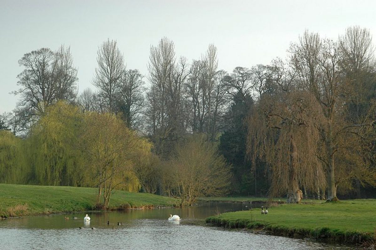
The undulating park, probably laid out by Lancelot Brown in the mid C18 (Stroud 1975), encloses the Hall, gardens and pleasure grounds, and is dominated by the serpentine lake formed from the River Glyme which bisects it. It is laid largely to pasture and contains areas of woodland, together with clumps of mature trees and single specimens, including several mature cedars. The hillside below the main terrace adjacent to the Hall slopes down to the west and south, to the northern edge of the lake. The ground is smoothly contoured, with the Hall sitting on the plateau at the top with views down to the water. A further lake, formed in the mid C20, lies to the north of the footbridge across the north end of the main lake.
KITCHEN GARDEN
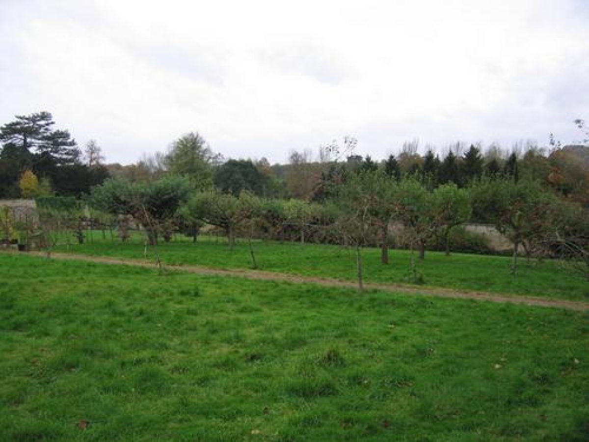
The kitchen garden lies 100m north of the Hall, on a west-facing hillside, and is entered via a doorway in the centre of the south wall. The c 0.75ha, square garden is still (1998) cultivated, and is surrounded by stone walls with the remains of brackets which formerly supported glass panels above the fruit trees trained against the walls. Two central paths bisect the garden in a cruciform pattern, with at the centre a small, stone-lined circular pond. In the north corner stand the derelict remains of a glasshouse and its beds. The gardener's cottage stands outside the garden, close to the south-east corner.
REFERENCES
Rev W Mavor, Blenheim guide, (1811 edn)
J Penn, An Historical and Descriptive Account of Stoke Park (1813)
N Pevsner and J Sherwood, The Buildings of England: Oxfordshire (1974), pp 669-70
D Stroud, Capability Brown (1975), pp 47, 230, pl 2B
Maps
R Davis, A New Map of the County of Oxford ..., 1797
A Bryant, Map of the County of Oxford ..., surveyed 1823
Tithe map of Kiddington parish, 1857 (Oxfordshire County Record Office)
A Jones (CPRE), Kiddington Hall, 1977 (copy on EH file)
OS 6" to 1 mile:
1st edition published 1884
2nd edition published 1900
3rd edition published 1923
OS 25" to 1 mile: 1st edition published 1881
Description written: May 1998 Amended: March 1999; April 1999
Register Inspector: SR
Edited: January 2000
- Visitor Access, Directions & Contacts
Directions
Off the A44, 4 miles north of Woodstock, 12 miles north of Oxford.
- History
The following is from the Register of Parks and Gardens of Special Historic Interest. For the most up-to-date Register entry, please visit the The National Heritage List for England (NHLE):
www.historicengland.org.uk/listing/the-list
HISTORIC DEVELOPMENT
Sir Charles Browne's great-grandfather bought the property at Kiddington c 1613, and Sir Charles, the first baronet, rebuilt the house in 1673, seemingly over the old foundations. Sir Charles Browne employed Lancelot Brown (1716-83) briefly c 1740, following Brown's move south from Northumberland in 1739, although he had moved to employment with Lord Cobham at Stowe in Buckinghamshire (qv) by 1741. Brown created the lake and landscaped the park (Stroud 1975), possibly c 1740 but more likely during the 1760s when he seems to have returned in his capacity as consultant landscape gardener (Mavor 1811). John Penn of Stoke House (qv) in south Buckinghamshire wrote in 1813 however that 'it has been said that the first piece of water he [Brown] formed, was at Lady Mostyn's in Oxfordshire' (An Historical and Descriptive Account of Stoke Park), Kiddington in the mid to late C18 being in her ownership, she having inherited as Sir Charles' grand-daughter in 1754. It would also appear that 'Brown was in fact recognised as an able undertaker of garden projects by the time he entered Lord Cobham's service' (Stroud 1975), perhaps having already created the Kiddington landscape.
Mortimer Ricardo (son of the political economist) employed Sir Charles Barry c 1850 to remodel the C17 house in Italianate style, build a new stable block and create formal terraces south and west of the house. The house remains (1998) in private ownership.
- Associated People
- Features & Designations
Designations
The National Heritage List for England: Register of Parks and Gardens
- Reference: GD2100
- Grade: II
Features
- Lake
- Description: 2 lakes
- Lawn
- House (featured building)
- Description: The house was re-built in 1673, then re-modelled in 1850.
- Earliest Date:
- Latest Date:
- Pond
- Description: Stone lined
- Outdoor Swimming Pool
- Description: C20
- Key Information
Type
Park
Purpose
Ornamental
Principal Building
Domestic / Residential
Survival
Extant
Hectares
90
Open to the public
Yes
Civil Parish
Kiddington with
- References
References
- {English Heritage Register of Parks and Gardens of Special Historic Interest}, (Swindon: English Heritage, 2008) [on CD-ROM] Historic England Register of Parks and Gardens of Special Historic Interest
- Stroud, D., {Capability Brown} (London: Faber, 1975), pp. 47, 230, plate 2B Capability Brown
- Pevsner, N. and J. Sherwood, {The Buildings of England: Oxfordshire} (Harmondsworth: Penguin, 1974), pp. 669-70 The Buildings of England: Oxfordshire