Introduction
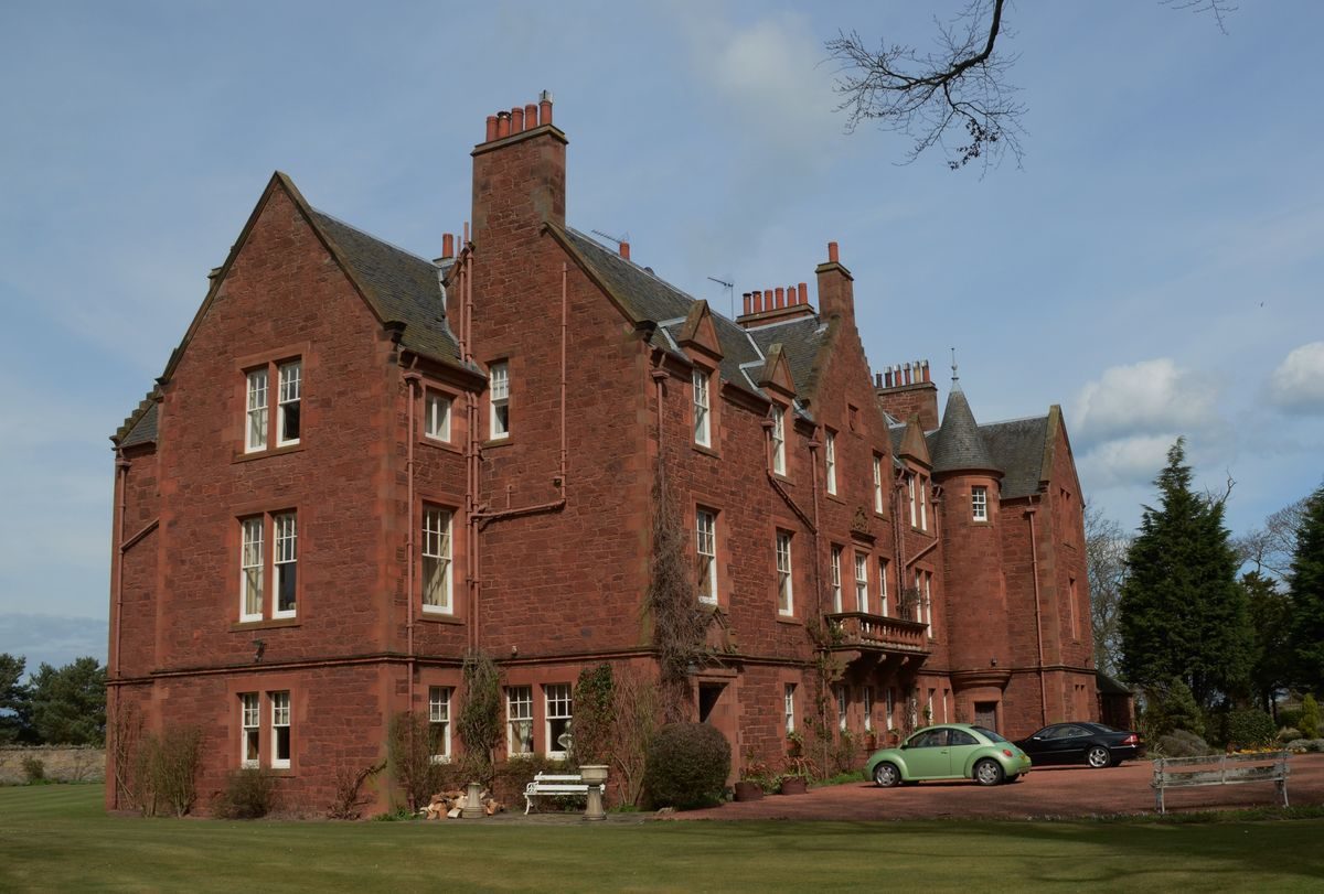
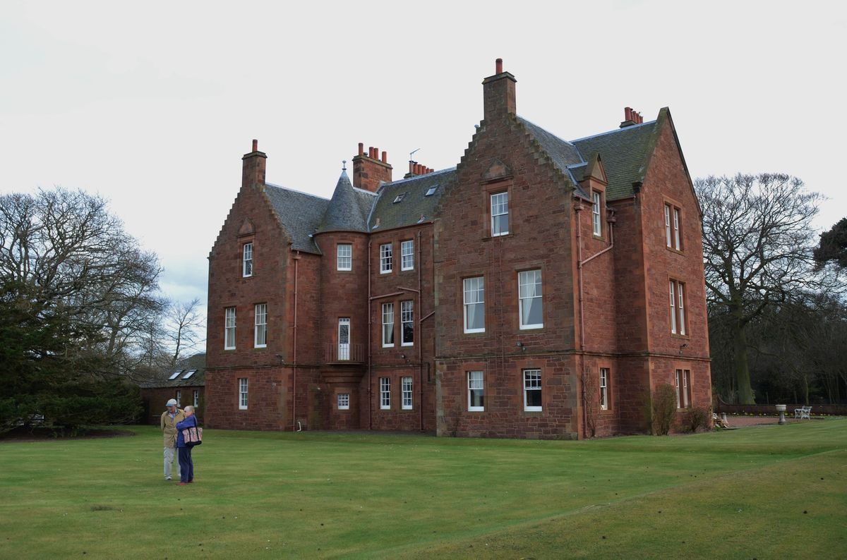
Invereil House is a baronial-style house with grounds laid out at the end of the 19th century in the eastern end of Linkhouse Wood. By the early-1990s it had been subdivided, with four owners.
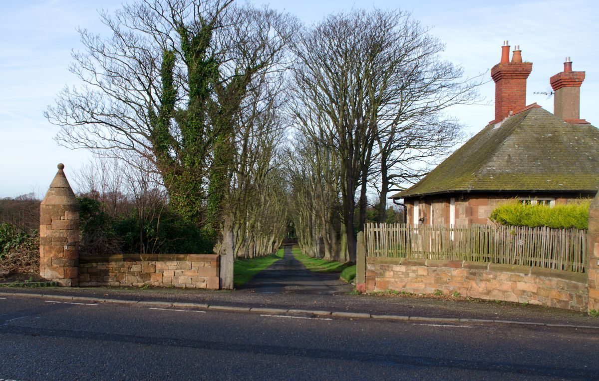
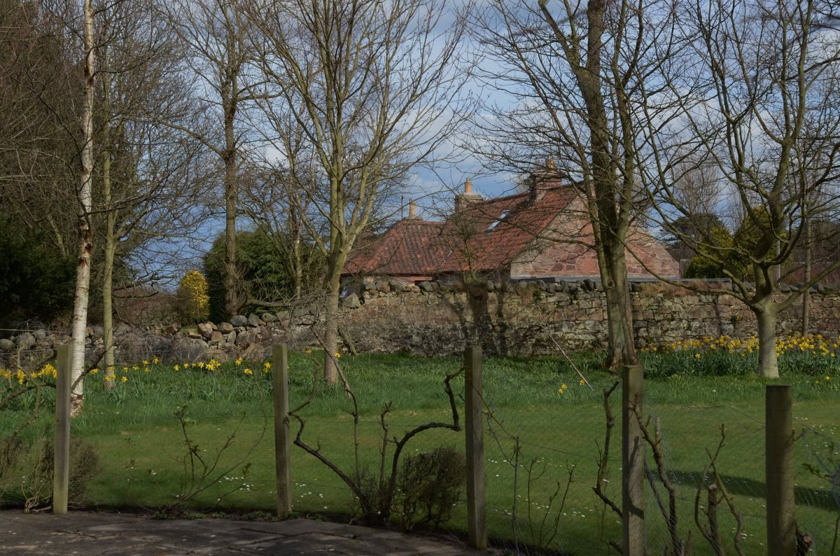
The Invereil designed landscape was laid out in the late 1890s on 4 hectares of land cleared of trees in the eastern portion of Linkhouse Wood, situated to the west of North Berwick. The baronial-style mansion house, coach house, stables, walled garden, and lodge are accessed from Dirleton road to the south. The upper floors of Invereil House have 180 degree panoramic views from the Forth Bridges in the west, to the Island of Fidra in the east. Subdivision of both house and grounds occurred in the 1970s but Invereil House is now, once again, in single ownership.
Further details about Invereil House are available on the Royal Commission on the Ancient and Historic Monuments of Scotland website:
http://canmore.rcahms.gov.uk/en/site/346337/details/invereil+house/
http://orapweb.rcahms.gov.uk/wp/00/WP003811.pdf
REFERENCES
1. MAPPED SOURCES
Unless otherwise stated all maps referenced are from the online National Library of Scotland Map Collection http://maps.nls.uk
Roy Military Survey of Scotland (Lowlands circa1755) showing Linkhouse and Ferrygate Farms
Map of Haddingtonshire (William Forrest 1802) showing crescent-shaped Linkhouse Wood
Ordnance Survey First Edition Six Inch to One Mile Haddingtonshire Sheet 2 Surveyed 1853, Published 1854
Ordnance Survey Second & Later Editions 25 Inch to One Mile Haddingtonshire Sheet 002.11 Revised circa1893, Published 1894
Ordnance Survey Second & Later Editions 25 Inch to One Mile Haddingtonshire Sheet 002.11 Revised circa1906, Published 1907
Ordnance Survey Second & Later Editions 25 inch to One Mile Haddingtonshire Sheet 002.11 Revised circa1938, Published 1945 [in outline only as the revision survey documents were lost during enemy action in World War II]
2. PRIMARY & DOCUMENTARY SOURCES
For J E Laidlay. Plan, sections and elevations [of Invereil House]. Dick Peddie & McKay (12/1897) Dick Peddie Archive (RCAHMS DPM 1890/84/1).
For J E Laidlay. Plan, sections and elevations [of Invereil House], including Ordnance survey map of area. Dick Peddie & McKay (6/1898) Dick Peddie Archive (RCAHMS DPM 1890/84/2).
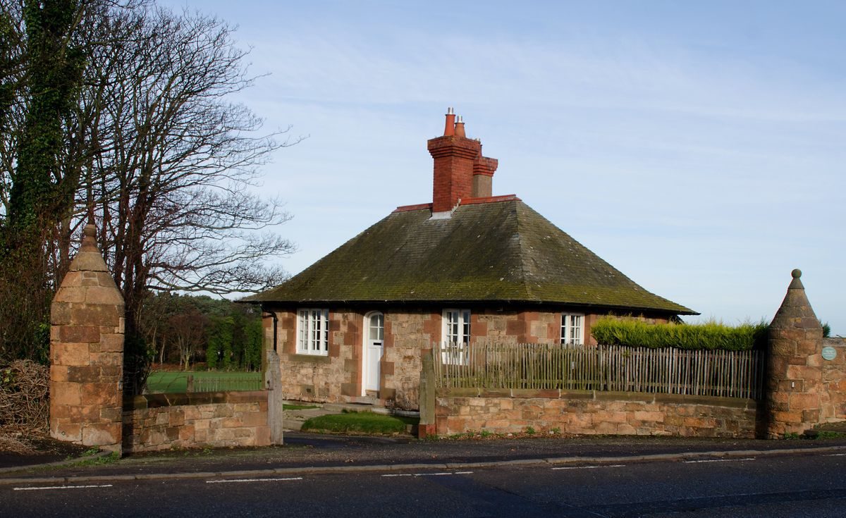
For J E Laidlay. Details of boudoir, entrance door, and principal staircase. General plan of Mr Laidlay’s feu. Plan, sections and elevations of [Invereil] gate lodge, including details. Dick Peddie & McKay (2/1899) Dick Peddie Archive (RCAHMS DPM 1890/84/4).
For J E Laidlay and later for Graham Wright. Drainage plans. Plans of alterations and additions [at Invereil House]. Dick Peddie & McKay (3/1906) Dick Peddie Archive (RCAHMS DPM 1890/84/5).
Gate Lodge Dirleton. Detail of front gate [for Invereil House]. Dick Peddie & McKay (1898) Dick Peddie Archive (RCAHMS DP002945).
Register of Sasines (RS) (National Archives of Scotland, Edinburgh)
Valuation Rolls (VR) (National Archives of Scotland, Edinburgh)
3. HISTORICAL ILLUSTRATIONS & PICTORIAL SOURCES
Darling, H M (22/8/1904) Country House [Photograph] Album (RCAHMS PA 78/27/2)
20 July 1940, RAF Second World War Aerial Reconnaissance B&W oblique aerial image, near Invereil House East Lothian, facing S. (RCAHMS 006-004-003-015-C)
19 June 1941, RAF Second World War Aerial Reconnaissance B&W vertical aerial image, near Ferrygate Dirleton East Lothian [Scale 1:18000]. (RCAHMS 006-004-003-587-C)
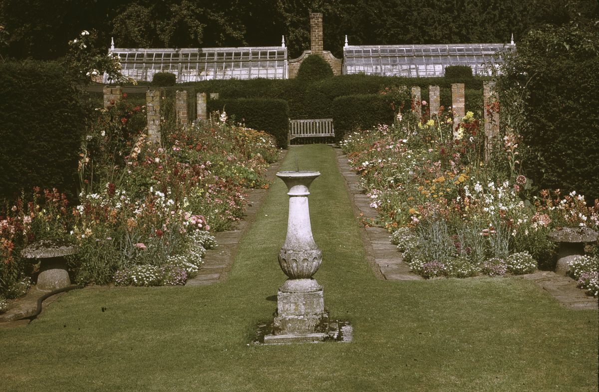
1970 Private collection, 35mm colour transparencies of walled garden.
07 June 1988, All Scotland Survey colour vertical aerial image near Hummel Ridges, North Berwick East Lothian [Scale 1:24000]. (RCAHMS 006-005-000-995-C)
Google Earth (2006)
4. BIBLIOGRAPHY OF PUBLISHED SOURCES
Bacon, G W (Ed.) (1907), Popular Atlas of the British Isles, Bacon. London
Census 1901 and 1911 www.scotlandspeople.gov.uk
Dictionary of Scottish Architects 1840–1980 (DSA) www.scottisharchitects.org.uk
Hall, D & Bowler, D, North Berwick, East Lothian: its archaeology revisited. Proc Soc Antiq Scot, 127 (1997), 659–75.
Historic Scotland http://www.historic-scotland.gov.uk
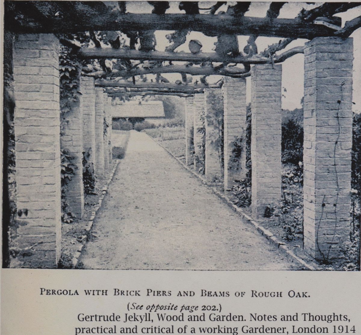
Jekyll, G (1914), Wood and Garden, Longman, p.214.
Kenneth Ryden and Partners (1985) Invereil House, by Dirleton, North Berwick, East Lothian: [sale particulars], Edinburgh (RCAHMS D.7.13.INV.S)
Knight Frank and Rutley (1992) Invereil House, by Dirleton, North Berwick, East Lothian: [sale particulars], Edinburgh. (RCAHMS D.7.13.INV.S)
Knight Frank and Strutt & Parker (2011) Invereil House, by Dirleton, North Berwick, East Lothian: [sale particulars], Edinburgh.
McWilliam, C (1978), Buildings of Scotland: Lothian, Yale.
Mosley, Charles (Ed.) (2003) Burke’s Peerage, Baronetage & Knightage 107th ed. Wilmington accessed via www.thepeerage.com.
http://www.northberwick.org.uk/laidlay.html.
http://www.northberwick.org.uk/walks_2.html.
- Visitor Access, Directions & Contacts
Directions
Invereil House is situated approximately 2.5 kilometres west of North Berwick.
- History
Forrest's survey of 1799 clearly indicates woodland at Yellow Craig, Ferrygate, Carlekemp and Linkhouse. Although the last two are unnamed, the plantation on Dirleton Common in the precise half-moon shape that persists to this day around Invereil House is without doubt the eastern end of Linkhouse Wood. It is not known how ‘ancient' Linkhouse Wood actually is although Prof. T C Smout, Historiographer Royal for Scotland, thinks that pine, beech and sycamore were probably planted as shelter to the west of Linkhouse in the 18th century (personal communication). Linkhouse is marked in the style of farm buildings on the Military Survey of Scotland (Roy 1755) and, although there may have been woodland nearby, it is not specifically shown by Roy. Only the farm cottages remained by 1853, when the main Linkhouse Farm steading is shown as ruins by the Ordnance Survey. In 1893, the east end of Linkhouse Wood is still shown as intact by the Ordnance Survey but, within 4 years, it would be partially cleared for the building of Invereil.
1897-99
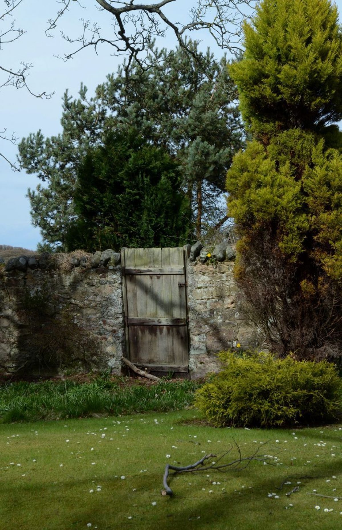
The east portion Linkhouse Wood (some 4.2 hectares) was feued from HENRY THOMAS NISBET HAMILTON OGILVY of Archerfield and East Fenton by JOHN ERNEST LAIDLAY, Champion Amateur Golfer, born in 1860 at Seacliff House North Berwick, died 1940 in Sunningdale Berks (http://www.northberwick.org.uk/laidlay.html). Partial clearance of Linkhouse Wood was followed by construction of Invereil House, coach house (stables), boundary walls and a walled garden of around 0.4 hectares. Also included in the feu was land for a 30-metre buffer between the north boundary wall and the golf links.
An access strip through the arable and woodland was purchased from Ferrygate (Dirleton Estate) for an avenue to Dirleton Road, where a gate lodge, quadrant and piers and a wooden gate were constructed. Dick Peddie & McKay designed high wooden gates.
Although Invereil House is a visual stopping point at the west end of Abbotsford Road, the only carriage access is via the gated avenue to the south on Dirleton Road. The two doors in the north boundary wall which give access to Abbotsford Road are only for pedestrians, or possibly horses.
1920
Invereil House and stables were purchased by JOHN GRAHAM WRIGHT, ship owner and timber broker, Glasgow (RS1920-05-15). He commissioned plans for alterations to the house by Richardson & McKay (Dick Peddie Archive). In 1920-21 the dwelling at the stables was unoccupied (VR99/28/536). By 1925-6, JAMES PATON, the chauffeur lived there (VR99/28/312) while JAMES LAW occupied the lodge. LAW had been gardener since at least 1901 (Census 1901 705 001/00 008).
1926
Invereil House, offices, stable, lodge and land were sold to NORA JANE CRAIG MILLAR COLVILLE or PELHAM-BURN, wife of CAPT. JAMES RUSSELL PELHAM-BURN, Seaforth Highlanders (RS1926-02-17). In 1930, JOHN REID was recorded as gardener (VR99/31/21).
1938
Invereil House, stables, land, woodland and shootings were sold to LORD and LADY HUTCHISON of London (RS1938-03-14 378/215 and RS1938-07-26 380/90). He was Major-General Robert Hutchison, 1st and last Baron Hutchison of Montrose (1873-1950), Member of Parliament for Kirkcaldy (1922-3) and Montrose (1924-32). They planted a walk north-west of the walled garden with rare rhododendrons and azaleas, and possibly also laid out the narrow canal leading from the south lawn to the lozenge-shaped lily pond (interview current proprietor). By 1940, no resident gardener is recorded but a chauffeur, CECIL MORRIS, was living in the house at the stables while RAF personnel occupied the gate lodge (VR99/36/24). But, by 1945, CECIL MORRIS had become the head gardener, living in the stables, while JOHN LORIMER, gardener was living in the gate lodge (VR99/38/579). Traditionally, when Invereil employed two gardeners, the head gardener lived in the stables and the under gardener in the lodge.
1948
Invereil House, stables, land, woodland and shootings were sold to the 9th EARL of BREADALBANE (1889-1959) (RS1948-04-17 415/171). His widow, ARMORER, COUNTESS of BREADALBANE inherited. She died in 1987. By 1950, ANDREW MACCORMICK was head gardener (stables) and JOHN WILSON under gardener (lodge) (VR99/42/29). By 1955, WALTER WALCZEK was under gardener (lodge) (VR99/53/45).
1960s-?
BILL LOCKIE, a brother of the Duke of Buccleuch's head gardener at Bowhill, was the single resident gardener (interview current proprietor).
1969
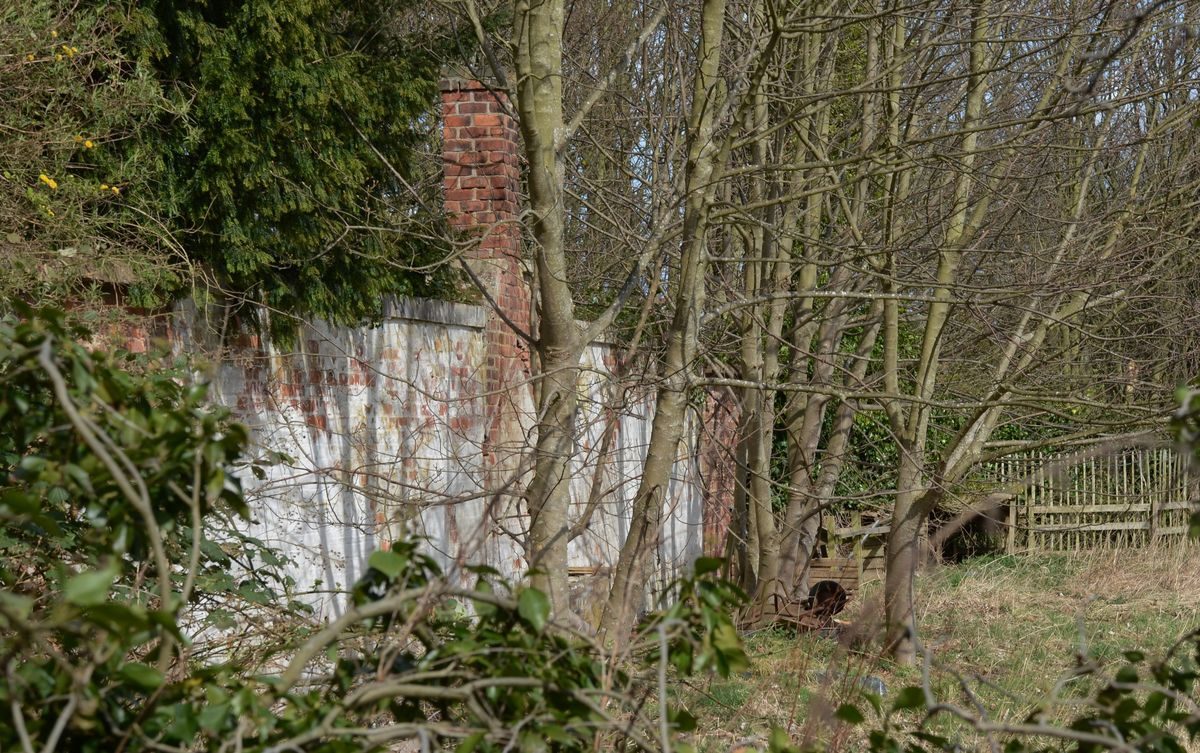
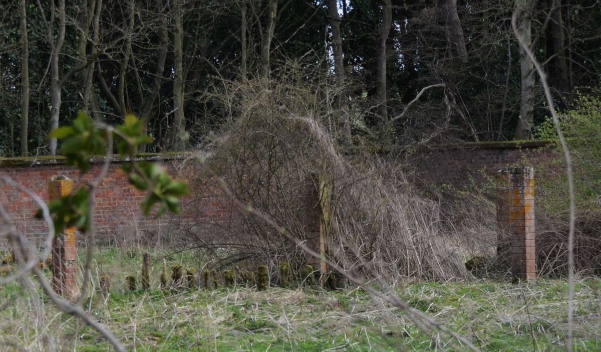
The estate was split into north and south sections. Invereil House and 1.4 hectares of surrounding landscape gardens on the north side were sold by HUGO ROMER NICHOLSON (elder son of ARMORER, COUNTESS of BREADALBANE) to JANET CHALMERS KIRBY of North Berwick (RS1969-11-20). ARMORER, COUNTESS of BREADALBANE, and ultimately her heir MARK NICHOLSON, retained ownership of the wooded policies, the walled garden and the coach house and stables, which were converted into a single dwellinghouse.
1974
MRS KIRBY split Invereil House vertically into two dwelling houses, each with its own services but with shared access to some offices and to Dirleton Road by the avenue (RS1974-07-03). She sold the main rooms and a ground-floor flat in the west as one property to EDWARD ROY KURYS of Edinburgh and the east wing, mainly comprising the former servants' quarters, to CHRISTOPHER SYDNEY HUDSON (born 1910, died 2005, formerly of Special Operations Executive).
1986
West house purchased by THOMAS GORDON ORANGE of Harrogate (RS1986-01-22).
1993
West section of Invereil House with 1.4 hectares of garden and woodland and shared access to Dirleton Road purchased from the Allied Irish Bank by HARRY JOHNSTON, the current proprietor (RS1993-02-23). He also purchased the east wing from HUDSON (RS1993-07-21) and 0.5 hectares of Linkhouse Wood from Ferrygate Farm (RS1993-10-25). The coach house with 0.5 hectares of garden ground and shared access avenue to Dirleton Road was purchased from MARK JULIAN NICHOLSON by DR MORGAN WILLIAM FLYNN (RS1993-12-20).
1999
East and West Invereil House were converted back to a single property by JOHNSTON, the current proprietor. However, the two independent sets of services were retained and remain separate today (interview 20 April 2013).
2011
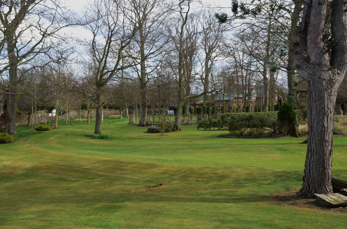
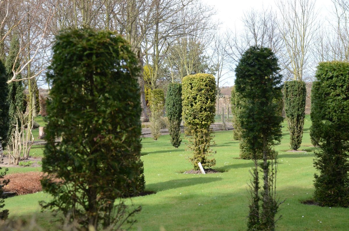
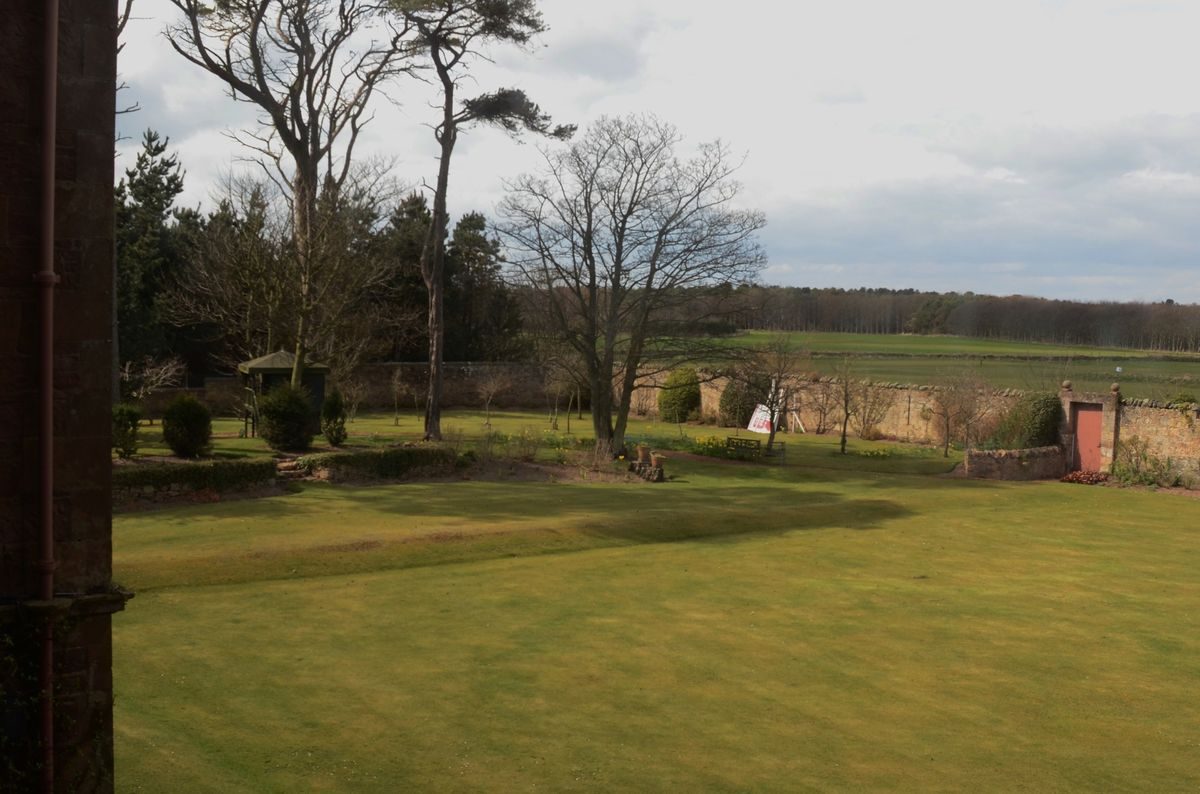
Invereil House and 1.9 hectares of formal garden and mixed woodland for sale by the current proprietor. Surrounding the house there are lawns flanked by formal herbaceous borders [the ghost of the Victorian layout], a circular lily pond [overgrown] with fountain bowl. The 0.5 hectares of Linkhouse Wood to the west of the original boundary wall added to the policies in 1993 now includes a shelter belt of Eucalyptus, Beech, Scots Pine, and a duck pond, polytunnel, vegetable garden, hen coup and kennels. Planning permission for an all-weather tennis court has lapsed.
THE PILGRIM ROUTE
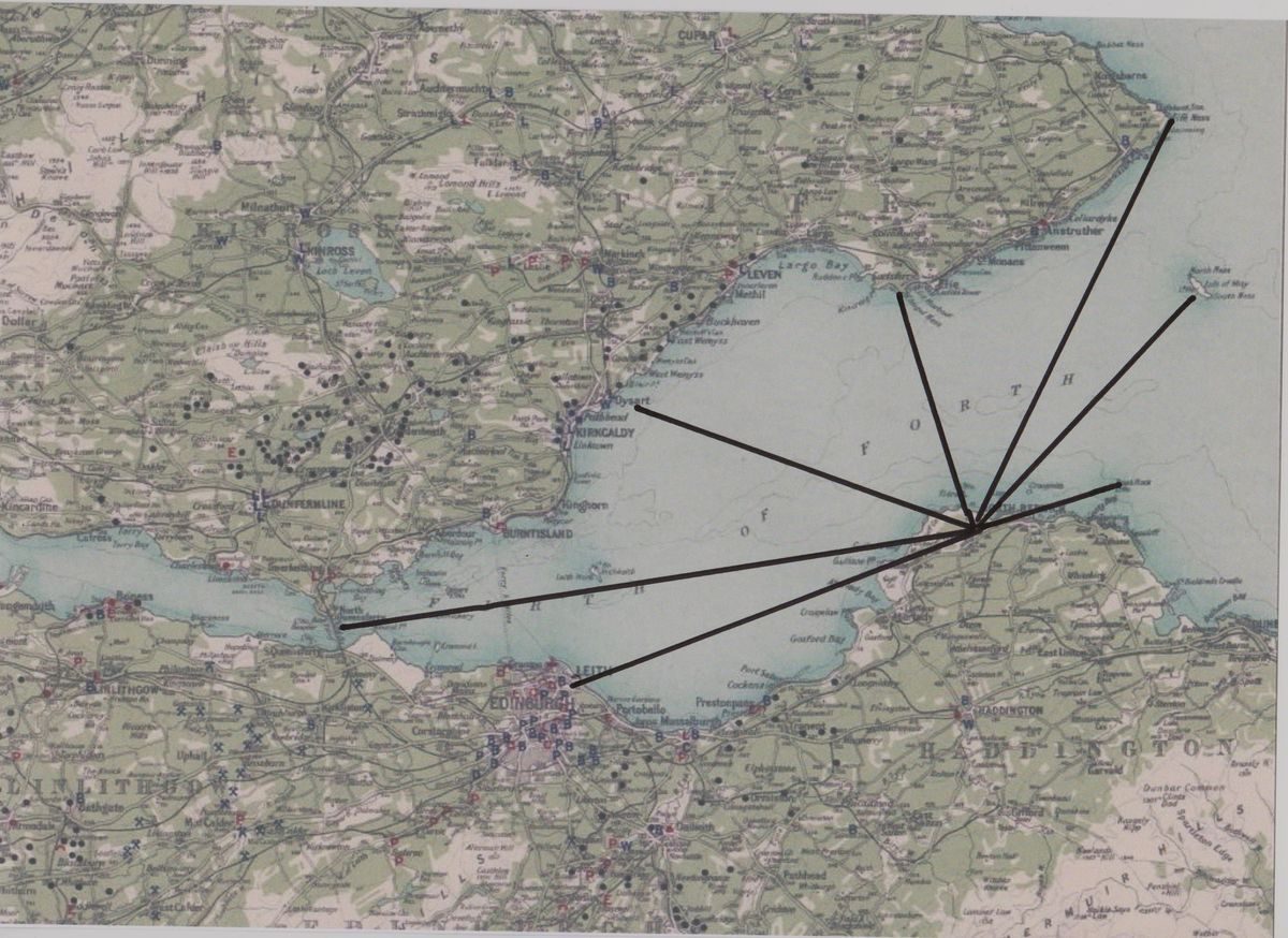
North Berwick owed much of its early importance to its location on the pilgrim route to the shrine of St Andrew. St Andrews is particularly affected by the peninsular geography of Fife, and is not readily accessible by land despite its ecclesiastical importance. This is also true of other early Christian centres, Iona being an extreme example, and emphasises the crucial importance of maritime travel in early medieval Scotland. The crossing from North Berwick to Earlsferry was the quickest route for pilgrims travelling from the south to St Andrews, and avoided long inland journeys on both sides of the Forth.
The precise boarding point for pilgrims in North Berwick is not certain; it has been suggested that it may have originally been closer to Dirleton at the Broad Sands, close by Ferrygate Farm (Ferrier 1991, 14) but, if so, it must soon have moved to North Berwick Bay. Small boats, or tenders to larger ones, probably beached to embark and disembark pilgrims at Broad Sands, and could still have beached on the sands at North Berwick. The crossing is quite a long one (18 km) for a small boat, and the ferry service may have been very busy at the height of the season, so there may have been more substantial arrangements for boarding larger boats directly, perhaps located like the present harbour on the small rocky peninsula called Kirk Ness at the east end of North Berwick Bay.
There are references to the harbour works in 1632 and 1726 (Simpson & Stevenson 1981, 18), and it was certainly in place by the time of Bishop Pococke's visit in 1760 (Kemp 1887, 319), while nearby is the ruin of the earliest parish church, established before 1177 and dedicated to St Andrew, suggesting a strong link with the pilgrim traffic. Also a ferryboat was chosen as the theme for the burgh's heraldic coat of arms, demonstrating the importance to the burgh of the pilgrim ferry. The ferry route seems to have existed until the late-17th century, but use by pilgrims would have ceased in the 16th century as a result of the Reformation, and might have been in decline earlier.
At a much earlier date, the sack (1296) and loss (1333) of Berwick-upon-Tweed extinguished a major centre of population in southern Scotland, while the ensuing long wars with England would have discouraged any movement of pilgrims from south of the border. This may have engendered an early decline in pilgrim traffic from the south passing through North Berwick; pilgrims from inland and the west might be more inclined to use the Queensferry crossing (http://www.northberwick.org.uk/walks_2.html).
- Associated People
- Features & Designations
Features
- Baronial Mansion House (featured building)
- Description: 3-storey plain Baronial house of red trachyte rubble.
- Earliest Date:
- Latest Date:
- Key Information
Type
Estate
Principal Building
Domestic / Residential
Survival
Extant
Hectares
2.5
Electoral Ward
North Berwick West
- References
Contributors
Garden History Society in Scotland