Introduction
Holker Hall has 80 hectares (50 hectares registered) of parkland, deer park and woodland dating from the late-18th century. There are also 10 hectares of formal gardens created by Thomas Mawson in the early-20th century. These have been extended by the present owners during the late-20th century.
Terrain
Slopes gently southwards.
The following is from the Register of Parks and Gardens of Special Historic Interest. For the most up-to-date Register entry, please visit The National Heritage List for England (NHLE):
Gardens, pleasure grounds and parkland with early C18 origins. The pleasure grounds were developed through the C19 probably on the advice of Joseph Paxton and in the early C20 by Thomas Hayton Mawson.
Location, Area, Boundaries, Landform and Setting
Holker Hall is situated c 0.7 km north-west of the village of Cark in an area which is predominantly rural and agricultural. The c 50 ha site is on land which slopes gently southwards towards Morecambe Bay. The eastern boundary is formed partly by the B5278 itself and partly by properties and an estate yard fronting the west side of the road, while a band of woodland surrounds the kitchen gardens at the north-east tip of the site. The north and west sides of the site are delineated by field boundaries and a ditch which separate the park from agricultural land, salt marshes and the woodland of a former deer park, called Old Park. The southern boundary runs through Hagg Wood and continues on the east side of Holker Farm along a drive called Evergreen Walk. From here it follows the line of Black Water Beck and continues, in the south-east corner of the site, on the south side of Pedder Wood.
Entrances and Approaches
There are two main entrances, both on the B5278. The principal entrance has gate piers and gates and a lodge (Paley & Austin 1875, listed grade II) which lead to a drive which runs north-westwards to the Hall. North Lodge (early C19, listed grade II) is at the north end of the site and stone gate piers here lead to a drive running south which curves around to the east to join with the main drive. There are various secondary service and farm entrances.
Principal Building
Holker Hall (listed grade II*) probably originated in the early C17. It was remodelled by the Lowthers at the end of the C17 and an east wing was added by the Cavendishes in 1756. It was further altered and extended by John Carr for Lord George Augustus Cavendish in 1788, and by George Webster for the second Earl of Burlington in 1840. A new east wing and substantial remodelling, by Paley & Austin of Lancaster, followed a fire in 1871 which destroyed the original east wing.
A conservatory by Joseph Paxton (1803-65) was attached to the north-west side of the building in the mid C19; it is not shown on the 1st edition OS map surveyed 1847-8 but it does appear on the large-scale OS map of 1891 and in a late C19 view. It was replaced in the early C20 by an arcaded garden shelter.
Immediately south-east of the Hall a stable courtyard of 1864 (listed grade II) is currently (1997) in use as offices and a café.
Gardens and Pleasure Grounds
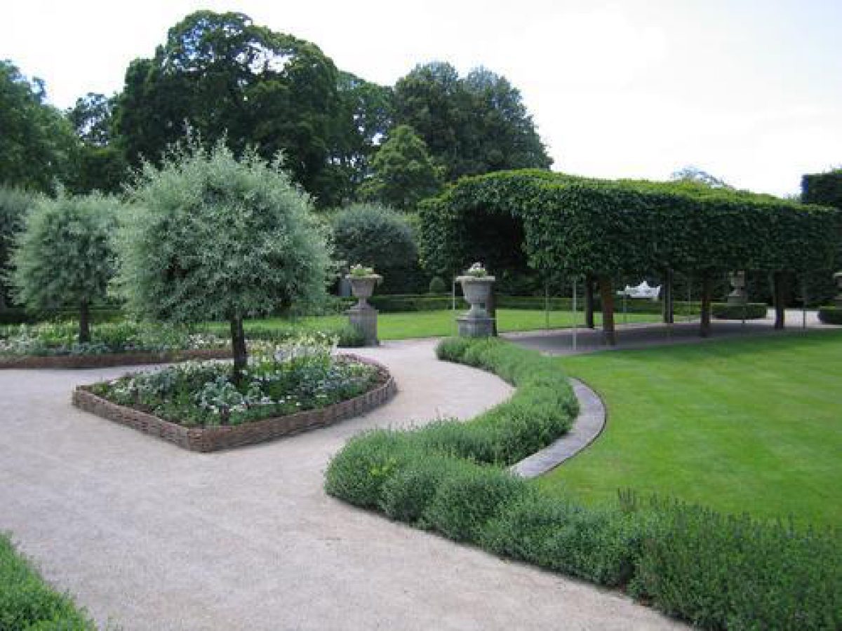
There are gardens covering an area of c 9 ha around the Hall; these consist of an area of formal gardens on the south and west sides of the house, and pleasure gardens with winding paths leading through an arboretum to the north and west. The gardens are separated from parkland by the walls of the Elliptical Garden and by a ha-ha, shown on the 1847 OS map, which is surmounted for most of its length by cast-iron paling.
A paved terrace runs around the south and west sides of the east wing of the Hall. To the south is an area called the Elliptical Garden, a square formal garden with quartering paths and shaped beds formed by an elliptical walk centred on the point at which the paths cross. This area is bounded on the east and south sides by a stone wall with a fretwork balustrade. In the centre of the south side there is a bastion, with views over parkland to the south.
Joseph Paxton advised on the layout of the gardens for the seventh Duke of Devonshire during the C19 and may have been responsible for this and other parts of the garden design. The garden is not shown on the 1847 OS map and the 1891 map shows it with only one path and a bastion at the south-west corner, suggesting that the area was remodelled, possibly by Thomas Mawson (1861-1933) in the early C20.
Steps lead down from the west side of the Elliptical Garden to a rectangular formal garden called the Summer Gardens, formed in the late C20 on the former site of tennis courts. There are quartering paths, that running from east to west being sheltered by a tunnel of pleached Portuguese Laurel. On the west side cast-iron gates lead into the park. To the north there is a lawn fronting the arcaded garden shelter. A path leads north and takes a curving course through an area planted with specimen trees and shrubs. Other paths lead west, and c 100 m west of the Hall there is a fountain which is shown on the 1891 OS map.
Aligned with the fountain, and running north-eastwards down the steep slope to it, is a C20 cascade. Leading north-west from the top of the cascade to the edge of the garden there is a grass terrace with a gravel walk along part of its length which is shown on the 1891 map. This might represent part of the remains of formal gardens laid out by Thomas Lowther in the 1720s who brought statues for the gardens by sea from London.
These gardens were swept away, probably in the early C19, by Lord George Augustus and had disappeared by 1820 when the Lonsdale Magazine of 1820 described 'a quantity of excellent specimens of statues recently removed in compliment to the chaster and more rational taste of modern improvements' (quoted in Dickinson 1980). The path along the terrace and other paths, including one which runs along the curved western edge of the garden, are shown on the 1847 OS map.
Some 140 m north-west of the Hall lies the Rose Garden, which was designed by Thomas Mawson for Lord Richard and Lady Moyra Cavendish c 1910 and has been reworked in the late C20. This consists of a pair of stone summerhouses, that to the east altered in the late C20, linked by a stone wall with a central seat, overlooking a semicircular area with beds and an openwork wooden shelter on each side. This garden is approached from the east via a curving walk through a timber pergola.
A tunnel (early to mid C19, listed grade II) situated on the edge of the pleasure grounds c 200 m north of the Hall leads beneath the B5278 to the kitchen gardens. On the garden side this is given a rustic appearance by the use of weathered blocks of limestone which have been augmented as rock gardens on each side of the tunnel entrance during the late C20.
The planting in the pleasure grounds includes trees introduced from the late C18 onwards such as the cedar planted by Lord George Cavendish in the late C18 and an Auracaria planted in 1844. A group of mature lime trees in the easternmost part of the garden and certain other specimens are possibly of earlier C18 date.
Kitchen Garden
There are two kitchen garden areas. A stone-walled garden is attached to the north-west tip of the Hall and entered from an archway in the west wall. This may relate to works by Joseph Paxton in the mid C19, and is shown on the 1891 OS map but not on that of 1847. More kitchen gardens are situated north of the B5278, c 300 m north of the Hall, and are reached via the rustic tunnel from the pleasure grounds. They consist of brick-walled enclosures, probably of C18 or early C19 date, with bothies and a gardener's house. The 1847 OS map shows the western side of the garden planted as an orchard.
Park
The park is situated to the south and west of the Hall and is bisected by the Black Water Beck which runs from north to south through it. It consists of open grassland, with knolls and low hills, and scattered mature trees and clumps. Woods and plantations shelter the western and southern edges of the park; Hagg Wood on the west side, planting north of Evergreen Walk, and Pedder Wood to the south all conform with areas of woodland shown on the 1847 OS map.
A fishpond is situated just north of the site of old quarries on the northern edge of Evergreen Walk, and north-east of this, c 640 m west of the Hall, is an early C18 icehouse (listed grade II) which has stone walls and a slate door and is thought to be the earliest surviving icehouse in the county (TCWAAS 1984).
The park supports a herd of fallow deer.
Maps
- C Saxton, Lancastria Comitatus Palatin Vera et Absoluta Descriptio, 1577
- R Morden, The County Palatine of Lancaster, 1695
- C Greenwood, The County Palatine of Lancaster, 1818
- OS 6" to 1 mile: Lancashire sheet XVII, 1st edition surveyed 1847-1848
- OS 25" to 1 mile: Lancashire sheet XVII.6, 1st edition surveyed 1889, published 1891
Description written: May 1998
Edited: March 1999
- Visitor Access, Directions & Contacts
Telephone
+44 (0)15395 58328Website
https://www.holker.co.uk/Access contact details
The site is open from March to October, Sunday to Friday 11am to 4pm.
For more detailed visitor information visit the Holker Hall website.
Directions
Off the B5278 north of Flookburgh.
- History
The following is taken from the Register of Parks and Gardens of Special Historic Interest. For the most up-to-date Register entry, please visit The National Heritage List for England (NHLE):
16th and 17th Centuries
Documentary evidence suggests that the site of Holker Hall has been occupied since the 16th century. The present hall dates from the 17th century.
Holker, which was part of the holdings of Cartmel Priory, was bought by the Preston family, substantial local landowners, during thee 16th
century following the Dissolution of the Monasteries. George Preston settled on the site of the present Hall in 1610. The estate was
confiscated from Thomas Preston by Parliament in 1644, but was later restored to him. Following his death in 1697, his heir Catherine married William Lowther
who was subsequently given a baronetcy by King William II.18th and 19th Centuries
The estate remained in the Lowther family until it passed through marriage to Lord George Augustus Cavendish in 1756. Lord George was
created Earl of Burlington by William IV in 1831. At his death in 1831 he was succeeded by his grandson William, second Earl, who became
seventh Duke of Devonshire in 1858.During the late-18th century the parkland was created. In the 19th century further additions were made including an arboretum, conservatory, terraces and a walled garden.
20th Century
In the early-20th century Thomas Mawson was commissioned to create formal gardens. Lord and Lady Cavendish, the present owners, have also created further formal gardens and a cascade in the 1980s. They have also created a new shelter belt of trees in one part of the garden.
In the 1990s Lord Cavendish registered with the National Collection for Conservation of Plants and Gardens and was awarded a National Collection of Styracaceae.
21st Century
Holker remains in the ownership of the Cavendish family and is in use (1997) as a private residence
Period
- 18th Century (1701 to 1800)
- Late 18th Century (1767 to 1800)
- Associated People
- Features & Designations
Designations
The National Heritage List for England: Register of Parks and Gardens
- Reference: GD1656
- Grade: II
NCCPG National Plant Collection
Features
- Labyrinth
- Cascade
- Earliest Date:
- Latest Date:
- Shelter Belt
- Conservatory
- Garden Terrace
- Hall (featured building)
- Description: Holker Hall (listed grade II*) probably early C17.
- Earliest Date:
- Kitchen Garden
- Icehouse
- Description: Early C18 icehouse (listed grade II)
- Stable Block
- Description: Stable courtyard of 1864 (listed grade II)
- Fishpond
- Summerhouse
- Description: Pair of stone summerhouses
- Key Information
Type
Estate
Purpose
Ornamental
Principal Building
Domestic / Residential
Period
18th Century (1701 to 1800)
Survival
Extant
Hectares
90
Open to the public
Yes
Civil Parish
Lower Holker
- References
References
- Pevsner, N {The Buildings of England: Cumberland and Westmorland} (London: Penguin, 1967) pp 144-145 The Buildings of England: Cumberland and Westmorland
- {English Heritage Register of Parks and Gardens of Special Historic Interest} (Swindon: English heritage 2008) [on CD-ROM] Historic England Register of Parks and Gardens of Special Historic Interest
- Morris, F O., A Series of Picturesque Views 6, (1866-1880), p 41 A Series of Picturesque Views 6
- (1914), pp 271-272 The Victoria History of the County of Lancashire 8
- pp 144-145 The Buildings of England: Lancashire : North
- Dickinson J C., p80 The Land of Cartmel: A History
- 26 June 1980), pp 1470-1473; 168 (3 July 1980), pp 18-21; no 18 (30 April 1992), pp 46-49 Country Life, 167
- Trans Cumberland Westmorland Antique Archaeology Society 84, (1984), pp 138-155 Trans Cumberland Westmorland Antiq Archaeol Soc 84,
- The Woodland Gardens of Holker Hall, guidebook, (Lord and Lady Cavendish 1991) The Woodland Gardens of Holker Hall, guidebook
- no 2 (Summer 1992), pp 23-25 Historic House 16
- Holker Hall and Gardens, guidebook, (Lady Cavendish 1996) Holker Hall and Gardens, guidebook