Introduction
Elshieshields is a landscaped estate of approximately 8.9 hectares lying 3 km north of Lochmaben on the banks of the River Ae. Elshieshields Tower dates from the 15th century. Much of the landscaping has been laid since 2000.
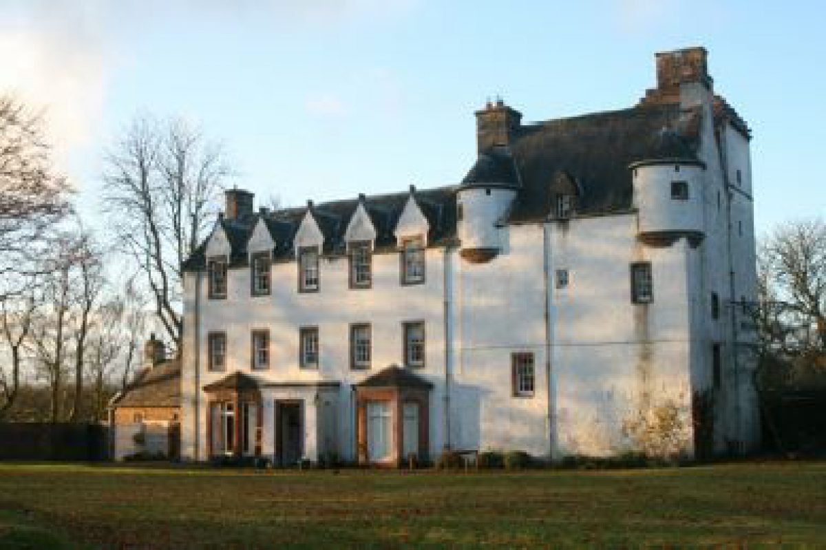
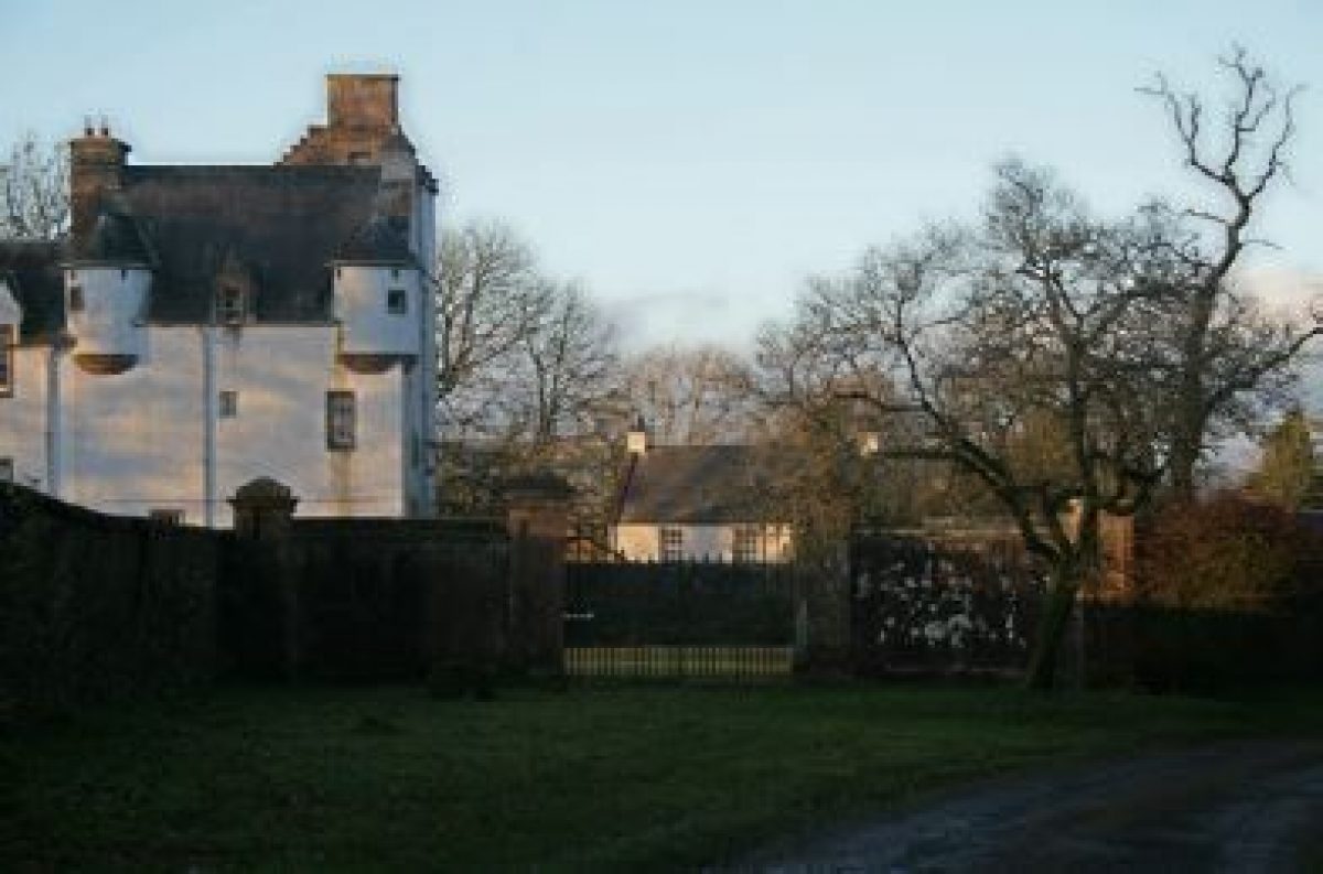
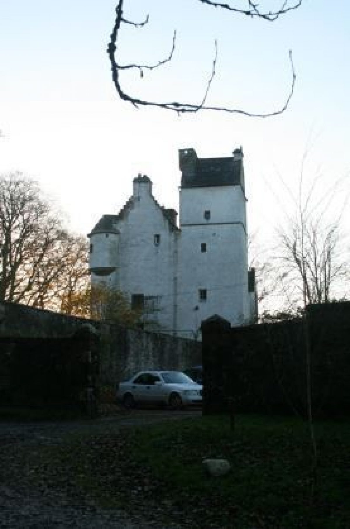
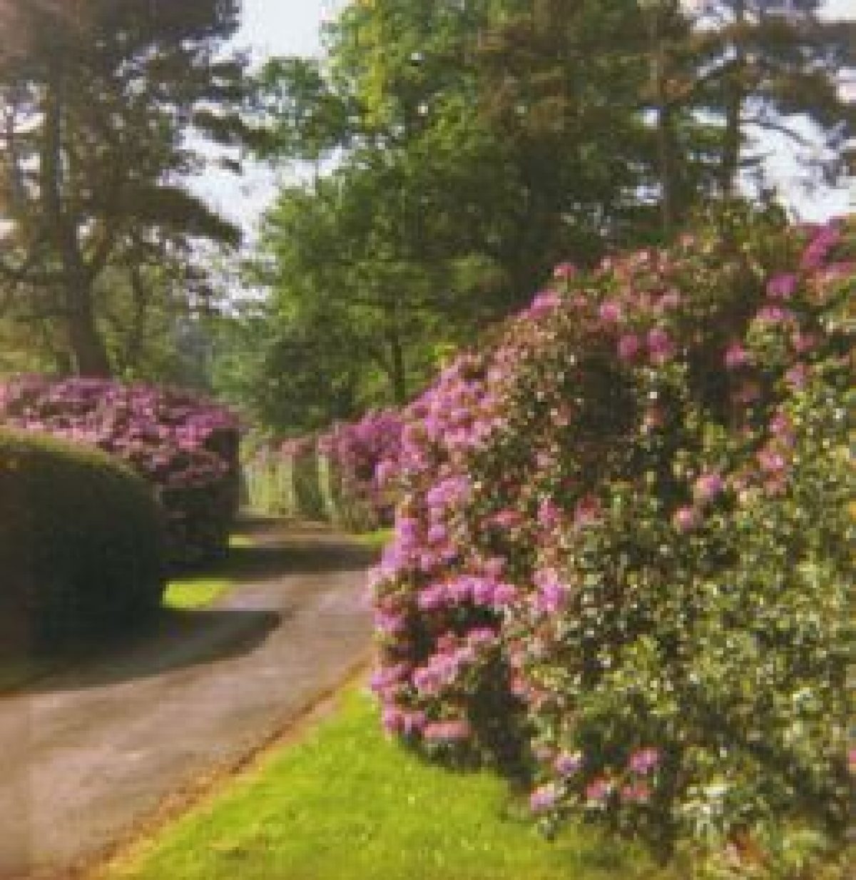
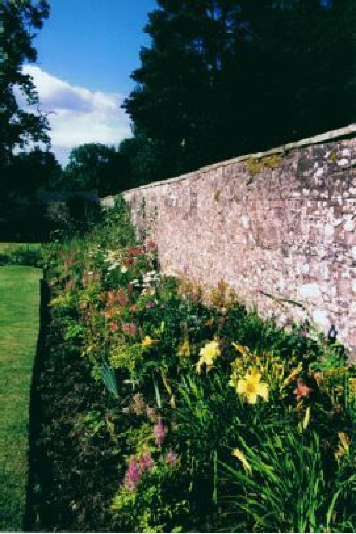
Elshieshields is a landscaped estate of approximately 8.9 hectares lying 3 km north of Lochmaben. Elshieshields Tower dates from the 15th century. For nearly 500 years it was the home of the Johnstone family and their descendants. In the 18th century they added the main house to the original tower, and made further additions in the 19th century. Latterly it was the home of the historian Sir Steven Runciman who used the tower rooms as his library. Beyond the wide lawn and herbaceous border lie the wildflower garden and slate labyrinth. Paths lead through the 20 acres of traditionally maintained woodland and to the banks of the river Ae.
Further details about Elshieshields are available on the Royal Commission on the Ancient and Historic Monuments of Scotland website:
http://canmore.rcahms.gov.uk/en/site/334210/details/elshieshields/
http://orapweb.rcahms.gov.uk/wp/00/WP002590.pdf
REFERENCES
1. MAPPED SOURCES
Unless otherwise stated all maps referenced are from the online National Library of Scotland Map Collection
http://maps.nls.uk
Circa 1755 Roy Military Survey of Scotland (Lowlands)
Map of Dumfries-shire – William Crawford 1804
John Ainslie 1821, Ainslie's Map of the Southern Part of Scotland; Right Side
Ordnance Survey First Edition Six inch to One mile Dumfries-shire Sheet XLII Surveyed 1857, Published 1861
Ordnance Survey First Edition 25 inches to One mile Dumfries-shire Sheet LV.16 Surveyed 1857, Published 1861
Ordnance Survey Second & Later Editions Six inch to One mile Dumfries-shire Sheet XLII.SE Revised 1898, Published 1900
Ordnance Survey Second & Later Editions Six inch to One mile Dumfries-shire Sheet 042.11 Revised circa 1898, Published 1899
Ordnance Survey Second & Later Editions Six inch to One mile Dumfries-shire Sheet XLII.SE Revised 1948, Published 1952
2. PRIMARY & DOCUMENTARY SOURCES
Documents held at Elshieshields by the owner:
1860 Estate plan from Ordnance Survey
1916 Plan of Elshieshields Estate
1916 Plan of Elshieshields Estate (enlarged)
1943 Map attached to deposition by Colonel EGJ Byrne
1967 extract from Ordnance Survey 1899 of estate only
1967 Drainage map based on Ordnance Survey 1899
Summer 2004 Summary of proposed works showing ground levels
Valuation rolls 1862-1988
Sale details
1898, January 1st Dumfries and Galloway Standard – shooting and fishing rights offered to let
1943 Sale of Elshieshields – map attached to deposition by Colonel E G J Byrne in favour of Mr Laurie
1951 Country Life advert showing kitchen garden at south end of lawn
1962 Country Life advert
1966 Estate agent details lawn, shrubs, terraced areas, herbaceous border, four large Beech trees, 16th century Sweet Chestnut. NB no mention of formal or kitchen garden
Documents held at Dumfries Archive Centre – Papers of Maxwell of Barncleugh and Johnson of Elshieshields:
GGD 85/1/1 - 17April 1581 Sasine to W Johnson in Elshieshields, Esbie and Howes in favour of Wilkine Johnston as heir to father John Johnston
GGD 85/2/2 - 23 November 1652 Letter of James Halliday and his wife Margaret Edgar in their case against John Johnston of Elshieshields accepting Decreet of Absolvitor obtained by John Johnston of Elshieshields from the alledged crime of bloodshed and mutilation etc.
GGD 85/2/3 – 18 July 1656 Letters of Condescension under the Signet of Oliver Cromwell, Lord Protector of the Commonwealth of England, Scotland and Ireland dividing up the possessions of John Johnston of Eschesheills to meet debts (list of 9 creditors)
GGD 85/2/5 – 4 December 1656 Poinding of goods of John Johnston of Elshieshields (list of cows, bullocks, salmon, corn, barley)
GGD 85/2/12 – 1667 Particular charge of John Johnstoune of Elshiesheills – details of taxes he collected from landowners of Annandale
RG 2/8/26 – 12 February 1774 Sasine re I Merkland of Elshieshields made by Theodore Edgar to various legal officers etc. in return for £1,000.
Documents held at Raehills:
Box 611- 18th October 1715 Bond by Gavin Johnstone of Elshieshields (among others) to keep the peace .
Documents held at National Archives of Scotland:
EGD1/5/5 - 1630 Rental of Elshieshields for the crop and year 1630
EGD 1/4/3 - May 1708 Account of plenishing the house
3. HISTORICAL ILLUSTRATIONS & PICTORIAL SOURCES
Royal Commission on the Ancient and Historic Monuments of Scotland Online Digital Images
Aerial Photography Digital Collection 3 August 2011. Oblique Aerial Images DP107793 to DP107798
Scanned Images 1998 SC384499 to SC384503, SC384505
Drawings showing Glamis Castle, Cawdor Castle, Megginch Castle, Ferniehurst Castle, Elsieshields, Kellie Castle, Killochan Castle and Girnigoe Castle: Lorimer & Matthew Collection circa 1875-1925 DP004362.
Views from the South-East circa 1885 John Flemming SC1168790 & SC1168791
Photograph of property printed in undated Lochmaben and Vicinity published by AT Johnston, Stationer, Lochmaben, probably 1898
Aerial photograph 2010
4. BIBLIOGRAPHY OF PUBLISHED SOURCES
The Second Statistical Account of Scotland Parish of Lochmaben County of Dumfries 1835 vol 4 pages 377-397. Includes owner as John Dickson, “mansion house”, site of Roman pilum find
The Third Statistical Account of Scotland Dumfries-shire Houston, G 1962 merely refers to building as occupied
Border Towers, Country Life 1947, January
Field Meeting. Amisfield Tower, Elshieshields Tower, Lochmaben and The Barony Dumfries and Galloway Natural History and Antiquarian Society Transactions III 10, 234. An account of visit by 40 members shown around by Colonel Byrne 21st May 1923
Gifford, John The Buildings of Scotland: Dumfries and Galloway 1996 pages 304-305
Groome, Francis Ordnance Gazeteer of Scotland 1882 – 96
Fortified Houses on the Anglo-Scottish Border post 1975 bound photocopy of thesis for degree at University of Nottingham 2 volumes page 58 volume 2 held at RCAHMS
Hyslop, J & R Langholm as it was: A History of Langholm and Eskdale from the Earliest Times 1912 page 320 held at RCAHMS
RCAHMS 7th Report with inventory of monuments and constructions in the County of Dumfries 1920 pages 155-156 no 447 fig107
RCAHMS Eastern Dumfriesshire: An Archaeological Landscape 1997 page 69
Forman, Sheila A Border Keep Scottish Field January 1948photographs by Patrick Forman
Russell, James Anderson The Book of Dumfriesshire 1964 Dumfries pages 180-181
Maxwell-Irving, Alastair The Border Towers of Scotland: Their History and Architecture, The West March 2000 pages 136-141 held at RCAHMS
Lindsay, Maurice The Castles of Scotland 1986 London page 236
MacGibbon, D & Ross, T The Castellated and Domestic Architecture of Scotland from the Twelfth to the Eighteenth Centuries 1887-1892 5 volumes Edinburgh volume 2 pages 68-70, figures 534-535 held at RCAHMS
Malvern, M Salter The Castles of South-West Scotland 1993 page 69 held at RCAHMS
Copy of a manuscript tract addressed to Lord Burghley, illustrative of the Border topography of Scotland AD 1590 with a platt or map of the Borders taken in the same year 1829 by M Ellis Archaeologica volume 22 pages 161-162 pl 21
Tranter, Nigel G The Fortalices and Early Mansions of Southern Scotland 1935 Edinburgh and London page 45
Tranter, Nigel The Fortified House in Scotland volume 3 1965 Edinburgh and London pages 81-82 held at RCAHMS
Wilson, John B The Royal Burgh of Lochmaben, Its History, Its Castles and Its Churches 1987 1st edition, 2nd edition pages 39, 108, 109, 115, 119,156, and 192
Cruden, Stewart The Scottish Castle 1960 London rev. 1963 page 153
Towers of Stone – the fortified buildings of Dumfries and Galloway 1993 edited by Graham Roberts Dumfries and Galloway Libraries page 7
- Visitor Access, Directions & Contacts
Directions
On the southern bank of the Water of Ae approximately 2.5 kilometres north west of Lochmaben
- History
PRINCIPAL PERIODS OF DEVELOPMENT:
The main tower dates from the mid-15th century and the second staircase tower from the late-16th century. A dwelling house extension to the tower was added in 1730, a top storey and kitchen wing in 1830. The bay window, to the south front of house, and garden porch were added in the mid-19th century.
In 1848 Byrnes added a coach drive to front of the property and further changes were made in 1952 so that the house became accessed from the former rear of the property.
From 1966 onwards during ownership of Sir Steven Runciman:
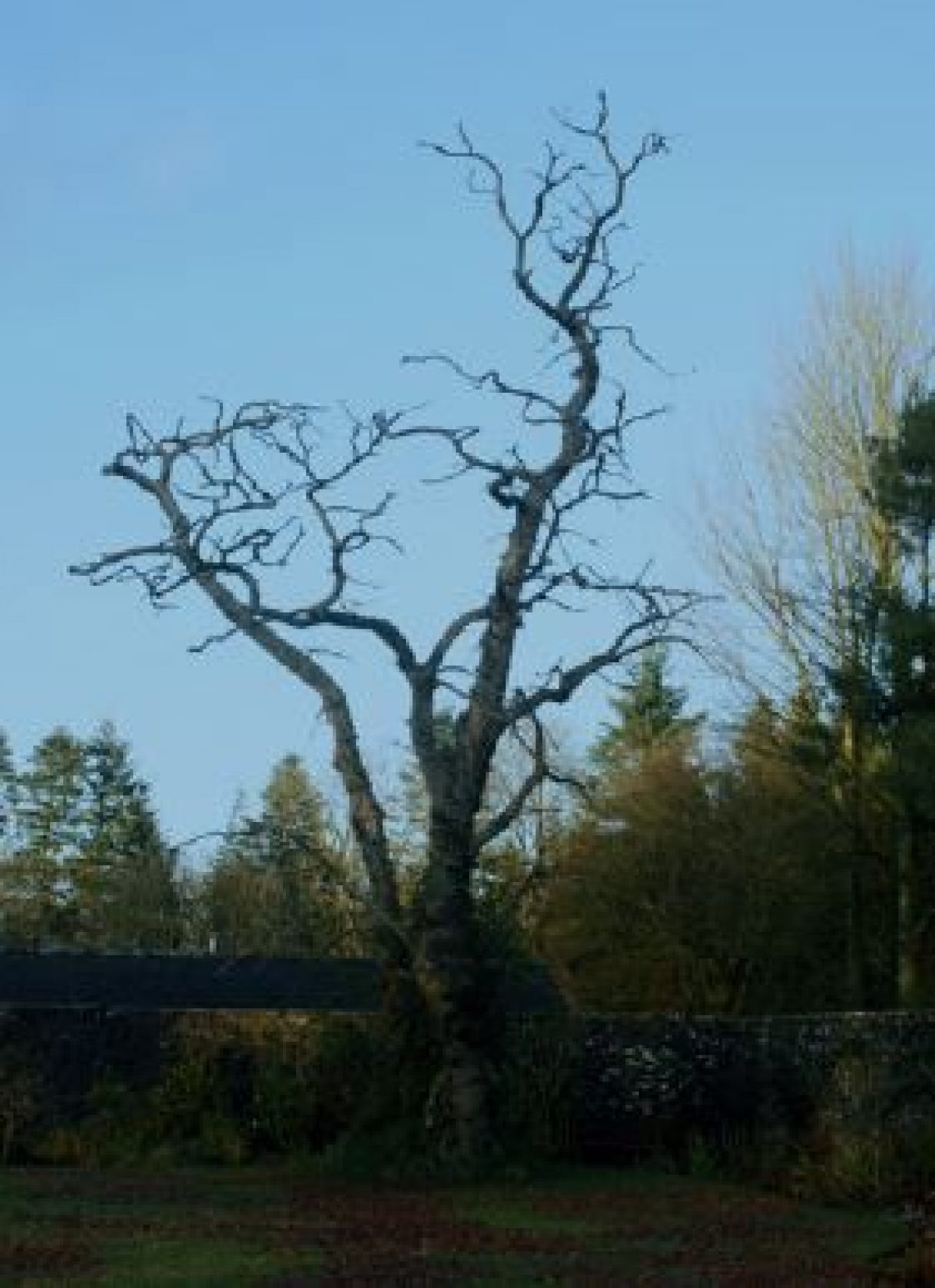
The Tower was restored by Walter Schomberg Scott and the terraces enlarged. The large meadow lying between the main road and the drive on the east side of the property was densely planted with Sitka and the small piece of land (including fishing rights) on west side of property, along the Water of Ae from the road bridge to farmer's field, was purchased. This boggy land was planted with Guelder Rose, Alder and Willow. The four magnificent Beech trees along the east wall of the upper lawn area were felled due to disease.
2000 to the present day:
The undergrowth was removed from the west banks of the site to reveal the view across the valley to High Town Hill. A vegetable garden was established in the old orchard to the north of the outbuildings and the Sitka plantation thinned to allow for paths and undergrowth to flourish. Trees and roses planted by Sir Steven were largely replaced. Rhododendrons were removed from the upper lawn to allow for an open vista, and from the drive to allow for replanting with Silver Birch, Cornus, Azaleas, and Bird Cherry. The kitchen wing was extended and the courtyard remodelled in 2007. The death of a 16th-century Sweet Chestnut tree in the north-east corner of the walled garden in 2009 allowed the replanting of the long herbaceous border. Earth was removed to reveal the full height of the old east wall and used to create a grass bank at the top of the upper lawn to conceal the wire boundary fence. A Labyrinth designed by Simon Lidwell was installed in the upper lawn and a wildflower meadow sown around it. Land drains were built and a new seating area created on the west side of the lower lawn.
- Features & Designations
Features
- House (featured building)
- Description: A tower house dating from the 15th century.
- Earliest Date:
- Latest Date:
- Key Information
Type
Estate
Purpose
Ornamental
Principal Building
Domestic / Residential
Survival
Extant
Hectares
8.9
Electoral Ward
Lochmaben
- References
Contributors
Heather Barrington, Patricia Brown, Anne Fairn, Ann Shukman, Eileen Toolis Dumfries & Galloway Designed Landscapes and Gardens Survey Group under the auspices of the Garden History Society in Scotland.