Introduction
Conheath is a small, relatively intact designed landscape with the current house dating from the early-19th century. The walled garden probably dates from the 17th century and is now managed as Conheath Nurseries.
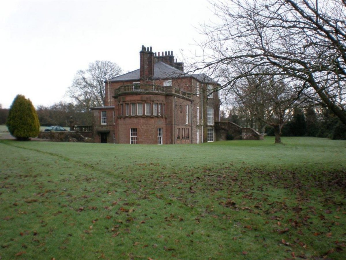
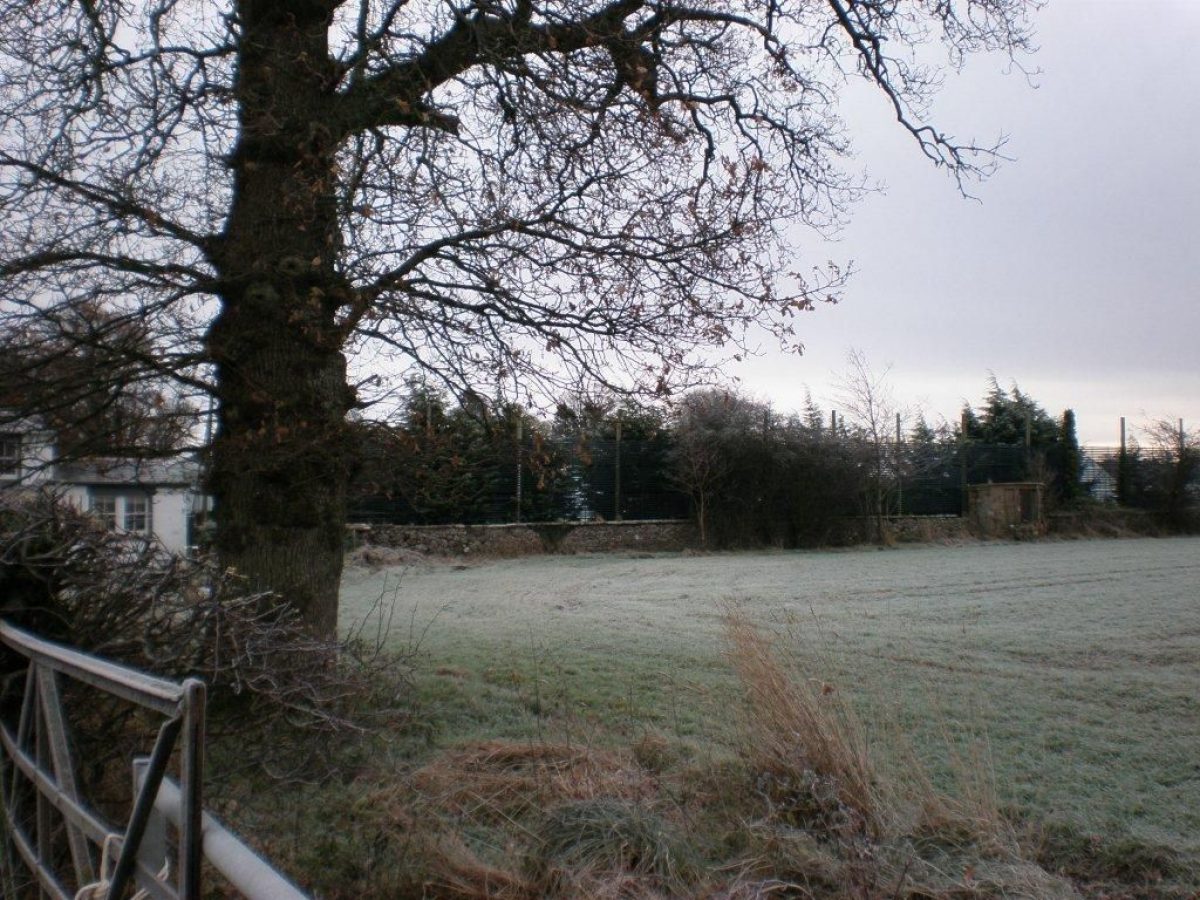
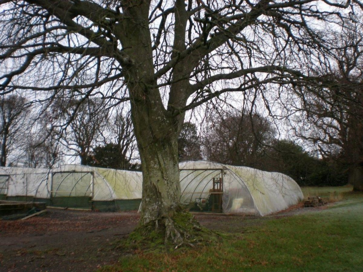
Conheath is a small, relatively intact, designed landscape lying about 7km south of Dumfries in the Nith Estuary National Scenic Area. The current Conheath House dates from the early-19th century but records suggest the walled garden is probably earlier, dating from the 17th century and a previous house. The Farmhouse and Stables were added in the late-19th century and the Chapel in the early-20th century. The estate was subdivided into two in the mid-20th century; Conheath Farm, and Conheath House and Walled Garden, with the principal approach realigned to service the farm. A new approach from the west was created to access the house and walled garden. The walled garden is now a successful commercial nursery.
Further details about Conheath are available on the Royal Commission on the Ancient and Historic Monuments of Scotland website:
http://canmore.rcahms.gov.uk/en/site/331785/details/conheath/
REFERENCES
1. MAPPED SOURCES
Unless otherwise stated all maps referenced are from the online National Library of Scotland Map Collection http://maps.nls.uk
Timothy Pont, circa 1583-96 35: (Nithsdale; part of Teviotdale)
Joan Blaeu, 1654 Nithia Vicecomitatus, The Shirifdome of Nidis-dail
Herman Moll, 1745 The Shire of Dumfries or Nithisdale
Roy, circa 1755 Military Survey of Scotland (Lowlands) Conheath not Named
William Crawford, 1804 Map of Dumfries-shire
John Thomson, 1820 Dumfries-shire
Historic Environment Map 1950, Dumfries & Galloway Council
Historic Environment Map 2009, Dumfries & Galloway Council
Ordnance Survey First Edition Six inch to One mile Dumfries-shire
Sheet LV Surveyed 1856, Published 1861
Sheet LX Surveyed 1856, Published 1861
Ordnance Survey First Edition 25 inches to One mile Dumfries-shire
Sheet LV.16 Surveyed 1856, Published 1861
Ordnance Survey First Edition 25 inches to One mile Dumfries-shire
Sheet LX.4 Surveyed 1856, Published 1861
Ordnance Survey Second Edition & Later Editions 25 inches to One mile Kirkcudbrightshire
Sheet 038.02 Revised circa 1894, Published 1895
Ordnance Survey Second Edition & Later Editions Six inch to One mile Dumfries-shire
Sheet LV.SE Revised 1899, Published 1900
Sheet LX.NE Revised 1898, Published 1900
Ordnance Survey Second Edition & Later Editions Six inch to One mile Dumfries-shire
Sheet 055.16 Revised 1899, Published 1900
Ordnance Survey Second Edition & Later Editions 25 Inches to One Mile Dumfries-shire
Sheet 060.04 & 03 Revised circa 1898 Published 1900
Ordnance Survey Second Edition & Later Editions Six inch to One mile Kirkcudbrightshire
Sheet XXXVIII.NW Revised 1908, Published 1910
Ordnance Survey Second Edition & Later Editions Six inch to One mile Kirkcudbrightshire
Sheet XXXVIII.NW Revised 1946, Published 1951
2. PRIMARY & DOCUMENTARY SOURCES
Decreet of Sale of Lands of Conheath in Favour of Mr George Bell, Merchant in Dumfries 29/7/1748 (Ref: EG10 1/85, Ewart Library Db18 (929.2)
Valuation Rolls 1872-73, 1902-03, 1912-13, 1922-23, 1932-33, 1942-43, 19464-7, 1947-48, 19525-3 & 1972-73 (Ref: Ewart Library, Dumfries)
Census Data for Conheath: 815 004 Caerlaverock, Dumfries-shire 6 June 1841
Census Data for Conheath: 815 005 Caerlaverock, Dumfries-shire 30/31 March 1851
Census Data for Conheath: 815 001 Caerlaverock, Dumfries-shire 3/4 April 1881
3. HISTORICAL ILLUSTRATIONS & PICTORIAL SOURCES
Conheath House including one large tree possibly Oak (1900) (Ref: Ewart Library, Dumfries)
Painting of Sundial in Walled Garden Date Unknown (From Scenery in Shakespeare's Plays and Other Studies: Rannie, D W see Published Sources)
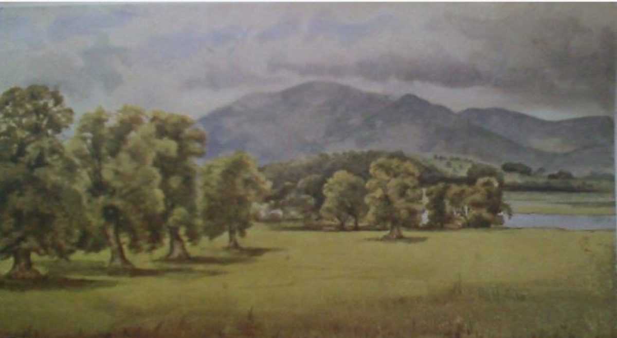
Painting of Parkland circa 1850 (From Scenery in Shakespeare's Plays and Other Studies: Rannie, D W see Published Sources)
Royal Commission on the Ancient and Historic Monuments of Scotland:
1915 Floor and drainage plans, sections and elevations. Details of staircase, fireplace, wash house, doors, windows and cornicing. Plans of farm house garden (Ref: LOR C/12/1, Lorimer & Matthew Collection)
1924 Conheath. Plans of gardener's cottage. Perspective views and elevation of bridge. Plan, elevations and details of gates (Ref: LOR C/13/1, Lorimer & Matthew Collection)
1975 North Lodge, View from West (Ref: DF 5639)
1975 Garden House, Walled Garden, View of Wall (Ref: 5638)
4. BIBLIOGRAPHY OF PUBLISHED SOURCES
County Directory of Scotland 1862
Groome, Francis 1882-1885 Ordnance Gazetteer of Scotland
Doyle, John A (Ed) 1898 Memoirs & Correspondence of Susan Ferrier 1782/1854 Spottiswoode
Rannie, David Watson 1931 Scenery in Shakespeare's Plays and Other Studies. Blackwell.
County Directory of Scotland 1972
Horsey, Miles 1983. Conheath Chapel. Transactions of Dumfries & Galloway Natural History & Antiquarian Society, Series III, Vol. LVIII, p.97
Colvin, Howard 1995 Biographical Dictionary of British Architects 1600-1840. 4th Ed Yale p. 698
Gifford, John 1996 Buildings of Scotland: Dumfries & Galloway p.189
4. REFERENCES RELATING SPECIFICALLY TO THE SITE TIMELINE ON THE HISTORY TAB
1. Decreet of sale of lands of Conheath 29th July 1748. Ewart Library EGD1/85 Db18(929.2)
2. Scottish Archive Network person code NA20385 www.scan.org.uk
3. Doyle, John A (ed) 1898 Memoirs and Correspondence of Susan Ferrier
4. Gifford, John 1996 The Buildings of Scotland: Dumfries & Galloway
5. Historic Scotland Listing Description http://data.historic-scotland.gov.uk/pls/htmldb/f?p=2200:15:0::::BUILDING,HL:3806,Conheath
6. Principal Acts of the General Assembly of The Church of Scotland 1814
7. 1841 Census Data Caerlaverock, Dumfries-shire 6 June 1841
8. Caerlaverock Parish Deaths and Burials Index 1753 - 1854
9. 1851 Census Data Caerlaverock, Dumfries-shire 30/31 March 1851
10. Valuation Rolls
11. Dictionary of Scottish Architects http://www.scottisharchitects.org.uk
12. Groome, Francis 1882-1885 Ordnance Gazetteer of Scotland
13. 1881 Census Data Caerlaverock, Dumfries-shire 3/4 April 1881
14. Scottish Archive Network person code GL416 www.scan.org.uk
15. Wikipedia http://en.wikipedia.org/wiki/Robert_Young_Pickering (not verified)
16. Royal Commission on the Ancient and Historic Monuments of Scotland http://www.scotlandsplaces.gov.uk/
17. Oral Record (Mrs M. Dobie, Mr W. Dobie, Mrs J. Murray)
18. NAS catalogue GD138/1/139
19. NAS catalogue CS107/228
20. The IBRA Bee Boles Register http://ibra.beeboles.org.uk
- Visitor Access, Directions & Contacts
Directions
Conheath is located on the east side of the Nith estuary, approximately 7 kilometres south of Dumfries on the B725
- History
Documented sources record a significant property at Conheath in 1748 and possibly as early as the survey for Timothy Pont's map of Nithsdale in the late-16th century. Surprisingly no property at Conheath is depicted on Roy's Military Survey of around 1755 but the pattern of land enclosure appears to be that later recorded on the First Edition Ordnance Survey and that which survives to the present day.
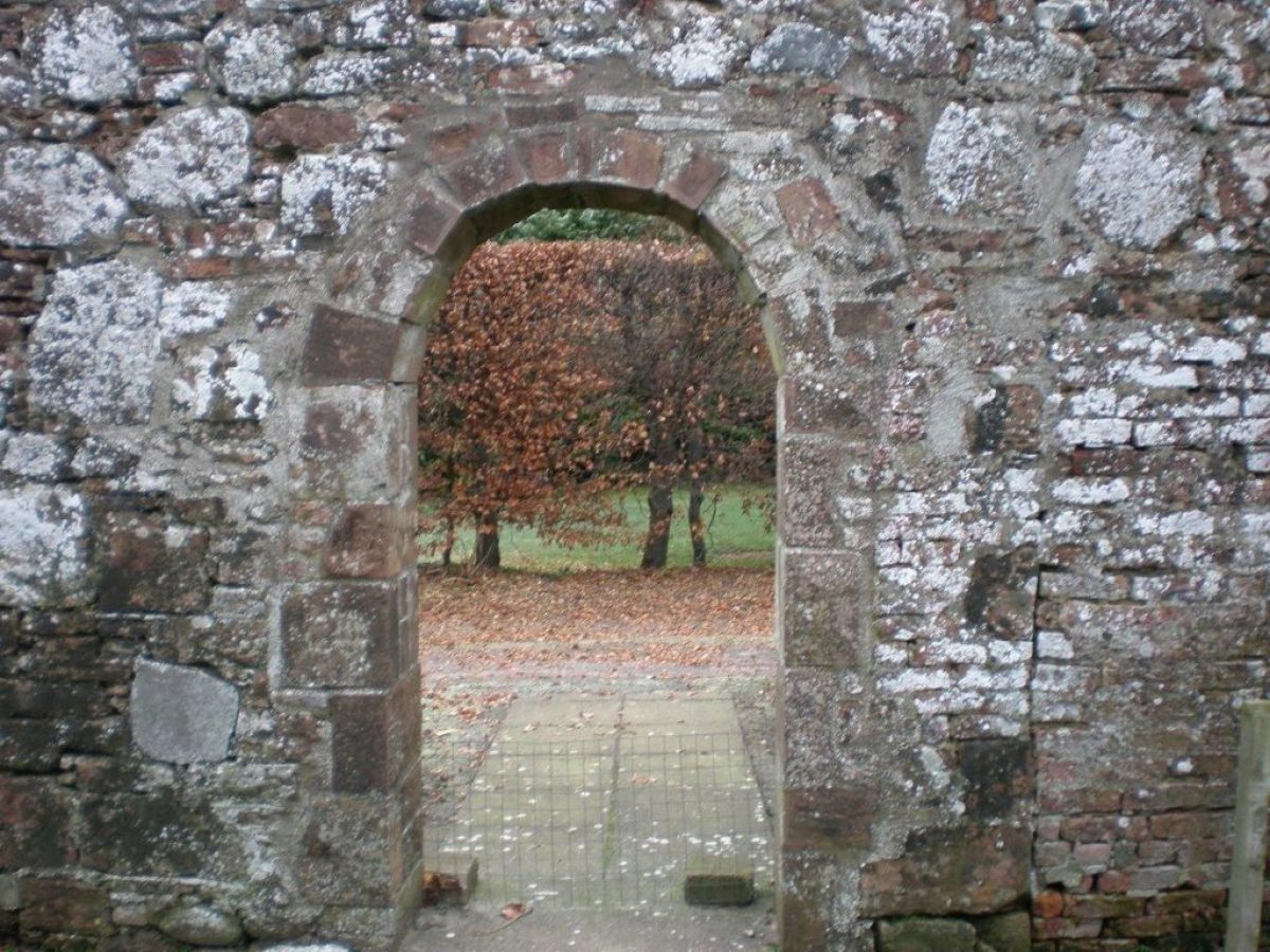
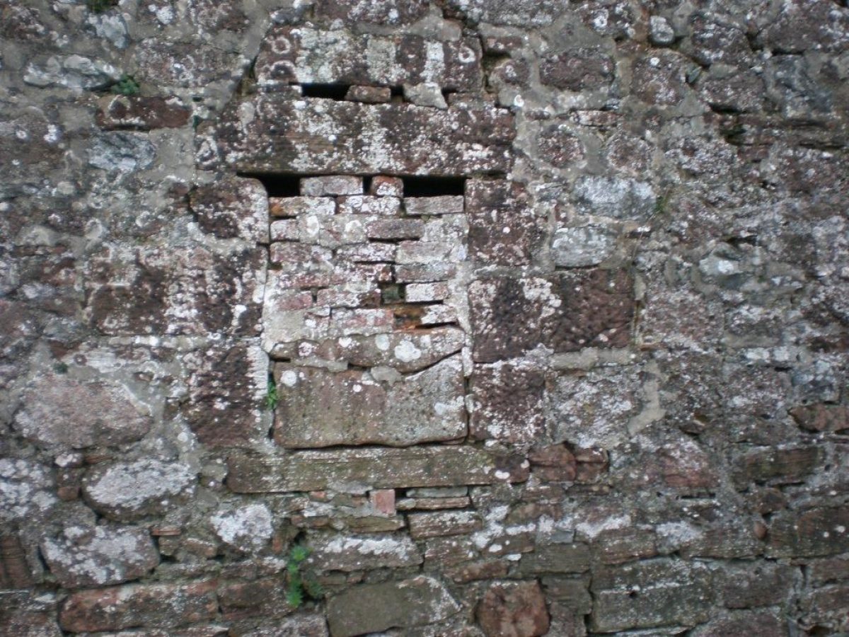
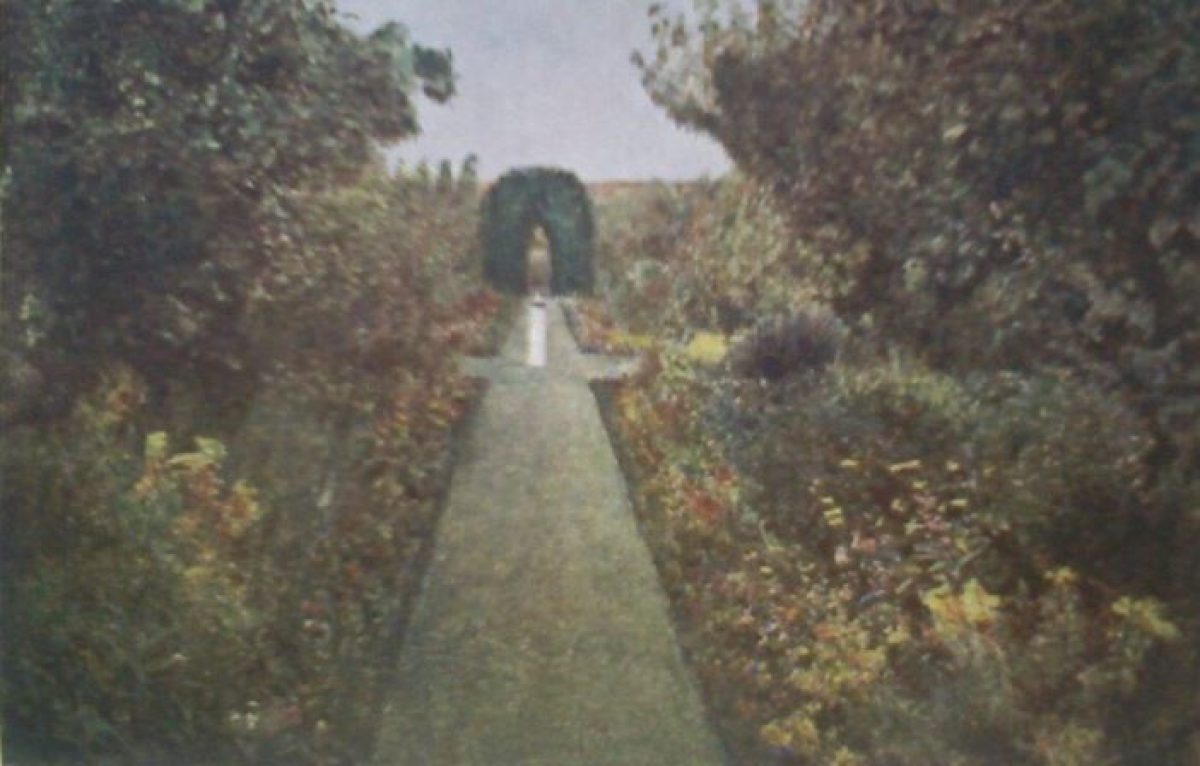
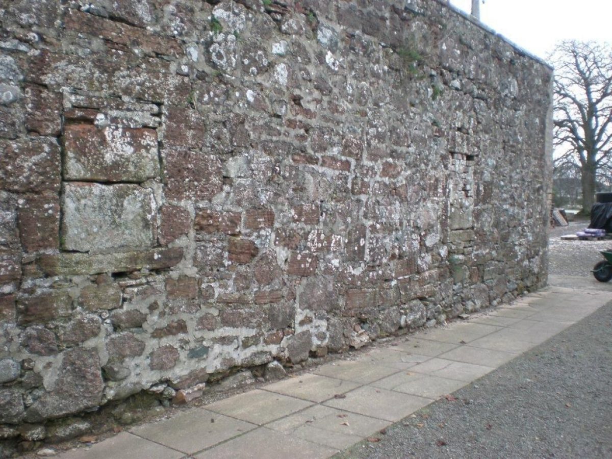
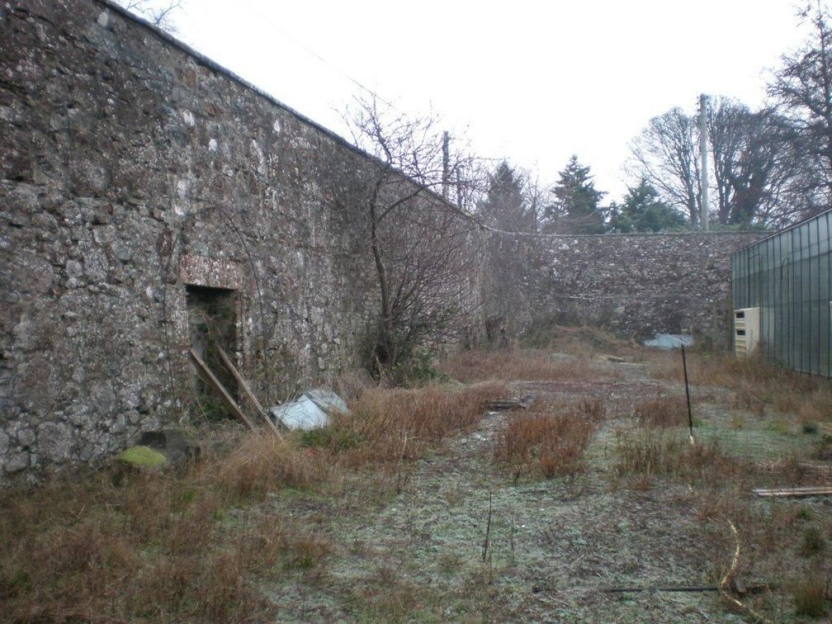
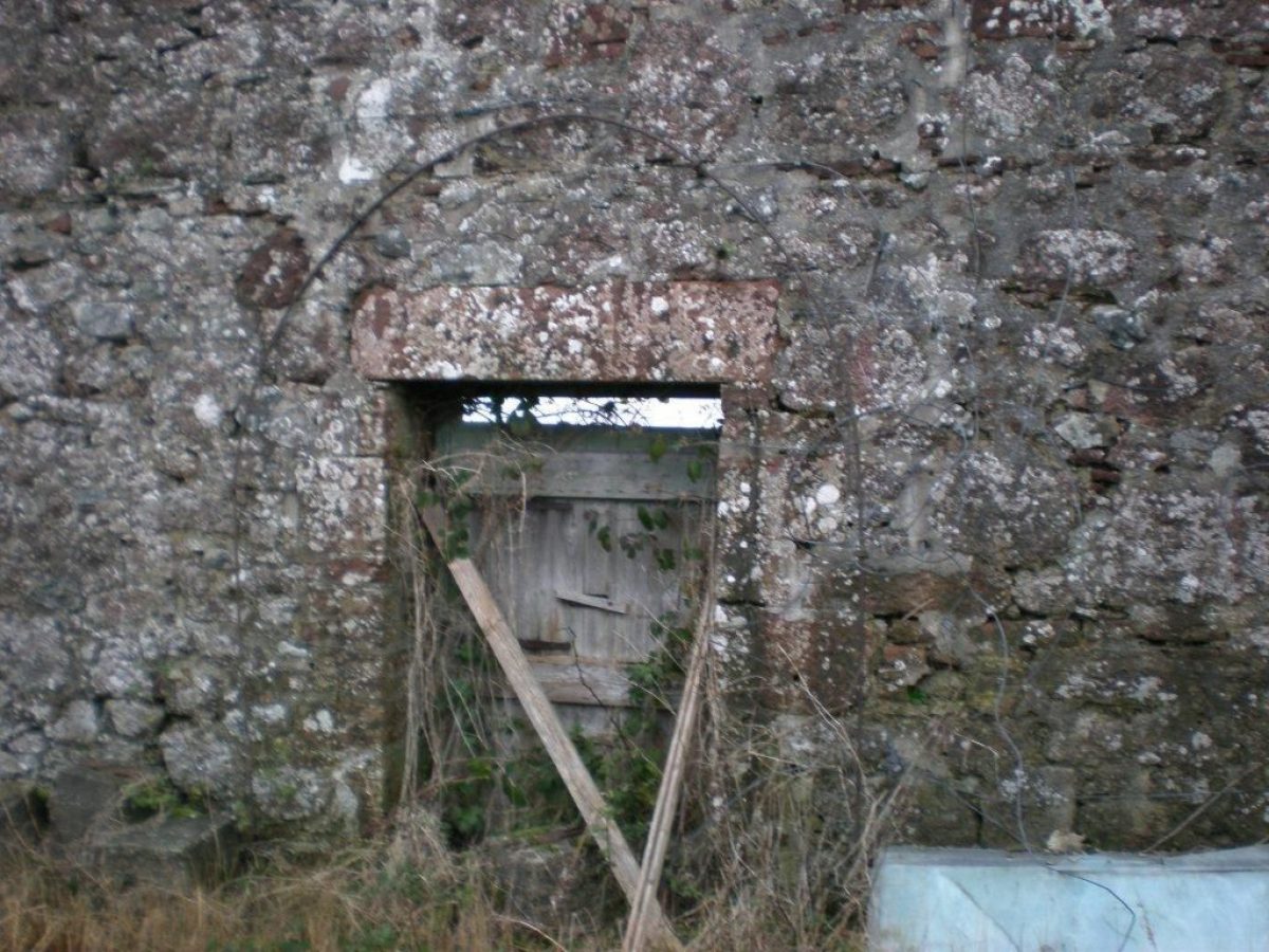
The present Conheath House is early-19th century, designed by architect Walter Newall for James Connell who had purchased the estate in 1791. The garden is probably contemporary with the surviving house but the blocked doorway and Bee-Boles in the garden walls may date from 17th century, indicating they are associated with an earlier house and have been altered. Records from the mid-18th century show the lands of Conheath were being cultivated as a fruit garden and the walled garden was extended to the south in later in that century. The farm steading and dovecot date from the early-19th century.
The Connell family remained at Conheath until 1876 with correspondence between Mrs Janet Connell and her sister recording the cultivation of apples and flowering plants in the garden. In 1874 James Connell junior added a Farmhouse to the estate, designed by James Barbour, shortly before the estate was purchased by David Watson Rannie. D W Rannie added stables to the estate in 1877, again designed by James Barbour.
The estate was purchased by Robert Young Pickering in 1900 and changes undertaken to the house to designs by James Morris. Morris' designs for a chapel were only partially executed at this time and subsequently completed by Robert Lorimer in 1928. Following his death in 1932 Pickering was buried in the chapel, and the estate with the exception of the chapel, sold to Mr Murray. The principal approach to Conheath House was adjusted to become the access to Conheath Farm, with a new access from the west being created for Conheath House and the walled garden. Mr Murray split the estate, retaining the farm but selling on the house and walled garden to William Dobie, a pioneering organic gardener.
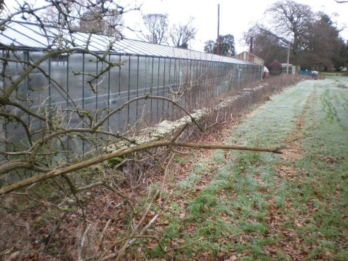
By the early 1950s a market garden had been established and today there is a commercial nursery in the walled garden. Despite changing use and split ownership of the estate, the overall designed landscape has remained remarkably intact.
SPECIFIC REFERENCES TO THE GARDEN
1740s: Charles Davidson and John Anderson say they ‘possess jointly the lands of Conheath and the Grass (of/or) in the fruit garden there' and they ‘pay yearly rent for sum of £20 sterling and six hens and twelve chickens'. That they ‘pay for the grass of the said garden twenty shillings sterling yearly'. They ‘have been used to take care of the fruit which grew in the garden for the Master's behove, which yielded sometimes more. Sometimes less and sometimes nothing and not more than twenty shilling sterling in a year.' The rental of the grass and fruit was determined by the Lords to be twenty four pounds.
1812, 5th December: Letter to Mrs Janet Connell at Conheath from her sister in Edinburgh, thanking her for a box of apples, a large quantity ‘most excellent of their several kinds'. (Doyle, John A (ed) 1898, p118)
1820s: A letter notes anxiety over how to dispose of the apples at Conheath.
p.155 (undated) Advised Mrs Connell that the stocks lift better in the spring (i.e. growing flowers).
1822 p.163 apples mentioned in letter
1823 p.168 Letter from her sister advising Mrs Connell to sow large beds and long rows of dwarf rocket larkspur as ‘nothing makes a garden look more brilliant'.
- Features & Designations
Designations
National Scenic Area
Features
- Sundial
- Description: Sundial in illustrated in painting by D W Rannie, date unknown but probably late 18th to early 19th century is now in pieces beside Conheath House and with dial missing
- Summerhouse
- Description: A circular summerhouse centrally placed along the west wall of the garden was built circa 1800. Constructed of red ashlar with a door into the garden, it is now roofless.
- Earliest Date:
- Latest Date:
- Bee Bole
- Description: Blocked up bee boles in the north east wall of the garden.
- Earliest Date:
- Latest Date:
- Chapel
- Description: Private T-plan, red ashlar, chapel with crypt begun by James A Morris of Ayr, circa 1909 but completed circa 1928 by Sir Robert Lorimer. T-plan. It is no longer in ecclesiastical use and maintained by a family trust.
- Earliest Date:
- Latest Date:
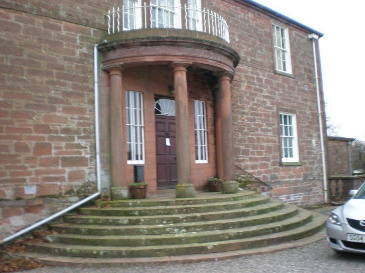
- House (featured building)
- Description: A two-storey, three-bay house with basement and a lower north wing. Constructed of squared red rubble with polished margins and dressings. On the east elevation of the original house is a central Roman Doric-columned semi-circular porch above a flight of concentric steps. The roof is piended slate.
- Earliest Date:
- Latest Date:
- Key Information
Type
Estate
Purpose
Horticultural
Principal Building
Domestic / Residential
Survival
Extant
Hectares
2
Electoral Ward
Caerlaverock
- References
Contributors
Eileen Toolis, Heather Barrington, Anne Fairn, Pam Wortley
Dumfries & Galloway Designed Landscapes and Gardens Survey Group under the auspices of the Garden History Society in Scotland