Introduction
The gardens at Cotehele have developed since the 16th century. They include about 6 hectares of formal and informal gardens within about 54 hectares of parkland and ornamental woodland.
Terrain
The site is undulating, rising to its highest point at the prospect tower in the park north of the house, while to the east of the house a valley falls steeply to the River Tamar. The ground also falls away to the river to the south-east of the house.The following is from the Register of Parks and Gardens of Special Historic Interest. For the most up-to-date Register entry, please visit the The National Heritage List for England (NHLE):
www.historicengland.org.uk/listing/the-list
19th century formal and informal gardens, of 16th century origin, together with a 20th century woodland garden and a park which is the remnant of two 16th century deer parks.
DESCRIPTION
Location, Area, Boundaries, Landform and Setting
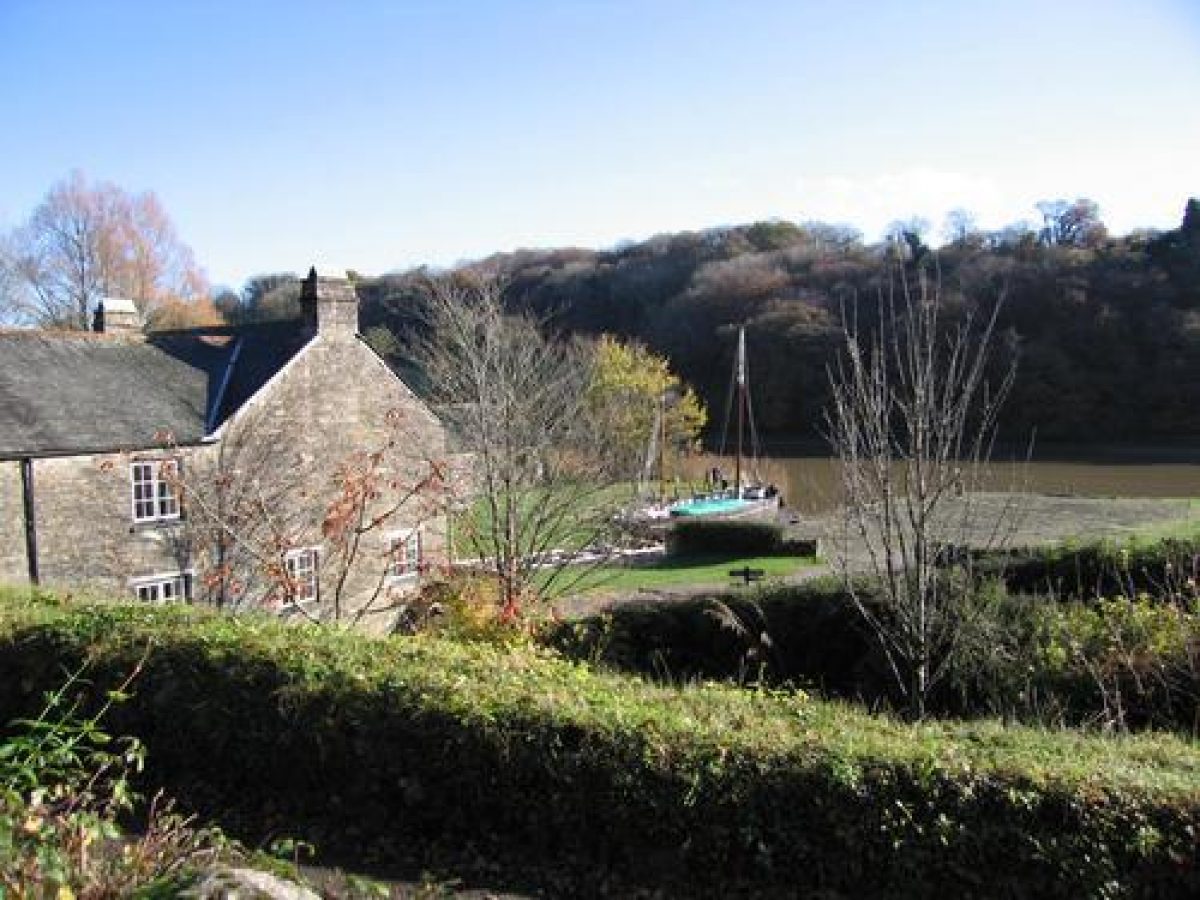
Cotehele is situated c 1km west-south-west of Calstock, on the west bank of the River Tamar, which here forms the boundary between Cornwall and Devon. The c 60ha site comprises some 6ha of formal and informal gardens, pleasure grounds, and orchards, and c 54ha of parkland and ornamental woodland through which passes a circuit of carriage drives and rides. To the east the site is bounded by the River Tamar, while to the south-east it adjoins buildings and old lime kilns at Cotehele Quay. The north-east, north, and west boundaries are all formed by agricultural land, while a projecting finger of woodland to the south-west is bounded to north and south by minor public roads.
The site is undulating, rising to its highest point at the prospect tower in the park c 320m north of the house, while to the east of the house a valley falls steeply to the River Tamar. The ground also falls away to the river to the south-east of the house, while to the south-west and north there are further valleys. There are significant views east from the formal gardens and valley garden towards Calstock, the River Tamar, and the C19 railway viaduct across the Tamar at Calstock, while from the Chapel there are views north, south, and east along the Tamar valley. From the Prospect Tower there are wide views in all directions across the site and surrounding country.
Entrances and Approaches
Cotehele is approached from a minor road which leads south-east from the hamlet of Harrowbarrow. Some 3km south-east of Harrowbarrow, the road passes along the northern edge of a wooded valley before turning north-east and north to reach a gate leading to a late C20 visitors' car park c 130m south of the house. Beyond the gate leading to the car park, the minor road continues c 200m north to arrive at a gravelled forecourt c 100m south-east of the house, the entrance to which is marked by a mid or late C19 lodge (listed grade II). This two-storey, asymmetrical stone structure stands to the east of the entrance and to the south-east of the forecourt.
To the north-west a single white-painted timber gate supported on a pair of stone piers with pyramid caps leads to a gravel drive which extends c 80m north-west between the bowling green and a line of mature sycamores to the south-west and a late C15 stone barn (listed grade I) to the north-east, to reach a gravelled carriage turn below the gatehouse. The carriage turn comprises a circular lawn with a centrally placed granite cider press.
To the west a gravelled drive leads c 10m to the Retainers' Court (listed grade I) to the south of the house. The late C15 Retainers' Court is cobbled, and is enclosed to the south and west by ranges originally containing the dairy and still-room, to the north by the chapel and a crenellated screen wall containing an arched gateway, and to the east by the west wing of the house. An archway in the west wing leads from the Retainers' Court to the central courtyard of the house. To the east of the carriage turn a further drive descends gently for c 30m, passing a gateway leading north to the terraced garden east of the house, to reach a junction with a further drive which leads south to the former farmyard.
To the north this drive passes between the terraced garden and the valley garden before turning east for c 250m and north for c 1km through Cotehele Wood. The Wood is situated on the east- and south-east-facing slopes of a valley which leads north from the River Tamar c 400m north-east of the house. The drive, which forms part of the network of C19 carriage drives on the estate, leads c 200m north-west of Cotehele Wood to join a minor road at Danescombe c 1.5km north-west of the house. This northern approach was formed c 1860 when existing tracks and footpaths were diverted away from the east front of the house (map, CRO).
A further drive approaches the site from Cotehele Quay to the south-south-east. The entrance, some 40m above and to the north of the Quay, is marked by a white-painted timber gate supported by a pair of mid C19 rusticated stone piers under pyramid caps. To the north-west of this entrance stands a C19 two-storey stone lodge (listed grade II) with an ornamental half-hexagon loggia supporting a first-floor canted bay to the south. Beyond the lodge the drive ascends c 400m north through mixed woodland before joining the principal drive and continuing c 50m north-north-west to reach the forecourt c 100m south-east of the house.
In the late C15 and C16 the principal approach to the house was from Trehill c 800m north-west of the house. This approach, which is shown on the C16 estate plan (CRO) survives in part as a track which follows the western boundary of several agricultural enclosures before entering the park c 300m north-north-west of the house. Entering the gardens c 50m north-north-west of the house, the track continues as a path, passing through the orchard north of the house, to enter the Retainers' Court through the arched gateway in its northern screen wall.
Principal Building
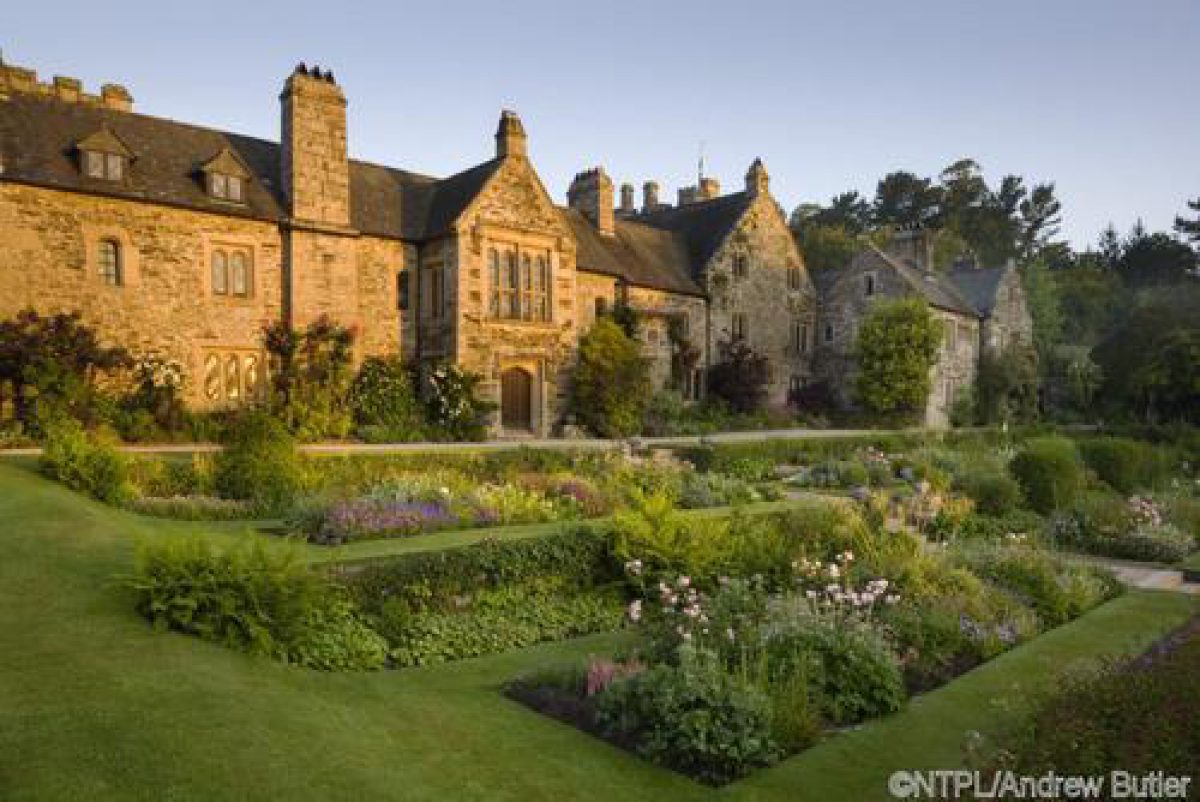
Cotehele House (listed grade I) stands on a terraced site some 270m west of the River Tamar. The house is constructed around a central courtyard, with a further courtyard, the Retainers' Court (listed grade I) adjoining to the west. The principally two-storey stone house is of irregular outline with mullion windows, gables, and tall stone chimney stacks. The south facade has a centrally placed late C15 gatehouse which comprises a three-storey crenellated tower rising above a small stone entrance arch. The west range is of two storeys and is terminated to the north by a substantial, three-storey crenellated tower. The east range has an off-centre two-storey gabled porch leading to the terraced garden, while the north range is of irregular form and contains the hall. The central court is laid out with two terraced lawns separated by a retaining wall which crosses the court from north to south. Cobbled paths link gateways in the south and west ranges, dividing the lawns into plats of unequal area. The walls of the court are planted with trained shrubs and climbers.
The house originated c 1300, and was altered in the early C15; the original house probably stood on the site of the north or hall range. Rebuilding was undertaken by Sir Richard Edgcumbe in 1485-9, and by his son, Sir Piers Edgcumbe from 1489 to 1520. Periodic alterations were made in the C16 and C17, including the construction of the north-west tower in 1627. Further internal changes were made in the early and late C18, while in 1862 the east range was remodelled for the widow of the third Earl of Mount Edgcumbe. The house has remained substantially unchanged since the late C19.
Gardens and Pleasure Grounds
The formal gardens lie to the north, east, and west of the house, with informal woodland gardens in the valley to the east. The formal gardens to the north and north-west of the house, an orchard to the south-west, and the bowling green to the south are enclosed by partly crenellated stone walls, that to the west listed grade II.
The bowling green to the south of the house comprises an approximately rectangular level lawn, with low banks rising to the south and west, the latter planted with shrubs. To the south the bowling green is enclosed by a C19 stone wall with brick coping (listed grade II), while to the east the lawn drops down to the drive. The south and east perimeters of the bowling green are planted with a single line of mature and recently planted sycamores. The bowling green is shown on Doidge's plan of 1731 (CRO), and a watercolour of 1832 by G R P James shows the green but without the sycamores; a photograph of c 1850 shows the green much as it remains today (NT Conservation Plan).
The arch in the north screen wall of the Retainers' Court leads to an area known as the Meadow to the north and north-west of the house. This area comprises a south-facing grass slope planted with specimen trees and groups of ornamental shrubs, together with a collection of narcissi. A gravel walk leads north-west from the gate leading from the Retainers' Court to a stone arch closed by a lattice timber door set in a stone wall (listed grade II) which separates the Meadow from the Upper Garden. To the west of this walk is a group of headstones dating from the 1870s commemorating family dogs.
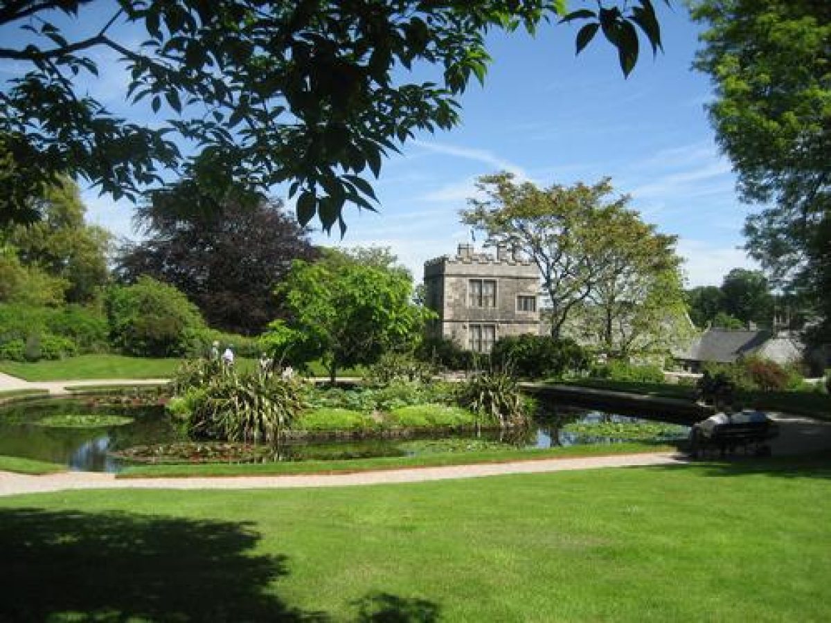
The Upper Garden comprises an approximately rectangular enclosure laid out in three terraces. The lower terrace to the south comprises a gravel walk which passes from east to west linking the Meadow to Mrs Julian's Garden, beyond the Upper Garden. Below this walk is an area of lawn planted with specimen trees and shrubs. The middle terrace comprises a level lawn with a central rectangular pond fed from the north-east by a stream which is channelled through a stone rill. The pond has a central rectangular island planted with ornamental shrubs and herbaceous subjects; a statue of Neptune formerly on the island was removed by Graham Stuart Thomas c 1970 (ibid).
A gravel walk surrounding the pond is linked by four diagonal paths to the four corners of the middle terrace, while a yew hedge to the west of the terrace serves as background to an herbaceous border. The upper terrace forms a gravel walk which runs parallel to the stone wall forming the north boundary of the Upper Garden; a mixed border is planted below the wall. The original designs for this border, and that to the west of the lawn, were made by Graham Stuart Thomas and John Sales c 1970 (NT archive). The Upper Garden, known in the mid C19 as the 'Italian Garden', was developed c 1860 from the 'Old Orchard' recorded on Doidge's plan of 1731 with terraces, complex flower beds, gravel walks, and the central pond. The design of the garden was simplified in the mid C20.
Mrs Julian's Garden, named after an early C20 tenant, lies to the west of the Upper Garden and is enclosed to the east by a yew hedge. It is entered from the lower terrace walk through a yew arch. The Garden is laid out with a series of stone-edged ramped beds flanking a central path. The beds are planted with specimen trees and shrubs including a collection of eucalyptus, but were probably constructed in the early or mid C19 for the cultivation of vegetables; similar examples survive in the kitchen garden at Trengwainton, Cornwall (qv). To the north of Mrs Julian's Garden the Cut-Flower Garden comprises four rectangular beds flanking a central grass walk aligned on an opening in a yew hedge to the east; the walk leads to the middle terrace of the Upper Garden. North of the Cut-Flower Garden, and separated from it by a yew hedge, is a further area planted with specimen shrubs. A late C20 metal-framed free-standing glasshouse stands on the site of a C19 timber and brick lean-to house which was constructed against the south-facing boundary wall.
A gravel walk leads east through a gap in a yew hedge to the upper or north terrace in the Upper Garden. This terrace walk leads east to a gateway set in the east boundary wall of the Upper Garden which gives access to the Meadow. Continuing parallel to the crenellated stone wall forming the northern boundary of the Meadow, the walk affords views south and south-east across the house and gardens. Ornamental trees and shrubs are planted in a border parallel to the north wall of the Meadow. To the east of the Meadow the walk turns south and descends the south-facing slope in a series of curves. The slope is planted with specimen maples, while a service drive below to the south is screened by mature laurel. This area is identified as the Rookery on the Tithe map (c 1840). The walk continues south of the service drive to reach steps which descend to a stone arch surmounted by a cross (listed grade II) which leads to the east terraces.
The terraced garden east of the house comprises four terraces retained by stone walls and linked by stone steps which are aligned on the gabled porch on the east facade of the house. The upper terrace forms a gravel walk linking the north entrance to the east porch and the drive leading east from the carriage turn. To the east the walk is bordered by a narrow lawn, while to the west mixed borders are planted below the walls of the house. The second, third, and fourth terraces follow a similar plan with narrow beds below the retaining walls and a pair of long rectangular beds set in grass flanking the axial walk aligned on the east porch. The beds are planted with roses on the second terrace, and mixed herbaceous and seasonal subjects on the third and fourth terraces.
Stone steps descend north and south to a gravel walk on the fourth or lowest terrace, which runs parallel to the crenellated retaining wall. A flight of off-centre stone steps descends east to enter a stone-lined tunnel linking the formal terraces to the valley garden beyond the north drive. The east terraces are of uncertain age and origin, but are shown on mid C19 photographs pre-dating the alteration and renovation of the east wing in 1862 (John Lanyon pers comm, 2000); their plan and planting is recorded on early C20 photographs published by Country Life (1902, 1905).
The informal woodland garden to the east of the north drive comprises a steep-sided valley which descends from the terraced garden to the River Tamar. Gently sloping walks terraced into the north- and south-facing slopes of the valley pass through mixed trees and specimen shrubs; these walks are linked by a series of lateral paths which cross the valley. The walk on the south side of the valley leads c 160m east-south-east to reach a gate which gives access to Cotehele Wood, the riverside ride, and the medieval Chapel of St George and St Thomas a Becket (listed grade II*) c 240m east of the house.
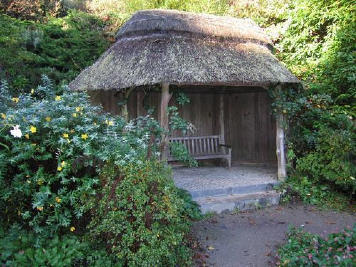
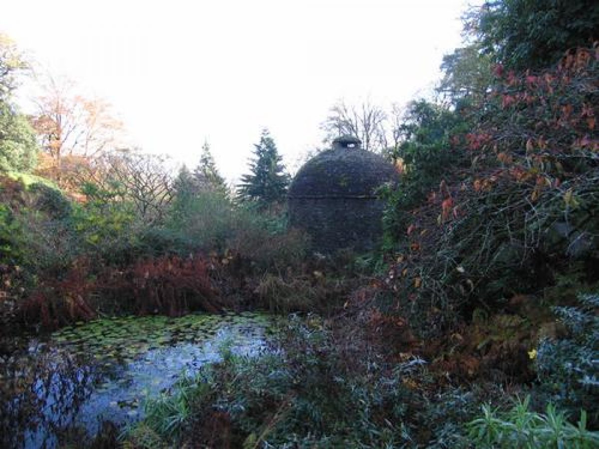
The head of the valley is formed into a terrace, with a stream being dammed to form an approximately rectangular pond c 50m east of the house. This pond is possibly of medieval origin, and may have served as a fishpond to supply the household (Pett 1998). To the north-west of the pond stands a rustic timber and thatch summerhouse on a cobbled base; this late C20 structure replicates a late C19 summerhouse which is known from photographs. The terrace is lavishly planted with herbaceous and moisture-loving plants, together with mature rhododendrons and other ornamental shrubs. Below and to the south-east of the terrace stands a stone dovecote (listed grade II*). Of late C16 or early C17 construction, the dovecote is circular on plan and is covered by a domed stone roof with a central lantern providing access for the birds. The stream which flows east through the valley below the fishpond is formed into a series of pools and cascades which are constructed from white quartz.
The fishpond and dovecote are both indicated on Doidge's plan of 1731, while the lower valley is shown as woodland. In the mid C19 walks were developed in the valley and the stream was ornamented with pools and picturesque cascades (NT Conservation Plan). The valley remained woodland until 1891 when severe blizzards destroyed many mature trees. The lower valley was replanted with ornamental subjects including specimen trees and conifers, rhododendrons, and other flowering shrubs; this area has continued to be developed throughout the C20.
Park
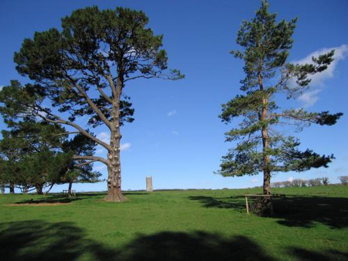
The park is situated principally to the north-east of the house, with a further area of ornamental paddock to the south. The park comprises a single pasture enclosure on a south- and south-east-facing slope. The western boundary of the enclosure is marked by a single row of mature Scots pines which are planted parallel to the track which follows the course of the medieval north approach, while the northern and eastern boundaries are formed by Cornish hedges. Adjacent to the northern boundary, at the highest point of the park c 320m north of the house, stands the Prospect Tower (listed grade II*).
The stone tower, which is triangular on plan, rises through three storeys, each storey being marked by a string course. The two lower storeys have blind gothic arches, while a similar arch on the upper storey has stone false louvres. The parapet is crenellated, and the corners are marked by simple pinnacles. Each facade is slightly dished, giving the structure the appearance of greater height. A late C20 timber staircase allows access to a gallery behind the parapet, from which there are wide views in all directions. The Tower was probably constructed in 1789, either to commemorate the elevation of Viscount Mount Edgcumbe to an earldom, or the second visit of King George III to Mount Edgcumbe in that year.
A tower of similar date and design at Mount Edgcumbe (demolished early C20) was visible from the Prospect Tower at Cotehele. The Tower stands approximately on the site of a structure, possibly a lodge, marked on the C16 estate survey (CRO). Adjacent to the southern boundary of the park c 100m north of the house, an C18 icehouse (listed grade II) is built into a bank. The entrance is formed by granite jambs and lintel and is closed by a C20 timber door. The two paddocks to the south of the house remain pasture with C19 and C20 ornamental planting.
The park survives as a remnant from the eastern of two parks recorded on the C16 estate survey (CRO). The extent of the eastern park is reflected by field names recorded by Doidge on his plan of 1731. This indicates that the northern boundary corresponded to the present field boundary and footpath c 240m north of the Prospect Tower, while the western boundary corresponded to the minor road running north to Trehill, c 530m west of the Prospect Tower. The southern boundary of the park followed the north wall of the gardens, and continued west following a surviving Cornish hedge and other field boundaries to meet the minor road c 240m west. The west park lay to the west of the minor road leading to Trehill, and to the south of Newton; it included at least part of Comfort Wood, which was the site of a lodge marked on the C16 estate plan (CRO). Today (2000), with the exception of the single enclosure in which the Prospect Tower stands, the two parks have reverted to mixed agricultural use and are excluded from the site here registered.
It is likely that the parks were enclosed in the late C15 or early C16 by either Sir Richard Edgcumbe, or his son, Sir Piers as part of their improvements to the estate; the latter was responsible for creating a deer park at Mount Edgcumbe in 1515 (guidebook). The parks were disparked by 1731 (Doidge), and probably ceased to be maintained after the mid C17 when the family reverted to using Mount Edgcumbe as its principal residence. The present park and the ornamental paddocks south of the house were developed in the late C18 and mid C19.
Kitchen Garden
No kitchen garden survives at Cotehele, but the ramped beds in Mrs Julian's Garden c 50m west of the house were used in the early or mid C19 for growing vegetables. The area which now comprises the Upper Garden, Cut-Flower Garden, and Mrs Julian's Garden, in 1731 formed part of the 'Old Orchard', a large rectangular enclosure to the west of the house (Doidge). The southern half of this enclosure remains an orchard today, with mixed standard fruit trees planted in grass. A large rectangular depression in the orchard c 80m south-west of the house is of uncertain age and purpose. The orchard is enclosed to the west by a C19 stone wall c 3m high (listed grade II), while to the south it is bounded by further walls and a range of mid or late C19 two-storey cottages and cart sheds (listed grade II). The east boundary is formed by further walls and the late C19 coach house (listed grade II).
A further orchard, the 'New Orchard', is marked by Doidge (1731) on the south-facing slope above the valley c 50m north-east of the house. Today known as Nelson's Piece, this area was used as a market garden until the 1960s, and was subsequently added to the valley garden and planted with ornamental trees and shrubs to a plan by Graham Stuart Thomas in 1978 (NT Conservation Plan).
Other Land
The site includes woodland to the south-west, south, east, and north of the house, through which passes a network of rides and drives. The woodland broadly corresponds to the areas shown as timbered on Doidge's plan of 1731, while the principal rides or drives are marked on the Tithe map (c 1840). The drive leading north through Danescombe extends south and south-west to Cotehele Quay, passing c 240m east of the house the late C15 Chapel of St George and St Thomas a Becket (listed grade II*). This simple, single-storey stone structure comprising a single cell stands on a steep rocky cliff overlooking the River Tamar. It was built by Sir Richard Edgcumbe c 1490 to commemorate his escape from Sir Henry Trenowth in 1483.
References
R Carew, The Survey of Cornwall (1602, Lord de Dunstanville (ed) 1811), p 269
C S Gilbert, Survey of Cornwall II, (1820), pp 449-451
The Garden, 44 (1893), pp 21, 117; 62 (1902), pp 44-46
Country Life, 11 (19 April 1902), pp 485-488; 17 (10 June 1905), pp 822-833; 56 (30 August 1924), pp 324-331; (6 September 1924), p 360; no 5 (1 February 1990), pp 52-55; no 6 (8 February 1990), pp 68-71
Architect Hist 7, (1964), p 24
N Pevsner and E Radcliffe, The Buildings of England: Cornwall (2nd edn 1970), pp 57-58
G S Thomas, Gardens of the National Trust (1979), pp 124-126
D E Pett, The Parks and Gardens of Cornwall (1998), pp 224-225
National Trust Conservation Plan for the Garden at Cotehele, (National Trust 1999)
Cotehele, guidebook, (National Trust 1999)
Maps
Map of Cotehele, Calstock and Mordenmills, mid C16 (DD/ME 2369), (Cornwall Record Office)
C Saxton, Map of Cornwall, 1576
W Doidge, A Plan of the Barton of Cotele and some other Tenements ... being part of the Estate of the Honble Richard Edgcumbe Esqr, 1731 (DD/ME2371), (Cornwall Record Office)
W Doidge, A Plan of the Ancient House of Cotele, 1731 (DD/ME 2372/1), (Cornwall Record Office)
Tithe map for Calstock parish, c 1840 (DD/ME 2374), (Cornwall Record Office)
Plan for re-routing road east of Cotehele, mid 19th century, (DD/ME2022/92), (Cornwall Record Office)
Plan of proposed alteration of footpaths at Cotehele, 1861 (DD/ME 2375/1(3), (Cornwall Record Office)
Illustrations
G R P James, watercolour, 1832 (private collection)
Archival items
The Mount Edgcumbe family and estate papers, including plans, accounts and surveys from the 16th to 20th century are held in the Cornwall Record Office (DD/ME).
Photographs, mid and late 20th century (National Trust)
Photographs, late 19th and early 20th century (Country Life)
Description written: January 2001
Amended: July 2001
Edited: October 2001
- Visitor Access, Directions & Contacts
Telephone
441579351346Access contact details
The house is open between March and November, but the gardens are accessible all year round, 10am to dusk. http://www.nationaltrust.org.uk/place-pages/96/pages/opening-times-calendar
Directions
8 miles south-west of Tavistock, 2 miles east of St Dominick.
Owners
The National Trust
Heelis, Kemble Drive, Swindon, SN2 2NA
- History
The following is from the Register of Parks and Gardens of Special Historic Interest. For the most up-to-date Register entry, please visit the The National Heritage List for England (NHLE):
www.historicengland.org.uk/listing/the-list
HISTORIC DEVELOPMENT
Cotehele belonged to a family of the same name until 1353, when it was acquired through marriage by William Edgcumbe (d 1379). In the late 15th and early 16th century an existing house was remodelled by Sir Richard Edgcumbe (d 1489) and his son, Sir Piers (d 1539). Sir Richard Edgcumbe supported Henry VII against Richard III and was handsomely rewarded after the Battle of Bosworth in 1485 (guidebook). A mid-16th century plan of Cotehele (Cornwall Record Office) shows two parks, together with orchards and enclosures around the house.
In the mid 16th century Sir Piers Edgcumbe built a new house and enclosed a park at Mount Edgcumbe, Cornwall, which was subsequently adopted as the family's principal seat. Cotehele was occupied on an occasional basis, except for a period during the Civil War in the mid 17th century when Colonel Piers Edgcumbe (about 1610-1667), a supporter of the Crown, returned to the house, which he then occupied until his death. Colonel Edgcumbe's son, Richard, was knighted in 1662, while his grandson, also Sir Richard (1680-1758), was created Baron Edgcumbe in 1742 for his political support for Sir Robert Walpole.
It has been suggested that the first Lord Edgcumbe, a keen antiquarian, began to furnish Cotehele in a consciously antique style in the 1730s (Country Life 1990). An estate plan of 1731 by William Doidge (Cornwall Record Office) shows walled orchards to the west of the house, a bowling green to the south, and further enclosures to the east and north. In 1781 the second Baron's younger brother and heir, George (1720-1791), was created Viscount Mount Edgcumbe and Valletort, and in 1789, Earl of Mount Edgcumbe.
The first Earl was a close friend of Horace Walpole, and, like his son, the second Earl (1764-1839), a member of the Society of Antiquaries; Cotehele was visited in 1781 and 1789 by King George III and Queen Charlotte. On the death of the third Earl in 1861, his widow, Caroline Augusta (1808-1881) moved to Cotehele; the house was renovated and partially remodelled, and improvements were made in the gardens, including the re-routing of a road to the east of the house (plan, Cornwall Record Office). Following the death of the Countess Dowager in 1881 the house was occupied by the fourth Earl's sister, Lady Ernestine (d 1925). Piers, fifth Earl (1865-1944) also lived at Cotehele from 1941 following the destruction of Mount Edgcumbe during the Second World War. In 1947 his second cousin and heir, Kenelm (1873-1965), sixth Earl, passed Cotehele to the government in lieu of death duties. The estate was subsequently passed to the National Trust, in whose ownership it remains today (2000).
- Features & Designations
Designations
The National Heritage List for England: Register of Parks and Gardens
- Reference: GD1639
- Grade: II*
Features
- House (featured building)
- Earliest Date:
- Latest Date:
- Garden Terrace
- Lawn
- Shrub Feature
- Specimen Tree
- Folly
- Parkland
- Woodland
- Formal garden
- Key Information
Type
Park
Purpose
Ornamental
Principal Building
Domestic / Residential
Survival
Extant
Hectares
60
Open to the public
Yes
Civil Parish
Calstock
- References
References
- {English Heritage Register of Parks and Gardens of Special Historic Interest} (Swindon: English Heritage 2008) [on CD-ROM] Historic England Register of Parks and Gardens of Special Historic Interest
- Pevsner, N and Radcliffe, E {The Buildings of England: Cornwall} (Harmondsworth: Penguin, 1970) pp 57-58 The Buildings of England: Cornwall
- Pett, D {The Parks and Gardens of Cornwall} (1998) pp 224-225 The Parks and Gardens of Cornwall