Introduction
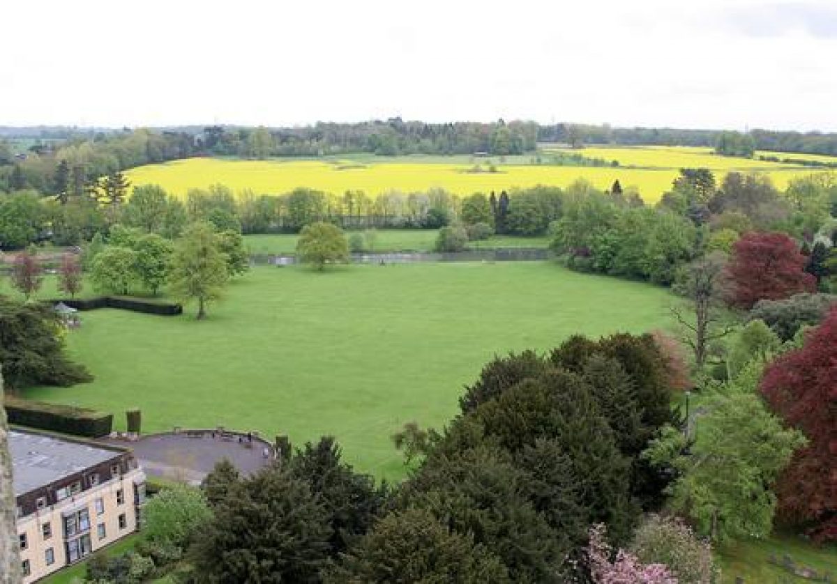
The site was the town seat of the Masters family, situated next to the parish church of the site of the former abbey. A semicircular terrace is the only remnant of the later house, the site of which is now occupied by flats. The grounds are now a public open space extending down to the River Churn and retaining the general form of the late-17th-century landscaping.
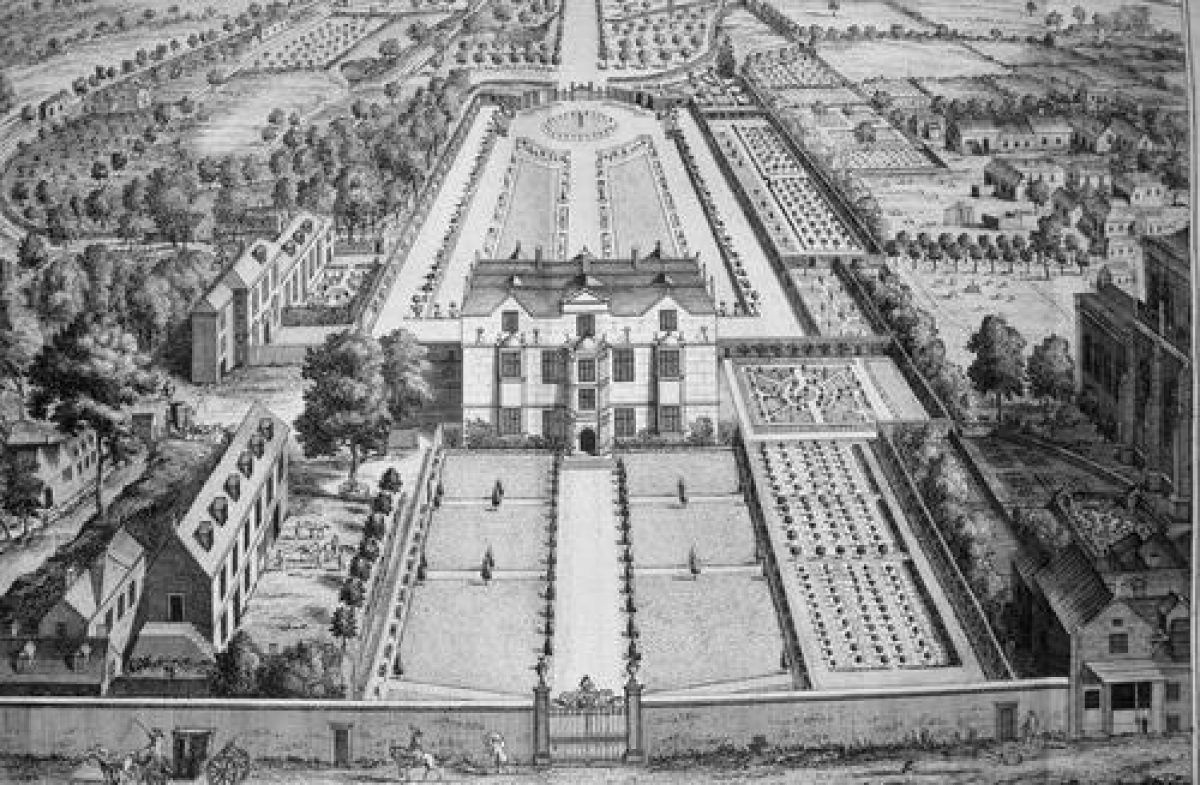
The details of the history of the house are known. It is not known when the garden illustrated in the Kip engraving was created, but it was probably formed in the second half of the 17th century. Plans in the Gloucestershire County Record Office show that it was progressively altered until the final landscaping in the 1770s. The general scheme survives in the existing public space including the former fishponds on the River Churn.
- Visitor Access, Directions & Contacts
Telephone
01285 655646Access contact details
The site is now in a public park.
Directions
In public park west of St.John's Church
- History
The Kip engraving shows a formal walled garden extending north from Gosditch; parts of this wall survive. The garden shown in the engraving is large and relatively narrow. There is a central decorative formal core, mainly on the central axis of the house, and a small formal extension to the south. Shown to the north are service and farm buildings and to the south extensive vegetable gardens are depicted. Illustrated beyond the formal garden are orchards and the park, which extends down to the river.
- Key Information
Type
Park
Purpose
Recreational/sport
Principal Building
Parks, Gardens And Urban Spaces
Survival
Extant
Open to the public
Yes
Civil Parish
Cirencester
- References
References
- Atkyns, R and others {The Ancient and Present State of Gloucestershire} (London: W. Bowyer for Robert Gosling, 1712) The Ancient and Present State of Gloucestershire
- Kingsley, N {The Country Houses of Gloucestershire, Vol. I 1500-1660} (Cheltenham: Phillimore, 1989) The Country Houses of Gloucestershire, Vol. I 1500-1660
- Verey, D {The Buildings of England: Gloucestershire 1: The Cotswolds} (London: Penguin, 1970) p 259 The Buildings of England: Gloucestershire 1: The Cotswolds
- Mowl, T {Historic Gardens of Gloucestershire} (Stroud: Tempus, 2002) Historic Gardens of Gloucestershire
Contributors
Martin McNicol