Introduction
Chantmarle has early 20th-century formal terraced and water gardens of around 1 hectare. Features include an approach drive through mature trees, yew hedges, herbaceous borders and a circular balustraded pool. The property is now a Christian retreat, educational centre and wedding venue, but is not open to the public in the general sense.
The following is from the Register of Parks and Gardens of Special Historic Interest. For the most up-to-date Register entry, please visit The National Heritage List for England (NHLE):
Early-C20 formal gardens designed by Francis Inigo Thomas for Francis Savile, perhaps incorporating elements of an early-C17 formal garden, and extended c.1920 by Edward Warren.
Location, Area, Boundaries, Landform and Setting
Chantmarle is situated c.1km west of Frome St Quintin. The c.4ha site is adjoined to the south by agricultural land, while to the north-west it is bounded by mid-to-late-C20 institutional buildings constructed for the police training centre. To the east the railway line from Weymouth to Yeovil bounds the garden. The site slopes from west to east, sloping down to the River Frome which crosses the north-eastern corner of the site, and flows on the eastern side of the railway. There are easterly views from the gardens across the valley of the River Frome towards Frome St Quintin.
Entrances and Approaches
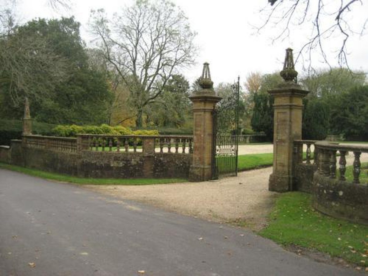
Chantmarle is approached from a minor road, Chantmarle Lane, which leads west from Frome St Quintin. The main approach begins c.500m east of the house, through a pair of thatched cottages designed c.1920 by Alfred Powell for CH St John Hornby. The approach lane is then carried over the railway line by a bridge with an ornamental stone balustrade built c.1910 by Inigo Thomas for Francis Savile. Chantmarle Lane continues c.80m west before arriving at the entrance gates north-east of the house. The forecourt is separated from the lane by an early-C20 stone wall surmounted by balustrades. Similar quadrant walls flank a pair of tall stone piers surmounted by obelisk finials, which support a pair of tall wrought-iron gates.
Opposite the entrance to the forecourt, an avenue leads north for c.100m. This area has been partly developed as a car park in the late C20.
Principal Building
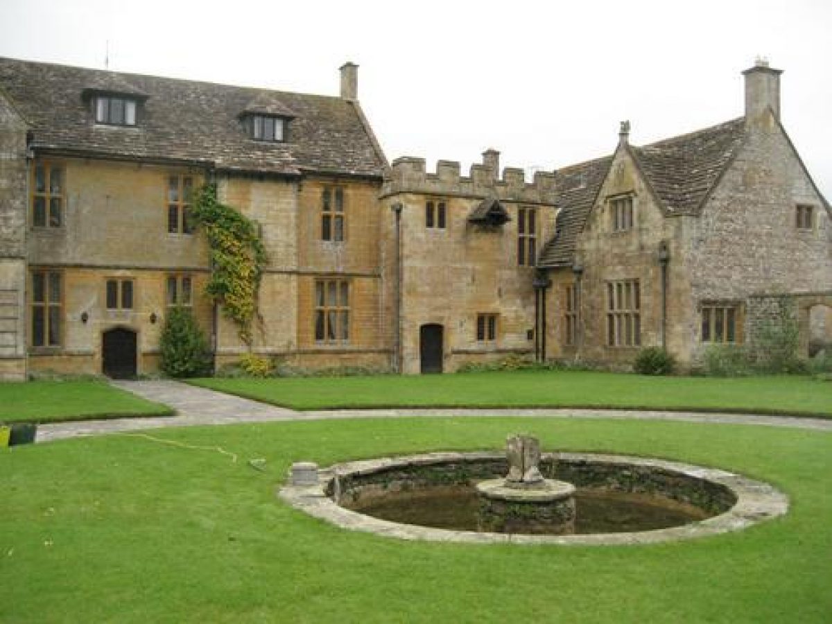
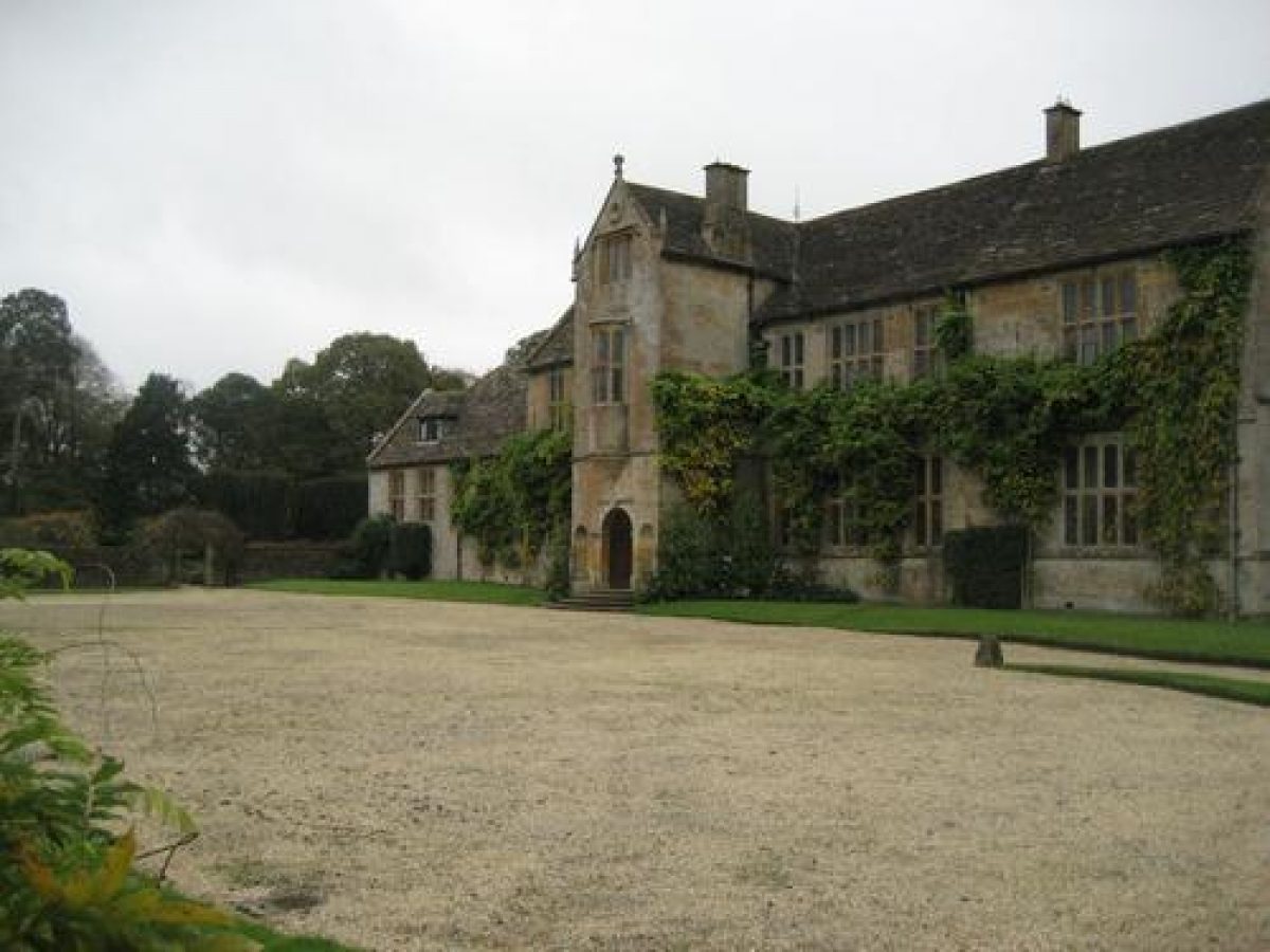
Chantmarle (listed Grade I) stands on a level terrace towards the centre of the site. The house is irregular in plan and is constructed in ashlar Ham stone, knapped flint and banded stone under slate roofs. It comprises two storeys and an attic. The principal range faces east and forms the house built by Sir John Strode in 1612. The entrance façade has a central, full-height gabled porch with a first-floor oriel, with stone mullion and transom windows across the elevation.
Originally E-shaped on plan, this range lost the projecting north-east and south-east wings in the early C19. A lower range projects to the south of the principal range, with a further range, comprising part of the C15 house, extending north-west from the C17 house.
Gardens and Pleasure Grounds
The formal gardens are situated to the south and east of the house, with a further area lying between the east and north-west ranges of the house. Beyond these are areas of meadow and glade, with a tree belt to the west.
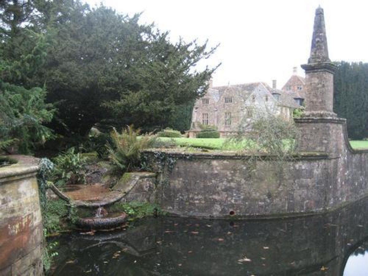
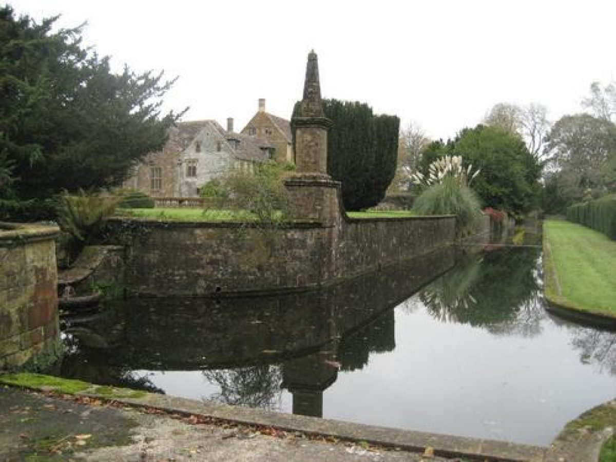
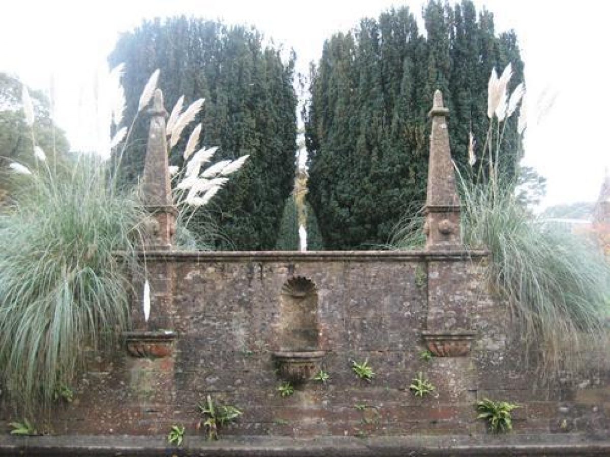
The forecourt to the east of the house is integral to the garden scheme, and consists of a carriage turning area surrounded by panels of lawn. To the east the court is enclosed by stone balustrades. The balustrade breaks forward in a semi-circular balcony on an axis with the three-story porch of the house, supported on corbels which match those of the oriel window above the entrance door. The balcony is framed by obelisks and Irish yews, and overlooks a long, narrow canal which is bounded on its western side by the stone walls enclosing the gardens around the house, and on its eastern side by a grass terrace walk and a row of yew hedges. The grass walk is approached by a flight of stone steps at the north-eastern corner of the forecourt. A pair of stone piers with ball finials in the yew hedge continues the axis from the balcony and porch, and frames the vista to an area of meadow below which is approached down a flight of semi-circular stone steps which descends between the stone piers. In the meadow there are several streams and a small pond with a cascade at its northern end.
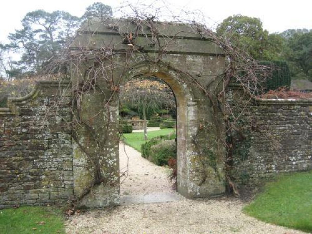
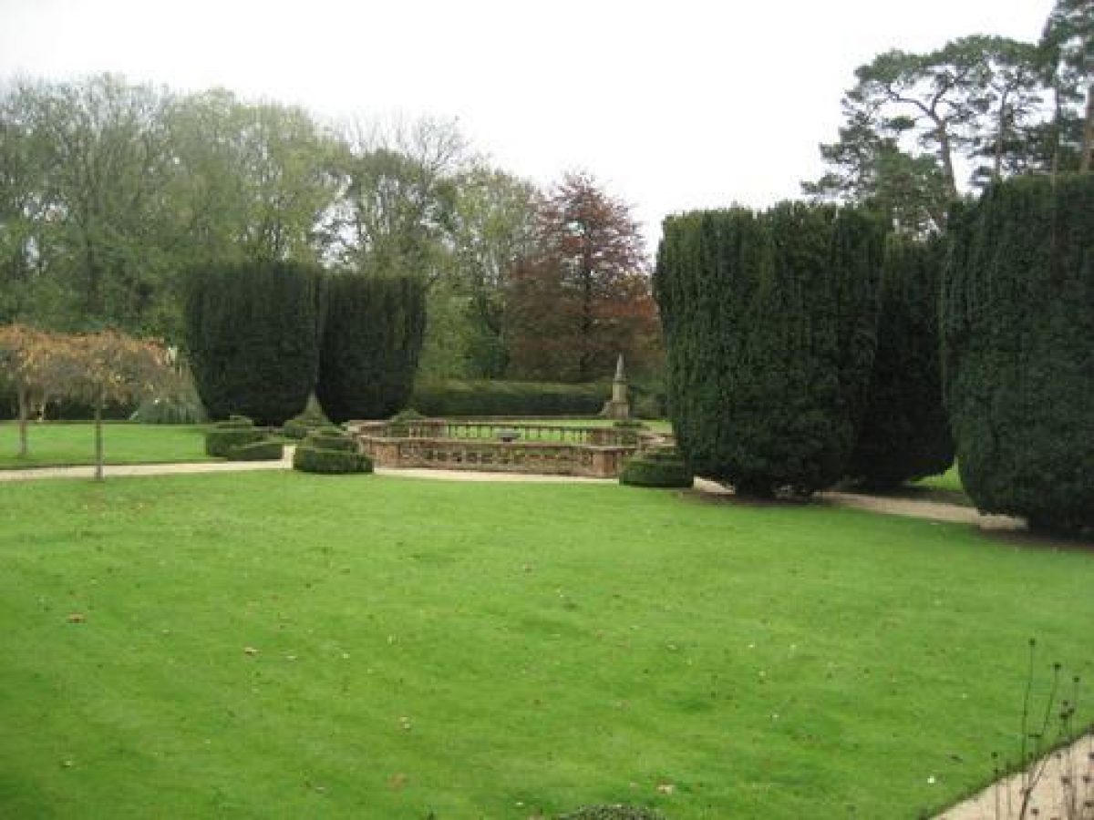
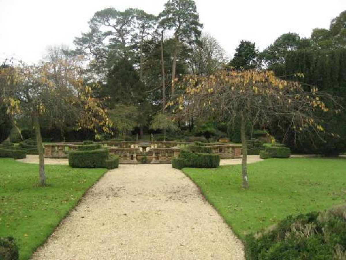
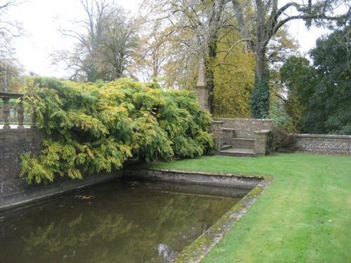
The southern side of the forecourt is enclosed by a stone wall in which is set an arched doorway with a wrought-iron gate leading to the south garden. This approximately square area is laid out with four panels of lawn and a central, circular pool enclosed by stone balustrades. The lawns are separated by gravel walks, while a stone-flagged walk extends along the northern side of the garden, separating the lawns from a herbaceous border. The north-south axis through the garden extends from the forecourt gateway to a balustraded stone bridge, which crosses a stream on the southern side of the garden with an area of bog and rock garden, beyond which is an area of meadow. There is a further east-west axis through the garden, terminated to the east by a stone bench flanked by obelisks, with a shell-headed niche in the retaining wall behind. The walk leading west from here is flanked by Irish yews, and was originally terminated to the west by a flight of stone steps ascending to a croquet lawn. A later flight of steps and a gate with the date 1920 extend the vista westwards, in a wall built on a further terrace above the croquet lawn.
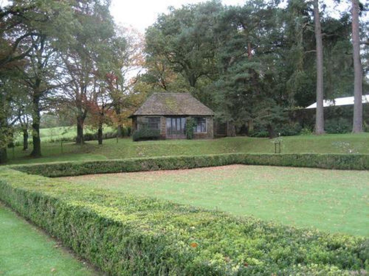
The croquet lawn is retained above the level of the south garden by a buttressed stone wall surmounted by a balustrade, with low yew hedges enclosing the croquet lawn itself. These hedges have openings at the central point of each side leading to a perimeter grass walk. The further terrace to the west is planted with a single row of mature pines which form a visual backdrop to the garden terraces. At the southern end of this terrace is a single-storey summerhouse, while a flight of steps to the north-east descends to a stone-flagged walk which extends between yew hedges on the northern side of the croquet lawn. This walk provides access to the courtyard garden to the west of the house, through an opening in the stone wall adjacent to the walk.
The courtyard garden is an irregular-shaped area enclosed to the east and south-east by the C17 house, and to the north-east by the surviving range of the C15 house, with early-C20 ranges beyond and to the west. Cruciform stone flagged walks converge in a central, circular fountain pool. The outer quarters of the garden are laid to lawn, while low stone walls to the west echo the central circular motif. A shallow flight of stone steps rises on the central western axis to reach a further area of lawn and the early-C20 service wing.
The gate in the wall above the croquet lawn leads to an area of grass to the west, which was laid out as tennis courts c.1920, with a thick yew hedge with a central exedra enclosing it on its western side. At the northern end of this terrace the 1960s buildings built for the police training centre can be seen. The westernmost terrace, beyond the yew hedge, is a wild garden with a small pond with an ornamental balustrade at its northern end. South and west of the terraces and formal gardens is a shelter belt of trees rising to the ridge to the west offering privacy and enclosure to the estate.
The stable courtyard lies to the west of the courtyard garden, and partially comprises mid-C20 buildings. An historic range faces Chantmarle Lane to its north with an area beyond of open grass with some fruit trees surviving from the orchard shown on early Ordnance Survey maps.Reasons for Designation
Reasons for Designation
The gardens at Chantmarle are included on the Register of Parks and Gardens at Grade II* for the following principal reasons:
- Date: as a good example of an early C20 formal garden, associated with a largely C17 manor house (listed Grade I);
- Design quality: the design and layout of the gardens are of a particularly high quality, as expressed in the layout of the gardens and the formal architectural features which express the axes through the site;
- Architect and designer: the gardens were laid out by Francis Inigo Thomas, a noted garden designer;
- Group value: the gardens have strong group value with Chantmarle Manor (Grade I), the footbridge, terrace walls, steps and balustrading and approach bridge over the railway (Grade II).
REFERENCES
Country Life, 9 Mar 1907, 344-348; 30 Jun 1950, 1966-1971; 5 Jul 1950, 46-49.
Mowl, T, Historic Gardens of Dorset, (2003), 134-138
Newman J and Pevsner N, The Buildings of England:Dorset, 1972, 137-139.
Oswald A, Country Houses of Dorset, 1959, 97-99, pls 101-105.
- Visitor Access, Directions & Contacts
- History
The following is from the Register of Parks and Gardens of Special Historic Interest. For the most up-to-date Register entry, please visit the The National Heritage List for England (NHLE):
www.historicengland.org.uk/listing/the-list
HistoryThe house at Chantmarle belonged to the Cheveral family in the late medieval period, before being sold in 1606 to Sir John Strode, younger son of John Strode of Parnham, Dorset. Sir John was a wealthy lawyer and proceeded to build a new house, retaining a portion of the existing house which is believed to date from the C15. The construction of this new E-plan house, which was begun in 1612 and retained a portion of the existing house, was described by Sir John in an account book which shows it to have cost £1,142. In 1628, Sir John inherited Parnham from his brother, and thereafter Chantmarle became a secondary residence.
During the C18 and C19, Chantmarle was used as a tenanted farmhouse, and a drawing by JC Buckler of 1828 shows one wing partly ruinous. In 1898, the estate was sold to the Earl of Ilchester, before being sold again in 1907 to Francis Savile who repaired and restored the house, and commissioned Inigo Thomas to design new formal gardens. In 1919 Chantmarle was sold again to CH St John Hornby, who employed the architect Edward Warren to make alterations to the house and gardens. In April 1950 Chantmarle was sold to the Ministry of Works for use by the Home Office as a police training centre and a number of new buildings were constructed to the west of the house. It continued in institutional use until c.2000, when it passed into private ownership.
The First Edition Ordnance Survey map of 1888 and the Second Edition from 1903 show a series of enclosures or terraces to the east and south of the house which correspond to the areas developed as formal gardens by Thomas. These may represent the remnants of C17 gardens associated with Sir John Strode's early-C17 house. A ditch or stream on the eastern side of these enclosures was developed by Thomas as the canal, which was intended to recall the moat which Sir John Strode recorded as 'some time invironing the house'.
Period
- 20th Century (1901 to 2000)
- Early 20th Century (1901 to 1932)
- Associated People
- Features & Designations
Designations
The National Heritage List for England: Register of Parks and Gardens
- Reference: GD1448
- Grade: II*
Style
Formal
Features
- House (featured building)
- Earliest Date:
- Latest Date:
- Herbaceous Border
- Hedge
- Description: Yew hedges
- Pool
- Description: Circular balustraded pool.
- Terrace
- Drive
- Water Garden
- Terrace
- Trees
- Key Information
Type
Estate
Purpose
Ornamental
Principal Building
Religious Ritual And Funerary
Period
20th Century (1901 to 2000)
Survival
Extant
Hectares
4
Civil Parish
Cattistock
- References
References
- Newman, J and Pevsner, N {The Buildings of England: Dorset} (Harmondsworth: Penguin, 1972) The Buildings of England: Dorset
- {English Heritage Register of Parks and Gardens of Special Historic Interest} (Swindon: English Heritage 2008) [on CD-ROM] Historic England Register of Parks and Gardens of Special Historic Interest