Introduction
Cadogan Place is an early-19th century private square garden, covering about 3.5 hectares. The garden has been further developed in the later 19th and 20th centuries.
Terrain
The undulating site is slightly lower than the surrounding road and is enclosed within iron railings.www.historicengland.org.uk/listing/the-list
The site of the late 18th century London Botanic Garden, which by the early 19th century had become a public promenade. In the mid 19th century the site became the private garden of the newly redeveloped residences of Cadogan Place.
DESCRIPTION
LOCATION, AREA, BOUNDARIES, LANDFORM, SETTING
Cadogan Place gardens are situated to the north of the River Thames, c 1km south of Hyde Park (qv) and c 1km to the west of Victoria Station. The long rectangular site of c 3ha runs approximately north/south and is bounded by Sloane Street to the west. The thoroughfare, Cadogan Place, provides the boundary to the north, east, and south. Pont Street, which runs east/west between Sloane Street and Cadogan Place, divides the site into two unequal parts, the largest being to the south.
The undulating site is slightly lower than the surrounding road and is enclosed within iron railings, replacements for those removed during the Second World War. The access road to the underground car park, which lies beneath the northern part of the site, cuts a swathe into the eastern boundary of the northern garden.
ENTRANCES AND APPROACHES
The main entrance to the site is in the north-east corner of the larger, southern garden. A tarmac path leads down a wide sloping drive to the complex of greenhouses and other gardeners' buildings that make up the working part of the site. A number of smaller entrances in the eastern and southern boundary railings provide pedestrian access for visitors with keys to the iron gates. Access to that part of the garden north of Pont Street is through similar iron gates, one to the east, south of the car park entrance, one to the west, and a third to the north.
PRINCIPAL BUILDINGS
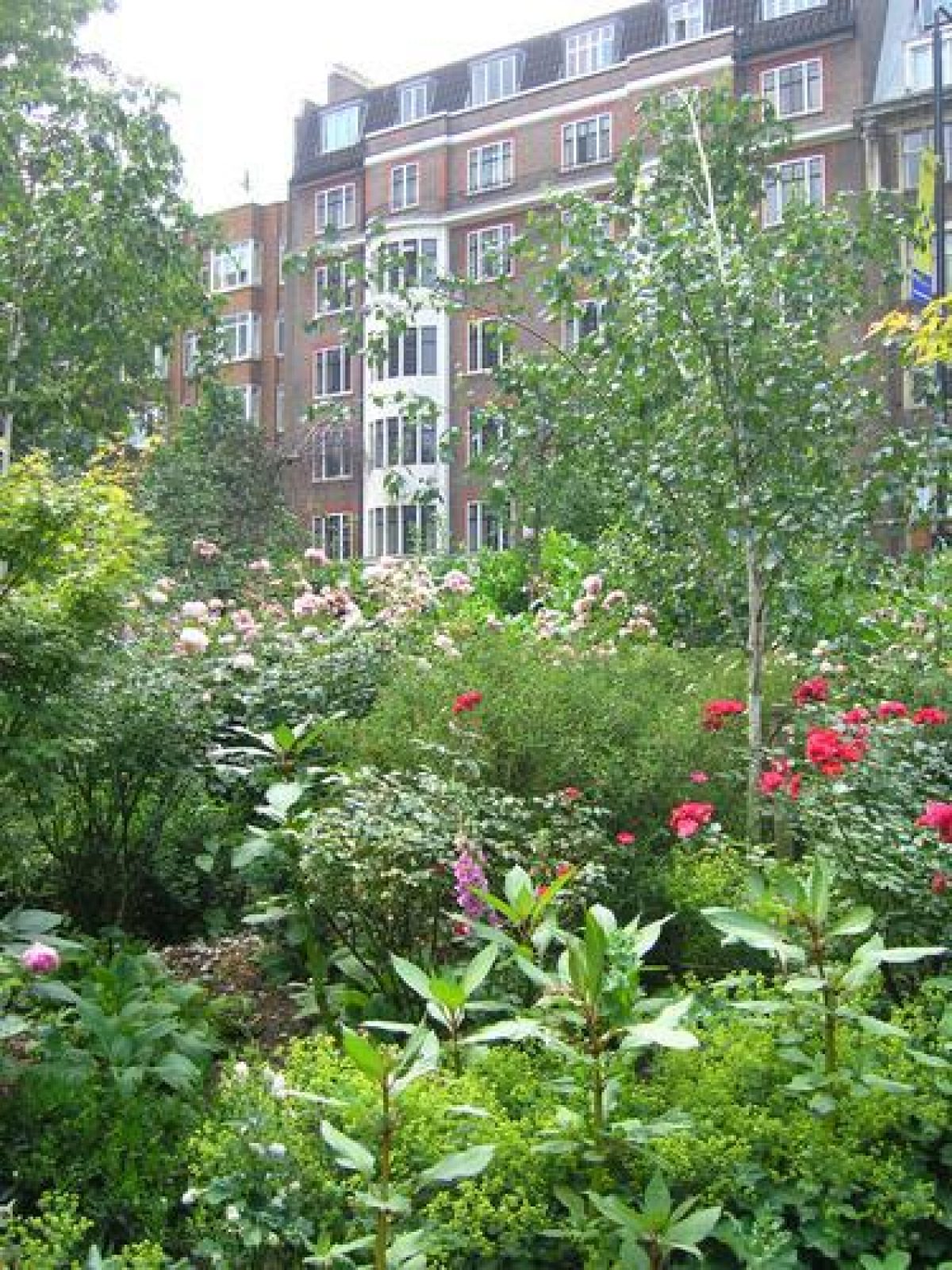
The buildings surrounding Cadogan Place are a mixture of C19 and C20 developments. The more notable buildings are to be found on the east where there are well-preserved stretches of early C19 terraces. On the north side is the eighteen-storey, stone-faced tower of the Carlton Tower Hotel, built in 1961.
GARDENS AND PLEASURE GROUNDS
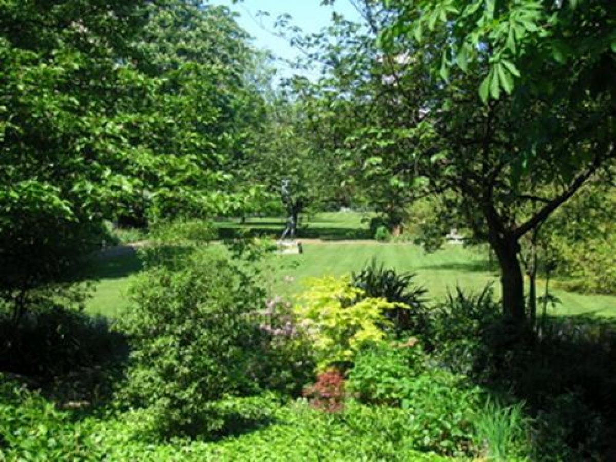
Both the northern and southern parts of the Cadogan Place gardens are laid mostly to lawn enclosed within shrubberies and decorated with clumps of shrubbery and trees.
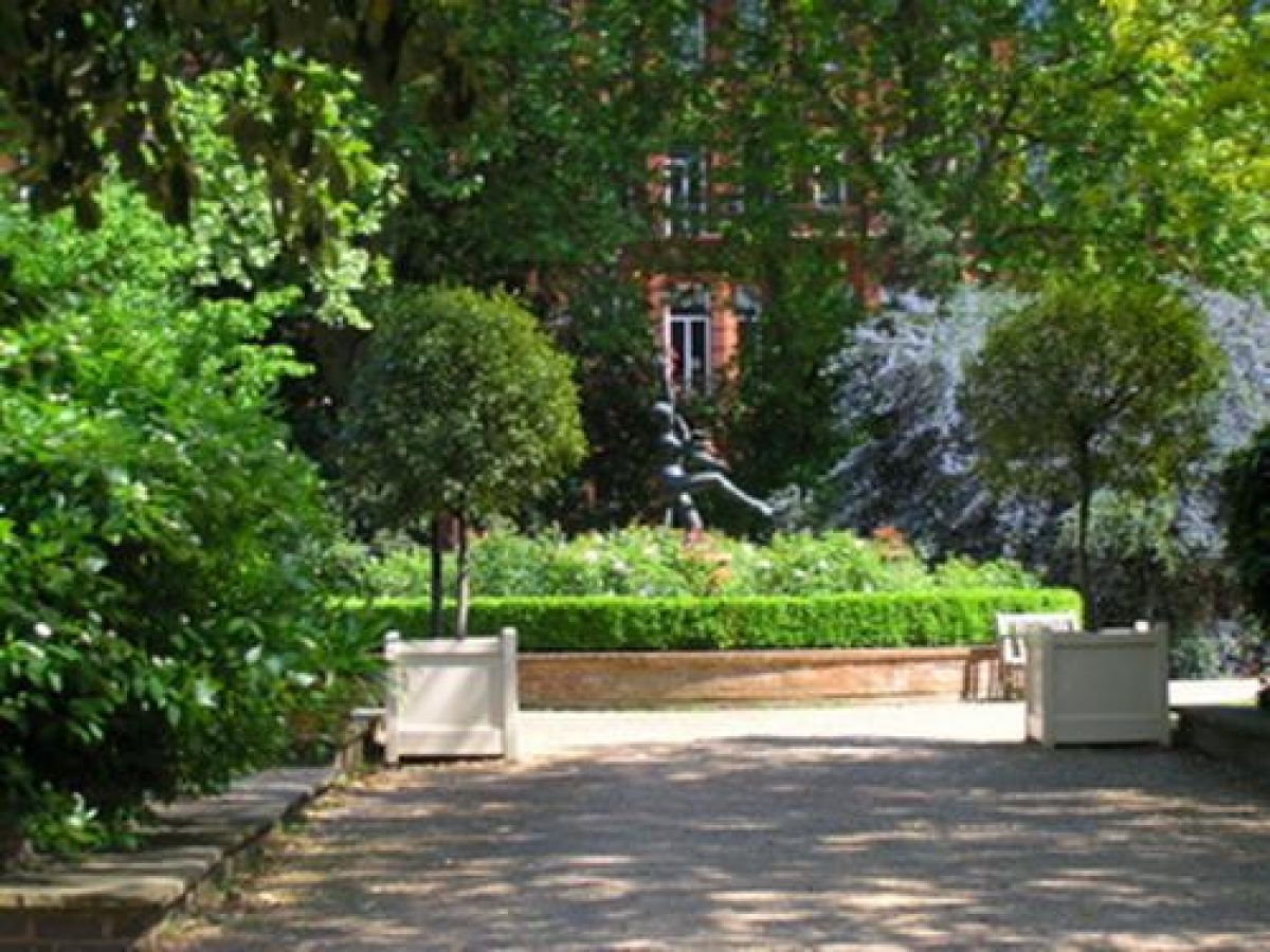
The perimeter paths around the garden to the south of Pont Street are lower than the surrounding pavements. Short flights of steps lead down from the pedestrian gates onto the perimeter paths, which are screened from the road by banked shrubberies. Against the northern boundary of this half of the site is the C20 complex of greenhouses and other gardeners' buildings. To the west of the buildings is the C20 children's play area. A tarmac path runs east/west from the main entrance along the south side of the buildings and the play area. Paths branch at right angles from the east and west corners and extend the length of the garden, enclosing three informal areas of lawn. The northern lawn is decorated with occasional mature plane trees, young specimen trees, and a late C20 bronze sculpture by David Wynne. Between the northern lawn and the central lawn are the tennis courts, made c 1920 on part of the garden which was, from the early C19, the site of numerous glasshouses, originally a feature of the London Botanic Garden. The central lawn is enclosed within island shrub beds with, to the east, a late C20 wild garden complete with pond, and to the south a late C20 metal rose arbour. To the south of the rose arbour is the third area of lawn. Growing to the south is a mature mulberry tree, reputed to be a relict from the mulberry trees planted by Charles II as part of his unsuccessful attempt at producing silk in London.
The smaller garden which lies to the north of Pont Street is cut through on the east side by the access road to the underground car park. The tarmac perimeter paths are screened from the road by shrubberies, and their rather formal lines are broken by a serpentine path which runs west, from south of the car park access road, across the lawn for c 50m before swinging north to join up with the northern perimeter path. Besides the shrubs, the lawn is decorated with centrally placed rose beds, to the west of the rose beds a small octagonal summerhouse, and to the north a David Wynne bronze sculpture of two figures.
REFERENCES
Gentleman's Magazine, (August 1810)
E Hyams, Capability Brown and Humphry Repton (1971), p 183
Country Life, 189 (13 November 1986), pp 1492-1493
B Cherry and N Pevsner, The Buildings of England: London 3 North West (1991), p 582
M Brown, The History of the Cadogan Estate, (student dissertation 1994) [copy on EH file]
Maps
C Greenwood, Map of London, 1830
J P Thompson, To the Earl of Cardigan, This Map of Chelsea from a new and actual survey, 1836 [copy on EH file]
Cadogan Place estate map, 1880 [copy on EH file]
OS 25" to 1 mile: 1st edition surveyed 1862-1865
2nd edition surveyed 1893-1894, published 1896
3rd edition surveyed 1916
Description written: December 1999
Edited: September 2003
- Visitor Access, Directions & Contacts
- History
The following is from the Register of Parks and Gardens of Special Historic Interest. For the most up-to-date Register entry, please visit the The National Heritage List for England (NHLE):
www.historicengland.org.uk/listing/the-list
HISTORIC DEVELOPMENT
Until 1777 the site of Cadogan Place was almost completely occupied by fields. After 1777, 100 acres (about 40 hectares) of land to the west of the site was developed as Hans Town by the architect Henry Holland (1745-1806) for the owner, Charles, first Earl of Cadogan. Holland reserved for himself 8.5 hectares of land on the west side of Sloane Street. On this he erected an elegant house and gardens, known as The Pavilion. At the end of the 18th century William Salisbury, who had been a pupil of Mr Curtis, the gardener at Chelsea Physic Garden, designed a garden in Sloane Street; this was named the London Botanic Garden. The garden, about 2.5 hectares, which was bordered to the east by Cadogan Place, contained a library, hothouse, greenhouse, and conservatory. In 1807 Salisbury labelled the plants into seventeen divisions (Gentleman's Magazine 1810). Twice a week students of horticulture were given lectures in the garden and, during summer evenings, concerts would be held in the garden for subscribers. The subscribers lived within one mile of the site and paid an annual fee. At around the same time, Humphry Repton (1752-1818) was commissioned to work on a neighbouring garden. His work, completed by 1806, concentrated on the smaller area to the north of the Botanic Garden which was separated from it by Pont Street. Repton used excavated soil to form dips and ridges, and laid out gently winding paths (Hyams 1971). By 1820 the layout of the Botanic Garden had been changed to suit its new use as a public promenade, as shown on a plan by Thompson of 1836. The new arrangements were the idea of a Mr Tate, who took over the management of the garden when Salisbury left.
The lease of Holland's development was due to expire in 1874 and in 1873 a new scheme for the development of the area was proposed. North Ritherdon, the promoter of the scheme, put a bill to Parliament for improvements to the area, which by this time had become very run down. The improvements included making new streets and widening others. The Act of Parliament which allowed for the compulsory purchase of land in the area received Royal Assent in 1874, by which time the proposed scheme had been much reduced. In order to organise the redevelopment and subsequent upkeep of the new estate, the Cadogan and Hans Place Estate Co Ltd was set up. The new layout of the Cadogan and Hans Place Estate was designed by Messrs Elliott and Warren, surveyors working in conjunction with H A Hunt, the surveyor for the Cadogan Estate. In 1875 the Metropolitan Board of Works approved a road scheme which included the widening of Pont Street. The redevelopment of Cadogan Place included the houses and two gardens; the former botanic garden and the small area laid out by Repton. The new design for the gardens was quite simple (Ordnance Survey 1896) and had not been greatly altered when the onset of Dutch elm disease in the 1970s necessitated the removal of a great number of elm tress. Replanting was undertaken, and at about the same time, an underground car park was constructed beneath the smaller garden to the north of Pont Street.
- Associated People
- Features & Designations
Designations
The National Heritage List for England: Register of Parks and Gardens
- Reference: GD1789
- Grade: II
- Key Information
Type
Designed Urban Space
Purpose
Ornamental
Survival
Extant
Hectares
3.5
- References
References
- {English Heritage Register of Parks and Gardens of Special Historic Interest} (Swindon: English Heritage 2008) [on CD-ROM] Historic England Register of Parks and Gardens of Special Historic Interest
- Cherry, B. and Pevsner, N. {The Buildings of England: London 3: North West} (London: Penguin, 1991) p 582 The Buildings of England: London 3: North West