
Introduction
Burton Constable has a landscape park, woodland and gardens associated with a country house.
Terrain
The site is situated on the plain of Holderness in a setting which is rural and agricultural.www.historicengland.org.uk/listing/the-list
Park and gardens laid out c 1769-82 to designs by Lancelot Brown retaining elements of an existing late C17 or early C18 layout, with a formal garden of early C19 date.
DESCRIPTION
LOCATION, AREA, BOUNDARIES, LANDFORM, SETTING
Burton Constable lies c 11km north-east of Hull, c 2km north of the village of Sproatley. The c 300ha site is situated on the plain of Holderness in a setting which is rural and agricultural. The boundaries are generally fenced and are formed by Pasture Lane, Brickfield Plantation, Crook Lane and Engine Lane on the east side, Sandpit Belt to the south, and Wycliffe Plantation, Old Wood, Bigland's Belt and Sallymere Plantation on the west side. North Plantation runs along the north boundary. The park conforms broadly with the fields, woods and parkland shown on the 1621 estate map.
ENTRANCES AND APPROACHES
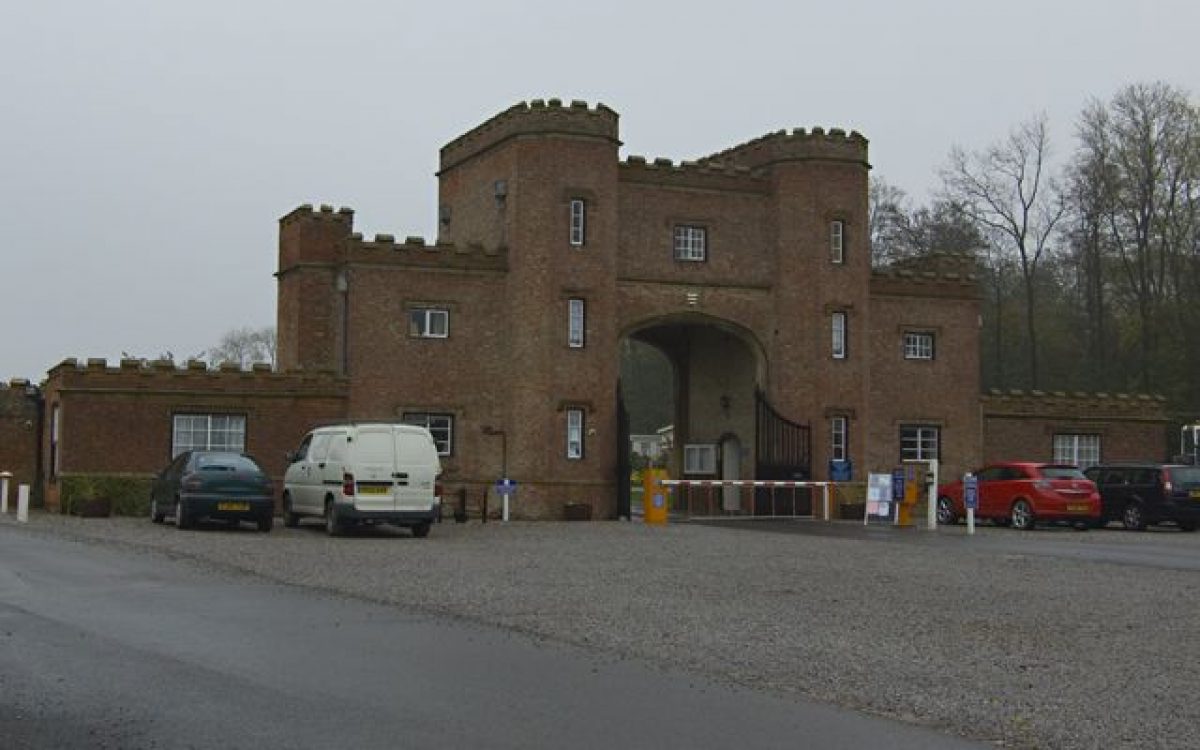
The main entrance is from the Sproatley road where a drive, aligned with the east front of the Hall, runs west and divides, with branches curving to the north-west and south-west, and a central drive running west to a forecourt in front of the Hall. A second drive off the road, c 300m to the south, runs west to the stables. An entrance on the south side of the site, formerly the principal entrance, has a lodge (listed grade II) of 1786 by James Wyatt in the form of an arch flanked by turrets. The drive leads north, crossing the lake via a bridge (listed grade II) and continuing north-east on the south side of the Hall to join with the drives from the Sproatley road. Other entrances include one from Back Lane, to the south, which is aligned with the South Avenue, and one from Jackey Lane to the west, from which a drive runs south as Chestnut Walk, shown on a map of 1818, to the bridge.
PRINCIPAL BUILDING
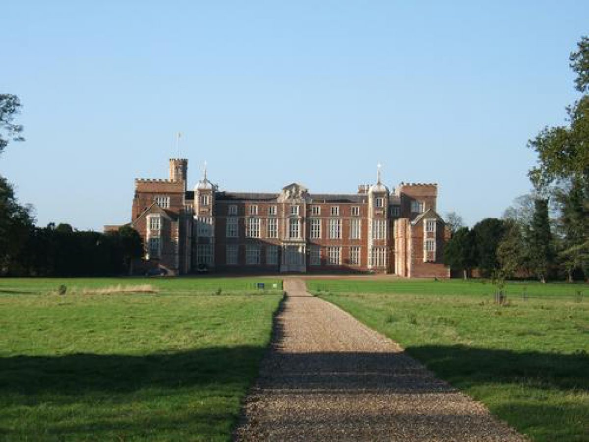
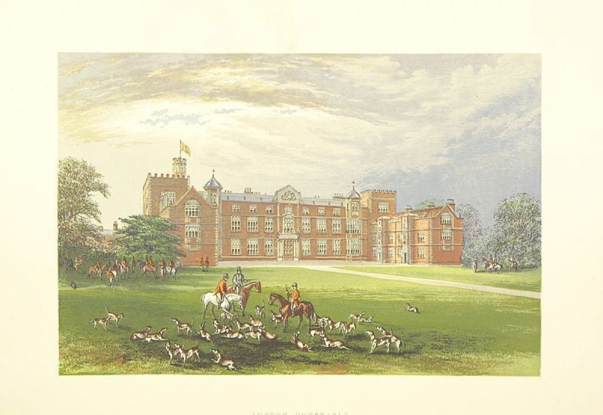
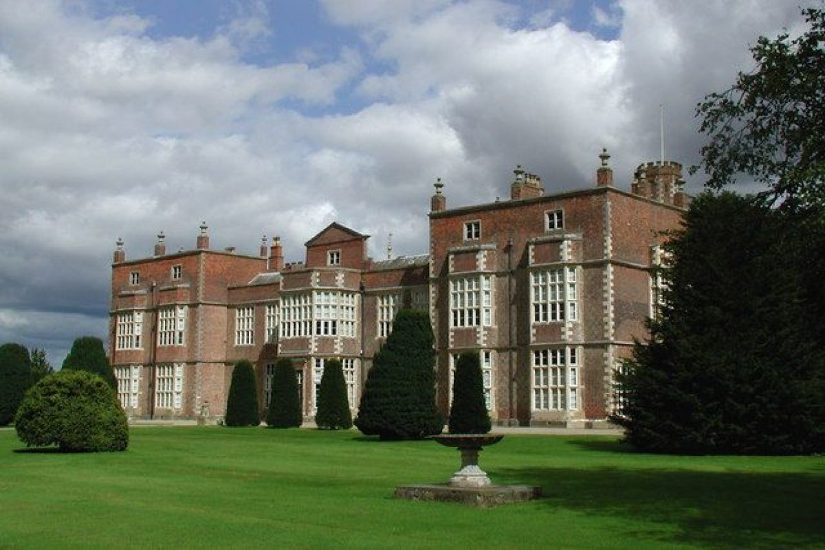
Burton Constable Hall (listed grade I) was described by Sir John Constable in 1560 when he took up residence there as a 'goodly mansion house of ancient building' (quoted in Pevsner 1995). He made alterations to the building and further changes were made in the late C16 and early C17. The interior was substantially remodelled and alterations made to the east side in 1757(68 by Timothy Lightoler. Some alteration followed in the early C19. The building has two wings projecting eastwards on each side of the main range. It is a registered museum in the care of the Burton Constable Foundation (1998) with a private residence in one wing.
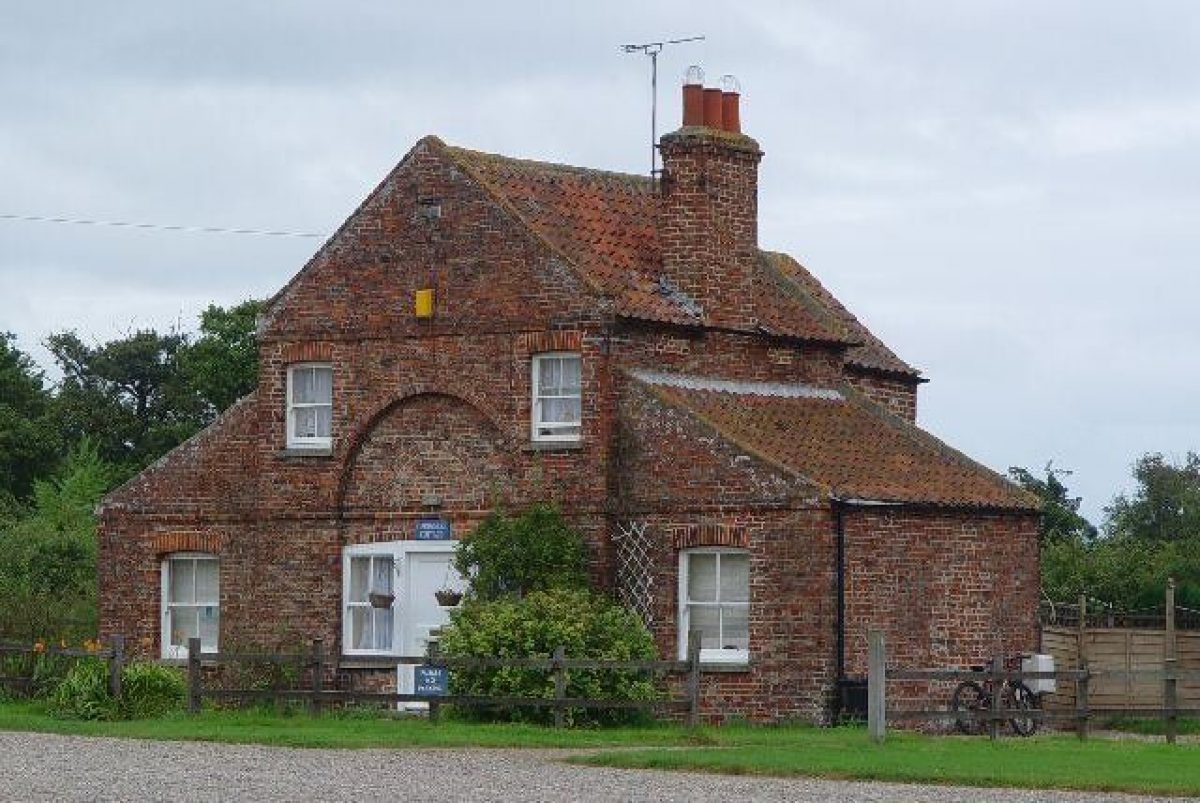
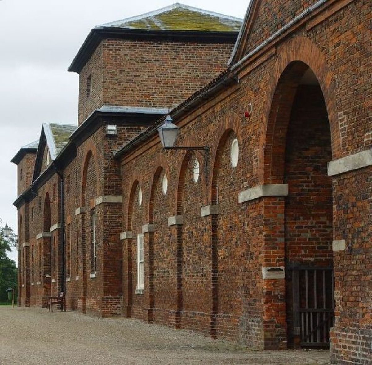
Stables and a carriage house (listed grade I) designed by Lightoler in 1768 are situated c 150m south-east of the Hall. Two C18 gardeners' cottages (listed grade II) lie c 20m to the east and c 50m south-east of the stables. Additional stables and a riding school were added to the south of the main block in the early C19.
GARDENS AND PLEASURE GROUNDS
On the east side of the Hall there is a forecourt fronted by a lawn with views over parkland to the east. The 1818 map shows drives leading off to the north and south, as suggested on Brown's plan. A painting of c 1680 (private collection, partially reproduced in guidebook) shows a wall surmounted by urns, with a central entrance arch flanked by turrets enclosing formal gardens between the two east wings, with a secondary forecourt to the east with central gates and urns ranged along the top of the walls. A clump of trees to the south of the Hall partially obscures a courtyard designed by Brown on the south side of the building, which has service wings with castellated towers on each side and a central pedimented entrance arch aligned with the South Avenue. Within the courtyard there is a rectangular lawn with bases for statues. To the south of the courtyard there are lawns, and on the west side a wall extends south from the courtyard for a distance of c 20m.
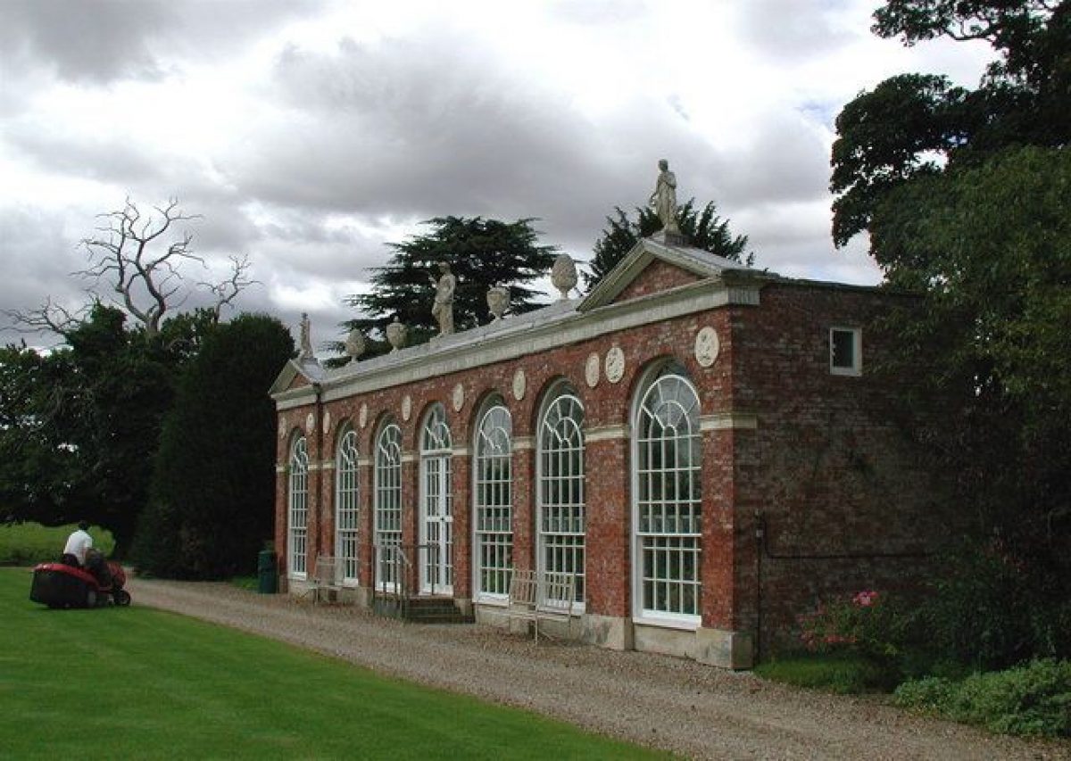
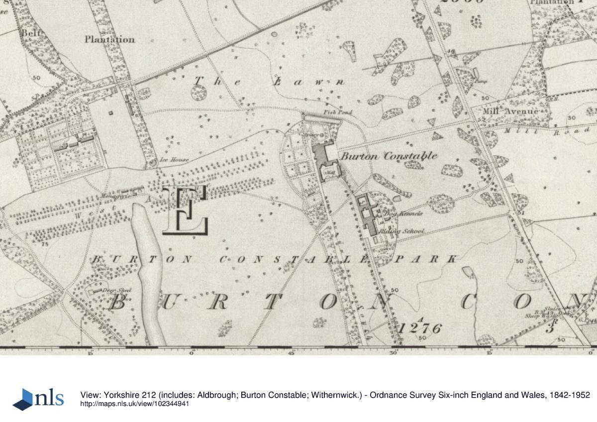
On the west side of the Hall a gravel walk immediately west of the building extends north and south to the edges of the garden. On the south side there are lawns with scattered trees and, c 80m south-west of the Hall, an orangery (listed grade II*) remodelled in 1788(9 by Thomas Atkinson, with pedimented end bays and a range of seven arched windows. The building is surmounted by Coade stone urns, finials and statues and faces south overlooking a lawn fringed with trees. The lawn, but not the orangery, is shown on Brown's plan. Immediately north of this area there is a formal garden laid out in a pattern of rectangular lawns divided by paths. It is enclosed by a semicircular ha-ha (listed grade II) by Brown, which is probably on the line of a former moat. The garden is planted with a formal pattern of yew trees. There are views along the West Avenue from the ha-ha. The formal garden was laid out during the 1830s for Sir Thomas Aston Clifford Constable.
On the north side of the Hall there is a bridge crossing the ha-ha and east of this a stretch of water, probably part of a moat, which is shown as a more extensive curving watercourse on the 1621 and 1767 maps. Between the Hall and water there are lawns with scattered trees in an area which William Constable had planted as a flower garden during the 1750s and 1760s, shown on a map of c 1779 (detail reproduced in Garden Hist 1986, 15). Formal gardens with a geometric layout are shown immediately to the north of the moat arm on maps of 1755 and 1767. Brown's plan shows the ha-ha, moat arm and areas of planting on each side of the east front. A scheme for the area around the Hall attributed by William Constable to Lightoler (ibid, 10) shows the moat arm and areas of planting around the Hall.
PARK
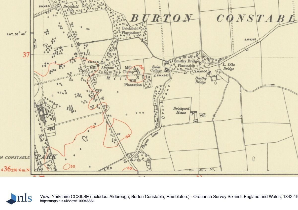
The Hall lies in the centre of the parkland with avenues aligned on it running to the west and south. Early C18 maps show that there were also avenues leading east and south-west and a map of 1621 shows an elongated enclosure on the east side of the Hall which appears to be on the line of the east avenue. The avenues were probably laid out during the late C17 or early C18. The painting of c 1680 does not show the West Avenue but trees shown on the south side of the Hall could be part of the South Avenue. Maps of 1755 and 1767 show the east avenue, and a strip of woodland called Mill Avenue on the east side of the Sproatley road preserves its line. The section immediately east of the Hall was removed as part of Brown's improvements and the other avenues were thinned at the same time. The South and West Avenues were replanted during the C19.
On the east side of the Hall the parkland has scattered trees and clumps which seem to be designed so that views of the Hall appear framed by trees as it is approached from the Sproatley road, which Brown re-routed to the east. Planting to Brown's instructions was probably undertaken in this part of the park, but the clumps may have been planted during the C19 to either augment or replace the late C18 planting, as they do not conform with those shown on the 1818 map. The map does show a semicircular drift of trees east of the stable site, shown on Brown's plan, vestiges of which remain. A detailed drawing of landscaping around the stables (ibid, 10, 12), ascribed to Lightoler, shows a drift of mature trees in a similar position, but whether these proposals were incorporated by Brown in detail is not certain. It is possible the drawing represents an artistic setting for the stable building rather than actual proposals.
The south side of the Hall is dominated by South Avenue and there are views down the Avenue, and from parts of the south and west areas of parkland, of a C17 tower, c 800m south-east of the Hall. This is part of a building (listed grade II) called Tower House or Engine House which was formerly a water tower and is now (1998) a dwelling. The tower is partially obscured from the south side of the Hall by the stables.
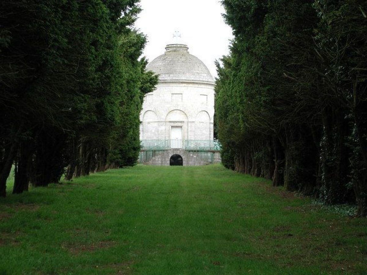
On the west side of the Hall in the centre of the West Avenue is an early C19 statue of a stag, placed c 180m west of the Hall in a position Brown had earmarked for an ornamental arch. The parkland to the west and south-west has scattered trees and clumps, and an elongated lake which extends from a point c 500m west of the Hall to a point c 1km to the south-west. At the north end of the lake there is an C18 pavilion called the Menagerie (listed grade II*) of c 1757-60, probably designed by Lightoler or possibly by Thomas Knowlton. Knowlton submitted bills for designing a menagerie in 1757-8 (ibid, 7), but it is not clear whether this refers to the building which survives or the internal layout of enclosures for animals. He and Lightoler were collaborating in the design of kitchen gadens at about the same time (see below). The lake is divided by a bridge (listed grade II), designed by Brown, which acts as a dam dividing the upper part of the lake, which forms a serpentine, from the larger, lower part. The bridge is a pivotal point in the landscape from which there are views north-east to the Hall, south to Wyatt's castellated lodge, and north and south over the water. A painting of 1777 (reproduced in guidebook) shows the view (now partially obscured by trees) from the lodge with the bridge and the Hall set in the parkland. Fishponds are marked in this part of the park on maps from 1621 onwards. A serpentine lake was proposed on the 1755 map, and Thomas White's plan also shows lakes in this position. Work began on the lake in 1775 but the project was attended by difficulties in levelling the banks and with shortage of water. The lake can only be seen from the upper floor levels of the Hall, and the attempts to modify it as work proceeded suggests that these efforts were aimed at producing a level of water which would have been visible from the gardens.
On the west side of the northern part of the lake there are the remains of an avenue, shown on the 1755 map, which ran south-west from the Hall. A caravan site, which was formed in 1968, lies along the west side of the lower part of the lake and a clubhouse of 1995 lies c 100m west of the bridge.
The northern part of the park is largely under arable cultivation. A band of planting called Icehouse Plantation runs northwards from the West Avenue to the edge of a large field called Norwood. This is shown as an avenue on maps of 1755 and 1827. There are shelter belts to the north and west of Norwood. A circular platform close to the centre of the field was formerly the site of a grandstand for a racecourse, created in 1790 by felling North Wood. A circular feature is marked within the woods in this position on the 1755 map suggesting that an existing feature was retained. Woodland in the north-east corner of the site called The Moors occupies areas marked on the 1621 map as Mary Johnson's Moor and Alexander's Moor.
The park was described by William Constable in the mid C18 as 'wilderness ...with swamps gorse and whin higher than a man on horseback' (guidebook, 27). It supported a herd of wild white cattle as well as deer until c 1760. The succession of improvement plans from 1755 onwards suggest that Constable was closely involved in the park's design. The 1755 proposal with a serpentine lake and retention of the south and south-west avenues shows that the ideas for the park developed over a long period. The final design is likely to have been a collaboration between Constable and Brown in which elements of schemes by White and Lightoler may have been incorporated.
KITCHEN GARDEN
The kitchen garden lies c 600m north-west of the Hall, to the north of the West Avenue. It is a rectangular enclosure with brick walls on part of the north side, the east side and part of the south side. On the north side there are two gardeners' houses (c 1770, listed grade II) altered late C20. Each has an arcaded front with a pedimented gable containing a lunette. The 1767 plan (which is very crudely drawn and probably designed to show field boundaries) indicates enclosures on the site. Its position is clearly indicated, with the two houses, on a plan of 1774 (copy at Burton Constable). The 1854 OS map shows that it was extended to the north and west of the lines shown on the 1818 map. This was almost certainly the site of extensive gardens with fire walls and hothouses erected c 1757(60 to the design of Thomas Knowlton with buildings designed by Lightoler. The two gardeners' houses are probably survivors of the scheme since they are almost identical in detail to drawings of hothouse buildings ascribed to Lightoler (reproduced in Garden Hist 1986, 7). Constable was stocking the gardens with plants before its completion and by 1758 he had appointed Thomas Kyle, who published a book on growing peaches and nectarines in 1783, as one of his two head gardeners. The man in charge of the everyday running of the gardens was Robert Peacock, appointed in 1757. Knowlton, who had been Lord Burlington's gardener at Londesborough (qv), seems to have acted as a consultant.
REFERENCES
Country Life, 171 (22 April 1982), pp 1114(17; (29 April 1982), pp 1198-1202; (6 May 1982), pp 1278-81; (13 May 1982), pp 1358(61
Garden History 14, no 1 (spring 1986), pp 6-27
D Neave and D Turnbull, Landscaped Parks and Gardens of East Yorkshire (1992), pp 22-6
Burton Constable, guidebook, (I Hall and the Burton Constable Foundation 1994)
N Pevsner and D Neave, The Buildings of England: Yorkshire The East Riding (1995), pp 371-7
Maps [Unless otherwise stated, all the estate plans, or copies of them, form part of the Burton Constable Collection.]
W Senior, Burton Constable, 1621 Plan of landscaping around the stables, nd, ascribed by William Constable to 'Mr Lightoler' (reproduced in Garden Hist 1986, 10)
Plan of landscaping for the pleasure grounds, nd, ascribed by William Constable to 'Mr Lightoler' (reproduced in Garden Hist 1986, 10)
Burton Constable Proposals, 1755 Plan, 1767
L Brown, Plan of garden area, c 1769 (in Neave and Turnbull 1992)
Plan, 1774 Burton Constable Survey, 1775
Survey Plan of the Park at Burton Constable, c 1779 (reproduced in Garden Hist 1986, 18)
Map of Burton Constable, 1818
Map of Burton Constable, 1827
OS 6" to 1 mile: 1st edition surveyed 1852, published 1854
OS 25" to 1 mile: revised edition published 1910
Description written: April 1998
Amended: March 1999; December 1999
Register Inspector: CEH
Edited: May 2000
- Visitor Access, Directions & Contacts
Website
https://www.burtonconstable.com/Access contact details
For detailed visitor information visit the Burton Constable website.
- History
The following is from the Register of Parks and Gardens of Special Historic Interest. For the most up-to-date Register entry, please visit the The National Heritage List for England (NHLE):
www.historicengland.org.uk/listing/the-list
HISTORIC DEVELOPMENT
The Constable family owned the site from the C12 and there are records of a park in the C14. By 1578 the park had been enlarged and at about that time the Constables made it their principal seat. William Constable (1721-91), who inherited in 1747, was a noted plant collector who assembled an extensive botanical collection at Burton Constable and a Hortus Siccus of at least thirteen volumes, of which ten survive. Of particular note is his establishment of a flower garden near the Hall and his interest in native plants to which he devoted a segregated bed in his garden. He embraced Linnaean botany and employed Linnaeus' botanical artist G D Ehret (1708-70) to draw flower pictures for him. Constable commissioned plans for improvements to the park dated 1755, but these were not immediately executed. Designs were commissioned from Lancelot Brown (1716-83) in 1767 and Thomas White (1736-1811) in 1768. These plans were rejected but Brown was retained and prepared new proposals. Of these only a plan of c 1769 showing the garden and area immediately around it survives. Brown visited Burton Constable at regular intervals over the period 1769 to 1782 to check on progress and attend to details. A series of estate maps show the development of the landscape from 1621 to 1827. The site remained in the ownership of the Constable family until the late C20 when part of it was taken over by the Burton Constable Foundation.
Period
- 18th Century (1701 to 1800)
- Late 18th Century (1767 to 1800)
- Associated People
- Features & Designations
Designations
The National Heritage List for England: Register of Parks and Gardens
- Reference: GD1918
- Grade: II*
Features
- Lake
- Lake
- Orangery
- Earliest Date:
- Latest Date:
- Ha-ha
- Description: The ha-ha was partially filled in during the early 19th century.
- Earliest Date:
- Latest Date:
- Tree Avenue
- Tree Avenue
- Moat
- Description: The North Pond.
- Outdoor Swimming Pool
- Description: A small outside swimming pool dating to the Victorian period.
- Earliest Date:
- Latest Date:
- Dam
- Description: Lancelot Brown created a dam between the two lakes.
- Earliest Date:
- Latest Date:
- House (featured building)
- Description: A large Elizabethan brick-built house.
- Earliest Date:
- Latest Date:
- Parkland
- Woodland
- Gardens
- Key Information
Type
Park
Purpose
Ornamental
Principal Building
Education
Period
18th Century (1701 to 1800)
Survival
Extant
Hectares
300
Open to the public
Yes
Civil Parish
Burton Constable
- References
References
- {English Heritage Register of Parks and Gardens of Special Historic Interest}, (Swindon: English Heritage, 2008) [on CD-ROM] Historic England Register of Parks and Gardens of Special Historic Interest
- Pevsner, N. and D. Neave, {The Buildings of England: Yorkshire, York and the East Riding} (London: Penguin, 2nd edition 1995), pp. 371-7 The Buildings of England: Yorkshire, York and the East Riding
- Neave, D. and D. Turnbull, {Landscaped Parks and Gardens of East Yorkshire} ([n.p.]: Georgian Society of East Yorkshire, 1992), pp. 22-6 Landscaped Parks and Gardens of East Yorkshire, 1700 - 1830
Contributors
Louise Wickham
- Related Documents
-
CLS 1/532/2
Parkland Management Plan Review - Hard Copy.
Collington Winter - 2019
-
CLS 1/533
Parkland Management Plan Appendices - Hard Copy.
Collington Winter - 2019
-
CLS 1/534
Landscape Management Plan, Findings and Proposals - Digital copy
Janette Ray Associates with The Landscape Practice and Northern Archaeological Assocs. - 2011
-
CLS 1/538
Park and Garden Management Plan - Digital copy
Landscapes and Gardens, Dept of Archaeology, Univ. of York - 1999
-
CLS 1/539
Parkland Management Plan Review - Digital copy
Collington Winter - 2019
-
CLS 1/532/2