
Introduction
Pearson Park is a public park with ornamental gardens, bowling greens, water features and statuary. The site covers some 11 hectares (8 hectares registered). Features include marble statues of Queen Victoria and Price Albert, a monolith commemorating Zachariah Charles Pearson, a small lake and an ornamental gateway. Pearson Park, situated between Beverley Road and Princes Avenue, covers 11 hectares (27 acres).
Terrain
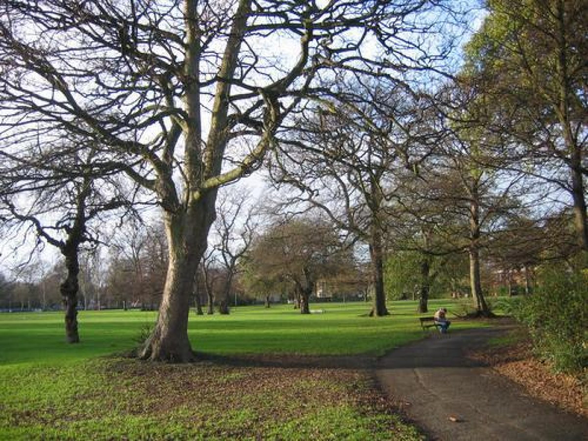
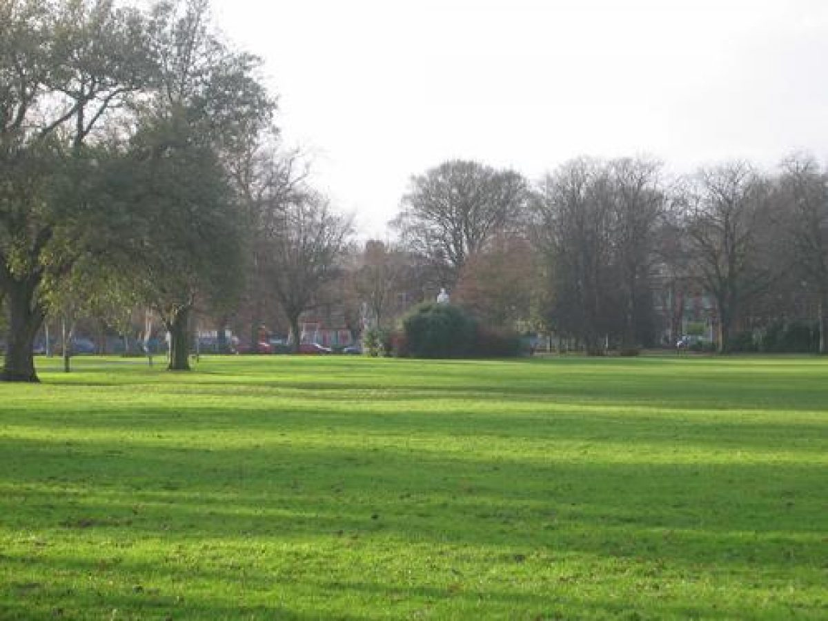
FlatThe area is generally flat and laid to grass with several fine trees. There are serpentine paths and the entire park is surrounded by a broad carriageway. Around the park are many Victorian mansions, several of which are listed buildings. Philip Larkin, the poet, lived in one of them for many years.
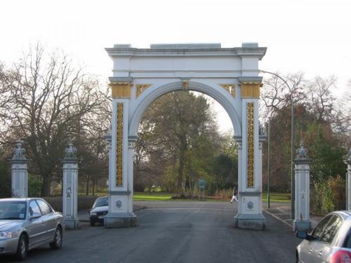
The main entrance to the park is from Beverley Road, through Pearson Avenue, where there is an ornamental iron gateway. This was constructed in 1863 and originally had a pair of decorated iron gates. These were removed in World War Two and not replaced.
There are bowling greens and a modern pavilion, boarded up to prevent vandalism, at the south eastern corner. On the south side are formal flower beds, surrounded by iron railings, an arboretum and a conservatory. The conservatory was originally built in the late 19th century and rebuilt in 1930. It is now covered in metal sheeting to prevent vandalism.
At the western edge of the park is a large children's play area which has been on this site since about 1950. The play equipment is relatively modern, having been replaced in 1990, although there is a rock pile with passages through it which has been there for over 50 years.
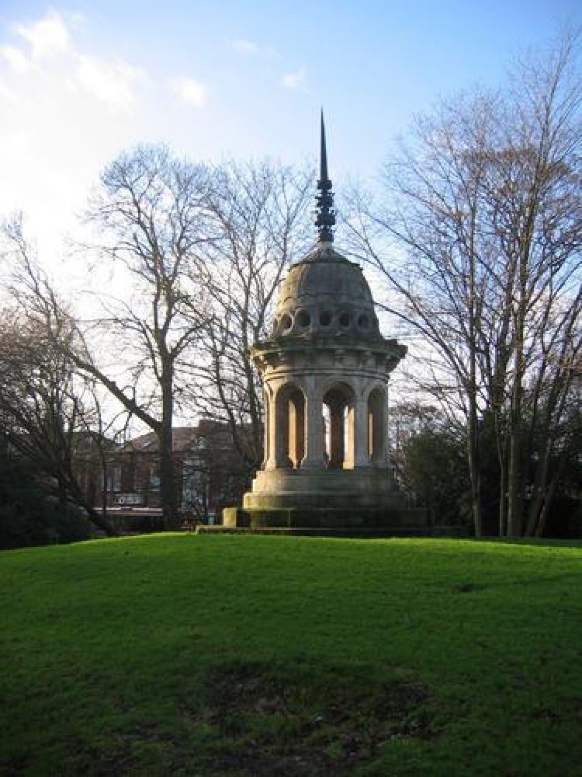
There is an artificial mound covered in shrubbery on which stands the cupola taken from the old town hall in 1912.
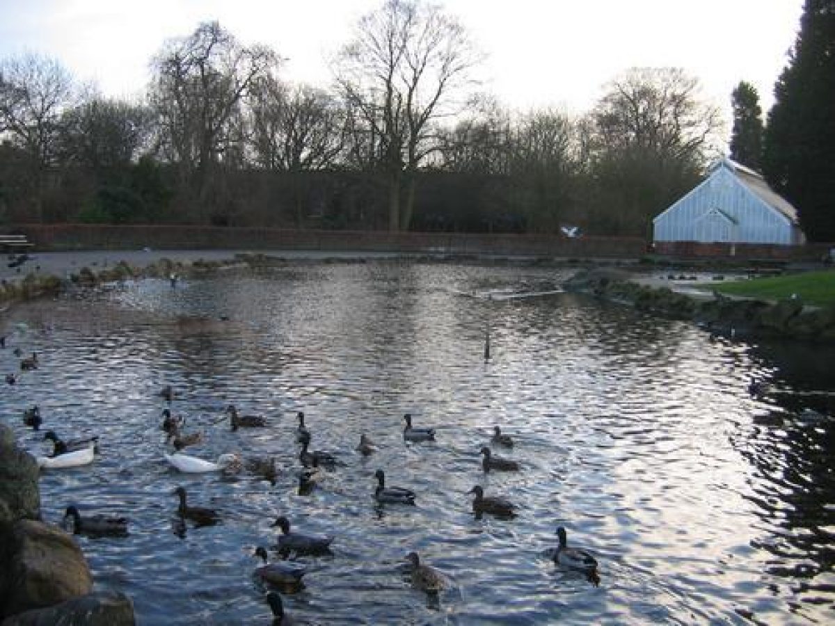
There is an oxbow-shaped lake with numerous waterfowl, surrounded by a paved area.
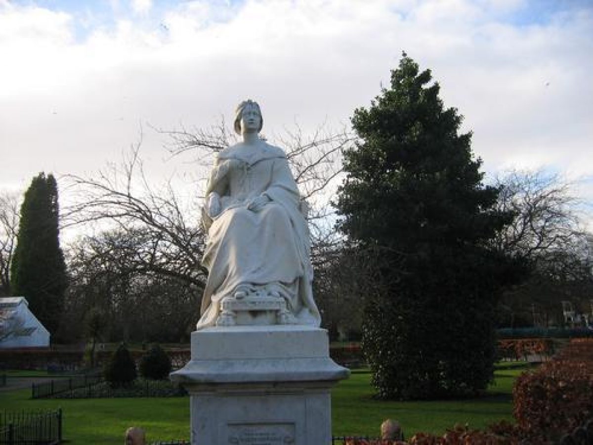
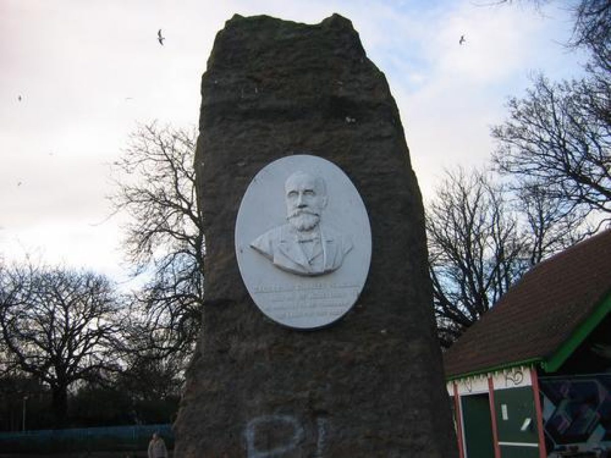
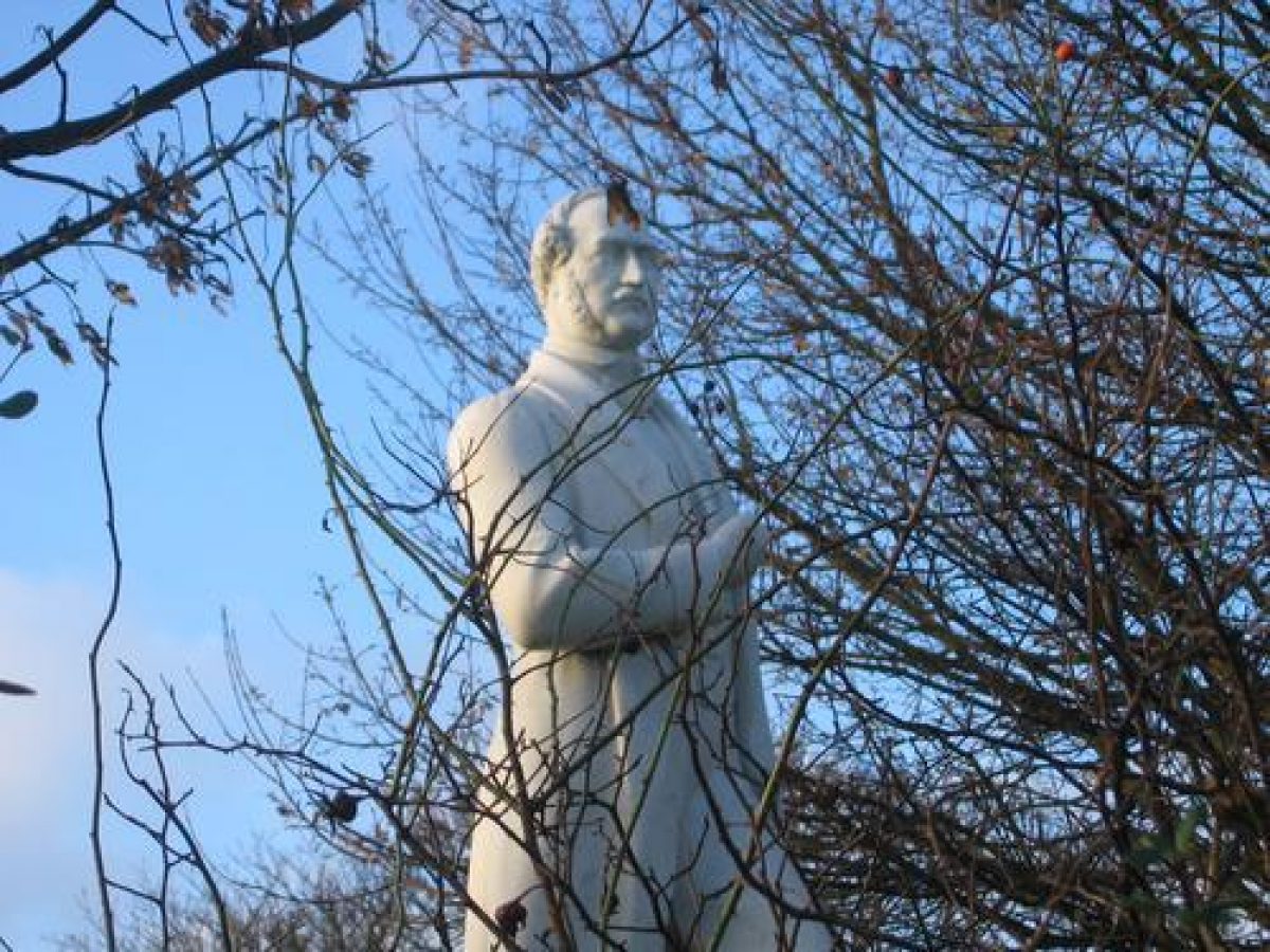
There are marble statues of Queen Victoria and Prince Albert, both sculpted by Thomas Earle, and a monolith with a plaque commemorating Zachariah Pearson.
The following is from the Register of Parks and Gardens of Special Historic Interest. For the most up-to-date Register entry, please visit The National Heritage List for England (NHLE):
Location, Area, Boundaries, Landform and Setting
Pearson Park lies about 1.5 kilometres north of the centre of Hull in a heavily developed area of suburban housing. The roughly rectangular site of 8 hectares is largely level but includes a significant earth bank along the western boundary next to Princes Avenue. The eastern boundary of the park is unfenced. A shrubbery belt along the southern part of the western boundary and the fenced ornamental garden enclose the park in this area; other areas are open with the boundary of the park being marked by individual or groups of trees. The houses surrounding the park are of various periods and there has been infilling in recent times; tree cover in the surrounding gardens is sparse.
Entrances and Approaches
The main entrance to the park is to the centre of the eastern boundary from Pearson Avenue, which opens off Beverley Road to the east. A cast-iron entrance arch (Young and Pool 1863) flanks the entrance into the park. The arch incorporates Kingston Upon Hull's coat of arms and several motifs, such as anchor, capstan, and dolphins, which refer to the city's maritime history. The original iron gates were removed in 1901. To the south of the entrance stands East Lodge (1861), built in the Gothic Revival style. From here the carriage drive encircles the park and so, owing to its predominantly open boundaries, the park can be approached at almost any point from the carriage drive. A further entrance to the south gives access from Park Road. The carriage drive follows a route to the west of the lake in the south-west part of the park and then runs north, separating the banked and wooded area to the west from the main gardens and pleasure grounds. A pedestrian entry and cycle route which enters at the north-west corner of the park from Princes Avenue runs diagonally north-west to south-east across the park to the Park Road entrance.
Gardens and Pleasure Grounds
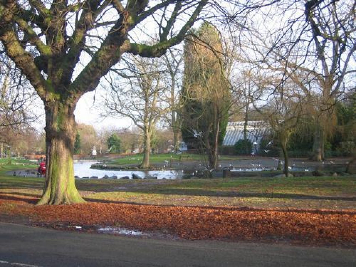
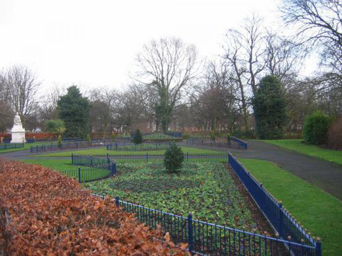
Pearson Park includes wide grassed areas in its northern and central sections, with a small, irregular-shaped lake in its south-west corner and a bowling green and pavilion to the south-east. The structure of the park is as it was designed in 1861 by Niven although some alterations have been made to the path system. The roughly circular flower bed on the eastern boundary of the park was intended as the site for Queen Victoria's statue which, with the entrance gates themselves, would have created a grand entrance space. The statue was never erected here but was placed in its present position in the south-west section of the park. The circle of gravel and the flagpole which occupied this space in 1910 have been removed and the area is now planted with rose beds. Beyond this planting bed the central path follows closely the plan of the mid-19th-century design. Trees along this path include evergreen oak Quercus x hispanica 'Luconbeana' and Quercus x hispanica 'Ambrozyana'. There are also silver birch planted to commemorate National Tree Week in 1977.
The area to the north of the central east/west path is predominantly open with trees planted individually or in groups. The mid-19th-century serpentine path system in this area was destroyed when Nissen huts and air-raid shelters were sited in the park during the Second World War and was not reinstated when these structures were removed in 1954. The straight east/west path across the park is a modern feature and reflects the increased pressure of pedestrian and cycle traffic between the city centre and the developing housing estates to the north.
The statue of Prince Albert (1868), designed by Thomas Earle, occupies its original position but there is no evidence of the fountain, rustic shelter, or putting green (OS 1928) which were once in this part of the park. The statue of Queen Victoria (1860), also by Earle, was placed in its present position to the east of the lake in 1863 at the sculptor's request, and required a modification to the original path layout.
The paved garden immediately to the south of the statue, which is enclosed by bow-top fencing backed by a beech hedge, marks the site of the bandstand (1908) which was removed after the Second World War (Landscape Design Associates 2000). Part of the original path layout remains and the northern half of this garden has specimen hollies, ornamental trees, and flower beds in the space formerly occupied by the bandstand.
The irregular-shaped lake in the south-west section of the park is part of the mid-19th-century design although the ironwork bridge crossing the narrow central section was removed after the Second World War. The continuous footpath around the lake was created at this time. The rocks surrounding the edge of the lake date from 1867 and were donated by local ship's captains having been dragged up in trawler nets (Landscape Design Associates 2000). The fountains in the lake are late 20th century.
The conservatory on the south bank of the lake is a 1930s rebuild of original Victorian conservatory and is now used as an aviary and to house an aquarium. To the east of the conservatory is an ornamental cast-iron drinking fountain (disused) presented to the park by Mr Atkinson. The rockery around the drinking fountain, which was acquired from the former Zoological Gardens, has been removed and replaced by stone paving. The small modern refreshment building to the north of the lake occupies the site of an aviary (1885) which was removed after the Second World War. A rustic shelter adjacent to the aviary was also removed at the same time. At the northern tip of the lake is an ironstone memorial to Zachariah Pearson.
The south-west section is separated from the main body of the park by the carriage road. A planted bank screens the park from Princes Avenue to the west and the area is enclosed on the park side by iron bow-top rails. At the northern end of the bank is the stone cupola from the town hall designed by Cuthbert Brodrick (1822-1905) which was moved to the park in 1912.
The children's playground (1990) close to the Princes Avenue entrance replaces a playground built after the Second World War and occupies the site of earlier tennis courts (Landscape Design Associates 2000). Niven intended that this area of the park should be kept for games and early photographs show that facilities included a bowling green (ibid).
The bowling green in the south-east corner of the park was moved to its current position in 1914 and sits within the mid-19th-century path layout in this part of the park. The green is enclosed by an iron bow-top fence dating from 1935 when all the mid-19th-century wrought-iron fences were removed and replaced. The bowling pavilion (1956) replaces an earlier one on the same site.
Maps
- OS 6" to 1 mile: 2nd edition published 1893
- 3rd edition published 1910
- 1928 edition
- E Prentice Mawson, General Report on the Parks, Cemeteries and Open Spaces, (unpublished report for City Council, 1948), (Hull Local Studies Library)
Description written: January 2001
Edited: May 2001
- Visitor Access, Directions & Contacts
Telephone
441482300300Website
http://www.hullcc.gov.uk/Access contact details
The site is open daily, from sunrise to sunset.
Owners
Kingston upon Hull City Council
Guildhall, Hull, HU1 2 AA
- History
Pearson Park was created on land given to the people of Hull by Zachariah Charles Pearson in 1860 when he was Mayor of Hull. He had bought a large area of land to the west of Beverley Road, and gave 27 acres of this for the park. The rest he retained and a number of houses were built around the park.
Among the conditions attached to the gift of land were that an entrance road from Beverley Road should be 40 feet wide, and that a carriage drive 35 feet wide was to be established around the perimeter of the park with gas lighting.
The park was designed and laid out by James Craig Niven, who was then the curator of the Hull Botanical Gardens. The park was opened to the public within a year of the land being given. The total cost of developing the park was £11,859 8s 11d, of which £7502 was raised by a mortgage on the rates, the rest by public subscription.
The grand opening ceremony was held on 27 and 28 August 1861, following a large procession from the centre of the town. It is estimated that some 40,000 people attended the opening, which featured military bands, the mayor and aldermen, and numerous other dignitaries. Attractions included hot-air balloons, displays of gymnastics and the ceremonial planting of the first tree.
The following is from the Register of Parks and Gardens of Special Historic Interest. For the most up-to-date Register entry, please visit The National Heritage List for England (NHLE):
A public park designed by James Craig Niven, with an associated housing development, opened in 1861.
19th - 20th Century
Pearson Park was laid out on land given to the Corporation by Zacharia Pearson, Mayor of Hull and was opened in 1861. The park was designed by James Craig Niven (died 1881), Curator of Hull's Botanic Gardens. An essential element of the design was a broad carriage drive running around the park which linked the park with the surrounding plots for housing development. The intention was that the private gardens should be developed simultaneously with the park and that each garden be provided with two horse chestnut trees (Landscape Design Associates 2000). This did not happen. A rockery and a fountain from the Hull Zoological Gardens, which were closing, were moved to the park in 1862 and between 1863 and 1900 statues of Queen Victoria and Prince Albert, arbours, pavilions, and an aviary were added to the park.
The main changes to the park have occurred in the post-war period when park features such as the bandstand, bridge over the lake, aviary and shelters, and shrubbery planting were removed.
21st Century
Pearson Park remains (2001) open to the public and is in the ownership of Hull City Council.
Period
- Post Medieval (1540 to 1901)
- Victorian (1837-1901)
- Associated People
- Features & Designations
Designations
The National Heritage List for England: Register of Parks and Gardens
- Reference: 4774
- Grade: II
The National Heritage List for England: Listed Building
- Reference: 3 villas surrounding Pearson Park
- Grade: II
The National Heritage List for England: Listed Building
- Reference: Cupola from Hull's demolished Town Hall
- Grade: II
Features
- Lake
- Description: A small serpentine lake.
- Drive
- Description: A broad carriage drive running around the perimeter of the park.
- Bowling Green
- Conservatory
- Description: A Victorian-style conservatory, rebuilt in 1930.
- Earliest Date:
- Latest Date:
- Aviary
- Description: The original Victorian aviary was demolished sometime after 1930.
- Entrance
- Description: The ornamental gateway at the eastern entrance to the park, from Pearson Avenue / Beverley Road. The elaborate cast-iron archway and gates were created in 1863 by the firm of Young and Pool. The original gates were removed during World War II but the archway remains.
- Earliest Date:
- Latest Date:
- Gate Lodge
- Description: East Lodge, built in the Gothic Revival style.
- Earliest Date:
- Latest Date:
- Statue
- Description: The marble statue of Queen Victoria, depicted seated, was sculpted by Thomas Earle from a single block of Carrera marble. It was commissioned in 1861 by Zachariah Charles Pearson to commemorate an earlier Royal Visit, but due to his bankruptcy he was unable to pay for the work. It was completed in 1863 and paid for by the then Mayor, William Henry Moss.
- Earliest Date:
- Latest Date:
- Statue
- Description: Marble statue of Prince Albert, sculpted by Thomas Earle in 1868, now surrounded by shrubbery.
- Earliest Date:
- Latest Date:
- Fountain
- Description: A cast-iron canopied drinking fountain.
- Earliest Date:
- Latest Date:
- Sculpture
- Description: An ironstone (granite?) monolith with a marble plaque commemorating Zachariah Charkes Pearson, who bought the land and presented the park to the City. The plaque was carved by William Day Keyworth junior in 1897.
- Earliest Date:
- Latest Date:
- Bowling Green Pavilion
- Description: The bowling pavilion replaces an earlier one on the same site.
- Earliest Date:
- Latest Date:
- Structure
- Description: The cupola from Hull's demolished Town Hall. This was originally built in 1862-66 and re-erected in the park in 1912.
- Earliest Date:
- Latest Date:
- Ornamental garden
- Water Feature
- Gateway
- Key Information
Type
Park
Purpose
Recreational/sport
Principal Building
Parks, Gardens And Urban Spaces
Period
Post Medieval (1540 to 1901)
Survival
Extant
Hectares
11
Open to the public
Yes
Electoral Ward
Avenue
- References
References
- {English Heritage Register of Parks and Gardens of Special Historic Interest}, (Swindon: English Heritage, 2008) [on CD-ROM] Historic England Register of Parks and Gardens of Special Historic Interest
- Mayfield, J W, {History of Springhead Waterworks and how the Pearson Park was given to the People}, A. Brown & Sons, Hull, 1909 History of Springhead Waterworks and how the Pearson Park was given to the people.
- Allison, K. J. {Victoria County History: York, East Riding, Volume 1} (London: Oxford University Press, 1969), p. 237 Victoria County History: York, East Riding, Volume 1
- {Pearson Park Restoration Plan} (1997) Pearson Park Restoration Plan
- Sheahan, J J., (2011) pp 694-9 The History of the Town and Port of Kingston Upon Hull (2nd edn)
- Landscape Design Associates (2000) Parks for the People - A Strategy for the Development of Hull's Parks in the 21st century