Introduction
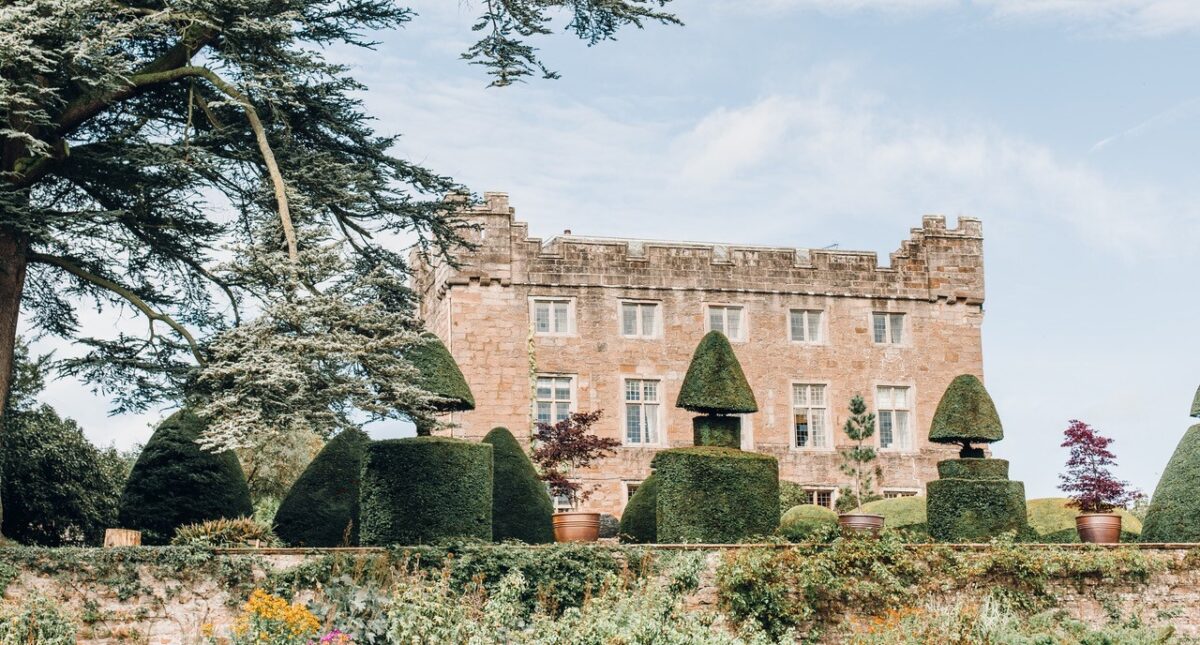
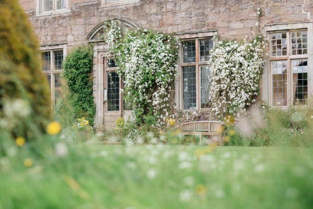
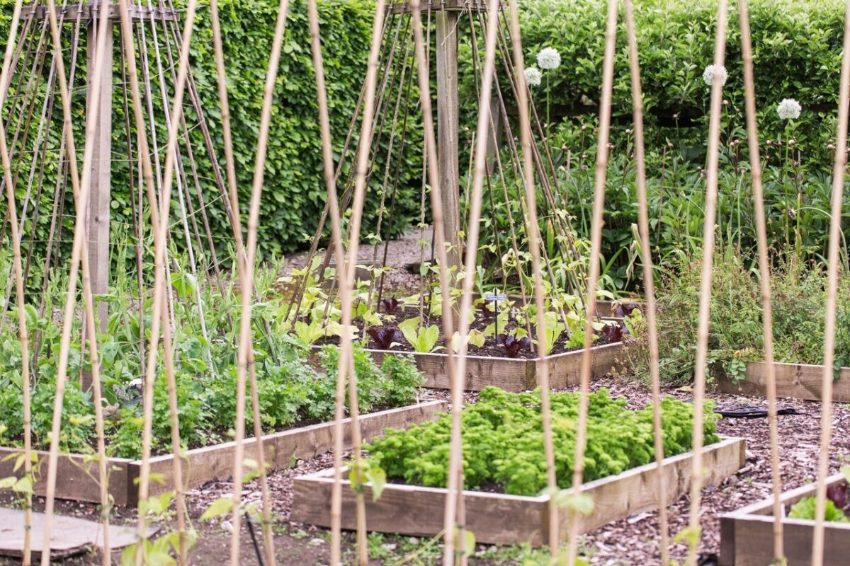
Askham Hall has formal and woodland gardens covering three hectares. The formal outlines of the gardens, the terraces and the topiary probably date from the late-17th century. There are also herbaceous borders dating from the 19th century. A formal garden and terraces, possibly with late 17th or 18th century origins.
Terrain
The site is on land which slopes down to the south and east.
The following is from the Register of Parks and Gardens of Special Historic Interest. For the most up-to-date Register entry, please visit The National Heritage List for England (NHLE):
Location, Area, Boundaries, Landform and Setting
Askham Hall is situated on the eastern edge of the village of Askham overlooking the River Eamont, which lies some 200m to the east of the Hall, on land which slopes down to the south and east. The setting is rural and agricultural. The boundary of the c 3ha site is formed by a track between Askham and Broadgate on the west side, walls on the north and east sides, and a wall dividing the site from the by-road between Askham and Lowther on the south side.
Entrances and Approaches
The main entrance is on the south side of the site where a gateway with stone gate piers (late C17/early C18, listed grade II) leads to a drive which runs north and north-east to the Hall. A second drive leads to the north side of the Hall from the track to Broadgate.
Principal Building
Askham Hall (listed grade I) originated as a pele tower, probably in the C14. It has three irregular wings around a rectangular courtyard. The tower forms the south front and was remodelled 1685-90, although medieval tunnel vaulting survives at ground floor level. The north wing retains some medieval work and the remainder of the building is of C16 and C17 date with later alterations and additions.
Gardens and Pleasure Grounds
The gardens are on the south, west and east sides of the Hall. Immediately south of the Hall a sloping lawn is divided by a central path and there are signs of terracing, probably on the line of that shown on the 1859 OS map c 20m south of the Hall. South of this, and c 50m south of the Hall, there are two formal terraces (walls and steps listed grade II). The first terrace has an ashlar retaining wall with a cornice and a central gate which leads to steps down to the second terrace. This is also supported by a retaining wall and has central steps leading down to a lawn below. The terraces are c 22m long and are possibly of late C17 or C18 date. In the centre of the lawn below the terraces there is a mid C20 swimming pool.
On the north-east side of the Hall there is a rectangular formal garden with geometrical beds, enclosed on the north and south sides by yew hedges.
On the west side of the Hall there is a c 1ha area of woodland, with a central clearing. The large-scale OS map surveyed 1857-60 shows this area divided from the terraces by a boundary, possibly a fence or wall. An avenue is shown running north alongside the terraces on the east side of this division and the area now covered by trees is open land, with a possible vestigial avenue running from east to west across the area.
The gardens are shown extending eastwards down to the river on Greenwood's county map of 1824. A building is shown south of the Hall, fronting the road, on Jeffreys' county map of 1770, indicating a post 1770 expansion of the grounds down to the roadside.
Maps
- T Jeffreys, The County of Westmorland, 1770
- C & J Greenwood, Map of the County of Westmorland, 1824
- OS 6" to 1 mile: 1st edition surveyed 1859
- OS 25" to 1 mile: 1st edition surveyed 1857-60
Description written: July 1997
Register Inspector: CEH
Edited: March 1999
- Visitor Access, Directions & Contacts
Access contact details
Please note: The information on this website is advisory, but please always check the website of the house or garden you intend to visit before travelling.
- History
The following is from the Register of Parks and Gardens of Special Historic Interest. For the most up-to-date Register entry, please visit The National Heritage List for England (NHLE):
13th Century
The manor of Askham was acquired in 1280 by Sir Thomas de Helbeck, and remained in the de Helbeck family until the early 14th century when it passed by marriage to the Swynburn family.
14th Century
An inquisition of 1326 refers to a dwelling on the site being partially burnt by the Scots. Edmund de Sandford and his wife Idonea, co-heiress of Sir Thomas English, came into possession of Askham in 1375, and it remained in the family for approximately 350 years.
17th Century
In 1680 it was sold to the Lowther family.
19th Century
In 1828 the Hall was in use as a rectory and is described as such on the 1st edition OS map surveyed 1859.
20th - 21st Century
Following the abandonment of nearby Lowther Castle in the mid-20th century, it became the country seat of Lord Lonsdale and remains in use (1997) as a private residence.
Askham Hall is now a unique place to eat, drink and sleep on the edge of the Lake District (2021).
- Features & Designations
Designations
The National Heritage List for England: Register of Parks and Gardens
- Reference: GD1651
- Grade: II
Features
- Topiary
- Earliest Date:
- Latest Date:
- Fortified House (featured building)
- Description: Askham Hall was originally a 14th-century Pele tower which was converted into an Elizabethan style domestic house in 1574.
- Earliest Date:
- Latest Date:
- Terrace
- Earliest Date:
- Latest Date:
- Herbaceous Border
- Earliest Date:
- Latest Date:
- Key Information
Type
Garden
Purpose
Ornamental
Principal Building
Domestic / Residential
Survival
Extant
Hectares
3
Civil Parish
Askham
- References
References
- {English Heritage Register of Parks and Gardens of Special Historic Interest} (Swindon: English Heritage 2008) [on CD-ROM] Historic England Register of Parks and Gardens of Special Historic Interest
- Soc 37 (1937), pp 183-5 Transactions of the Westmorland Antiquarian & Archaeological Society
- Map of The County of Westmorland