Introduction
Worden Park originated as an 18th-century landscape park, with 19th-century formal gardens possibly designed by W A Nesfield. The site became a public park in 1951, occupying 63 hectares. Features include woodland walks, formal and sensory gardens, a rock garden, a hornbeam maze and an arboretum.
Terrain
The site is on land which slopes gently up to the north-east from the Shaw Brook.www.historicengland.org.uk/listing/the-list
Park and pleasure grounds with elements of an early 19th-century scheme and a formal garden probably of the mid- or later 19th century.
DESCRIPTION LOCATION, AREA, BOUNDARIES, LANDFORM, SETTING
Worden Park lies on the south side of Leyland in an area which is residential, with open agricultural land to the south and south-west. The c 60ha site is on land which slopes gently up to the north-east from the Shaw Brook. The boundary on the east side is formed by Holt Brow and Worden Lane. Parkgate Drive forms part of the north boundary, with the remainder being fencing dividing the site from a sports ground and private houses on Worden Close. On the west side fences divide the park from the private gardens of houses fronting onto Cumberland Avenue. The south boundary is formed by fencing on the south side of Shaw Brook.
ENTRANCES AND APPROACHES
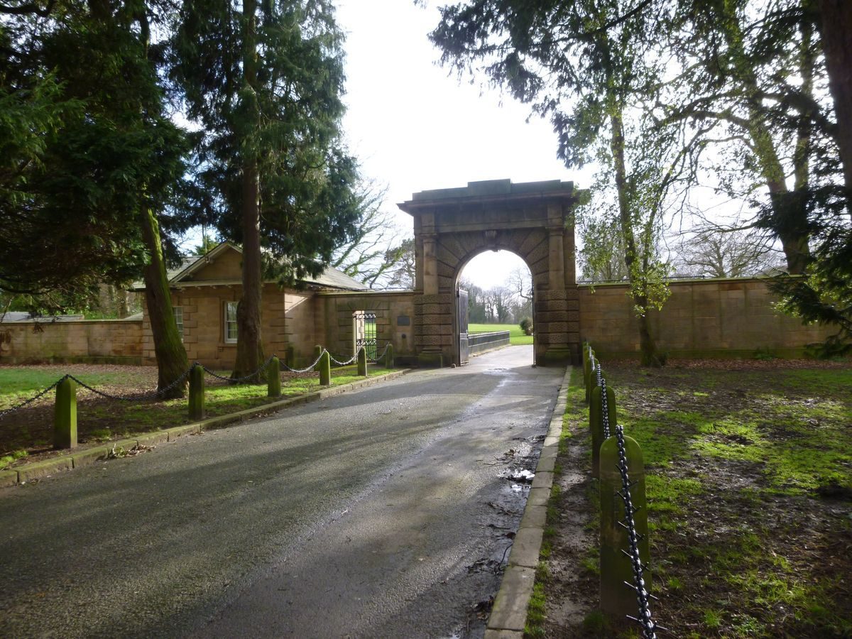
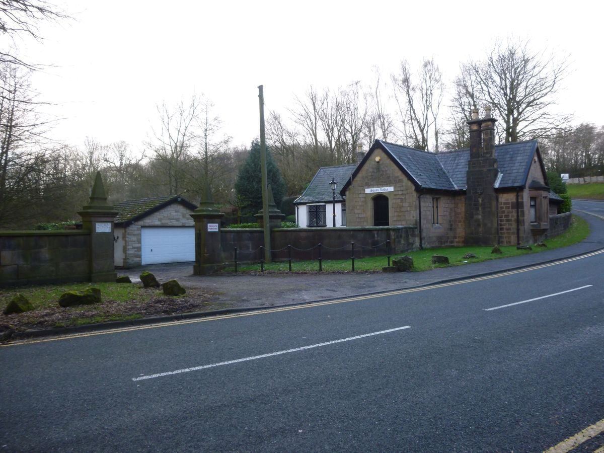
The principal entrance to the site is from North Lodge on Worden Lane where there is an early C19 entrance gateway and lodge (listed grade II). The entrance arch is flanked by Tuscan columns and attached to a single-storey lodge with pedimented gables. Both structures and the linking wall are of fine ashlar stone and the lodge has vermiculated rustication which extends across the lower part of the columns. A drive leads south from the entrance, on or close to the line of a road shown on an estate map of c 1725. It crosses another drive, called The Avenue and also shown on the 1725 map, which runs approximately east/west across the site, before continuing south to the site of Worden Hall. A second entrance with a later C19 lodge lies at the south-east corner of the site on Holt Brow. A track runs west and north-west from it to the site of the Hall. There is an entrance with mid or late C19 gate piers on Holt Brow at the east end of The Avenue, and a gated entrance at the west end. A stretch of this drive to the north-west of the site of the Hall is shown as an avenue on the 1725 map, and this is shown as partially extant on the OS map of 1928. Some of the trees which currently (1999) line the south side of the drive may be the survivors or successors of avenue planting.
PRINCIPAL BUILDING
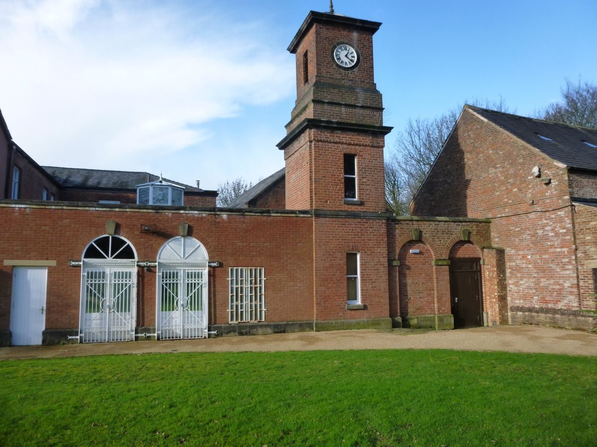
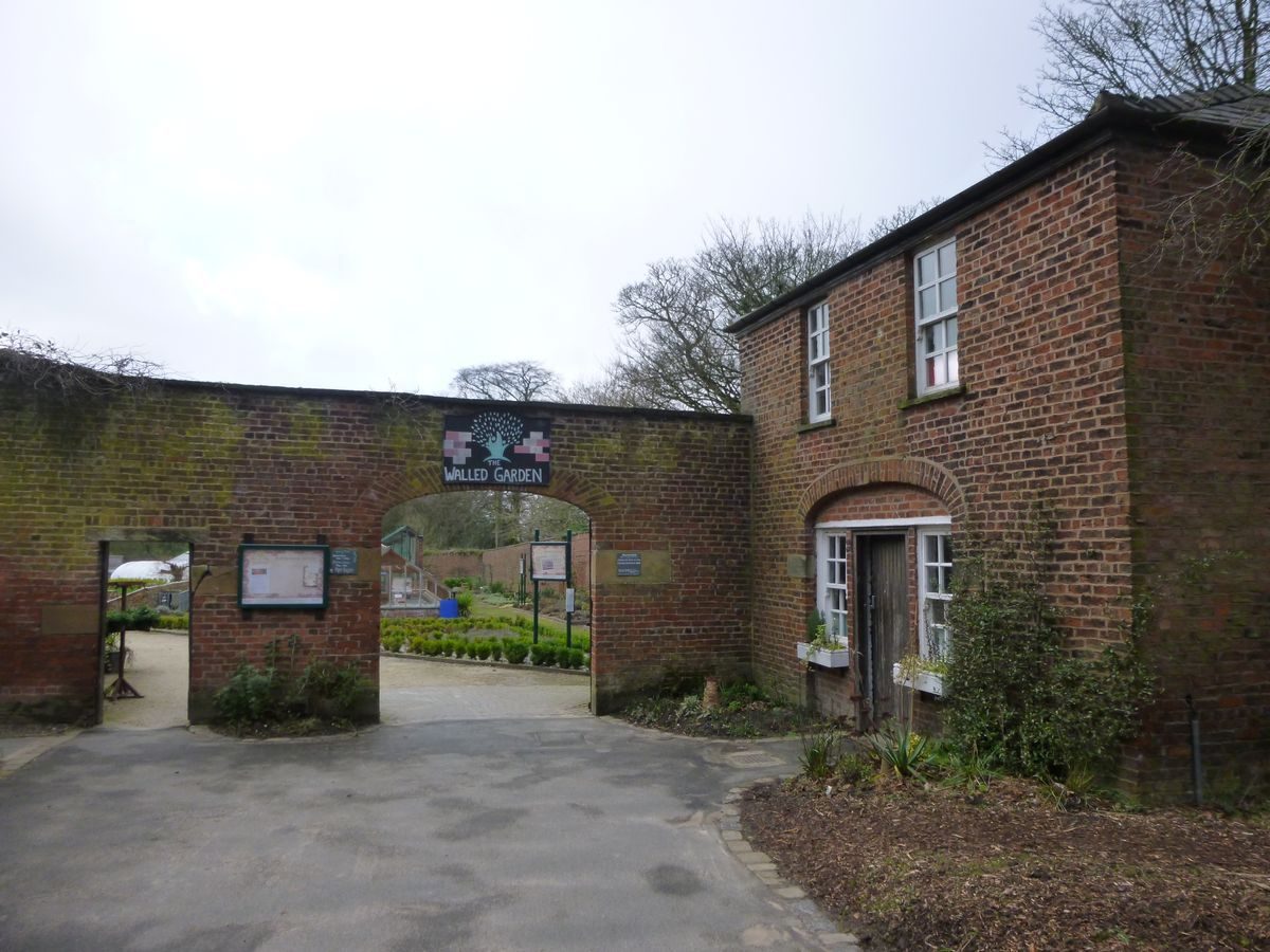
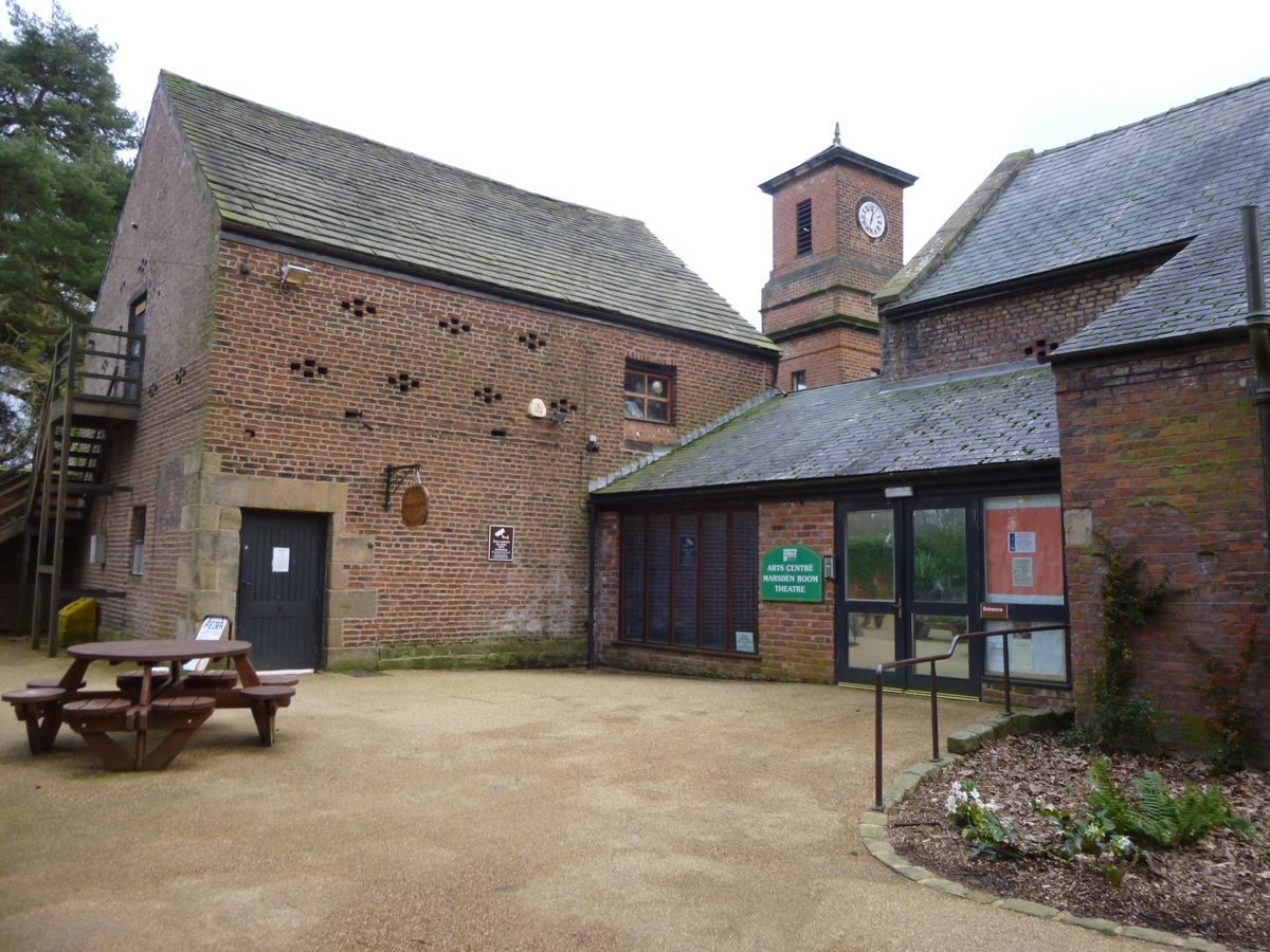
Worden Hall was known as Shaw Hall in the C18. A building is shown on the site on the 1725 map. This had been enlarged and altered c 1742 by Sir William Farington and was largely rebuilt in 1840-5 by Anthony Salvin before being demolished in 1960. Various service and ancillary buildings survive to the rear of the Hall site including an C18 barn, stable block and brew house (all listed grade II). The C18 service wing of the Hall (listed grade II) also survives and these buildings have been converted to studios, retail outlets and a café.
GARDENS AND PLEASURE GROUNDS
Gardens lie on the south side of the site of the Hall. They consist of the remains of a mid or mid to late C19 formal garden which fronted the Hall and may be contemporary with Salvin's remodelling of the building. One source (Leyland Hist Soc 1996) suggests that the garden was designed by W A Nesfield. It is on the site of part of a formal garden shown on the 1725 map which extended south over the sloping land to the edge of Shaw Brook and was axially aligned not with the Hall but with a rectangular building beside the Brook. This may have been designed for William Farington who died in 1714 or his second cousin George who succeeded in 1717.
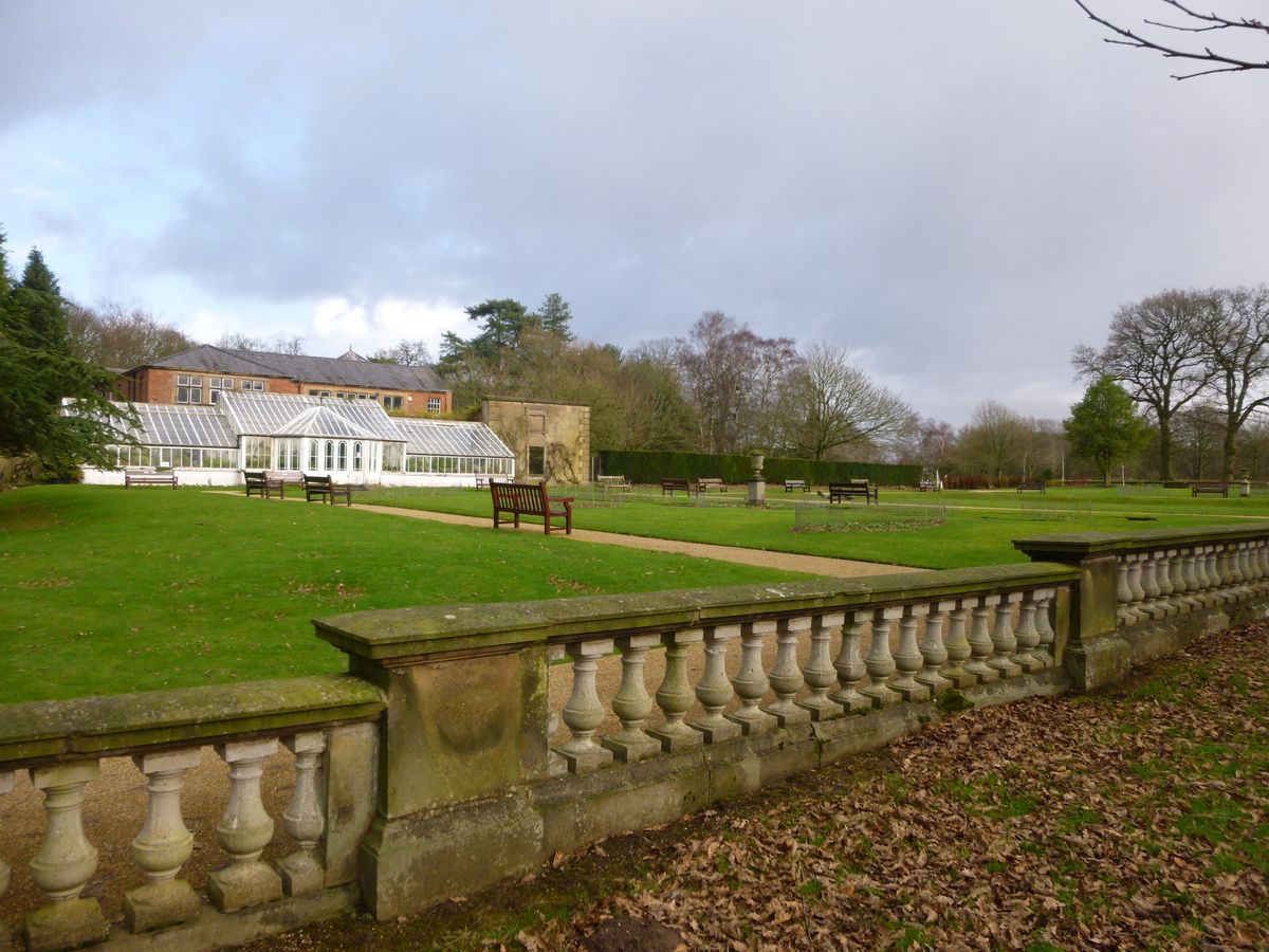
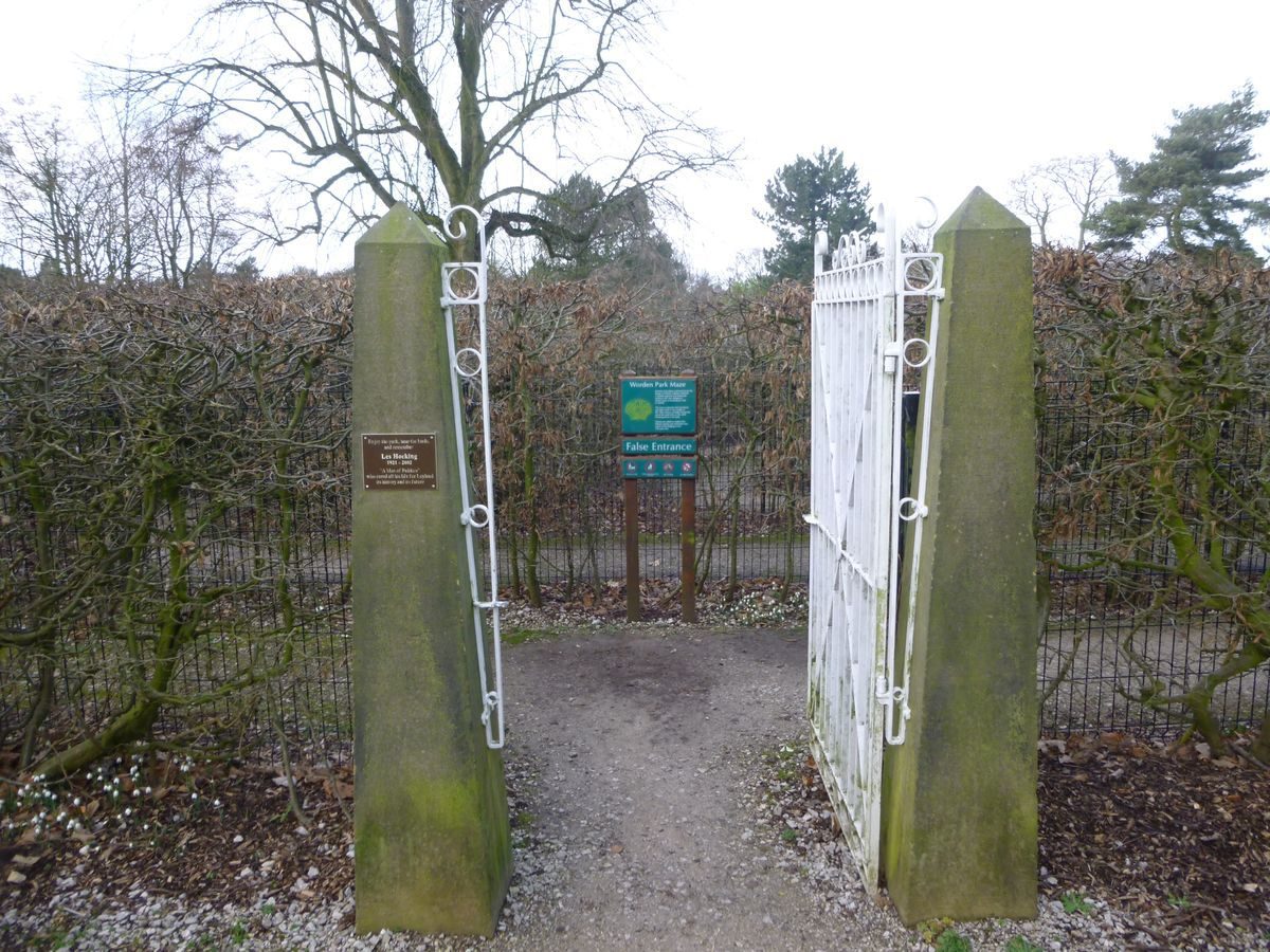
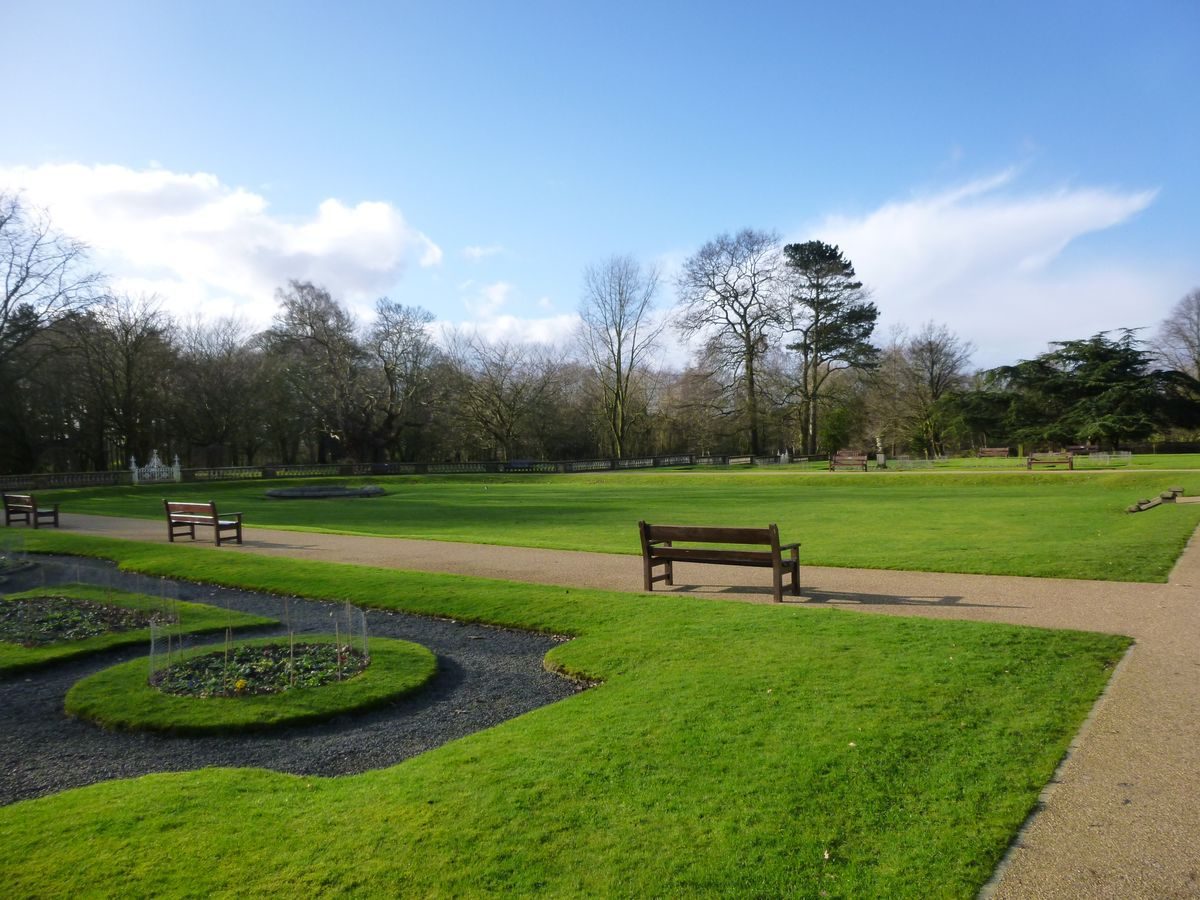
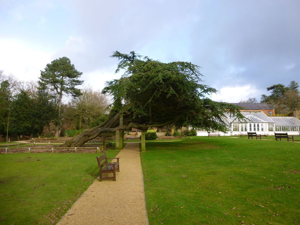
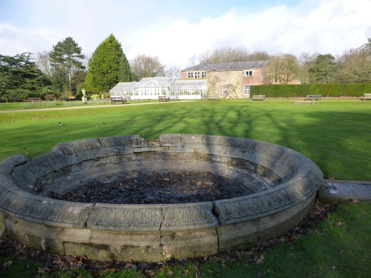
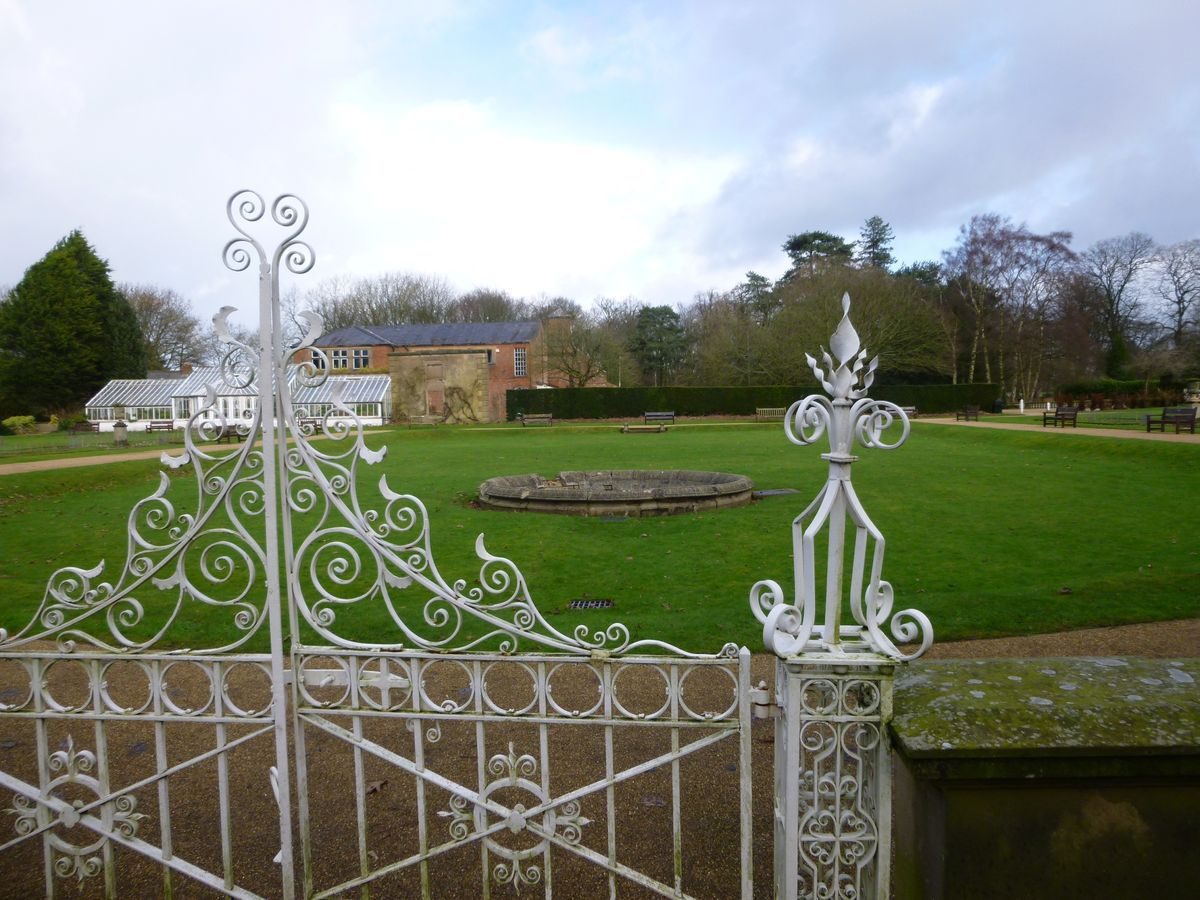
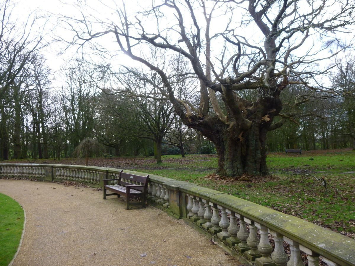
A sunken lawn is enclosed by an apsidal balustrade, which extends around flanking rectangular lawns. There are ornamental ironwork gates to the entrance to the garden on the east side and within the balustrade in alignment with the former Hall front. The garden is laid out with a system of paths and geometrical beds, the latter probably of late C20 origin. The 1928 OS map does not indicate any beds in this area. A path runs east/west alongside the former front of the Hall and a mid C19 conservatory (listed grade II), formerly attached to the south-west corner of the building, lies beside it. It has a central projecting canted bay flanked by two lower wings. The path continues westwards to a beech maze, c 75m west of the Hall site, which has been planted in the late C20 on the site of a maze designed by Harrington in 1886 which is shown on the 1928 OS map.
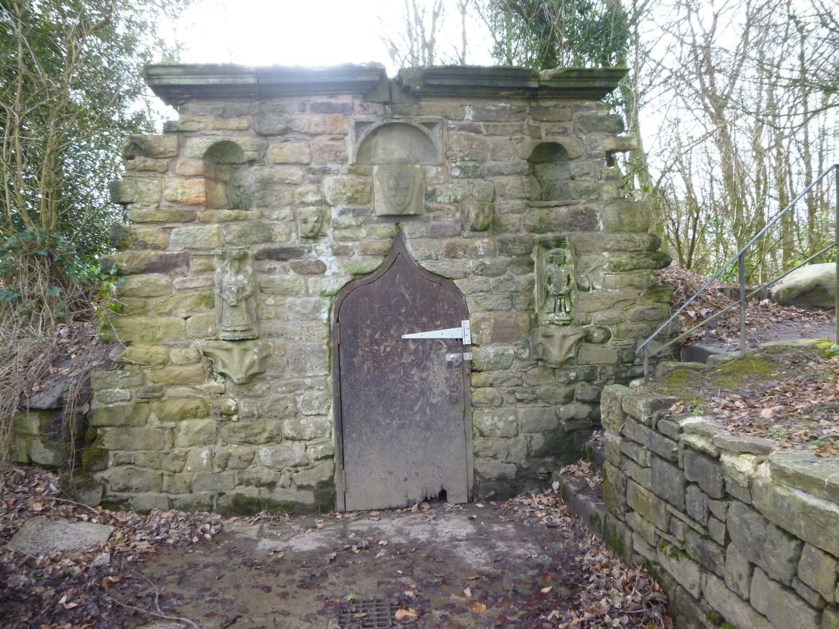
The area immediately south of the formal gardens, consisting of rolling grassland with specimen trees, has been integrated into the pleasure grounds by means of paths which link the formal gardens with walks alongside the wooded banks of the Shaw Brook. One of these paths, from the east side of the formal garden, leads past an icehouse (listed grade II) which lies c 100m south of the Hall site. It is probably of early C19 date and has a stone facade with a central door with an ogee head surrounded by various pieces of applied carved masonry, possibly of the C16 or earlier, including two carved figures. The carvings may have come from nearby St Andrew's church which was partially demolished in 1816, suggesting a plausible date for the structure. The decorative treatment suggests that the building was designed to be a picturesque incident in walks through woodland.
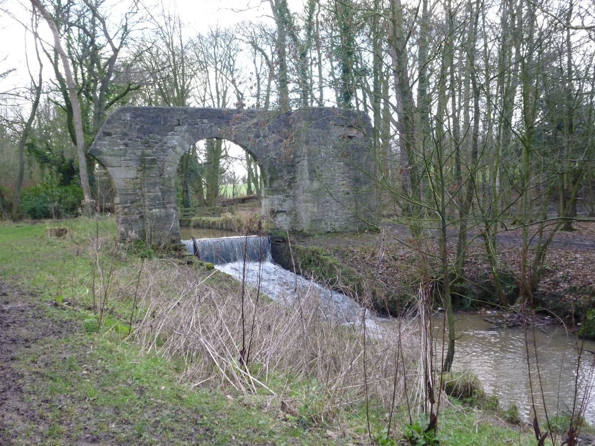
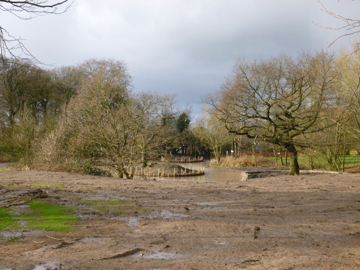
The path continues to the Shaw Brook and paths extend alongside the watercourse to the east and to the west. The Brook shows signs of having been modified at various times. Bridges of late C20 date cross it and there are weirs and masonry edging at various places along it. Footbridges and weirs are marked on the 1928 OS map which also shows the system of paths alongside the Brook. A stone arch (listed grade II) crosses the Brook beside a waterfall c 300m south-east of the Hall site. It is attached to a rectangular turret on the south bank and a broken arch on the north bank. The structure is probably of early C19 date and may have been designed to appear ruinous. The woodland alongside the Brook in this area is marked Ruin Wood on the 1928 OS map. The structure could well be contemporary with the icehouse (see above), and designed as a picturesque ornament to the landscape.
PARK
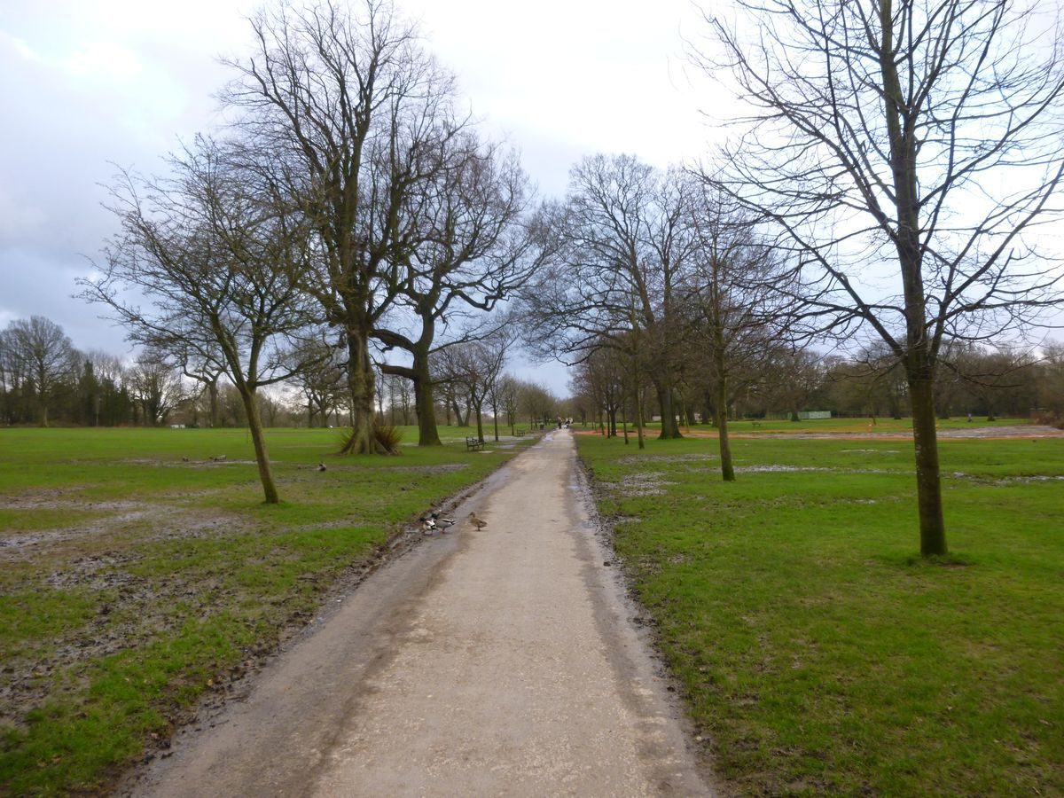
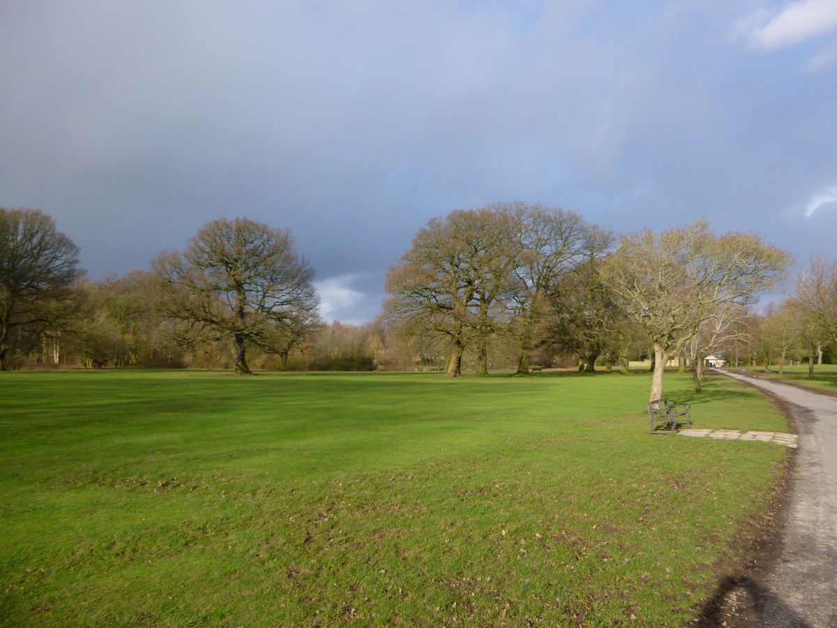
Parkland surrounds the Hall site and gardens. It consists of open grassland studded with trees. The area on the south-east side of the Hall site was the site of a circular feature flanked by linear features, possibly canals or alleys, which are shown lined with trees on the 1725 map, but no trace of this appears to survive. On the west side there is an area of open grassland with scattered trees which is bounded on all but the garden side with belts of trees.
The parkland on the north side of the Hall site has scattered trees which generally conform, on the west side, to the lines of field boundaries as shown on the 1st edition OS map surveyed 1844(6. Also shown on the map is the pond, fringed with trees, which lies c 300m north of the Hall site. It is not shown on the 1725 map, which shows large fields to the east and much smaller enclosures on the west side of this area. This part of the park is used as sports fields, and a range of single-storey changing rooms of c 1975 lies c 150m north of the Hall site. In the north-west corner of the park there is a patch of woodland called Brickfield Wood. A fenced area c 200m north-east of the Hall is occupied by a miniature railway. A car park lies c 500m north-east of the Hall site.
KITCHEN GARDEN
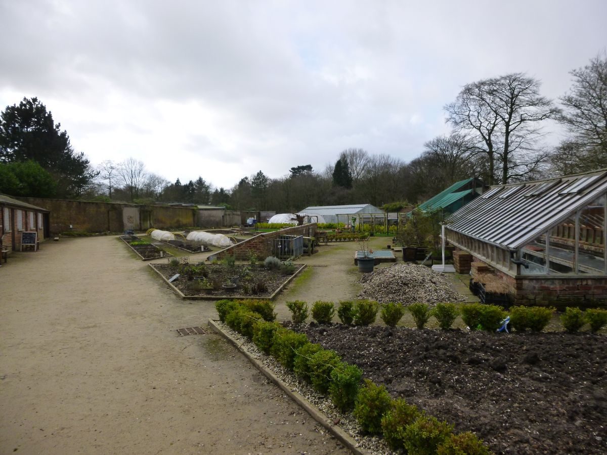
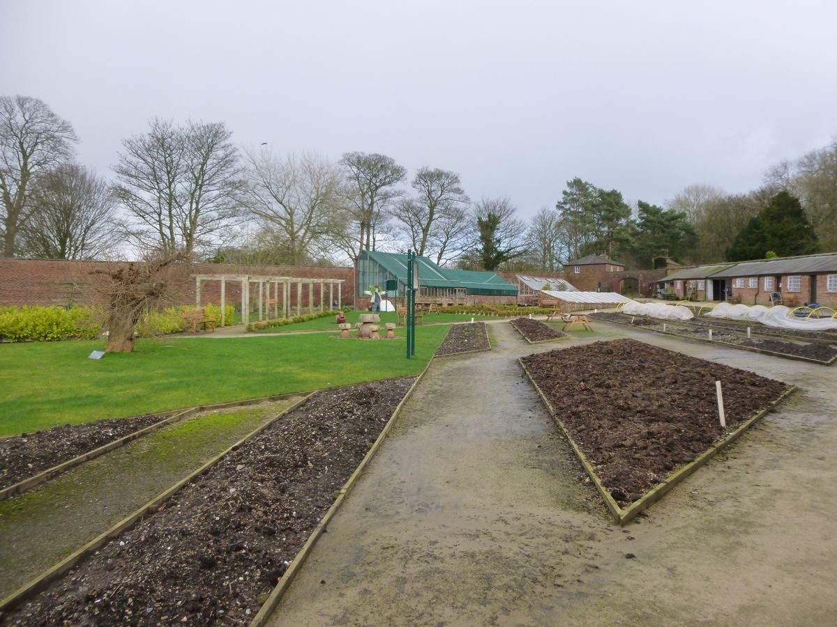
The kitchen garden lies c 150m north-west of the Hall site. The kite-shaped enclosure, probably of the early C19, is walled on three sides; on the south side the wall has been removed and replaced with a late C20 metal fence. A small rectangular building attached to the wall at the north-east corner could be a C19 bothy. The interior has been used as a maintenance yard and the structures and layout appear to date from the late C20.
REFERENCES
The Victoria History of the County of Lancashire vi, (1911), pp 12-15
N Pevsner, The Buildings of England: North Lancashire (1969), p 167
Maps
Estate map, c 1725 [extract in Leyland Hist Soc 1996]
OS 6" to 1 mile:
1st edition surveyed 1844-6, published 1848
1929 edition
OS 25" to 1 mile:
1st edition surveyed 1893, published 1894
1928 edition
Archival items
Leyland Historical Society, typescript report, (February 1996) [copy on EH file]
Description written: November 1999 Amended: February 2000
Register Inspector: CEH
Edited: March 2000
- Visitor Access, Directions & Contacts
Telephone
01772 625625Website
https://www.southribble.gov.ukAccess contact details
This is a municipal park, open daily from 8am to dusk
Directions
Located on the south-west side of Leyland, 2 miles south-west of the M6 junction 28.
Owners
South Ribble Borough Council
Civic Centre, West Paddock, Leyland, PR25 1DH
- History
The following is from the Register of Parks and Gardens of Special Historic Interest. For the most up-to-date Register entry, please visit The National Heritage List for England (NHLE):
12th - 13th Century
The site was included in land granted to the Knights of St John of Jerusalem in the 12th or early 13th century. Worden subsequently passed from the Bussel family to the Anderton family.
16th Century
In 1534 it was acquired by Sir Henry Farington and it remained in the Farington family until 1947.
20th Century
In 1950 Leyland Council purchased it. It was opened to the public on 18 June 1951 and it remains in use as a public park.
The Worden Park King George Playing Field is part of the Fields in Trust historic protection programme and has been protected since November 1961 under the King George V Playing Fields protection type.
Period
18th Century (1701 to 1800)
- Associated People
- Features & Designations
Designations
The National Heritage List for England: Register of Parks and Gardens
- Reference: GD1953
- Grade: II
Green Flag Award
Features
- Stream
- Pond
- Ornamental Fountain
- Flower Bed
- Maze
- Description: Hedge maze.
- Earliest Date:
- Latest Date:
- Icehouse
- Folly
- Conservatory
- Arts And Crafts Centre (featured building)
- Description: The majority of the hall was demolished after a fire in 1941. The remianing buildings are now in use as an arts and crafts centre.
- Planting
- Description: The formal gardens.
- Kitchen Garden
- Description: The walled garden lies some 500 metres north-west of the hall. It is now back in productive use.
- Earliest Date:
- Latest Date:
- Walk
- Description: Italian walk.
- Key Information
Type
Park
Purpose
Recreational/sport
Principal Building
Parks, Gardens And Urban Spaces
Period
18th Century (1701 to 1800)
Survival
Extant
Hectares
60
Open to the public
Yes
Electoral Ward
Leyland Central
- References
References
- {English Heritage Register of Parks and Gardens of Special Historic Interest}, (Swindon: English Heritage, 2008) [on CD-ROM] Historic England Register of Parks and Gardens of Special Historic Interest
- Hartwell, Clare and Pevsner, Nikolaus {The Buildings of England: Lancashire : North} (London: Yale University Press, 2009) The Buildings of England: Lancashire : North
- Farrer, W and Brownbill, J. {Victoria County History: Lancaster, Volume 6} ([n.p.]: [n.pub.], 1911), pp. 12-5 Victoria County History: Lancaster, Volume 6