Introduction
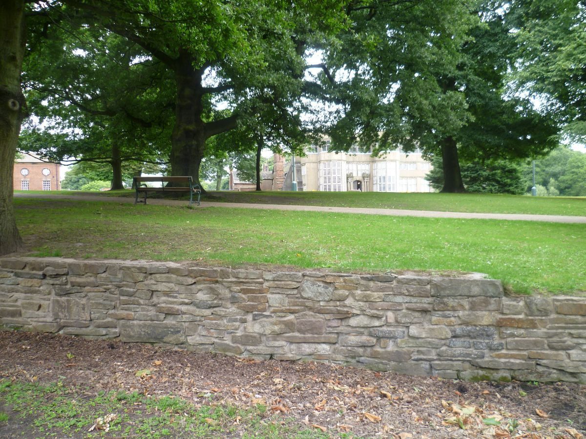
Astley Hall is situated within Astley Park, a late-17th-century park which was re-landscaped in the early-19th century. The site was adapted as a public park in the 20th century, and now occupies 43 hectares. Gardens which retain elements of a 17th- or early 18th-century layout and parkland of the 18th century or early 19th century, possibly laid out with advice from John Webb.
Terrain
The site is on land which slopes southwards down to the River Chor.The following is from the Register of Parks and Gardens of Special Historic Interest. For the most up-to-date Register entry, please visit The National Heritage List for England (NHLE):
Location, Area, Boundaries, Landform and Setting
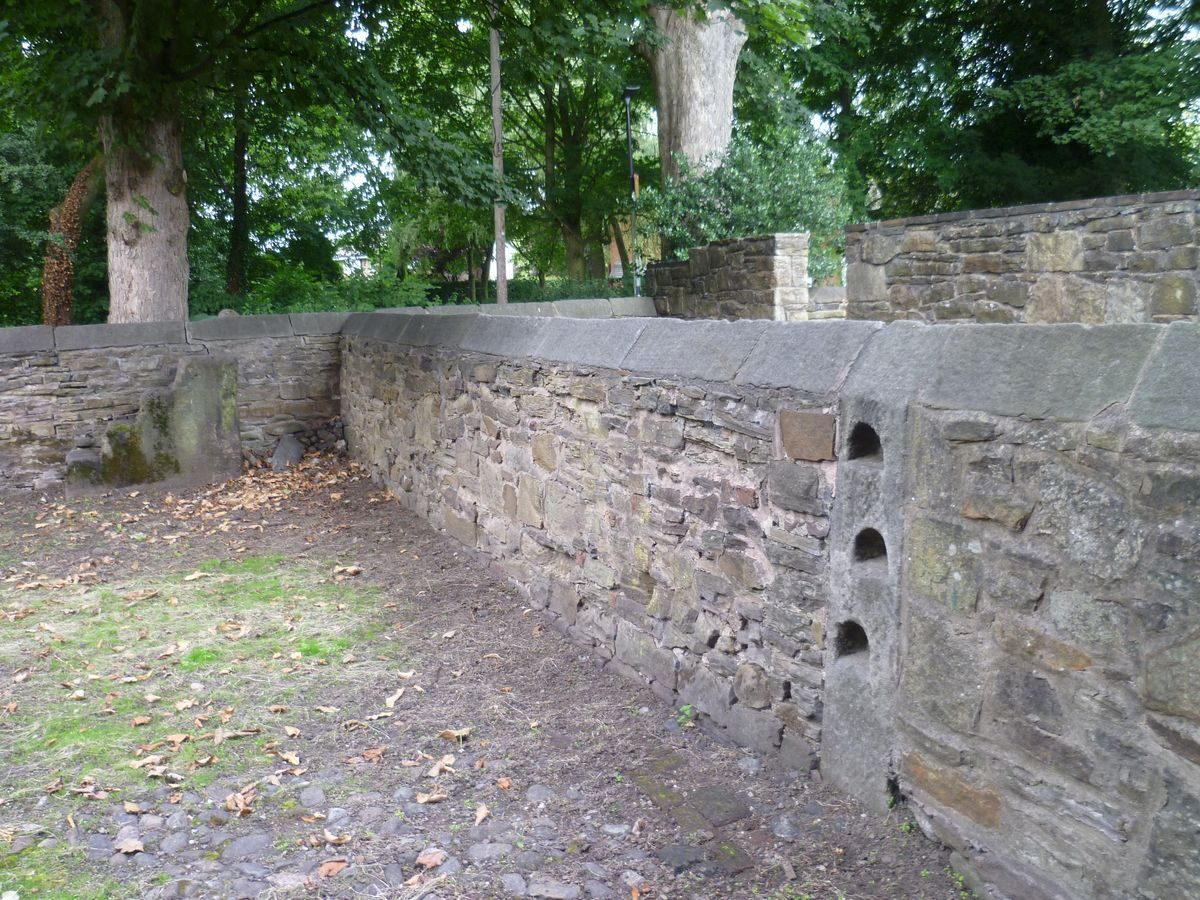
Astley Hall is situated on the north-west side of Chorley. It is surrounded by urban and residential areas. The c 40ha site is on land which slopes southwards down to the River Chor, which is no more than a stream in this area. The boundaries are largely formed by C20 fencing which divides the site from housing. At the south-east corner of the site the boundary is formed by a wall surmounted by lengths of railing between evenly spaced stone piers for a distance of c 100m along the A6, Park Road. This was erected in the 1920s. At the extreme south-east corner of the site there is a c 30m section of older walling, possibly of C19 or C18 date, which forms part of the southern boundary. At the extreme south-western corner of the site there is a section of wall, probably of early C19 date, running for c 150m along Southport Road.
Entrances and Approaches
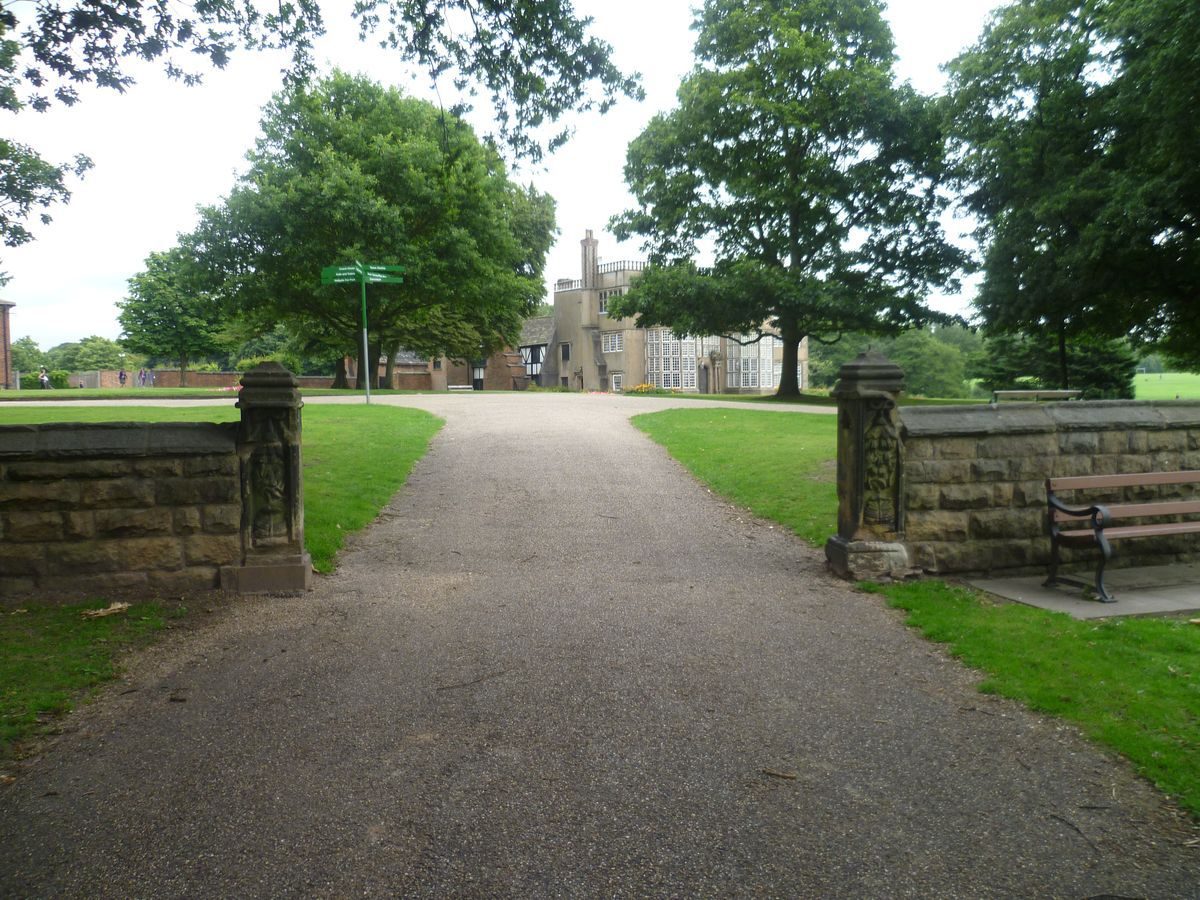
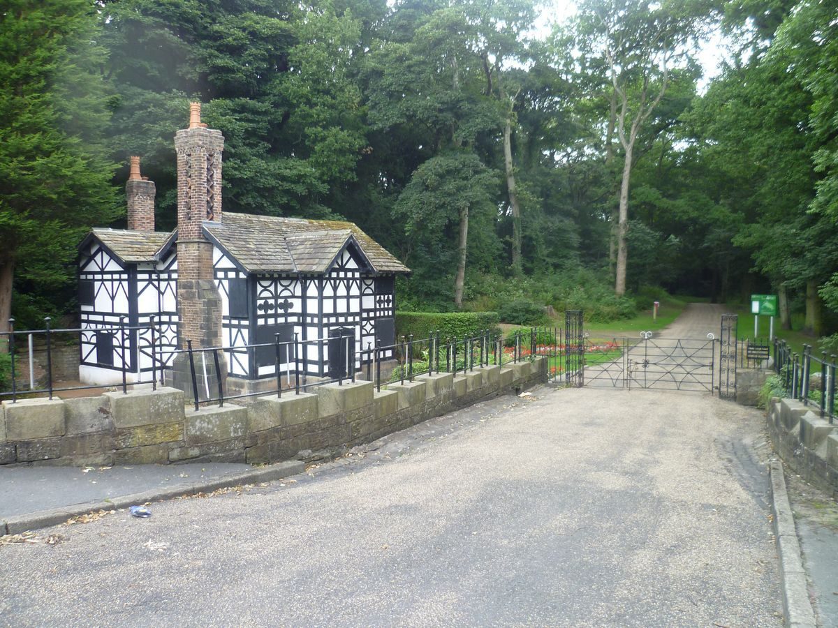
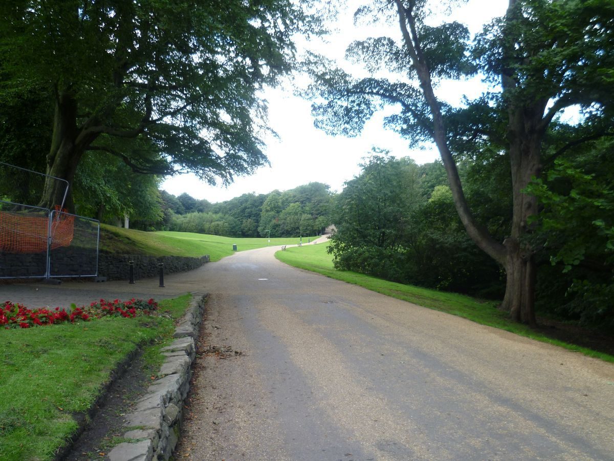
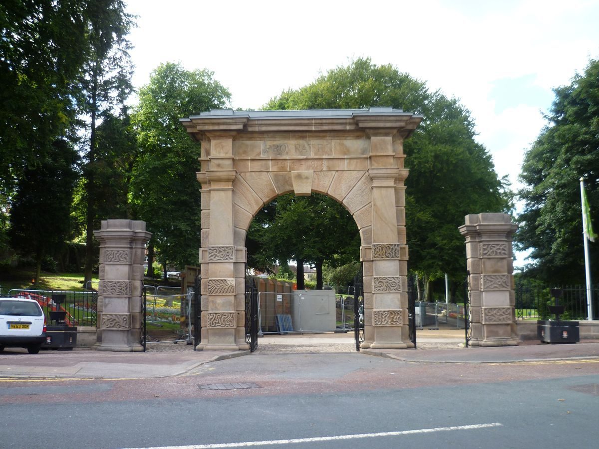
The principal entrance is from Park Road in Chorley where there is an arched gateway, probably of early C19 date, brought to this position from Gillibrand Hall. It is carved with the inscription 'Pro Patria 1914-1918'. On each side are gate piers of similar design. A drive leads north-west to the Hall from this entrance. The drive is shown on the 1st edition OS map surveyed 1844-7 and an estate map of 1822. There is a secondary entrance from Southport Road where a lodge (c 1842, listed grade II) called Ackhurst Lodge is situated on the west side of a drive which leads north-east to the Hall. The Lodge is shown on the 1844 OS map but not on the 1822 map. The drive from this lodge runs through woodland to a secondary entrance c 80m south-west of the Hall. Pre-1893 maps show it running west of this line to the west side of the stable block. The principal vehicular entrance is now from the north side off Hall Gate where there is a car park immediately north of the walled kitchen garden. This was formed in the later C20.
Principal Building
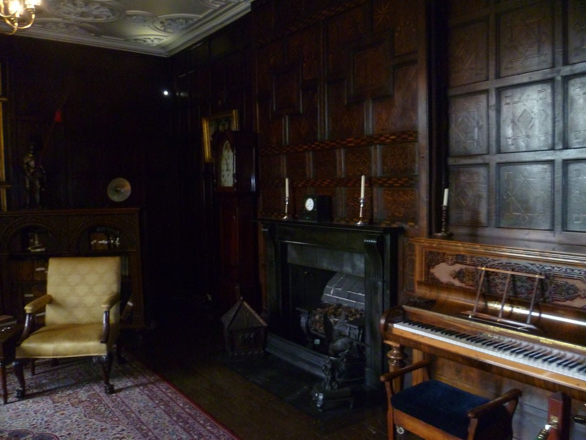
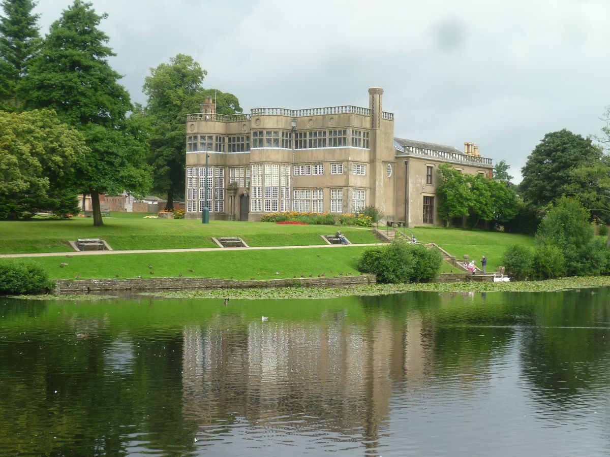
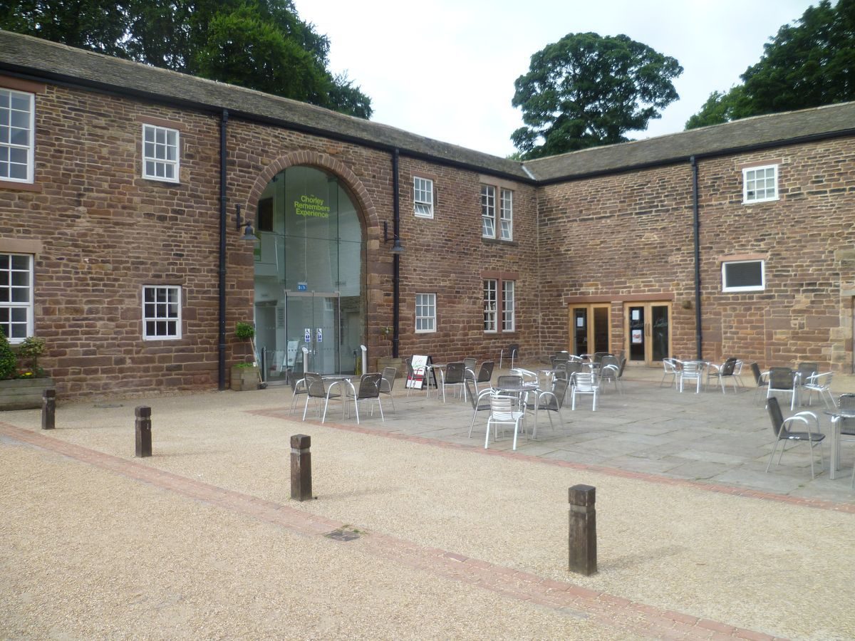
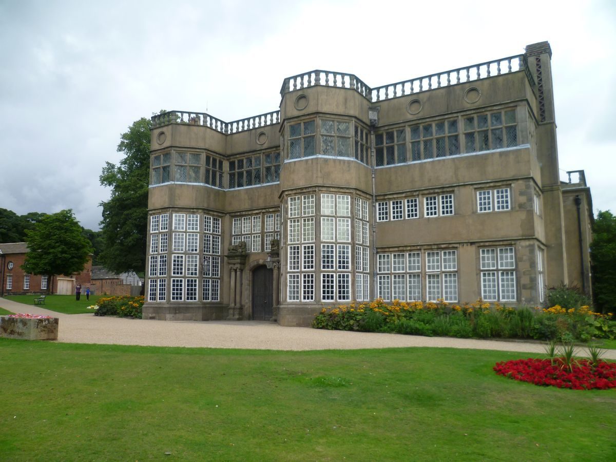
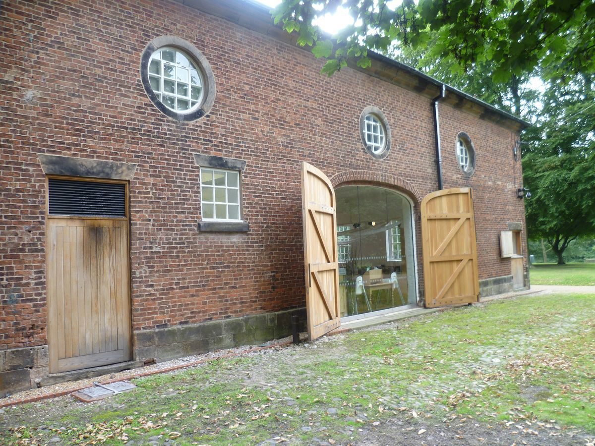
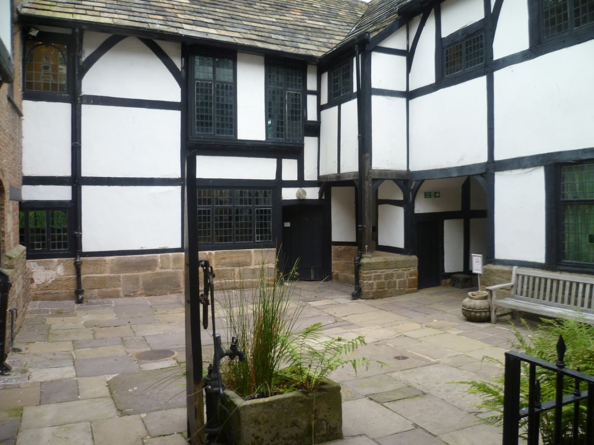
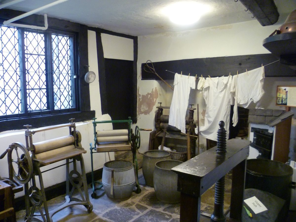
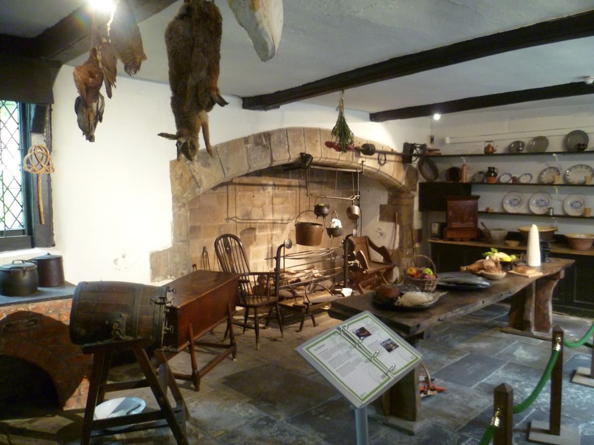
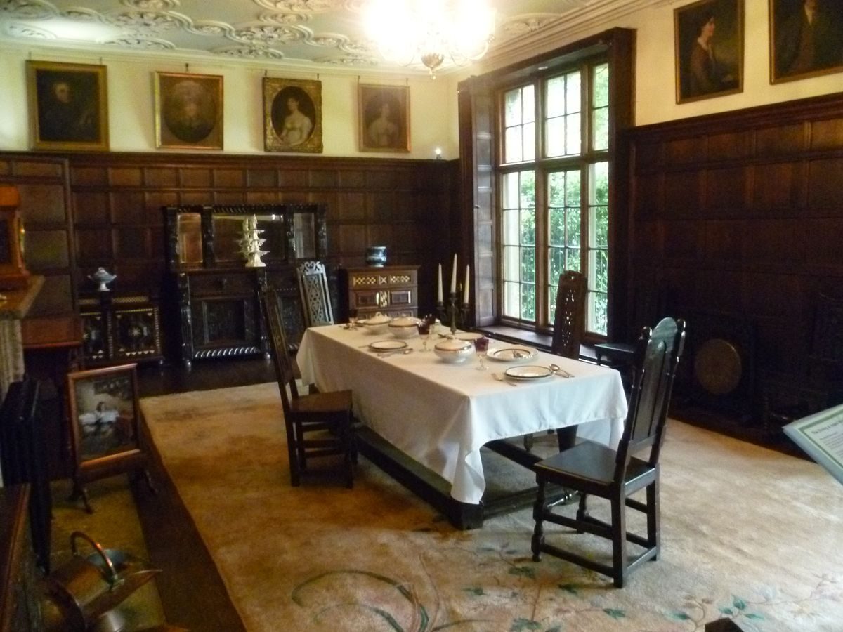
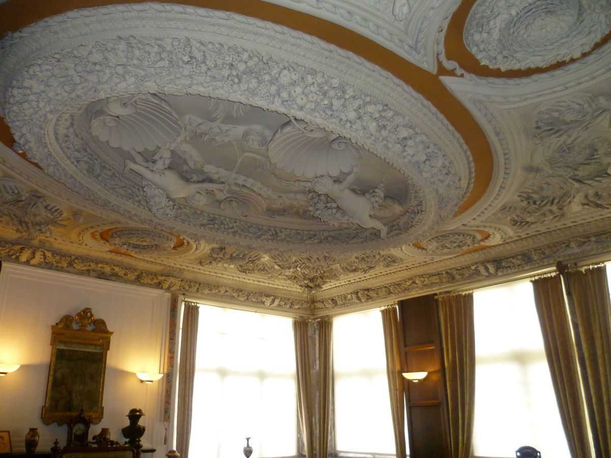
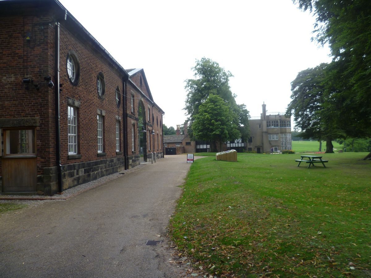
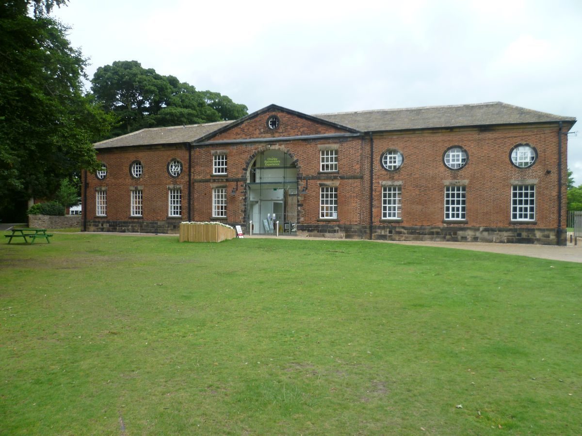
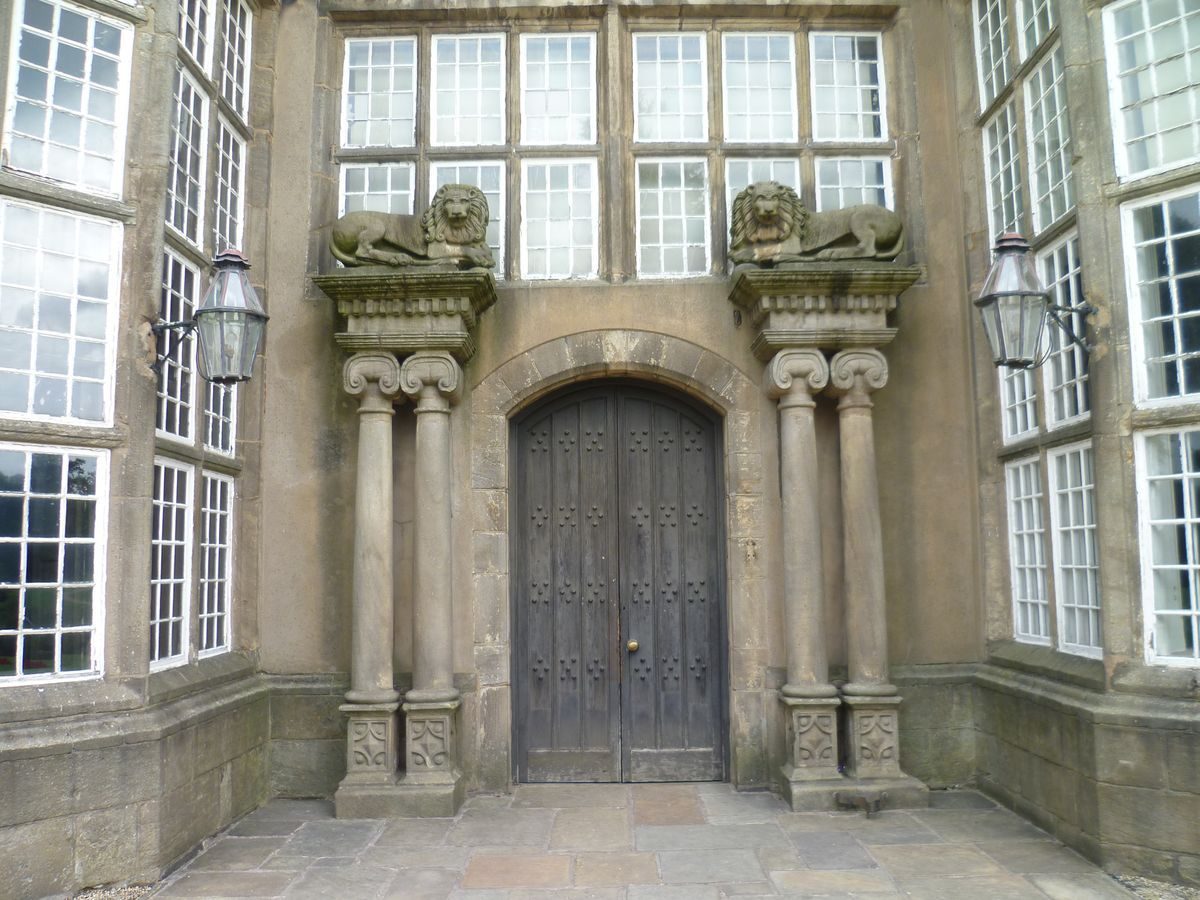
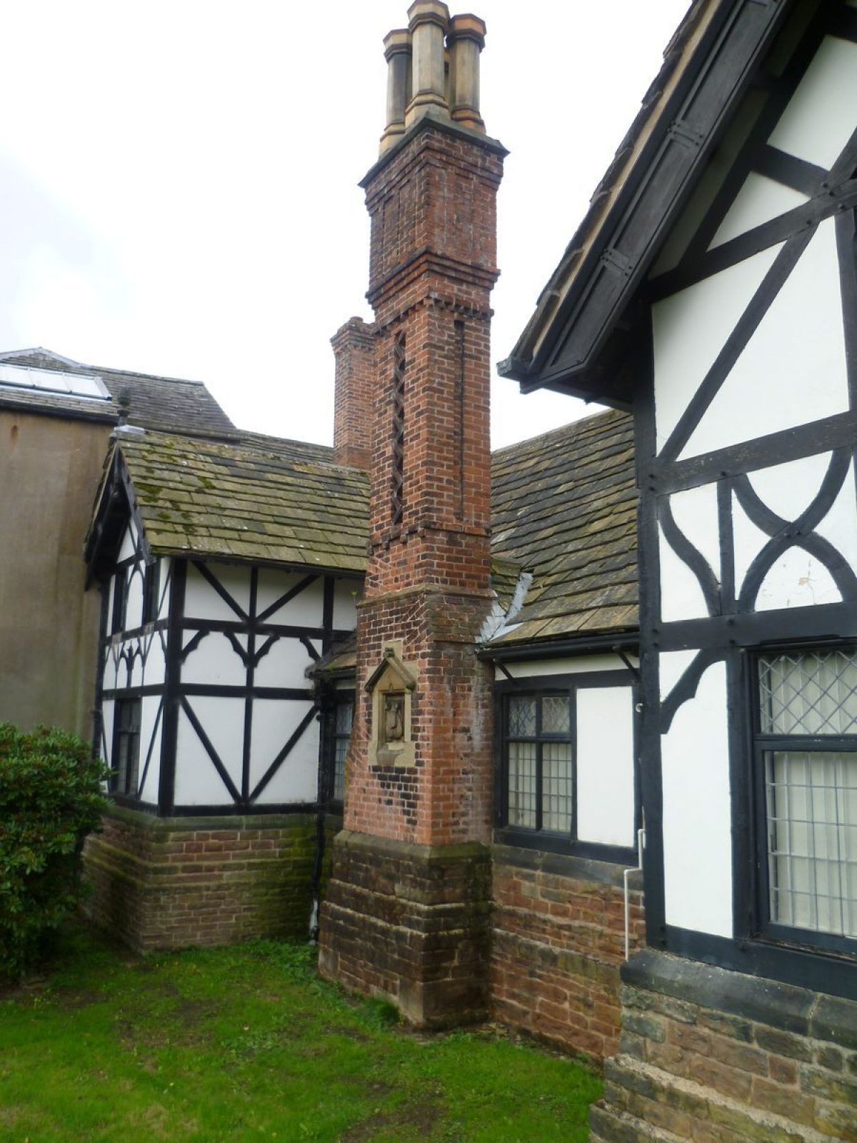
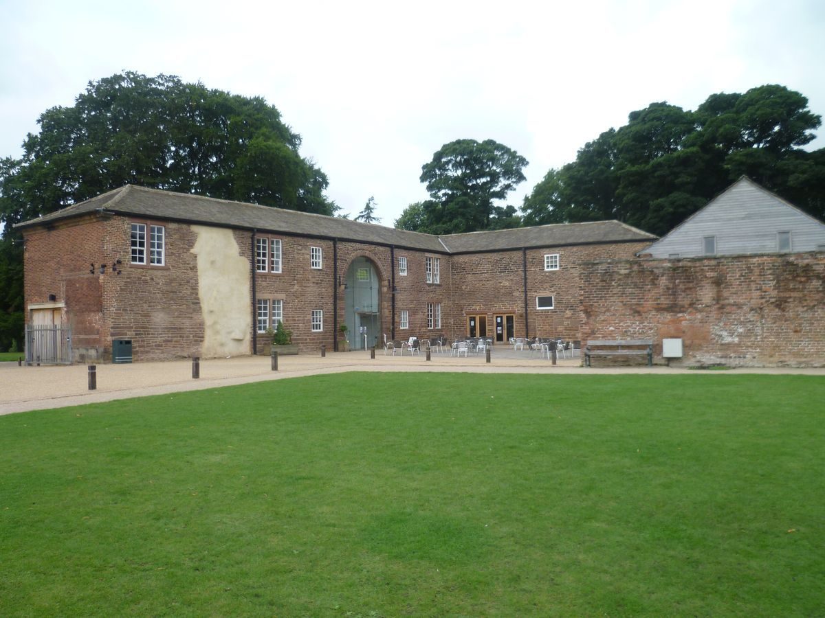
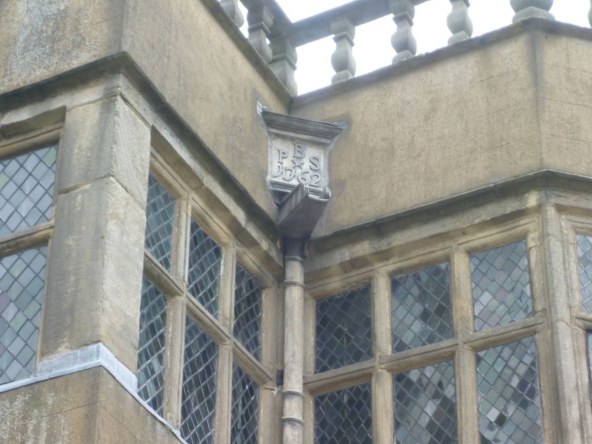
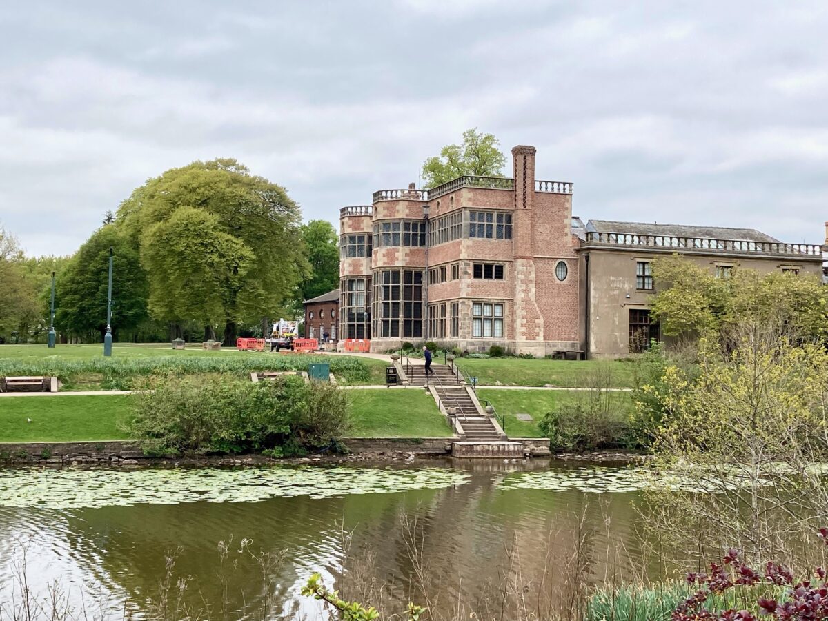
Astley Hall (listed grade I) dates from the C16. The principal (south) elevation is thought to date from c 1650 (Pevsner 1969) when it was set in front of a timber-framed courtyard house. The east range was refronted in 1825. The Hall is noted for its interior which has C17 features including a fine staircase and exceptional plasterwork. Some 30m west of the Hall there is a stable block, probably of the later C18 (listed grade II), and immediately north of this Astley Farmhouse, which is all that remains of the home farm and is probably identifiable with a building shown in this position in a painting of c 1710 (Harris 1979).
Gardens and Pleasure Grounds
The principal, south front of the Hall overlooks a broad terrace which steps down in two stages on the east side to a lake. This feature is L-shaped and c 200m in length, with the long arm running north/south. It is shown on the c 1710 painting when the Hall had walled gardens on the south and west sides. The garden walls south of the Hall terminated with corner towers, that on the east side overlooking the lake. The painting shows the lake extending west of its present line, in front of the Hall, suggesting that it may be the remains of a moat. It is shown at approximately its present shape and extent on Greenwood's county map of 1818.
A stone staircase with urns leads down from the terrace, c 20m south-east of the Hall, to a paved terraced walk and down again to the water's edge, where there is a stone-paved platform. This is much as shown on a photograph of c 1922 (CL 1922) and on the large-scale OS map surveyed 1893. A mid C19 view published by F O Morris shows the steps but there is no indication of a secondary terrace. The top of the steps approximates with the position of a gateway with stone piers shown on the c 1710 painting. The southern end of the lake is dammed and the principal drive crosses this dam as it approaches the Hall giving views of the Hall across the water.
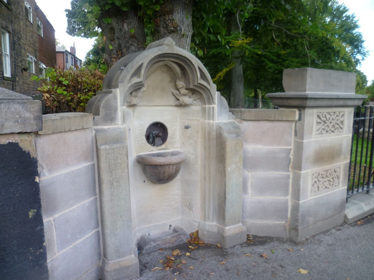
The area to the south of the Hall is grassed terrace with scattered trees. A late C19 cast-iron drinking fountain (listed grade II) is situated in the gardens c 50m south of the stable block. The garden is given a sense of closure by the Hall and stable block on the northern side, the lake on the east side and a walled secondary entrance from the drive leading from Ackhurst Lodge, c 80m south-west of the Hall. This consists of reset stone gate piers, carved with a foliated design which is identical to the carving on the newels of the C17 stair within the Hall. The piers are surmounted by ball finials and flanked by walls which run for c 3m then continue to the north-west and south-east as a ha-ha. This forms a line of c 130m length from a point c 70m south of the Hall to a point c 100m west of the Hall. The line is shown on the 1822 map and it appears as a scarp on the OS 2nd edition map published 1912, continuing west of the present boundary through an area which is now occupied by housing. The reset gate piers could be amongst those shown in the formal gardens of the c 1710 painting.
Park
The park consists of rolling open land to the east of the Hall which is used as playing fields. This area is described as 'Park' on the 1822 map; both the 1844 OS map and the large-scale edition of 1928 show scattered trees and clumps in the grassland. The northern side is bounded by a belt of trees called Dog Trap Wood. This continues as a finger of woodland directly north of the Hall where it is known as Damhead Wood, and a path leads from the open ground through this wood to the site of the home farm, as shown on the 1822 map. On the southern side the land slopes down to the wooded valley of the Chor. All the tree belts are identifiable with what is shown on the 1822 map.
The area south and south-west of the Hall is open grassland and there are mid C20 bowling greens and tennis courts situated on the northern edge of this area, against the western boundary c 120m south-west of the Hall. These are shown on the 1928 OS map but not that of 1912. This area is called 'Old Orchard' on the 1822 map. It is fringed on the south side by woodland.
The park includes the wooded Chor valley which extends along the southern edge of the site. Paths through the woodland cross and re-cross the river over footbridges which appear to be of C19 and C20 date and broadly follow the routes shown on the 1912 OS map. Similar routes are suggested on the 1844 map. These paths connect, on the west side of the site, with the drive from Ackhurst Lodge.
An earthen mound, which probably contains an icehouse shown on the 1912 OS map, is situated beside the river c 300m south-west of the Hall. Beside the mound there are the dry remains of a pond which is marked on the 1822 map; the 1844 OS map shows a fountain, but this does not appear on the 1928 edition. An undated newspaper cutting (private collection) shows the fountain in a photograph of c 1940. It appears to have consisted of a stone plinth and basin, possibly of C18 or earlier date.
Greenwood's map of 1818 shows that the park was much larger at that time, extending as far as Euxton road to the north, c 1.3km from the Hall, and including an area to the west. The northernmost part of the park now is c 200m north of the Hall and the former parkland on the north and west sides is now built-up.
John Webb (1754-1828) was consulted about the landscaping but it is not known when he was asked to advise and if any of his proposals were carried out.
Kitchen Garden
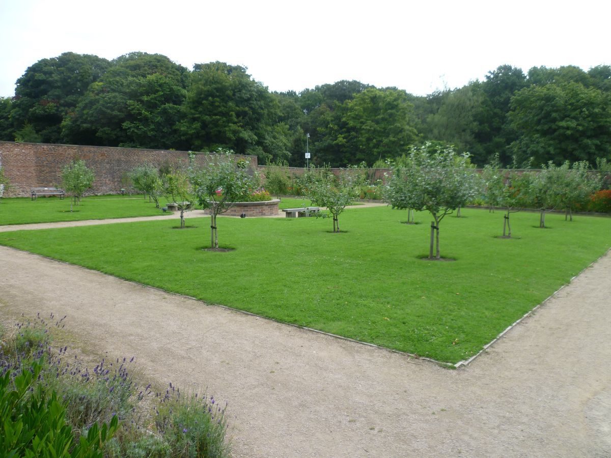
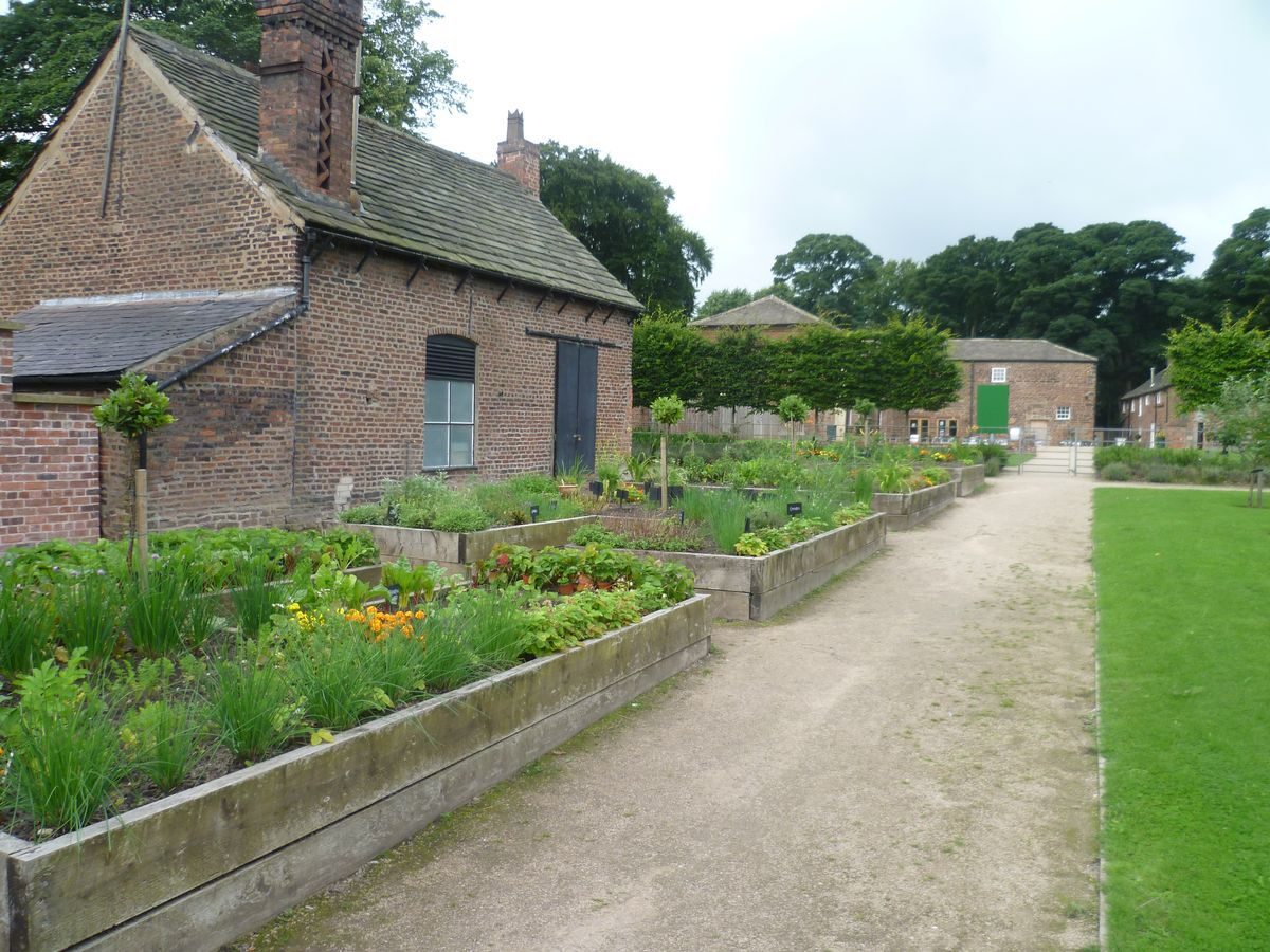
A brick-walled kitchen garden is situated immediately north of the Hall. It is shown on the 1822 map marked 'Garden'. The south wall has been partially demolished. It appears to be on the site of the north wall of the walled garden shown on the west side of the Hall in the painting of c 1710 (guidebook). The north wall of the kitchen garden has a centrally placed doorway with a Gibbs-style stone surround, probably of C18 date. The west wall survives and has a large arched opening and other secondary doorways. The 1928 map shows a small glasshouse in the garden, which is shown as an orchard. It also shows a further walled garden to the north, also planted as an orchard, in an area marked 'paddock' on the 1822 map. This area is now (1997) in use as a car park.
Maps
- C Greenwood, The County Palatine of Lancaster, 1818
- R Beesley, Plan of Lands called Astley Hall Estate or Astley Hall Demesne situate in the Parish of Chorley in the County of Lancaster, 1822, (Lancashire Record Office: DDX/985)
- OS 6" to 1 mile:
- 1st edition surveyed 1844-7
- 2nd edition published 1912
- OS 25" to 1 mile:
- surveyed 1893
- 1928 edition
Description written: April 1997 Amended: June 1998
Register Inspector: CEH
Edited: March 1999, May 2022
- Visitor Access, Directions & Contacts
Telephone
01257 515151Website
https://astleypark.co.uk/Access contact details
Astley Hall is currently closed for renovation work.
The park is open. The public toilets at the Farm House & Coach House are open 9am – 4pm daily, Pavilion toilets are open 10am until 2pm.
The Kiosk at the pavilion is open 10am – 4pm (Monday – Sunday)For more information visit the Astley Hall website.
Directions
West of Chorley town centre, off the A581 Chorley/Southport road. Well signed.
- History
The following is from the Register of Parks and Gardens of Special Historic Interest. For the most up-to-date Register entry, please visit The National Heritage List for England (NHLE):
15th - 16th Century
Astley Hall was the home of the Charnock family from the 15th century, and it became their principal residence in 1575.
17th Century
From the Charnock family it passed through marriage to the Brooke family in 1653 and to the Towneley-Parkers in 1787.
20th - 21st Century
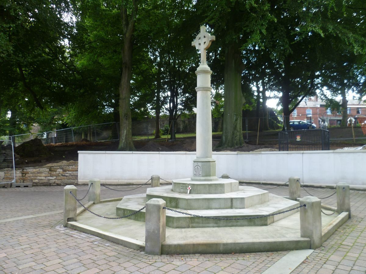
Reginald Tatton inherited in 1906. He conveyed the Hall and park to Chorley Corporation in 1922 who dedicated it as a War Memorial in accordance with his wishes.
The site remains in use as a public park. The park is open but currently the hall is closed for renovation work. (2022)
- Associated People
- Features & Designations
Designations
The National Heritage List for England: Register of Parks and Gardens
- Reference: GD1940
- Grade: II
The National Heritage List for England: Listed Building
- Reference: Astley Hall
- Grade: I
Style
English Landscape Garden
Features
- Flower Bed
- Lawn
- Lake
- Tree Belt
- House (featured building)
- Boundary Wall
- Description: At the south-east corner of the site the boundary is formed by a wall surmounted by lengths of railing between evenly spaced stone piers for a distance of about 100 metres along the A6, Park Road.
- Earliest Date:
- Latest Date:
- Boundary Wall
- Description: At the extreme south-east corner of the site there is a roughly 30 metre section of older walling, possibly of 19th- or 18th-century date, which forms part of the southern boundary.
- Earliest Date:
- Key Information
Type
Park
Purpose
Recreational/sport
Principal Building
Education
Survival
Extant
Hectares
43
Open to the public
Yes
Civil Parish
Astley Village
- References
References
- {English Heritage Register of Parks and Gardens of Special Historic Interest}, (Swindon: English Heritage, 2008) [on CD-ROM] Historic England Register of Parks and Gardens of Special Historic Interest
- Harris, J., {The Artist and the Country House} (London: Russell Chambers, 1979), plate 152 The Artist and the Country House
- Hartwell, Clare and Pevsner, Nikolaus {The Buildings of England: Lancashire : North} (London: Yale University Press, 2009) The Buildings of England: Lancashire : North
- {Victoria History of the County of Lancashire} ([n.p.]: [n.pub.], Volume 6, 1911), pp. 136-40 Victoria County History: Lancaster, Volume 6
- Vol 5, Morris, F. O., (1866-80), pl 5 A Series of Picturesque Views of the Seats of the Noblemen and Gentlemen of Great Britain and Ireland
- Farrer, W, and Brownbill, J., (1911), pp 136-40 The Victoria History of the County of Lancashire Vol 6
- (8 July 1922), pp 16-21 Country Life, 52
- Colvin, H., (1995), p 1031 A Biographical Dictionary of English Architects 1530-1830