
Introduction
Woodchester Park has the remains of an extensive 18th-century landscaped park of around 400 hectares, with a 19th-century mansion near the western end. One of the Repton's sons was involved. Gilpin's involvement is uncertain.
Terrain
The registered park occupies almost the whole of the Inchbrook valley.
The following is from the Register of Parks and Gardens of Special Historic Interest. For the most up-to-date Register entry, please visit The National Heritage List for England (NHLE):
C18 and C19 landscape park exploiting valley setting, and remains of terraced walks and other garden features, associated with a country house uninhabited since the earlier C19.
LOCATION, AREA, BOUNDARIES, LANDFORM, SETTING
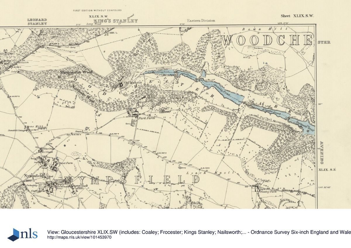
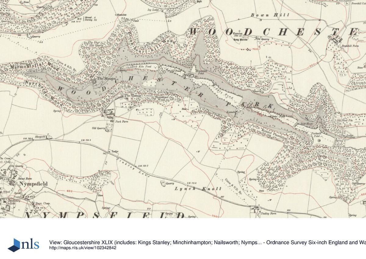
The straggling settlement of Woodchester run along the west side of the north/south Nailsworth valley, along the bottom of which runs the A46 from Stroud, c 4km to the north, to Bath. Woodchester Park and its Mansion occupy the subsidiary Inchbrook valley which opens off its west side. The registered park (c 400ha) occupies almost the whole of the Inchbrook valley, extending c 4km west to the B4066 from Stroud to Dursley which runs across the head of the valley and off which there is the principal modern access to the park and Mansion.
ENTRANCES AND APPROACHES
The modern visitor to the park or Mansion approaches the site from the west, and there is a car park off the unclassified road spurring south-east off the B4066 c 1km north of Nympsfield. This entrance is c 200m south-east of one of the two main historic entrances to the park, marked by a gateway with C18 stone piers with the Ducie coat of arms topped with ball piers. Some 300m to the east of the gateway is Scar Hill, a two-storey stone lodge of c 1860 by Benjamin Bucknall, the architect of the Mansion. From here the drive continues its descent through woods into the valley bottom, the Mansion lying 1km to the east. There is also an approach from the east end of the valley, along what is now a track from the Nympsfield Gates, c.2.5km east of the Mansion. The lodge here, presumably that noted in the sale particulars of 1921 (LUC 1995) as burnt out, has been demolished. A cottage with a gothic entrance to its porch stands south of the kitchen garden and Park Farm on the south boundary of the site; this appears on the Ordnance Survey as a lodge.
PRINCIPAL BUILDING
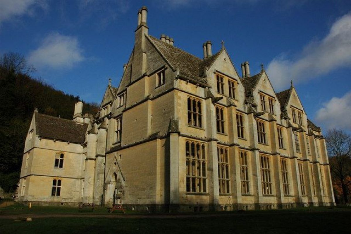
The lodge built by George Huntley c 1610 and probably used as a family house was replaced c 1735 by a new house. In 1797 the house appeared to be classical in design (VCH 1976) with a three-storey centre block and lower, balancing, wings. In the years before 1825 substantial additions were made by John Adey Repton (1775-1860) including library, dining and breakfast rooms, and a conservatory. After William Leigh purchased the estate in 1846 he followed the advice of A W N Pugin and demolished this house, Spring Park, and in the mid 1850s began the construction of a new one, the Mansion, on its site. The architect - Leigh's partnership with Pugin having broken down - was Benjamin Bucknall (d 1895), a follower and later friend and translator of the French architectural writer Viollet-le-Duc (1814-79). It is of stone, and in a blend of the grander Cotswold style with the Gothic, with a chapel in the C14 style. Building work stopped c 1870 with the house still incomplete. Parts of the shell are roofed, parts not.
North and north-east of the Mansion, terraced into the valley side behind and above it, are the ruins of service and stables buildings. Some of these may have been linked by a tunnel which runs beneath the garden terraces (see below).
GARDENS AND PLEASURE GROUNDS
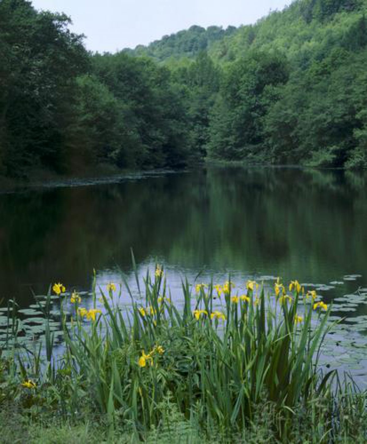
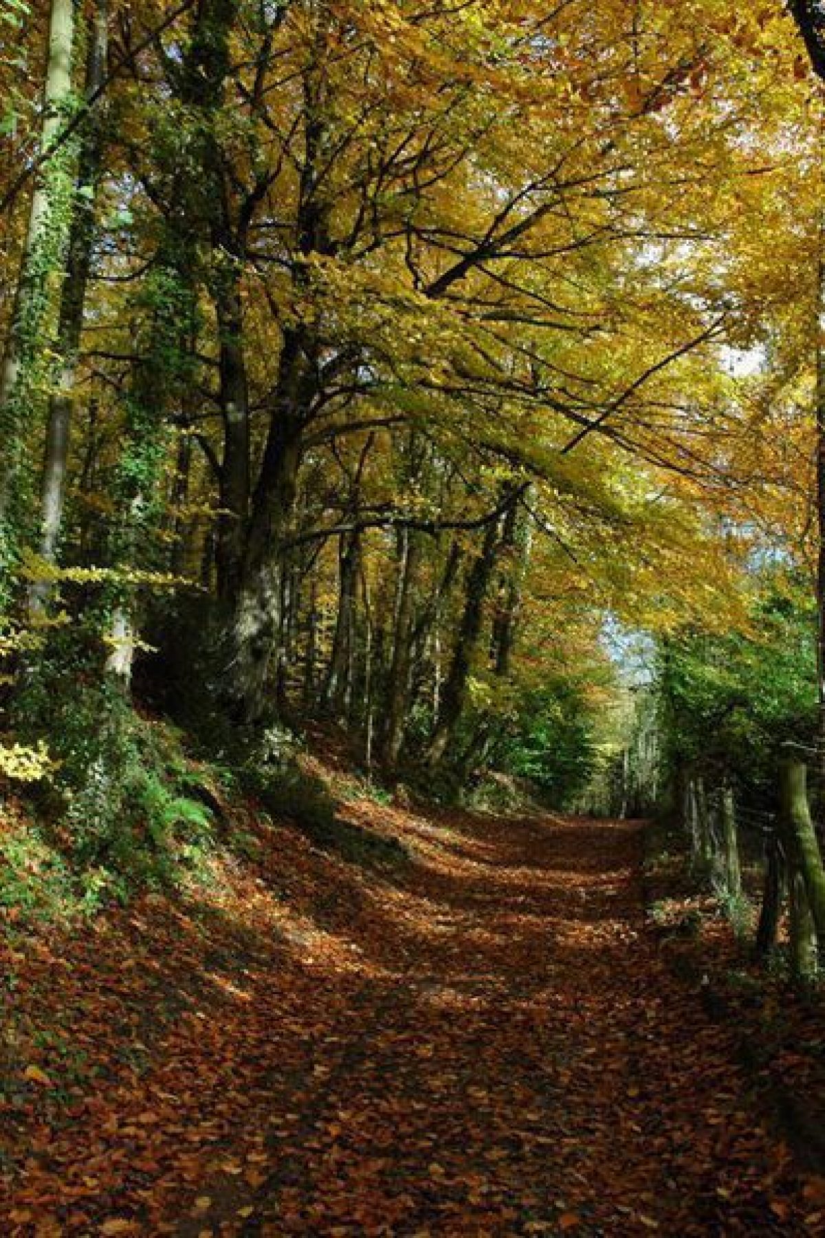
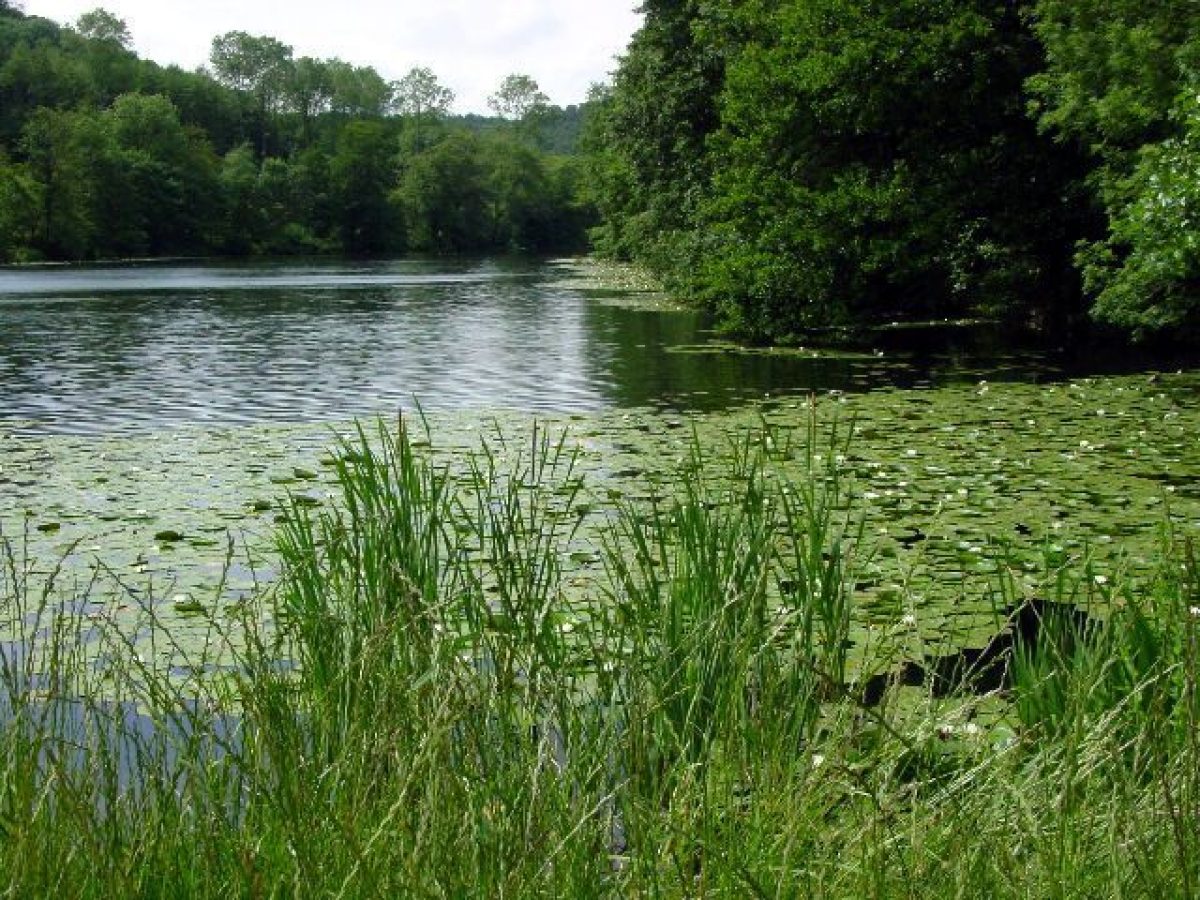
The Mansion now stands with woodland behind (to the north), with the pasture ground of the valley bottom sloping gently away to the south. The main views from the Mansion, at ground level, are south across the valley and east down the valley to Brick Kiln Pond. In the woodland north-east of the Mansion a flight of terraces, two of them fairly massive, runs along the side of the valley for c 150m to a small side valley. The terraces are shown on the estate plan of 1782, at which date one of them carried the drive from the east entrance to the park. The terraces continue as terraced contour paths around the sides of the side valley, wherein lay the Italian Garden laid out in the early C19 (see below). Woodland clearance in the late 1990s exposed some features of this: a central circular fountain basin; the collapsed stone walls at the head of the valley of a seat, presumably the Temple noted in 1843 (see below); and against the south-west side of the valley an icehouse. Among the C20 commercial woodland were stumps and other remains of redwoods and Wellingtonia, as well as much box, laurels, and also some syringa. The terrace paths continue east of the side valley, part of the complex and lengthy network of paths and rides which allowed enjoyment of the park.
Formal gardens north-west of the house may have been laid out in the earlier C18 at the time the house was rebuilt. Spyers' survey of 1782 recorded the Best and Canal Gardens, the latter with canal and circular pool running north-east to the west end of Brick Kiln Pond, which along with the old kitchen garden and orchards amounted to 7ha. By 1802 only 1ha of garden remained next to the house, and by this date or soon after the canal and circular pool had been infilled. Whether any garden works followed Humphry Repton's visit to Woodchester in 1809 is unknown, and it would seem probable that the Italianate Garden north-east of the house was made somewhat later, perhaps in the early 1820s when Repton's son was at work on the house. Sale particulars of 1843 (LUC 1995) refer to 'Terrace Walks of great extent ... a Temple adorns a different spot, which overlooks the Italian Gardens and fountains playing, with the ornamental woodland in the foreground'.
PARK
The park occupies the whole of the Inchbrook valley, and is c 4km long from east to west and up to 1km wide. Lengthy sections of its C17 and later wall survive, albeit often in poor condition. The Mansion stands on the north side of the valley floor c 1km from the east entrance. In the C18 and C19 the valley floor was grassland with specimen trees, while the upper slopes of the valley sides were heavily wooded. Commercial woodland greatly encroached on the former grassland in the mid C20 but in the late 1990s is beginning to be cut back and the open aspect and views along the valley bottom re-established. Some mature and over-mature specimen trees do survive in the valley bottom, especially close to the Mansion, notably several Luscombe oaks (perhaps of c 1810).
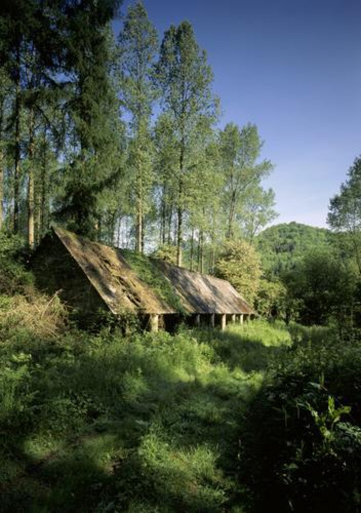
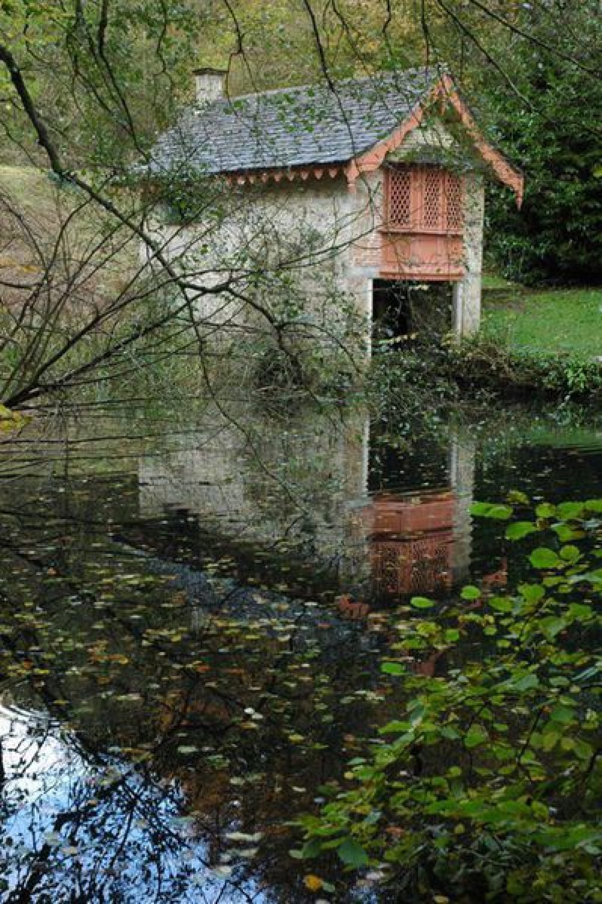
The main feature of the valley is the chain of five ponds along its bottom, retained by massive dams. The ponds were already in existence by 1782 (estate plan). From the west these are Brick Kiln Pond, Old Pond, Middle Pond, Kennel Pond, and Parkmill Pond. The smaller, triangular Honeywell Pond lies north-east of the dam, between Old and Middle Ponds. At the west end of Brick Kiln Pond, close to the site of the C18 circular pool in the Canal Garden, are the ruinous remains of a cascade. At the west end of Middle Pond is an ornate, cottage-like, early C19 boathouse (listed grade II), with a first-floor room with fireplace. South of the east end of the same pool is an open-fronted agricultural building, C18 or C19, and probably for cattle. This is all that remains of the kennels.
The terraced walks and rides which begin at the Mansion once extended around the whole valley, and sections are still followed by tracks. Restoration works in the later 1990s began to discover seats, usually stone benches, placed to enjoy views. One stands on the north bank of Brick Kiln Pond, while two are set on the north crest of the valley side north-west and north-east of Honeywell Pond. That to the north-west, backed by yews, has '1749' carved onto the stone bench. Standing on the crest of the valley 600m north-east of the Mansion is the Tower (or Castle, listed grade II), a crenellated tower house of c 1720. As well as being an eyecatcher it probably served as a summerhouse, only later being converted to residential use.
A park noted at Woodchester from 1311 which lay near the church and manor was abandoned soon after 1600 when George Huntley began to create a demesne, including a new deer park and warren, in the Inchbrook valley. This park, which was walled, included much of registered area, and was composed of what had previously been common and open-field land. In the early C18, when it extended into neighbouring parishes, Woodchester Park (also known as Spring Park) was said to be the largest in the county with a circumference of 11km. Its seclusion and lofty beechwoods were admiringly noted in Rudder's Gloucestershire (1779). In September 1782 Lancelot Brown visited Woodchester, and immediately afterwards despatched his surveyor and assistant John Spyers to make a survey. The overall charge for the visit and survey was £20 7s. 6d. No further involvement by Brown is known before his death in February 1783. Within the next twenty years there were dramatic changes at Woodchester: the formal gardens were largely removed, while in the park by 1800 woodland had been cleared to provide vistas up the side valleys. Humphry Repton was at Woodchester in 1809, although it is unknown if he made any suggestions for its improvement. Descriptions of the park in the early and mid C19 are highly complimentary, speaking of the miles of walks and drives, ornamental woods, lakes, and deer. The estate began to be broken up in the 1920s and timber sales, which had begun c 1905, accelerated in the 1930s. In the 1950s, by which time the estate was fragmented, there was further felling followed by large-scale planting of commercial woodland in the park by Fountain Forestry acting for a consortium. In the late 1990s clearance of the more intrusive of this woodland began under the National Trust.
KITCHEN GARDEN
By the time of Spyers' survey of 1782 there was already, in addition to the old kitchen garden near the house, the new one on the valley top, c 250m south-east of the Mansion. In the 1840s and 1850s, while work was proceeding on the Mansion, The Cottage (listed grade II), formerly a gardener's or labourer's house on the north side of the garden, was converted into the Leigh family's residence. In 1874, the year after he inherited the estate, William Leigh extended this into a sixteen-bedroomed house to designs by Bucknall. The interior of this garden, surrounded by brick and stone walls, is grass.
REFERENCES
S Rudder, A New History of Gloucestershire (1779)
Country Life, 145 (6 February 1969), pp 284-8
Victoria History of the County of Gloucestershire XI, (1976), pp 294-8
D Verey, The Buildings of England: Gloucestershire The Cotswolds (2nd edn 1979), pp 485-8
J Harris, The Architect and the British Country House 1620-1920 (1985), pp 198-9
Woodchester Park: Historic Landscape Survey & Management Plan, (Land Use Consultants 1995)
N Kingsley and M Hill, The Country Houses of Gloucestershire, Volume Three, 1830-2000 (2000)
Maps
Estate map, 1782, (D1011 P8), (Gloucestershire Record Office)
Estate map, c 1790 (D1011 P9), (Gloucestershire Record Office)
Estate map, c 1800 (D1011 P10), (Gloucestershire Record Office)
Estate map, 1859 (D1011 P11), (Gloucestershire Record Office)
OS 6" to 1 mile: 1st edition surveyed 1881, published 1885-7
Description written: April 1999 Amended: May 2001
Register Inspector: PAS
Edited: April 2003
- Visitor Access, Directions & Contacts
Telephone
441452814213Access contact details
The gardens are open daily from 9 am until dusk throughout the year.
Directions
The gardens are off the B4066 4 miles south-west of Stroud.
Owners
The National Trust
Heelis, Kemble Drive, Swindon, SN2 2NA
- History
The following is from the Register of Parks and Gardens of Special Historic Interest. For the most up-to-date Register entry, please visit the The National Heritage List for England (NHLE):
www.historicengland.org.uk/listing/the-list
HISTORIC DEVELOPMENT
In 1580 George Huntley (d 1622) succeeded to the Woodchester estate. During the course of the next thirty years the old manor house in Woodchester village was sold in favour of an estate, park, and lodge which he put together in the Inchbrook valley. In 1631 his son William conveyed the manor of Woodchester to Sir Robert Ducie, bt (d 1634), from whom it passed to his son Sir Richard (d 1657). His heir was his brother Sir William, created Viscount Downe (d 1679), who was succeeded by his niece Elizabeth, wife of Edward Moreton (d 1687). On her death in 1703 Woodchester passed to her son Matthew Ducie Moreton (d 1735), created Lord Ducie of Moreton in 1720. In his time the lodge was replaced by a new house, probably associated with which were formal gardens. The estate then passed to his eldest son of the same name who in 1763 became Lord Ducie of Tortworth. He died in 1770, being succeeded by his nephew Thomas Reynolds, Lord Ducie, who later assumed the name Moreton. In 1782 Lancelot Brown (1716-83) was brought in and Woodchester surveyed but no changes, at least directly, seem to have followed. On Lord Ducie's death in 1785 the estate passed to his brother Francis (d 1808), who also changed his name to Moreton. Francis was succeeded by his son Thomas Reynolds Moreton, created Earl Ducie in 1837, in whose time the house was enlarged and the gardens and park reworked, perhaps in part due to suggestions by Humphry Repton (1752-1818) who stayed at Woodchester in 1810. In 1840 the first Earl was succeeded by his son Henry George Francis. In 1845 he sold the estate to William Leigh, under whom Woodchester became a centre for Roman Catholicism and who commissioned a new mansion, never completed, to replace the old house. He died in 1873, his son William in 1906, and in 1922 the latter's son Henry Vincent Leigh sold it to J H Tooley. During the remainder of the C20 the estate changed hands several more times and was subdivided. In 1986 the Mansion and c 9ha were acquired by Stroud District Council and in 1992 leased to the Woodchester Mansion Trust, while in 1994 the park was purchased by the National Trust. Both house and landscape were under restoration in the later 1990s.
Period
18th Century (1701 to 1800)
- Associated People
- Features & Designations
Designations
The National Heritage List for England: Register of Parks and Gardens
- Reference: GD1781
- Grade: II
Plant Environment
- Environment
- Water Garden
Features
- Mansion House (featured building)
- Earliest Date:
- Latest Date:
- Lake
- Description: A chain of five lakes.
- Key Information
Type
Park
Purpose
Ornamental
Plant Environment
Environment
Principal Building
Domestic / Residential
Period
18th Century (1701 to 1800)
Survival
Part: standing remains
Hectares
400
Open to the public
Yes
Civil Parish
Woodchester
- References
References
- Verey, D., {The Buildings of England: Gloucestershire 1, The Cotswolds} (London: Penguin, 1970), pp. 485-8 The Buildings of England: Gloucestershire 1: The Cotswolds
- Kingsley. N., and M. Hill, {The Country Houses of Gloucestershire, Volume 3, 1830-2000} (Cirencester: Phillimore, 2000) The Country Houses of Gloucestershire, Vol. III 1830-2000
- {English Heritage Register of Parks and Gardens of Special Historic Interest}, (Swindon: English Heritage, 2008) [on CD-ROM] Historic England Register of Parks and Gardens of Special Historic Interest
- Herbert, N.M. {Victoria County History: Gloucester, Volume 11} ([n.p.]: Oxford University Press, 1976), pp. 294-8 Victoria County History: Gloucester, Volume 11
- Nicholas Pearson Associates {Woodchester Mansion Parkland Plan} (2009) Woodchester Mansion Parkland Plan
- Land Use Consultants {Woodchester: Historic Landscape Survey and Management Plan} (1995) Woodchester: Historic Landscape Survey and Management Plan
- Related Documents
-
CLS 1/353
Historic Landscape Survey and Management Plan - Digital copy
LUC - 1995
-
CLS 1/353