Introduction
Wentworth Woodhouse has gardens, pleasure grounds and the remains of a landscape park. Features include a set of notable early to mid-18th-century monuments and follies within and around the edge of the park.
Terrain
The site is on elevated land which drops down to the south.The following is from the Register of Parks and Gardens of Special Historic Interest. For the most up-to-date Register entry, please visit the The National Heritage List for England (NHLE):
www.historicengland.org.uk/listing/the-list
Gardens of the 18th and 19th century and a park remodelled by Humphry Repton in the early 1790s, with a set of notable early to mid-18th-century monuments and follies within and around the edge of the park.
Location, Area, Boundaries, Landform and Setting
Wentworth Woodhouse lies immediately south and east of the village of Wentworth in a setting with rural elements which lies between the conurbations of Barnsley, Sheffield and Rotherham. The c 700ha site is on elevated land which drops down to the south and the boundaries are formed by Cortworth Lane and Hague Lane to the north and north-west, Town Lane between Greasbrough and Wingfield to the south, with other boundaries dividing the park from agricultural land. The boundary is largely walled.
Entrances and Approaches
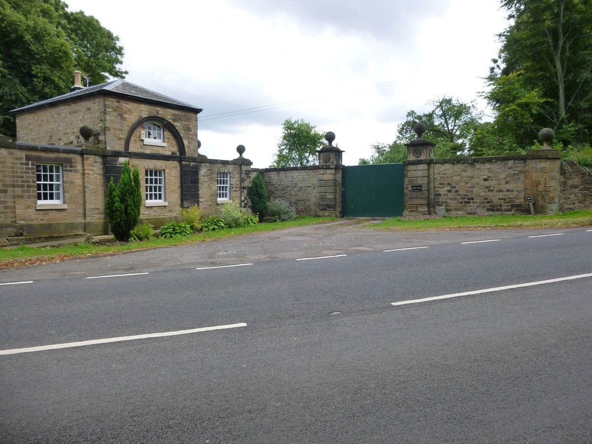
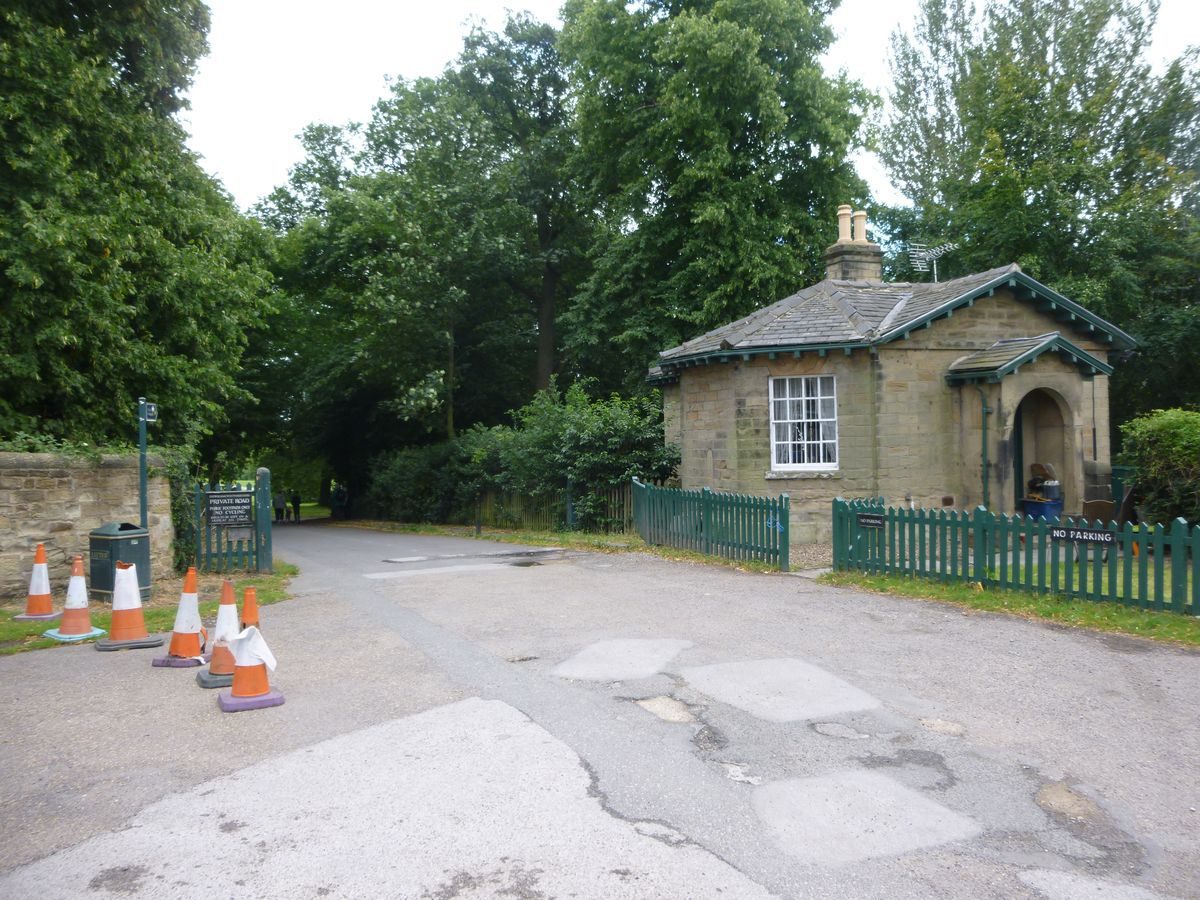
There are a number of entrances, some with lodges. North Lodge (listed grade II) is on Cortworth Lane and a drive leads south-east and south from it to the east front of the house. It is aligned with a route running north through the Needle's Eye (early C18, altered, possibly by Humphry Repton late C18, listed grade II), a folly which lies c 1.5km north of the house. The route continued north from the Needle's Eye through Rainbrough Park and outside the registered area, where it survives as a track, to the site of Rainbrough Lodge on the north side of the estate.
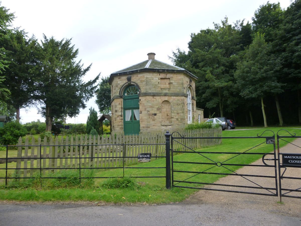
On the north-west side of the site Doric Lodge (early C19, listed grade II), in the form of a Doric temple, is opposite a clairvoie on the west side of Hague Lane which gives long-distance views to the west. A drive leads east from it to a doorway in the bastion wall which divides the garden from the park. On the north-east side of the site Mausoleum Lodge (probably John Carr c 1790, listed grade II) has a drive leading south-west to the Mausoleum (see below) and another drive leading north-west to the east front of the house. There are other entrances from Cinderbridge Road and from Church Street in Greasbrough. The approaches from the south give magnificent views of the house within the park.
Principal Building
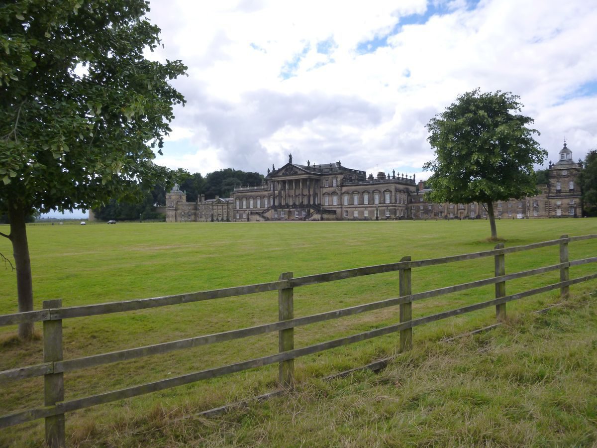
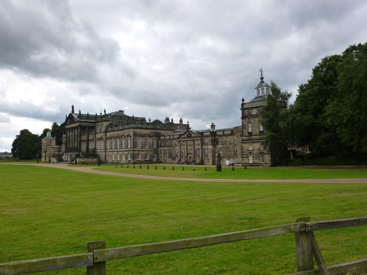
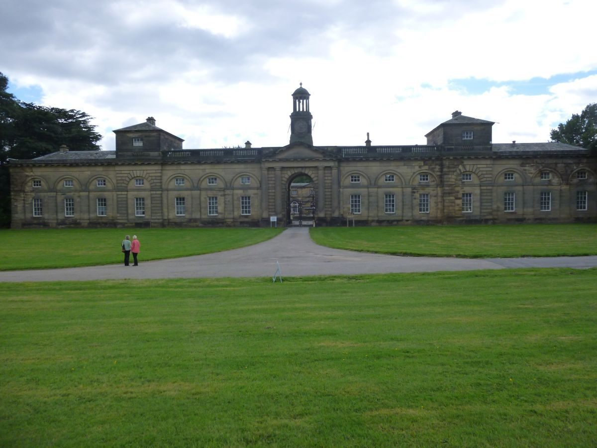
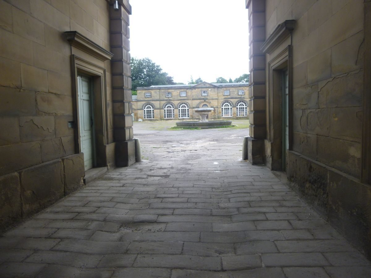
Wentworth Woodhouse (listed grade I) was built on the site of a medieval hall which had been replaced by a house of 1630 built by the first Earl of Strafford. The present building was erected in two campaigns, with the west front being erected 1725-34, retaining elements of the 1630 house, and the east front, to designs by Henry Flitcroft, in the period 1734 to c 1760. The east front has stylistic affinities with Wanstead (qv), the first great Palladian house in England, and has the longest front, stretching for more than 180m, of any English country house. It lies on a platform in the north-west corner of the park and the east front commands extensive long-distance views. A stable block and riding school (listed grade I) of 1758 by John Carr of York (1723-1807) is situated c 300m north-west of the house. Some 100m to the north-west of this the home farm complex includes buildings of C18 date which are listed grade II.
Gardens and Pleasure Grounds
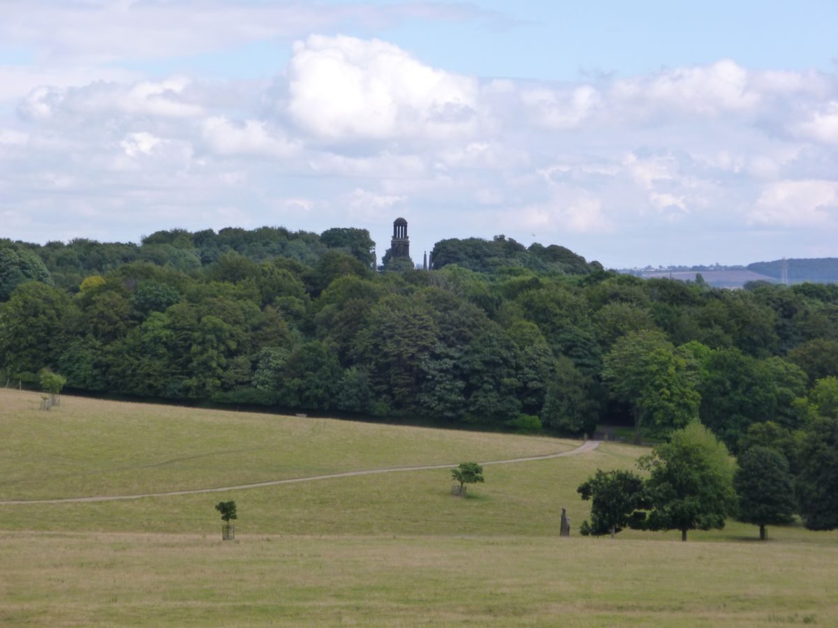
On the east side of the house there is a paved walkway with sets of stone obelisks at various points along it. Lawns are divided from parkland by a C20 fence. Extensive views over the park include glimpses of the Mausoleum (John Carr 1784-8, listed grade I) c 1.9km to the south-east and the Hoober Stand (Henry Flitcroft 1748, listed grade I), an unusual structure with offset cupola giving the appearance of a tumbling pyramid or obelisk situated c 1.1km to the north-east, beyond the park wall. It was built to symbolise the union of England, Scotland and Ireland and to commemorate the defeat of the Jacobites in 1745. A note on a set of estate maps of 1778 by W Fairbank (private collection) states that a hill was removed on the east side of the house to 'extend the lawn' thus improving views from this side of the building.
A terrace (c 1735, listed grade II) supported by a substantial stone retaining wall with a parapet runs from the south side of the house to a point c 70m south, where there is a bastion. The terrace then turns and runs westwards. In the centre there is a projecting platform and at the west end another bastion which is the site of the Ionic Temple (Henry Flitcroft c 1735, listed grade II*). There are extensive long-distance views from the south terrace within which the Keppel Column (John Carr 1773, listed grade II), c 2km to the south and beyond the park wall, is prominent. The column was raised in height in 1778 and named in honour of Admiral Keppel who was acquitted of charges arising from the English defeat by the French Navy in 1778.
The gardens on the west side of the house are divided from the park to the north by a ha-ha (listed grade II) which runs between house and stable block. The Camellia House (listed grade II*) situated c 400m south-west of the house is an early C19 remodelling of an C18 building. Much of the area west of the house was subject to opencast mining in the mid C20. The area affected extends from c 200m north of the terrace to a point only a few metres from the south-west side of the house. The 1905 OS map shows western pleasure grounds with a lawn immediately west of the house and woodland with sinuous paths running through it.
The area north and west of the Camellia House and south of the kitchen garden has a complex of informal water, rock and sunken gardens which are on the site of a quarry and were formed in the C19 and C20 incorporating and reusing C17 and C18 elements. The gardens are overlooked from the north by a terraced walk running alongside the south kitchen garden wall and from the east by a terraced walk running south from the south-east corner of the kitchen garden, as shown on the 1849 and 1905 OS maps. The east walk leads to a platform from which the garden, to the west, can be partially viewed. Beneath the platform there is a cascade of naturalistic and worked stones.
Close to the south end of the east walk is the Bearpit (listed grade II), c 500m south-west of the house. This consists of a domed structure set into a bank with an entrance leading to a curved tunnel and spiral steps down to a chamber with two vaulted cells. An entrance from the lower chamber into the sunken garden incorporates a C17 doorway taken from the earlier house on the site. It opens to a garden with a pond, shown on the 1849 OS map. Paths lead north through clipped hedges to a C20 water garden in an area shown with trees and winding paths on the 1905 OS map. Paths lead up to the west into an area of lawns divided by clipped hedges.
An engraving by John Cole of c 1728 (reproduced in Houlston 1998) shows extensive formal gardens around the house including, on the west side, four obelisks set in lawns and formal geometrical gardens. The obelisks are shown on the 1788 map and appear to be the only survivors of the scheme shown by Cole. These were commented upon by Horace Walpole in 1756 who stated that the 'bowling green behind the house has no less than four obelisks, and looks like a Brobdinag ninepin-alley' (quoted in Houlston 1998).
Park
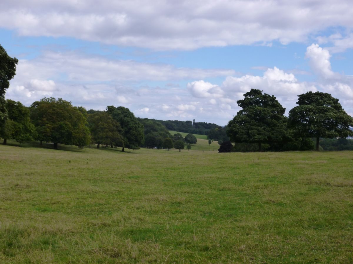
Extensive areas of parkland lie to the south and east of the house. The park is a mixture of pasture and arable land with scattered trees and areas of woodland. Planting on the north side of the house may represent the remains of avenues shown in Cole's 1728 view and on estate maps of c 1760 and 1778, remnants of which are shown on the 1849 OS map. The west side of the park is sheltered by Trowles Wood and Upper Ox Close Wood and the edge of Raspberry Plantation. To the south Shepherd's Plantation, Squirrel Castle Plantation and Morley Plantation shelter the boundaries. An area of woodland c 450m south-east of the house, called Temple Hill Plantation, is the site of the Doric Temple (C18, listed grade II). The area to the south-east between the house and Mausoleum Plantation is called the Deer Park.
Close to the centre of the park Morley Pond and Dog Kennel Pond are linked by a weir which is crossed by a causeway (C18, listed grade II) carrying a drive. The ponds are shown on the 1771 county map in approximately their present form, though their sinuous outlines may owe something to Repton's late C18 works. Rockingham Wood, which lies c 200m south of Morley Pond, has a ha-ha wall along its west side with a central projection and a curving projection at the south-west corner, recalling the bastion wall of the south terrace.
The system of drives and rides within the park gives views of the house, the lakes and the various monuments and follies within and outside the park, in particular the Mausoleum, the Hoober Stand and the Keppel Column. The Needle's Eye has been partially obscured by trees. The changing appearance of the monuments in distant views is an important attribute of the park and reflects a tradition which began with Thomas Watson Wentworth in the 1740s and was continued by the fourth Earl Fitzwilliam who erected the Mausoleum in memory of his uncle, the second Marquis of Rockingham, in 1784-8.
The park was remodelled to designs by Humphry Repton (1752-1818) who began work for Lord Fitzwilliam in 1790 and commented on the lack of tree cover and the fact that the house was surrounded by 'coarse grass and boulders' (quoted in Hyams 1971). This was remedied and the contours of the surrounding landscape were softened by ambitious earth-moving operations. The Red Book prepared for Wentworth Woodhouse has been lost; however the sketches reproduced in Repton's Observations on Landscape Gardening (reproduced in Houlston 1998) show views of Temple Hill Plantation and the Doric Temple suggesting that Repton intended to exaggerate the contours of the hill and plant it.
Repton's landscape was damaged by opencast mining which began in the 1940s and continued until the 1960s. The affected parts are the land between the south terrace and Trowles Wood, areas between the house and Temple Hill Plantation which extended to the east as far as Cortworth Field Plantation on the north-east boundary, a large area east and south of Rockingham Wood known as Middle Common and Upper Common and land along the south-east boundary north of the drive from Cinderbridge Road. Restoration, including the replanting of some of the woodland, followed the mining. The character of the landscape was altered as the levels were not restored in every case and replanting was not informed by an appreciation of vistas and views. The subtleties of the views, particularly those towards Temple Hill and from the south terrace, have been lost. Planting between Trowles Wood and Shire Oaks Wood has closed a vista which was evident on the 1778 map and suggested on Cole's view.
Kitchen Garden
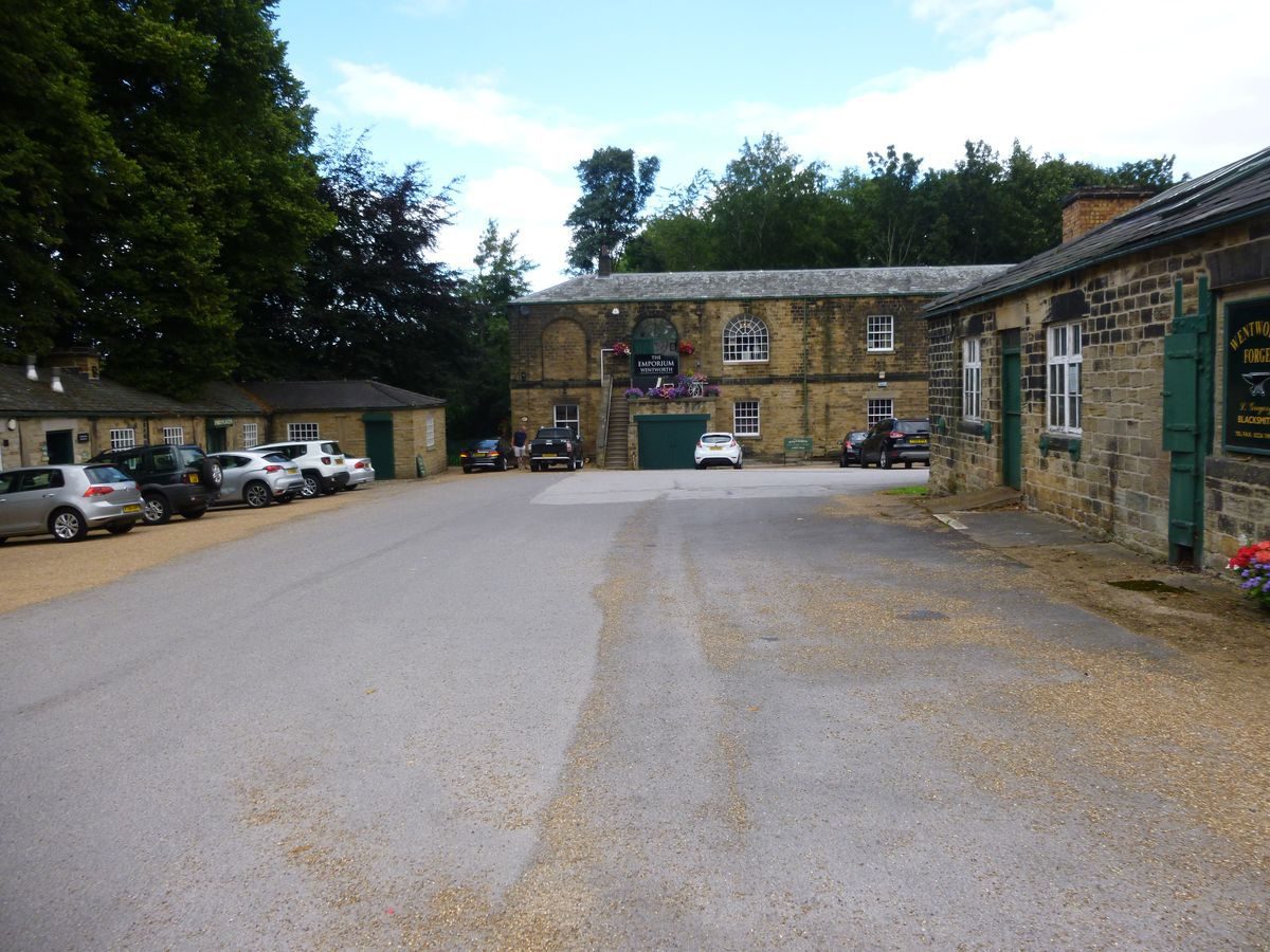
The kitchen garden lies c 550m west of the house and consists of a brick-walled enclosure with entrances with stone architraves. The garden is in use as a garden centre (1998) in connection with which there are a number of C20 buildings within it. The 1778 map shows a kitchen garden and gardener's house c 500m to the east of the house. They were rebuilt on the present site in 1786 probably for the convenience of transporting manure from the home farm.
REFERENCES
D Stroud, Humphry Repton (1962), pp 53-4
N Pevsner, The Buildings of England: Yorkshire The West Riding (1967), pp 539-45
E Hyams, Capability Brown and Humphry Repton (1971), pp 273-4
Wentworth Woodhouse, guidebook, (Sheffield Polytechnic 1979)
Country Life, 173 (17 March 1983), pp 624-7; no 4 (24 January 1991), pp 60-3
S Hird, The Wentworth Monuments (1994)
Follies 9, no 1 (1997), pp 16-18
I D Houlston, Wentworth Woodhouse Landscape History Study (1998) [in EH file]
Maps
Estate Map, c 1760 (private collection)
T Jefferys, County Map, 1771
OS 6" to 1 mile: 1st edition surveyed 1849
OS 25" to 1 mile: 2nd edition published 1905
Description written: September 1998
Edited: November 1999
- Visitor Access, Directions & Contacts
Telephone
01226 749639Access contact details
Some areas of the grounds are open to the public. Please see: http://www.wentworthgardencentre.co.uk/location/historic-gardens/
- History
The following is from the Register of Parks and Gardens of Special Historic Interest. For the most up-to-date Register entry, please visit the The National Heritage List for England (NHLE):
www.historicengland.org.uk/listing/the-list
HISTORIC DEVELOPMENT
The estate was acquired by William de Wyntword by his marriage to Emma Wodehous in the 13th century. It remained within the family and Thomas Wentworth, who succeeded to the estate in 1614, was created Baron Raby and Earl of Strafford in 1640. The second Earl of Strafford died in 1695 without issue and the estate passed to his nephew, Thomas Watson. Watson's son, Thomas Watson Wentworth, was created Lord Malton in 1728 and he became Baron Rockingham in 1746 and subsequently Marquess of Rockingham. The estate passed to the Fitzwilliam family in the late 18th century and remained in the family until 1948 when part of the house and grounds were sold to Barnsley Education Committee and subsequently to Sheffield Polytechnic. The house and part of the gardens were sold to a private owner in the late 20th century and the site remains in divided private ownership (1998).
- Associated People
- Features & Designations
Designations
The National Heritage List for England: Register of Parks and Gardens
- Reference: GD2167
- Grade: II*
Features
- Maze
- Heated Wall
- Planting
- Description: Japanese garden.
- Folly
- Gardens
- Parkland
- Key Information
Type
Estate
Purpose
Ornamental
Principal Building
Domestic / Residential
Survival
Extant
Hectares
700
Open to the public
Yes
Civil Parish
Wentworth
- References
References
- {English Heritage Register of Parks and Gardens of Special Historic Interest}, (Swindon: English Heritage, 2008) [on CD-ROM] Historic England Register of Parks and Gardens of Special Historic Interest
- Stroud, H {Humphry Repton} (London: Country Life, 1962) 53-4 Humphry Repton
- Pevsner, N., {The Buildings of England: Yorkshire The West Riding} (Harmondsworth: Penguin Books, 2nd edition 1967), pp. 539-45 The Buildings of England: Yorkshire The West Riding
- {Wentworth Woodhouse Landscape Conservation Plan} (1997) Wentworth Woodhouse Landscape Conservation Plan