Search for the name, locality, period or a feature of a locality. You'll then be taken to a map showing results.

Stracathro House (also known as Stracatherach)

Introduction

Stracathro was a landscaped estate and is now in multiple occupancy. The house and its immediate setting are privately owned, as is the walled garden and its immediate surroundings. The park is in the ownership of the NHS Tayside and the site of Stracathro Hospital.

Stracathro is located on the north of the A90, Aberdeen to Dundee main road just to the south of the Angus county boundary and near Brechin.
This is a site in multiple occupancy, involving three owners. The house and its immediate setting are privately owned, as is the walled garden and its immediate surroundings. The park is in the ownership of the NHS. The agricultural land of the former estate is also in private ownership but does not form part of this record.
Access to the immediate setting of the house was not possible. However, aspects of it in view of the public road have been recorded, as have all the historical data in the public domain. Access to the walled garden and its immediate surroundings was granted and the NHS land is open to the public. Both of these components of the estate were visited and have been recorded in full.
Further details about Stracathro House are available on the Royal Commission on the Ancient and Historic Monuments of Scotland website.
http://orapweb.rcahms.gov.uk/wp/00/WP000766.pdf
http://orapweb.rcahms.gov.uk/wp/00/WP000767.pdf
REFERENCES
1. MAPPED SOURCES
Unless otherwise stated all maps referenced are from the online National Library of Scotland Map Collection
http://maps.nls.uk
1678 (Imprint) – Robert Edward: Angusia Provincia Scotiae sive The Shire of Angus.
Shows Stacathro
1745 (Imprint) – H. Moll: The Shire of Angus or Forfar. Shows Stacathro
1747-55 Roy Military Survey of Scotland shows Strickatro
1776 Taylor & Skinner’s Survey and maps of the roads of North Britain or Scotland
1794 John Ainslie: Map of the County of Forfar or Shire of Angus
1825 John Thomson: Northern Part of Angus Southern Part
1850 James Knox: Map of the Basin of the Tay shows Strickathro
1862 OS 6” to mile published 1865; sheet XX
1862 OS 6” to mile published 1865; sheet XXVII
1862 OS 25” to mile published 1865; sheet XX.14
1862 OS 25” to mile published 1865; sheet XXVII.2
1901 OS 6” to mile published 1903; sheet XX.SW
1901 OS 6” to mile published 1903; sheet XXVII.NW
1901 OS 25” to mile published 1904; sheet 020.14
1901 OS 25” to mile published 1904; sheet 027.02
1922 OS 6” to mile published 1927; sheet XX.SW
1922 OS 6” to mile published 1927; sheet XXVII.NW
1922 OS 25” to mile published 1924; sheet 020.14
1922 OS 25” to mile published 1924; sheet 027.02
1957 OS 1:25,000 (2 ½” to mile) published 1957 sheet NO 66
2. PRIMARY & DOCUMENTARY SOURCES
1792 NAS RHP83 Plan of the estate of Stracathro (available on-line)
1832 NAS RHP44711 Plan of estate of Stracathro. The condition of this plan at NAS is such that it cannot be digitally copied and is not available to the public. A second copy is available in Angus, contact GHSS or Angus Archives.
(NAS Formerly National Archives of Scotland, now National Records of Scotland)
1844 Aberdeen Journal; potential disposal of Stracathro House
1846 Dundee Courier; death of Alexander Cruickshank.
1847 Sale of Stracathro estate Morning Chronicle of April 6 1847.
1937 Aberdeen School of Architecture (1941) – small scale plan elevations by George J. Forrest, 1937. From RCAHMS Architectural notes. Not seen.
2001 The Brechin Advertiser shows details from Buildings at Risk Register
3. HISTORICAL ILLUSTRATIONS & PICTORIAL SOURCES
Where the images from RCAHMS are suffixed ‘CN’, this implies a colour image and is the duplicate of the previous, black and white entry. For example E38801 and E38802CN both have the same description ‘Stracathro House; General view from S’. E38801 is black and white and E38802CN is identical but in colour.
1848 Forfarshire Illustrated – sketch of Stracathro House.
1850c RCAHMS RAB 292/269 Engraving of Stracathro House. Titled 'Stracathro House, Co. Forfar. The seat of Sir James Campbell’. W. Gauci. Stannard & Dixon Lithrs. From ‘Views in Scotland’, an undated collection of engravings, page 269. EAFAS Bibliography.
1853-1908 Aberdeen University Archives – George Washinton Wilson collection; GB 0231 MS 3792/C3540 Stracathro House; View across park to house
1885c RCAHMS AN 3004 PO Print – photographic view by George Washington Wilson
1890c RCAHMS AN 3023 PO Print – photographic view by George Washington Wilson
1890 RCAHMS B 41527 Copy of photograph AN 3023 PO showing general view
1900 RCAHMS AN 1251 Copy of postcard showing general view
1900c Undated photograph of Stracathro House looking SSE across to the house. Cattle in behind a fence at the front circle.
1904 Stracathro House from Around the Ancient City by D.H. Edwards.
1910-1913 RCAHMS DPM 1910/16/1 to 3. Drainage plans. Sketch plans, sections and elevations as existing, showing measurements.
1914 RCAHMS DPM 1910/16/4 Plans and sections showing additions and alterations to house. Plan and section of roof light over entrance hall. Plan of stables. Now available as digital image DP003005.
1920 RCAHMS AN 2649 Stracathro; Copy of postcard showing general view
???? Undated Angus Archives 747/65:7 Postcard of Strcathro House, Brechin. Published by Valentines.
???? Undated Angus Archives 747/65:1 Aerial postcard of Strcathro Hospital. Published by Aerofilms (Aero Pictorial Ltd.)
1962 RCAHMS PA 229/7/25/1 Print showing view from the S of Stracathro Stables with octagonal doocot behind.
1962 RCAHMS H 93992 CS View from the south of the stable at Stracathro with doocot behind.
1962 RCAHMS H 93994 CS View from the southwest of the stable at Stracathro with the top of the doocot in the background.
1964 RCAHMS H 93993 CS View of the south front of the stable at Stracathro with doocot behind.
Undated RCAHMS AN 1380/15 Stracathro House; View of E wing from S
Undated RCAHMS AN 1380/16 Stracathro House; View of E wing from W
1964 RCAHMS AN 514 Stracathro House; View from SW
1964 RCAHMS AN 515 Stracathro House; General view
1964 RCAHMS AN 516 Stracathro House; View from SE
1964 RCAHMS AN 517 Stracathro House; Detail of main entrance portico
1964 RCAHMS AN 518 Stracathro House; Detail of portico
1964 RCAHMS AN 519 Stracathro House; View from N
1964 RCAHMS AN 520 Stracathro House; View from W
1964 RCAHMS AN 521 Stracathro House; View from N Stracathro Page 16 of 42
1964 RCAHMS AN 522 Stracathro House; View of W wing from S
1964 RCAHMS AN 523 Stracathro House; View of E wing from S
1964 RCAHMS AN 524 Stracathro House; View from E
1964 RCAHMS AN 594 Stables; view from SW
1964 RCAHMS AN 595 Stables; view from SW
1964 RCAHMS AN 596 Stables; view from NE
1964 RCAHMS AN 597 Stables; view from N
1964 RCAHMS AN 598 Stables; view from NW
1964 RCAHMS AN 599 Walled garden; general view
1964 RCAHMS AN 600 Walled garden; view from NE
1964 RCAHMS AN 601 Walled garden; view from SE
1964 RCAHMS AN 602 Walled garden; Interior. Detail of door and fire place at Belvedere.
1964 RCAHMS AN 603 Walled garden; Interior. Detail of fire place at Belvedere.
1964 RCAHMS AN 604 Statue east of walled garden
1964 RCAHMS AN 605 Statue east of walled garden
1964 RCAHMS AN 606 Stracathro House, Ornamental Footbridge
1964 RCAHMS AN 607 Stracathro House, Ornamental Footbridge
1964 RCAHMS AN 608 Stracathro House, Ornamental Footbridge
1975 RCAHMS A 10212 Statue east of walled garden
1975 RCAHMS A 10213 Engineer’s House
1975 RCAHMS A 10214 Stracathro House, Footbridge And Flight Of Steps
1975 RCAHMS A 10215 Stracathro House, Footbridge And Flight Of Steps. Detail of steps.
1975 RCAHMS A 10221 Cruick water bridge
1994 GHSS – set of photographs taken in and around the walled garden
2003 RCAHMS E 38801 Stracathro House; General view from S
2003 RCAHMS E 38802 CN Stracathro House; General view from S
2003 RCAHMS E 38803 Stracathro House; General view from SSW
2003 RCAHMS E 38804 CN Stracathro House; General view from SSW
2003 RCAHMS E 38805 Stracathro House; General view from SW
2003 RCAHMS E 38806 CN Stracathro House; General view from SW
2003 RCAHMS E 38807 Stracathro House; Axial view from S
2003 RCAHMS E 38808 CN Stracathro House; Axial view from S
2003 RCAHMS E 38809 Stracathro House; View from SW
2003 RCAHMS E 38810 CN Stracathro House; View from SW
2003 RCAHMS E 38811 Stracathro House; View from SE
2003 RCAHMS E 38812 CN Stracathro House; View from SE
2003 RCAHMS E 38813 Stracathro House; View of portico from S
2003 RCAHMS E 38814 CN Stracathro House; View of portico from S
2003 RCAHMS E 38815 Stracathro House; View of portico from SE
2003 RCAHMS E 38816 CN Stracathro House; View of portico from SE
2003 RCAHMS E 38817 Stracathro House; View of portico showing Corinthian Stracathro Page 17 of 42 capitals and plaster ceiling
2003 RCAHMS E 38818 CN Stracathro House; View of portico showing Corinthian capitals and plaster ceiling
2003 RCAHMS E 38819 Stracathro House; Detail of main entrance
2003 RCAHMS E 38820 Stracathro House; View of E wing from S
2003 RCAHMS E 38821 Stracathro House; View of main block and S landscape with hospital from NE
2003 RCAHMS E 38822 Stracathro House; General view from NE from former tennis court
2003 RCAHMS E 38823 CN Stracathro House; General view from NE from former tennis court
2003 RCAHMS E 38824 Stracathro House; General view from ENE with raised terrace
2003 RCAHMS E 38825 Stracathro House; General view from ENE with raised terrace
2003 RCAHMS E 38826 CN Stracathro House; General view from ENE with raised terrace
2003 RCAHMS E 38827 Stracathro House; View from NW with raised terrace
2003 RCAHMS E 38828 CN Stracathro House; View from NW with raised terrace
2003 RCAHMS E 38915 View of exterior and greenhouses from NE
2003 RCAHMS E 38916 Walled garden; N entrance buildings from W
2003 RCAHMS E 38917 CN Walled garden; N entrance buildings from W
2003 RCAHMS E 38918 Walled garden; N entrance and tower from NW
2003 RCAHMS E 38919 Walled garden; Interior. N tower observation room from N
2003 RCAHMS E 38920 CN Walled garden; Interior. N tower observation room from N
2003 RCAHMS E 38921 Walled garden; Interior. N tower observation room plasterwork
2003 RCAHMS E 38922 Walled garden; View of exterior curved wall from E
2003 RCAHMS E 38923 Walled garden; View of exterior curved wall from NW
2003 RCAHMS E 38924 Walled garden; Elevated view from NE
2003 RCAHMS E 38925 CN Walled garden; Elevated view from NE
2003 RCAHMS E 38926 Walled garden; View of exterior of wall from E
2003 RCAHMS E 38927 CN Walled garden; View of exterior of wall from E
2003 RCAHMS E 38928 Walled garden; Elevated view of garden from NW
2003 RCAHMS E 38929 CN Walled garden; Elevated view of garden from NW
2003 RCAHMS E 38930 Walled garden; S section of garden from SW
2003 RCAHMS E 38931 CN Walled garden; S section of garden from SW
2003 RCAHMS E 38932 Walled garden; Garden from SW
2003 RCAHMS E 38933 CN Walled garden; Garden from SW
2003 RCAHMS E 38934 Walled garden; Garden from SE
2003 RCAHMS E 38935 CN Walled garden; Garden from SEStracathro Page 18 of 42
2003 RCAHMS E 38936 Walled garden; Greenhouses from E
2003 RCAHMS E 38937 CN Walled garden; Greenhouses from E
2003 RCAHMS E 38938 Walled garden; Main greenhouse from S
2003 RCAHMS E 38939 CN Walled garden; Main greenhouse from S
2003 RCAHMS E 38940 Walled garden; Main greenhouse from SW
2003 RCAHMS E 38941 CN Walled garden; Main greenhouse from SW
2003 RCAHMS E 38942 Walled garden; Interior, Main greenhouse from SW
2003 RCAHMS E 38943 CN Walled garden; Interior, Main greenhouse from SW
2003 RCAHMS E 38944 Stracathro House, Ornamental Footbridge; General view from N
2003 RCAHMS E 38945 CN Stracathro House, Ornamental Footbridge; General view from N
2003 RCAHMS E 38946 Stracathro House, Ornamental Footbridge; View from SSE
2003 RCAHMS E 38947 CN Stracathro House, Ornamental Footbridge; View from SSE
2003 RCAHMS E 38948 Stracathro House, Ornamental Footbridge; View from ESE
2003 RCAHMS E 38949 CN Stracathro House, Ornamental Footbridge; View from ESE
2003 RCAHMS E 38950 Stracathro House, Ornamental Footbridge; View from SW
2003 RCAHMS E 38951 CN Stracathro House, Ornamental Footbridge; View from SW
2003 RCAHMS E 38952 Stracathro House, Ornamental Footbridge; Detail of ironwork
2003 RCAHMS E 38953 Stables; view from D showing main front
2003 RCAHMS E 38954 CN Stables; View of Stracthro House stables from S showing main front. Now available as digital image SC1250854
2003 RCAHMS E 38955 Stables; view from SW
2003 RCAHMS E 38956 CN Stables; view from SW
2003 RCAHMS E 38957 Stables; view from SE
2003 RCAHMS E 38958 CN Stables; view from SE
2003 RCAHMS E 38959 Stables; Detail of main S entrance
2003 RCAHMS E 38960 CN Stables; Detail of main S entrance
2003 RCAHMS E 38961 Stables; view from NW
2003 RCAHMS E 38962 Stables; view from NE
2003 RCAHMS E 38963 Stables; view from E
2003 RCAHMS E 38964 Stables; detail of detached game larder
2003 RCAHMS E 38965 CN Stables; detail of detached game larder
2003 RCAHMS E 38966 Stracathro west cottage; view from SE
2003 RCAHMS E 38967 CN Stracathro west cottage; view from SE
2003 RCAHMS E 38968 Gardener’s House view from E (On-line description says Curling pond, view from E) Stracathro Page 19 of 42
2003 RCAHMS E 38969 Gardener’s House view from SSW (On-line description says Curling pond; view from SSW)
2003 RCAHMS E 38970 CN Curling pond; view from SSW
2003 RCAHMS E 38971 Statue east of walled garden; View from E
2003 RCAHMS E 38972 CN Statue east of walled garden; View from E
2003 RCAHMS E 38973 Statue east of walled garden; View from E
2003 RCAHMS E 38974 Statue east of walled garden; View from E
2003 RCAHMS E 38975 Statue east of walled garden; Detail of statue plinth
2003 RCAHMS E 38976 Statue east of walled garden; Detail of statue plinth
2003 RCAHMS E 38977 Statue east of walled garden; View from SW
2003 RCAHMS E 38978 Statue east of walled garden; View from SW
2003 RCAHMS E 38979 Statue east of walled garden; View from E
2003 RCAHMS E 38980 Stracathro House from S
2003 RCAHMS E 38987 Stracathro House Lodge; View from W showing lodge and gates
2003 RCAHMS E 38988 Stracathro House, Lodge; View from NE showing lodge and gates
2003 RCAHMS E 38989 Stracathro House, Lodge; View from N showing lodge main front
2003 GHSS 100_2035 Stracathro House
2003 GHSS 100_2036 Stracathro House
2010 RCAHMS DP097244 etc Set of five aerial prints (digital) centred on stable block
2010 RCAHMS DP97248/9/50 Set of three aerial prints (digital) showing walled garden
2010 RCAHMS DP097241 etc Set of eight aerial prints (digital) centred on Stracathro House
4. BIBLIOGRAPHY OF PUBLISHED SOURCES
Allighan, A. 2008, Stracathro Hospital, Angus Report on behalf of The Garden History Society in Scotland for the NHS.
Black, D.D. 1867, The History of Brechin to 1864 Edinburgh, Wm. Paterson, 99. (Re: Road bridge over the Cruick Water).
Buxbaum, T. 1989, Scottish Garden Buildings – Shire Edinburgh, Mainstream, (Photograph of the cast iron bridge by William Atkinson, 1828.)
Edwards, D.H. 1904, Around the Ancient City Brechin, David Herschell Publishing, 324-326
Cruickshank, F. 1891, Historic Footmarks in Stracathro, Brechin, Black & Johnston
Cumming, G. 1848, Forfar Illustrated Dundee, Gershom Cumming, Engraver 138-139,182.Stracathro Page 20 of 42
Gifford, J. 2012, The Buildings of Scotland: Dundee and Angus, Yale University Press, New Haven and London, 671-674
Groome, F.H. 1896, Ordnance Gazetteer of Scotland, On-line edition edited by Mike Spathaky, 408.
Gerard, W. 1843, The New Statistical Account of Scotland, Stracathro, On-line edition, Vol. 11, 662
Gittings, B., Scottish Places: On-line Gazetteer University of Edinburgh and the Royal Scottish Geographical Society. (nb there are errors on this page)
Illsley, W.A. 1977, The Third Statistical Account of Scotland, (Vol. 26), The County of Angus, Arbroath, Herald Press, 239-246
Jervise, A. 1879, Epitaphs & Inscriptions Vol II Edinburgh, David Douglas, 236-245.
MacLehose, J. 1886, Memoirs and Portraits of 100 Men of Glasgow, Glasgow, James MacLehose and sons on-line edition http://gdl.cdlr.strath.ac.uk/mlemen/mlemen019.htm
Pirie, J. 1987, Stracathro Hospital (GHSS / AA 2008 / D. Orr) In 1987 Jim Pirie, the Hospital Administrator endeavoured to record information on the development of the hospital to illustrate the passage of time, and to inform and provide a picture of the hospital over the years and be of interest to patients, visitors and staff who have known Stracathro Hospital.
Seton, W. 1743, Description of the Parish of Forfar in Mitchell, A (ed) Macfarlane's Geographical Collections, 1906 Vol I, 274
Thomson, J.M (ed.) 1894, Register of the Great Seal of Scotland H.M. General Register Office
Warden, A.J. 1884 Angus or Forfarshire the Land and People Vol V, Charles Alexander & Co, 169-178
5. PRINCIPAL ARCHITECTS/DESIGNERS ASSOCIATED WITH SITE
See Dictionary of Scottish Architects
http://www.scottisharchitects.org.uk/building_full.php?id=225295
The following individuals or organisations have carried out design/construction work.
Archibald Simpson Architect From 1827
J M Dick Peddie & Forbes Smith Architectural practice From 1913 Alterations (attic at rear?)
James Forbes Smith Architect From 1913 Alterations (attic at rear?)
John More Dick Peddie Architect From 1913 Alterations (attic at rear?)
Andrew Graham Patrick Architect From 1940 Layout of hutted wartime hospital in grounds
Charles Geddes Soutar Architect From 1940 Layout of hutted wartime hospital in grounds
Maclaren Soutar Salmond Architectural practice From 1940 Layout of hutted wartime hospital in grounds
William Salmond Architect, Engineer From 1940 Layout of hutted wartime hospital in grounds
Eastern Regional Hospital Board From 1951 Responsible for proposed central heating
Cast iron bridge by William Atkinson, 1828 Buxbaum, T. 1989, Scottish Garden Buildings – Shire Edinburgh, Mainstream,
Visitor Access, Directions & Contacts

Directions

Approximately 5km north-east of Brechin off the A90 (Stracathro Services and Hospital exit).

Owners

  • NHS Tayside

    Stracathro, DD9 7QA
History

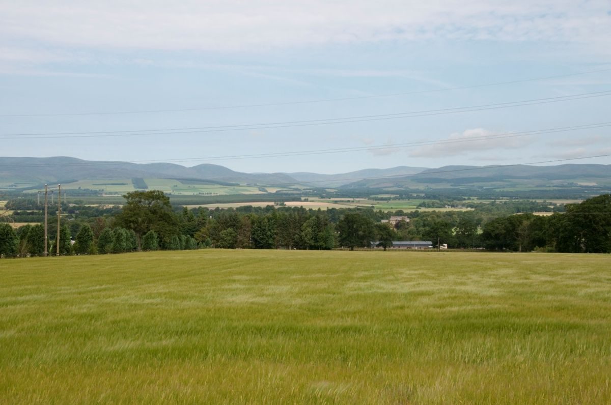
The Stracathro Estate is located in Strathmore, an area of exceptionally productive agricultural land. It has enjoyed good road links with Aberdeen to the north and Dundee to the south since the 18th century and is also situated comparatively close to the port of Montrose. It has existed as an estate since at least 1566 when Sir Robert Lauder acquired the lands and township (terras et villam) which had been in the ownership of the cathedral at Brechin until the Reformation. The estate subsequently changed hands in 1647 and again in 1656 when it was acquired by the Turnbull family in whose possession it remained until 1764. The first indication of the existence of a house on the estate is on Robert Edward's map of Angus of 1678 where two houses are shown on the north bank of the Cruick Water close to the church.

Despite the existence of a building shown on estate land on Robert Edward's map, John Ochterlony of The Guynd, writing in around 1682 says of ‘Strickathroe' that ‘Turnbull hath a good estate in it', but he makes no mention of either a house, a garden or yards. Writing some sixty years later, William Seton, in his Description of the Parish of Forfar (1743), sited the ‘House of Strickathrow' a ‘large' half mile south-south-east from the church, suggesting that it was situated south of the Cruick Water. This is the location of buildings shown in Roy's Military Survey (around 1745-1752) which contradicted Moll's siting of the house to the north of the Crick Water (1745).

Also shown on Roy is the first evidence of rectangular enclosure and plantings on a north-west/south-east axis running up the Hill of Stracathro and over the public road which passed just below the crest of the hill on the north side. The status of the approach to the house is not clear although there appears to be an avenue of sorts or a vista coming in from the west between two wooded enclosures and leading directly to the house. There is also a long, straight track, not linked with the house, which runs along the boundary of one enclosure and leads to a second on the north-west/south-east axis referred to above. These two enclosures have not been planted, suggesting that the fields are in the process of being taken out of run-rig and into either arable cultivation or grazing. In contrast, the largest, highest and most southerly enclosure which crossed the public road appears to have been densely planted out with trees. The boundaries of all the enclosures, which are contiguous, are marked in red, indicating stone dykes, fences or combined hedges and ditches planted with hedge trees. The two areas of plantings constitute the beginnings of a designed landscape, but not yet an integrated design incorporating the house.

John Ainslie's map of 1794 provides the first evidence of a unified designed landscape which includes both the house and its setting, a landscape possibly designed by Patrick Cruickshank who purchased the estate prior to the death of the previous owner, Dr John Mackenzie in 1775. Some ten rectangular enclosures bounded by shelter belts are shown surrounding the house. The house itself was approached directly by a long, straight, avenue, tree-lined on one side, which descended from the public road referred to above before crossing the recently constructed lower road which lay along approximately the same line as does the modern A90 constructed in the 1990s. Unusually, it turned to the right in front of the house, then ran along the east front before making a left and then a right 90˚ turn and continuing on to the church.

The avenue shown by Ainslie is different in intent from that shown on Roy. It was part of the overall design for the house and its setting. It made statements about land ownership, wealth and power whilst providing a commanding view over the house and its setting to impress visitors. Looking back from the house, the semi-circle at the head of the avenue on the public road could have been cut out to provide a location for an ornamental object to take the eye of the observer up the hill from the immediate surroundings of the house, as suggested on the later 1862 OS map. The construction of straight entrance avenues as indicators of status began in Scotland in the Restoration period and they became the height of fashion. The first use of the word ‘avenue' in English is credited to the much travelled John Evelyn in a diary entry of 1654 (Hewer, S, ‘Searching for Evidence of the Scottish Baroque in William Roy's Military Landscape' in Scottish Archives 2010 Vol. 16, 23). The extent of their proliferation is shown in Roy's Military Survey with some 60% of country seats shown to have such an approach (Hewer, 2010, 3).

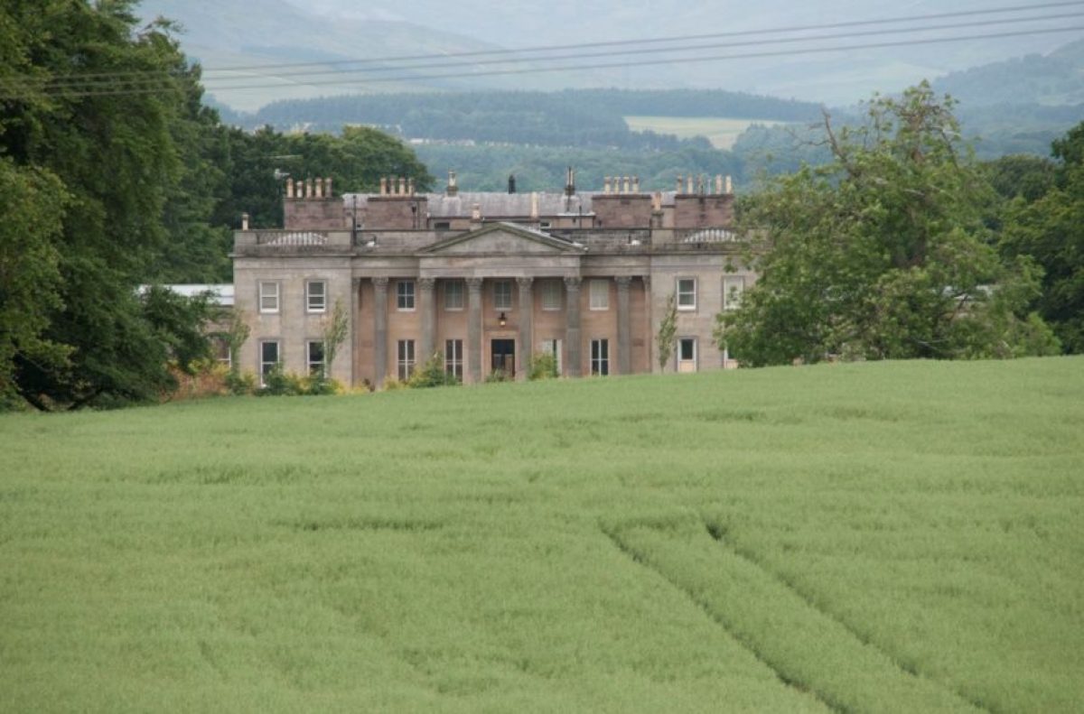
By the late-18th century, however, such avenues were seen by some as ‘vulgarly rectilineal, direct or abrupt' (Loudon, J A, Treatise on Forming, Improving and Managing Country Residences, 1806, Vol. II, p 590-592) and not in keeping with the more informal style of the age. However, as is the case with Stracathro, they often remained in the landscape, although not always as the prestigious features they had once been. The Stracathro avenue is the one remaining identifiable feature of the landscape associated with the 18th-century house, probably the second to be built on the estate and the immediate predecessor of the present house designed in 1827 by Archibald Simpson for Alexander Cruickshank and completed around 1830 (Gifford, J, 2012, The Buildings of Scotland: Dundee and Angus, 671).

The avenue does not line up with the 19th-century house, indicating the selection of a new site to the north-west of the former house for the Alexander's neo-Palladian mansion, possibly in a bid to distance the house from the recently constructed lower public road. It is also likely that the choice of location was made to take advantage of the borrowed landscape offered by the view up Glen Esk which can be seen from the drawing room and was reflected in a mirror which used to hang over the fireplace (Personal Communication).

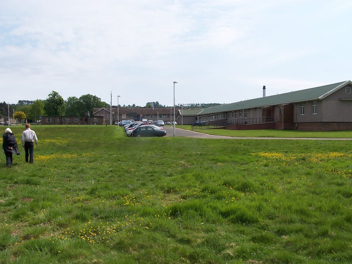
The setting for the house created by Alexander Cruickshank was essentially informal, consisting of what A.J. Warden calls ‘the fine existing gardens' (Warden, A.J., 1885, Angus or Forfarshire, The Land and People, 169) in the immediate environs of the house to the north and west, a park to the south of the house and a deer park. An impression of the appearance of the former park can be obtained from the few remaining 19th-century specimen trees and clumps which remain on the land now largely occupied by Stracathro Hospital. Later in the 19th century a number of sequoias were planted, as was the case in many Angus estates. Potential replacements were planted in the mid-20th century (Personal Communication).

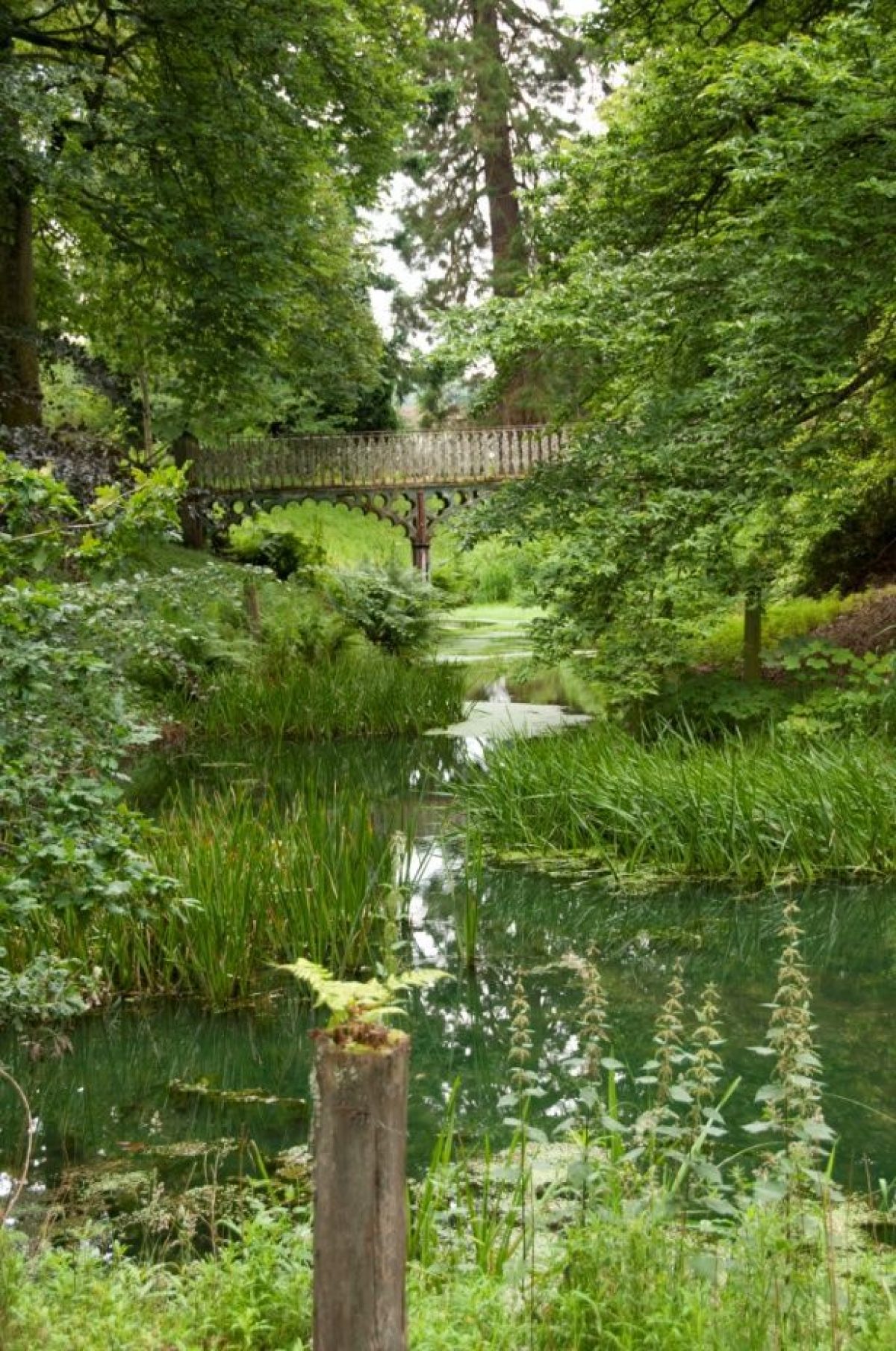
For the most part it is not possible to comment in detail on the development of the gardens themselves since access for the survey was not granted. One exception to this is the ‘naturalistic' but entirely man-made water garden consisting of a lily pond and a weir which is crossed by the road which remains a public right of way to the church. The cast iron three arched neo-Tudor road bridge with mullioned spandrels and delicate balustrades was to an 1828 design by William Atkinson (Buxbaum, T,. 1989, Scottish Garden Buildings, 91 & 93).

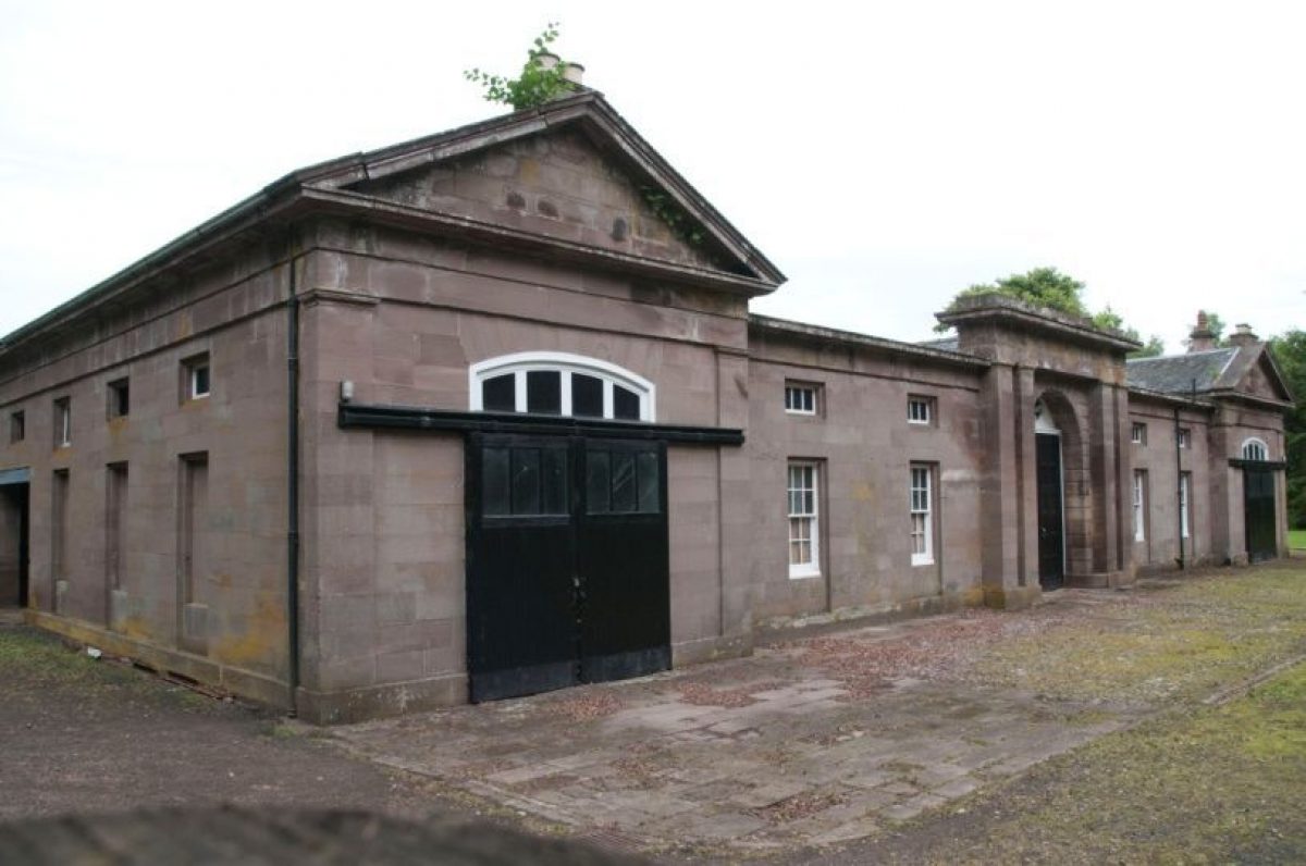
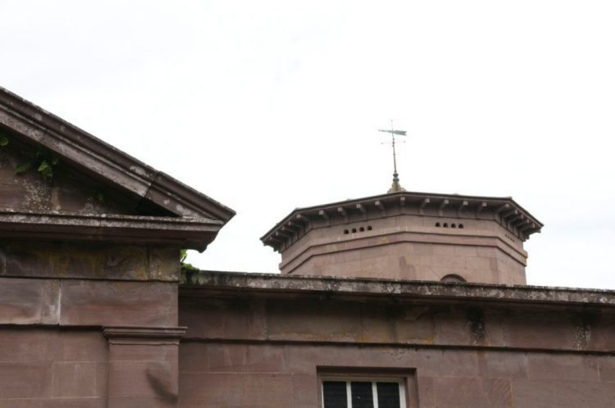
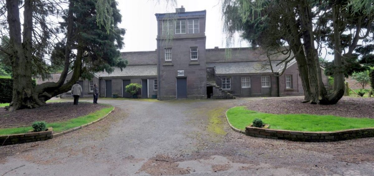
A delicate footbridge, also of cast iron, crosses the water feature a short distance above the road bridge. The 1832 plan of the estate does not include the lily ponds and bridges suggesting that they might have been a later addition using an earlier design, unless, of course, the survey preceded the printing of the plan by several years. Also in view from the public road and the area around the walled garden is the network of paths in the present garden, probably dating from Alexander Cruickshank's time. A short distance from the walled garden, between the garden and the lily pond, there is a stable block which Gifford dates to around 1830. Given the similarity between the roof of the belvedere and that of the doo'cot at the centre of the stable, it is very likely that they were designed and/or constructed at the same time, although not necessarily by 1830 if the 1832 plan was executed shortly after the survey was undertaken.

Attached to the south wall of the walled garden there are two wings said to have provided shelter for a large herbaceous border which used to run the length of the wall. Across the track which winds round the perimeter of the walled garden, there is some evidence of an orchard to supplement the fruits trees in the garden and, beyond them, two large copper beech trees which frame the view from the belvedere referred to above.

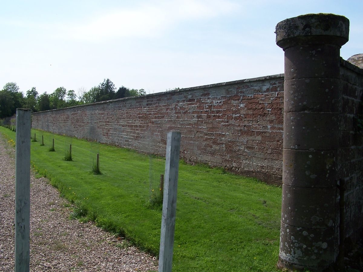
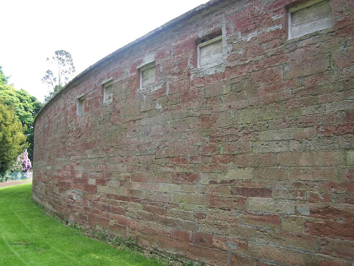
It is stated above that the avenue is the only remaining identifiable feature of the 18th-century landscape. However, it is possible that the extant D-shaped walled garden sited west-north-west of the present house, but without the 19th-century belvedere and central glasshouses, could have served the earlier house referred to by William Seton in 1743 and shown on John Ainslie's map of 1794. Eighteenth century estates had to be self-sufficient and could not have existed without the means of growing fruit and vegetables, an undertaking requiring high walls to cope with the Scottish climate. No cartographic evidence of another walled garden exists however, and it has to be said that the present walled garden would have been at an unusually long distance from the assumed site of the earlier house in an area where there are quantities of dressed stone and the remains of cellars (Personal Communication).

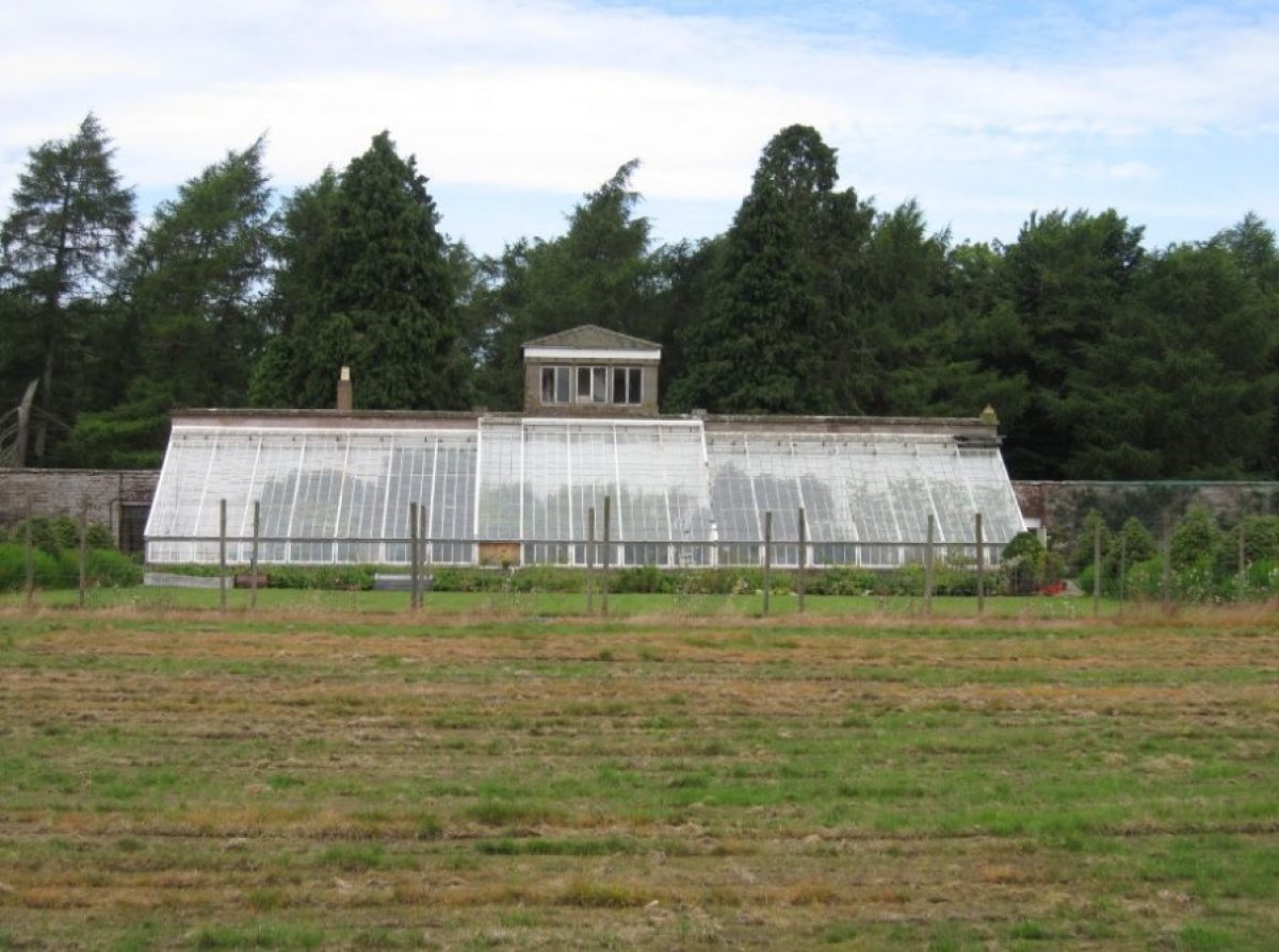
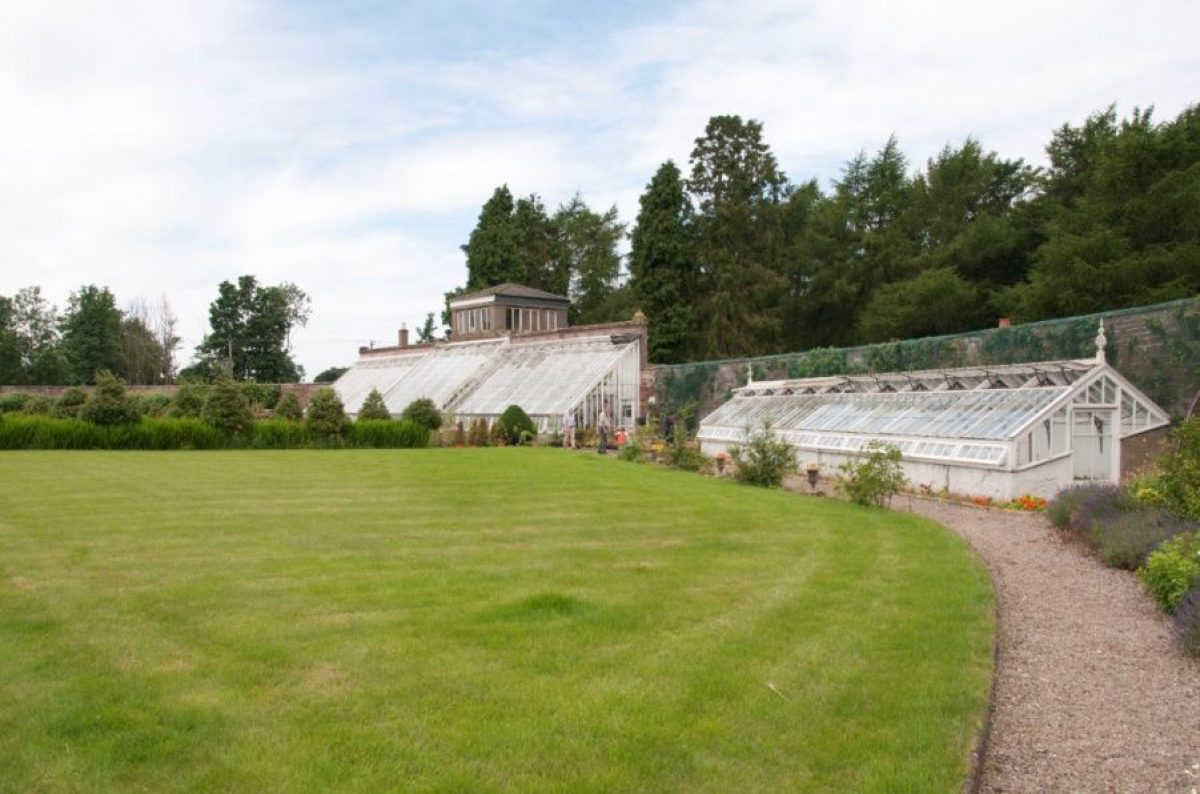
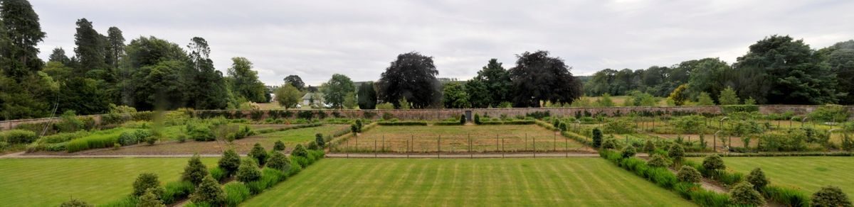
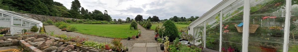
As of September 2012, the walled garden is laid out as shown in the 1st edition Ordnance Survey map published in 1865. The central section of the curved wall supports a range of three glasshouses and above them, a belvedere. There are five gates, one of which is situated in the centre of the straight south wall. Interestingly, the belvedere and main glasshouses are not shown in the garden on the estate survey of 1832 although they are said by Gifford to be of around 1830 (Gifford, 2012, The Buildings of Scotland: Dundee and Angus, 674). This cartographic evidence suggests that the belvedere and central glasshouses were additions to an existing structure, possibly dating from the 18th century. The failure of the centre point of the main range of glasshouses to line up with the door in the centre of the south wall is indicative of an addition to an existing garden and of the problems encountered when introducing a rectilinear structure into a curved wall. The presence of mature yew trees in the area of the walled garden also suggests cultivation of the area earlier than the 19th century. The question is whether the perimeter walls of the garden were built in the 18th or the 19th centuries. Ainslie provides no clues since he never includes walled gardens. Equally, no walled garden is shown on the estate plan of 1792. However, absence of such a feature on a plan concerned essentially with agricultural productivity is not unusual and does not prove that the garden was not in existence at the time.

This cartographic evidence suggests that the belvedere and central glasshouses were additions to an existing structure, possibly dating from the 18th century. The failure of the centre point of the main range of glasshouses to line up with the door in the centre of the south wall is also indicative of an addition to an existing garden and the problems of introducing a rectilinear structure into a curved wall. The presence of mature yew trees in the area of the walled garden also suggests cultivation of the area earlier than the 19th century.

The question is whether the perimeter walls of the garden were built in the 18th or the 19th centuries. Ainslie provides no clues since he never includes walled gardens. Equally, no walled garden is shown on the estate plan of 17??. However, absence of such a feature on a plan concerned essentially with agricultural productivity is not unusual and does not prove that the garden was not in existence at the time.

Alexander Cruickshank's ownership of Stracathro lasted twenty years. His trustees sold the property to Sir James Campbell in 1848. Sir James was succeeded by his son, Sir James Archibald Campbell on his death in 1876 (http://gdl.cdlr.strath.ac.uk/mlemen/mlemen019.htm). A.J. Warden is fulsome in his praise of the gardens as he found them in 1885, referring to the lawn in front of the house as ‘closely shaven, verdant, and of mossy softness'. He also comments on the young trees in the park which are thriving well, the choice flowers and plants in the gardens, the vineries, greenhouses etc and states that ‘Behind the house the contour of the ground admits of variety in the ornamentation, and it is turned to good account' - no doubt a reference to the mouth of Glen Esk (Warden, A.J., 1885, p.172).

Since 1914 the house and grounds have been occupied from time to time for medical purposes, the house serving as a military hospital in the 1914-1918 World War and then reverting to the Campbell family before being leased to the Department of Health in 1938. Andrew Graham Patrick, Charles Geddes Soutar, Maclaren Soutar Salmond and William Salmond were all involved in the layout of the hutted wartime hospital in the park in 1940.

The house and 203 acres of gardens and parkland were finally sold to the government in 1949, the balance of the agricultural land remaining with the Campbell family. By 1977 the estate of Stracathro, as opposed to the NHS holdings, was owned by the laird of Careston Castle (Illsley, W.A., 1977, The Third Statistical Account of Scotland, (Vol. 26), The County of Angus, Arbroath, Herald Press, 240).

In 1980, 107 acres of land was bought back into the estate from the NHS by Hugh Campbell-Adamson. Ordnance Survey maps from the 19th century through to the present suggest that few changes have been made from the 19th-century layout. Whilst in the ownership of the Campbell-Bannerman family, it is said that fruit from the garden was sent to London daily by train from Montrose (Personal Communication).

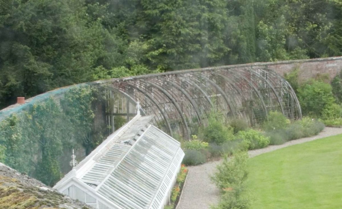
The walled garden was sold privately in around 1997. It is now maintained and limited restoration work is undertaken when possible. Planting is mixed and includes herbaceous borders, shrubs, soft fruit and vegetables with some wall fruits. Whilst the beds, paths and growing areas were neglected following their cultivation during World War 2 (1939-1945), the pear, fig and mimosa in the central section of the main glasshouse range have been there since the building of the glasshouses and are thriving, as is a peach tree. The mimosa is said to be associated with the Free Masons and used in floral arrangements in the house to signify the adherence of the family to the organization in the 19th century. In addition to the main glasshouse range there is another glasshouse alongside the north wall between the main range and the former peach house, possibly that shown on the 1922 Ordnance Survey map. Outside the garden and part of the additions which included the belvedere, known as the ladies' sewing room (Personal Communication), there is the elegant stairway to the belvedere itself, a bothy for the gardeners and a line of single storey offices. There is also a pineapple pit, two further glasshouses and the sites of others now removed.

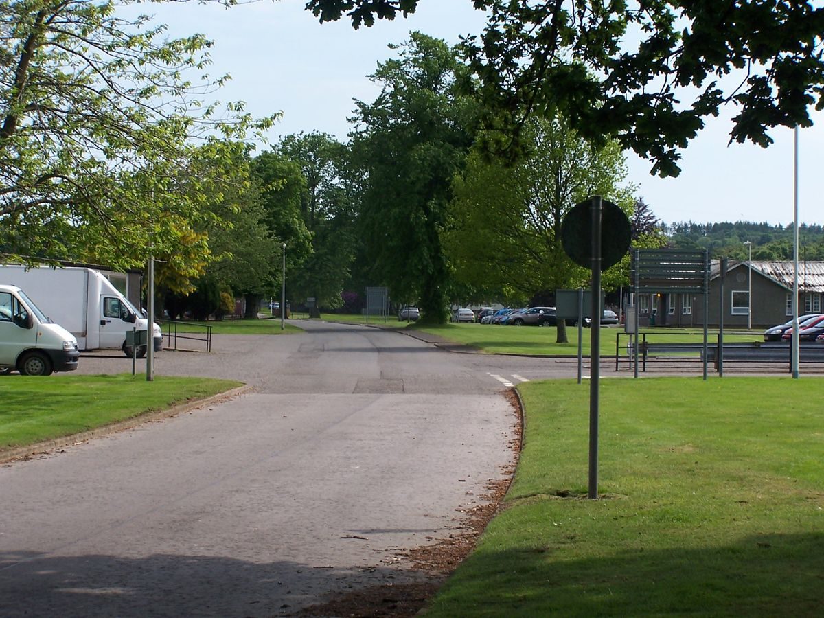
In 2003, the house and stable block were sold by the NHS and returned to private hands. Following the sale, significant quantities of leylandii were planted around the south-eastern, southern and south-western perimeter of the garden grounds belonging to the house backed up by lap fencing in order to maintain privacy. The Stracathro Hospital site is always open and it is possible to walk through to the walled garden from the most northerly of the hospital car parks to the walled garden which is normally open during working hours.

Features & Designations

Features

  • Belvedere
  • Description: Belvedere tower above north wall of walled garden.
  • Earliest Date:
  • Glasshouse
  • Description: Half moon plan glasshouses on north wall of walled garden.
  • Earliest Date:
  • Mansion House (featured building)
  • Description: 2 storey Graeco-Roman ashlar faced mansion with later single storey and basement wings
  • Earliest Date:
  • Ornamental Bridge
  • Description: Three span cast iron bridge with gothic detail.
  • Earliest Date:
  • Ornamental Bridge
  • Description: Semi-elliptical cast iron span with spandrels pierced by circles.
  • Earliest Date:
Key Information

Type

Estate

Principal Building

Domestic / Residential

Survival

Extant

Hectares

785

Electoral Ward

Brechin North Esk

References

Contributors

  • Angus Landscape Survey Group under the auspices of the Garden History Society in Scotland