Introduction
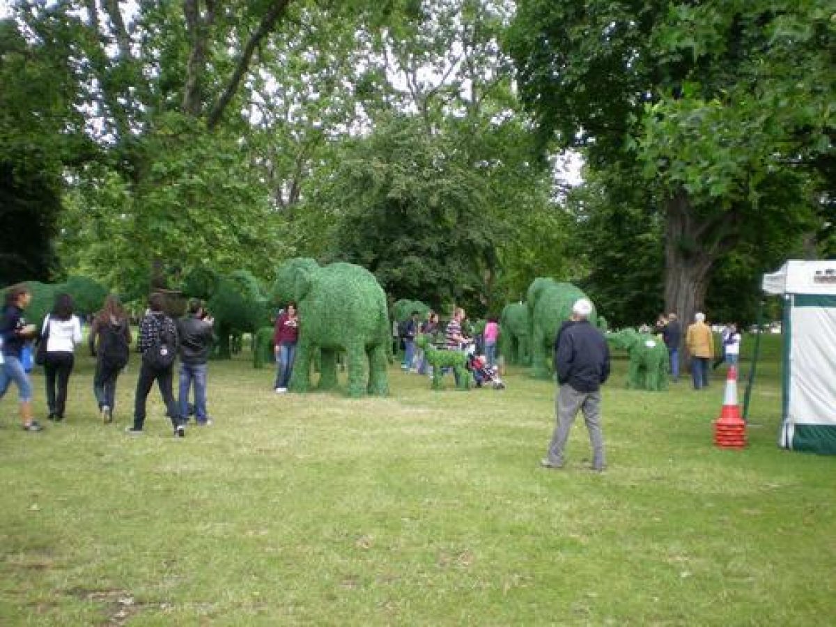
St James' Park covers about 32 hectares. Clumps of shrubs and trees decorate the undulating ground which slopes down towards the lake in the centre of the site.
A Tudor royal hunting park, laid out formally in the C17 and remodelled as a landscape park in 1828. Famous names associated with the development of the site include Andre Mollet, Henry Wise, Charles Bridgeman, Lancelot Brown, and John Nash.
Terrain
Undulating.
The following is from the Register of Parks and Gardens of Special Historic Interest. For the most up-to-date Register entry, please visit The National Heritage List for England (NHLE):
Location, Area, Boundaries, Landform and Setting
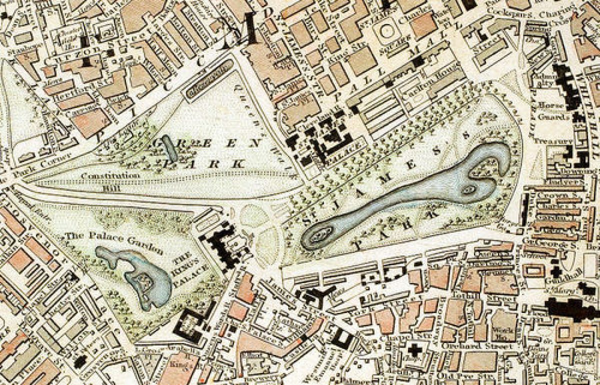
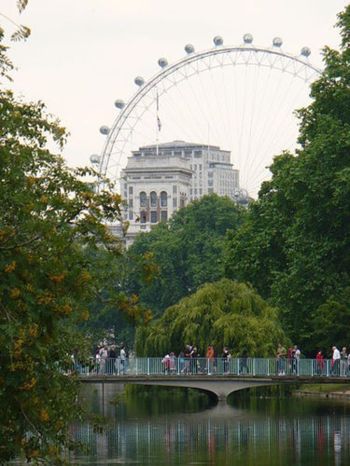
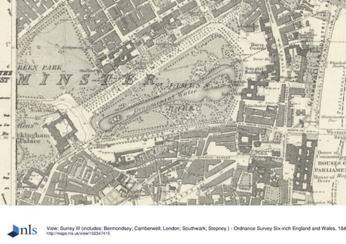
St James's Park is situated in central London. Piccadilly Circus lies c 600m to the north, the Houses of Parliament 400m to the south-east, and Buckingham Palace c 200m to the west. The c 32ha site is bounded by major roads: both The Mall to the north and Birdcage Walk to the south can be traced back to the reign of Charles II when they were an integral part of the park. The former, a broad triumphal way lined with plane trees, has its origins in the C16, and the latter, also tree-lined, is related to the site of the Charles II's aviary. The rear of numerous government buildings associated with Whitehall to the north-east provide the boundary to Horse Guards Parade which lies at the east end of the park, the site having originally been used as a mustering ground for Charles II's personal body guard. The parade ground became detached from the park when Horse Guards Road was made in 1916. To the west, the area around the Victoria Memorial is included within the area here registered, the main gates of Buckingham Palace (qv) forming the boundary at the west end. Clumps of shrubs and trees decorate the undulating ground which slopes down towards the lake in the centre of the site.
Entrances and Approaches
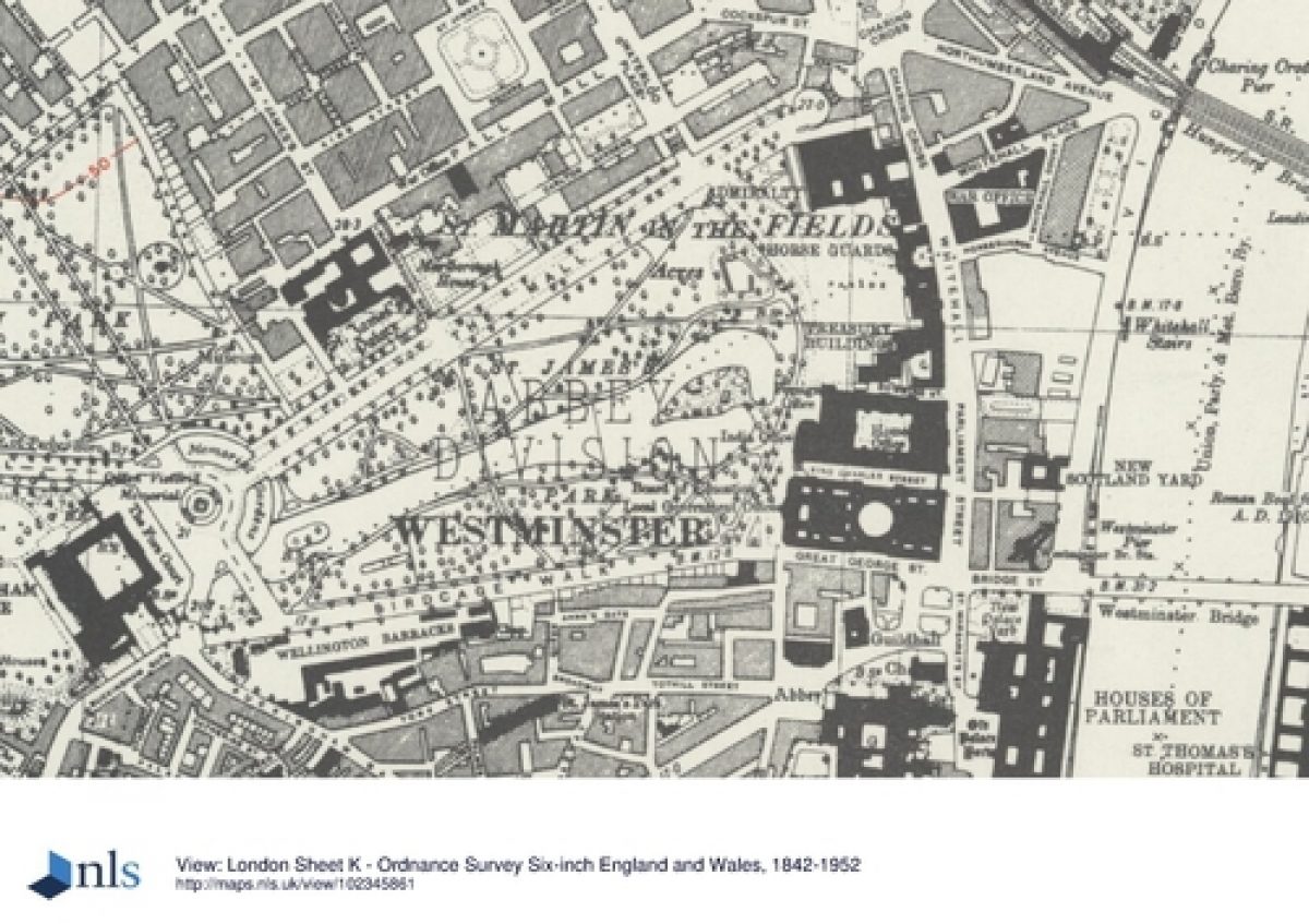
The site boundary extends to the building line on all four sides and there are numerous access points from the surrounding area. The principal gate to the inner park is Marlborough Gate. Situated on the south-east side of The Mall, opposite St James's Palace and Marlborough Road, the iron gates and Portland stone gate piers (listed grade II) were designed by Aston Webb c 1901-1911 as part of his Victoria Memorial/Mall scheme. Other formal entrances include Queen Anne's Gate (listed grade II) to the south of the site which leads onto Birdcage Walk, as does Buckingham Gate (1832, listed grade II) in the south-west corner; and Storey's Gate in the south-east corner. Edward Storey, the first keeper of the king's birds, lived here in the late C17; the existing lodge house (listed grade II) however dates to c 1840. All the entrances lead to a network of paths which traverse the site, many of which are part of Nash's scheme of 1857 and are recorded on the OS 1st edition map of 1869.
Principal Building
Duck Island Cottage is situated on Duck Island, an isthmus at the northern end of the lake. The picturesque cottage orné was built in 1840 by John Burgess Watson for the Royal Ornithological Society. The two single-storey pavilions are linked by a tree-trunk colonnade. The rendered walls with patterned leaded lattice casements and rustic doors, are topped with patterned tile roofs set off with ornate carved bargeboards and finials.
Park
From Marlborough Gate a gravel-coated asphalt path divides, the eastern branch leading across undulating lawns to meet up with the lake-side path at the northern end of the lake, where after c 90m it arrives at the Guards Memorial and Horse Guards Parade. The main path from Marlborough Gate continues south between shrubberies and lawns which slope down from The Mall towards the lake. To the west is the Rose Walk, given by the friends of the National Gardens Scheme to mark the occasion of Queen Elizabeth, the Queen Mother's eightieth birthday (4 August 1980). The path continues south past the site of the temporary bandstand to the north-east, to the stone bridge which spans the lake. In 1957 this bridge replaced the iron suspension bridge designed by Rendall and erected in 1857. Here the path divides: to the south it crosses over the lake, to the east and west paths follow the line of the lake. This basic path layout was in place by the 1860s (OS).
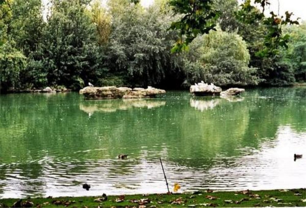
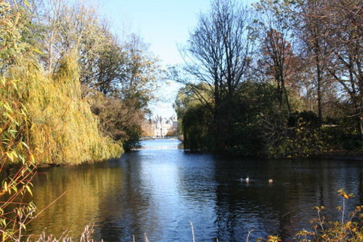
The c 4.6ha lake runs north-east/south-west for the length of the site and covers some twenty percent of the area of the park. The lake was made as part of Nash's scheme when he developed the late C17 formal canal (made on the former course of the Tyburn Brook) to form a serpentine lake. Nash constructed two islands: a small one to the west and a larger complex, Duck Island, to the east. By 1904 the Victoria Memorial Gardens had been constructed, modifying the west end of the lake. During the restoration of the lake in 1923 it was further shortened to accommodate a northern shoreline footpath. Today (1998) the west end of the lake terminates at the rusticated piers of the retaining wall (listed grade I) of the Victoria Memorial Garden. The lake is enclosed within waist-high iron railings which protect the large colonies of wildfowl from the public. Views along the lake-side paths provide vistas to Buckingham Palace to the west and Horse Guards and Whitehall to the east.
After 100m the eastern lake-side path divides, the northern branch continuing north for c 450m and exiting onto the northern end of The Mall at the junction with Horse Guards Road. The Cambridge Triangle, the piece of land to the north-east of the junction, can trace its association with St James's Park to the C17 patte d'oie. The lake-side path itself continues past, to the north, the refreshment house built in the 1970s as 'The Cakehouse', but demolished and replaced by a new building in 1999. After c 50m the lake-side path meets up with the upper eastern path. With fine views north-east to Horse Guards, it then continues around the eastern end of the lake and past Duck Island Cottage. After c 50m the path divides, the eastern branch leading out to Horse Guards Road and King Charles Street, a second branch to the south terminating at the eastern end of Birdcage Walk, passing Storey's Lodge c 50m to the south-east. The serpentine lake-side path continues west for c 350m where it meets up with the path leading south from the stone bridge to Queens Anne's Gate. Like the north lawn, the ground to the south of the lake undulates and slopes down to lake. The lake-side path continues west, past the children's playground, before turning north at the head of the lake past the retaining wall of the Victoria Memorial Garden to meet up with the north-west lake-side path.
Maps
- Newcourt and Faithorn, St James Park and Garden, surveyed 1643-7, published 1658 (reproduced in LUC 1981)
- Ogilby and Morgan, St James Park and Garden, 1681-2 (reproduced in LUC 1981)
- J Rocque, Plan of the Cities of London and Westminster and Borough of Southwark and the country near ten miles around, surveyed 1741-5, published 1746
- R Horwood, Plan of the Cities of London and Westminster, 1792-9
- OS 6" to 1 mile:
- 1st edition published 1871
- 2nd edition published 1893
- OS 25" to 1 mile:
- 1st edition published 1869
- 2nd edition published 1893
Description written: August 1998
Register Inspector: LCH
Edited: December 2021
- Visitor Access, Directions & Contacts
Access contact details
The park is open from 5 am to midnight throughout the year.
WCs. Refreshments. Disabled access.
Directions
St James's Park underground station (District and Circle lines).
Owners
The Royal Parks
- History
The following is from the Register of Parks and Gardens of Special Historic Interest. For the most up-to-date Register entry, please visit The National Heritage List for England (NHLE):
16th Century
St James's Park was formed in 1531 under Henry VIII who bought the ancient leper hospital of St James and rebuilt it as St James's Palace, a royal retreat from his palace in Whitehall. The land to the south of the Palace was walled in to make a royal hunting park. During the reign of Elizabeth I, an east/west avenue on the alignment of The Mall was established. James I started a menagerie and a collection of wildfowl, brought water over from Hyde Park (qv) to Rosamund's Pool (now lost under the west end of Birdcage Walk), and made an unsuccessful attempt to establish a mulberry garden, which was also situated at the western end of the site. Under the Protectorate, the park became slightly more accessible with a number of privileged residents being allowed to hold keys.
17th - 18th Century
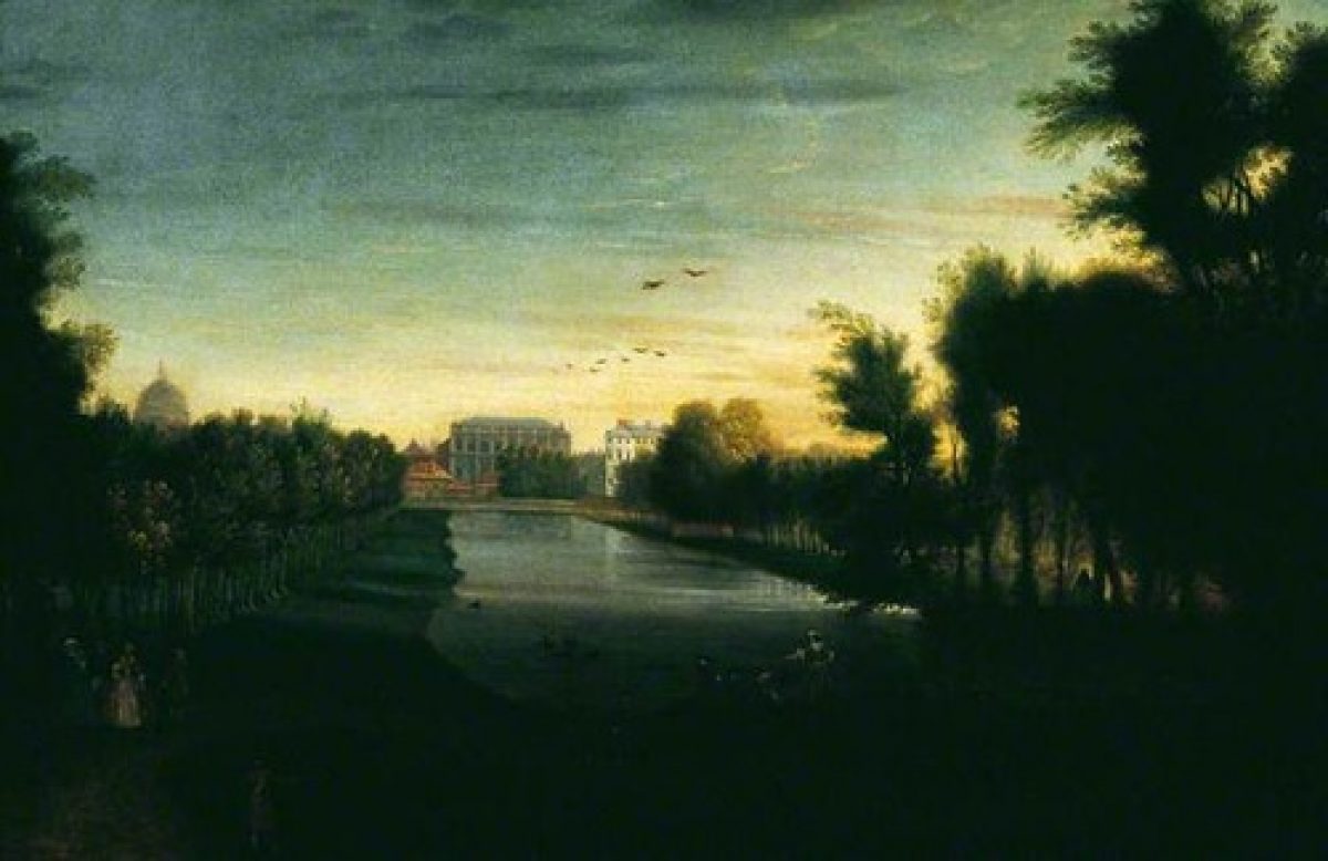
Charles II enlarged St James's Palace and initiated a new design for what became London's first city park. The formal French layout, possibly by Andre Mollet (LUC 1981), centred around a new canal, c 2.5km long, which was made by Adrian May (a gentleman of the Court) in 1660 (Garden Hist 1998). Additional avenues of trees marked the promenade of The Mall to the north and Birdcage Walk to the south. A patte d'oie of tree-lined paths was designed at the eastern end of the canal, with a decoy area for ducks to the south-east. Rosamund's Pool was formalised (Knyff 1662; in LUC 1981). Around the same time the king acquired further grassland to the north-west which formed Upper St James's Park (now The Green Park qv).
Subsequent reigns saw little major change. Under the reign of William and Mary works continued in the decoy and a tea house was built near there. After the destruction of Whitehall Palace by fire in 1698 the court took up residence in St James's Palace. Henry Wise (1653-1738) managed the park for Queen Anne as part of his duties as Royal Gardener. At the same time the Duke of Buckingham redeveloped the site of Goring House at the western end of the park and sited his new Buckingham House at the intersection of the vistas of The Mall and the canal which gave the impression that the park and The Mall had been created for the new house.
By 1761 George III had bought both Buckingham House and its grounds. In 1770-1 Lancelot Brown (1716-83), who had been appointed Royal Gardener in 1764, supervised the infilling of both the decoy canals and Rosamund's Pool and put forward proposals to improve the park. By 1790 the inner parkland was separated from The Mall and Birdcage Walk and enclosed by a fence. The park in general however was allowed to decay and by 1823 the Commissioners of Woods were reporting on the poor state of the park, the inadequate drives and walks, and the poor drainage, and suggested that it should be laid out as a pleasure garden.
19th Century
John Nash (1752-1835) responded to the Commissioners' brief for improvements to the park, putting forwards his plans and gaining approval by the beginning of 1827. His proposals included not only opening the park to the public but also buildings on both sides of the park. As part of Nash's scheme the canal was deformalised and, while retaining a number of the mature trees, included thirty-seven new plantations. The superintendent of the Royal Gardens at Kew, William Aiton (1731-93), is thought (LUC 1981) to have advised on suitable planting.
The period up to the 1880s saw several additions and improvements to the park. In 1887 light-wheeled traffic was allowed along The Mall, the Queen Victoria Memorial and gardens were created in front of Buckingham Palace to the design of Sir Aston Webb at the beginning of the C20, and in 1910 the roads around the park were modified. By 1916 the inner park was completely encircled by traffic.
20th - 21st Century
The park continues to be managed as a popular, well-used public open space.
- Associated People
- Features & Designations
Designations
Conservation Area
- Reference: St James's
The National Heritage List for England: Register of Parks and Gardens
- Reference: GD1455
- Grade: I
Site of Local Importance for Nature Conservation
Features
- Lake
- Ornamental Bridge
- Pulhamite
- Road
- Description: Site is bounded by major roads
- Gate
- Description: The principal gate to the inner park is Marlborough Gate.
- Gates
- Description: The iron gates
- Gate Piers
- Description: Portland stone gate piers
- Gate
- Description: Queen Anne's Gate
- Walk
- Description: Which leads onto Birdcage Walk
- Gate
- Description: Buckingham Gate
- Gate
- Description: Storey's Gate
- Lodge
- Description: The existing lodge house
- Island, Cottage
- Description: Duck Island Cottage is situated on Duck Island,
- lake-side path
- Description: Eastern lake-side path
- Cakehouse
- Description: The Cakehouse
- Key Information
Type
Park
Purpose
Recreational/sport
Principal Building
Parks, Gardens And Urban Spaces
Survival
Extant
Hectares
32
Open to the public
Yes
- References
References
- {English Heritage Register of Parks and Gardens of Special Historic Interest} (Swindon: English Heritage 2008) [on CD-ROM] Historic England Register of Parks and Gardens of Special Historic Interest
- Cherry, B and Pevsner, N {The Buildings of England: The Cities of London and Westminster} (Harmondsworth: Penguin, 1973) p 642 The Buildings of England: London 1: the Cities of London and Westminster
- Hitching, C {Rock Landscapes: The Pulham Legacy} (Garden Art Press, 2012) Rock Landscapes: The Pulham Legacy
- The Royal Parks Agency {St James' Park and The Green Park Operations Plan} (2009) St James' Park and The Green Park Operations Plan
- Land Use Consultants {St James's Park and the Green Park Strategy and Resource Plan} (1991) St James's Park and the Green Park Strategy and Resource Plan
- Land Use Consultants {St James's Park and the Green Park Management Plan} (2008) St James's Park and the Green Park Management Plan
- Colvin and Moggridge {St James's Park: Management Plan} (1996) St James's Park: Management Plan
- Land Use Consultants {St James's Park: Strategic Management Plan} (1999) St James's Park: Strategic Management Plan
- Cecil, E., (1910) A History of Gardening in England
- Edgar, D., (1986), pp 67-90 The Royal Parks
- no 1 (Summer 1998), pp 3-18 Garden History 26
Contributors
London Parks and Gardens Trust
- Related Documents
-
CLS 1/289/1
St.James's Park Management Plan - Digital copy
Colvin and Moggridge - 1996
-
CLS 1/288/2
Royal Parks Historical Survey - Digital copy
Land Use Consultants - 1981
-
CLS 1/289/1