Introduction
Sledmere House has an associated landscape park, plantations and gardens. The core is about 300 hectares. Features include an 18th-century octagonal walled garden, a recently laid out parterre and herbaceous borders.
Terrain
The site is on land which falls gently to the south and east, rising again beyond.www.historicengland.org.uk/listing/the-list
Pleasure grounds and a park with mid C18 origins laid out within an improved landscape by Sir Christopher Sykes 1771-1800 with advice from Thomas White and Lancelot Brown, with model farms designed by Sykes acting as eyecatchers.
DESCRIPTION
LOCATION, AREA, BOUNDARIES, LANDFORM, SETTING
Sledmere park surrounds the village of Sledmere on all but the north side, on land which falls gently to the south and east, rising again beyond. The c 300ha site is in a rural and agricultural setting. The north boundary is formed by the Bridlington Road and fencing along the edges of Cherry Wood and Castle Wood. The south-east and south boundary is formed by Avenue Wood and the west boundary by Sylvia Grove and the York road (B1251) which is the main street of the village and is walled from a point c 400m south-west of the House to a point c 550m to the south-east.
ENTRANCES AND APPROACHES
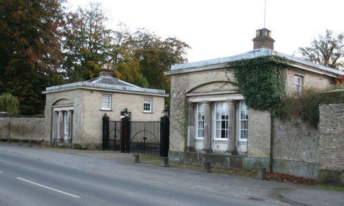
The principal entrance to the site is from the York road where paired early C19 neo-classical lodges called West Lodge (probably by Watson & Pritchett of York, listed grade II) form the entrance from which a drive runs west to the House. Another entrance from the York road has stone gate piers and secondary iron gate piers surmounted by tritons blowing horns, from which a drive runs south of the church and continues north-east to the House (this entrance, another to the stables north of the House, and the connecting wall are all listed grade II). On the west side of the site there is an entrance, at the bottom of a hill, from the Wetwang road, and a drive runs as a track north-east to the House through Sylvia Grove on the line of the old York road, which was diverted in 1777. Other gated entrances on each side of Limekiln Hill, c 1.5km south-east of the House, lead to rides running through the woods which encircle most of the site.
PRINCIPAL BUILDING
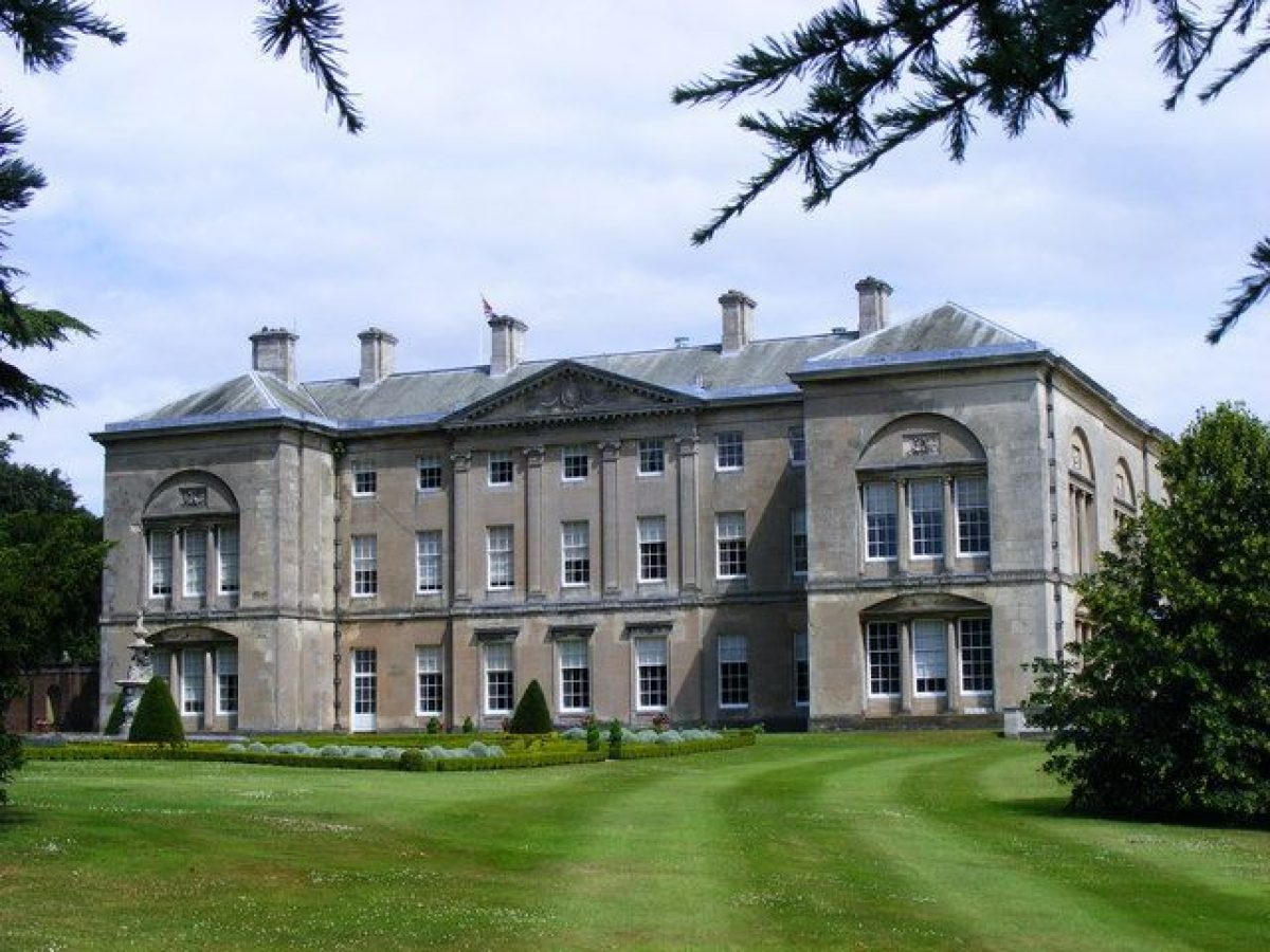
A house on or near the site is recorded from the C16, and a new house was built 1751(3 by Richard Sykes. A design for alterations and extension was commissioned by Sir Christopher Sykes from John Carr c 1786, and from Samuel Wyatt. Both were rejected, but a second design by Wyatt of 1787 was approved. The interiors were decorated by Joseph Rose and work was completed c 1793. The House was badly damaged by fire in 1911 and was restored by Walter Brierly retaining or reinstating as many of the C18 features as possible. Sledmere House (listed grade I) is in use as a private residence (1998).
Stables and a carriage house (listed grade II*) lie immediately north of the House. These are in use (1998) as garages and tea rooms. Immediately west of the stables there is a brick-walled paddock.
The church of St Mary (listed grade II*) lies c 150m south-west of the House, in a graveyard. It is entered from the York road where there are ornamental gates (listed grade II). A medieval church on the site was replaced by a brick classical building in 1758, and this was replaced in turn to designs by Temple Moore in 1898.
GARDENS AND PLEASURE GROUNDS
There are gardens on all but the north side of the House. On the east side there are scattered trees and lawns with a line of yews concealing the precincts of the stables. This was the site of village houses until c 1783 when estate records (see Popham 1997) describe levelling on the site. An orangery designed by Sir Christopher Sykes was erected on the eastern edge of the lawns, immediately west of the kitchen garden, c 1786. It is shown on a painting of c 1795 (private collection) but not on the 1854 OS map.
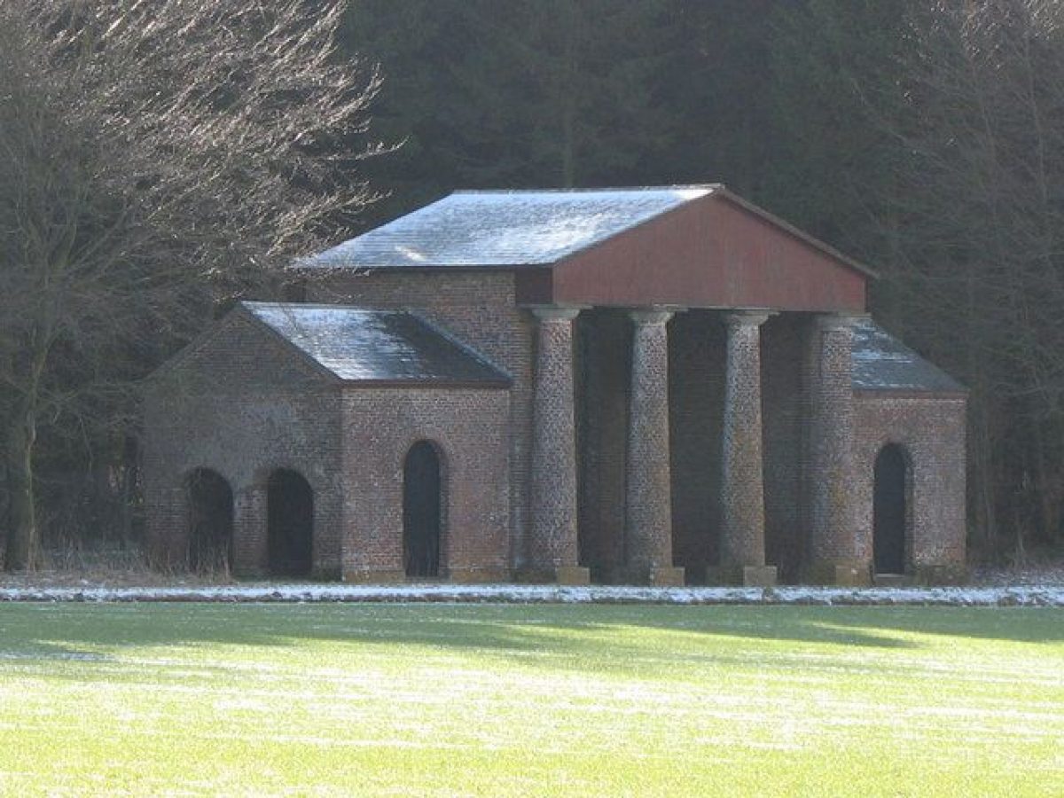
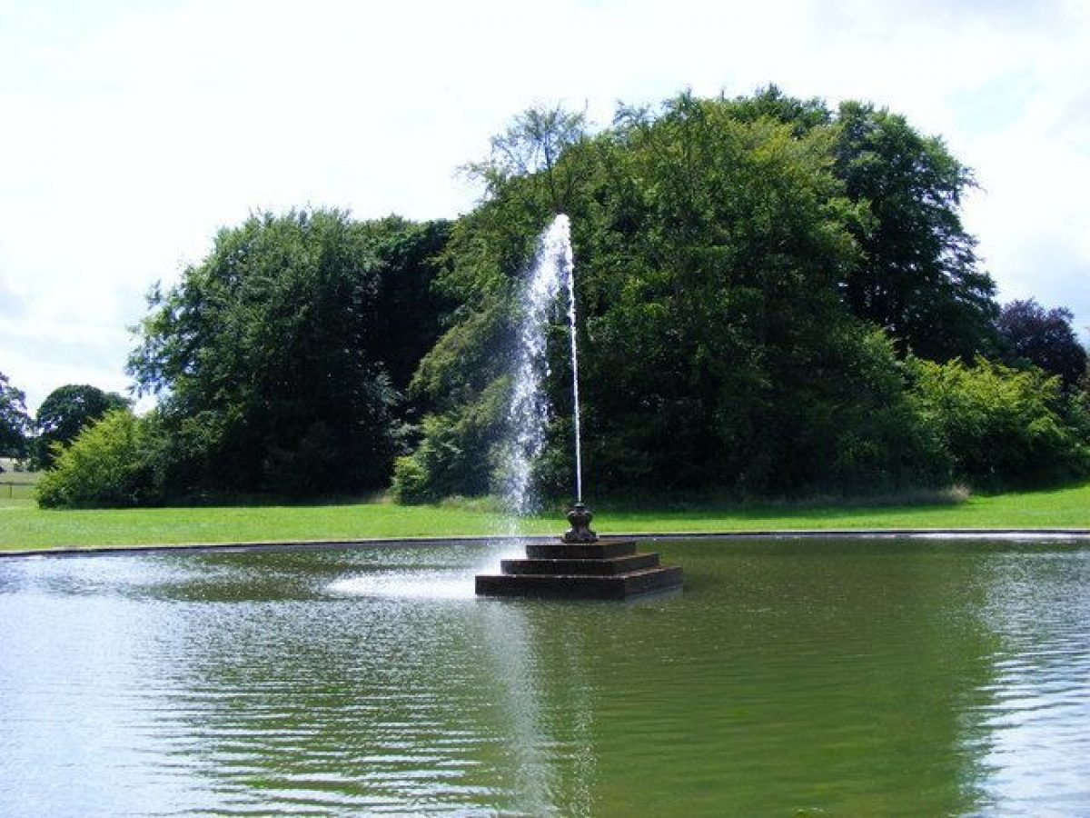
Immediately south of the House there is a terrace reached by steps on the west side and a ramp on the east side. The terrace overlooks a sloping lawn terraced in stages down to a rectangular grassed platform with a fountain in the centre of it. There are views to the east to Sledmere Castle (John Carr 1778, listed grade II), an ornamental former farmhouse on the edge of woodland c 1.8km distant, and to a pedimented deer shed probably designed by Sir Christopher Sykes (1792, listed grade II) on the edge of woodland c 1km to the south. The area in front of the House was laid out early C20 following reconstruction of the building after the fire; this involved building up the area with rubble, so increasing the height of the terrace and altering the level of the slope from it. The painting of c 1795 shows that there was a terrace along the south front of the House, from which lawns sloped gently downwards to the south. The lawn at the base of the terrace was the site of a mere, which was converted into a fishpond by Richard Sykes in 1752, who diverted the York road from its line south of the House to a line running immediately north between it and the stables, at the same time. The exact position of the mere and fishpond is uncertain. Sir Richard Sykes completed the present pond in the early 1960s.
On the west side of the House there are lawns and, aligned with the west front, a knot garden laid out in the 1980s, with a central fountain (listed grade II) of C18 date. There are views to the south-west of St Mary's church, c 150m distant. A ha-ha, c 200m south of the House, divides the pleasure grounds from parkland, and is probably that shown on a map of c 1755 which had pavilions at each end.
PARK
Parkland to the south, east and north-east consists largely of pasture land and is sheltered on all sides apart from the north by belts of trees. Immediately south-east of the House there is a group of large clumps in the middle distance which are the remains of an avenue shown on the c 1755 map and on a county map of 1771. The avenue splayed out from the House and was closed by a belt of trees so that it formed a triangular shape, enclosing parkland. White proposed complete removal of the avenue, and Brown shows it partially retained. The 1854 OS map shows the western arm of the avenue as a thin band of trees.
Beyond the clumps the land rises and on the skyline south of the House is the serpentine northern edge of Avenue Wood, which has a ride leading through it from which views of the parkland and the House, framed by the clumped remains of the avenue, can be obtained.
On the west side of the House there are scattered trees around the fenced graveyard of St Mary's church and a belt of trees, Sylvia Grove, runs south-west down the slope and is linked to Avenue Wood by a further belt of trees. A folly called the Pavilion was situated at the south-west end of Sylvia Grove overlooking the western entrance to the park. It was built c 1800 and is marked on the 1854 OS map but not on that of 1891.
To the north-east, on the north side of Limekiln Hill, there is an area of open fields on land rising gently to the north-east with a central clump of trees, the only survivor of several clumps shown on the c 1815 plan. The Castle (in use as a private residence, 1998) is positioned on the edge of the woodland belt which curves in a semicircle around the fields on the north, east and south sides. A map of 1776 has vistas pencilled on it, including a line from the House to the Castle, and vistas to two outlying farms, Marramatte and Life Hill (both designed by Sir Christopher Sykes in 1778 and listed grade II). Both farms are outside the registered area and the vistas have largely been lost owing to the maturity of the tree cover and new planting. Life Hill, c 2.5km south-west of the House, can be glimpsed from the upper floor of the House, and Marramatte, c 1.5km west of the House, can be seen from some points in the park, but the lines of sight connecting them with each other and the Castle are no longer (1998) clear.
Sir Christopher began work on the park in 1771 when plantations designed by Mr Perfect (probably John Perfect, a nurseryman from Pontefract active in the 1750s) for Richard Sykes were modified, but the wide-ranging proposals he had in mind did not begin in earnest until the fields had been enclosed and the main road, which ran to the south of the stables, had been diverted to the present (1998) curving line north of the stables. A bill to raise a mortgage for enclosure came before Parliament in 1776, but objections to the re-routing of the road, which dated back to Richard Sykes' alterations, were not resolved until the following year.
By 1800 Sir Christopher had spent more than £8600 on planting woodland throughout the township, with woodland covering more than 400ha.
KITCHEN GARDEN
The kitchen garden (listed grade II) lies c 200m north-east of the House, and there is access to it via a lane called Gardeners' Row running south from the York road. It is of an irregular octagonal shape divided by a wall running south-west/north-east. It is surrounded by an outer wall, replaced by a yew hedge on the south-east side, with a gate leading from the pleasure grounds on the west side. This wall, together with that which divides the site from the York road, forms a complete secondary enclosure around the garden walls. A row of C18 garden buildings, in use as private residences (1998), is ranged along the west side of the outer wall of the garden, facing onto Gardeners' Row. The kitchen garden was laid out in 1786, and a payment of more than £50 for levelling the site suggests that substantial preparatory work was required.
REFERENCES
Country Life, 106 (30 September 1949), pp 972-6; (7 October 1949), pp 1064-8; (14 October 1949), p 1140; 179 (16 January 1986), pp 128-32; (23 January 1986), pp 188-91
Sledmere House, guidebook, (1988)
D Neave and D Turnbull, Landscaped Parks and Gardens of East Yorkshire (1992), pp 65-7
N Pevsner and D Neave, The Buildings of England: Yorkshire, York and the East Riding (1995), pp 692-7
J Popham, Heritage Landscape Management Plan 4, (1997)
Maps [in Popham 1997]
Estate Map, c 1755
T Jefferys, County map, 1771
Estate Map, 1776 Estate Map, 1815
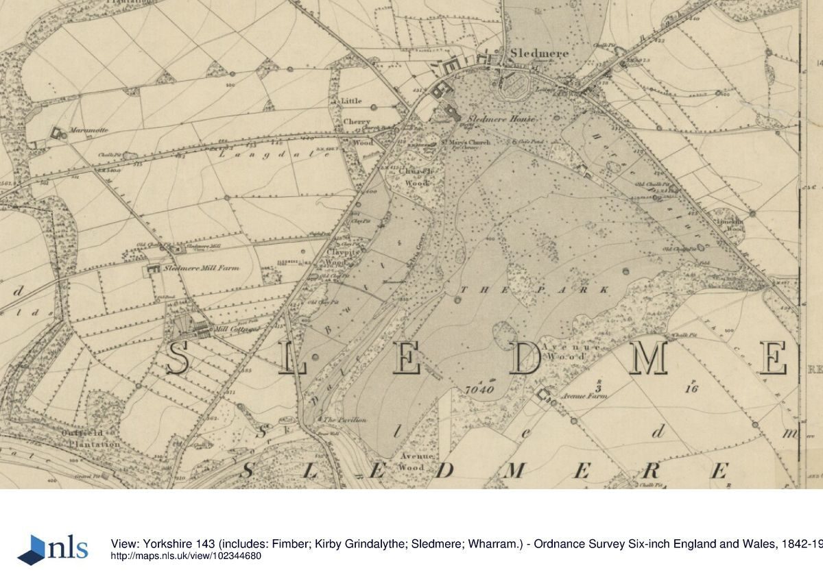
OS 6" to 1 mile: 1st edition published 1854
Description written: June 1998 Amended: March 1999
Register Inspector: CEH
Edited: November 1999
- Visitor Access, Directions & Contacts
Telephone
44 1377 236637Website
https://www.sledmerehouse.comAccess contact details
The site is open between April and September. It is closed on Saturdays and Mondays.
Owners
Sir Tatton Sykes
- History
The following is from the Register of Parks and Gardens of Special Historic Interest. For the most up-to-date Register entry, please visit the The National Heritage List for England (NHLE):
www.historicengland.org.uk/listing/the-list
HISTORIC DEVELOPMENT
The site was owned in the C15 by the Scrope family who sold it to Sir Richard Yorke in 1489. It remained in the Yorke family until the C17 when it was bought by Mark Kirkby. On his death it passed to the Sykes family through marriage. In 1776 Thomas White (1736-1811) prepared a design for the landscape for Christopher Sykes. Lancelot Brown (1716-83) was also consulted and prepared a plan in 1778. Neither plan was followed exactly, though White continued to supply trees through the 1770s, and Sykes incorporated elements from both the designs into his scheme for the park. The completed scheme is reflected in a plan of c 1815 which was drawn up for Sir Mark Masterman Sykes following the death of Sir Christopher in 1801.
Sir Christopher was offered a baronetcy in 1783, perhaps for his services to agriculture (Popham 1997) and his changes to the landscape were aimed at agricultural improvement as much as at aesthetic effect. He was responsible for building model farms and laying out plantations throughout the township, and was honoured by the Agricultural Society for the East Riding of Yorkshire and County of Hull in 1780 for planting trees. The site remains in private ownership (1998).
Period
- 18th Century (1701 to 1800)
- Late 18th Century (1767 to 1800)
- Associated People
- Features & Designations
Designations
The National Heritage List for England: Register of Parks and Gardens
- Reference: GD1922
- Grade: I
Features
- Great House (featured building)
- Earliest Date:
- Latest Date:
- Ha-ha
- Herbaceous Border
- Fountain
- Summerhouse
- Rose Garden
- Parterre
- Walk
- Parkland
- Plantation
- Gardens
- Walled Garden
- w
- Key Information
Type
Park
Purpose
Recreational/sport
Principal Building
Domestic / Residential
Period
18th Century (1701 to 1800)
Survival
Extant
Hectares
300
Open to the public
Yes
Civil Parish
Sledmere
- References
References
- {English Heritage Register of Parks and Gardens of Special Historic Interest}, (Swindon: English Heritage, 2008) [on CD-ROM] Historic England Register of Parks and Gardens of Special Historic Interest
- Pevsner, N. and D. Neave, {The Buildings of England: Yorkshire, York and the East Riding} (London: Penguin, 2nd edition 1995), pp. 692-7 The Buildings of England: Yorkshire, York and the East Riding
- Neave, D. and D. Turnbull, {Landscaped Parks and Gardens of East Yorkshire} ([n.p.]: Georgian Society of East Yorkshire, 1992), pp. 65-7 Landscaped Parks and Gardens of East Yorkshire, 1700 - 1830