


Introduction
The importance of the Shillinglee Park lies in the high aesthetic value of the house and ancillary buildings, its roots in the landscape, its structural planting and in its close connection with the surrounding estates of Petworth Park, Cowdray Park and Burton Park. All have connections to Lancelot ‘Capability’ Brown, with known work by Brown at Petworth and Cowdray and accounts for work carried out at both Burton Park and Shillinglee Park.
Maps of the Shillinglee estate after alterations took place show increased levels of woodland planting in the park that gradually narrow the view from the house to the lake, clumps of tree planting, smoothing of the edges of the lake, and a less formal parkland. Large scale planting of thousands of trees took place in the 1760s outside the park but within the estate. The view of an expert on Brown and his work is that his suggestions in his general plan were carried out.
The following is an excerpt from a detailed report on Shillinglee prepared by Sussex Gardens Trust. A link to the full report can be found at the bottom of this tab.
ENTRANCES AND APPROACHES
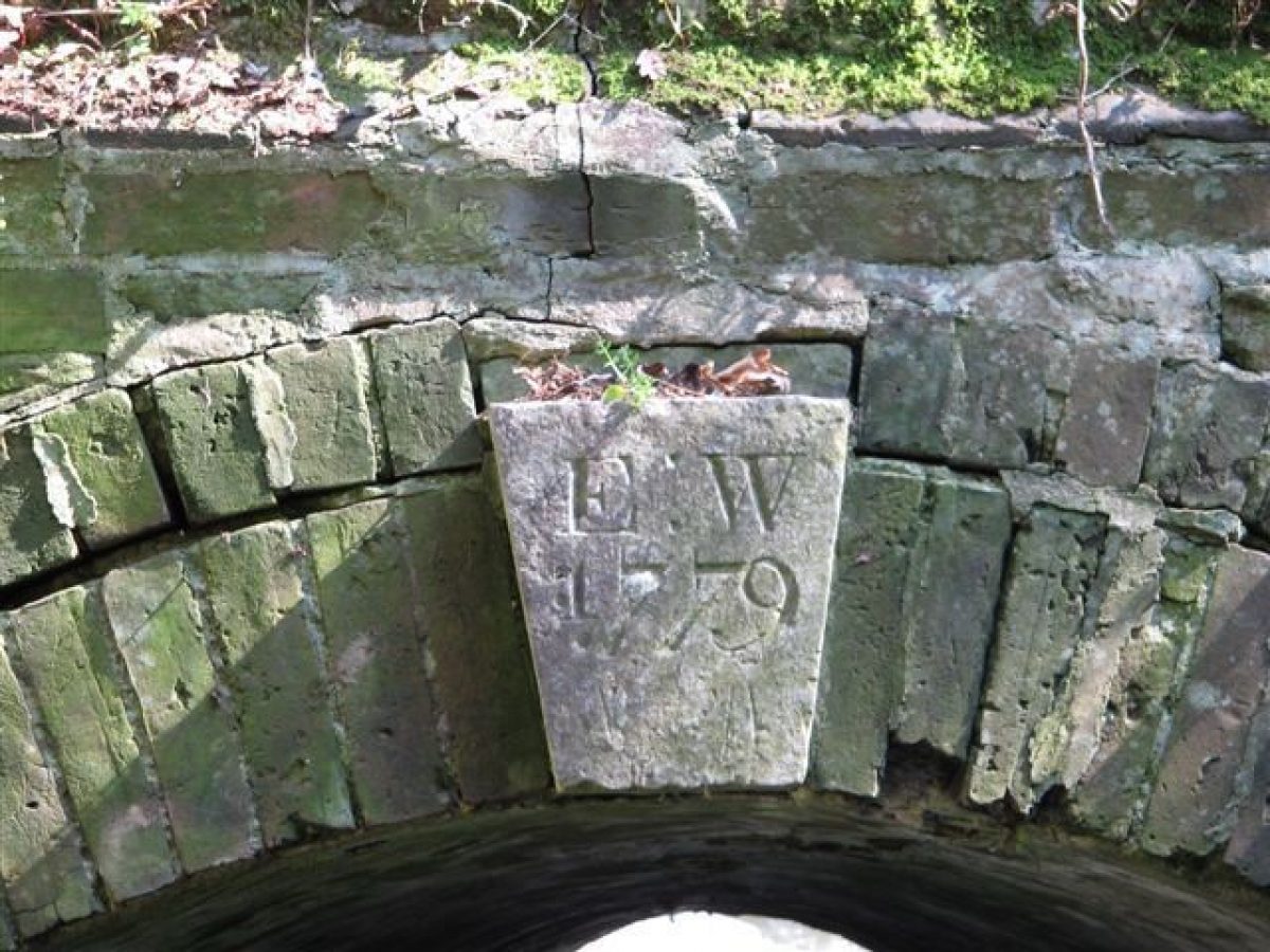
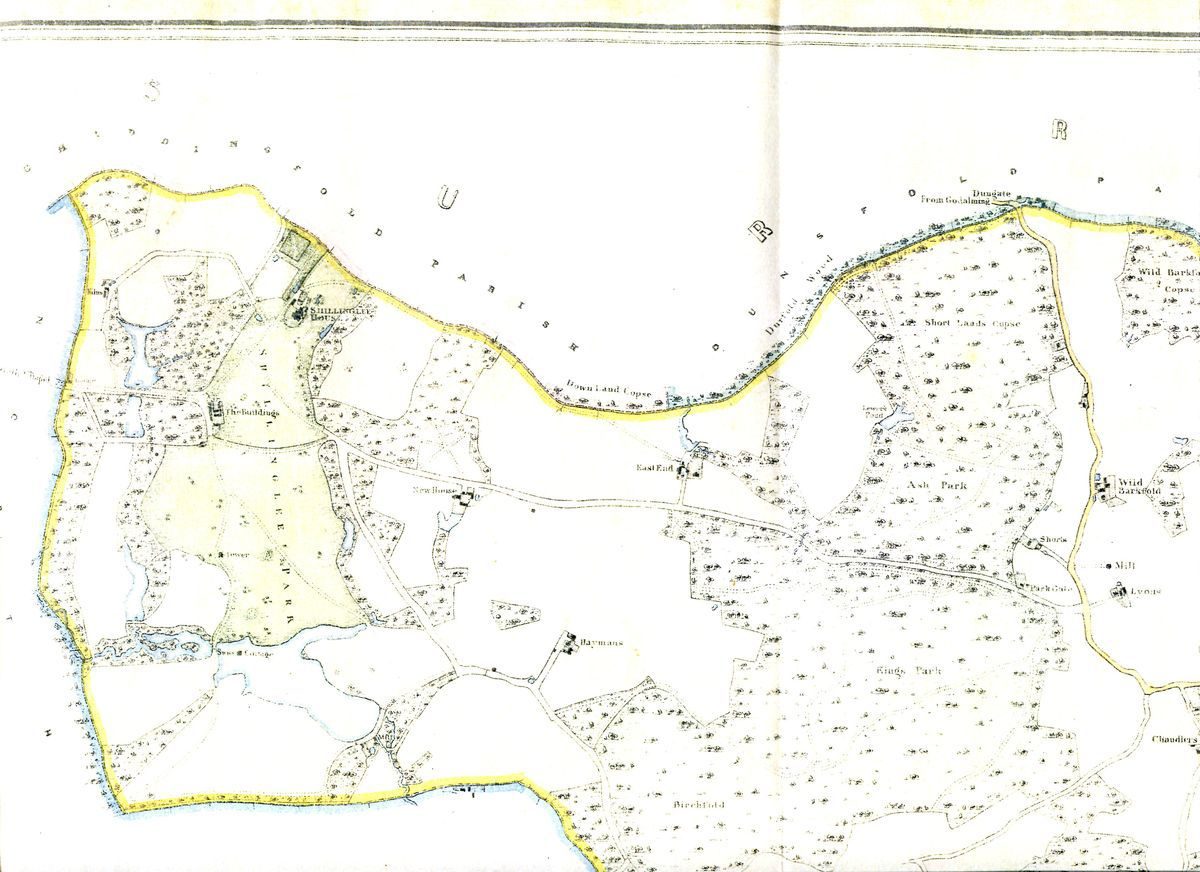
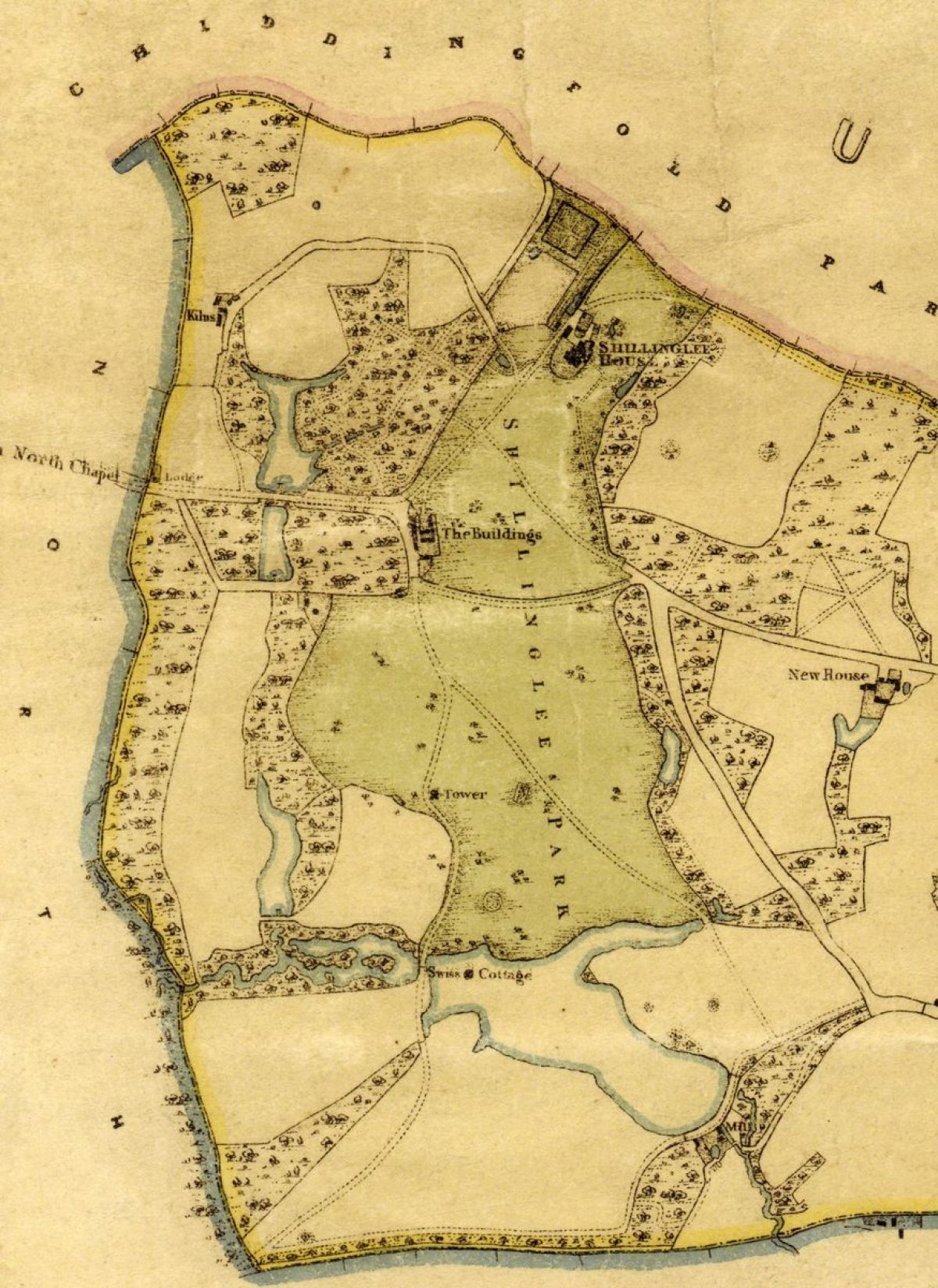
The main approaches to Shillinglee Park remain as they were in the 18th century. There is one entrance from the north, where it turns south-west after passing the house, entering the park from a minor road to Chiddingfold and then continuing south-east to The Buildings. The entrance from the west enters the park and runs due east to meet The Buildings and then connects with the north entrance. The 1836 map of Kirdford parish shows a lodge at the entrance. This drive through the park is now a public road that runs in a west/east direction from the A283 Petworth to Chiddingfold road towards Plaistow. Another main entrance shown on the 1836 map is in the south-west corner of the park. The historic drives and access routes are still in existence on the modern map as footpaths or bridleways, indicating their original uses.
Way Wardens or overseers of the highways were appointed each year from 1630 until 1764 when the record written by Richard Mosse finished (WSRO Shillinglee 3/34).
KITCHEN GARDEN
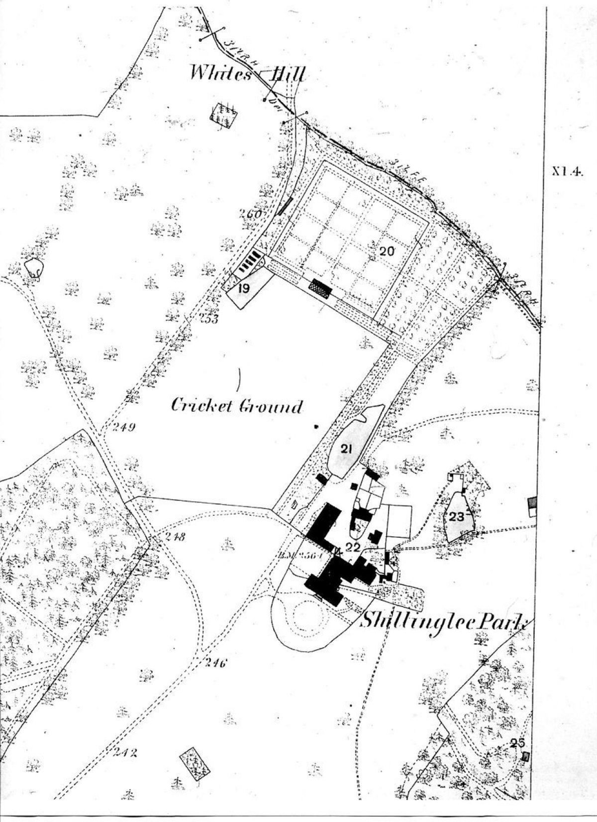
There is no map evidence of a kitchen garden before 1808, where its location is shown on the 1808 Ordnance Surveyors' drawing and the 1836 map of Kirdford Parish. Both show a square kitchen garden with diagonal paths dividing the beds, located on the northern border of the estate, to the north-west of the house. The diagonal beds are shown on later maps to have been changed to the more usual quarter paths running with the walls of the kitchen garden.
We can assume that given the new south wing of the house and Lord Winterton's elevated position to the Earldom that the walled kitchen garden was in place by the mid- to late-17th century. Bricks would have come from the brick kiln noted as on plans on the north-west of the estate. Its existence is confirmed by an extensive plant list for the kitchen garden dated July 25, 1771 from James Gordon which shows that equipment was being purchased, as well as flowers, but that in the main it was for the supply of vegetables. (British Museum Ref: collection, Heal,74.16).
Although there is little evidence to date of a formal garden, in February, March and April 1766, the Earl was employing 9, 15 and 26 gardeners under the head gardener, Walter King. Mending the Pond Head in the garden was mentioned.
Detailed description contributed by Sussex Gardens Trust 07/01/2016
REFERENCES
Internet References:
www.british-history.ac.uk/vch/essex/vol8/pp223-237 Little Parndon
www.cracroftspeerage.co.uk
www.historyofparliamentonline.org
www.britishhistoryonline.org
Reports and Articles:
Holden, Derek, A Brief History of Shillinglee Park, Haslemere Angling Society Newsletter, September 2006 and January 2007, derek.holden2@virgin.net
Country Life, Volume LXXX 1936 p 142, 8 August 1936
Dallaway, James (1832) Rape of Arundel Western Division of the County of Sussex, Volume II, Park of the First, Parish of Kirdford, page 370
Viscountess Wolesley, Historic Houses of Sussex Shillinglee Park, Kirdford, The Sussex County Magazine, No.111 December 1936
Kenyon, G H, A Shillinglee Sale Catalogue of 1788, Sussex Notes and Queries, G H Kenyon, Vol XIII November 1953, pages 15 and 16
West Sussex Record Office Sale Particulars SP 2645
West Sussex Record Office, Shillinglee Archive, Add Mss 3/36 1763 Memo relating to Shillinglee Estate, Richard Mosse
Royal Society of Arts RSA PR GE/110/11/34 and RSA PR GE/110/22/95
Archives:
British Library
British Museum, Invoices to Lord Winterton, research/collections online/search the collections/Heal,74.2
Essex Records Office, Turnour estates in Essex and Norfolk
West Sussex Record Office, Shillinglee Archive Accession number 454
University of British Columbia, Turnour Sussex Deeds 1745-1845, deposited by the 7th Earl
Maps:
Ordnance Surveyors' Drawings 84, Midhurst, Charles Budgen, British Library online
WSRO Kirdford Parish Map 1836, Surveyed and executed in lithography by I T and C Lewis of Chichester ref: Add Mss 2056
WSRO Kirdford Tithe Map, TD/W74 1845-47
WSRO Ordnance Survey 1st edition 25" to the mile 1875
WSRO Plan of Shillinglee Park, Kirdford circa 1735 for Edward Turnour Esq, ref: Shillinglee Mss 26/10
WSRO Gardner and Gream 1795, ref: MP 4015
WSRO Ordnance Survey 2nd edition 6" to the mile 1899
- History
The following is an excerpt from a detailed report on Shillinglee prepared by Sussex Gardens Trust. A link to the full report can be found at the bottom of the 'Description' tab.
THE PARK
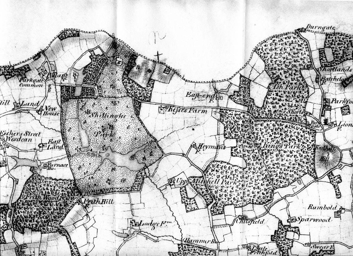
Shillinglee Park has a long history, traceable from its Tudor ownership to the Gores and then the Turnours who owned it for 300 years. Its domestic boundaries of buildings and deer park have remained consistent throughout. After 1975 and the division in ownership of the estate, the park boundaries have remained as they were. Saxton's map of Sussex in 1579 gives Shillinglee Park great prominence in terms of size within its park pale, and each map drawn during the 17th to 19th centuries continues to follow a similar pattern. One change is that the map of Sussex by John Cary (1805) shows an avenue reaching from the eastern boundary of the estate towards Plaistow through what would have been the wider estate outside the deer park boundary. This does not appear on the 1836 map of Kirdford Parish.
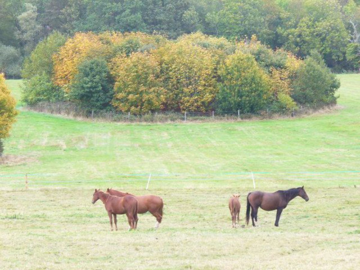
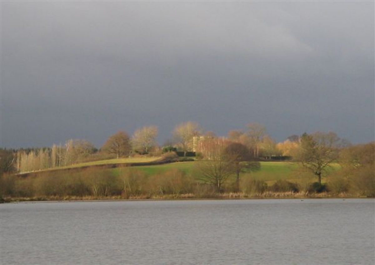
In 1832 Dallaway wrote about Shillinglee that ‘the beautiful forest scenery commands a view of the lake of 70 acres (28.3 ha) in extent'. This is likely to be an exaggeration as the size is in the region of 30-40 acres (12-14 ha). ‘Large woodland tracts, called Kings Park and Ash Park are contiguous and included in the same property, which contains 6,000 acres (2,428 ha) in a ring fence'. The woodland continues to form a large portion of the park although less so on the undated estate map of around 1735 for Edward Turnour Esq.
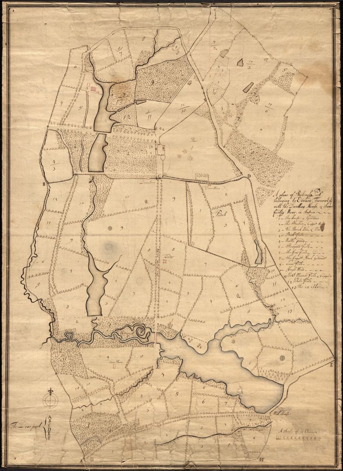
This estate map of Shillinglee Park shows a formal landscape with extensive areas of water; the two North Ponds, New Pond, The Lake (more often referred to as the Mill Pond) and a number of lesser ponds and feeder streams. It is notable that the edges of the lake are irregular with many curves and inlets.
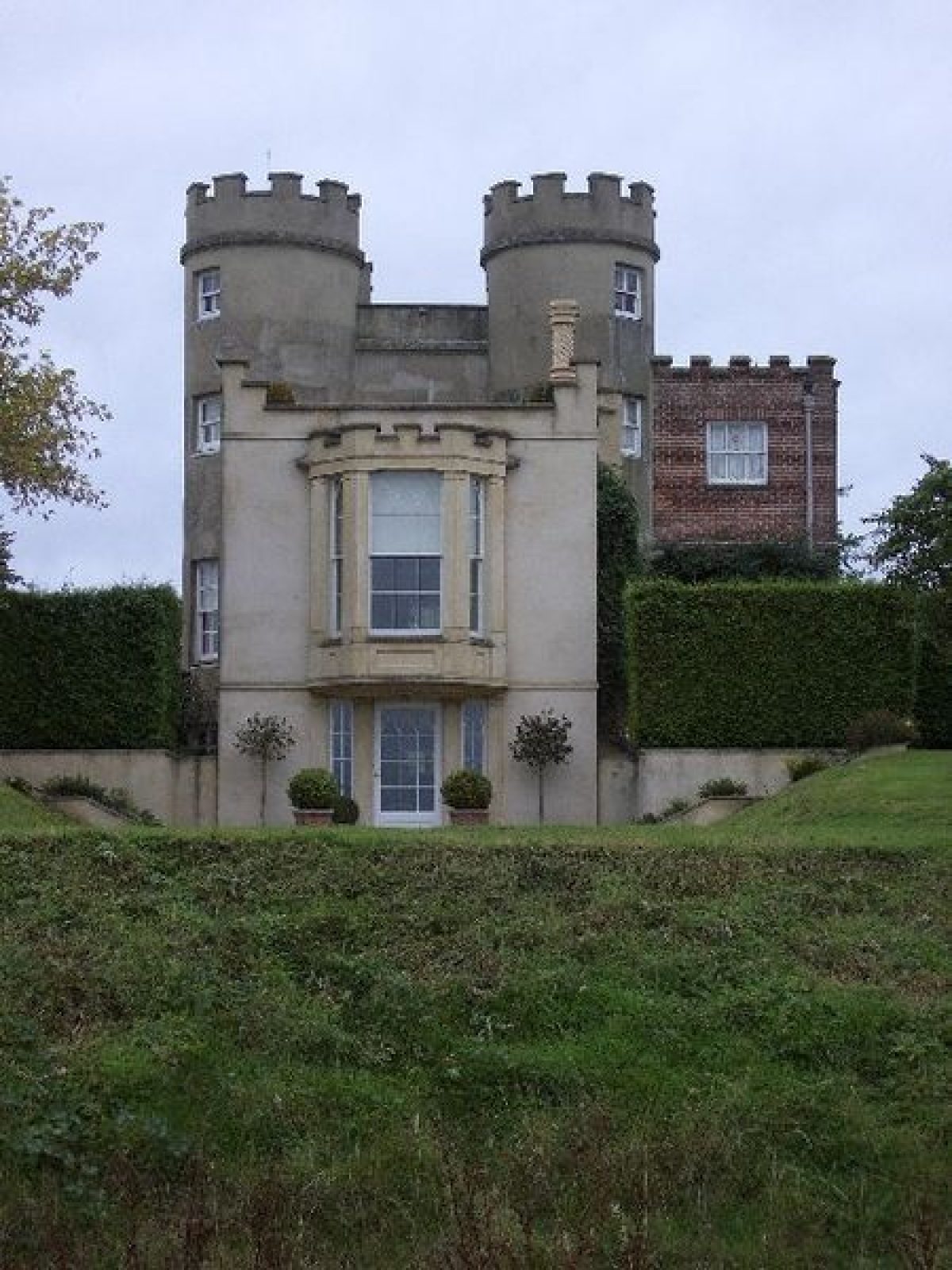
The deer park is marked at points A to E on the map and is contained to the south of one of the main drives to ‘The Buildings', otherwise the Home Farm, that continues to the house and the northern boundary of the estate. Shown within the park are three deer barns and the Deer Tower (marked as Lodge) which was four storeys high with its four turrets and an imitation keep. Detailed examination of the map show that the house and buildings are outlined in red, as is the China Bridge.
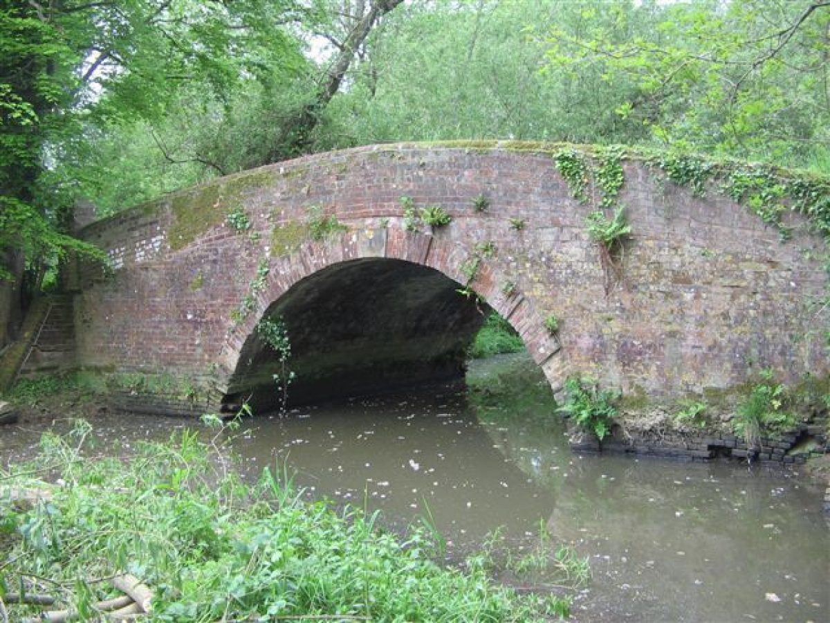
Field divisions are shown throughout the plan with an index providing field names and uses. The deer park is divided in much the same way and in the north-east corner is an area containing four fields, marked as Paddock. A network of drives, access ways and paths intersect the estate, the drives being shown as tree-lined avenues. The South Walk commences at the northern end of the deer park adjacent to one of the drives, with a marked entrance, perhaps gates, and continues due south to the boundary, crossing the lake at the China Bridge. This again is shown as tree-lined.
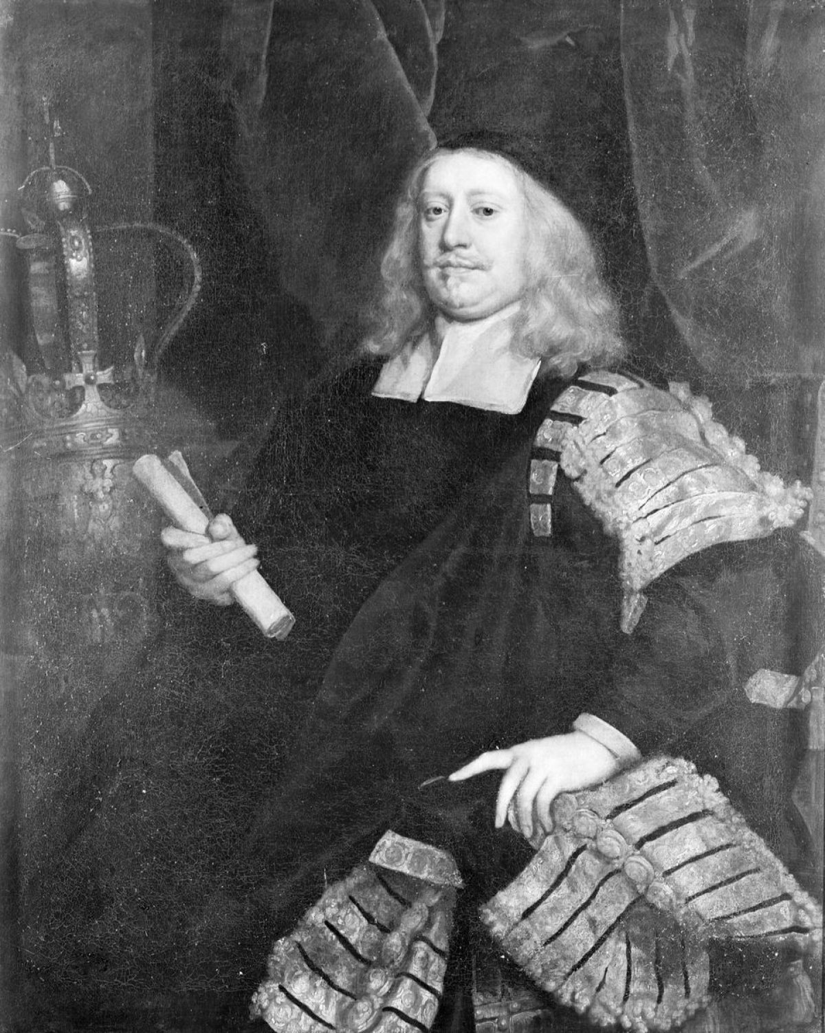
By 1761 Edward Turnour had been granted the Barony of Gort and had taken the title of Lord Winterton. In the style of Lancelot Brown, he started planting two outlying areas of land to the east of the Park known as Kings Park and Ash Park. Three documents written as certificates, now in the Royal Society of Arts archive, show that he had instructed his bailiff, James Peto, to plant ‘20 acres (8 ha) in the freehold estate of Lord Winterton', 13 acres (5 ha) being a parcel of a farm called Kings Park and other 2 acres (0.8 ha) adjoining it, and then 4 acres (1.6 ha) of a parcel of land at Ash Park. It was to be ‘sufficiently ploughed and planted with 84 bushells of the best and soundest acorns', and to be ‘well and effectualy fenced and secured on all sides with a wide deep Ditch and a high Bank and a very good strong Hedge fence thereon'. This was signed by James Peto, Thomas Hock, Carter to Lord Winterton and John Parkhurst, husbandman. The accounts show that in 1760 Joseph Cox was planting acorns in Kings Park and work continued using women and families. A year later John Parkhurst was working there for six months. The bills were signed by William Heath, presumably the Earl's steward.
Two further documents follow in 1766 from the newly ennobled Earl. One relates to Ash Park where ‘2,000 small-leaved English Elms, (well fenced in and preserved from Cattle)' were planted. The second notes that ‘12 acres (4.8 ha) in Shillinglee Park were set with Spanish Chestnuts. On each acre of which there are now many more than five hundred Spanish Chestnut Plants'. A total of 12,000 Spanish or sweet chestnuts were planted. These two certificates were signed by Walter King Gardener and Peter Holden. The employment of Walter King as gardener was a new departure for Lord Winterton. 1n 1766 the fish pond was being mended and stocked with carp, perch and tench. The park and garden were drained by James Baker with three men, this being a regular occurrence.
The Earl was awarded medals from the Royal Society for the tree planting; there was concern at the time, because of the loss of trees needed for shipbuilding while the country was at war, so tree planting was encouraged. In his Will the 1st Earl Winterton bequeathed to his five youngest sons ‘the five gold medals which I received of the Society of Arts & Commerce for planting Timber'.
Again in 1766 the Earl was buying trees, this time from Viscount Midleton (the 4th Viscount of Peper Harrow), some being relatively newly arrived in England and more exotic varieties than his previous purchases. The list with quantities varying from 100 to 4 and with spellings as written consists of America Oaks, Deciduis Cypress, Sweet Gums, Broad leaved Spindle trees, Small Virginian Tulip Trees, Small Red Cedars, Pine Asters, Scotch Fires, Small judas trees, White American Ash, White Mulberry trees, America Berch, Small Cockspur thorns, Small Mountain Ash, Lymes, Waymouth pines and Carolina poplars. The list was signed by John Coulson (WSRO, Shillinglee, Acc 454/44). Note: Pine Asters - Pinus pinaster, Mediterranean pine. Deciduis Cypress - Taxodium distichum.
This planting period ties in with the date of 7th February 1762 when Lancelot Brown sent in his account to Earl Winterton ‘To a survey paid to Brown with his expenses up and down at 4 pence per acre, the amount being £12.13s. 0d.'Then follows ‘To a general Plan for the Place very large and very troublesome' costing £40.0.0. Following on ‘To various times being at Shillingley [sic] Park to view it in order to make a Plan to several times being there to mark Timber and to men trying the ground etc etc' that amounted to £31.10.0, bringing a total of £84.3.0. The estimated size of the park at this time, given the costs involved, was 759 acres (307 ha).
Shillinglee lies north of Petworth, with lands running adjacent to each other. The road to North Chapel and Chiddingfold runs immediate on east side of the park at Petworth and by turning right after North Chapel the visitor arrives at Shillinglee. There exists in the Shillinglee archive correspondence concerning rights to the different lands and it is almost inconceivable that the families did not meet on social occasions. Brown was working at Petworth between 1751 and 1764 which would allow for him to be in Sussex around 1761 and 1762.
Brown's account for his work at Shillinglee and the planting of vast numbers of trees both within the park and at Kings and Ash Parks, together with the map evidence of the changes in both woodland and the lake at Shillinglee, would suggest that the timings are more than coincidental. Indeed, examination of the maps and plans by one of the most qualified Brown experts confirms the view that Brown's work for Earl Winterton was carried out, although the map evidence suggests that this was not in the lifetime of the 1st Earl.
The estate contains all the hallmarks of Brown's landscapes. There are the rolling contours, the serpentine lake and both single and tree clumps, the changing of South Walk to the softer more diagonal route through the park, together with vast areas of tree planting both within and beyond the park.
The Shillinglee archive accounts (WSRO 35/45) show that one of the carpenter's jobs in 1772 was moving the summerhouse from New Copse and moving the gates in the paddock; it is possible that this was the Chinese summerhouse noted in the sales particulars. Other entries in the accounts mention work on the ‘Little House'. It is possible that this was the garden building shown on the Ordnance Surveyors' drawing, Midhurst, of 1808 and to be seen on the print of Shillinglee of 1832.
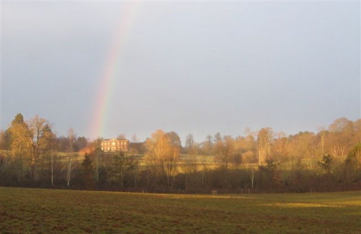
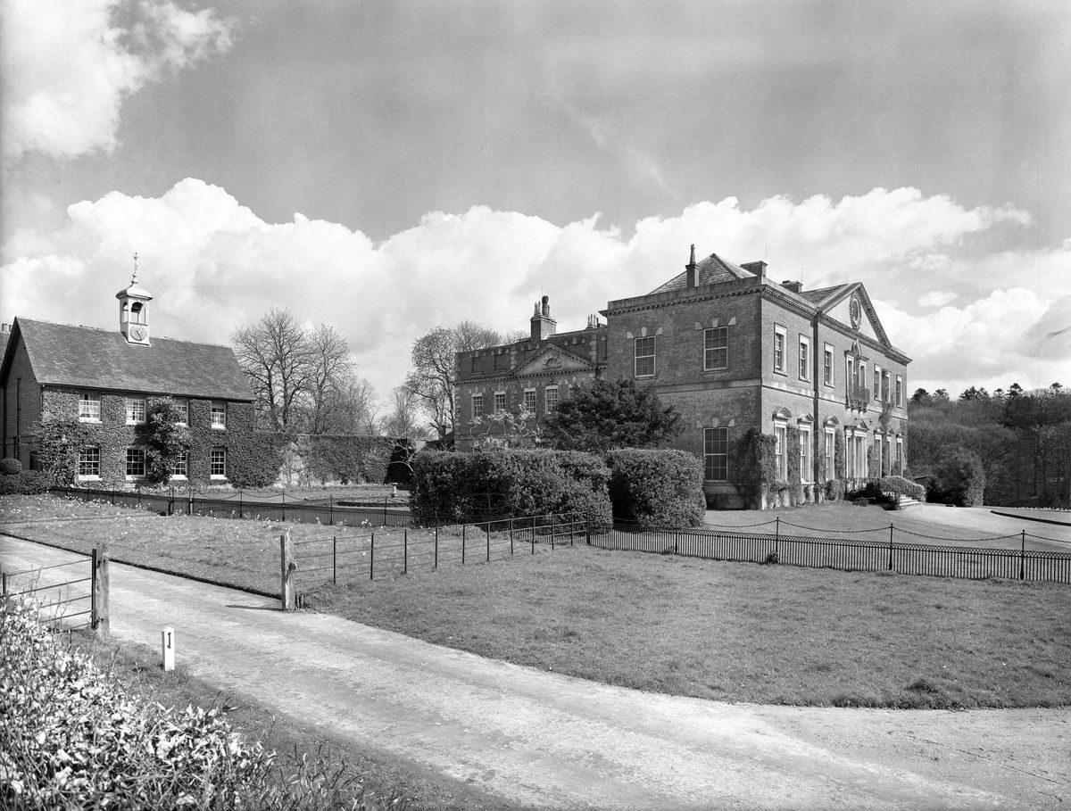
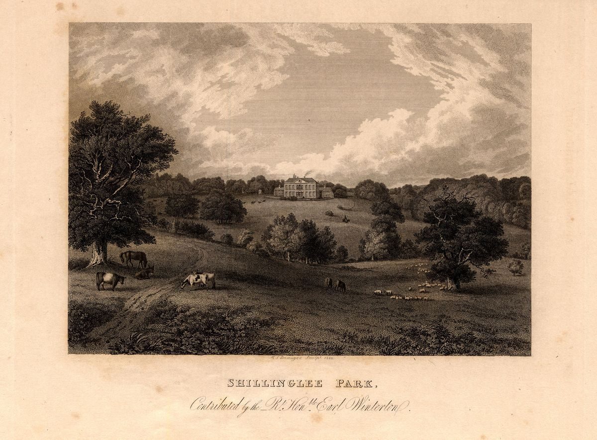
At present three plans of Shillinglee in the late-17th century in West Sussex are missing in the West Sussex Record office, but the Ordnance Surveyors' Drawing of Midhurst shows Shillinglee without much change. A print of Shillinglee Park ‘Contributed by the Rt Hon. Earl Winterton' (the 3rd Earl), and a detailed map of Kirdford Parish of 1836 show evidence of the changes noted below. The print shows a conservatory on the east wing of the smaller two bays either side of the new south facing wing and a fence separating the house from the park which slopes gently down to the lake before it rises again, showing a landscape of great aesthetic appeal. None of the lakes can be seen but woodland rings the edges of the park, together with tree clumps and specimen trees set within the open landscape of the park. To the west of the house appears an obelisk on its plinth and a garden house again set on a low plinth and two stories high. So far there are no records of these garden structures but they may appear on the map of 1808. It is difficult to confirm this without more information about their exact location.
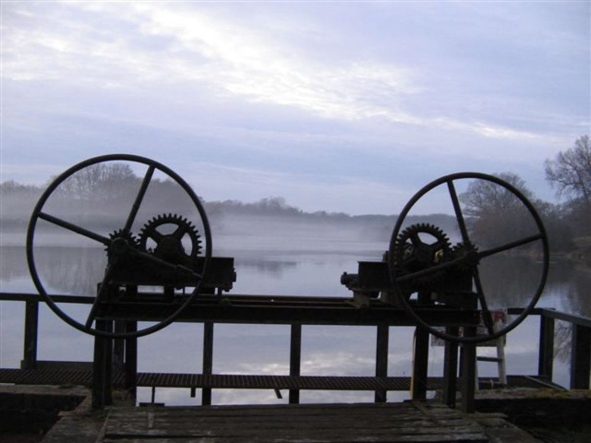
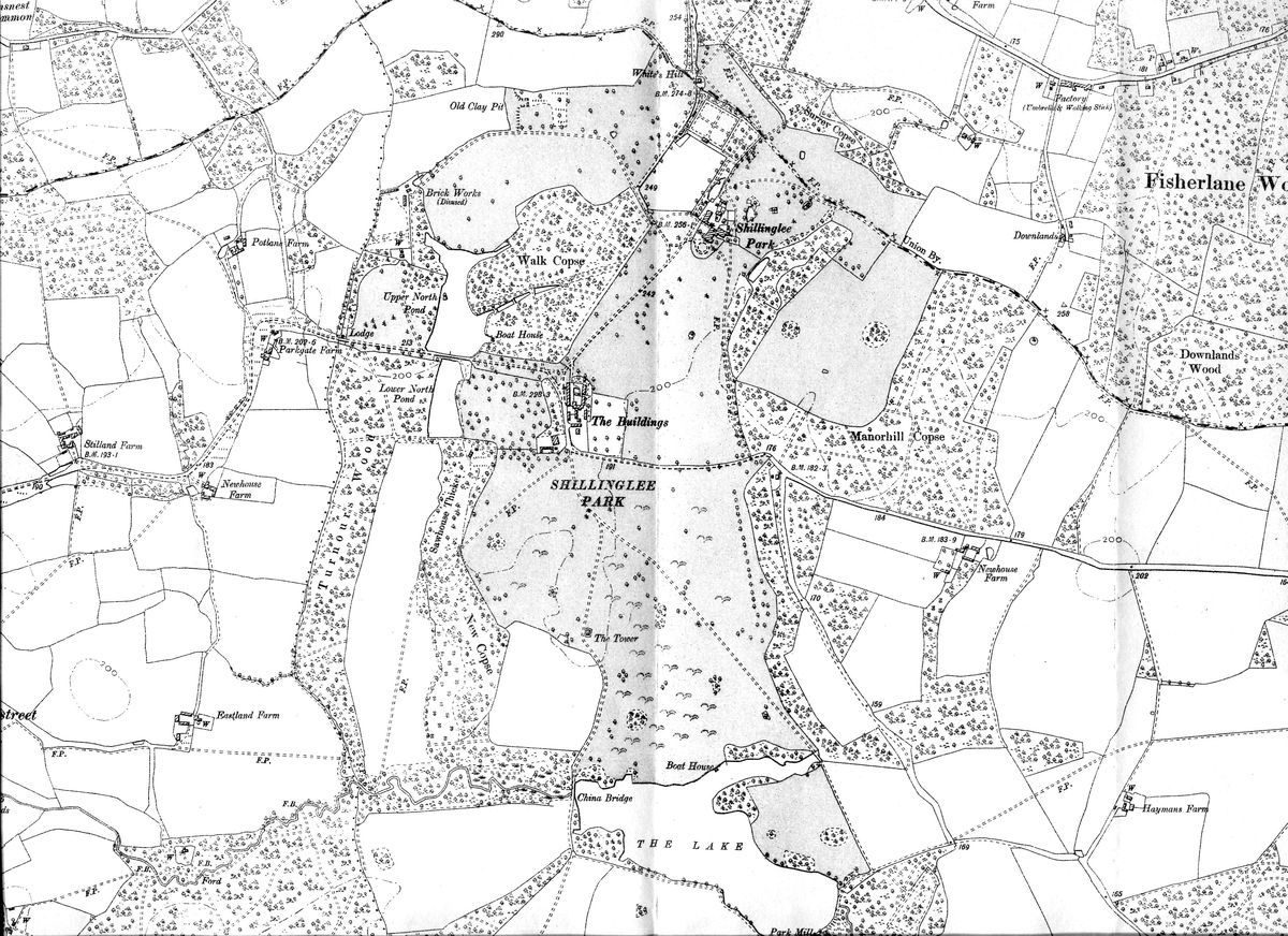
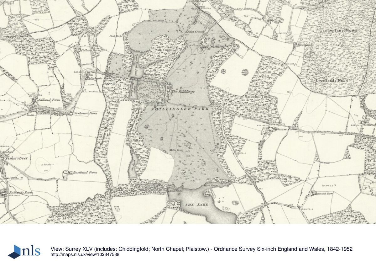
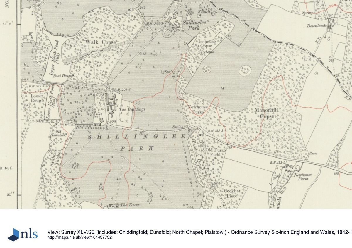
The 1836 map of Kirdford Parish (WSRO, Add Mss 2056) shows Shillinglee in detail, with the boundaries of the park corresponding with the earlier maps. New tree planting runs from the western side of the stream linking the Upper North and Lower North Ponds and the New Pond and likely to be where the 12,000 Spanish Chestnuts were planted. This is named as New Copse on the 1st and 2nd edition Ordnance Survey maps of 1875 and 1899. Woodland curves gently from north to south to meet the southern end of New Pond. Groups of trees in twos, threes and fours stand in the park, together with specimen trees. The South Walk shown on the earlier plan has gone, and has been replaced with a curving drive which forks in the middle of the park to go to the Deer Tower (Lodge) and over China Bridge to the edge of the park at the south-west corner. In the other direction it passes the end of the eastern arm of the lake and continues to interconnect with other drives. The lake has its edges smoothed into gentle contours to the eastern end where the Park Mill stands, together with a sluice. To the west another stream feeds into the lake and again the stream has edges that have been softened and widened to form interconnecting ponds.
The next century following the Ordnance Survey 1st edition map of 1875 shows little map evidence of change to the landscape. Subsequent Earls were evidently happy with the setting of the house and landscape but continued to maintain the various areas of woodland, lakes and feeder streams. At some point, New Pond was drained and filled.
The changes to ownership from the 1970s, with the division of the landscape, has made little impact, the house and park remain as it has been for so many years, serene in its setting.
Detailed history contributed by Sussex Gardens Trust 07/01/2016
Period
18th Century (1701 to 1800)
- Associated People
- Features & Designations
Designations
The National Heritage List for England: Listed Building
- Reference: Deer Tower
- Grade: II
Site of Special Scientific Interest
Features
- House (featured building)
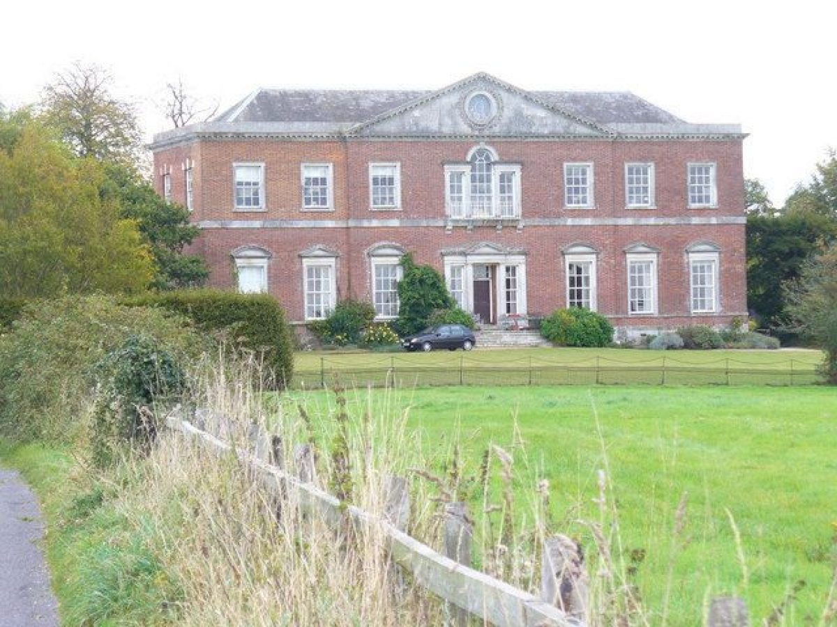
- Description: The house was built in two phases between 1735 and 1778. It burnt down during World War 2 and was later converted into flats in the 1970s.
- Earliest Date:
- Latest Date:
- Planting
- Description: Water garden.
- Rose Garden
- Tree Avenue
- Description: There is a lime avenue in the park.
- Orchard
- Lake
- Deer House
- Description: In the park was a C18th deer tower as an eye catcher for the house to the north, stuccoed with four corner turrets. This has since been converted into a private residence.
- Parkland
- Trees
- Woodland
- Key Information
Type
Park
Purpose
Ornamental
Principal Building
Domestic / Residential
Period
18th Century (1701 to 1800)
Survival
Part: standing remains
Hectares
48.56
Open to the public
Yes
Civil Parish
Kirdford
- References
References
- Nairn, I and Pevsner, N {The Buildings of England: Sussex} (Harmondsworth: Penguin, 1965) The Buildings of England: Sussex
Contributors
Sussex Gardens Trust
Sally Walker