Introduction
The site has gardens, pleasure grounds and a park. The gardens of 6 hectares date from the early-19th century. The park is medieval in origin and was landscaped in the late-18th century.
Terrain
The site lies on a low east to west ridge running parallel to the South Downs, which rise up steep, well-wooded slopes to a crest some 1km south of the site.
The following is from the Register of Parks and Gardens of Special Historic Interest. For the most up-to-date Register entry, please visit the The National Heritage List for England (NHLE):
www.historicengland.org.uk/listing/the-list
An early to mid-19th-century informal, woodland garden, possibly associated with the landscape designer William Sawrey Gilpin, with later 19th-century and early to mid-20th-century formal, walled gardens, set within an early to mid-19th-century park.
DESCRIPTION
LOCATION, AREA, BOUNDARIES, LANDFORM, SETTING
Bignor Park is situated c 1km to the west of the A29 Arundel to Pulborough road, immediately to the east of the village of Sutton and north-east of Bignor village. The 123ha registered site which comprises c 5.5ha of formal and informal gardens and 118ha of parkland, woodland and farmland, lies on a low east to west ridge running parallel to the South Downs, which rise up steep, well-wooded slopes to a crest c 1km south of the site. On the south side of the intervening ridge, immediately beyond the southern site boundary on Bignor Hill is the site of the Bignor Roman villa. From the centrally positioned house and gardens, the site rises gently towards the north-east, while southwards the ground drops into an east to west stream valley. The boundaries are enclosed by agricultural fencing fringed with trees or hedges and abut minor lanes in the north-east corner and on the west side. The site is otherwise surrounded by a landscape of woodland and farmland.
ENTRANCES AND APPROACHES
The site is entered from the lane to the north-east, a metalled drive entering through gates and following a fairly straight course west-south-west to a rectangular, gravelled forecourt, enclosed by a low wall, on the north front of the house. The drive continues beyond the house to a gate on the lane in the extreme south-west corner. The house appears to have been similarly approached from the north-east in the late C18, with a formal avenue lining the western section (nearest the house) of a route similar to that of the present drive. By the early 1800s (OS Old Series, published 1813), a further approach drive was established to the north front, from an entrance at the northernmost point of the site, which curved southwards through Decoy Copse (this section now a track) and ran across the west side of the park. Between 1898 and 1912 (OS 2nd and 3rd editions), the southern section (now gone but surviving until 1929, Lord Mersey pers comm, 1998) was altered to follow a serpentine course across the centre of the park between the tree clumps, to meet the present east to west drive some 150m east of the house.
PRINCIPAL BUILDING
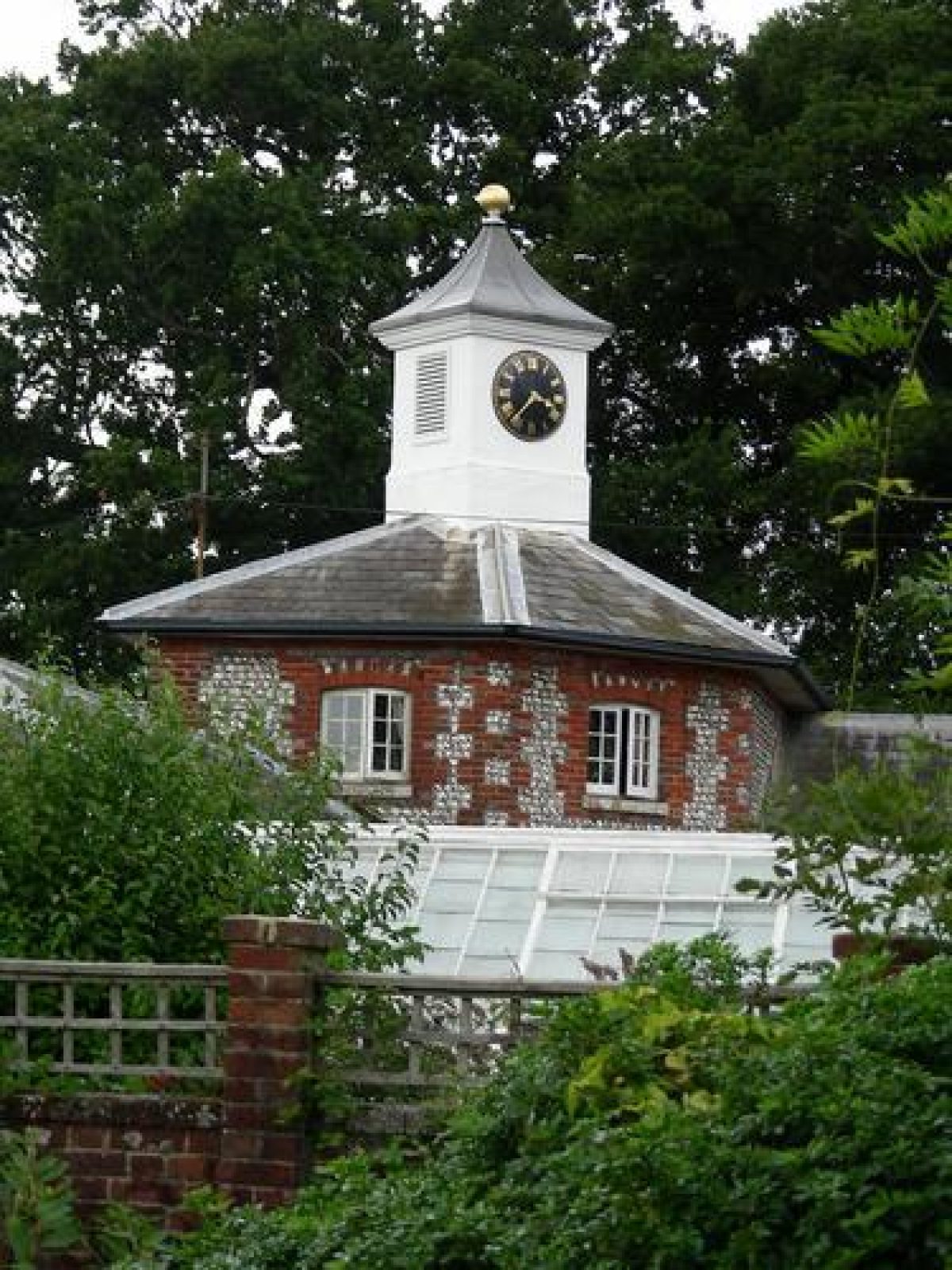
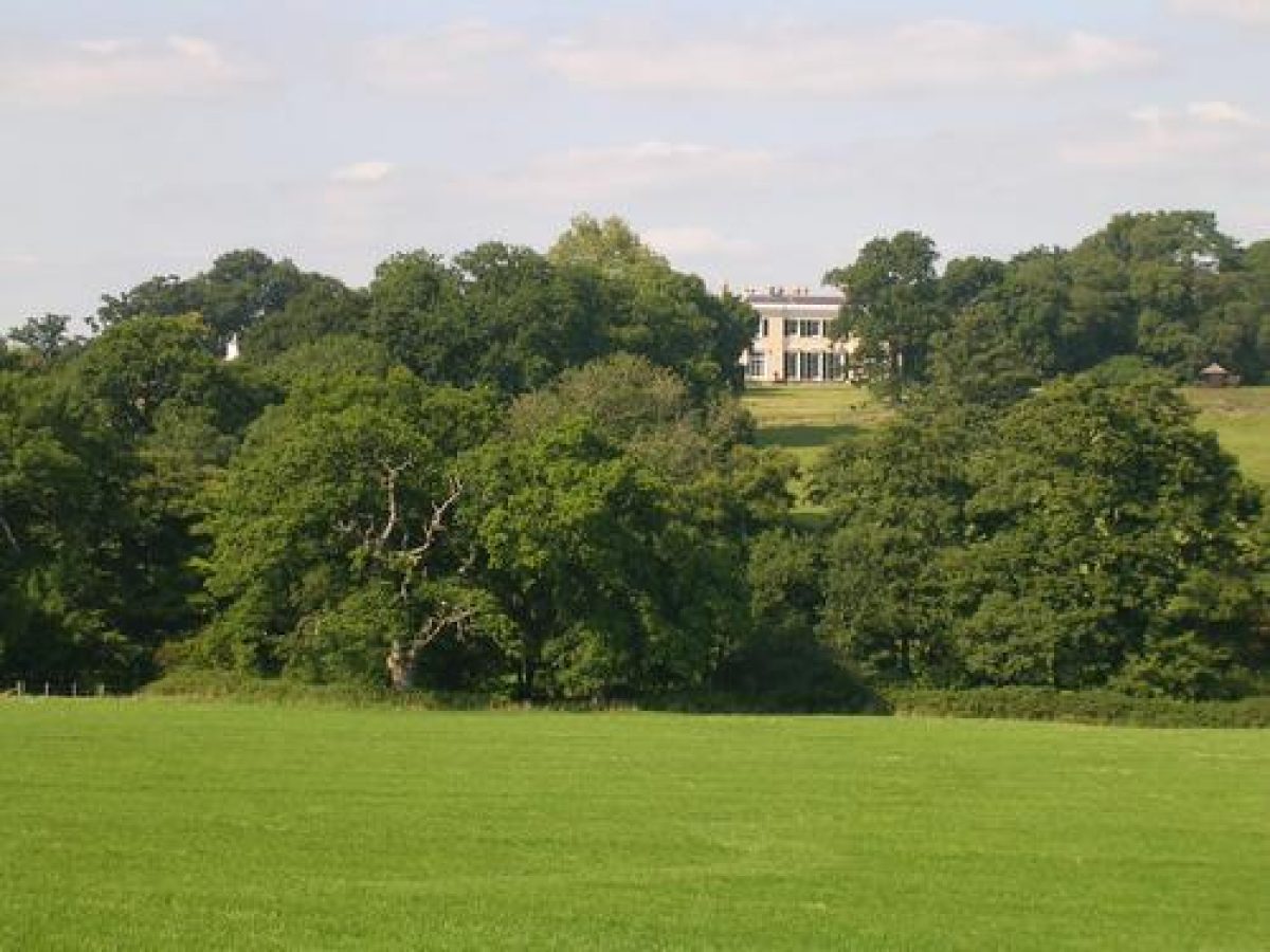
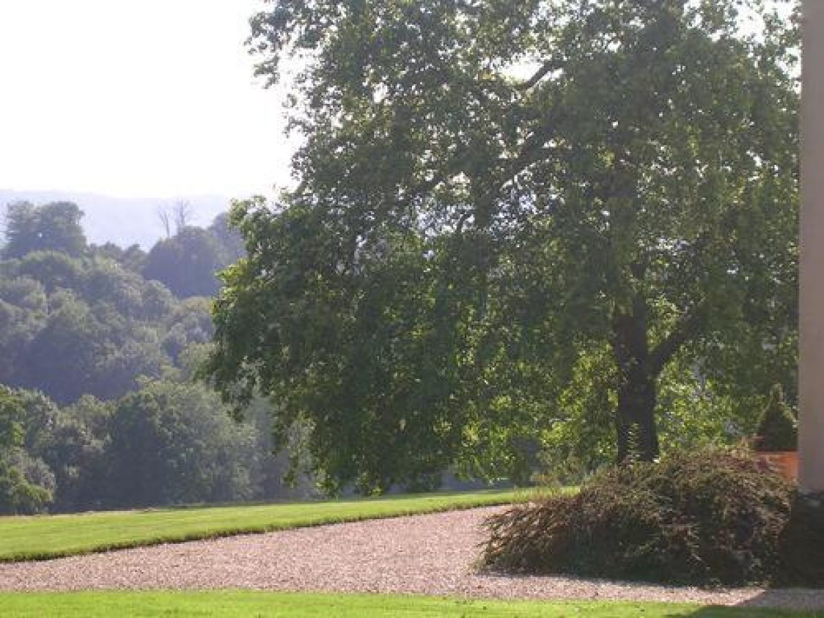
Bignor Park (listed grade II) stands on level ground in the centre of the site and on the crest of a ridge, with extensive views, framed by trees, southwards to the South Downs. The two-storey house, faced with stucco and with a hipped, slate roof, has a portico on the north, entrance front, composed of two rectangular columns enclosing a solid porch, which stands at the head of four steps and links the two end window-bay projections. Built between 1826 and 1829 by the architect Henry Harrison (active in the 1820s and 1830s) for John Hawkins and reduced in size at the western end in the early 1980s, the house replaced a former one on the same site built in 1632 (illustrated in a drawing of c 1785 by S H Grimm, CL 1956). To the immediate north-west of the house are the early C19, single-storey stables, comprising a north-west and south-west range, faced with flint set in galleting and red-brick dressings, which, with flint walling to the north-east and south-east, form an enclosed courtyard.
GARDENS AND PLEASURE GROUNDS
The ornamental gardens lie to the south and east of the house and are shown established to their present outline by 1876 (OS 1st edition). Correspondence of 1830/31 associates the landscape designer William Sawrey Gilpin (1762-1843) with the layout and planting of the garden at that date but there is no detailed documentation of his contribution (Piebenga 1994). The south-east front of the house, flanked at the south-west end by a broad mixed shrubbery (part planted on the site of the demolished section of the house), opens onto a gravelled terrace and a broad lawn with a few mature trees (oak and plane) which descends a slope for some 140m south-eastwards to a random stone ha-ha. The west side of the lawn is enclosed by a mature beech hedge, south-west of which a path lined by a lime avenue (planted 1990s) leads along the south side of the walled gardens to further informal lawn and shrubbery and at the south-western limit of the gardens into a grove of mixed deciduous trees, shown mixed with conifers in 1876.
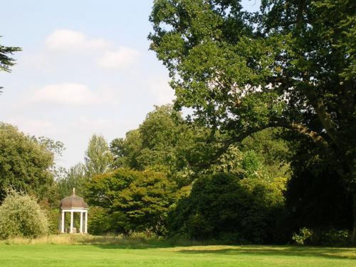
North-east of the house is an informal woodland garden, its extensive open lawns lightly dotted towards the north-east end with trees of mixed ages and species and island shrubberies, the dense tree cover surviving from that shown in 1876 being largely destroyed in the storm of 1987. The lawns are bounded from the drive along the north-west side by a clipped beech hedge and, further to the north-west by iron park paling and a belt of tall, mixed shrubbery. Further tree clumps including an ilex (holm oak) grove and a small area of woodland which contained three fountains in 1912 (now, 1998, gone) enclose the south-east side of the garden from the park. On a low knoll at the north-east end of the lawn stands an eight-columned temple with a domed copper roof, erected in 1993.
PARK
The park surrounds the house but has its greatest extent to the north-east, south and south-west, the areas to the north and south of the house and gardens (bounded to the south-west by Courthill Wood) first shown enclosed as parkland by 1813 (OS Old Series).
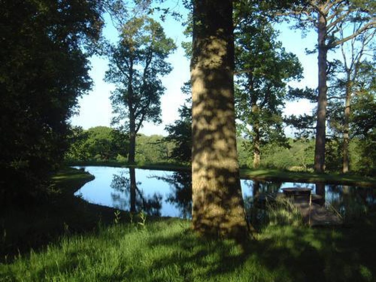
Northwards, the parkland is now (1998) largely laid to permanent grass and is planted with several extensive mature deciduous clumps (with late C20 replanting), and a good scatter of smaller clumps and individual trees, to a pattern shown established by 1876 (OS 1st edition). Towards the west side of the park a stream, which runs south-westwards through a pond in Decoy Copse and then through a belt of mixed woodland, feeds a linear, tree-fringed lake with two islands at the south end, the lake and the southern part of Decoy Copse both shown established by 1795 (Gardner and Gream). Some 200m west-north-west of the house is the three-sided courtyard range of the former Bignor Park Farm, with, at the south-east end of the south range, a two-storey building with coursed stone walls with galleting, the farm buildings and cottage (listed grade II ) probably those shown on the Tithe map of 1843. An octagonal dovecot with coursed stone walls, red-brick quoins and a small wooden cupola (listed grade II) stands within the courtyard.
South of the house and gardens, both the south- and north-facing valley sides are open in character and laid to mixed arable (south-facing slopes) or pasture (north-facing slopes), with only a very few individual trees and one or two clumps (including Round Copse on the north-facing slope) surviving from the light scatter show in 1876. The southern site boundary is fringed with tree belts shown established in 1876.
By 1898 (2nd edition OS) the area south-east of the gardens abutting Hammonds Copse and that to the north-east (north of Bowler's Crab Wood) are shown as parkland while by 1912 (OS 3rd edition) the south-west corner north of Courthill Wood had also been added. Apart from a few dotted trees in the south-east area, these appear not to have been otherwise planted up and are at present under mixed arable cultivation.
KITCHEN GARDEN
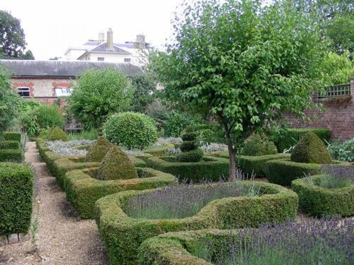
The kitchen gardens, shown established to their present plan by 1876 and enclosed within red-brick walls on all sides except that to the south-east, lie to the immediate south-west of the house and stables and are now laid out to formal, ornamental gardens. A gravelled path from the south front of the house leads south-westwards to a small brick and tile-roofed loggia (a building is shown on the site in 1876) which faces south-west over a rectangular lawn enclosed to the south-west and north-west by high brick walls. The loggia contains five wall-mounted bas-reliefs brought from Greece by John Hawkins in c 1810. An arch in the north-west wall leads into the rectangular, walled Dutch Garden, laid out in the early to mid C20 to a geometric pattern of low, box-edged beds planted with aromatics and embellished with box pyramids and corkscrews and with a sundial at the south-west end and a rectilinear pool (built between 1876 and 1912) at the north-east end. On the south-east-facing wall is a late C19 lean-to greenhouse, the surviving, glassless, curved frame ribs of its south-west section planted in the mid C20 with laburnum trees to form a tunnel arbour. To the south-west is a larger walled compartment, the south-eastern half enclosed and quartered by box hedging and laid out to lawn and a central circular pool featuring a mobile sculpture (Duet for Two Flutes by Peter Logan). The north-western half is laid out to lawn, fruit trees, a swimming pool and box-edged beds.
REFERENCES
D G C Elwes, The Castles and Mansions of Western Sussex (1876), pp 32-3
Country Life, 119 (26 April 1956), pp 860-3; (3 May 1956), pp 924-7
I Nairn and N Pevsner, The Buildings of England: Sussex (1965), p 102
S Piebenga, William Sawrey Gilpin (English Heritage Designer theme study 1994)
Maps
W Gardner and T Gream, A Topographical Map of Sussex ..., 1" to 1 mile, published 1795
OS Old Series, 1" to 1 mile, published 1813
OS 6" to 1 mile:
1st edition surveyed 1876, published 1880
2nd edition published 1898
3rd edition published 1914
OS 25" to 1 mile:
1st edition surveyed 1876
3rd edition published 1912
Description written: April 1998 Amended: January 2000
Register Inspector: VCH
Edited: June 2000
- Visitor Access, Directions & Contacts
Telephone
07798 807043Access contact details
The estate is only open on selected days during the year. http://www.bignorpark.co.uk/
Directions
From London: (53 miles) Take A3 and turn left at Milford onto A283 to Petworth.
From Petworth: (5 miles) Take A285 Chichester Road for 2 miles. Turn left, signposted Burton Mill & Roman Villa. Straight over next crossroads, then fork right signposted West Burton & Roman Villa. After 1 mile Bignor Park Estate is on the right.
From Pulborough: (5 miles). Take the A29 Bognor Road for two miles. Turn right, signposted Fittleworth. Left at 'T' Junction, first right leads to Bignor Park Estate's 1/2 mile driveway.
From Arundel: (7 miles). Take Pulborough Road. At bottom of long steep hill fork left signposted B2138 to Petworth. Second turn left leads to driveway.
- History
The following is from the Register of Parks and Gardens of Special Historic Interest. For the most up-to-date Register entry, please visit the The National Heritage List for England (NHLE):
www.historicengland.org.uk/listing/the-list
HISTORIC DEVELOPMENT
The park and manor of Bignor were held from at least the mid-14th century by the earls of Arundel, the two being separated and descending in separate ownership from the early 16th century. Bignor Park was bought in 1584 by Richard Pellatt of Steyning who built the first house on the site, the property descending through his family until sold in 1712 to Nicholas Turner. It passed by the marriage in 1780 of his grand-daughter, Anne, to Michael Dorset and in 1806 was bought by the antiquary John Hawkins of Trewithen (see description of this site elsewhere in the register), in Cornwall, who rebuilt the house and laid out the nucleus of the surrounding parkland. Hawkins died in 1841 and Bignor Park passed to his eldest daughter and her husband, the Rev George Dempster Johnson. He was succeeded by his son John Hayward Johnson, MP for Horsham from 1893 until his death in 1904. His son sold Bignor in 1926 to Lord and Lady Mersey and the property remains (1998) in private ownership.
- Associated People
- Features & Designations
Designations
The National Heritage List for England: Register of Parks and Gardens
- Reference: GD1189
- Grade: II
Features
- Summerhouse
- Description: A summer house was created from the cedar trees that fell in the great storm of 1987.
- Earliest Date:
- Latest Date:
- House (featured building)
- Earliest Date:
- Pleasure Garden
- Parkland
- Gardens
- Key Information
Type
Park
Purpose
Ornamental
Principal Building
Domestic / Residential
Survival
Extant
Hectares
56
Open to the public
Yes
Civil Parish
Bignor
- References
References
- {English Heritage Register of Parks and Gardens of Special Historic Interest}, (Swindon: English Heritage, 2008) [on CD-ROM] Historic England Register of Parks and Gardens of Special Historic Interest
- Nairn, I. and N. Pevsner, {The Buildings of England: Sussex} (Harmondsworth: Penguin Books, 1965), p. 102 The Buildings of England: Sussex
- Elwes, D. G. C., {A History of the Castles, Mansions and Manors of Western Sussex} (London: Lewes, 1876), pp. 32-3 A History of the Castles, Mansions and Manors of Western Sussex
- ACTA {Bignor Park West Sussex Parkland Plan Vol1} (2011) Bignor Park West Sussex Parkland Plan Vol1