Introduction
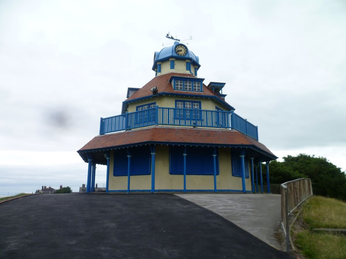
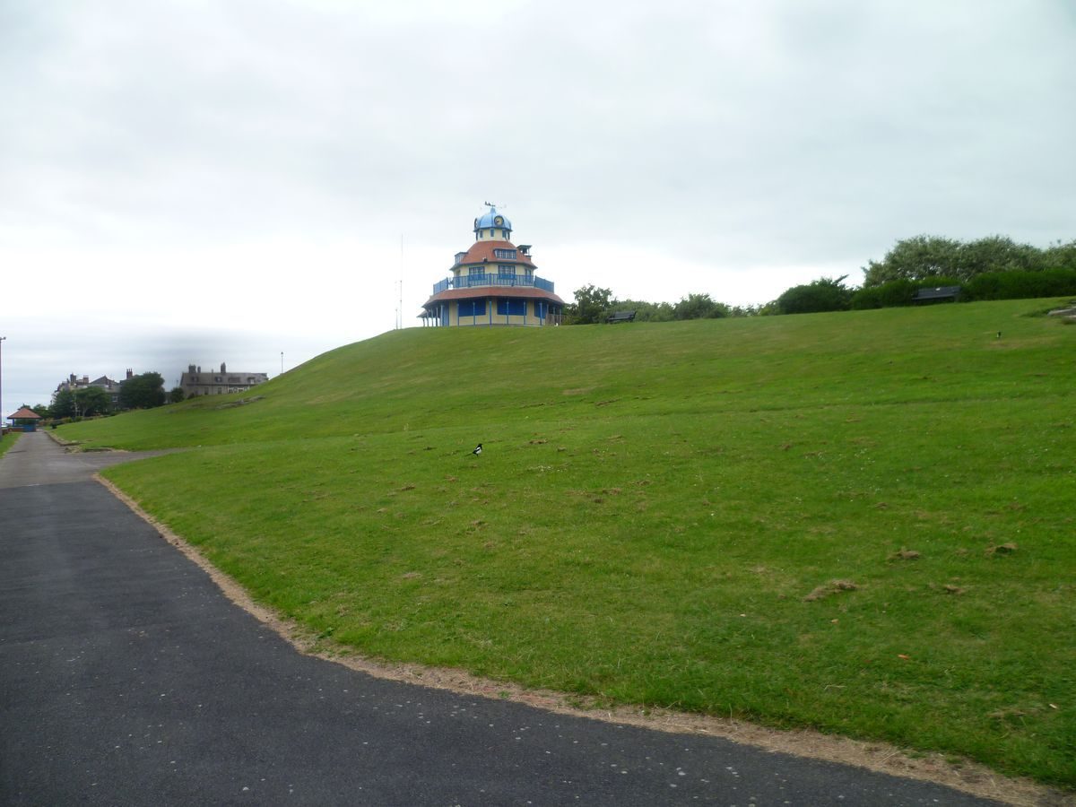
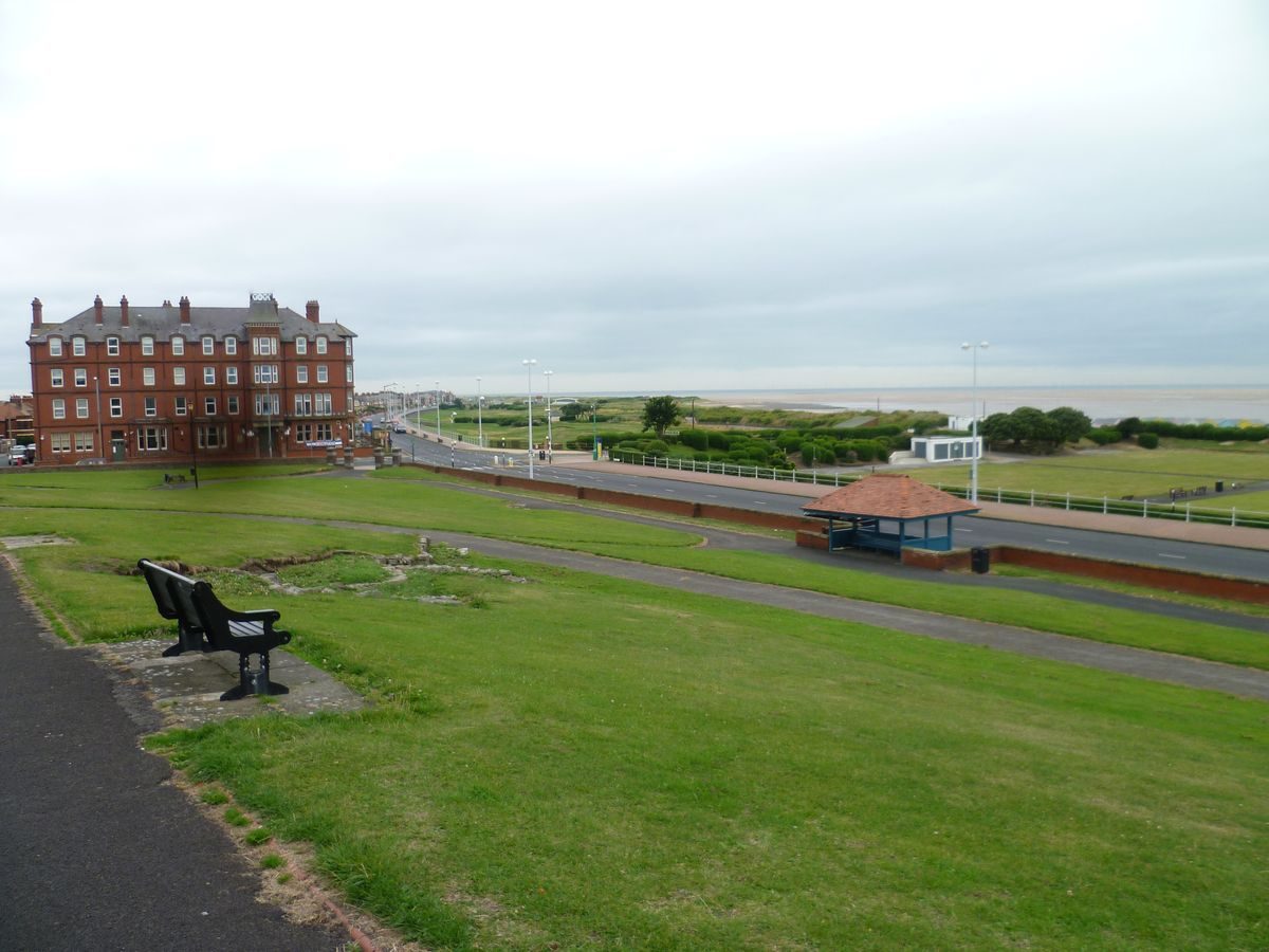
The last in a line of sand dunes along the south shore of Morecambe Bay, The Mount at Fleetwood was the centre of the planned town developed in the mid-19th century. It is crowned by a pavilion built in 1904, and features municipal planting.
Terrain
The site rises to a high point at its centre.
The following is from the Register of Parks and Gardens of Special Historic Interest. For the most up-to-date Register entry, please visit the The National Heritage List for England (NHLE):
www.historicengland.org.uk/listing/the-list
A C19 seaside garden created out of a former sandhill from where the new town and port of Fleetwood was laid out. Both the garden and town were designed by the eminent architect and landscape designer Decimus Burton.
DESCRIPTION
LOCATION, SETTING, LANDFORM, BOUNDARIES AND AREA
The Mount is located overlooking the south east side of The Esplanade in Fleetwood from where C19 streets of the town radiate outwards. It rises to a high point at its centre and its boundaries are formed by a low buttressed brick wall with chamfered stone copings flanking the Esplande and a cobble wall with semi-circular brick copings elsewhere that encloses an area of approximately 2.5 hectares.
ENTRANCES AND APPROACHES
Access to the garden is via a number of entrances with the principal one being through the Gate Lodge on Mount Road opposite London Street. There are also entrances at the west and east corners; the former has two pairs of brick and concrete gateposts topped by concrete copings separated by short lengths of low brick wall topped by concrete coping, while the latter has a single pair of gateposts of similar design. Other entrances are found at the east and west sides at either end of a principal path crossing the garden; these match each other and are of brick construction with concrete copings. The cobble boundary wall adjacent to both these entrances rises to form 'shoulders' to the gateposts. Another entrance from Mount Road, close to its junction with Bold Street, is flanked by simple stone gateposts. There are also two entrances on the Esplanade, each in the recesses housing the timber shelters and each flanked by low iron gateposts.
PRINCIPAL BUILDINGS
The Mount Pavilion, architect unknown, (listed Grade II) stands at the centre of the site. Built in 1904 to replace Decimus Burton's pagoda, it is a two-storey polygonal structure with a north wing and is built of brick with tiled roofs. A balcony encircles the building at first floor level and there are dormers to the roof slopes and a west-facing bell cote. It is surmounted by a cupola with clocks at the cardinal points.
The Citizen's Advice Bureau, Mount Road, by Decimus Burton (Grade II) is the former gate lodge and entrance pavilion to the gardens. It is built of ashlar and is single storey beneath a modern tile roof with overhanging eaves. There is a central through passage framed by wooden Tuscan columns taking modillioned pediments on each elevation. Internally the passage has an octopartite vault with cast iron ribs.
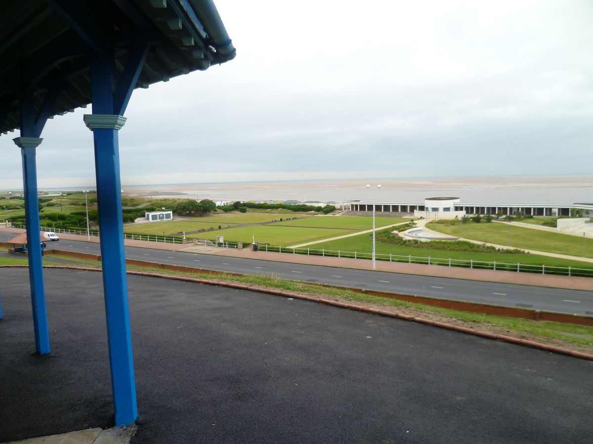
Two timber shelters occupy recesses in the boundary wall flanking the Esplanade. Each is panelled to half height with a central subdivision holding fixed bench seating facing outwards either across the Esplanade or across the gardens. Above half height the sides and central subdivision are open and the hipped roofs are supported on posts with V-struts.
GARDENS AND PLEASURE GROUNDS
From the former Gate Lodge paths to left and right rise and swing around a large semi-circular hollow that contains a children's play area with modern equipment. The steep slopes of the hollow are planted with trees and shrubs. The two paths continue rising to join a path running along the spine of The Mount rising to the Pavilion which stands at the highest point. The slopes of The Mount are predominantly laid to lawn divided by sinuous footpaths. Early C20 postcards show that paths were originally lined with heaby rock work, possibly Pulhamite; this no longer survives. There are flowerbeds to the west of the Pavilion, some of which are cut in the shape of fish to represent Fleetwood's history as a fishing port, while one is laid out as a limestone rockery. The Mary Hope Garden For The Blind opened in 1963 has been laid out to the west of the Gate Lodge. It contains flowerbeds and borders together with an engraved commemorative stone recording its opening and an adjacent engraved memorial stone to Diana, Princess of Wales. To the east of the Gate Lodge there is an area of thinly-planted trees separated from the lawn by a hedge.
LAND BEYOND THE SITE BOUNDARY RELEVANT TO THE HISTORIC INTEREST OF THE SITE
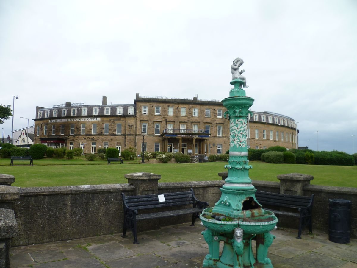
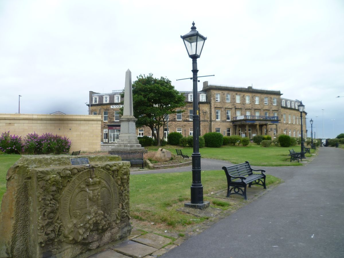
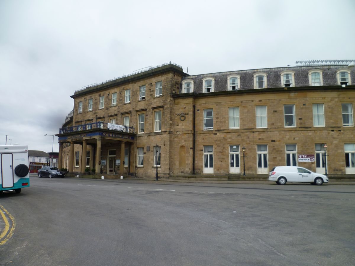
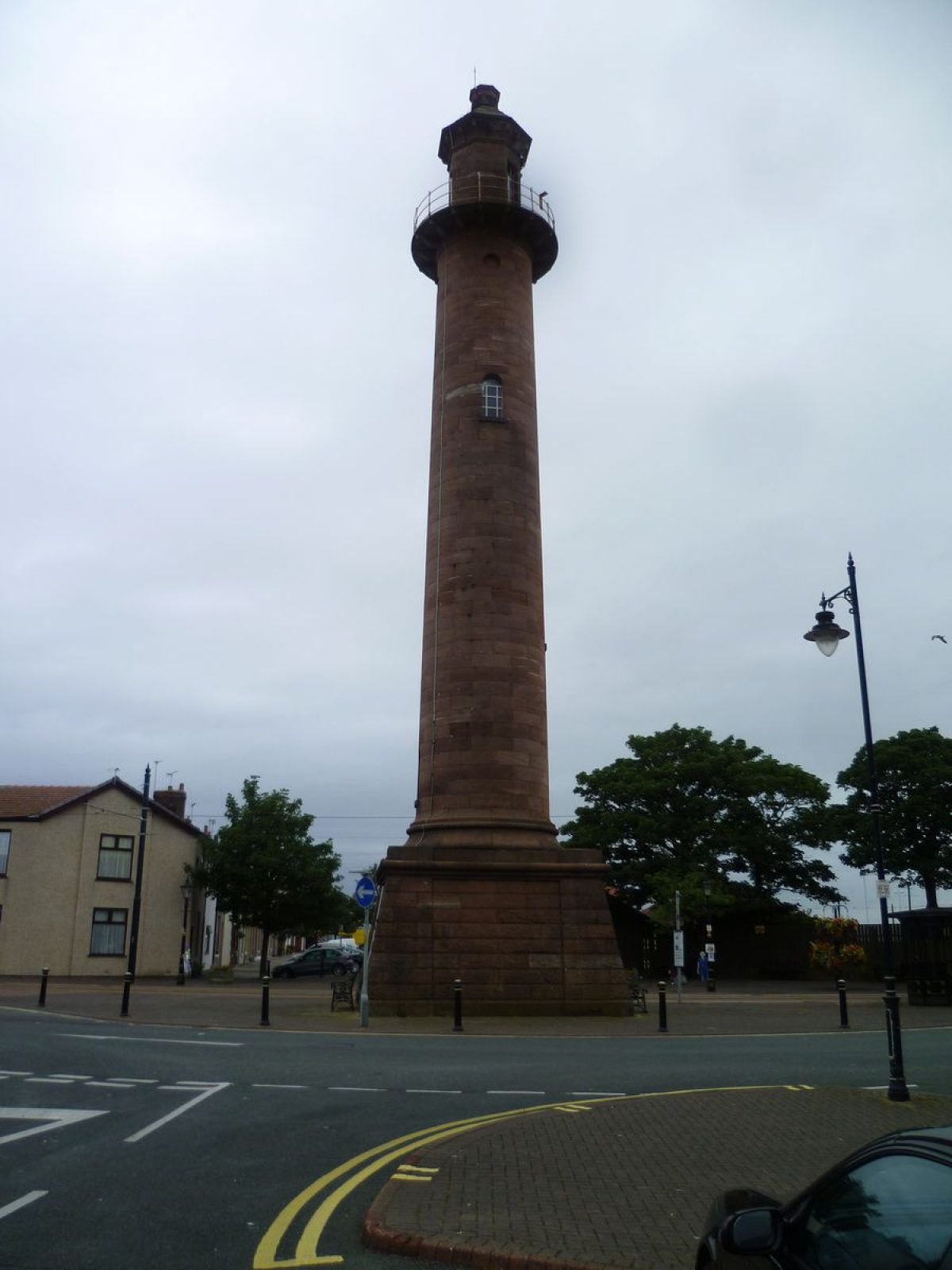
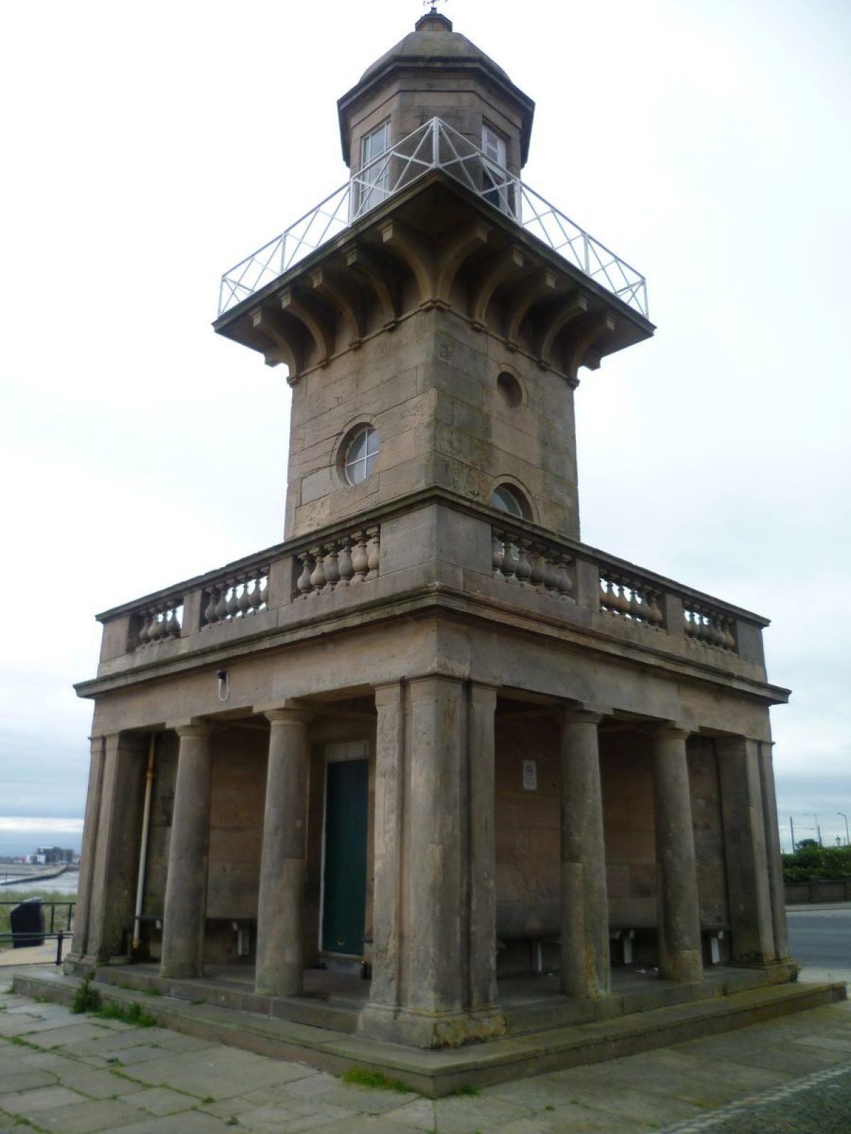
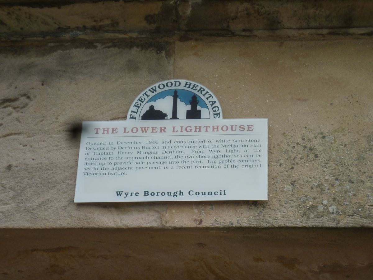
Burton's designs for Fleetwood as a new town with The Mount as its focal point can still be appreciated today and it remains a good example of Burton's strength for designing distinct urban environments. His significant contribution to the development of the town is recognised by 15 Grade II listings and one Grade B listing to his name, including the Victoria Public House, the Lower Lighthouse, the North Euston Hotel, the Parish Church of St Peter's, the Upper Lighthouse or Pharos, Wyre Borough Treasurer's and Borough Housing Departments, and numerous rows of terraced housing.
SOURCES
Curtis, B, Fleetwood: A Town is Born, Lavenham Press Ltd., 1986, 22.
McLoughlin, B, Railways of the Fylde, Carnegie Publishing, 1992, 3-9.
Oxford Dictionary of National Biography, Decimus Burton, Oxford University Press 2004-7.
Porter, J, A History of the Fylde of Lancashire, W. Porter & Sons, Fleetwood & Blackpool, 1876, 221, 243-5.
1st edition Ordnance Survey Map 1:10,560, 1848.
2nd edition Ordnance Survey Map 1:2500, 1912
REASONS FOR DESIGNATION
The Mount garden is designated at Grade II for the following principal reasons:
* Its form and function is little altered since its creation during the 1830s
* It played a fundamental role in the original layout of the new town of Fleetwood which can still be appreciated today
* Its designer Decimus Burton was an architect and landscape designer of national renown who was noted, amongst other things, for his design of distinct urban developments
* Burton's contribution to the development of Fleetwood is recognised with 15 Grade II listed buildings and one Grade B listed building and The Mount's designation would complement these existing designations.
- Visitor Access, Directions & Contacts
Access contact details
This is a municipal park, open daily for general public use.
Directions
On The Esplanade, Fleetwood.
- History
The following is from the Register of Parks and Gardens of Special Historic Interest. For the most up-to-date Register entry, please visit the The National Heritage List for England (NHLE):
www.historicengland.org.uk/listing/the-list
HISTORIC DEVELOPMENT
Fleetwood was a new town and port, created from a greenfield site at the mouth of the River Wyre by landowner, politician and businessman Sir Peter Hesketh-Fleetwood, who envisaged recreating the buildings and wide tree-lined streets of St Leonards on the Fylde coast. Sir Peter hired the noted London architect and personal friend Decimus Burton to design the town. Decimus Burton is renowned as a Neo-Classical architect and landscape designer who worked on Hyde Park and Regents Park, both in London as well as a key buildings associated with them such as the Wellington Arch (Grade I).
Building work in Fleetwood began with the design of the town being laid out from the highest point on the coast, a large sandhill formerly known as Tup Hill and now known as The Mount, from where there are spectacular views across the Wyre estuary and Morecambe Bay to north Lancashire and Cumbria. A series of wide streets radiated from the hill and a local farmer, Robert Banton, was hired to trace out the line of the streets with his plough. The Mount Garden, as the hill became, formed part of Burton's initial design for the town and it is depicted on his 1841 town plan. The outline of the garden remains largely the same today. Subsequent maps show a pagoda designed by Burton and erected on the highest point surrounded by a raised platform or terrace. This was subsequently removed and replaced by the current Grade II Listed pavilion on the same site in 1902. A Gate Lodge designed by Burton, was listed at Grade II in 1978. In about 1860 a cobble wall was erected around the garden. Late-C19 and C20 maps and photographs show some minor additions to the arrangement of paths within the garden and some minor changes to the planting scheme. Maps show that by 1912 the Esplanade has been completed on the garden's seaward side and a boundary wall with shelters had also been constructed on this side.
Period
- Post Medieval (1540 to 1901)
- Victorian (1837-1901)
- Associated People
- Features & Designations
Designations
The National Heritage List for England: Register of Parks and Gardens
- Reference: 5344
- Grade: II
Features
- Carpet Bed
- Shrubbery
- Lawn
- Description: The slopes of The Mount are predominantly laid to lawn divided by sinuous footpaths.
- Pavilion (featured building)
- Description: The Mount Pavilion is a two-storey polygonal structure with a north wing and is built of brick with tiled roofs.
- Earliest Date:
- Latest Date:
- Boundary Wall
- Description: The boundaries are formed by a low buttressed brick wall with chamfered stone copings.
- Entrance
- Description: There are a number of entrances to the site.
- Gateway
- Description: The entrance at the west corner has two pairs of brick and concrete gateposts topped by concrete copings.
- Gate Lodge
- Description: The former gate lodge and entrance pavilion to the gardens is built of ashlar and is single storey beneath a modern tile roof with overhanging eaves.
- Garden Building
- Description: Two timber shelters occupy recesses in the boundary wall flanking the Esplanade.
- Rockery
- Description: Limestone rockery.
- Planting
- Description: The Mary Hope Garden For The Blind opened in 1963 has been laid out to the west of the Gate Lodge.
- Latest Date:
- Key Information
Type
Park
Purpose
Recreational/sport
Principal Building
Parks, Gardens And Urban Spaces
Period
Post Medieval (1540 to 1901)
Survival
Extant
Hectares
2.5
Open to the public
Yes
- References
References
- {English Heritage Register of Parks and Gardens of Special Historic Interest} (Swindon: English Heritage 2008) [on CD-ROM] Historic England Register of Parks and Gardens of Special Historic Interest
- The Buildings of England: Lancashire : North