
Introduction
Stanley Park was opened on the 2nd October 1926, and occupies a total of 104 hectares, including an 18-hole golf course. Features include an Italian garden, a rose garden, a sensory garden, a woodland walk, and a variety of water features. There is a lake terrace and promenade, and a clock tower.
Terrain
The site is on undulating land which falls gently to the south-east.www.historicengland.org.uk/listing/the-list
A public park designed by Thomas Mawson & Sons in 1922 which was intended to extend visitor facilities in Blackpool and to link with existing attractions. The park was laid out in close conformity to the 1922 plans. It was opened in 1926 and retains all the principal features of the executed plan as shown on the 1933 OS map.
DESCRIPTION
LOCATION, AREA, BOUNDARIES, LANDFORM, SETTING
Stanley Park is situated c 1.5km north-east of the centre of Blackpool, on undulating land which falls gently to the south-east. The 104ha site is bordered by residential development on all but the eastern side where the former site of Blackpool Aerodrome, shown on the OS map of 1933 map, is still largely open land. The oval park is enclosed by a road called Park Drive. A band of land between the roadside pavement and the park fence around the southern half of the site, from a point immediately south of the cricket ground continuing round to the eastern boundary as far as the boating lake, is planted with trees and a herbaceous border. Mawson planned the park in relation to existing connecting roads from the North Pier, the Promenade, South Shore and the station to the west, as well as residential areas to the north and south. New connecting roads were suggested from the south and south-west but only South Park Drive, at the southern tip of the park, was laid out as suggested. Mawson prepared designs for houses to be built around the park and stipulated that there should be no housing built on the park side of the encircling road; this stricture has been adhered to. The boundary is formed by a brick wall which runs south from the principal Mere Road entrance as far as the entrance to a sports centre, c 450m to the south. From this point there are cast-iron railings along the southern edge of the park which are being introduced in an on-going (1997) programme to replace a concrete post fence which exists around the north-eastern and northern boundaries.
ENTRANCES AND APPROACHES
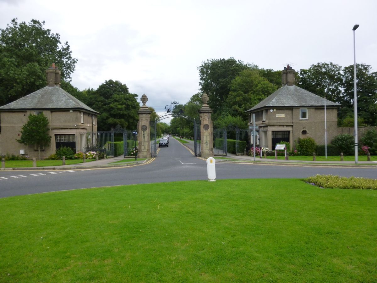
The principal entrance to the park is situated towards the north-west corner of the site at the head of Mere Road. There is a circus at this point and the main entrance faces this and consists of splayed walls and a central pair of stone gate piers with urn finials and plaques commemorating the opening of the park, cast-iron gates with an ornamental overthrow which has the words 'Stanley Park', and flanking secondary gates with Blackpool's coat of arms. On each side there is a lodge, called North and South Lodge respectively, of restrained classical style with hipped roofs and central chimneys. There is a separate entrance to a cricket pitch, which is walled and has gates, c 40m south of the main entrance, and there is a C20 entrance to a sports centre c 300m south of the cricket ground. Other entrances consist of simple pairs of gate piers in accordance with Mawson's stipulation that secondary entrances should be treated 'with the severest simplicity' (Mawson 1927). The principal entrance links with a broad avenue which leads east across the site to a car park and service area on the north-west side of a cafe at the centre of the site.
PRINCIPAL BUILDING
The principal building of the park is an Art Deco-style cafe of 1937 designed by C J Robinson which acts as a focal point to the central formal gardens. It is situated almost exactly at the centre of the park on the site of a proposed Social Centre for which Mawson produced designs which were not carried out.
GARDENS AND PLEASURE GROUNDS
Stanley Park is characterised by a strongly formal central core connecting with areas which become less formal towards the edges of the park. The north part of the site is a golf course, to the east is a large lake, and playing fields and sports facilities are concentrated in the south and west. There is perimeter planting on all but the north side of the site.
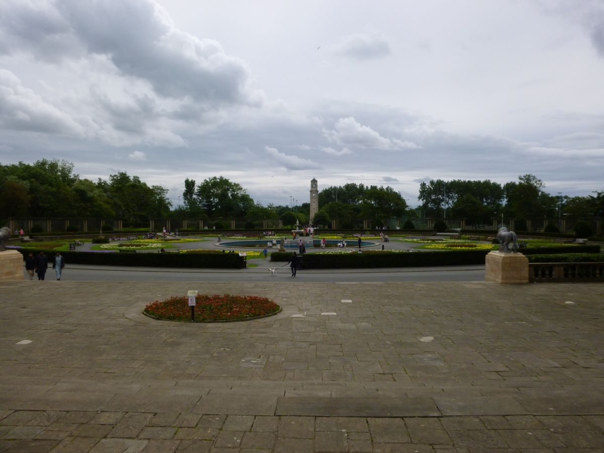
At the centre of the park the cafe faces south onto a terrace with formal beds. A grand flight of stone steps leads southwards down to a lower terrace, which has semicircular seating areas on each side; the stair continues down and terminates with stone piers surmounted by statues of lions which were the gift of the Chairman of the Park Committee in 1926. The steps lead into a formal garden called the Italian Gardens. This consists of a circular area with paths radiating from it. Around the edges a sense of enclosure is created by the use of curved linear pergolas consisting of paired Tuscan columns. Paths lead to the centre between geometrical beds and a central marble fountain. The arrangement of the Italian Gardens accords in almost every detail with the plan Mawson published in 1922.
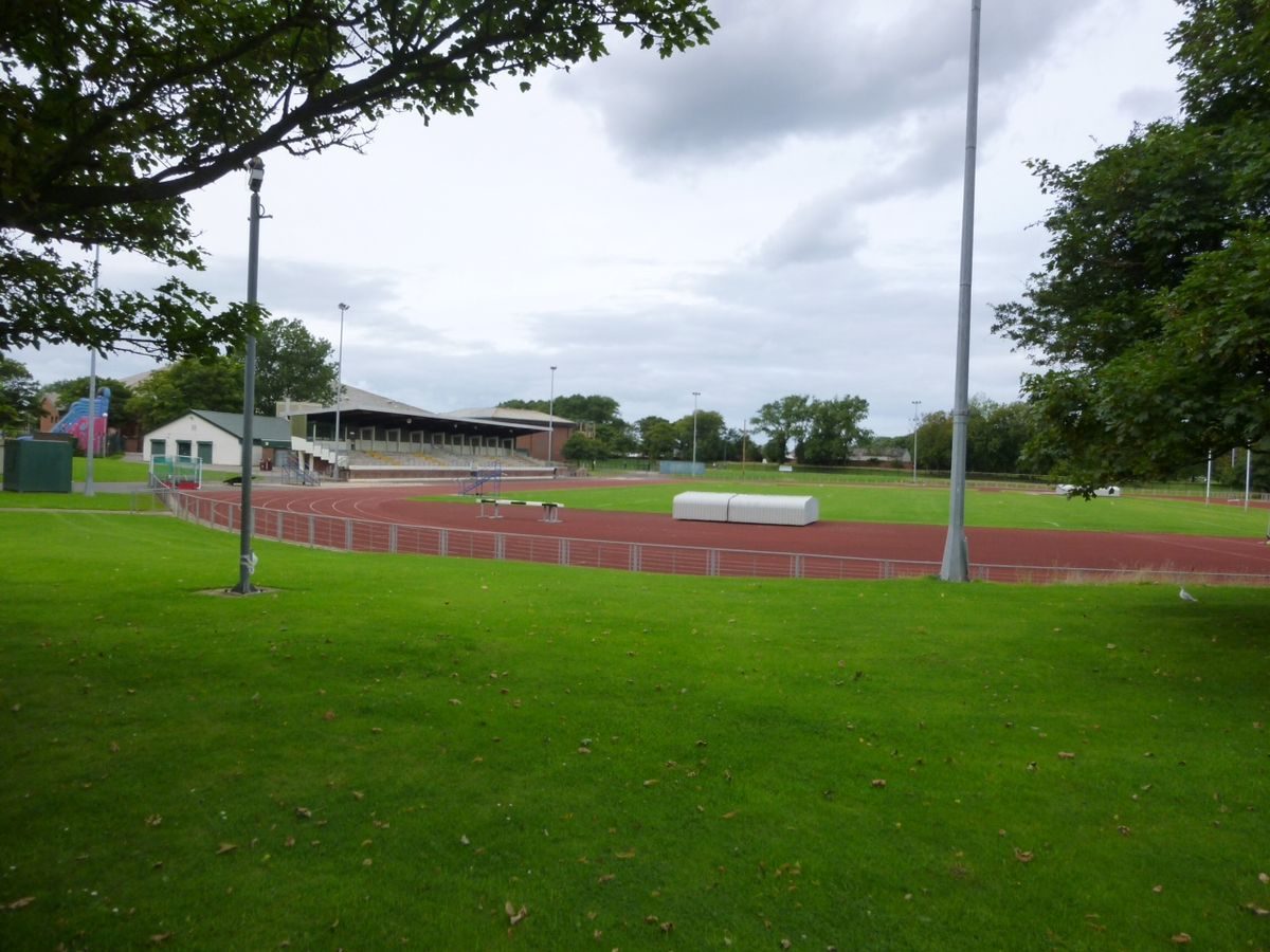
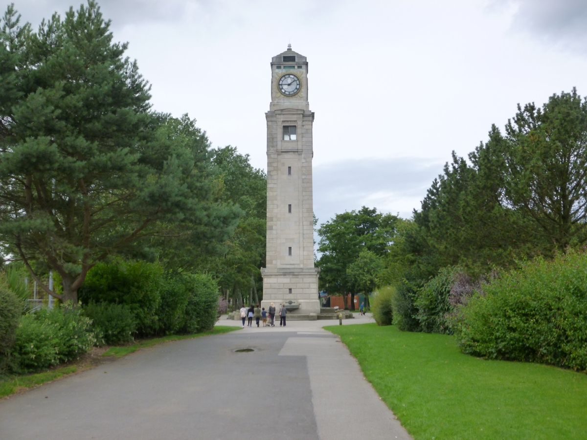
An axial path leads southwards from the Italian Gardens past tennis courts on the east side. There are four sets of courts in total and they are divided by formal walks and beds. Opposite, on the west side, there is a fenced athletics ground which occupies an oval area as shown on Mawson?s 1922 plan and has a track and stand of late C20 date. Some 150m south of the Italian Gardens the path intersects with another path running from east to west; at this point there is a clock tower memorial to Dr William Henry Cocker, first Mayor of Blackpool, designed in 1926 by L B Budden with plaques by H Tyson Smith. The path continues south where it becomes an avenue, as shown on Mawson's 1922 plan, leading to an entrance aligned with South Park Drive. On the west side of the avenue there are fenced playing fields and the remainder of the southern part of the park consists of informal grassed playing fields, as shown on the 1922 plan.
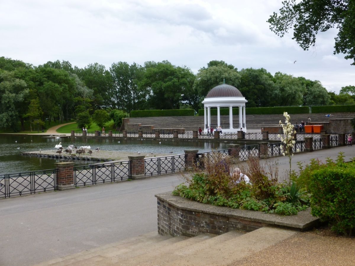
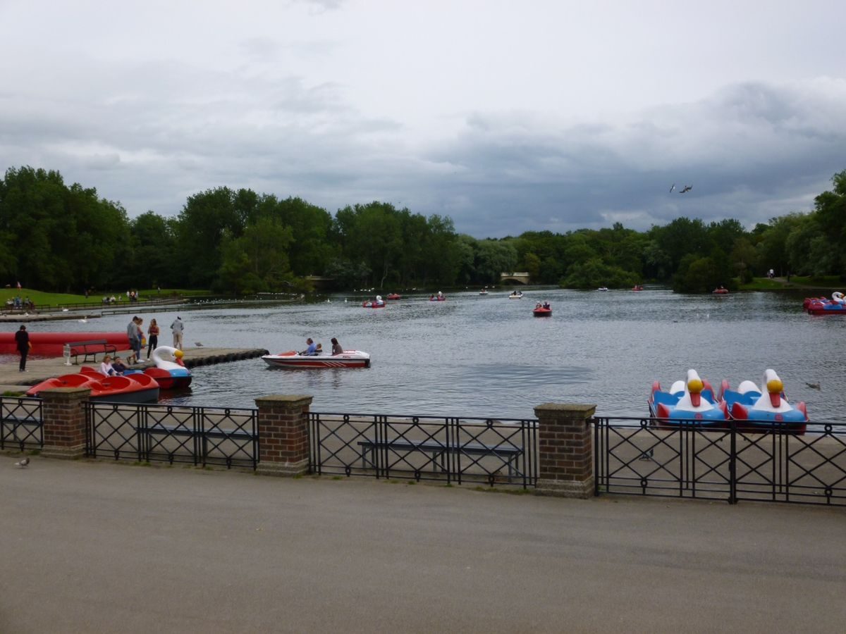
On the east side of the Italian Gardens paths lead to a terrace overlooking a large lake. The western shore has a walkway and iron railings. On the south shore, c 100m south-east of the Italian Gardens, there is a semicircular amphitheatre with seating facing a lakeside bandstand in the form of a circular classical temple. Mawson had intended the bandstand to be on a promontory to the east so that it would terminate the vista from the Italian Gardens across the lake. On the north shore, c 150m north-east of the Italian Gardens, there is a range of boathouses. The lake is approximately in the shape of a reversed L, with the long arm running north/south along the north-eastern edge of the park. The shore lines become irregular, with rockwork in places to the east of the formal bandstand and boathouse area and there are sinuous walks along the edges through tree belts. The lake narrows c 400m north of the Italian Gardens, at the angle of the L, and at this point there is an island connected to the shores on each side by stone balustraded footbridges. The outline of the northern part of the lake is slightly at variance with Mawson's 1922 plan which does not show the footbridges. An area immediately south of the south-east corner of the lake is occupied by an enclosed model village.
To the north of the cafe and north-west of the lake is a golf course which was designed by Colt & Mackenzie and is screened from the rest of the park by trees. It is shown on Mawson's plan of 1922 and was considered a useful source of revenue for the park.
Some 80m north-west of the cafe there is a set of six bowling greens, in a sunken area overlooked by two shelters with Tuscan columns on the south-west side, a club house with changing rooms on the south-east side, and a pavilion on the north-west side. The walled edges of this area consist of a mixture of brick, including bricks of differing sizes, and artificial stone blocks, reflecting the close attention to surface texture and colour which is evident throughout the park. Between this area and the cafe there is a car park and a maintenance yard.
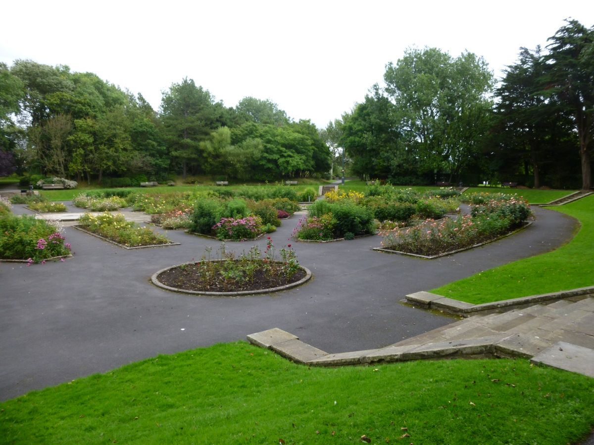
Some 100m to the north-west of the bowling greens, in the north-west corner of the site, there is a sunken rose garden concealed by banks planted with trees. The garden is oval in shape and flights of stone steps lead down into it from a walk around its edge. The garden is paved and has geometrical beds and two circular lily ponds. The paving stones interlock and are laid diagonally along the paths to the edges of the beds and ponds. The garden is not shown in this form on the 1922 plan but it conforms with what is shown on the 1933 OS map.
Immediately south of the main, Mere Road entrance is a cricket pitch with pavilions and viewing stands which is divided from the main park by a tall brick wall. Immediately south of this is an area formerly occupied by a nursery. There is a building relating to the former nurseries which has been converted for office use and some late C20 glasshouses on the northern part of the nursery site, while the southern part is occupied by a sports centre of 1994 and a car park.
REFERENCES
New Park and Recreation Ground for Blackpool, (County Borough of Blackpool 1922)
T H Mawson, Life and Work of an English Landscape Artist (1927), pp 341-4
G F Chadwick, The Park and the Town (1966), pp 223-4
Stanley Park Blackpool Souvenir and Guide, guidebook, (nd)
Maps
OS 6" to 1 mile: Lancashire sheet LI SW, published 1933
Description written: January 1997
Register Inspector: CEH
Edited: March 1999
- Visitor Access, Directions & Contacts
Access contact details
This is a municipal park, open daily from dawn till dusk.
Directions
Within the town, inland from the sea front attractions.
Owners
Blackpool Council
Customer First Centre, Municipal Building, Corporation Street, Blackpool, FY1 1NF
- History
The following is from the Register of Parks and Gardens of Special Historic Interest. For the most up-to-date Register entry, please visit the The National Heritage List for England (NHLE):
www.historicengland.org.uk/listing/the-list
HISTORIC DEVELOPMENT
Land for a public park was secured in 1920 as part of a drive to control and plan the expansion of Blackpool. Thomas Mawson & Sons were commissioned to design the park and to prepare a scheme for the development of the surrounding area. The County Borough of Blackpool published a detailed description of the proposals with financial estimates, descriptions of all the proposed recreational and sporting facilities, and proposals for how the park would relate to existing routes and visitor facilities. This publication, New Park and Recreation Ground for Blackpool, was illustrated with plans, coloured views, line drawings and photographs. It was prepared by Thomas Mawson & Sons in association with the Borough Surveyor, Francis Wood, and published in 1922. Provision was made for recouping the costs through the sale of surrounding building plots and this was largely successful.
Period
- 20th Century (1901 to 2000)
- Early 20th Century (1901 to 1932)
- Associated People
- Features & Designations
Designations
The National Heritage List for England: Register of Parks and Gardens
- Reference: GD1950
- Grade: II*
Features
- Lake
- Ornamental Fountain
- Bandstand
- Conservatory
- Column
- Lawn
- Carpet Bed
- Sculpture
- Key Information
Type
Park
Purpose
Recreational/sport
Principal Building
Parks, Gardens And Urban Spaces
Period
20th Century (1901 to 2000)
Survival
Extant
Hectares
104
Open to the public
Yes
Electoral Ward
Marton
- References
References
- {English Heritage Register of Parks and Gardens of Special Historic Interest}, (Swindon: English Heritage, 2008) [on CD-ROM] Historic England Register of Parks and Gardens of Special Historic Interest
- Mawson, T. H., {The Life and Work of an English Landscape Architect} (London: Richards Press, 1927), pp. 341-4 The Life and Work of an English Landscape Architect