Introduction
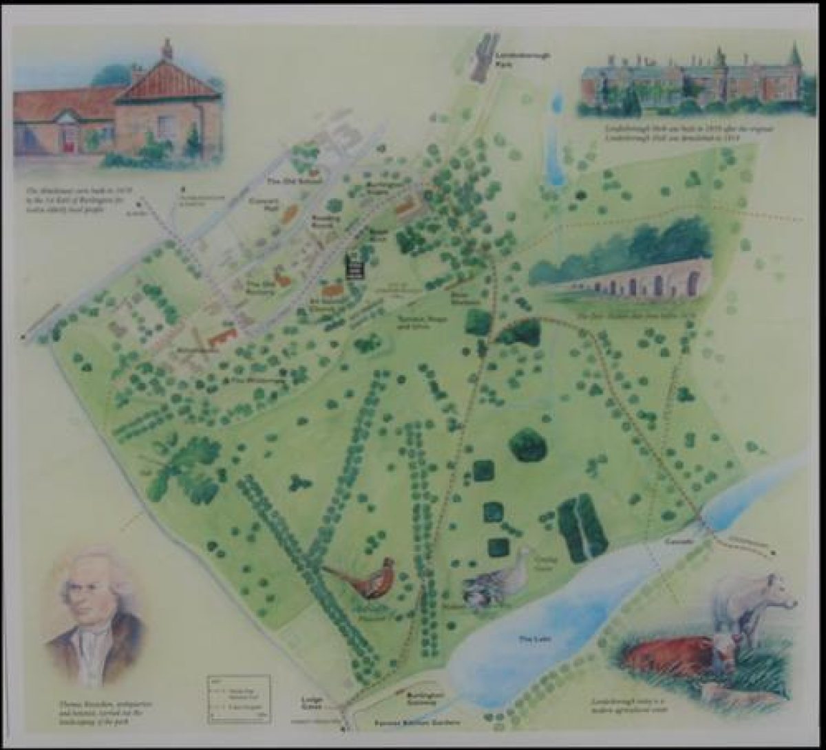
Londesborough Park has a landscape park, woodland and gardens. There are parkland avenues, a lake and cascades and a 1730s kitchen garden.
Terrain
Rolling woldswww.historicengland.org.uk/listing/the-list
Gardens laid out in the late 17th century wholly or partly by Robert Hooke for the 1st Lord Burlington, with alterations and additions by the 3rd Lord Burlington in the early to mid-18th century. Park with avenues of early 18th-century date with earlier origins. Kitchen garden of 1730-5 with cascades and entrances aligned with parkland avenues.
DESCRIPTION
LOCATION, AREA, BOUNDARIES, LANDFORM, SETTING
Londesborough Park lies immediately south of the village of Londesborough, c 1.5km north of Market Weighton. The c 200ha site is in a rural setting on the south-west edge of the Wolds on land which slopes down to the south and south-east to a valley, rising again on the south-east side. The boundary is fenced, apart from a stretch of walls and railings on the south-west side, where the boundary is formed by a by-road between Market Weighton and Londesborough. The boundary with the village to the north-west is largely walled, and fences separate the north, east and south sides from agricultural land. Included within the boundary is Londesborough Avenue which runs for a distance of c 2km from the west side of the pleasure grounds to the A1079 York road.
ENTRANCES AND APPROACHES
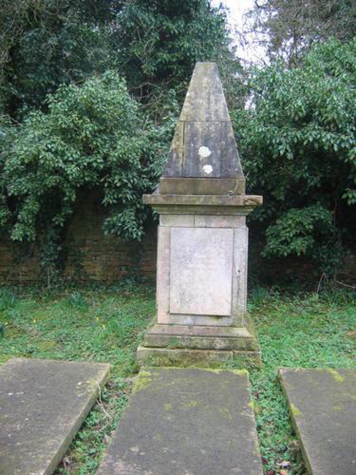
The principal entrance is from the by-road between Londesborough and Market Weighton where there is a lodge of 1904 and splayed entrance walls surmounted by decorative railings flanking a gateway with brick gate piers. A drive runs north-east across the park to the site of the house. The main approach to the house was formerly from the York road, from which the remains of an avenue called Londesborough Avenue runs north-east to an entrance with gate piers and flanking walls (probably by Robert Hooke c 1670-80, listed grade I) on the west side of The Wilderness. From this point a drive, with some mature trees alongside it, runs eastwards to the house site on the north side of The Wilderness. This section of drive within the pleasure grounds is shown as an avenue on the Knyff and Kip view, and the estate map of 1739 shows it and part of the Londesborough Avenue. In 1740 the third Lord Burlington successfully applied to Sir Marmaduke Constable to extend the avenue over his land to the York road. The Avenue is shown planted with platoons on the 1854 OS map, and some of these survive with areas of replanting to replace elms lost to disease in the late C20. The section between the Market Weighton road and the entrance was planted with chestnuts during the 1930s. There are a number of entrances from the village, including an C18 brick archway (listed grade II) on the east side of the churchyard from which a path leads south to a set of stone gate piers (C18, listed grade II*) and an entrance to The Wilderness. A drive from the village main street leads south-east to Londesborough Park, now the principal building of the site.
PRINCIPAL BUILDING
Londesborough Hall was built by Frances Clifford in 1589, and enlarged during the late C17 for the first Lord Burlington. It commanded impressive views over the sloping land to the south. Daniel Defoe commented on its 'noble aspect' (Defoe 1724-6). After years of neglect following the death of the third Lord Burlington it was demolished in 1818-19. A stable block, now converted for residential use (late C20), incorporates part of the stables of 1678-9 (listed grade II) and lies c 60m north of the house site. Another house was built as a shooting box c 300m north-west of the old house site in 1839, and extended in 1875. This building is called Londesborough Park, and is a brick castellated house set into the slope with views over parkland to the south-east. It is in use as a private residence (1998).
GARDENS AND PLEASURE GROUNDS
There are gardens to the east and west of the house site. A rectangular platform extends c 100m east of the house site and is supported by a brick wall and a range of brick arcading (probably by Robert Hooke c 1660-80, listed grade II) which forms a deer shelter within the park. Immediately east of the house site there is a sunken rectangular area where Knyff and Kip show a sunken parterre with a circular pool at its east end. The arcaded deer shelter continues to the west as a ha-ha as the slope gradually dies away. A walkway along the edge of the shelter and ha-ha, to the south of the house site, runs westwards along the edge of the platform. A flight of stone steps flanked by stone urns (listed grade II with deer shelter) leading down into the park is aligned with the former front of the house. The arcading, terraced walk and steps are all shown on the Knyff and Kip view.
On the west side of the house site there is an area of open grassland which has on its north side the entrance with gate piers at the south end of the pathway alongside the churchyard wall. The ruinous remains of walls on the north side of this area probably represent parts of walls which subdivided gardens shown to the north of the house by Knyff and Kip. To the west of this the ha-ha breaks forwards, to the south, enclosing an area called The Wilderness. An avenue of yew trees leads westwards into The Wilderness which has a mixture of mature trees, self-sown trees and shrubs. There is a path along the edge of the ha-ha, and from this, c 400m west of the house site, stone steps lead down and are aligned with an avenue in the parkland and a doorway in the kitchen garden (see below). The Knyff and Kip engraving shows the Wilderness area divided into rectangular compartments with a bowling green and orchard. This garden was laid out for the first Lord Burlington in the 1670s and 1680s by Robert Hooke, who also provided plans for gate piers. Estate records (quoted in Neave 1977) show that the bowling green was laid out during the winter of 1678(9.
The 1739 map shows alterations to the layout made by the third Lord Burlington. The bowling green was replaced by an enclosure with a central rectangular pond with apsidal ends. A walk aligned with the terraced walk in front of the house, and approximately on the line of the yew avenue, led through an area planted with trees or shrubs to an oval clearing and then on to a small circular clearing at the west end of the garden. On each side of this route winding paths are shown leading through the planting. The gardens on the west side of the house are shown unchanged. Burlington spent more than £1600 on the gardens in the years 1728(32 with his head gardener Thomas Knowlton, who was appointed in 1726, directing the operations and a staff of more than forty men.
The 1854 OS map shows that the corner of the former bowling green area had by then been rounded off and the formal pond had disappeared, though it is shown on a drawing of 1802. The site of the pond is now within the parkland and terraced earthworks c 150m south-west of the house site probably represent its remains. The route through The Wilderness and the large oval clearing are shown on the 1911 OS map.
There are gardens to the south of Londesborough Park which has a balustraded terrace running along the east front of the house overlooking an area of informal lawns planted with shrubs and trees. Ponds within the gardens c 100m south of the house appear to be those shown within open parkland on the 1739 map.
PARK
The park extends to the north-east, east and south-east of the house site on land which slopes down to a valley to the east and south-east, and rises beyond to the east and north-east. There are three avenues in the parkland south-west of the house site. Two radiate south-westwards; the westernmost consists mainly of walnut, and the other of Turkey oak. A third avenue which runs between The Wilderness and the kitchen garden is also of Turkey oak. Avenues in these locations are shown on the 1739 map when a semicircle of trees fronted the house with avenues radiating from it, those to the south and south-east having largely disappeared. The semicircle is shown by Knyff and Kip, flanked on the west side by an enclosed rectangular orchard.
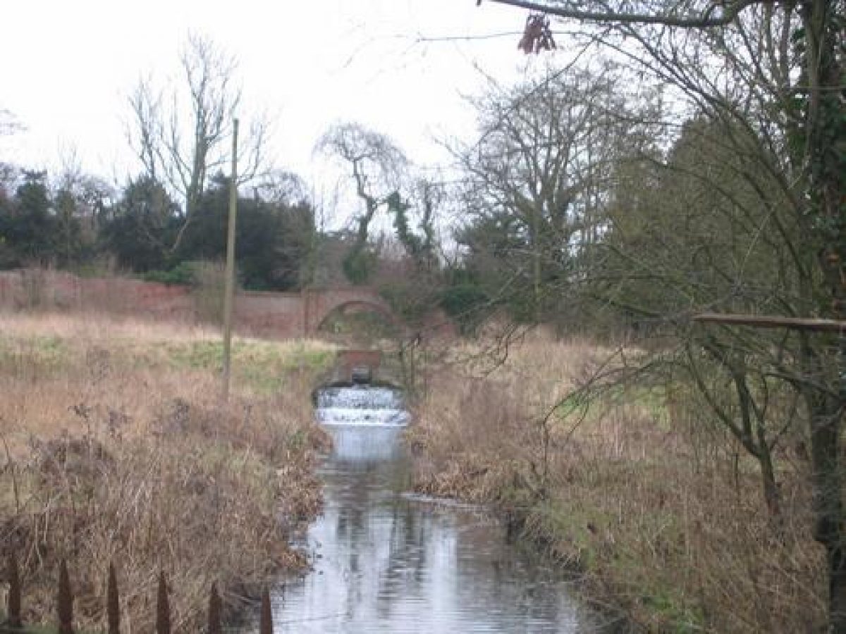
A series of four lakes linked by cascades runs along the valley, increasing in size as the land falls from east to south, extending from a point c 700m east of the house site to a point c 250m to the south. Another lake is situated in Spring Wood, c 900m to the north-east, and the 1739 map shows that there were lakes linking this with the others. The lakes were restored in the mid C19 by the Londesboroughs, and again in the late C20 by the Ashwin family. A stream which runs south-west from the site of Londesborough Park to the westernmost lake is shown in 1739 as a series of pools descending the slope, and banking survives in some areas alongside the stream.
There are scattered mature trees within the park, shelter belts along the north and north-east sides, and an area of woodland, called Pond Wood, to the south of the westernmost lake, much as shown on the 1854 OS map. The 1739 map shows Pond Wood and a rectangle of trees on the slope east of the house site. This area was formerly the site of Easthorpe, a village which was depopulated and demolished during the 1730s as part of the third Lord Burlington's expansion of the park.
KITCHEN GARDEN
The kitchen garden (listed grade II) lies c 650m south-west of the house site, immediately west of the westernmost lake. It consists of a brick-walled enclosure bowed outwards at the west end and inwards at the east end, with splayed walls on each side of the bow. There are two opposed entrances in the south and north walls. That in the north wall (listed grade II with the garden) has an arched opening designed by Lord Burlington in 1735 which is aligned with the Turkey oak avenue between the kitchen garden and Wilderness. A brick arch at the centre of the eastern wall has the remains of a cascade beneath it, which formerly took the outflow from the lake which has been diverted beneath the garden wall and flows into stream which runs east/west bisecting the garden. A secondary cascade takes the water over a terrace which divides the garden into two unequal parts with the larger area on the lower, west side. As well as being useful for irrigation, the stream was used to grow waterlilies. In the north-east corner of the garden there are the ruinous remains of a building, formerly a greenhouse, converted during the C19 to a bothy. This has an entrance in the north wall which is aligned with the eastern of the two radiating avenues in the park. At the west end of the garden there is an opening with iron railings at the tip of the bow which gives views from the road of the two cascades and the stream. There is a former water mill of early C18 date attached to the outer, south-east side of the garden. This was converted to a gardener's residence in the C18 and extended in the C19. It is in use (1998) as a private residence.
The garden was constructed in 1730-5 and is shown on the 1739 map. More detail is shown on a plan 'sketched from a plan by Mr Knowlton Jany 1792'. This shows the cascades and the mill which is marked 'Old Mill inhabited by a garden labourer'. The bothy in the north-east corner is marked 'Green-house' and flanked by hothouses. The door aligned with the avenue is shown on the north side of the building. The plan shows the planting scheme and states that the wall on the north side was eleven-feet high and that to the south seven-feet high. The accompanying notes describe the decay of the walls, greenhouse and doors, and mention a 'pretty & antient botanical Collection' in the greenhouse. The garden was repaired in the later C19, and by the end of the C19 large greenhouses, shown on the 1911 OS map, had been introduced.
REFERENCES
Knyff and Kip, Britannia Illustrata (1707) [engraving showing Londesborough from the west, around 1700]
Daniel Defoe, A Tour Through the Whole Island of Great Britain ii, (1724-6, revised edition 1962), p 234
D Neave, Londesborough (1977)
S Neave, Medieval Parks of East Yorkshire (1991), pp 42-3
D Neave and D Turnbull, Landscaped Parks and Gardens of East Yorkshire (1992), pp 48-54, 82
D Arnold, Belov'd by Ev'ry Muse Richard Boyle, 3rd Earl of Burlington & 4th Earl of Cork (1694-1753) (1994), pp 21-8
N Pevsner and D Neave, The Buildings of England: Yorkshire, York and the East Riding (1995), pp 603-5
Maps
T Pattison, Estate Map, 1739 (DDX 31/173), (East Yorkshire Record Office)
Map of Park and Garden Sketched from Mr Knowlton's Plan, January 1792 (EH file)
The Kitchen Garden at Londesborough sketched from a plan by Mr Knowlton Jny 1792 (EH file)
OS 6" to 1 mile: 1st edition published 1854
1911 edition
Archival items
W Howard, sketch of House and eastern part of the gardens, 1802 (J21/4), (Castle Howard archives)
Description written: April 1998
Edited: November 1999
- Visitor Access, Directions & Contacts
Directions
North of Market Weighton, between Market Weighton and Pocklington.
- History
The first house and landscape on the Londesborough estate in East Yorkshire dates from the mediaeval period when the Fitzherbert family leased it from the Archbishop of York. The manor house, with an adjoining closed garden, was on the site of the current stable block. The estate passed to the Clifford family in the late 14th century and in 1589, a new Hall was built to the southwest, giving a view to the natural valley below. Richard Boyle, 1st Earl of Burlington, following his marriage to Elizabeth Clifford, heiress to the estate, did further work on the Hall from 1676. He called in Robert Hooke at the same time to develop the gardens.
In 1704, Richard Boyle, the 3rd Earl of Burlington inherited this estate along with others, most notably Chiswick where he was to implement his revolutionary ideas on landscape design. Unlike Chiswick, there are no garden buildings, instead he utilised the natural beauty of the surrounding landscape, which may have reminded him of Italy.
In 1726, he appointed Thomas Knowlton as his gardener and the latter was instrumental in turning Londesborough into a more natural landscape. Apart from a series of radiating avenues from the south front of the house, all the other areas including the lake are informal. The lakes constructed between 1728 and 1730 are unlike the formal pools and canals at Chiswick at the time. The formal plantation to the west was turned into a pleasure garden. It retained its formal structure but serpentine walks were added as a secondary feature. On Burlington’s death in 1753, the estate passed to his son-in-law, the future 4th Duke of Devonshire. It was little visited, although the gardens were maintained. However the Hall was demolished in 1818 and park divided into two farms. In 1839, a shooting lodge was built next to the stable block that became Londesborough Park.
After a brief period of ownership by George Hudson in the 1840s, the estate was sold to the Denison family who took the title of Lord Londesborough. They restored the pleasure gardens and the lakes that had silted up and probably replanted some of the trees in the old avenues. Londesborough became the property of the Lupton Booth family in 1923 and then the Ashwins, the current owners, in 1935. Although the grounds are private, some attempts have been made to maintain the estate including replanting of some of the avenues and the maintenance of the lakes.
The following is from the Register of Parks and Gardens of Special Historic Interest. For the most up-to-date Register entry, please visit the The National Heritage List for England (NHLE):
www.historicengland.org.uk/listing/the-list
The estate was part of the Archbishop of York's manor of Everingham in 1086. It passed to the Fitzherbert family in 1108, to the Broomfleet family in the 14th century and to the Clifford family in 1469. In 1643 the estate passed by marriage to Richard Boyle, Earl of Cork (created Earl of Burlington in 1664) for whom Robert Hooke (1635-1703) laid out gardens about 1660-80. Boyle reintroduced deer to the park about 1650. The 3rd Lord Burlington remodelled the gardens and extended and landscaped the park, and an estate map of 1739 may have been prepared to show the works when completed. Burlington preferred Londesborough to any of his other country seats, spending part of almost every summer in visits which could last for several weeks or months. After his death in 1753 the estate passed to his son-in-law, who became the 4th Duke of Devonshire in 1755. The park and Hall were little used in the years which followed, and the park was divided into farms in 1820.
In 1845 it was bought by George Hudson who in turn sold it to Lord Albert Denison (created Lord Londesborough in 1850) who recreated the parkland and restored the lakes. The site was sold by the Londesboroughs to the Lupton Booths in 1923, and it subsequently passed to the Ashwin family. It remains (1998) in private ownership.
- Associated People
- Features & Designations
Designations
The National Heritage List for England: Register of Parks and Gardens
- Reference: GD1921
- Grade: II*
Features
- Hall (featured building)
- Now Demolished
- Earliest Date:
- Latest Date:
- Building
- Description: In 1839, a shooting lodge was built next to the stable block that became Londesborough Park.
- Earliest Date:
- Latest Date:
- Avenue
- Earliest Date:
- Kitchen Garden
- Earliest Date:
- Latest Date:
- Cascade
- Lake
- Parkland
- Woodland
- Gardens
- Key Information
Type
Estate
Purpose
Ornamental
Principal Building
Domestic / Residential
Survival
Part: standing remains
Hectares
200
Civil Parish
Londesborough
- References
References
- Knyff and Kip, {Britannia Illustrata }(1707) [engraving showing Londesborough from the West] Britannia Illustrata, Vol. 1
- Daniel Defoe, {A Tour Through the Whole Island of Great Britain ii,} (1724-6, rev edn 1962) A tour through the whole island of Great Britain : Divided into circuits or journeys
- {English Heritage Register of Parks and Gardens of Special Historic Interest}, (Swindon: English Heritage, 2008) [on CD-ROM] Historic England Register of Parks and Gardens of Special Historic Interest
- Pevsner, N and D Neave, {The Buildings of England: Yorkshire, York and the East Riding} (London: Penguin, 1995) The Buildings of England: Yorkshire, York and the East Riding
- Arnold, D, {Belov'd by Ev'ry Muse Richard Boyle, 3rd Earl of Burlington & 4th Earl of Cork (1694-1753) } (1994), pp21-8 Belov'd by Ev'ry Muse Richard Boyle, 3rd Earl of Burlington & 4th Earl of Cork
- Neave, D and D Turnbull, {Landscaped Parks and Gardens of East Yorkshire} (1992), pp 48-54, 82 Landscaped Parks and Gardens of East Yorkshire, 1700 - 1830
- S Neave, {Medieval Parks of East Yorkshire} (1991), pp 42-3 Medieval Parks of East Yorkshire
Contributors
Louise Wickham