Introduction
Gifted to the people of Bolton by Lord Leverhulme, Lever Park has been a country park since 1904. Designed by Thomas Hayton Mawson in collaboration with William Hesketh Lever, later first Viscount Leverhulme, Lever Park was laid out as a country park in 1901-11.
Terrain
The site is situated between the villages of Rivington and Horwich, on land which slopes westwards down to Lower Rivington Reservoir.The following is from the Register of Parks and Gardens of Special Historic Interest. For the most up-to-date Register entry, please visit The National Heritage List for England (NHLE):
Location, Area, Boundaries, Landform and Setting
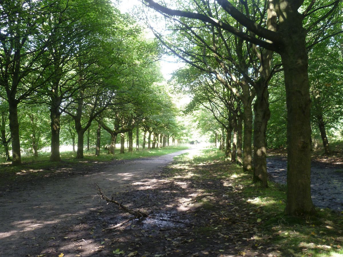
The c 160 ha site is situated between the villages of Rivington and Horwich, on land which slopes westwards down to Lower Rivington Reservoir. The park is divided from Rivington Gardens to the east by meadowland. The village of Rivington is on the north-west side and forms part of the northern boundary, and there is a band of agricultural land separating the site from Horwich to the south. The western boundary was originally formed by a wrought-iron fence along the edge of the reservoir, erected by Liverpool Corporation. This has largely been removed apart from a section along the north-west side. The northern boundary is formed by fencing along the edge of Sheep House Lane and Hall Lane. The remaining boundaries are formed by fencing between the site and agricultural land. Within the park there are two farms: Top o'th'Hill Farm close to the centre of the site and Middle Derbyshires towards its southern end. Both these, and fields immediately around them, were excluded from the sale in 1902 to Liverpool Corporation and they have never been part of the Park. The same applies to Rivington and Blackrod High School and its grounds at the southern end of the site. The site is bisected by Rivington Lane which runs north/south between Rivington and Horwich.
Entrances and Approaches
Access to the site is via Rivington Lane which enters the park immediately south of the village of Rivington and immediately north of the outskirts of Horwich. The road from Horwich which joins with Rivington Lane is called Lever Park Avenue; at its junction with Chorley Road there are two polished granite pillars erected in memory of Lord Lever by his son in 1934 (outside the registered area). There is an entrance on the east side of the park from Rivington Gardens where a path runs west across Breres Meadow to a gate leading into Lever Park. Another similar entrance gives access from the south end of Rivington Gardens and there are gated entrances at other points along the eastern and northern boundaries. The park can be entered informally along most of the length of Rivington Lane.
Principal Building
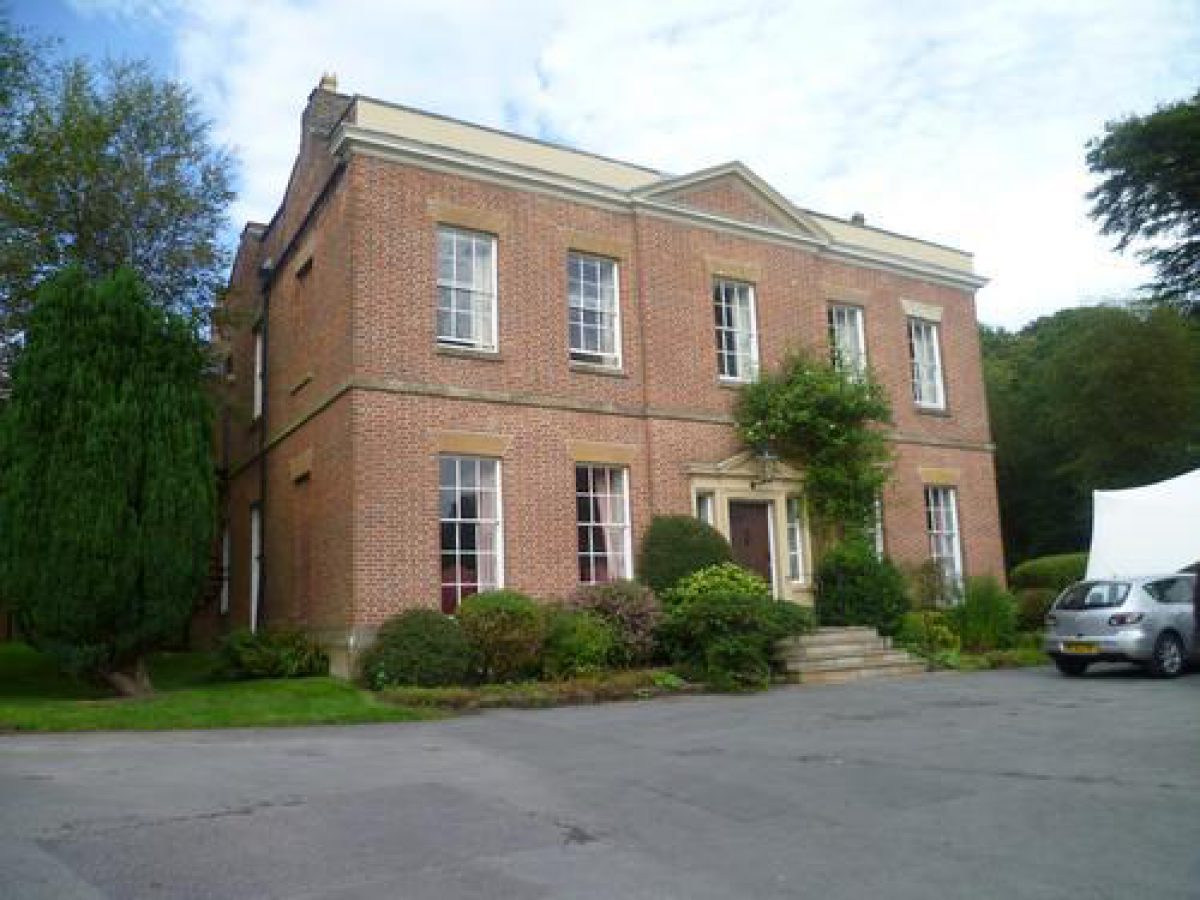
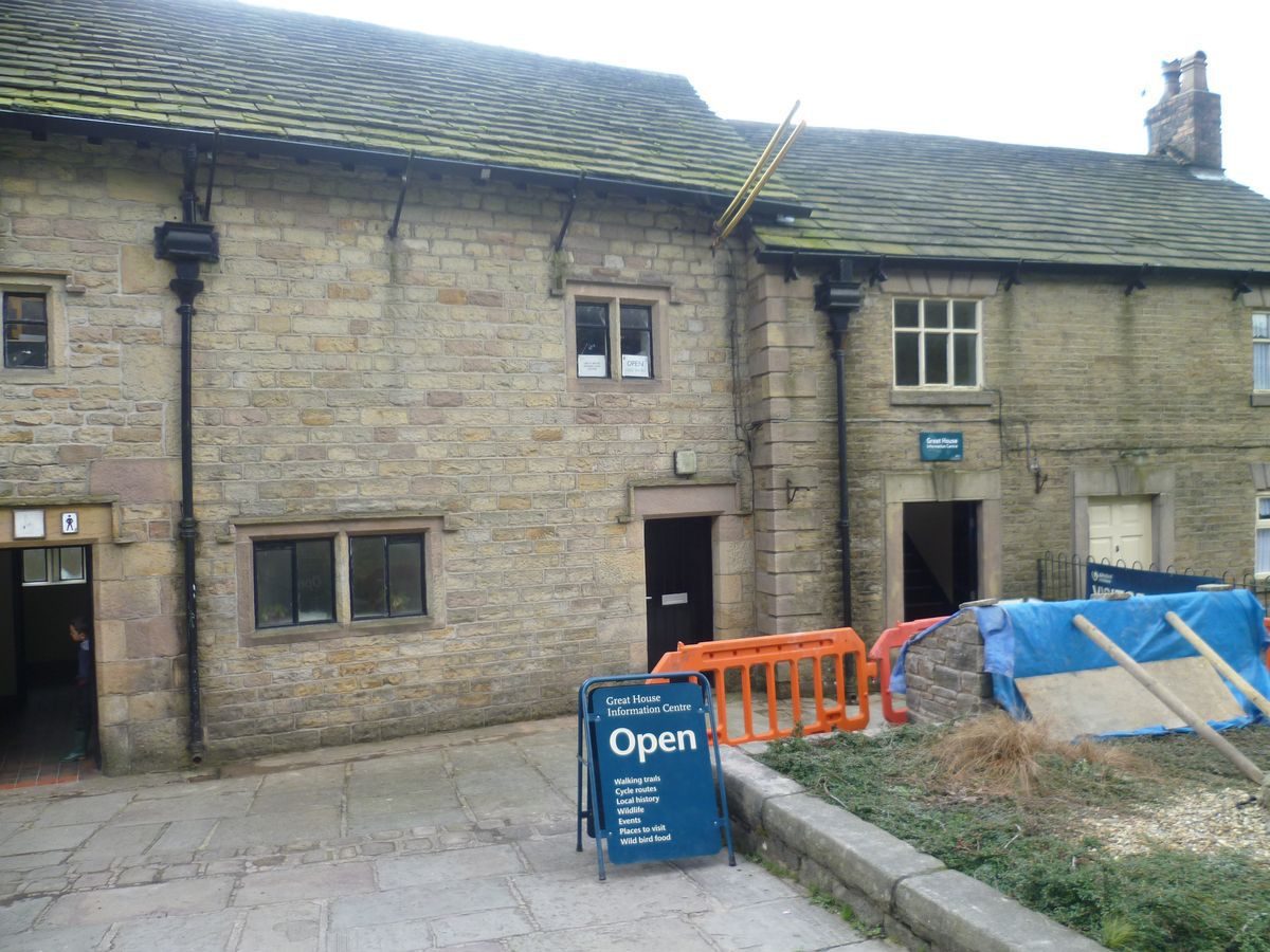
Rivington Hall (listed grade II*) is situated close to the north-east corner of the Park. It is a multi-phase building with C16 work visible in the rear of the house, concealed by an C18 symmetrical front. Immediately to the north-west of the house is Rivington Hall Barn (listed grade II), a cruck barn possibly of C16 or C17 date which was restored and altered by Jonathan Simpson for Lord Leverhulme to provide shelter for visitors to the park. A similar barn, called Great House Barn (listed grade II), is situated on the west side of Rivington Lane c 600m south-west of Rivington Hall. It was also altered for visitor use by Jonathan Simpson. Great House Farmhouse and Cottage are situated immediately south of the barn. These have been converted in the late C20 to provide various visitor facilities.
Gardens and Pleasure Grounds
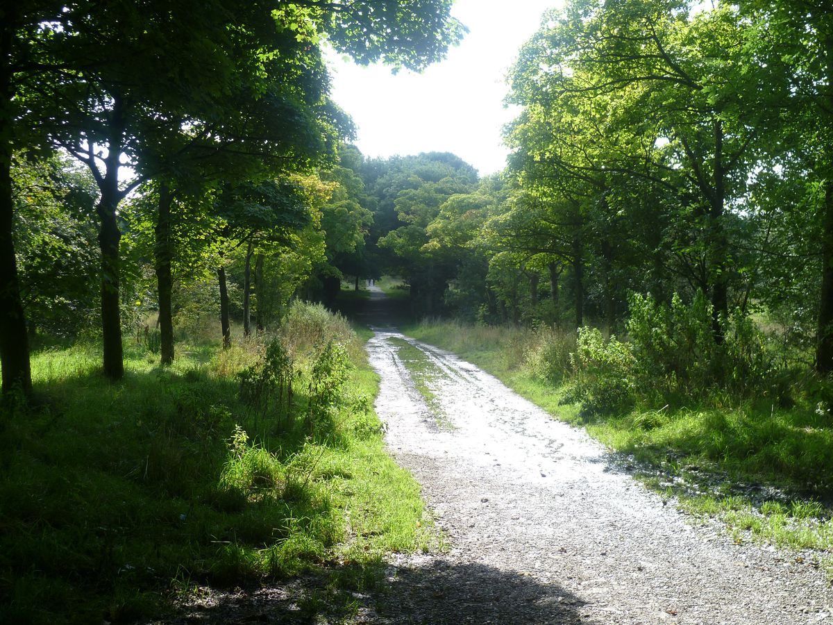
There is a small informal garden immediately to the south of Rivington Hall. Mature trees frame lawns and there is a small lake c 60m south-west of the Hall which is crossed by a bridge carrying a drive. This garden preserves a degree of intimacy and appropriate scale around the Hall. Apart from the route of the drive across the pond, the garden broadly conforms with what is shown on the 1st edition OS map surveyed 1844. An avenue runs south-west from the bridge over the pond, crossing Rivington Lane, and then runs past Great House Barn and on to the edge of the reservoir. A second route runs eastwards through woodland and curves southwards to join Rivington Lane, while a third route cuts a sinuous line through woodland and runs south to connect with routes running through the park. A plan published by Mawson in Civic Art: Studies in Town Planning, Parks, Boulevards and Open Spaces in 1911 shows that he had planned five avenues radiating from the Hall, but the executed plan as shown on the 1929 OS map shows that a less formal approach was used.
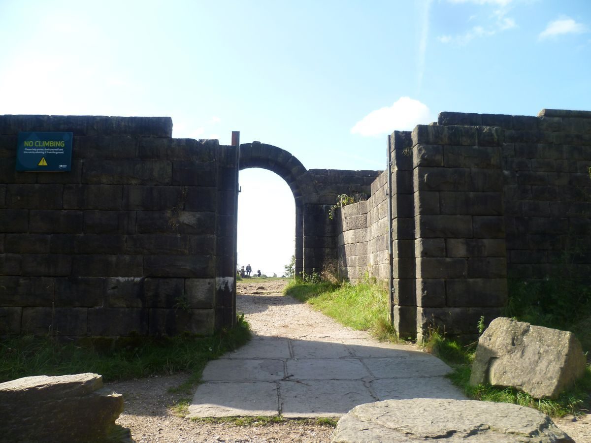
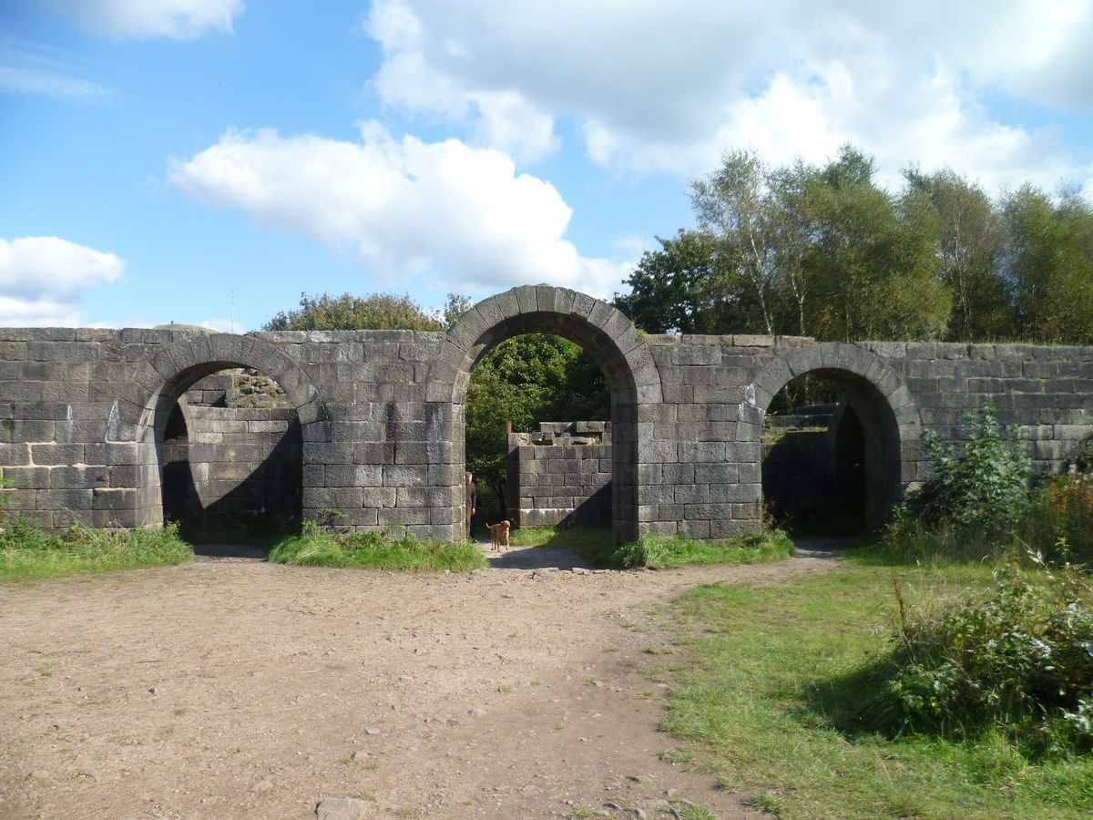
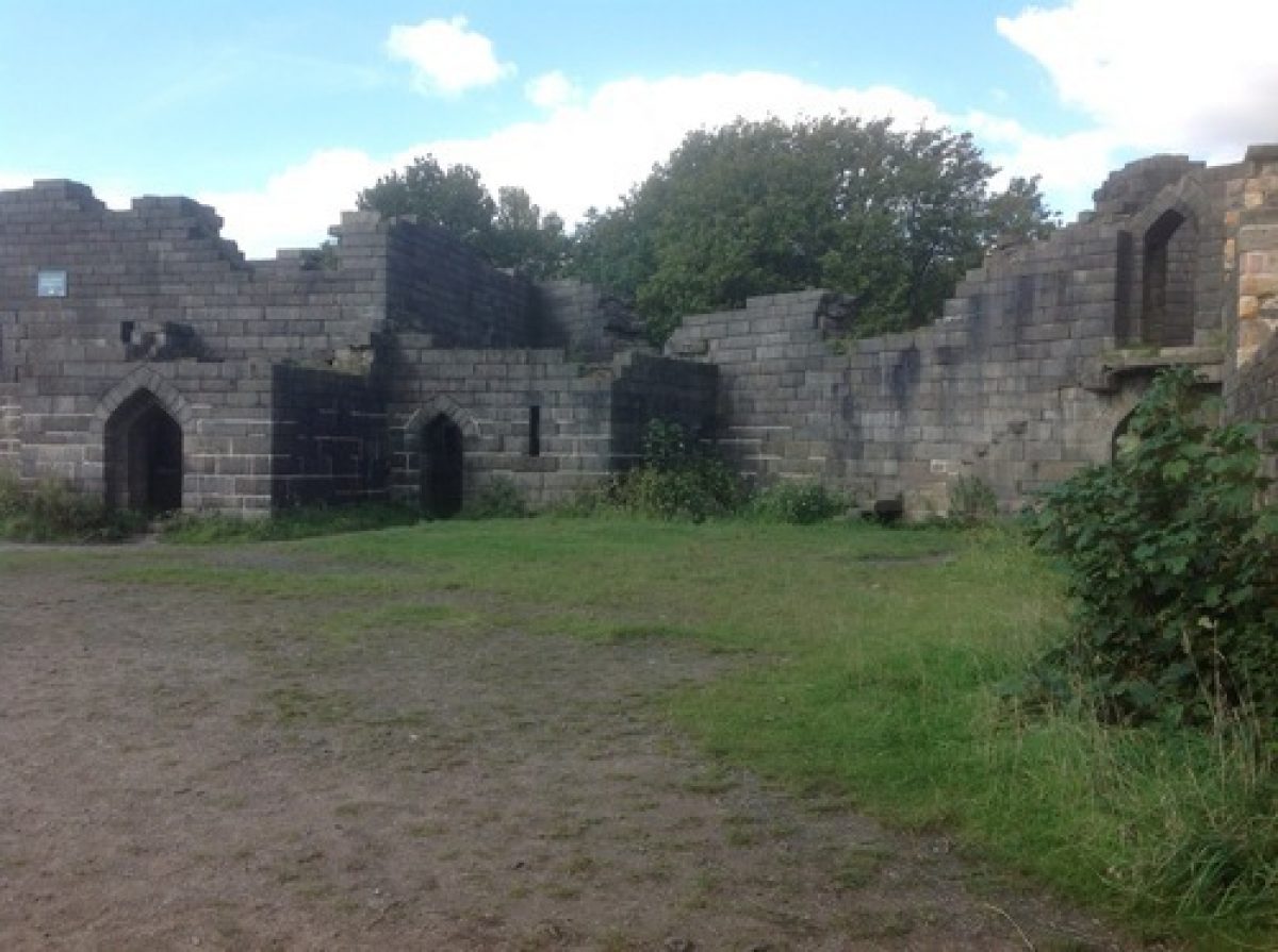
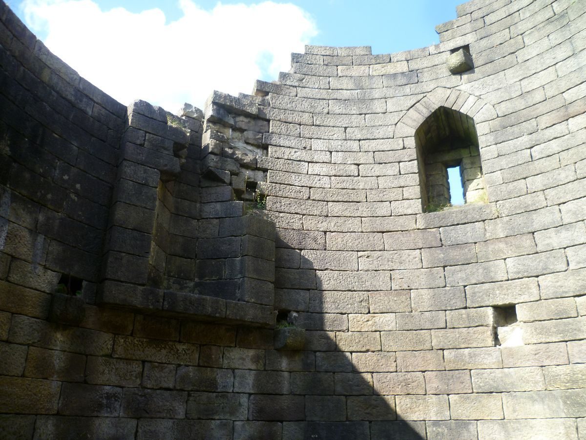
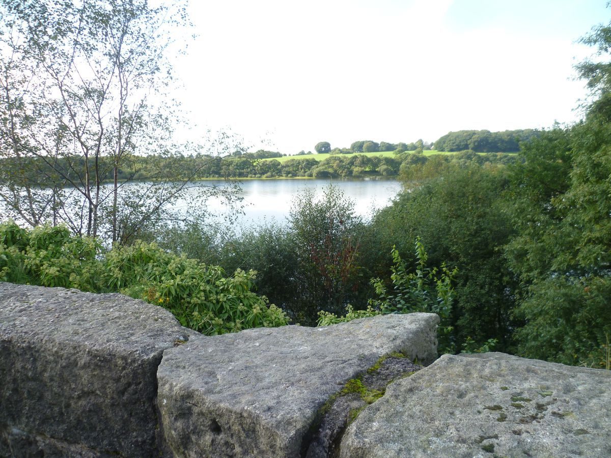
The other main focus within the park is a reconstruction of the ruin of Liverpool Castle (listed grade II), called Rivington Castle, which was designed by Jonathan Simpson. This was begun in 1912 but was never completed as intended. It is situated on a promontory overlooking the shore of the reservoir, c 1.5 km south-west of Rivington Hall, and is the focus for three radiating avenues running roughly north, north-east and south-east. This is not shown on Mawson's 1911 plan but it is on the 1929 OS map which suggests that the planned formality of avenues radiating from the Hall was softened in favour of formal emphasis on the Castle. Views across the reservoir to the south and west and over the park to the moors to the north and east are obtained from the Castle. The principal route through the park is Rivington Lane which carries vehicular traffic.
The parkland consists of a mixture of open ground, woodland and avenues. The specific aim of the design was to create a country park which utilised the existing moorland topography and water features and enhanced the rural qualities of the area (Mawson 1911). To this end a number of villas and houses were removed 'to destroy all suggestion of the suburb' (Mawson 1911). Existing woodland to the north and south of Rivington Hall, south of Rivington village and south of Top o'th' Hill Farm was augmented and new planting undertaken, principally around Great House Barn and to the east of Rivington and Blackrod High School.
The edge of the reservoir, which has a path along it for much of its length, apart from that section belonging to Top o'th' Hill Farm, is wooded. This woodland is not shown on Mawson's 1911 plan or on the 1929 OS map.
Maps
- T H Mawson, Lever Park, Rivington, Bolton, 1911
- Plan based on Mawson's notes and annotations to the survey map of 1905
- Map based on the executed plan and the OS 6" to 1 mile 1929-30 (All reproduced in Cobham Resource Consultants)
- OS 6" to 1 mile:
- 1st edition surveyed 1845-7
- 2nd edition published 1909
- 1929 edition with additions 1938
Description written: May 1997; Amended: June 1998
Register Inspector: CEH
Edited: March 1999, November 2022
- Visitor Access, Directions & Contacts
Access contact details
The site is open daily, from dawn to dusk.
Directions
East of the M6, immediately north of Horwich
- History
The following is from the Register of Parks and Gardens of Special Historic Interest. For the most up-to-date Register entry, please visit The National Heritage List for England (NHLE):
13th Century - 17th Century
The site was formed from land belonging to the Manor of Rivington which was owned from 1212 until 1605 by the Pilkington family.
19th Century
Lever Park was one of a series of commissions carried out by Thomas Hayton Mawson (1861-1933) for the industrialist and philanthropist Lord Leverhulme.
After several changes of ownership the Hall and Manor of Rivington were offered to Liverpool Corporation in 1899 because they formed part of the gathering grounds for two reservoirs on the western side of the site which were built in the 1850s. The Corporation declined the offer and the site was bought by Lever.
20th Century
In 1901 he offered to donate around 160 hectares of the land to Bolton Corporation for a public park, keeping the remaining land on the eastern side of the site for his own house and gardens. This site, called Rivington Gardens, was also laid out to designs by Mawson.
In 1902 Liverpool Corporation sought to acquire the land through an Act of Parliament. Lever challenged this legislation and the case was settled by a Select Committee of the House of Commons which decided to exclude the area around Lever's dwelling and some of the village properties, but to allow the purchase of the remainder providing that it was maintained as a park for the benefit of the people of Bolton and the public generally. Lever laid out the park at his own expense and offered to maintain it during his lifetime. The park was opened in 1904 and another ceremony was held in 1911 to celebrate the completion of most of the work.
In 1974 it passed to the North West Water Authority following local government reorganisation and it has continued to be maintained as a public park.
Period
- 20th Century (1901 to 2000)
- Early 20th Century (1901 to 1932)
- Associated People
- Features & Designations
Designations
The National Heritage List for England: Register of Parks and Gardens
- Reference: GD1946
- Grade: II
Features
- Lake
- Walk
- Garden Terrace
- Pavilion
- Ornamental Bridge
- Folly
- Pool
- Key Information
Type
Park
Purpose
Recreational/sport
Principal Building
Water Supply And Drainage
Period
20th Century (1901 to 2000)
Survival
Extant
Hectares
160
Open to the public
Yes
Civil Parish
Rivington
- References
References
- {English Heritage Register of Parks and Gardens of Special Historic Interest}, (Swindon: English Heritage, 2008) [on CD-ROM] Historic England Register of Parks and Gardens of Special Historic Interest
- Mawson, T H., (1911) Civic Art: Studies in Town Planning, Parks, Boulevards and Open Spaces
- Smith, M D., (1984) Leverhulme's Rivington
- Cobham Resource Consultants nd, (c 1989) Lever Park
- Pauline Roscoe Associates (1996) Lever Park Management Plan