Introduction
Killerton is an early-19th-century woodland garden of 10 hectares, set within a larger park and woodland of around 100 hectares. The house, garden and estate are in divided use.
An early 19th century woodland garden and pleasure ground associated with the Veitch family, with an early 20th century terrace designed by William Robinson adjacent to the house, set within wider parkland which developed from the late 17th century.
Terrain
The site includes the dramatic outcrop of volcanic rock, Dolbury Hill, together with land running north and west into the valley of the River Culm.The following is from the Register of Parks and Gardens of Special Historic Interest. For the most up-to-date Register entry, please visit The National Heritage List for England (NHLE):
Location, Area, Boundaries, Landform and Setting
Killerton is located 0.5km west-north-west of the hamlet of Budlake in the parish of Broad Clyst, and c 2km south-west of the village of Silverton. The site, comprising c 100ha, includes the dramatic outcrop of volcanic rock, Dolbury Hill, together with land running north and west into the valley of the River Culm. The north, west and south-west boundaries of the site are fenced, while the south boundary follows a minor road and is enclosed by metal estate fences. The east boundary also follows a minor road and is marked by a stone wall c 2m high and by timber fencing. The site has wide views in all directions from the high ground north of the House, together with significant views south-west, south and south-east from the House and terrace, framed by Ashclyst Forest to the south-east and Danes Wood to the south-west, which are outside the site boundary.
Entrances and Approaches
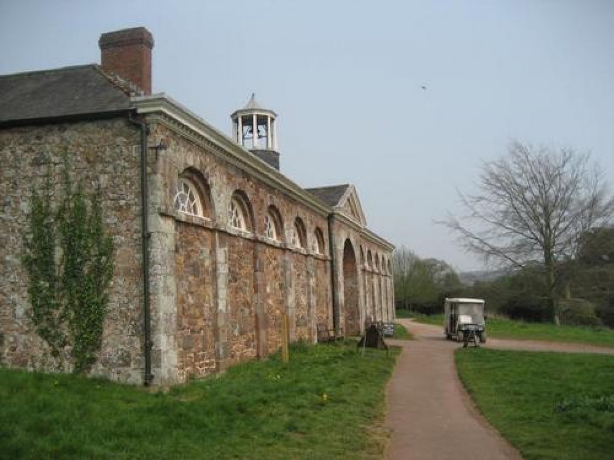
The site is approached from a minor road which follows the southern boundary of the site from Budlake west to Columbjohn. A single-storey stuccoed lodge (listed grade II) built in 1825 by C R Cockerell stands to the north of the entrance which is marked by a pair of granite obelisks (listed grade II) c 3m high which support simple early C19 wrought-iron gates. The drive enters the south park between a pair of mature Turkey oaks, and passes south of the late C18 stables (listed grade II) and estate yard. Following a level course west-south-west for c 350m, the tarmac drive enters the early C20 carriage court which is retained to the south and east by a stone ha-ha (1931). The gravel turning circle is bordered by lawn to the south-east, and by ilex oaks and shrubbery to the north. The gardens are separated from the carriage court by an early C20 stepped stone wall with ball finials and pierced wooden gate.
East of the entrance to the main drive, and adjacent to a stone water trough commemorating Ellen Acland (d 1924), the Lower Drive, now a gravelled track, leads c 400m south-east through an area of early C19 parkland with specimen trees, to join the B3185 Exeter road at Lower Budlake.
Principal Building
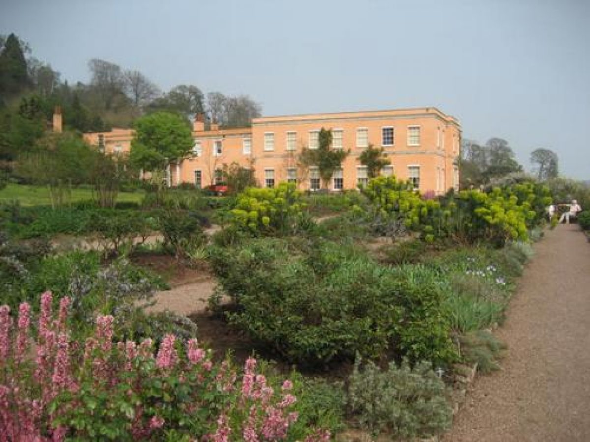
Killerton House (listed grade II*) is a rebuilding of an earlier house undertaken in 1778-9 by John Johnson as a temporary residence for Sir Thomas Acland. Following the abandonment of James Wyatt's scheme for a house on a new site in 1779, Johnson's house was retained, and enlarged in 1830. Further additions including a billiard room to the north-east of the original block were made in 1900 by Prothero and Philpot of Cheltenham, and a new entrance hall was designed by Randall Wells in 1924. Johnson's house comprises two storeys under a hipped slate roof, the walls being stuccoed with stone dressings. The south façade, originally the entrance front, retains the original recessed front door flanked by early C19 ships' cannon from a family yacht. The west front was extended north in the early C19, when the balcony and verandah supported on open-work iron columns was added.
Gardens and Pleasure Grounds
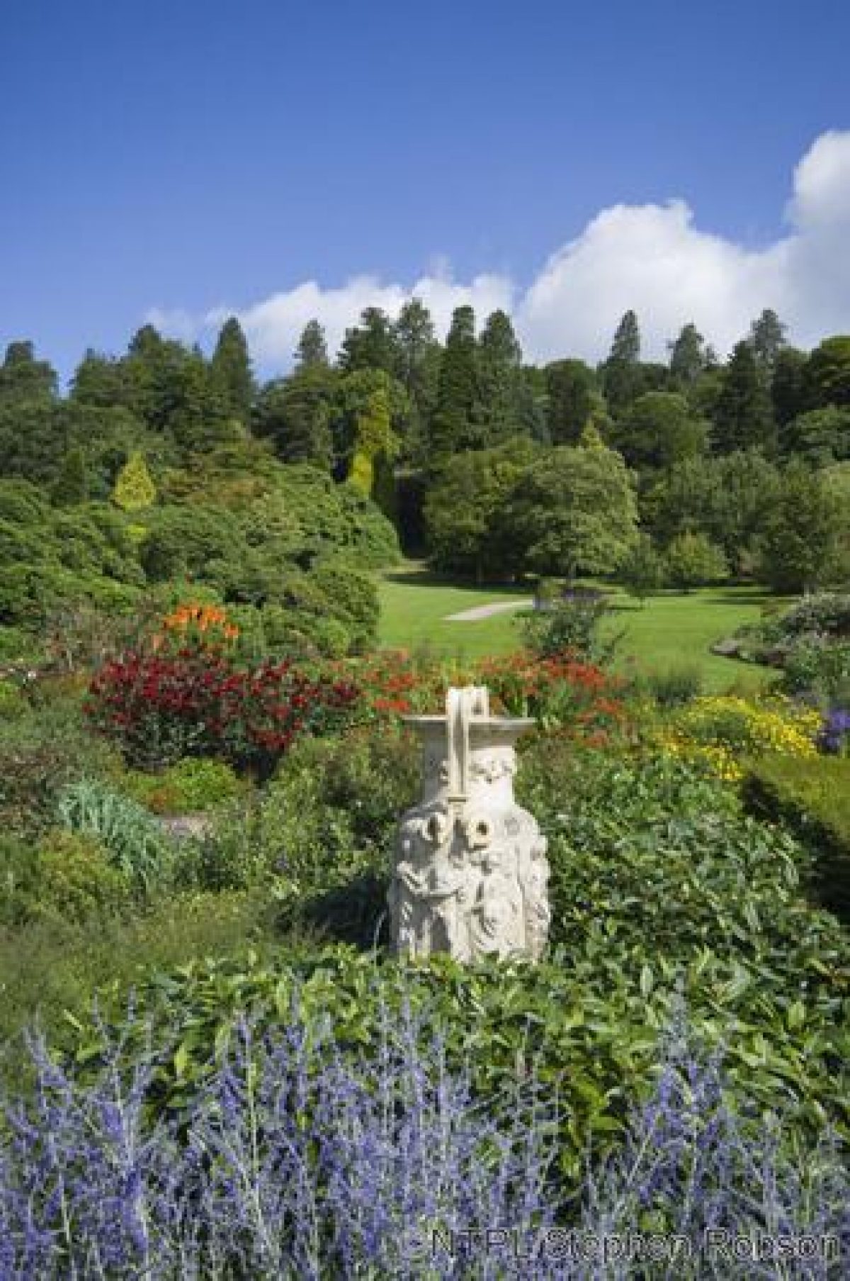
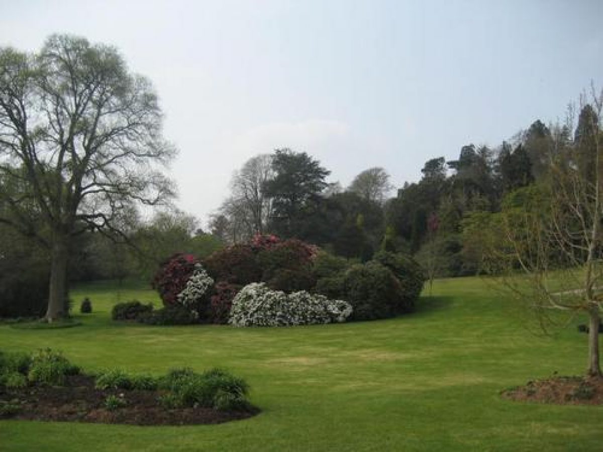
Lying principally to the south, west and north-west of the House, the pleasure grounds are separated from parkland to the south by William Robinson's 100m terrace of 1900. Stone retaining walls with low stone parapets support a lawn 4m deep below the south front of the House. Narrow planting beds run parallel to the parapet and the House walls, and a gravel walk 3m wide separates the border below the House from the lawn. At the south-west corner of the House the terrace wall is broken by a stone bastion containing a semicircular seat and sundial, from which there are significant views across the park. To the west of the House the terrace extends c 80m with a herbaceous border to the north separating a gravel walk from the lawns. To the south a symmetrical arrangement of stone-edged panel beds are all planted with herbaceous plants, shrubs and roses in a late C20 scheme devised by Graham Stuart Thomas and John Sales to replace Robinson's early C20 rose garden. A pair of fine relief decorated Coade stone vases (1805) are placed centrally to the east and west of the panel beds. The terrace walk leads to an area of lawn planted with specimen trees and shrubs which has views over a late C20 ha-ha to the park.
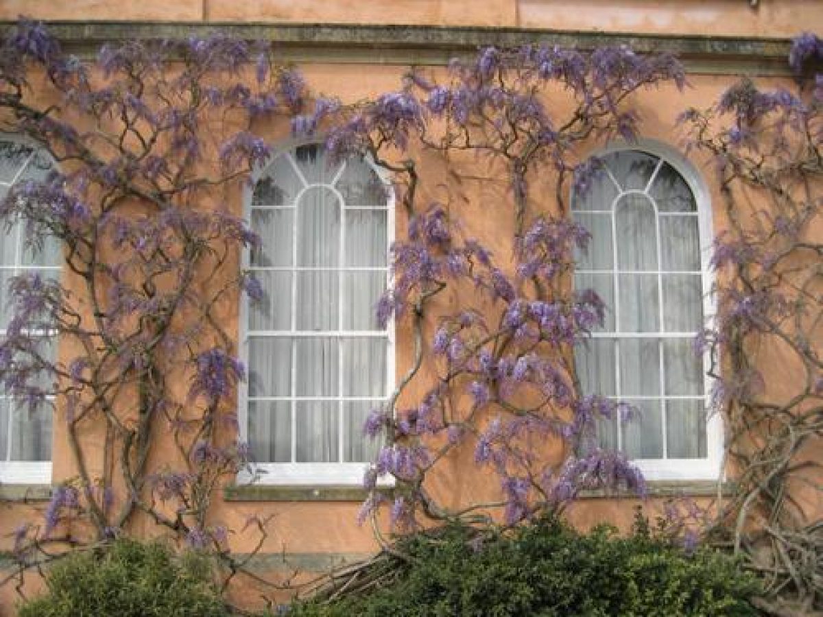
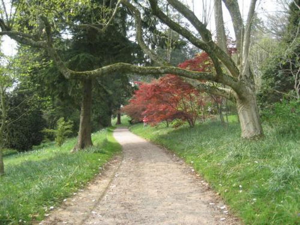
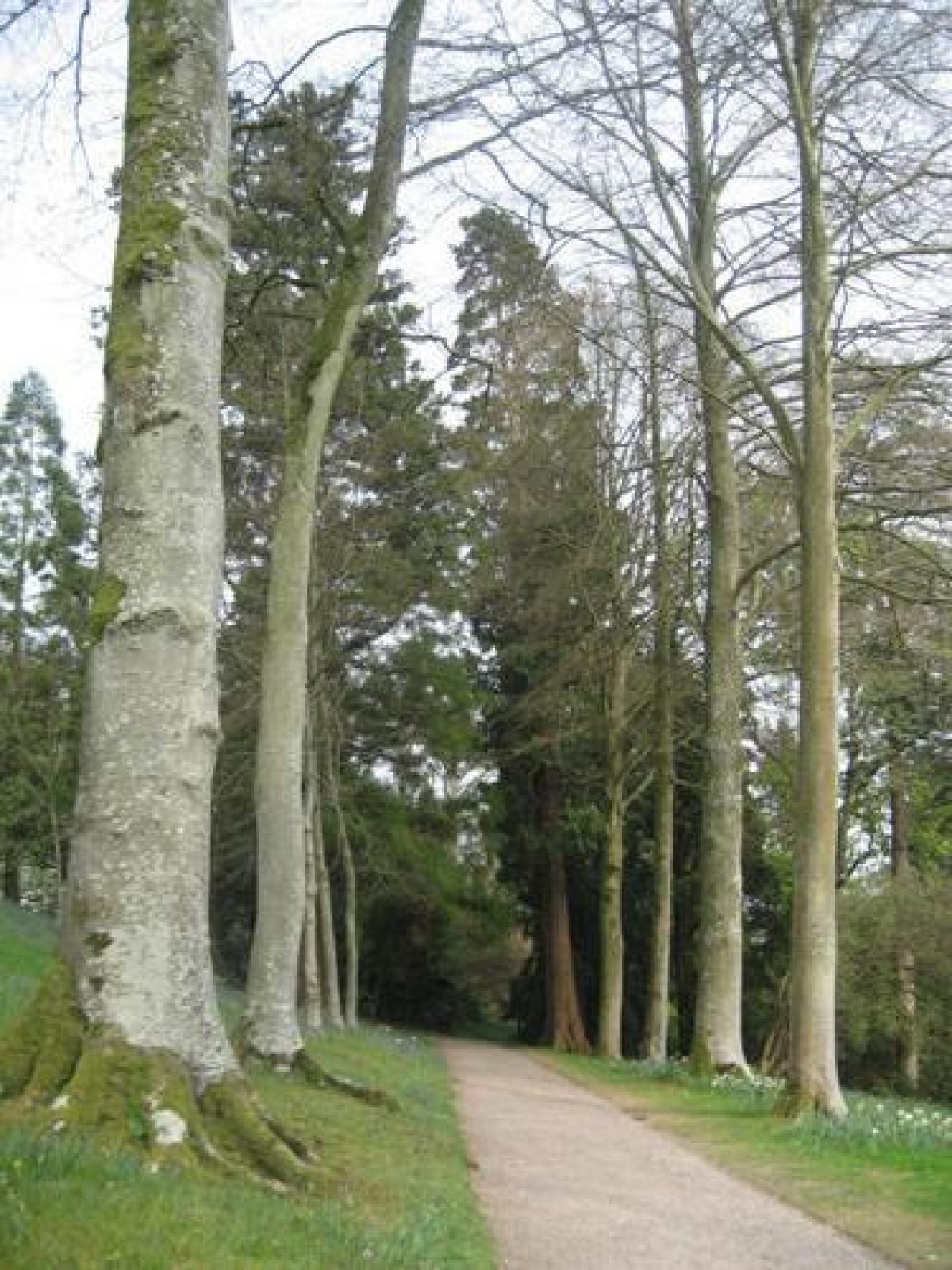
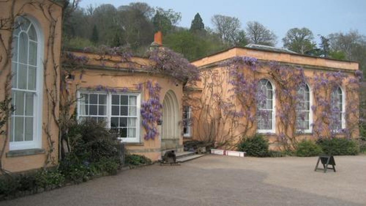
The walls of the House support various climbers including Virginia creeper, wisteria, magnolia and solanum. Below the west façade a gravel walk rises north with late C20 mixed planting adjacent to the verandah, to reach an east/west walk which is punctuated by a pair of carved stone urns c 80m west of the House. Lawns with a mature liriodendron and groups of rhododendron sweep south-west and north-west from the House to an area of denser shrubbery adjacent to the west boundary c 250m from the House. A series of east/west walks including Veitch's early C19 Beech Walk traverse the slope north-west of the House, linked by serpentine north/south paths.
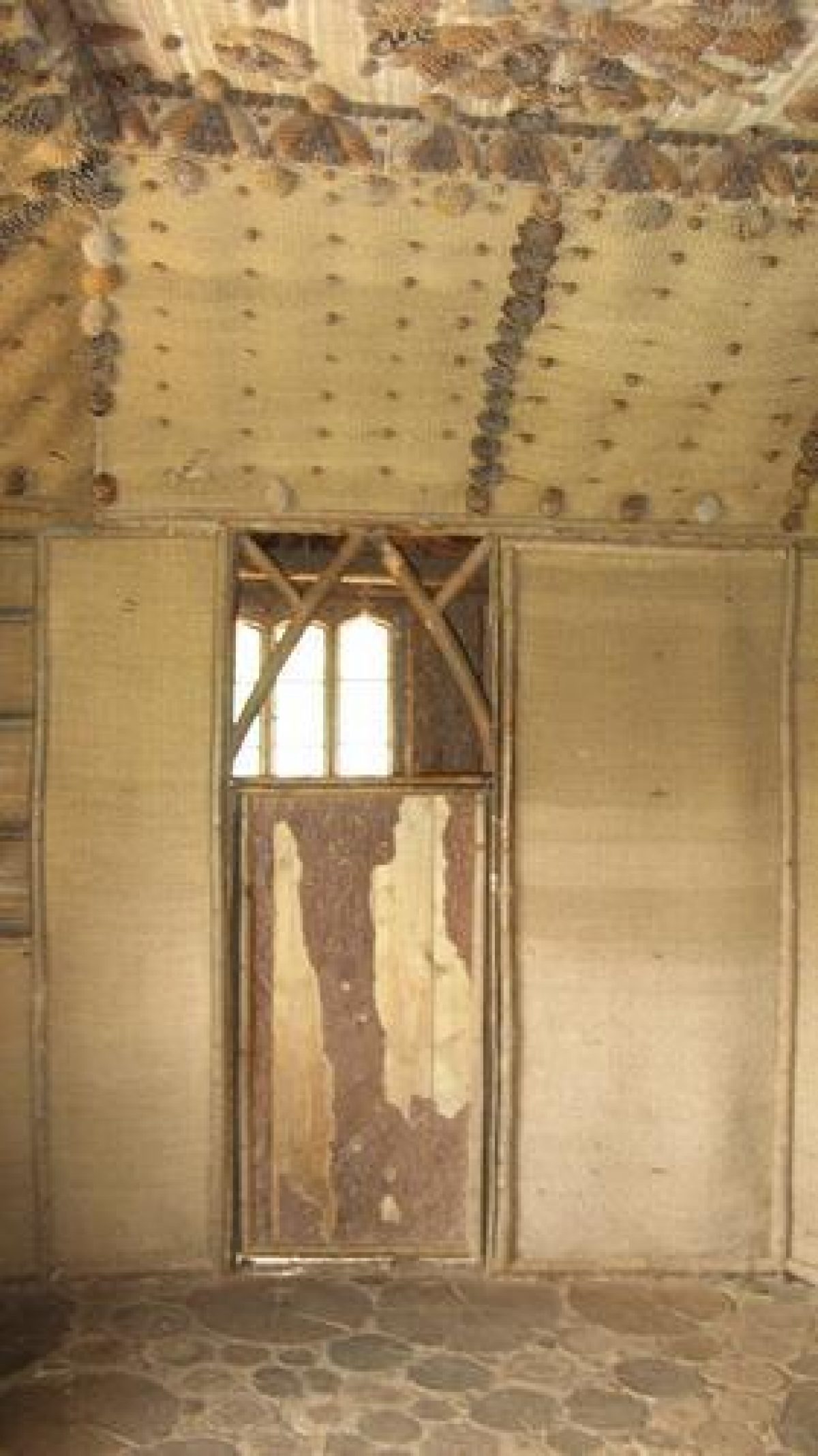
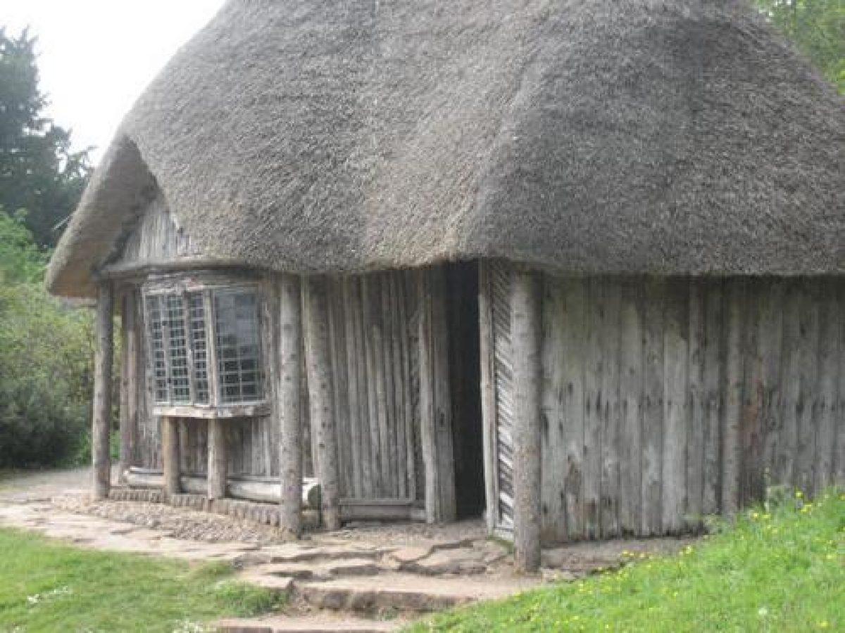
Other features include the Bear's Hut or Ladycot (listed grade II*) c 280m north-north-west of the House. Built c 1808, this rustic single-storey timber and thatch building comprises three rooms including a 'hermit's cell', decorated with materials including deer skins, wickerwork, fir cones and deer knuckle bones. An icehouse (listed grade II) was built in 1808 into the slope above a former quarry 30m north of the Bear's Hut, and was converted into a rock garden c 1900. Rocky outcrops are picturesquely planted, with a central pool fed by an artificial stream running down the rock face. A fragment of the Giants' Causeway incorporated in the scheme was placed here in the early C19 by Sir Thomas Acland, tenth Baronet. Sir Thomas is commemorated by a granite Celtic cross (listed grade II) which stands on the western boundary of the pleasure grounds overlooking Cross Parks 270m north-west of the House. North-east of the Memorial Cross the early C18 sunken deer fence which formed the boundary of Veitch's 1770 park remains as a planted ditch within the pleasure grounds, the boundary having been moved west c 1808.
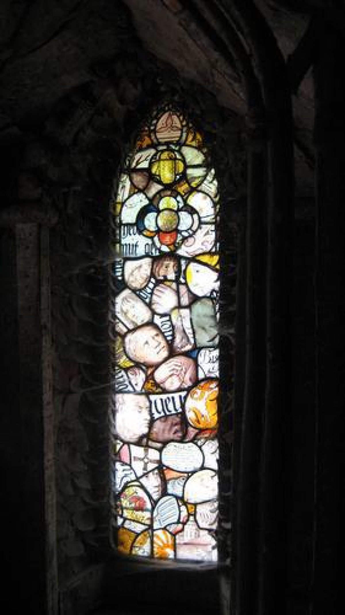
A further area of pleasure ground separated from the park by metal deer fences surrounds the Chapel of the Holy Evangelists (listed grade I) which was built in 1840-1, 400m north-north-east of the House in an existing shrubbery garden. Early C19 shrubbery sweet chestnuts, tulip trees and Lucombe oaks survive, together with later C19 specimen conifers. Mid C19 metal and wire fencing to the north, east and south of the Chapel supports mature wisteria.
Park
South Park to the south and east of the House slopes gently north/south and is today (1998) pasture with scattered specimen trees including Turkey oaks, cedars and mature sweet chestnut pollards. A pond c 260m south-east of the House was formed in 1845-6 and contains an island with a mid C19 small stone duck house and a dogs' cemetery. Parkland with scattered trees extends east adjacent to the early C19 lower drive.
The substantial area of early C19 parkland on the slopes of Dolbury Hill to the north of the House has been reduced by significant areas of mid and late C19 tree planting. The flat summit of Dolbury Hill and the Iron Age fortifications (scheduled ancient monument) retain some early C19 beech planted by John Veitch which form Killerton Clump, together with later C19 specimen conifers. Planting on the Clump is now contiguous with areas of mid and late C19 planting on the west and north-west slopes of Dolbury Hill including Deodara Glen 250m west of Killerton Clump which was planted in the mid C19 with Deodar cedars and other conifers to imitate a Himalayan valley and which has been restored in the late C20.
Mount Peel, originally Mount Pleasant, a knoll 450m west of the Clump was developed in the mid C19 with yew trees to form a viewpoint west across the Culm valley, while Park Wood, 660m north-west of the Clump, has been largely replanted with Douglas fir in the late C20 following storm damage. Veitch's sunk deer wall (1810) is evident on the north and north-west boundary of Park Wood, planted on its outer side with deciduous trees to effect a smooth visual transition to the agricultural landscape of the Culm valley. The slopes to the north, north-east and east of Killerton Clump retain a parkland landscape with scattered groups of mainly deciduous trees in pasture, with wide views across the surrounding agricultural land.
The Plain, a level plateau north-north-west of the summit of Dolbury Hill retains some late C19 conifers from an arboretum developed by the Veitch nursery for Sir Thomas Acland c 1870, and is now pasture. Cross Parks slopes south from Columbjohn Wood to the west of the pleasure grounds and extends west to Columbjohn chapel and gateway 1.4km south-west of the House. Now (1998) in agricultural use with enclosures of pasture, and limited arable to the south, there has been extensive late C20 planting to restore the late C18 park landscape shown in Tompkin's painting and which was reflected on the OS Drawing (1801). The site of the C18 folly on the eminence 930m west-south-west of the House is marked by limited planting including a mature cedar. In Columbjohn Wood a network of C19 paths survives which link it to the early C19 planting on the west slopes of Dolbury Hill.
Kitchen Garden
Some 350m north-east of the House, the late C18 kitchen garden is now (1998) used as a car park. Enclosed by brick walls c 3m high, an opening in the south-west corner admits vehicles, and original gateways survive in each wall flanked by clipped buttresses of bay while figs are planted in wall angles. Gravel tracks are bordered by grass, and there is an east/west symmetrical planting of ornamental trees centred on a circular dipping pool with a tufa-clad fountain in the middle of the garden. An opening in the north wall leads to an irregular-shaped nursery or fruit garden enclosed by holly hedges, which is now (1998) terraced for additional car parking. To the east of the kitchen garden a further area of nursery remains with late C20 glasshouses and gardeners' offices.
Maps
- A Map of Killerton, 1756 (Devon Record Office)
- A Map of the Barton of Culm John, 1756 (Devon Record Office)
- B Donn, A Map of the County of Devon, 1765
- Drew and Cox, Broad Clyst Tithe map, 6 chains to 1", surveyed 1842 (Devon Record Office)
- OS Surveyor's drawing, 1" to 1 mile, 1801 (British Library)
- OS Old Series, 1" to 1 mile, published 1809
- OS 6" to 1 mile: 1st edition surveyed 1887(8, published 1891
- 2nd edition revised 1904, published 1906
- OS 25" to 1 mile: 1st edition surveyed 1884, published 1885
Illustrations
- William Tomkins (?), oil painting of Cross Parks from the east showing the folly, nd (18th century), (National Trust Collection)
- W W J Gendall, Fragments of Killerton, 1831-1832 (private collection)
Archival items
- J Veitch to Sir Thomas Acland, 1808 (1148M/11(ii)/7), (Devon Record Office)
- J Veitch garden accounts, 1808-1813 (1148/M add special accounts), (Devon Record Office)
- W Robinson to Sir Charles Acland, 1900 (1148M/18/4), (Devon Record Office)
Description written: September 1998
Amended: June 1999; May 2000
Edited: November 2021
- Visitor Access, Directions & Contacts
Telephone
01392 881345Access contact details
The gardens are open all year round, but the house is open only between March and December. Please visit the National Trust website for more information about visitor opening.
Directions
The estate lies off the B3181 between Exeter and Cullompton.
Owners
The National Trust
PO Box 39, WA5 7WD
- History
Dolbury Hill
In the south west of England, some 8km north east of Exeter, a volcanic extrusion rises dramatically out of the undulating Devonshire countryside. Clothed in ornamental woodland and surrounded by parkland, ‘Dolbury Hill' forms the centerpiece to Killerton Park, a diverse and complex grade II* registered landscape designed during the 18th and 19th centuries by its owners, the Acland family, and renowned nurserymen John Veitch and sons. The site's origins, however, long predate this fruitful collaboration.
In addition to the time-depth readily evidenced by the area's geology, which is nationally designated (SSSI) for its interest, the history of early human occupation at Killerton is similarly palpable and reaches back into prehistory. On top of Dolbury Hill itself sit the remains of a hillfort dating back to the Bronze and Iron Ages, its national importance reflected by its designation as a Scheduled Monument.
16th Century
The true story of the development of Killerton, however, begins in the flat valley landscape to the west of the area on the banks of the River Culm, where Sir John Acland is purported to have built himself a mansion in the late 16th century. Known as Columbjohn, the house played a prominent role in British history, serving as the regional headquarters for both the Roundheads and the Cavaliers at different stages of the Civil War, with Cromwell himself known to have been a guest. Now only faint earthworks remain where the house once stood, in a tranquil and forgotten corner of the park with just the lowing cattle to interrupt the dreams of those long-dead partisans.
Columbjohn Mansion
Although Columbjohn Mansion was not to survive, the possession and influence of the Acland family continued unbroken into the 20th century (the estate was donated to the National Trust in 1944). The family relocated from Columbjohn to their dower house at Killerton sometime during the 18th century. Their new home, nestled at the southern foot of Dolbury Hill, was originally built around 1610, although the present house dates to 1779 with later additions.
Park
The park's earliest incarnation lies to the north of Dolbury Hill, where a large expanse of deer park had been created as a discreet entity separate from Columbjohn. Dating back to at least the 18th century, this landscape more likely represents a former medieval hunting ground, its impressive western park pale still an important feature of the park and forming another Scheduled Monument. A number of spectacular trees survive from this early landscape, forming part of the rich collection of veterans and ancients that are such a distinctive feature of Killerton and that support a diverse range of flora and fauna. The earliest mapped evidence of the area dates to 1756 and shows the extent of the park to the north, as well as an avenue linking Columbjohn in the west with Killerton.
The landscape recorded in this survey was to alter dramatically with the arrival to Killerton in 1770 of John Veitch, hired to realise the ambitions of the Acland family. Veitch hailed from Scotland, training as a nurseryman but with hitherto little experience of designing on the grand scale. By the turn of the century, however, new areas of parkland had been created in front of the house to the south and most extensively to the west, stretching over to Columbjohn. In creating the southern parkland, the road was moved east to accommodate the new stable block and entrance drive; to the west, the former avenue was swept away and the hedgerow boundaries removed.
Today no trace of the 18th century avenue remains, although its route was retained within the parkland design and became known as the ‘Processional Way' after 1841, when the family would file across the park for funerals held at Columbjohn chapel - the physical link joining the Acland's new residence to the home of their ancestors may have gone, but the spiritual connection remained strong.
One feature to be retained within the early layout of the western parkland was a folly located on a prominent knoll to the north of the old avenue. It is thought that the folly actually pre-dated the creation of the parkland, although it was relatively short-lived, disappearing sometime in the early 19th century. Now only the brick foundation survives, but the historic existence of this eye-catcher reflects one of Killerton's primary assets - its outstanding views.
Veitch demonstrated his skill at parkland design by capitalising upon the area's dramatic topography to produce numerous awe-inspiring vistas. Far-reaching views to the south were included within the parkland experience by way of a series of terraced paths snaking across the rising ground to the east of the house. Even more impressive is the kinetic sequence of vistas to be obtained from the carriage drive along the eastern edge of the north deer park, which had been newly expanded as part of Veitch's late 18th century alterations.
Here the importance of the surrounding landscape comes fully into play, as the knolls and ridgelines of Devon's distinctive countryside are progressively revealed in theatrical fashion through an ingenious use of topography and tree planting. It is only a small leap to imagine the full effect as experienced from a horse-drawn carriage - today the deer have been replaced with dog-walkers, but the route remains impressive and, in spite of the M5, the landscape in general is devoid of the sort of development that lessens the experience of so many parks throughout the country.
Another important addition to the park at this time was the planting of beech trees on Dolbury Hill, emphasising the drama of the landform and providing a focal feature within the landscape. Today the unintended consequence of Veitch's design is the damage being done to the Scheduled hillfort by the roots of the mature trees. Both are important elements in their own right, and further research is required to inform future management.
19th century
The second major campaign of parkland alteration dates from 1808, when one of the most influential Aclands, the ‘Great Sir Thomas', came of age and returned to the estate. Veitch's services were retained and developments continued apace in both park and garden. A new park pale was built across the north deer park in 1810 to develop the western half as ornamental woodland (Park Wood), with numerous drives directing views west over the River Culm.
The southern parkland was further expanded, with the road moved further from the house in two phases and a new parkland drive created to extend the arrival sequence. A grand chapel was built to the east of the house to a design by C. R. Cockrell, now a grade I listed building which reflects the architect at the height of his powers. The garden was transformed with numerous buildings added, including the Bear's Hut, the icehouse and the orangery (the only one not to survive).Perhaps the most important additions to Killerton during the 19th century in the national context, however, were the ornamental planting schemes introduced by Veitch and sons via their local nursery. The Veitches were introducing new plants to the country through their contacts with the plant-hunters of the day, tested first at Killerton before going on to furnish many other estates throughout the land. Such was its influence, Killerton is considered to be one of the first Arboreta to be established in the country.
20th century
In 1911, the 140-year-old relationship between the Acland and Veitch families culminated in the development of a national diploma in horticulture, as Arthur Acland (13th Bart) and Sir Harry Veitch were both members of the RHS horticultural education committee.Alongside these features of national significance, much of the appeal of the park lies in the personal story of the Acland family that is firmly embedded in the landscape, from the imposing Acland Cross to the more modest memorial marking the tragic bicycling accident of 11-year- old Ellen Acland at the front gate. The liberal persuasions of the family are reflected in features such as Mount Peel, renamed in support of Sir Robert Peel's free trade policy, and the front terrace where Lloyd George addressed a gathered crowd in 1926, inspiring the moniker ‘the Castle of Beautiful Liberalism'. Nearly 300 years on from the Civil War, politics still featured large at Killerton.
As with most parks throughout the country, 20th century ploughing, planting and benign neglect has obscured some of the design intent at Killerton. A recently completed Parkland Plan (2012) serves to address this and identifies the best approach for management to restore and conserve the park over a 10-year period, bringing alive the many fascinating stories associated with this rich and diverse landscape.
Text taken from Cookson, Will and Tickner, Matthew 'Acland and Veitch: A Long and Productive Association - Uncovering the fascinating stories behind the development of Killerton Park, Devon'; contributed by the National Trust.
The following is from the Register of Parks and Gardens of Special Historic Interest. For the most up-to-date Register entry, please visit The National Heritage List for England (NHLE):
Historic Development
A house was built on the site in the mid 16th century by a lawyer, Edward Drewe, who acquired the property through marriage. In the early 17th century it was sold to John Acland, whose principal residence was Columbjohn, 1.5 kilometres west-south-west of Killerton. Sir Hugh Acland (1637-1713) abandoned Culmbjohn in favour of Killerton in about 1680. Estate maps for Columbjohn and Killerton (1756) provide evidence for the early 18th century landscape: rectangular enclosures to the east and west of Killerton House appear to represent formal gardens, and a formal avenue running through enclosed agricultural land linked Killerton and Columbjohn to the west.
To the north, north-west and east of the House an area of 135 acres (about 56 hectares) on Dolbury Hill is shown as enclosed park. This park is shown on Benjamin Donn's Map of Devon (1765), where a small tower west of the park pale probably corresponds to an octagonal brick and stone structure which stood on a knoll 930 metres west of the House. This structure, now demolished, figured in a painting of the Killerton landscape by William Tomkins (1730-1792) which now (1998) hangs in the House.
Sir Thomas Acland (1723-1785) employed John Veitch (1752-1839) in 1770 to lay out a landscape park which was intended to form the setting for a new mansion. Veitch's park enclosed about 500 acres (about 208 hectares) around Dolbury Hill, the summit of which, Killerton Clump, was planted with beech to emphasise its height. The main Exeter to Cullompton road to the south-east of the House was moved east as part of the park improvement. John Johnson was commissioned to remodel the existing house as a temporary residence in mid 1778. The stables about 260 metres east of the House were built by Johnson in 1779-1780, and the walled garden 50 metres north east was constructed in about 1782.
The 1801 Ordnance Survey Drawing shows parkland flowing round the House, together with significant areas of woodland planting on Dolbury Hill, including Mount Pleasant (later Mount Peel). The octagonal folly in Cross Parks to the west of the House survived in 1801, and this area appears to have been developed as parkland by the early 19th century. Veitch developed pleasure grounds from 1808 to the west and north-east of the House for Sir Thomas Acland and his wife, Lydia Hoare, on land enclosed from the late 18th century park. Features included gravel walks, shrubberies and a grove of tulip trees near the House.
A further area, known as Lady Acland's Shrubbery, was planted to the north-east of the House, which became the site for the Chapel designed by C R Cockerell in 1840-1841. Plans attributed to William Sawrey Gilpin (1762-1843) for a new drive from Killerton to Columbjohn (1820) were not implemented. An orangery was built north-west of the House in 1808, and the appearance of the pleasure grounds and park was recorded in a series of pencil sketches, 'Fragments of Killerton' by John Gendall (1831-1832).
Under the direction of John Veitch's son, James, the pleasure grounds and areas of the park including the Plain, about 650 metres north-north-east of the House, were planted with trees and shrubs newly introduced to cultivation by Veitch's expanded nursery which had relocated from Budlake to Exeter in 1832. Plant-hunting was continued in the early 20th century by Sir Francis Acland, who sponsored expeditions by F Kingdon-Ward.
Sir Charles Acland who succeeded in 1898 remodelled the House, and in 1900 commissioned William Robinson to advise on its immediate setting. Overgrown shrubbery was cleared and the 100 metre terrace south and south-west of the House was built, while the head gardener, John Coutts, developed an old quarry 200 metres north-west of the House as a rock garden in about 1900. Sir Francis, fourteenth Baronet made minor changes in the pleasure grounds which included the construction of a ha-ha between the early 20th century carriage court and the south park, and the demolition of the early 19th century orangery in 1937.
The Killerton estate was given to the National Trust by his son, Sir Richard Acland, in 1943. Programmes of replanting in the park, particularly since the construction of the M5 motorway to the east in about 1970, and the introduction of new planting schemes by Graham Stuart Thomas and John Sales on the terrace have been undertaken by the Trust.
- Associated People
- Features & Designations
Designations
The National Heritage List for England: Register of Parks and Gardens
- Reference: GD1685
- Grade: II*
Features
- House (featured building)
- Description: The house was built for the Acland family in 1778.
- Earliest Date:
- Latest Date:
- Natural Landscape
- Description: Dramatic outcrop of volcanic rock, Dolbury Hill.
- Boundary Wall
- Description: Stone wall, about two metres high.
- Terrace
- Earliest Date:
- Latest Date:
- Stable Block
- Earliest Date:
- Latest Date:
- Summerhouse
- Description: The Bear's Hut was originally a summerhouse. A pet black bear was brought back from Canada by Gilbert Acland, and was kept here in the 1860s.
- Earliest Date:
- Latest Date:
- Icehouse
- Earliest Date:
- Latest Date:
- Woodland
- Parkland
- Gardens
- Key Information
Type
Estate
Purpose
Ornamental
Principal Building
Domestic / Residential
Survival
Extant
Hectares
100
Open to the public
Yes
Civil Parish
Broad Clyst
- References
References
- {English Heritage Register of Parks and Gardens of Special Historic Interest} (Swindon: English Heritage 2008) [on CD-ROM] Historic England Register of Parks and Gardens of Special Historic Interest
- Nicholas Pearson Associates {Killerton Historic Landscape Survey/Management Plan} (1993) Killerton Historic Landscape Survey/Management Plan
- Land Use Consultants {Killerton Park Historic Landscape Plan} (2012) Killerton Park Historic Landscape Plan
- Mudge, Andrew {Guidelines for the management conservation and development of Garden and Park at Killerton} (1998) Guidelines for the management conservation and development of Garden and Park at Killerton
- Gendall, W W J., (1830), p 95 Views of Country Seats
- Acland, A., (1981) A Devon Family
- National Trust (1997) Killerton, guidebook
- Ackerman, R., (1809-1828), pl 25 Repository 11
- (1843), pp 240-242 Gardener's Magazine 19
- (22 May 1958), pp 1132-1133 Country Life, 123
- National Trust (1975) The Garden at Killerton, guidebook
- (1903), pp 365, 386 Gardeners' Chronicle II
Contributors
The National Trust
Philip Smart
- Related Documents
-
CLS 1/16/107
Relevant documents but no CMP
-
CLS 1/16/107