
Introduction
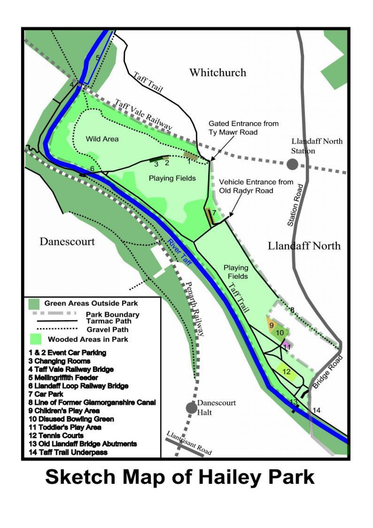
Hailey Park comprises about 19 hectares of land bordered to the west by the River Taff, to the north by the Taff Vale Railway, to the east by the built-up area of Llandaff North and to the south by Bridge Road. At the southern end of the park there are tennis courts, a toddler's play area, a (disused) bowling green and a children's play area. North of this are two areas of playing fields separated by the Taff Trail. North of the playing fields there is an area for wild life designated as a Site of Importance for Nature Conservation. At the northernmost end of the park is the five-arched Taff Vale Railway Bridge over the River Taff, designed by Isambard Kingdom Brunel.
Terrain
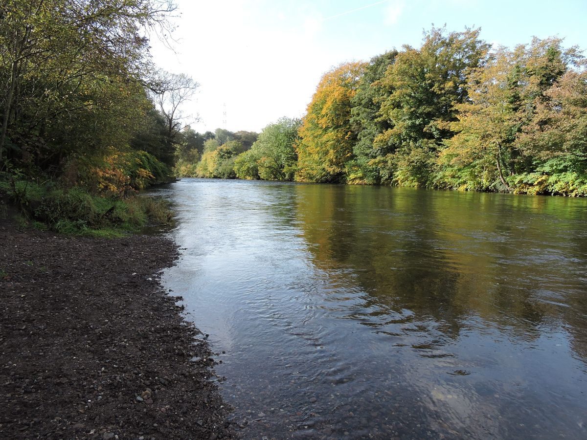
Low lying river valley. Southern area slopes toward the River Taff. Elsewhere mostly flat except close to river.Hailey Park is located in Llandaff North, Cardiff, centred on ST 145 793. It comprises about 19 hectares of land bordered to the west by the River Taff, to the north by the Taff Vale Railway, to the east by the built-up area of Llandaff North and to the south by Bridge Road. The land varies in elevation from about 14.6mOD at the southernmost extremity to about 28mOD at the northeastern extremity. The maximum length of the park between these extremities is about 1.36km. The width of the park varies from about 150m at the southern end to a maximum of about 580m at the northern end.
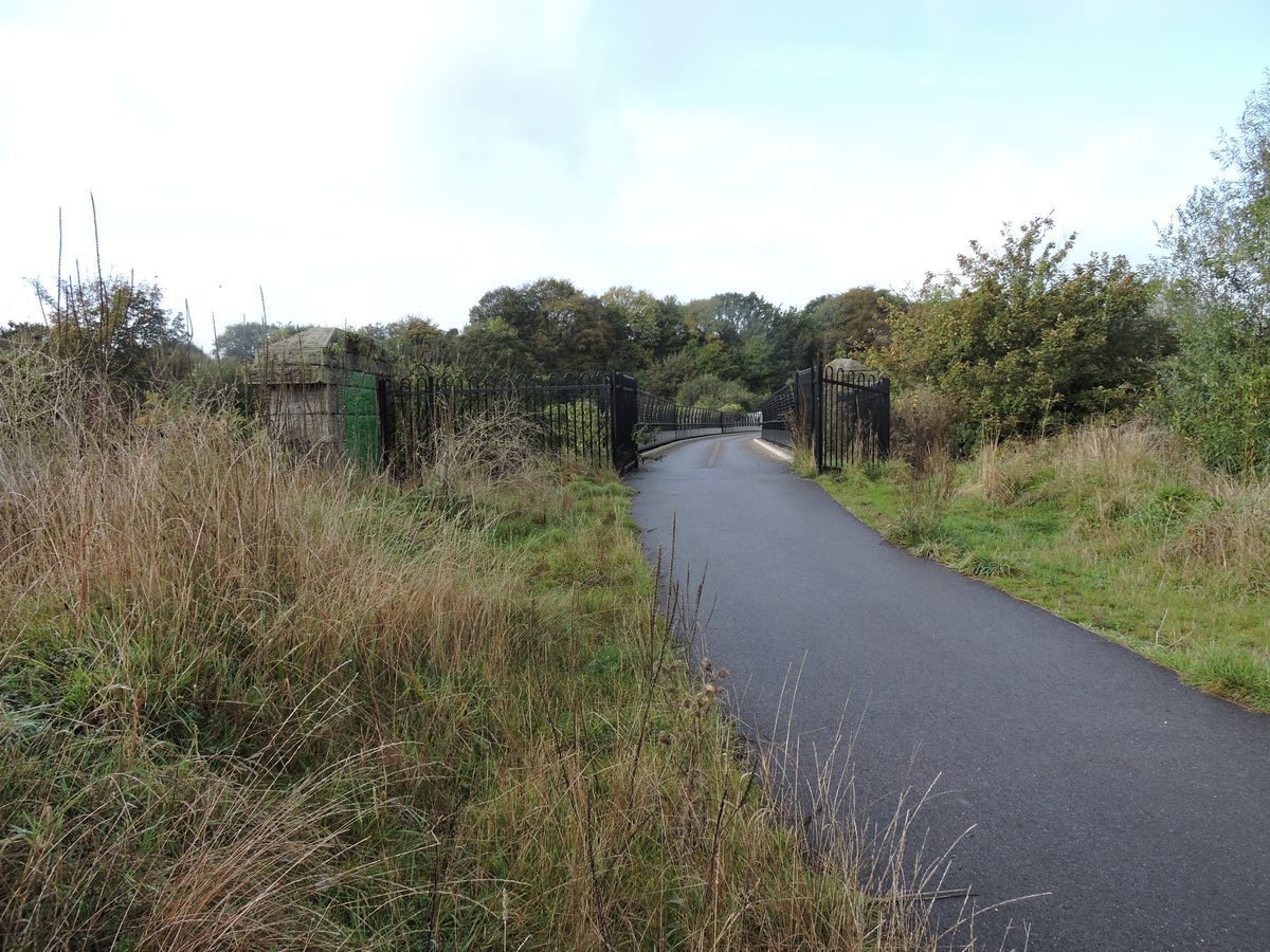
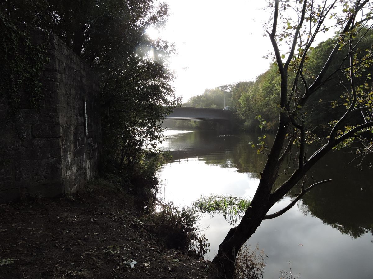
There is open access from Bridge Road in the south (ST 149 788) and at various points in the east from Llandaff North, including vehicle access to a car park from the old Radyr Road. At the southern end of Station Road, just before it joins Bridge Road, there is further access via a 200m long avenue of trees; the route of the former Glamorganshire Canal. The most northerly access point is close to the railway bridge over Ty Mawr Road (ST145 795). It can also be accessed from the west side of the River Taff via the old Llandaff Loop railway bridge (ST142 795), where there is an information board giving details of the park and surrounding areas. The Taff Trail, which extends from Cardiff Bay to Brecon, a distance of about 88km, passes through the park, entering via an underpass of the new Llandaff Bridge over the River Taff, skirting the west edge at the southern end of the park then crossing the park near old Rady Road and exiting at the Ty Mawr Road entrance. About 20m north of the Bridge Road underpass, a view point over the River Taff has been formed on the abutment the old Llandaff Bridge.
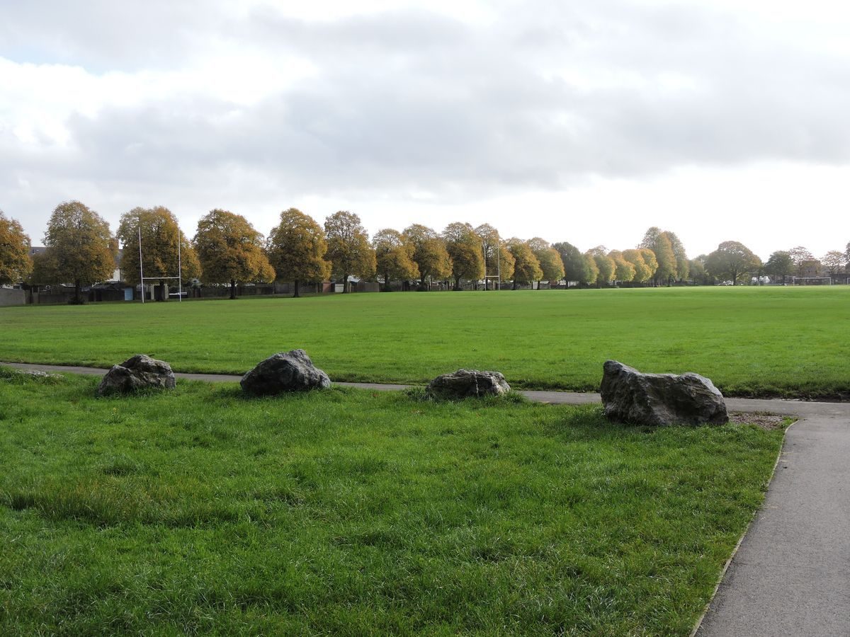
At the southern end of the park there are tennis courts, a toddler's play area, a (disused) bowling green and a children's play area. North of this are two areas of playing fields separated by the Taff Trail. At the northernmost end of the playing fields there is a pavilion/changing rooms building which can be accessed by road from Ty Mawr Road, but it is only opened for scheduled events.
North of the playing fields there is an area for wild life designated as a Site of Importance for Nature Conservation. Towards the centre of this area an information board details how the area is managed with the aid of volunteers and notes the plants and animals that can be found there.
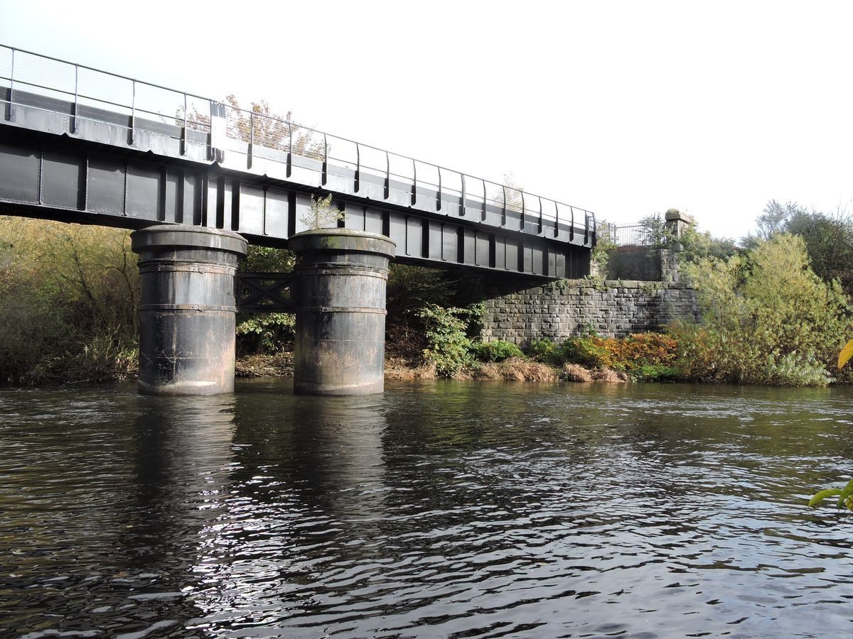
At the northernmost end of the park is the five-arched Taff Vale Railway Bridge over the River Taff, designed by Isambard Kingdom Brunel. The bridge was originally constructed for a single track but has been widened, first to twin track and later to four track. The early parts of the bridge were constructed in the locally sourced Radyr stone quarried on the west side of the Penarth Railway just opposite the park. The bridge is a CADW Grade II listed structure. It carries a public footpath on its upstream side, though this is not within the park boundary. It is possible to walk under the eastern arch of the bridge to gain access to this footbridge and to a footpath that leads back via the Mellingriffith feeder to Ty Mawr Road, where the recently restored Mellingriffith Water Pump, which dates back to 1807, is located.
- Visitor Access, Directions & Contacts
Telephone
01443 336000Website
http://www.cadw.wales.gov.uk/Access contact details
This is a municipal site open for general public use.
Directions
Bus Route 25 (northwards from Central Station) 24 (Southwards from Whitchurch). Route 64/65 St Mellons to Central Station. Close to Llandaff North Railway Station and Danesecourt Halt Railway Station.
Owners
Cardiff Council
Other Websites
- http://www.cardiffparks.org.uk/otheropenspaces/haileypark/info/index.shtml
- http://www.britishlistedbuildings.co.uk/wa-82590-afon-taff-viaduct-llandaff-north
- http://www.tafftrail.org.uk/
- http://www.waymarking.com/waymarks/WMH1E6_Melingriffith_water_pump_Cardiff_Wales_UK
- http://www.friendsofhaileypark.org.uk/
- http://www.cardiffparks.org.uk/otheropenspaces/haileypark/index.shtml
- History
The original bridge over the River Taff on Bridge Road, Llandaff Bridge, was constructed in stone in the mid-18th century. It was widened in the 19th century using a metal structure supported by the original stone abutments and piers. This bridge was demolished in the 1980s after a new, single span bridge was completed a little further downstream. Only the abutments of the old bridge remain. The Glamorganshire Canal, which once formed the eastern boundary of the park, was opened in 1794 and industrial and domestic development of neighbouring land soon began. The Taff Vale Railway north of the park was opened in 1840. The Penarth Railway, on the west side of the River Taff, opposite the park, was opened in 1859.
The first edition 1:2500 Ordnance Survey (OS) plan dated 1880 shows the entire park area to comprise fields. The area was crossed by Radyr Road, a mere cart track, which led to a ford across the River Taff. By 1900 the twin-track Llandaff Loop railway line, connecting the Taff Vale Railway near Llandaff North station with the Penarth Railway on the other side of the River Taff, had been constructed. Just north of where the Taff Trail now crosses the park, a brickworks was opened by Solomon Andrews in 1888/9. It operated until about 1896 and featured a chimney stack some 33m in height. In 1896 the works was acquired by the Cardiff and Newport Portland Cement Works. This company attempted to manufacture Portland cement by a new process but made heavy losses and was apparently soon wound up. The 1:2500 scale OS plan dated 1900 shows the works to be disused. There were two pits within the curtilage of the works. The 1:2500 scale OS plan dated 1920 shows a boat house was present on the east bank of the River Taff roughly opposite where the tennis courts now stand. This was not marked on later maps.
In 1923 Mr and Mrs C P Hailey made a gift to Cardiff City Council of land now occupied by the southern area of playing fields, to be used for recreational purposes. The Council purchased a further area of land adjoining Bridge Road from the owner Emile Andrews and the park was eventually opened on May 3rd 1926. The facilities included tennis courts and a bowling green. During World War 2 parts of the park were used for allotments and temporary defence works were also constructed at this time. These features were removed during the 1950s. In 1944 the Council acquired the Glamorganshire Canal alongside the eastern edge of the park. At this time it was considered to be an eyesore and public nuisance and was filled in.
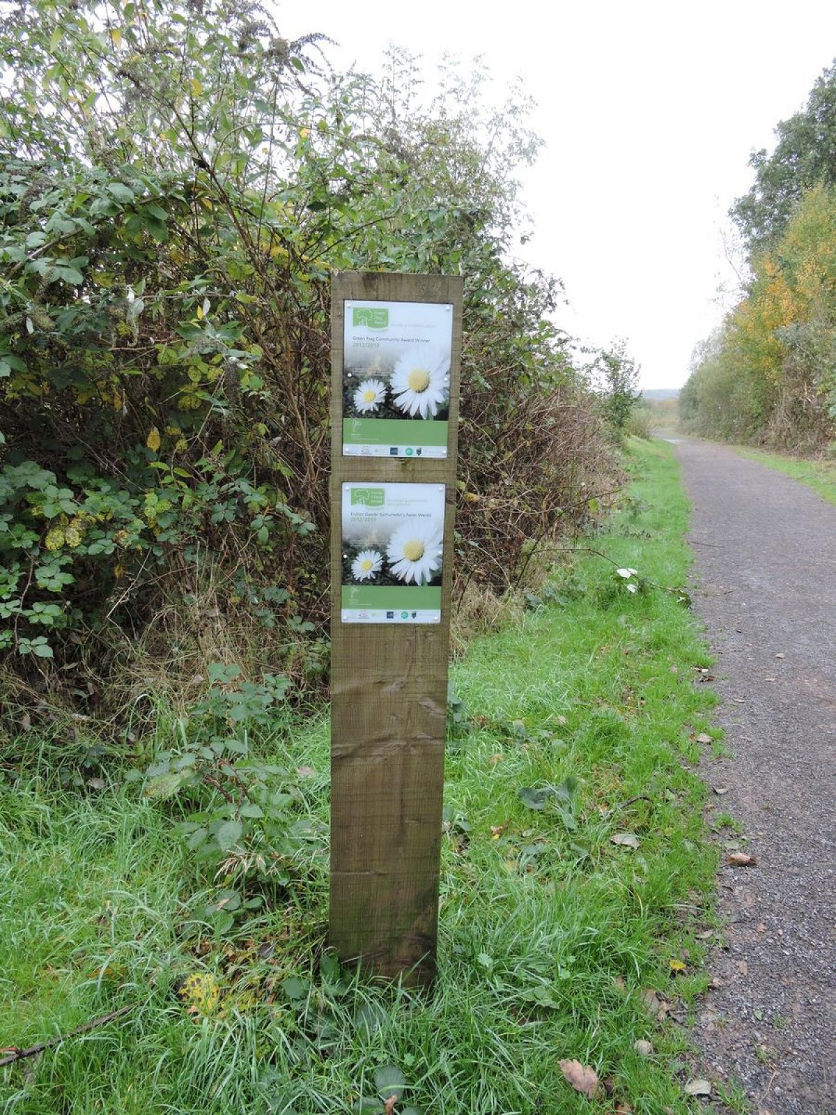
Between 1955 and 1966 the Council acquired the northern parts of the site, which were used for refuse disposal up to 1970. After tipping was complete the area was capped and the park was extended to its current area. The Llandaff Loop railway was reduced to single track in the mid-1960s and one side of the bridge over the River Taff was removed. The line closed by 2000 and the embankment was removed by the Council in 2001. The bowling green became under-used and was closed, although the pavilion continued in use for community meetings until it was damaged in a fire in 2010. It was demolished in 2011. In 2012 the Friends of Hailey Park won a Green Flag Community Award for their work on the wild life area at the northern end of the park, this organisation was also recently awarded a grant of £40,000 from the Landfill Communities Scheme to replace and upgrade the equipment in the children's play area. In 2013 the Llandaff Loop railway bridge was refurbished at a cost of £390,000 and opened as a public foot-way, connecting the park with the Radyr side of the River Taff.
Period
- 20th Century (1901 to 2000)
- Early 20th Century (1901 to 1932)
- Associated People
- Features & Designations
Designations
Site of Local Importance for Nature Conservation
Features
- Ornamental Bridge
- Description: Five-arched stone-built railway bridge designed by I K Brunel first constructed around 1839, later widened to twin track and later still to four track.
- Earliest Date:
- Latest Date:
- Key Information
Type
Park
Purpose
Recreational/sport
Principal Building
Parks, Gardens And Urban Spaces
Period
20th Century (1901 to 2000)
Survival
Extant
Hectares
19
Open to the public
Yes
Electoral Ward
Llandaff North
- References
Contributors
Mike Statham