Introduction
Dunham Massey has a 17th-century deer park which was remodelled with formal park landscaping from the late-17th to the mid-18th century. It is now a country park enclosing ornamental gardens and is owned by the National Trust.
Terrain
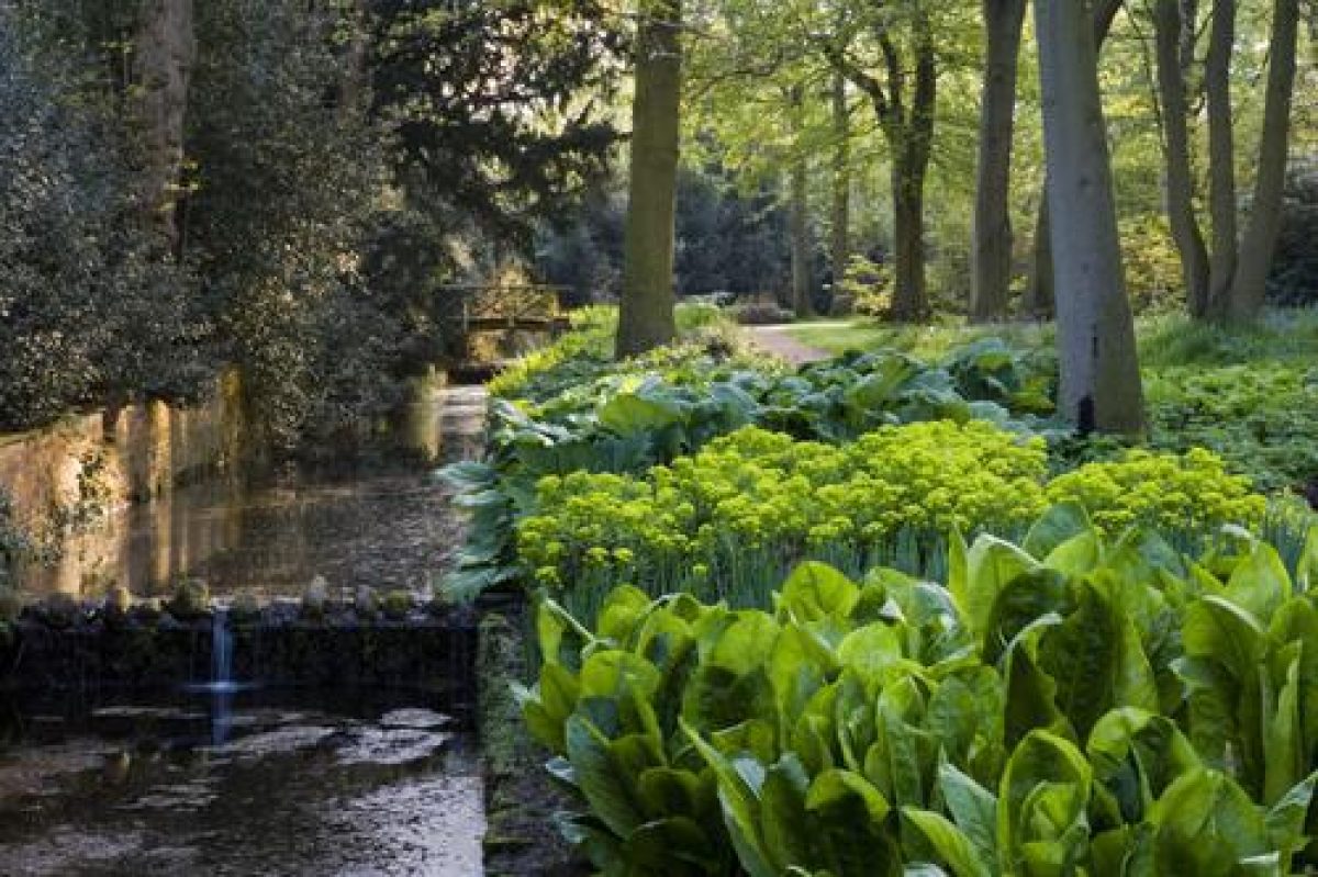
The park is on land which rises gently to the north and slopes down to the River Bollin on the west and south-west sides.
The following is from the Register of Parks and Gardens of Special Historic Interest. For the most up-to-date Register entry, please visit the The National Heritage List for England (NHLE):
www.historicengland.org.uk/listing/the-list
A walled deer park landscaped with avenues, water features and structures of the late C17 to mid C18, and gardens which retain C18 and C19 features.
DESCRIPTION
LOCATION, AREA, BOUNDARIES, LANDFORM, SETTING
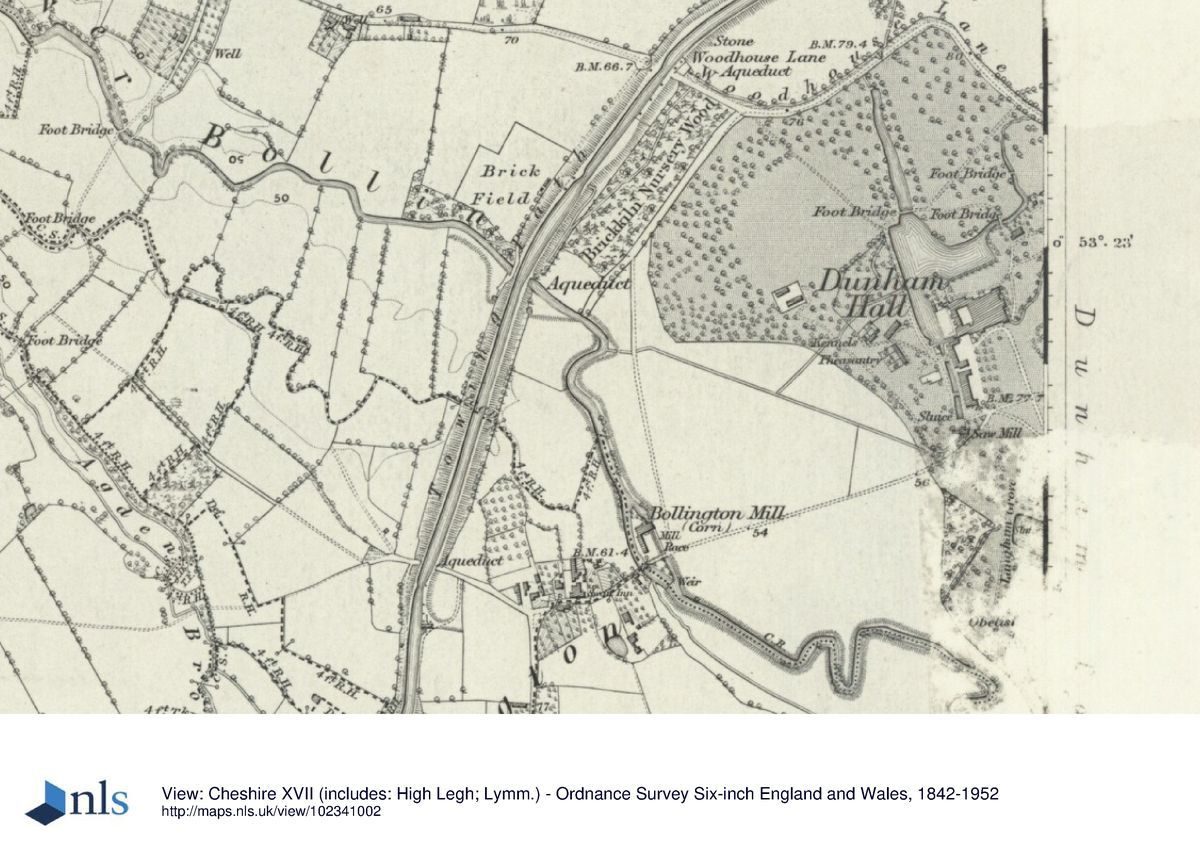
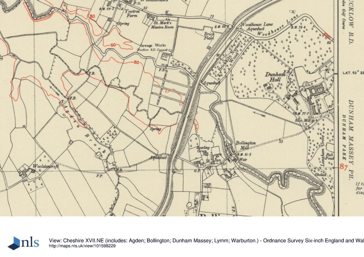
Dunham Massey is situated c 1.5km west of Bowdon in an area of agricultural land. The c 100ha park is on land which rises gently to the north and slopes down to the River Bollin on the west and south-west sides. The park is surrounded by a brick wall which was built 1748-51 when two 'iron pallisadoes' and three deer leaps were incorporated into it (Dunham Massey Papers). One of the palisades is probably the clairvoie incorporated into the wall and aligned with the north front of the Hall, and the other is at the end of the south-eastern avenue. Two of the deer leaps are situated on the eastern boundary, one c 100m south of Charcoal Lodge, the other c 50m south of the first. The third leap is situated c 100m west of Ash Walk Gate on the southern boundary. In the late C20 a bypass to the village of Dunham was constructed and the wall was rebuilt along the line of the new road between Charcoal Lane and Woodhouse Lane. The designed landscape extends beyond the wall to the north where there is an avenue terminating at an obelisk situated in Whiteoaks Wood (c 600m north of the Hall). On the south side of the site planting along Ash Walk, beyond the park wall, is also included within the boundary of the registered site.
ENTRANCES AND APPROACHES
The present vehicular entrance, constructed c 1980, is on the north side of the Hall on Woodhouse Lane. This leads to a drive which runs on the west side of the Hall to join with a drive from an entrance at the end of Bollington Lane south-west of the Hall. Other entrances are at the end of Smithy Drive, to the north-east, on Woodhouse Lane; at Charcoal Lodge (1906, listed grade II) on the north-east corner of the site on Charcoal Road; at Farm Gate on the south-east corner of the site where a drive leads west off Dunham Road past the home farm to a gate in the park wall; and c 50m west of Farm Gate where another gateway leads to a drive known as Ash Walk, where there was a double lodge destroyed during the 1940s. All these entrances are gated. There is an entrance from the gardens north-east of the Hall to Woodhouse Lane with a rusticated stone surround and decorative iron gates (listed grade II) which is shown on the 1751 paintings.
PRINCIPAL BUILDING
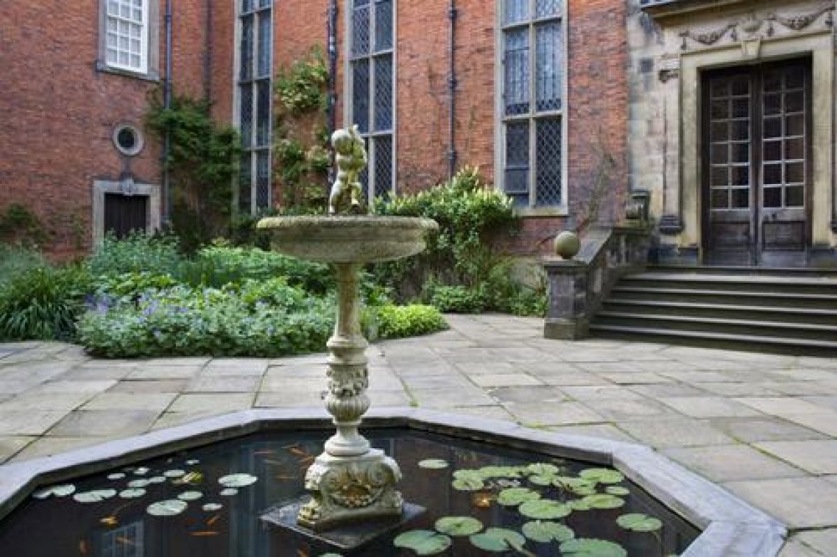
Dunham Massey Hall (listed grade I) is situated towards the north end of the park. A house was constructed by Sir George Booth on a moated platform in the early part of the C17, probably on or close to the site of an existing building, and this was completed by his grandson towards the middle of the century. It was substantially rebuilt in 1723 to the designs of John Norris. A major refurbishment was undertaken in 1906-7 by J Compton Hall. A carriage house dated 1721 and a stable building of similar date (both listed grade I) are ranged along the west side of the forecourt south of the Hall. A watermill of early C17 date (listed grade II*), called the Sawmill, is situated c 20m south of the stables.
GARDENS AND PLEASURE GROUNDS
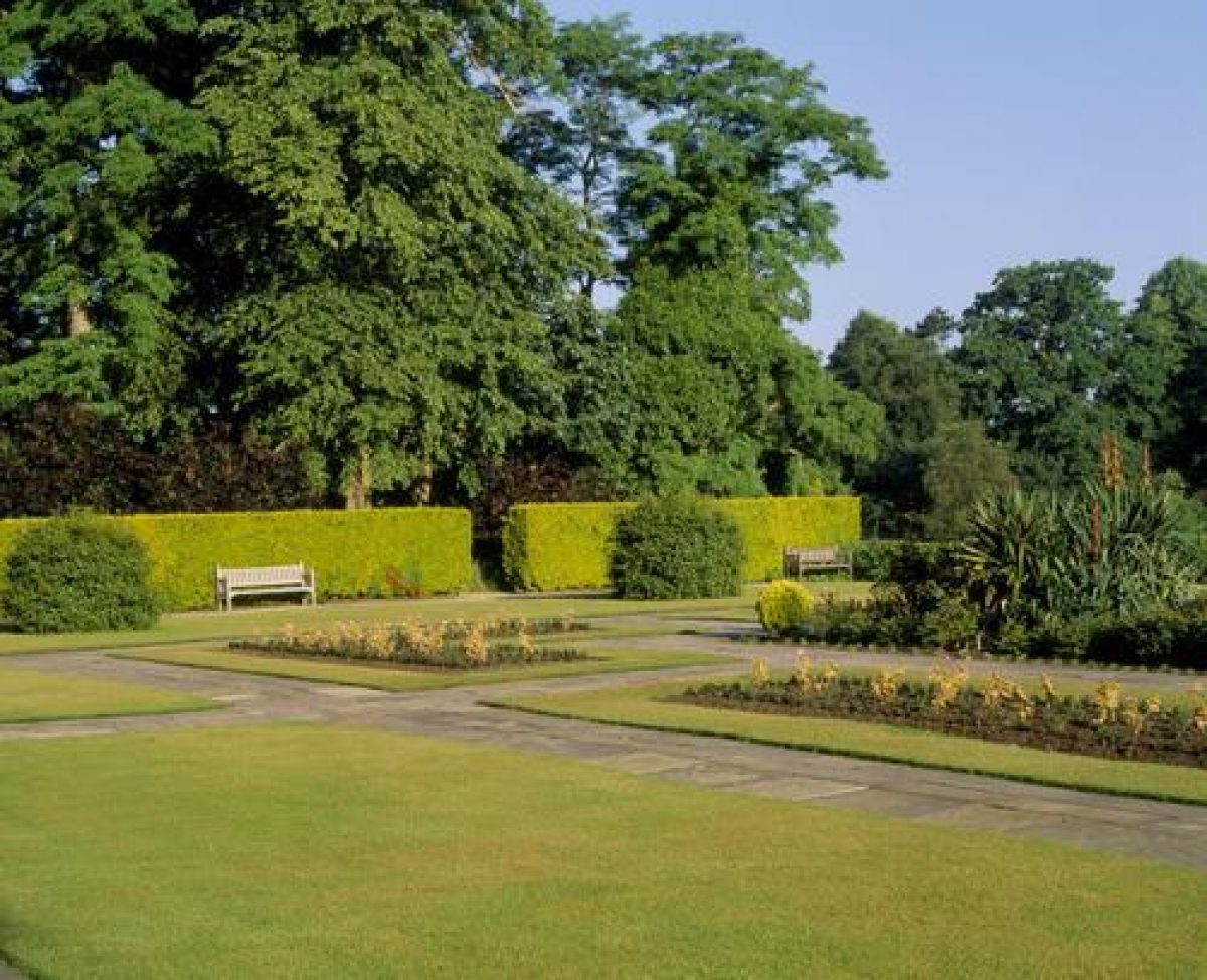
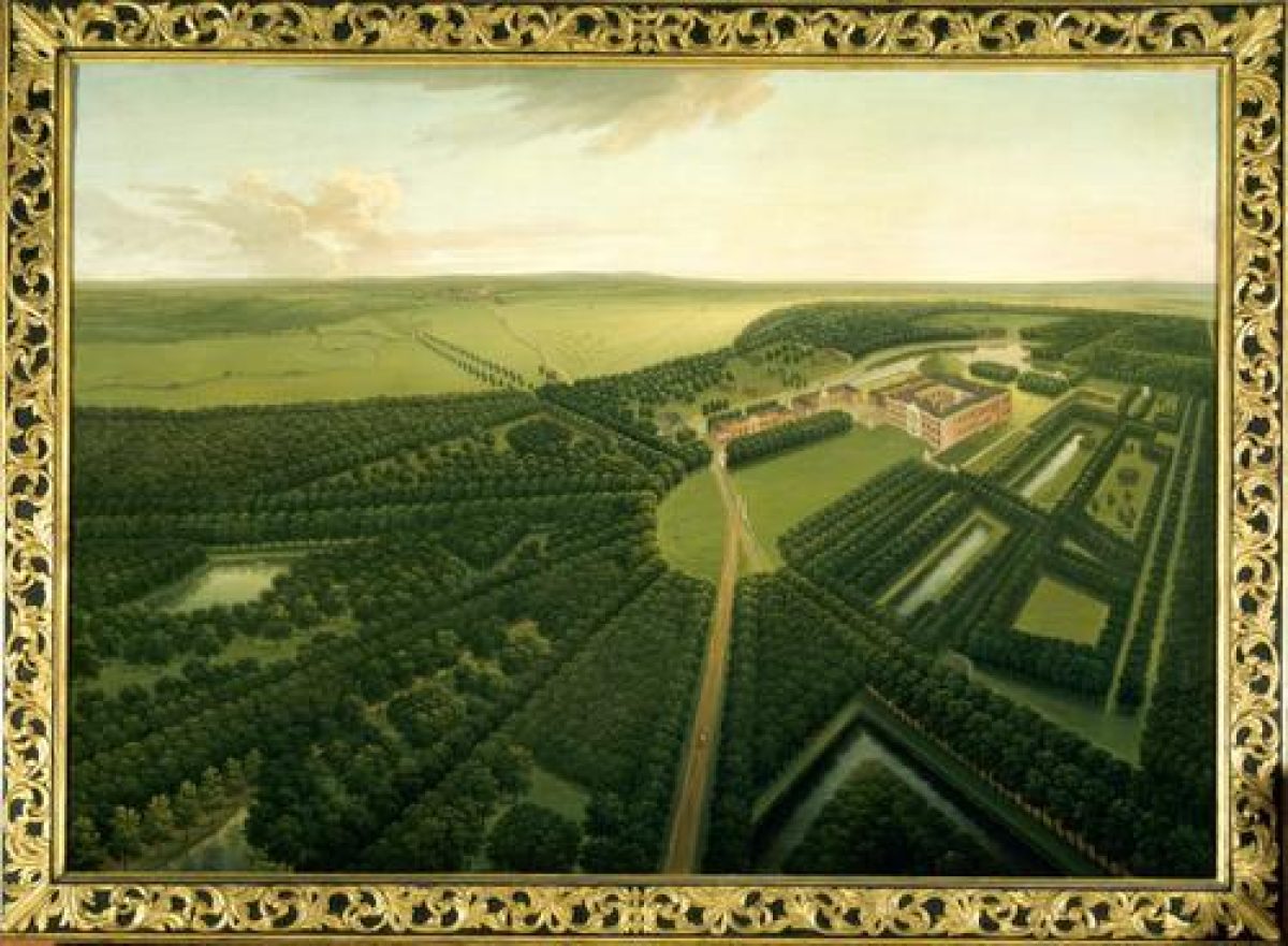
Gardens are situated on the north, east and south sides of the Hall. On the south side of the Hall there is a forecourt with a path running south aligned with the main entrance. On each side of this are lawns which were planted in the late C20 with three rows of lime trees, following the pattern of planting shown in the 1751 paintings. At the south-east corner of the forecourt is a pier supporting the figure of a lion, and an identical pier is situated at the south-west corner (both listed grade II). The stone bases of two obelisks (listed grade II) are situated on each side of the central path at the southern edge of the forecourt, while on the north-west edge of the forecourt there is a stone pier supporting a flaming urn (listed grade II). A matching pier originally stood on the other side of the forecourt. All these features are shown on the1751 paintings and replace walls and corner pavilions shown by van Diest in 1696.
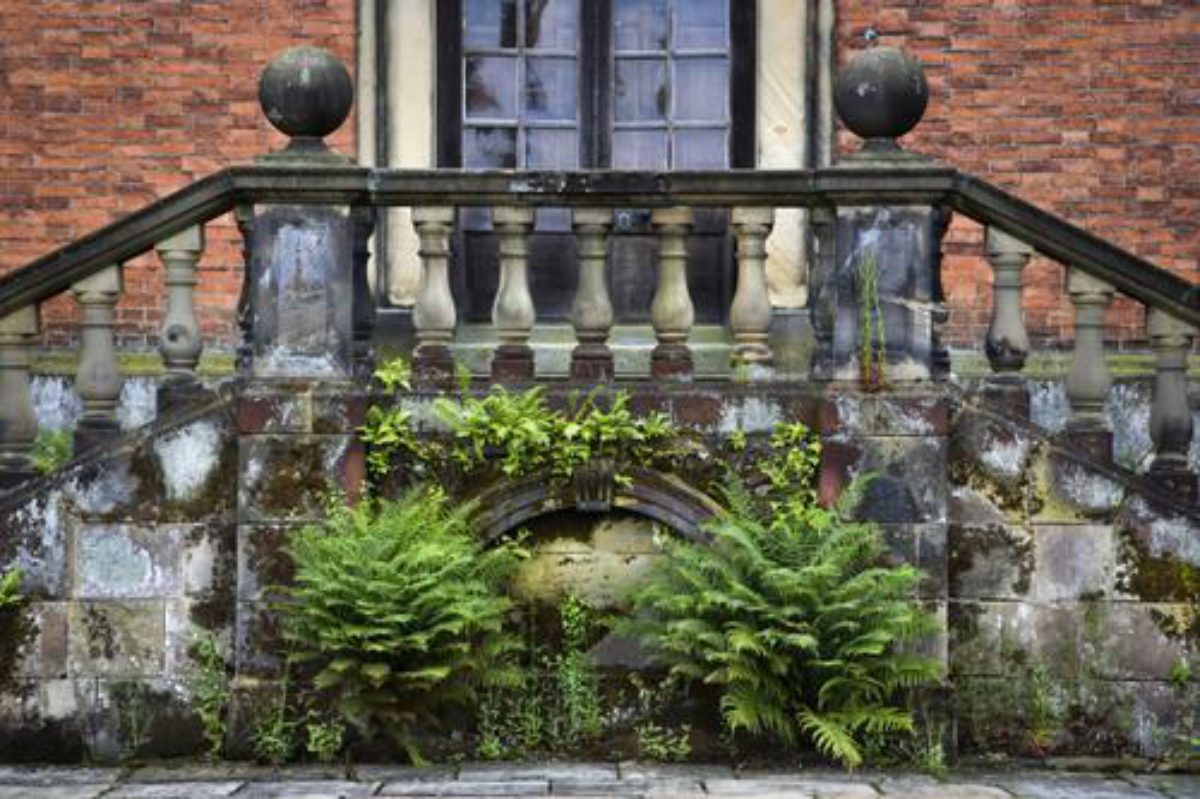
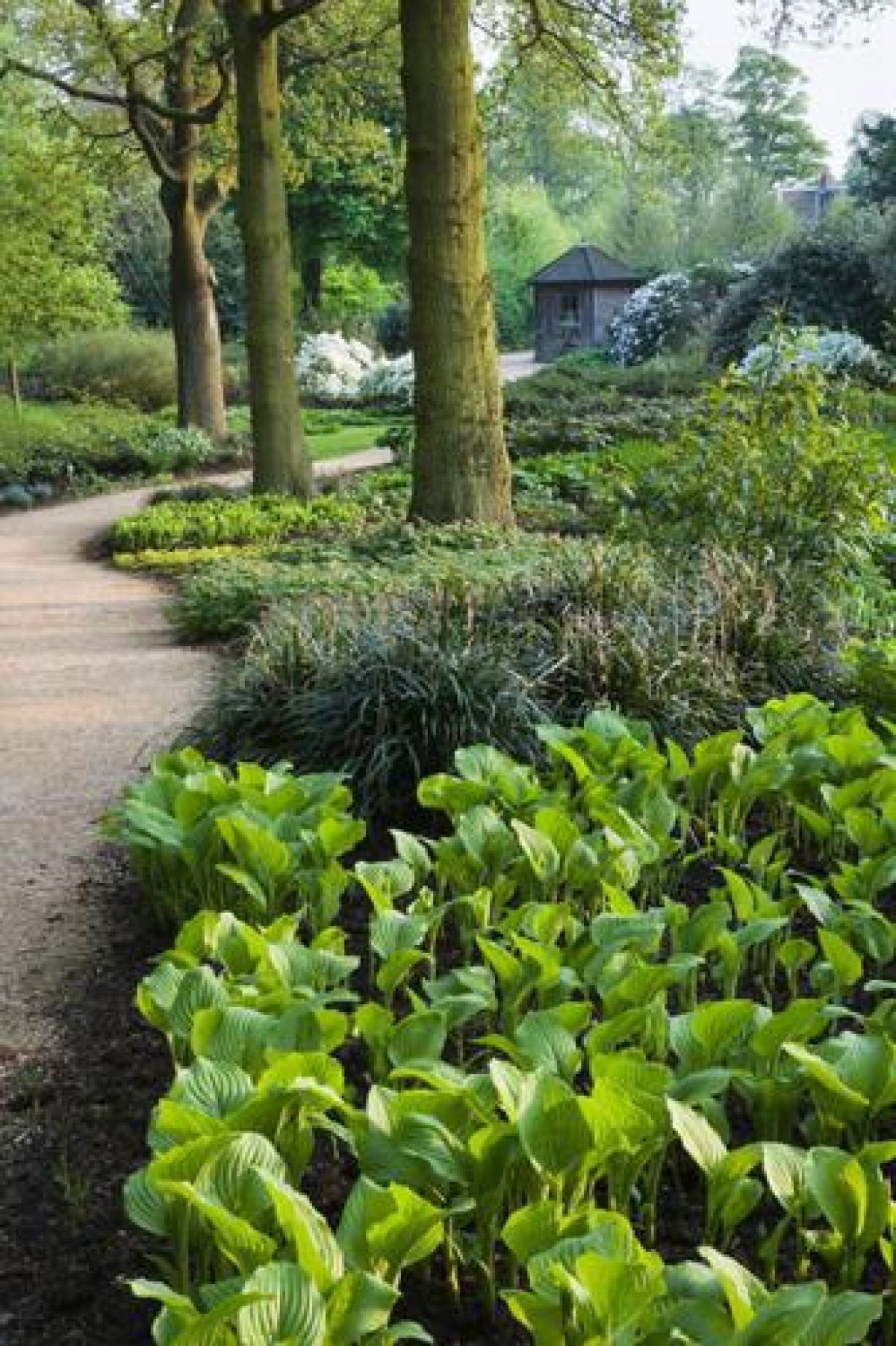
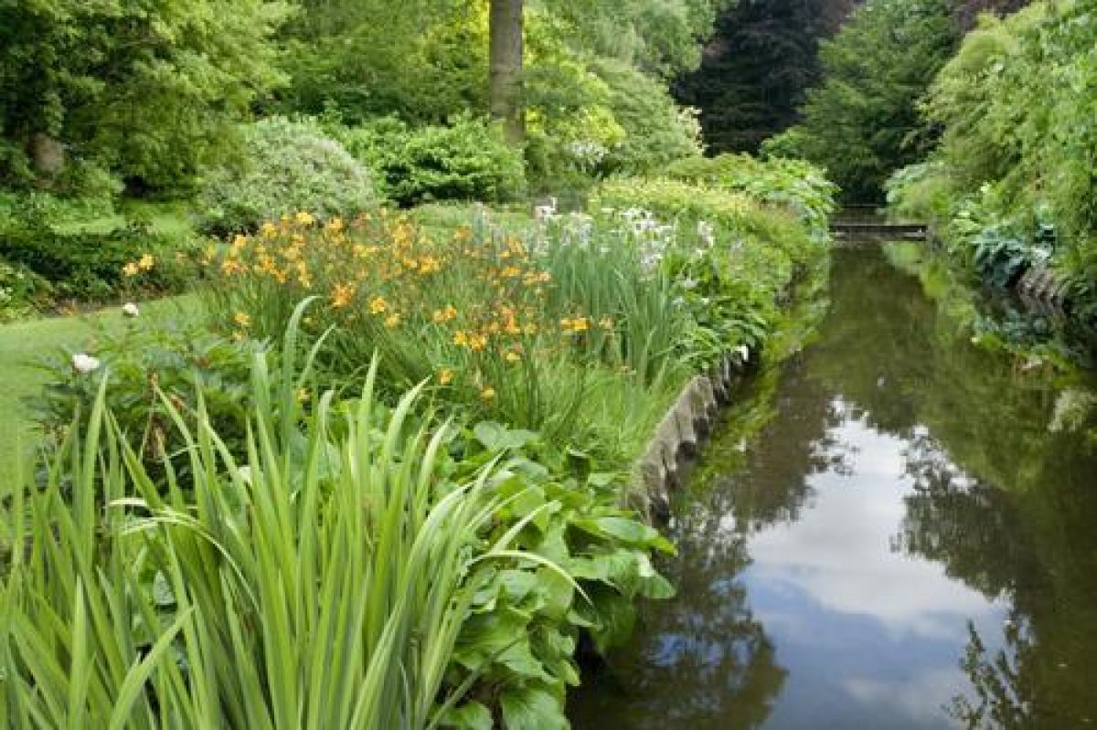
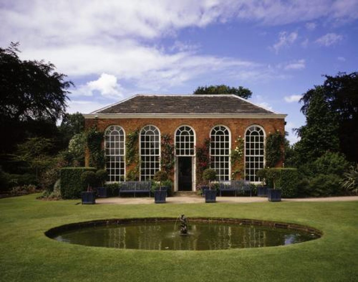
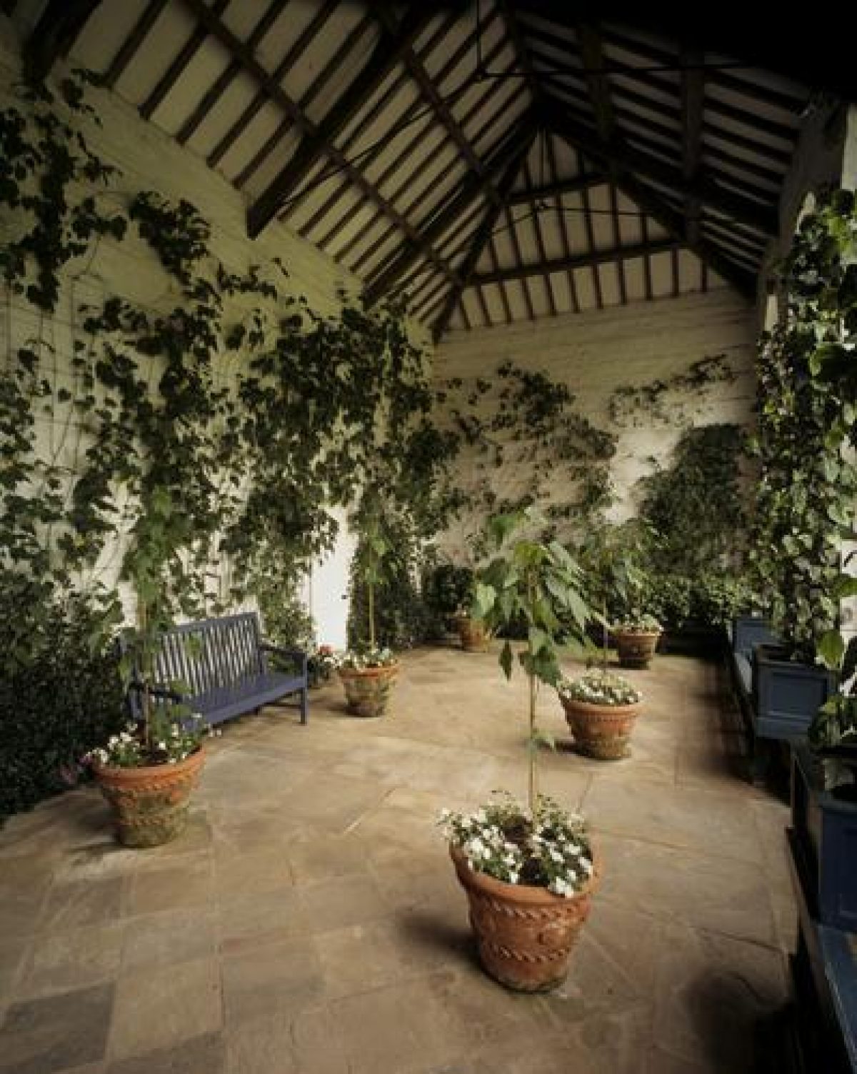
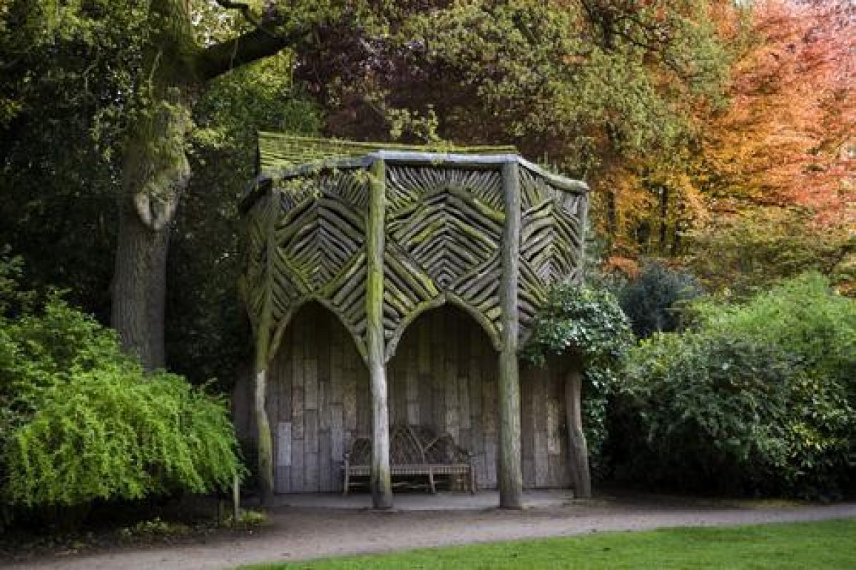
On the north-east side of the south forecourt a gate leads to gardens which are enclosed on the south side by a ha-ha which has a stream running along it for much of its length. The gardens have curving, informal paths leading around them with lawns and beds towards the centre of the site and belts of trees along the south, east and north sides. An orangery (listed grade II) overlooks the lawns and is situated c 80m north-east of the Hall. It is possibly the building shown on the 1751 paintings incorporated into an L-shaped walled garden. Some 30m north-east of the orangery is an C18 well house (listed grade II) and attached to the southern side of this is a root arbour, probably of early C19 date, which was moved to this position from the south-west wall of the orangery. The east side of the gardens are bounded by the park wall and a gate in the wall (C18, listed grade II) leads in to the walled garden on the other side of Woodhouse Lane. In front of the north side of the Hall is a parterre with geometrical beds laid out in 1905. On the north and west sides of the Hall the surviving arms of the moat, which surrounded the Hall in 1696, widen to form an L-shaped lake, as shown on the 1751 paintings. Aligned with the north front of the Hall on the edge of the lake, two stone piers (C18, listed grade II) with C20 cast-iron palings between them frame a view across the lake along an avenue which extends beyond the park wall to an obelisk in Whiteoaks Wood c 600m beyond. Immediately to the north-west of the Hall is a low mound planted with trees, which is shown in the paintings of 1696 and 1751. The 1696 view shows it topped by a gazebo and standing to a height that has been estimated to be over 10m (Nevell forthcoming). In the 1751 paintings the gazebo has been replaced by an urn on a plinth. The mound could be the remains of a motte forming part of Hamo de Massey's castle which was recorded in 1173 and again in 1323, reused as a viewing mound in the C17 (Nevell forthcoming). The mound was reduced in height during the late C18 or early C19.
PARK
A D-shaped clearing is situated immediately in front of the south forecourt and leading from this are five avenues. A sixth avenue shown on the 1751 paintings leading south-west between Bollington Drive and Langham Grove extended beyond the park wall to the River Bollin. To the south-west of the 'D' is Langham Grove, to the south South Avenue, aligned with the front of the Hall, then South-East Avenue; Charcoal Drive runs east, and Smithy Drive runs north-east. South and South-East Avenue are shown on the 1696 painting as single lines of immature trees.
Langham Grove terminates at an obelisk dated 1714 (listed grade II). Between this avenue and South Avenue is a stretch of water called Dead Man's Pool which is shown on the 1751 paintings with a fountain in it. In the southern corner of the park, between South Drive and the park wall, is an area of open grassland dotted with trees called Ice House Plain; the remains of a brick icehouse are situated on the edge of the plain c 800m south of the Hall. Between South Avenue and Charcoal Drive is a drive called Farm Walk and on the east side of this is a stretch of water called Island Pool which conforms well with what is shown on the 1751 painting. Farm Walk continues through the park and then forks c 100m from the park wall; the path leading south-east is called Ash Walk and it continues beyond the park wall within a belt of trees which appears to be in the position of an avenue extending beyond the wall in the 1751 paintings. The northern path leads to the home farm beyond the park wall. Between the Main Drive and Charcoal Drive, c 400m south-east of the Hall, is a slaughterhouse (C18, listed grade II).
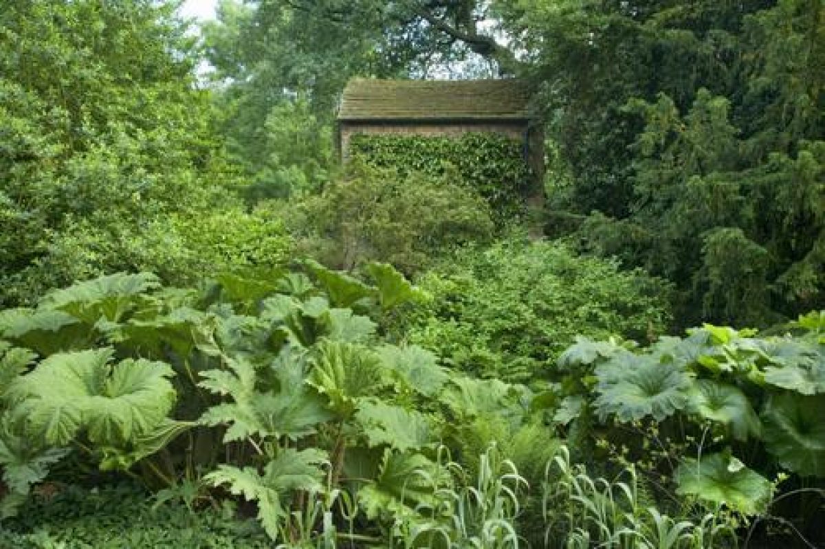
Some 800m from the 'D', Charcoal Drive turns north to run to Charcoal Lodge. Views of Bowdon church tower (C16, rebuilt C19) are obtained from this part of the park and the 1751 paintings suggest that drives through former areas of woodland south of Charcoal Lodge may have been designed to frame the church on the skyline. Some 300m west of Charcoal Lodge, in an area of open grassland dotted with trees, is an C18 deer shelter (listed grade II).
Between Charcoal Drive and Smithy Drive, c 40m south of the Smithy Drive entrance, is a stretch of water called Smithy Pool. The positions of two other pools west of this, alongside Smithy Drive as shown in the 1751 paintings, are suggested by depressions in the ground.
The southern part of the park has areas of woodland with a mixture of trees of different ages. A study undertaken in 1991 (Debois Landscape Survey Group) showed that certain oak, beech, lime and sweet chestnut trees probably survive from the planting scheme illustrated in the 1751 paintings. This accords with items amongst the Dunham Massey Papers which record mature oak, beech and sweet chestnut trees in the park in the late C18 and early C19.
The northern part of the park is wooded with a clearing west of the stables. A car park is situated in a meadow shown in the 1751 paintings c 200m north-west of the Hall. In the woodland on the southern edge of the car park is an C18, stone, pedimented shelter (listed grade II) which may have been placed there to take advantage of the views obtained from this point over the Bollin Valley.
Aligned with the north front of the Hall is an avenue which has been reinstated through woodland and across fields beyond the park wall, terminating at an obelisk in Whiteoaks Wood. This avenue is not shown on the 1696 van Diest painting, nor on a view by Knyff, engraved by Kip and published in 1714. A different edition of the engraving however, said to date from 1697 (guidebook), shows the avenue much as it appears on the 1751 paintings.
In the C18 the trees in the park were counted and a note dated 2 August 1762 details a total of 31,219 trees excluding 'hawthorn, elder and some alder' (Dunham Massey Papers).
KITCHEN GARDEN
A large walled garden is situated on the far side of Woodhouse Lane, c 300m north-east of the Hall. An arched entrance, which appears to have been rebuilt, gives access to the garden from Woodhouse Lane. The wall has been repaired and rebuilt in many places and is generally of narrow handmade bricks in English garden wall bond with a moulded stone coping. A gardener's cottage is built into the north-western wall. The remnants of glasshouses shown on the 1882 edition of the OS map survive in the northern part of the garden. The 1751 paintings show the gardener?s cottage and the garden planted with orchards to the north and divided into formal plots to the south.
REFERENCES
L Knyff & J Kip, Britannia Illustrata I, (1714)
Trans Lancashire Cheshire Antiq Soc 42, (1925), pp 53-79
N Pevsner and E Hubbard, The Buildings of England: Cheshire (1971), pp 203-5
Apollo, (July 1978), pp 4-11
J Harris, The Artist and the Country House (1979), pp 178-9, pls xvii-xviii
Country Life, 169 (4 June 1981), pp 1562-4; (11 June 1981), pp 1664-8; 170 (2 July 1981), pp 18-21; (9 July 1981), pp 106-9
Dunham Massey, guidebook, (National Trust 1981)
Trans Lancashire Cheshire Antiq Soc 91, (1995), pp 63-91
M Nevell, The Archaeology of Trafford (1997)
Maps
OS 6" to 1 mile:
Cheshire sheet XVII NE, 1st edition published 1882
Cheshire sheet XVII NE, 2nd edition surveyed 1874-6, revised 1897, published 1899
Cheshire sheet XVIII SW, 3rd edition surveyed 1874, revised 1908, published 1910
OS 25" to 1 mile: Cheshire sheet XVII.8, 2nd edition published 1898
Archival items
Dunham Massey Papers at the John Rylands Library, Deansgate, Manchester: Notes on the building of Dunham Massey park wall, 1751 (EGR3/6/2/14/13); A calculation of the number of trees within Dunham Massey Park, 1762 (EGR3/7/1/12/1);
Various papers concerning trees in the gardens and park (EGR4/2/12/4/4, 1769; EGR4/1/8/46, 1804; EGR4/2/4/6, 1826)
Description written: February 1997 Amended: June 1998
Register Inspector: CEH
Edited: February 1999
- Visitor Access, Directions & Contacts
Telephone
441619411025Access contact details
0161 941 1025.
Park and garden core hours 11am to 5pm. Park open all year. Garden closed November to March. Check for variations.
Directions
3 miles south-west of Altrincham, off the A56.
Owners
The National Trust
PO Box 39, Warrington, WA5 7WD
- History
The following is from the Register of Parks and Gardens of Special Historic Interest. For the most up-to-date Register entry, please visit the The National Heritage List for England (NHLE):
www.historicengland.org.uk/listing/the-list
CHRONOLOGY OF HISTORIC DEVELOPMENT
Dunham Massey was the chief seat of the barony of the de Massey family from the time of Domesday until c 1342 and the area has been the site of a deer park since at least 1353. Ownership had passed to the Booth family by 1453 and George Booth, second Earl of Warrington, is said to have planted large numbers of oak, beech and elm trees in the park at Dunham following his succession to the title (TLCAS 1925). The Hall and park were painted in an aerial view in 1696 by Adrian van Diest, and in 1751 a series of detailed aerial views of the Hall and park from different notional vantage points were painted for the second Earl by John Harris. Ownership passed through marriage to the Grey family, Earls of Stamford, and in 1976 Roger Grey, the tenth Earl of Stamford, bequeathed the Hall and park to the National Trust.
- Associated People
- Features & Designations
Designations
The National Heritage List for England: Register of Parks and Gardens
- Reference: GD1849
- Grade: II*
Features
- Orangery
- Bark House
- Earliest Date:
- Latest Date:
- Well House
- Earliest Date:
- Latest Date:
- Avenue
- Lake
- Pond
- Mixed Border
- Specimen Tree
- Boundary Wall
- Description: The park is surrounded by a brick wall which was built 1748-51.
- Earliest Date:
- Latest Date:
- Clairvoie
- Description: Clairvoie incorporated into the wall and aligned with the north front of the Hall.
- Palisade
- Description: Situated at the end of the south-eastern avenue.
- Obelisk
- Description: There is an avenue terminating at an obelisk situated in Whiteoaks Wood.
- Key Information
Type
Park
Purpose
Ornamental
Principal Building
Domestic / Residential
Survival
Extant
Hectares
105
Open to the public
Yes
Civil Parish
Dunham Massey
- References
References
- {English Heritage Register of Parks and Gardens of Special Historic Interest}, (Swindon: English Heritage, 2008) [on CD-ROM] Historic England Register of Parks and Gardens of Special Historic Interest
- Harris, J., {The Artist and the Country House} {London: Russell Chambers, 1979), pp. 178-9, pls xvii-xviii The Artist and the Country House
- University of Manchester and University of York, {A Survey of Historic Parks and Gardens in Greater Manchester}, York, 1994 A Survey of Historic Parks and Gardens in Greater Manchester
- Pevsner, N. and E. Hubbard, {The Buildings of England: Cheshire} (Harmondsworth: Penguin, 1971), pp. 203-5 The Buildings of England: Cheshire
Contributors
Cheshire Gardens Trust
Greater Manchester Archaeological Unit
- Related Documents
-
CLS 1/643
Dunham Massey Biological Survey - Hard Copy.
W Lutley, K Hearn, K Alexander - 1987
-
CLS 1/633
Preliminary Survey of the Landscape - Hard Copy.
John Phibbs - 1987
-
CLS 1/641
Dunham Massey Hall, Cheshire: Park Planting Plan - Hard Copy.
Debois Landscape Survey Group - 1991
-
CLS 1/638
The Old and New Parks and the surrounding fields and woods at Dunham Massey - Hard Copy.
Debois Landscape Survey Group - 2000
-
CLS 1/639
The Old and New Parks and the surrounding fields and woods at Dunham Massey - Hard Copy.
Debois Landscape Survey Group - 2000
-
CLS 1/643