Introduction
Cusworth Hall has an associated landscape park. The hall is now in use as a museum.
Terrain
The Hall stands on the southern edge of a ridge, with the parkland falling steeply to the plain to the south.The following is from the Register of Parks and Gardens of Special Historic Interest. For the most up-to-date Register entry, please visit the The National Heritage List for England (NHLE):
www.historicengland.org.uk/listing/the-list
A landscape park laid out 1761-5 by Richard Woods to provide the setting for a mid-18th-century country house.
Location, Area, Boundaries, Landform and Setting
Cusworth Hall stands to the west of Cusworth village, at the north-west edge of Doncaster. The Hall stands on the southern edge of a ridge, with the parkland falling steeply to the plain to the south. The site is bounded largely by agricultural land, and partly to the north by Back Lane. The setting is partly agricultural, with the suburbs of Doncaster close by to the east and south-east, and the A1(M) Doncaster by-pass slicing through the west half of the park. The 89ha site offers extensive views to the south and south-east over Doncaster.
Entrances and Approaches
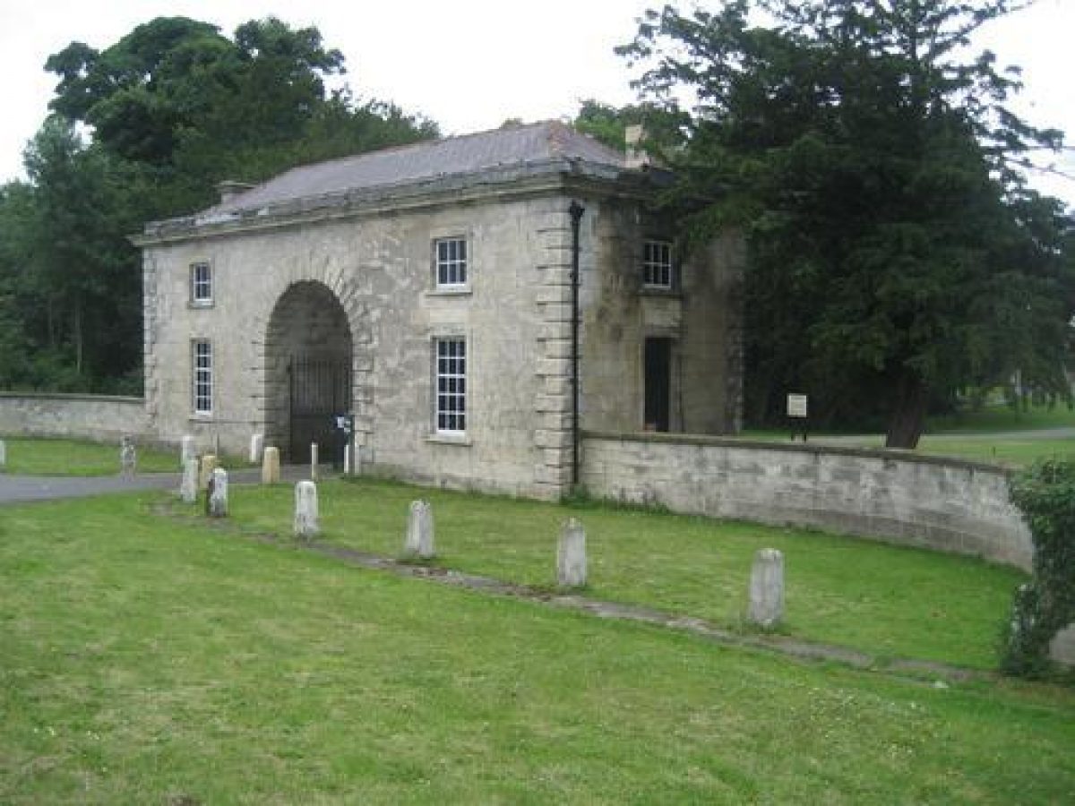
The Hall is approached via a short, straight, raised drive from the mid C19 gatehouse which stands between wing walls (listed grade II) on Back Lane, 150m to the north-west. The drive runs through New Plantation, a small area of woodland which post-dates Woods' planting plans for this area, to the turning circle beneath the north-west facade. The approach across the park from the south-west, which formerly entered the site c 1km west-south-west of the Hall (OS 1854), is no longer in use.
Principal Building
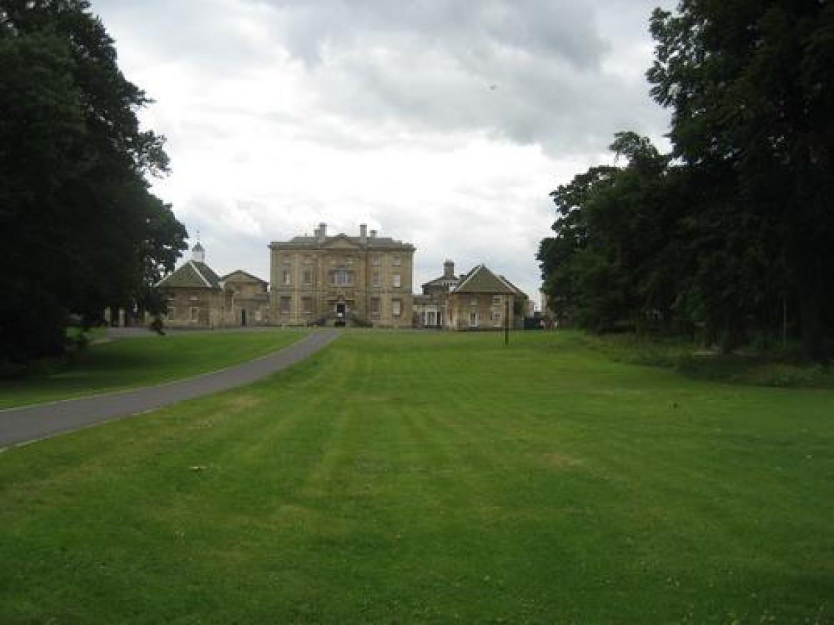
Cusworth Hall (listed grade I) was built 1740-5, in Classical style, by George Platt for William Wrightson, and altered 1749-53 by James Paine. Immediately to the north-east is the old stable block and bothy (listed grade II). A large, mid to late C20 car park area lies west of the Hall.
Gardens and Pleasure Grounds
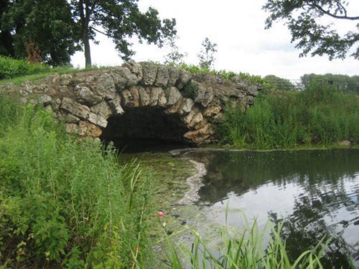
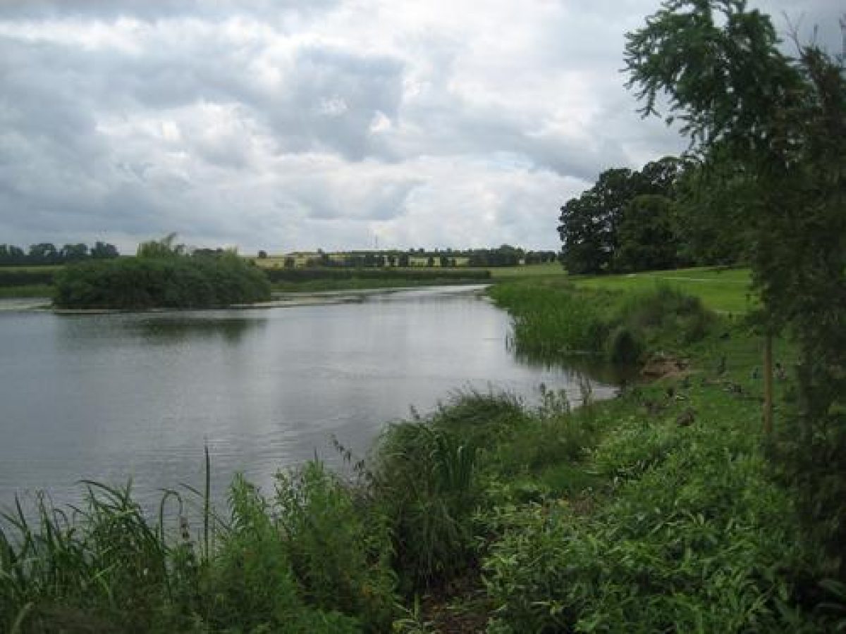
The sloping ground to the south-east of the Hall was carefully moulded under Woods' directions of the 1760s. A path through Shrubbery Walk, a band of ornamental planting east of the Hall, leads along the west wall of the kitchen gardens down to the Upper Fish Pond. At the northern tip of the water is an artificial mound, below which stands the rusticated arched boathouse (Woods 1762(3, listed grade II), built of limestone rubble and boulders. The small island in the lake is part of Woods' design. The north-east finger of the lake is joined by a rocky cascade (Woods 1760s) to the long, narrow, Middle Fish Pond below. The bridge is a late C20 replacement. The Middle Pond in turn links with the Lower Fish Pond which curves round into the flat area of the park and ends in the Basin Pond.
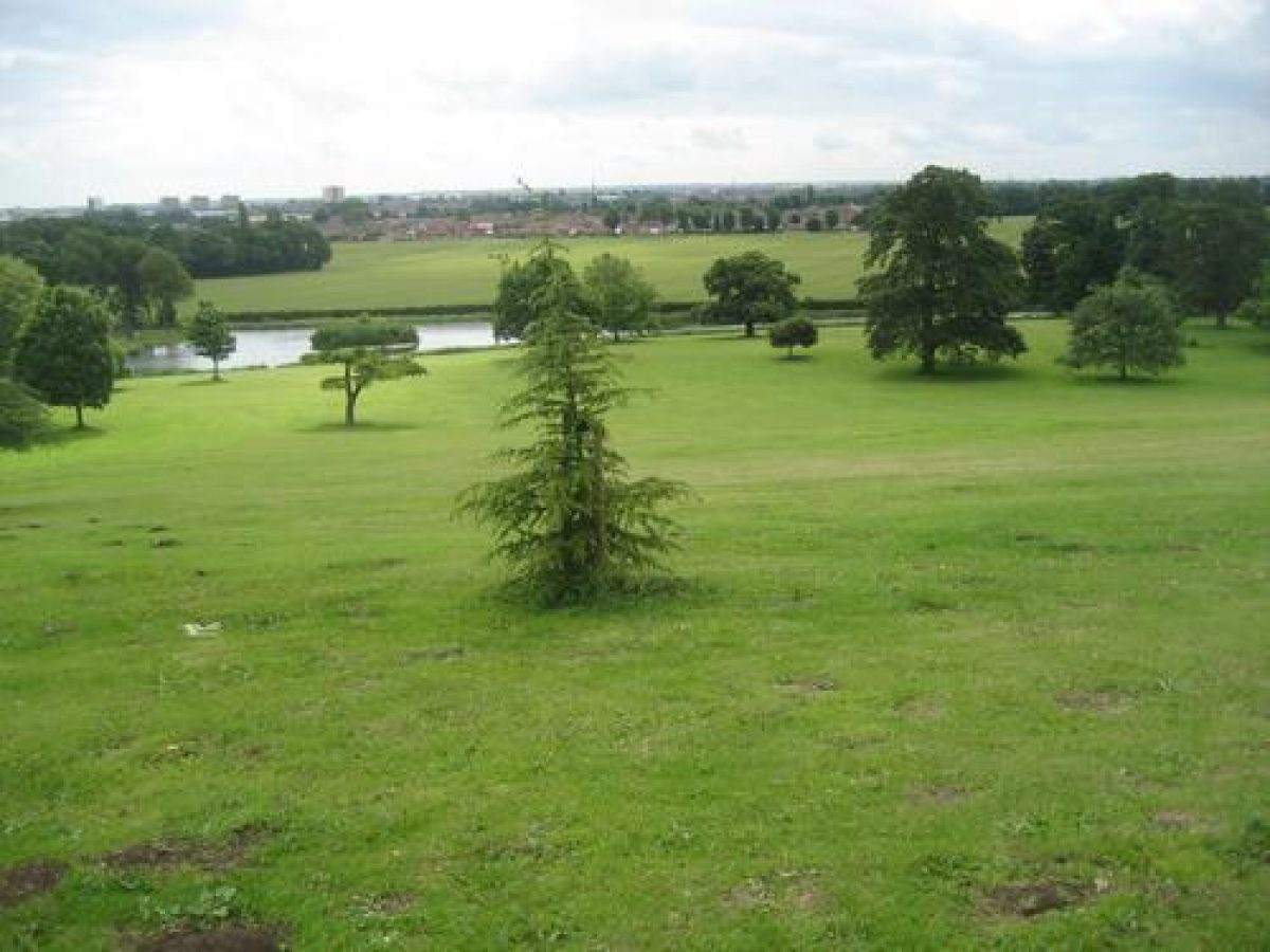
Park
Woods' park was well wooded but few parkland plantings now remain, much of the park having been ploughed. The southern perimeter belt, Long Plantation, is depleted and scarcely screens the late C20 housing estate immediately beyond. The Doncaster by-pass cuts through the west side of the park severing Temple Hill (marked as Castle Mound on the OS 1854), which formed part of Woods' landscaping, from the rest of the park.
Kitchen Garden
The part brick- and part stone-walled kitchen gardens lie 200m east of the Hall. They have been partially infilled with housing.
REFERENCES
W Angus, Seats of the nobility and gentry in Great Britain and Wales ...(1787), pl 16
J P Neale, Views of the seats of noblemen and gentlemen ...5, (1822)
Jones & Co, Great Britain Illustrated. Views of the seats, mansions, castles ... I (England), (1829), p 37
Trans Hunter Archaeol Society 8, no 5 (1963), pp 297-307
J Goodchild, Cusworth Hall Museum: A History Trail in Cusworth Park (1969)
Garden History 14, no 2 (1986), pp 91-8, notes 45-51 on p 118; 15, no 2 (1987), pp 115-35
Maps
OS 6" to 1 mile: 1st edition surveyed 1849-50, published 1854
Archival items
Accounts and Woods' working plans (Leeds City Archives)
Description written: November 1999
Edited: May 2000
- Visitor Access, Directions & Contacts
- History
The following is from the Register of Parks and Gardens of Special Historic Interest. For the most up-to-date Register entry, please visit the The National Heritage List for England (NHLE):
www.historicengland.org.uk/listing/the-list
HISTORIC DEVELOPMENT
William Wrightson built Cusworth Hall, 1740-5, employing James Paine to remodel it several years later. Wrightson died in December 1760, when the estate passed to his son-in-law John Battie. Battie employed Richard Woods (?1716-93) during the early 1760s to lay out a landscape park and lake to complement the Hall.
Good documentation for Woods' work survives including three plans and accompanying memoranda written in the course of the commission. Precise instructions are given about every stage, including extensive earthmoving, detailed planting instructions, the construction of carriage drives and gravel walks, and the construction of the ponds (Garden Hist 1986). Much of Woods' work survives (1999) and can be related to his plans and instructions of the 1760s.
The Hall was purchased by the local authority in 1961 and is run as a museum. The grounds are open to the public as a country park.
- Associated People
- Features & Designations
Designations
Conservation Area
The National Heritage List for England: Register of Parks and Gardens
- Reference: GD1378
- Grade: II
The National Heritage List for England: Listed Building
- Grade: I
Features
- Hall (featured building)
- Earliest Date:
- Latest Date:
- Parkland
- Museum
- Key Information
Type
Park
Purpose
Ornamental
Principal Building
Education
Survival
Extant
Hectares
89
Open to the public
Yes
Civil Parish
Sprotbrough and
- References
References
- {English Heritage Register of Parks and Gardens of Special Historic Interest}, (Swindon: English Heritage, 2008) [on CD-ROM] Historic England Register of Parks and Gardens of Special Historic Interest