Introduction
Croxdale Hall has an associated landscape park and woodland garden occupying about 205 hectares. The park is divided into South Park and North Park.
Terrain
Croxdale Hall sits on a low bluff on the east side of the valley of the River Wear, south of Durham city.The following is from the Register of Parks and Gardens of Special Historic Interest. For the most up-to-date Register entry, please visit The National Heritage List for England (NHLE):
A late C18 walled garden accompanying a country house and set in parkland of early to mid C18 origin. The walled garden and lakes are by the designer Lewis Kennedy.
Location, Area, Boundaries, Landform and Setting
Croxdale Hall sits on a low bluff on the east side of the valley of the River Wear, south of Durham city. The site occupies c 205 ha and is bounded by the River Wear to the west and north, Hett Lane to the south-west, and a belt of woodland to the south. To the east the park merges with woodland and farmland.
Entrances and Approaches
The main approach to Croxdale Hall is via a gatehouse on the B6300 to the west of the site, reached via Sunderland Bridge which spans the River Wear. From here, flanked by a double line of sycamores, the drive runs north-east across the park, parallel to the river, before turning sharply east onto the line of the early C18 approach and on an axis with the Hall. At the foot of the bluff on which the Hall stands, it crosses the Croxdale Beck over a single-arched stone bridge, built c 1760 by Christopher Ebdon. It then curves north off the axis to wind up the wooded slope, separated from the park to the north by a C19 ha-ha, before passing the church (dating from the late C11) and arriving from the north into the courtyard at the east side of the Hall. This layout is shown on an early C18 map of the estate.
The line of the west drive continues through the Hall east to High Croxdale, a farmhouse to which wings were added c 1765 to make it into an eyecatcher. Originally the axis was marked by an avenue planting of sixteen paired platoons, alternating square and round, each of nine mixed deciduous and coniferous trees. The first six of the southern blocks of these paired clumps were merged to form the plantation which gives shelter from the north to the walled garden, but otherwise no trace of this avenue remains. The west and east avenues are shown on estate plans for which there is a receipt from William Robinson of Kepier, Durham, dated April 1741.
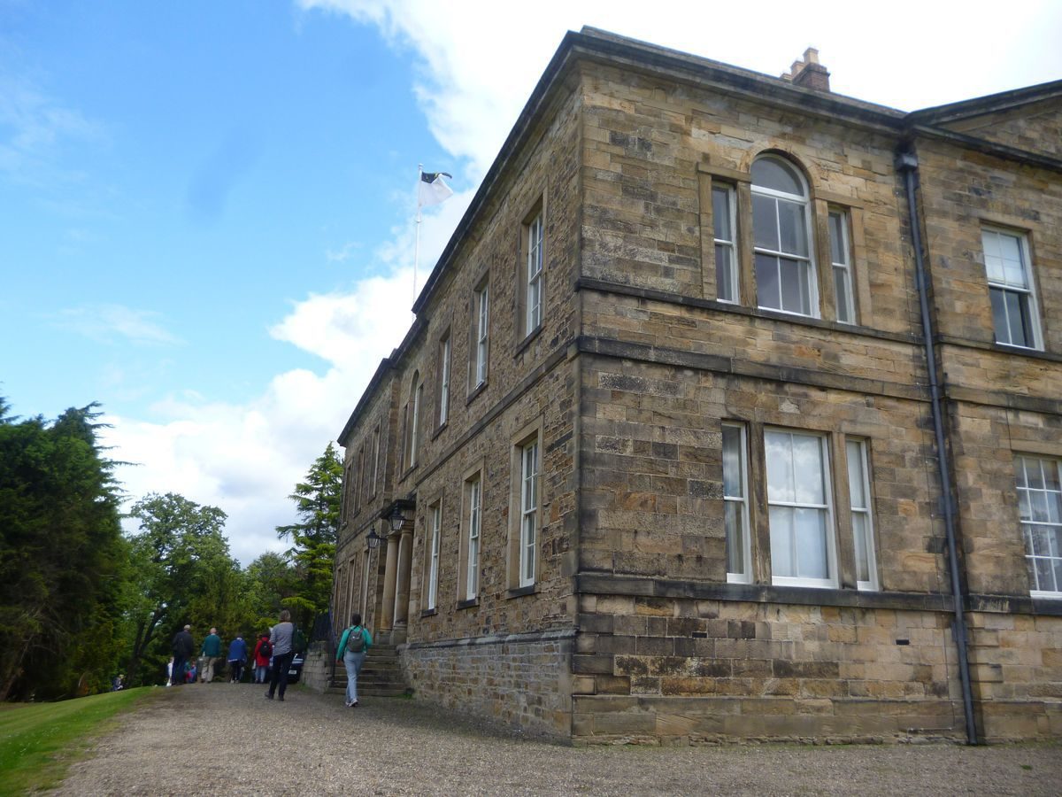
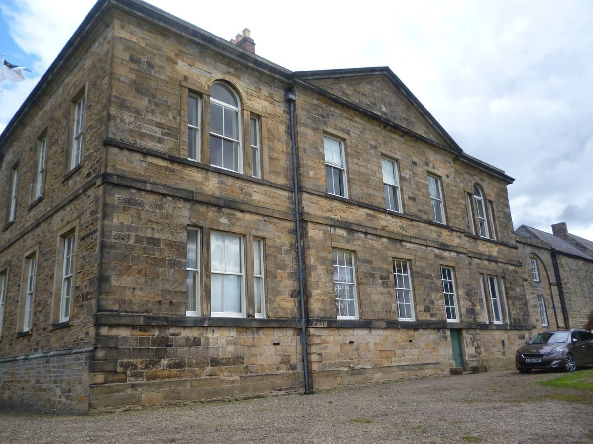
Principal Building
Croxdale Hall (listed grade I) is a large country house of squared sandstone, with an ashlar south front, built in the Classical style with a gothic chapel. The U-plan house is of two storeys with graduated green slate roofs and brick chimney stacks. The Old Hall was remodelled in 1759. To its east are C17 outbuildings (listed grade II), and to the north of these, the church (listed grade I) with its early C12 nave; further to the east is the early C18 Priest's House (listed grade II*) and the early C19 Home Farm (listed grade II*).
Gardens and Pleasure Grounds
The main garden, a 9acre (3.75 ha) plot walled on three sides, lies to the south-east of the Hall, separated from it by a strip of woodland known as the Cherry Gardens and shown on William Robinson's plan of 1741. The garden is entered by a door in the high brick wall down its western edge (listed grade II). Presumably it was established when the old walled garden south of the Hall was demolished in 1759. It is described by Surtees (1840) as being laid out 'in a manner which combines, with the liberal air of modern landscape, the rich and quaint but neglected beauties of the old fruit and flower garden'. The north side is also enclosed by a high brick wall, faced on its outer side with stone, which is built with a series of eight south-facing triangular projections forming bays, presumably for the growing of fruit. It incorporates a mid C18 orangery (c 1765, listed grade II) at its centre point, and the central section of the wall is flued.
A walk runs the length of the garden parallel to the north wall, to a double gate in the wall down the east side. The ground slopes down from the walk to two lakes formed by the damming of the Skip Beck, which runs from east to west through the garden. The higher, smaller lake is separated from the lower, serpentine piece of water by a grassed dam. Beyond the lakes to the south, the land rises more steeply to a stone-faced ha-ha, at the base of which runs a partly stone-lined leat, dividing the garden from the South Park. To the south of the eastern lake is the woodland garden or arboretum, planted up with exotics many of which are early introductions, and which were remarked upon by Richard Surtees in 1840.
To the south of the Hall the ground falls away as an open area of lawn, down to the continuation of the retaining wall along the southern edge of the garden. By this point, the leat and circuit walk around the gardens are high above the Skip Beck, which here flows in a stone culvert and, at a point south-west of the Hall and visible from it, the water from the leat cascades over a stone-built waterfall to join the stream below. The walk continues along the top of the southern and eastern bank of a steep wooded ravine, along the floor of which runs the Croxdale Beck, the water being broken into a series of waterfalls. The path continues south, through Croxdale Wood, following the deep ravine round the southern edge of South Park and forming a circular route which links with the eastern end of the gardens. A series of C17 to C19 mills stood along the Beck, of which Croxdale Mill is the sole survivor. Hutchinson, writing in 1787, describes the Croxdale Beck valley, mentioning the cliffs planted with forest trees, the cascades and the falling stream, and the 'grand and awful scenes' presented by the rocks. Paths are cut from the top of the ravine to a path that runs along the base of the rock outcrops and a lower path along the floor of the ravine.
Kitchen Garden
There is no area solely dedicated to use as a kitchen garden but in 1939 Country Life quoted Richard Surtees 1840 description of the main walled gardens described above as 'a noble garden of 9 acres, laid out in a manner which combines, with a liberal air of modern landscape, the rich and quaint but neglected beauties of the old fruit and flower garden'.
Park
The South Park occupies the high ground round which the stream winds. Just off the summit of this eminence, on an axis with a line north/south across the west front of the Hall, is a long, stone-lined canal. Originally this sat within an avenue which took this line, but the canal appears to have post-dated the planting which was cleared, all except the trees alongside the canal, shortly after it had been dug. The stumps of those trees which were left are still visible (1990s). Few of the scattered park trees which covered the park remain (1990s), and the two clumps which formed distinctive features to the west and east of the canal have also gone.
To the north of the Hall, the site is enclosed by the loop of the River Wear, on the south bank of which is the moated farmhouse, known as Low Butterby. Immediately north of the Hall is the area known as the North Park, bounded by the wooded valley of the Croxdale Beck to the west and Croxdale Wood to the north. An icehouse stands on the valley edge c 300 m north of the Hall. Beyond this, c 400 m to the north-east is the first of a string of three lakes, bounded to the east by Croxdale Wood and to the west by an open area known as The Island, due to its enclosure by the River Wear along the western boundary of the site, and Croxdale Beck to the south. The north-west tip of the park is divided into fields. The only trace that remains of the north avenue which in the early C18 crossed the park is an ancient hornbeam standing in the North Park between the Hall and the Icehouse.
A number of eyecatchers in the further landscape close views: Durham cathedral to the north; Burn Hall to the north-west; the tower of Brancepeth church to the west-south-west; and Sunderland village to the south-west. All are visible from the main entrance of the Hall, on the west front, and are marked by arrows on Jonathan Hunter's plan of 1771.
Maps
- W Robinson, untitled garden plan, 1741 (Durham County Record Office)
- Series of estate maps, mostly undated, including one of 1771 by J Hunter, steward for William Salvin (Durham County Record Office)
- OS 25" to 1 mile: 1st edition published 1857
Archival items
- The Salvin papers are at Croxdale Hall and Durham County Record Office.
Description written: 2000
Register Inspector: EMP
Edited: September 2000
Amended: SR 01.03.01
- Visitor Access, Directions & Contacts
Telephone
0191 3780911Owners
Salvin family
- History
The following is from the Register of Parks and Gardens of Special Historic Interest. For the most up-to-date Register entry, please visit The National Heritage List for England (NHLE):
16th to 18th Centuries
Croxdale Hall has been the seat of the Salvin family since the beginning of the C15. Bryan Salvin inherited in 1722 and was responsible for improvements to the landscape which included the planting of a cross of avenues of Dutch elm which intersected immediately to the west of the Hall. On his death in 1751, the estate passed to William Salvin (b 1723) who resided there until his death in 1800, and who was responsible for the construction of the walled garden and its lakes.
William was keenly interested in the landscape, purchasing during the 1790s exotics from J G V Perfect, William Falla, Jonathan White, and from John and George Telford of York, including a number of recent introductions from North America. His son, William Thomas, continued the interest in horticulture and forestry, carrying out a number of 'experiments'. William Thomas' correspondence includes letters from Joseph Sabine, Secretary of the Royal Horticultural Society, and Robert Menzies of the Royal Botanic Garden, Edinburgh.
20th Century
Planting has been continued through the mid and later C20, particularly in the woodland garden south of the lake which flows east/west through the walled garden. The site remains (1998) in single private ownership.
- Associated People
- Features & Designations
Designations
The National Heritage List for England: Register of Parks and Gardens
- Reference: GD2291
- Grade: II*
Features
- Great House (featured building)
- Description: A sandstone house built in the classical style. The original hall was remodelled in 1759.
- Earliest Date:
- Latest Date:
- Gatehouse
- Drive
- Description: A tree lined drive leading to Croxdale Hall.
- Ornamental Bridge
- Description: A single arched stone bridge over Croxdale Beck
- Earliest Date:
- Latest Date:
- Ha-ha
- Description: c19 Ha-Ha
- Earliest Date:
- Latest Date:
- Garden Building
- Description: An eyecatcher within the park. Wings were added to an older farmhouse to create the affect.
- Earliest Date:
- Latest Date:
- Lake
- Description: Two lakes formed by the damming of the Skip Beck,
- Lake
- Lake
- Waterfall
- Ornamental Canal
- Description: An ornamental, stone lined canal which pre-dates the 18th century improvments to South Park.
- Earliest Date:
- Latest Date:
- Moat
- Icehouse
- Walled Garden
- Description: The main garden is walled on three sides; originally a fruit and flower garden.
- Farmhouse
- Description: High Croxdale; farmhouse c 1765
- Church
- Description: Church (listed grade I) with early C12 nave
- House
- Description: Early C18 Priest's House (listed grade II*)
- Mill
- Description: A series of C17 to C19 mills stood along the Beck, of which Croxdale Mill is the last survivor
- Farm
- Description: Home Farmearly C19; (listed grade II*).
- Gardens
- Description: Main garden of 9acres (3.75ha)
- Orangery
- Description: Mid C18 orangery (c 1765, listed grade II)
- Arboretum
- Description: Arboretum, planted up with exotics many of which are early introductions, remarked upon by Richard Surtees in 1840.
- Key Information
Type
Park
Purpose
Ornamental
Principal Building
Domestic / Residential
Survival
Part: standing remains
Hectares
205
Open to the public
Yes
Civil Parish
Croxdale and Hett
- References
References
- English Heritage, {Register of Parks and Gardens of special Historic Interest: Durham} ([n.p.]: English Heritage, 2004) Register of Parks and Gardens of Special Historic Interest: Durham
- {English Heritage Register of Parks and Gardens of Special Historic Interest} (Swindon: English Heritage 2008) [on CD-ROM] Historic England Register of Parks and Gardens of Special Historic Interest
- Pevsner, N and Williamson, E {The Buildings of England: County Durham} (London: Yale University Press, 2002) The Buildings of England: County Durham
- Hutchinson W The History and antiquities of the County Palatine of Durham 2
- R Surtees The History ... of Durham 4, (1840) The History ... of Durham 4
- (26 August 1939), pp 202-6; (2 September 1939), pp 230-4 Country Life, 86
- Page, W., (2019) Victoria History of the County of Durham 2
- Tooley., Croxdale Hall, Durham, (Garden History Society Excursion Guide 1985, revised 1993) [copy on EH file] Croxdale Hall, Durham