Introduction
Woodfold is a park of about 175 hectares, newly imparked and landscaped in the 1790s to accompany a country house built by James Wyatt. The site includes extensive woodlands and an icehouse.
Terrain
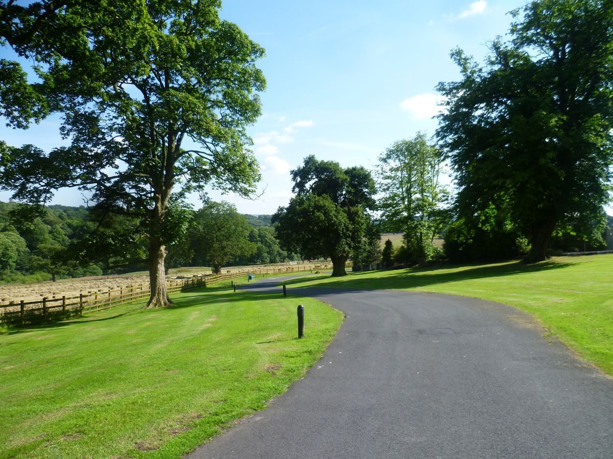
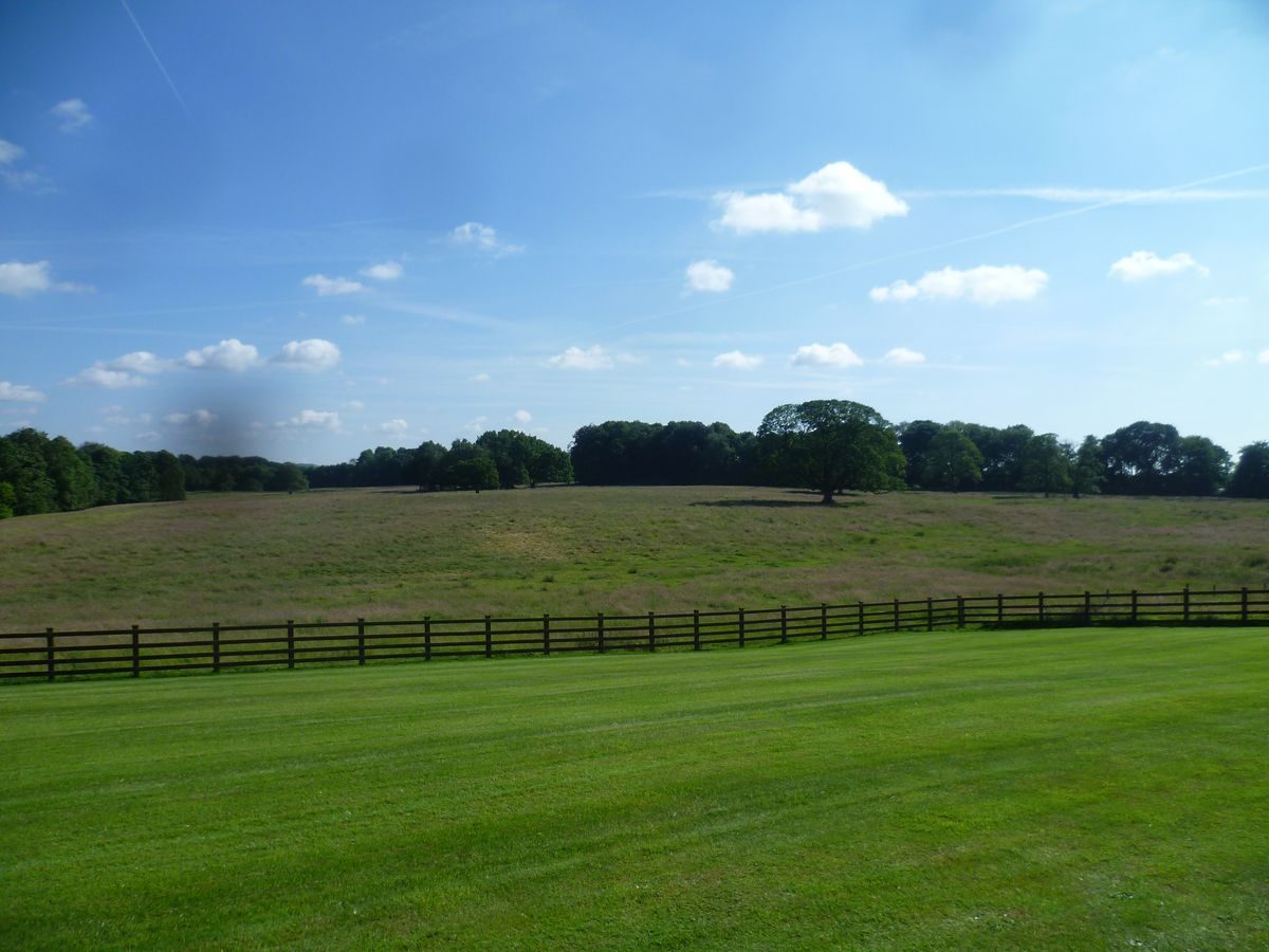
From the northern end of the site the ground falls away steeply to the south, offering long views along the valley of the Arley Brook to south and east.www.historicengland.org.uk/listing/the-list
A park laid out in the 1790s to accompany a country house.
DESCRIPTION
LOCATION, AREA, BOUNDARIES, LANDFORM, SETTING
Woodfold Park, c 175ha, lies to the west of Blackburn, north of Pleasington, and c 1.75km to the east of Samlesbury Bottoms. From the northern end of the site the ground falls away steeply to the south, offering long views along the valley of the Arley Brook to south and east. Much of the park is bounded by a high stone wall, beyond which lies an agricultural landscape. Further Lane twice touches the park at its north-west corner and the southern boundary is formed by Pleasington Road.
ENTRANCES AND APPROACHES
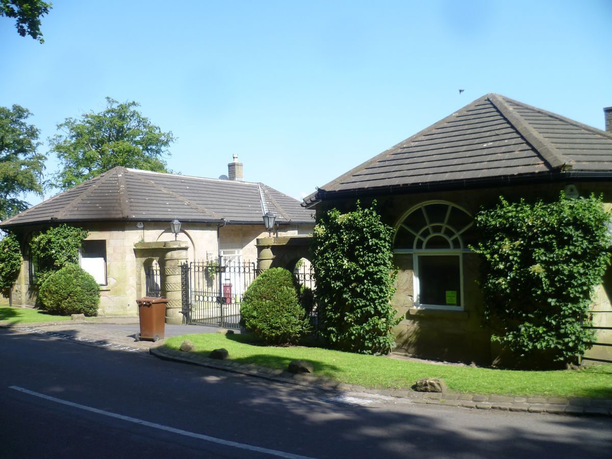
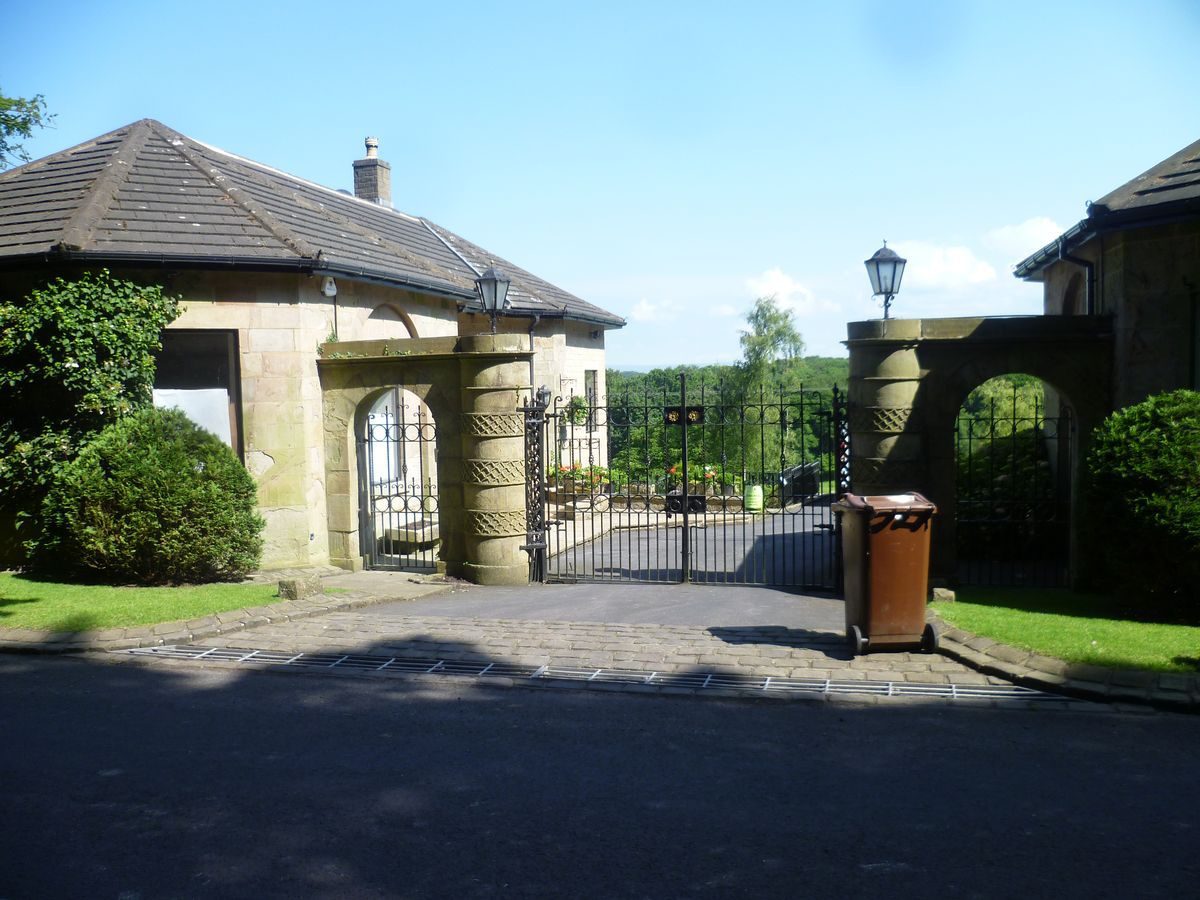
The main drive leads off the A677 road at the north-east corner of the site, through the gateway at Mellor Lodge (listed grade II), the pair of lodge houses probably being of the 1790s, possibly to the design of James Wyatt. From here the drive runs westwards through a narrow strip of woodland before breaking out into the park at the gateway at Middle Lodge (listed grade II). This pair of lodges again probably dates from the 1790s and is likely to be the work of James Wyatt. From here the drive continues westwards across the park to arrive at the south front of the Hall.
A second imposing gateway marks the entrance to the site from the public lane to the north, the drive here leading south to Woodfold Park Farm, where it branches eastwards to run through a band of woodland to join the east drive or continues south to the Hall.
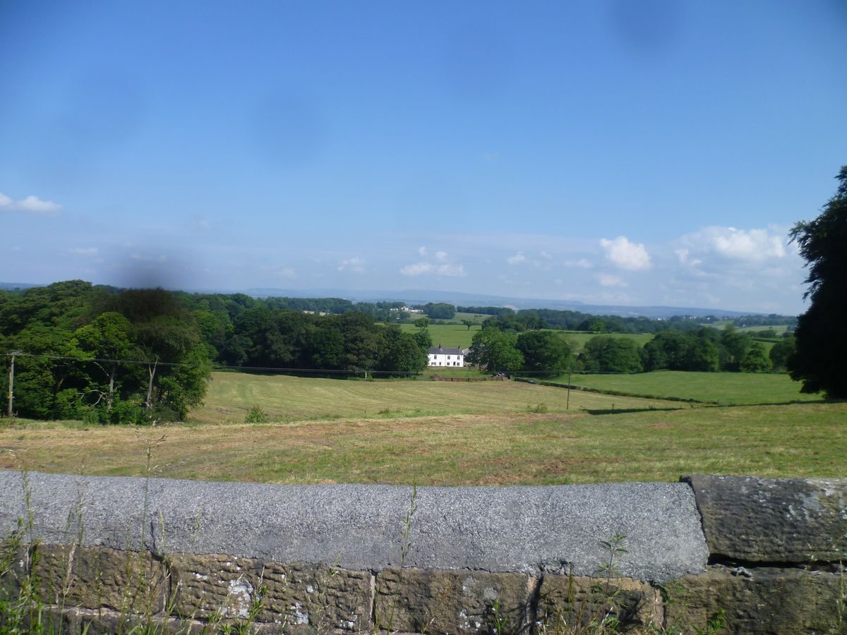
The access from the south is via the drive from Pleasington Lodge which stands on the Pleasington Road, the public road marking the southern boundary of the site. From here the drive leads northwards across the park, crossing the Alum House Brook as it runs east/west across the southern end of the park. The route continues past Old Woodfold Farm and the White House, then along the west side of White House Wood, which forms the eastern boundary of the site. The drive then bends sharply to the west to cross between two ponds, dog-legging back to run north up the steeply sloping ground to the Hall.
PRINCIPAL BUILDING
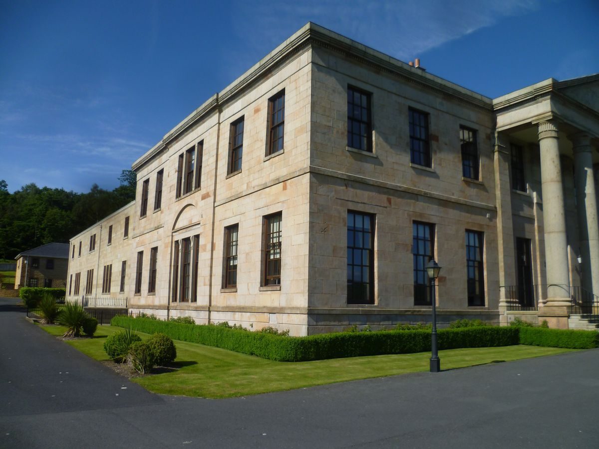
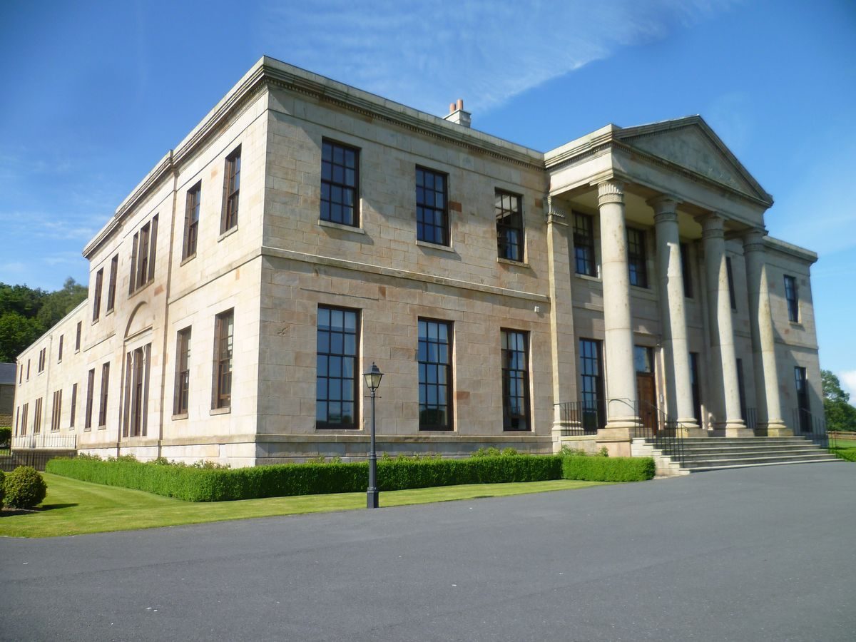
Woodfold Hall (formerly Woodfold Park, listed grade II) stands, unoccupied and derelict (1995), at the northern end of its park, enjoying views along the valley to the south and east. Built of sandstone rubble with the main facades of ashlar, the south front is of nine bays, the centre three flanked and separated by pilasters under a tetrastyle portico. To the rear (north), two wings run back to enclose a courtyard, their inner walls now collapsed.
GARDENS AND PLEASURE GROUNDS
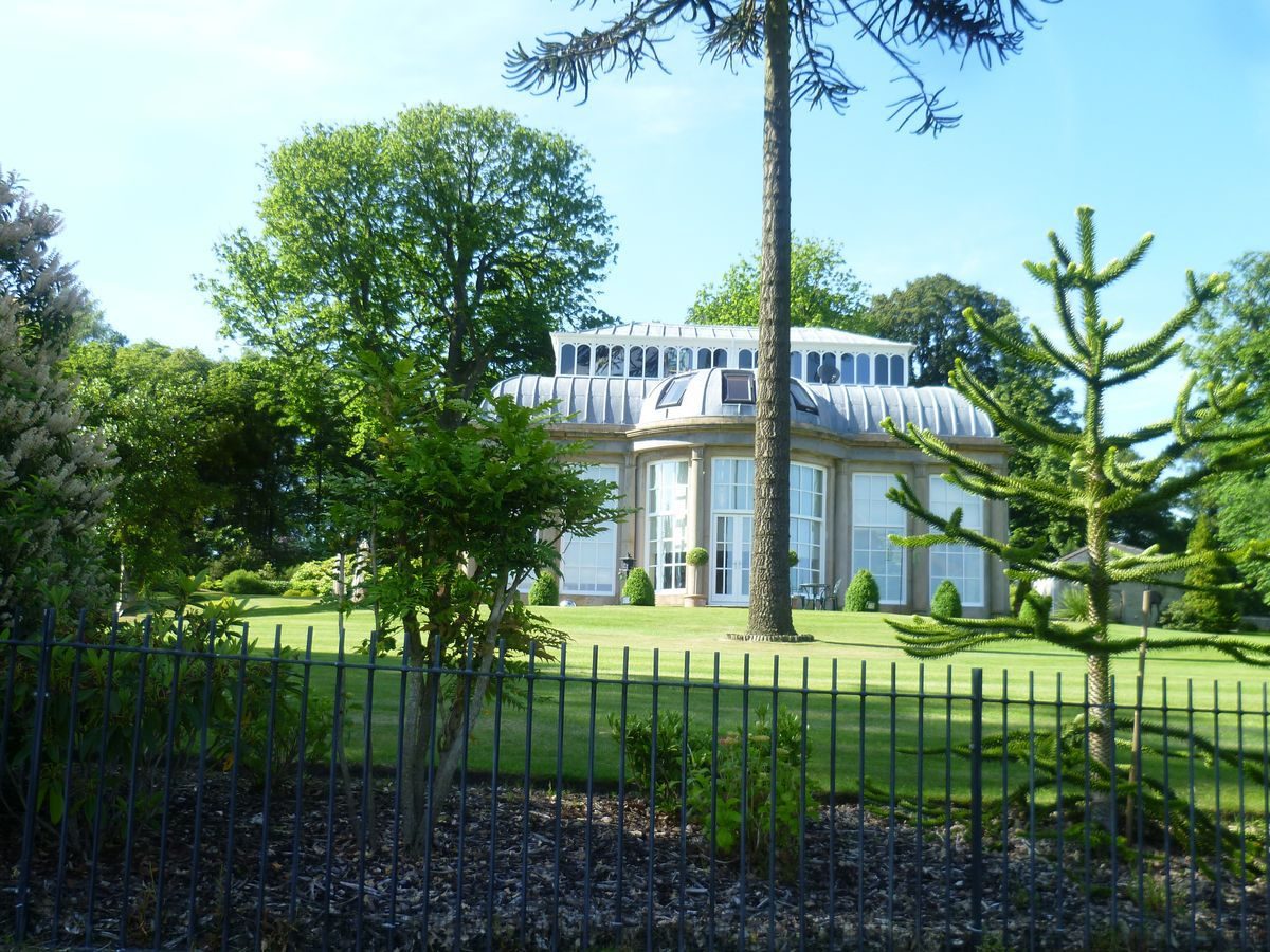
To the south of the Hall the ground is levelled to form a rectangular platform, supported by drystone walls. North of the Hall wooded pleasure grounds lead to the track which forms the walled northern boundary of the site. Within the pleasure grounds, 100m to the north-east of the Hall, stands an early to mid C19 orangery (listed grade II).
PARK
The park is set within farmland from which it is separated by a 3m high stone wall, 6.5km in length. To the south of the Hall lies parkland, divided from the farmland to the west by a broken wooded belt, and contained to the east by Old Woodfold Wood which here clothes either bank of the Arley Brook. Within the northern end of the wood is a sawmill; at the southern end, the brook leaves the site under the Alum Scar Bridge (listed grade II).
To the east of the Hall is a broad swathe of parkland, across which runs the east drive. The land falls from the northern boundary to the stream, the Arley Brook, which runs along the valley floor, Jeffery Wood beyond enclosing the south side of this stretch of the park. The flow of the Brook is broken by a series of weirs.
On the east side of the park, within Jeffery Wood, is Jeffery Pond. Below and to the south of the lake is a second, more extensive body of water, White House Pond, the south drive crossing the dam between the two. White House Pond lies parallel to the south drive, the two being separated by a strip of parkland sloping down to the water's edge. On the west side of the Pond, within Old Woodfold Wood and 100m from the water's edge, stands an icehouse, probably of c 1800 (listed grade II).
KITCHEN GARDEN
The kitchen garden lies 200m to the north-west of the Hall. It is enclosed on three sides by high brick walls, the fourth, the southern side, being open to the park and enclosed by a retaining wall.
REFERENCES
Edward Twycross, Mansions of England and Wales 1, (1847)
The Victoria History of the County of Lancashire 6, (1911), p 261
Maps
OS 6" to 1 mile: 3rd edition published 1913
Description written: February 1999
Edited: April 1999
- Visitor Access, Directions & Contacts
Directions
Situated to the north-west of Blackburn, south of Mellor and south of the A677.
- History
The following is from the Register of Parks and Gardens of Special Historic Interest. For the most up-to-date Register entry, please visit the The National Heritage List for England (NHLE):
www.historicengland.org.uk/listing/the-list
HISTORIC DEVELOPMENT
Towards the end of the 18th century Henry Sudell, a cotton manufacturer and financier of Blackburn, purchased several estates in the area, including Woodfold Park. This he imparked and, in 1798, called on Charles McNiven, an architect from Manchester, to build a new house. The house and park were sold in 1831 to Mr John Fowden Hindle, but he died shortly afterwards. The estate passed to various members of the Hindle family in fairly rapid succession. The Woodfold estate was sold in about 1878 to Robert Daniel Thwaites, a brewer of Blackburn. On Thwaites' death in 1888 the estate descended to his only daughter, Elma Amy. Through Elma Amy Thwaites' marriage in 1888 to Robert Armstrong Yerburgh, the estate became the property of the Yerburgh family. It remains (1990s) in private ownership.
Period
- 18th Century (1701 to 1800)
- Late 18th Century (1767 to 1800)
- Associated People
- Features & Designations
Designations
The National Heritage List for England: Register of Parks and Gardens
- Reference: GD 2645
- Grade: II
The National Heritage List for England: Listed Building
- Reference: Mellor Lodge
- Grade: II
The National Heritage List for England: Listed Building
- Reference: Middle Lodge
- Grade: II
The National Heritage List for England: Listed Building
- Reference: Orangery
- Grade: II
The National Heritage List for England: Listed Building
- Reference: Woodfold Hall
- Grade: II
Features
- Icehouse
- Earliest Date:
- Latest Date:
- Ornamental Bridge
- Boundary Wall
- Description: Much of the park is bounded by a high stone wall.
- House (featured building)
- Description: The house was designed by Charles McNiven, an architect from Manchester.
- Earliest Date:
- Latest Date:
- Key Information
Type
Park
Purpose
Ornamental
Principal Building
Domestic / Residential
Period
18th Century (1701 to 1800)
Survival
Extant
Hectares
175
- References
References
- {English Heritage Register of Parks and Gardens of Special Historic Interest}, (Swindon: English Heritage, 2008) [on CD-ROM] Historic England Register of Parks and Gardens of Special Historic Interest
- Farrer, W and Brownbill, J. {Victoria County History: Lancaster, Volume 6} ([n.p.]: [n.pub.], 1911), p. 261 Victoria County History: Lancaster, Volume 6