Introduction
The south part of the park is now covered by a modern housing estate. The northern part and gully became Mayfield Public Park (see separate entry).
Weston Grove suffered from developments in the 20th century, in particular the building of an ammunitions factory on the foreshore that destroyed the scenic views. The house was later demolished. The south part of the park is now covered by a modern housing estate. The northern part and gully became Mayfield Public Park.
- History
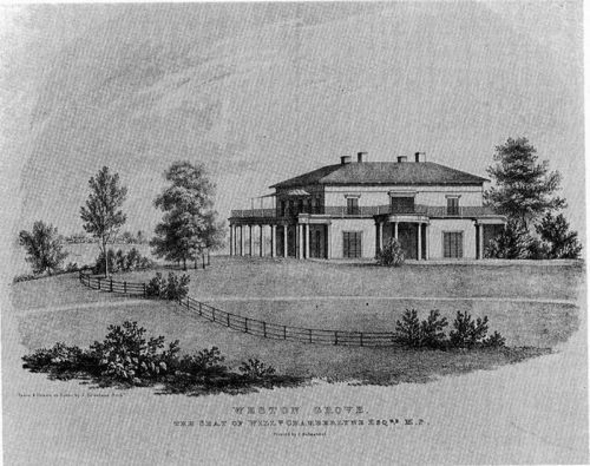
William Chamberlayne, who was M.P. for Southampton from 1818 to 1829, inherited land on the East side of Southampton Water. In 1801 he built a marine villa on the site and named it Weston Grove. The villa and park were much admired at the time for their picturesque qualities.
William Cobbett wrote 'to those who like water-scenes.... it is the prettiest spot, I believe, in all England'. The house stood on rising ground above the shore and had very fine views over Southampton Water and the New Forest. The long carriageway from the Portsmouth road was another attraction. Bordered by rhododendrons, it followed the wooded gully and then climbed the slope to the house.
Two decorative viaducts crossed Weston Lane and linked the House to the furthest reaches of the estate including the ancient ruins of Netley Abbey. A feature of the park was an obelisk raised in memory of Charles James Fox, the eminent politician.
The first half of the 20th century saw the breakup of the estate. This began with the sale of some of its lands by Tankerville Chamberlayne, which allowed the building of an ammunition factory on the Weston foreshore in World War 1. This destroyed the beauty of the scenic views. At the same time, the rural character of the area was disappearing with the encroachment of the suburb of Woolston on the edge of the park. The Ministry of Munitions took over the estate. By the 1940s Weston Grove house had become ruinous. The process culminated with its demolition and the building of a modern housing estate over the southern half of the park. The northern half of the park and the gully became Mayfield Public Park.
- Key Information
Type
Garden
Principal Building
Domestic / Residential
Survival
Lost