
Introduction
Watcombe (Brunel) Park has mid-19th-century parkland, gardens and shelter belts, laid out by I K Brunel. At its most extensive the estate was around 55 hectares, now (1987) it is in divided use and ownership, with around 27 hectares remaining as gardens, park, woodland and protected coastal scenery.
Terrain
The site occupies a south-facing valley, with the house standing on high ground towards its head. The woodland garden was established on steep slopes facing west, south-east and south.
Brunel's Hidden Kingdom
The last few years have stimulated a new interest in Isambard Kingdom Brunel. The many events of Brunel 200 commemorated his birth in 1806, while a recent television poll of ‘Great Britons’ placed him second in the list – next to Winston Churchill. It might seem that Brunel’s life had been thoroughly explored, that all that needed to be said had already been spoken.
Yet one big gap remained in the story of Brunel’s life – the twelve years spent in assembling and laying out Watcombe Park in Devon. Perhaps this is not surprising, given the multi-faceted achievement of his short life, so well described in Rolt’s biography of 1957. There was so much else to be fastened upon that there is only one mention of Watcombe in the index and little more than one page in the text. In that passage Watcombe was no more than the lost dream, cast aside in the urgency to complete Great Eastern. 'After 1855 the notebooks contain fewer and fewer references to Watcombe, for by this time Brunel’s last enterprise had become all consuming and the dream of a peaceful retirement to the West Country was driven ever further into the background of his thoughts.'
From this passage it appeared that Watcombe Park had been ‘written off’ as one of Brunel’s few failures and misjudgements; though Tom Rolt’s widow assured me that her husband was conscious of Watcombe’s significance and was resolved to research it. The ill-health that led to his death intervened.
In recent years Professor R.A. Buchanan, University of Bath, has become the leading authority on Brunel. In his 2002 biography he set out to modify some of the misjudgements and to fill some of the gaps in Rolt’s biography, recording his amazement that such a ‘powerful and elegant’ book should have been researched and written in eighteen months. In Buchanan’s Brunel there are no less than six references to Watcombe in a variety of contexts - noting for example that Brunel resembled many other leading engineers in aspiring to ‘a place in the country’ as a symbol of success. But the phrase ‘he bought the estate at Watcombe in Devon’ tends to give an impression of a place ‘ready-made’ though in fact it was assembled with difficulty over a number of years.
It is perhaps inevitable that for authors recording Brunel’s total achievement his landscaping venture should appear of marginal interest. What is more surprising has been the almost total lack of recognition by local historians. The standard work on Torquay by Percy Russell (1960) describes in detail Brunel’s contribution to the town’s development through bringing the railway to Torquay and on to Dartmouth. On Watcombe, however, there are only these few dismissive lines: 'he planned his retirement there, and is said to have gone so far as to construct the foundations of a large residence.'
Professor Buchanan notes the ‘valuable insights’ and ‘perceptive comments’ in the works of two descendants: Celia Noble’s The Brunels, Father and Son (1938) and Cynthia Gladwyn’s The Isambard Brunels (1971) The earlier biography by Brunel’s son Isambard, The Life of Isambard Kingdom Brunel, Civil Engineer, (1870) has been well described as ‘an act of filial piety’ and also as ‘a rather pedestrian publication.’ However it is here, in one or two places, where one can pick up a sense of how significant Watcombe became to Brunel himself.
- ‘There can be little doubt that the happiest hours of his life were spent in walking about in the gardens with his wife and children, and discussing the condition and prospects of his favourite trees.’
- ‘The improvement of his property was his chief delight.’
- The arrangement of his plantations ‘gave him unfailing pleasure.’
This new study, Brunel’s Hidden Kingdom, describes in detail how Brunel assembled his land, how he planned his improvements, how he planted his trees. As he stressed - when writing on Christmas Eve 1847 for a suitable gardener - the chosen man’s task would be ‘... the formation of a park where all is to be done.’ The man selected was Alexander Forsyth, at the time engaged on the tree-planting to embellish the ‘gothic wonderland’ of Alton Towers. Forsyth was one of the uncelebrated heroes of Victorian gardening: Brent Elliott, the RHS historian, is ‘glad to see Forsyth getting some sympathetic attention.’
Brunel’s landscaping venture also brought him into contact with some better known names in Victorian gardening. He probably received advice from William Nesfield who had taken over at Kew in 1844. He would have benefited, too, from the plant-hunting prowess of William Lobb, who brought back many of the specimens to be cultivated in the famous Veitch tree nurseries at Exeter. (The Rolle estate at Bicton, laid out by the Veitch family, was already demonstrating what could be achieved in the friendly climate of the West Country.)
Brunel died aged 53 in 1859 with his house un-built, but with nearly twelve years of shaping and planting accomplished. Brunel’s Hidden Kingdom has many photographs – the earliest dating back to around 1861 – recording that achievement. Fortunately there are two quite detailed descriptions of Watcombe in The Gardeners’ Chronicle, in 1882 and 1887, which also add considerable detail. The second article, in particular, notes the artistry with which various tree types had been assembled ‘a good illustration of what may be done in that direction when the planter knows what he is about.’ Artistry also appeared in the skill by which the visitor was exposed to ‘the unexpected’ – an important quality in landscape design in the days of the Picturesque. ‘In fact one of the features of Watcombe is that at every turn something unexpected presents itself to the eye.’
The book concludes with a brief description of Watcombe’s future after Brunel’s death. For a time the estate was well-maintained, especially in the hands of the Wrights, a Nottingham banking family. But misfortunes came: the eldest son was killed in the Second Afghan War, and by 1900 the bank itself was in deep trouble. The heartland of the estate has been preserved, though most outlying areas have now been built upon. In 1987 part of the original landscape was registered as a Historic Park, and the following year Torbay Council designated a more extensive area as a Watcombe Park Conservation Area. The Great Storm of 1990 caused considerable damage, to some extent mitigated through a grant from Task Force Trees. The book concludes that Brunel’s Watcombe Park has been undervalued for years.
‘Yet it remains the most personal of all memorials of Brunel - more personal than stations and statues and stained glass windows. His Great Britain was recovered from the Falkland Isles and brought home to Bristol to be restored. Surely it should be possible to salvage Watcombe Park for posterity.’ (Geoff Tudor, 2006)
The following is from the Register of Parks and Gardens of Special Historic Interest. For the most up-to-date Register entry, please visit the The National Heritage List for England (NHLE):
www.historicengland.org.uk/listing/the-list
Mid 19th century parkland, arboretum and gardens laid out by Isambard Kingdom Brunel and his head gardener Alexander Forsyth with advice from William Andrews Nesfield, many of the principal features surviving substantially unaltered from 1859.
DESCRIPTION
LOCATION, AREA, BOUNDARIES, LANDFORM, SETTING
Watcombe is situated c 4km north of Torquay and 0.5km south-west of the coastal village of Maidencombe. The A379 road from Torquay north to Teignmouth runs through the site, the majority of which lies to the west of the road. Covering c 27ha, the site comprises c 6ha of formal and informal gardens associated with the house, and a further 21ha of woodland garden, arboretum, pinetum and protected coastal land. The site occupies a south-facing valley, with the house standing on high ground towards its head. The woodland garden was established on steep slopes facing west, south-east and south which afford views south and east to the sea, with a further area of ornamental planting on the south-facing ridge to the east of the Teignmouth road. The site is bounded by mid and late C20 suburban development with the exception of the tree belt to the east of Watcombe Heights Road, which adjoins protected coastal land at Giant Rock.
ENTRANCES AND APPROACHES
The site is approached from the A379 Teignmouth Road 160m east-north-east of the house. Stepped stone wing walls, originally surmounted by wrought-iron railings, flank gabled gothic stone gate piers which now (1998) lack their gates. A pedestrian gate with a simpler stone gate pier stands immediately to the north (all listed grade II). Some 15m north-west, Brunel Lodge, a much altered mid C19 structure, incorporates two cottages built by Brunel for Alexander Forsyth. The tarmac drive sweeps south and turns west, passing through C19 evergreen shrubs and conifers. After c 90m a subsidiary drive leads north 60m to the much altered late C19 stables. The drive enters a carriage court, now used for car parking, on the north side of the house between low stone piers. The areas of Watcombe Park in public ownership are entered via pedestrian gates from Brunel Avenue c 70m north-west of its junction with Steps Cross Lane, and from Seymour Drive c 60m east of its junction with Kingsgate Close. The south entrance from Brunel Avenue follows the line of the mid C19 drive from the Teignmouth road. This ran c 200m west along the boundary of Watcombe Hill House before continuing for c 70m along the course of the C20 road. Turning north, it ran c 350m through the pleasure grounds to the site of the house. It survives as the principal walk on the east side of the valley, and has a brick-lined shallow channel along part of its length; this carried water from the upper rock garden to the lower rock garden c 40m north-north-west of the gate to Brunel Avenue.
PRINCIPAL BUILDING
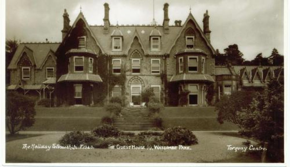
Brunel Manor (listed grade II) is a substantial two-storey gothic house constructed in limestone rubble with Bath stone dressings for James Crompton to the design of J Watson c 1870. The house, which stands on foundations built for a house designed for Brunel by William Burn in 1851, has a three-storey gabled tower above the entrance on the north facade, and prominent gabled dormers set in the slate roofs. A lower service wing projects at the north-west corner, enclosing the west side of the carriage court, while to the east of the main block the single-storey ballroom extends c 20m with bargeboarded, gabled attic dormers, and blind arches at ground level. This leads via a small courtyard to a late C20 extension. The south or garden facade is flanked by canted bay windows surmounted by cusped bargeboards to west and east, while recesses to the west and east of the building are both filled with late C20 additions. The east recess originally contained a conservatory, and that to the west a verandah and formal garden.
GARDENS AND PLEASURE GROUNDS
The formal gardens comprising terraces and lawns lie principally to the south and west of the house. To the south, three descending terraces are linked by a flight of stone balustraded steps (listed grade II) placed axially to the facade of the house, but which pre-date the present building. At the upper level there is a broad concrete walk with flower beds below the walls of the house and adjacent to the steps. Two steep mown grass banks separated by a narrow level grass terrace descend to the lowest terrace which breaks forward in a semicircular bastion and is enclosed to the south by stone balustrades (listed grade II). A circular lily pool surrounded by rustic stonework and a concrete walk is the focus of the lower terrace, the remainder of which is lawn with segmental-shaped rose beds to the south and groups of specimen shrubs to east and west. There are herbaceous borders and further specimen shrubs to the south-east and south-west. The broad outline of the terrace scheme with the projecting semicircular bastion is shown on the 1859 estate plan and appears to have formed part of Nesfield's design, and planting schemes were described by the Gardeners' Chronicle (1882; 1887). Below the terraces grass slopes planted with specimen trees and conifers descend to the lower pleasure grounds, with a sweeping gravel walk corresponding to one shown in 1859 leading from the east terrace to a circular rock-margined pond (dry in 1998) 100m south-south-east of the house. Immediately below the south terraces a flat-roofed late C20 building partly obliterates the line of a level grass walk which followed the base of the terrace wall. West of the house, the upper terrace returns and overlooks an oblong garden c 60m long with a curved end to the west, enclosed by low stone walls and steep banks to the north, west, and east, and by a low balustrade (partly ruined) and Irish yews to the south. Stone steps (listed grade II) descend into the garden from the east. In 1882 this area was described as the Italian Garden with a yew hedge to the south, Cupressus macrocarpa on the bank to the north, and an internal scheme of specimen conifers and simple flower beds. By 1887 it had become a tennis lawn, and remains an area of mown grass today (1998).
The lower pleasure grounds were laid out to the west and east of the valley which runs south from the house. To the east the valley side is formed into two sloping terraces separated by a gravel walk which runs south for c 130m. Planting above the walk is principally of pines, beech and lime to provide shelter and screening from the road which forms the boundary at a higher level. The upper walk extends c 60m south-east above the mid C19 Thornery to the site boundary. Below the upper walk more exotic trees are planted. The lower walk on the east side of the valley is formed from the mid C19 south drive. The valley floor is managed as rough mown grass allowing north/south vistas between the trees planted on the slopes to east and west. A group of sculptures illustrating aspects of Brunel's life and the physical elements with which he worked, carved by Keith Barrett from trees blown down in January 1990, have been placed c 160m south-south-east of the house. Walks on the west side of the valley include the Macrocarpa Avenue c 250m south-west of the house, part of which preserves the distinctive pebble edging which was a feature of Brunel's mid C19 walks (CL 1988). Surviving exotic C19 planting includes a mature monkey puzzle 130m south-west of the house, adjacent to which are the earthwork remains of mid C19 shrubbery beds. Planted in the 1880s with flowering shrubs below specimen trees and exotic conifers (Gardeners' Chronicle 1882), this area is now heavily overgrown with scrub. To the north-west of the shrubberies, steps ascended to an informal upper woodland walk which survives as a path through beech woods leading to the pedestrian gate to Seymour Drive. The southern end of the valley was developed as a Pinetum with well-spaced specimen conifers. This area was heavily damaged in 1990 and has since been extensively replanted. Plantations continue c 250m on the south-facing slope west of the valley, returning north for c 350m as a narrow strip of principally deciduous woodland between late C20 residential developments. Features in this area include a quarry 290m south-south-west of the house which was converted into a picturesque incident, and the mid C19 rockery c 260m south of the house. There has also been extensive replanting since 1990 in The Avenues 350m south-west of the house which was partly developed as an arboretum in the mid C19.
PARK
Brunel's park lying 300m south of the house has been developed with residential roads in the mid and late C20, and is excluded from the registered site.
KITCHEN GARDEN
Some 95m north of the house, the kitchen garden has been developed with late C20 houses inside the mid C19 stone walls. It does not retain any horticultural elements and is excluded from the registered site.
OTHER LAND
The plantations and walks to the east of the Teignmouth road were separated from the main pleasure grounds with the loss of Brunel's timber bridge c 1914 (New Civil Engineer 1987). While the level ground on the summit of the hill was developed for housing from the 1930s, the plantations which enclosed it to the south-west, south, east and north survive in divided ownership with a mixture of deciduous trees and exotic conifers reflecting the mid C19 planting.
REFERENCES
I Brunel, The Life of Isambard Kingdom Brunel Civil Engineer (1870), p 508
J Horticulture and Cottage Gardener (1871) Gardeners' Chronicle, ii (1882), pp 75-76; ii (1887), pp 463-464
W H Grant, Memoirs (1922), p 144
B Elliott, Victorian Gardens (1986), p 94
New Civil Engineer, (29 January 1987), pp 14-15
Country Life, 182 (31 March 1988), pp 140-141
Watcombe Park: A Survey of the Landscape, management plan, (Debois Landscape Survey Group 1990)
M J Tooley (ed), William Andrews Nesfield 1794-1881 (1994)
T Gray, The Garden History of Devon An Illustrated Guide to Sources (1995), pp 228-229
Maps
J Grant, Tithe map for St Marychurch parish, 3 chains to 1", 1840 (Devon Record Office)
Day and Son, The Watcombe Estate ... in the County of Devon The Property of the late Isambard Kingdom Brunel, Esquire, 1859 (337/B1025 ME195), (Devon Record Office)
OS 6" to 1 mile: 1st edition surveyed 1888, published 1891
OS 25" to 1 mile: 1st edition surveyed 1888, published 1890
2nd edition revised 1904, published 1906
1937 edition
Archival items
Brunel MSS (Bristol University Library)
Sale particulars, 1901 (547B/334), (Devon Record Office)
Sale particulars, 1931 (547B/P3139), (Devon Record Office)
Description written: September 1998
Amended: May 1999; May 2000
Edited: July 2000
- Visitor Access, Directions & Contacts
Telephone
01803 329333Website
https://www.brunelmanor.comAccess contact details
The site is open daily throughout the year. Admission is free.
Directions
Watcombe lies to the north of Torquay.
- History
The following is from the Register of Parks and Gardens of Special Historic Interest. For the most up-to-date Register entry, please visit the The National Heritage List for England (NHLE):
www.historicengland.org.uk/listing/the-list
HISTORIC DEVELOPMENT
Watcombe was created on a site which remained farmland until it was acquired by Brunel in a series of purchases made between late 1847 and 1858. Brunel's son noted (1870) that his father had admired the view from Watcombe while travelling between Teignmouth and Torquay. The St Marychurch Tithe map (1840) indicates the disposition of the fields from which the landscape was developed; some field boundary banks and trees remain within the 19th century landscape and appear to have been used to form its outline. Parish roads from St Marychurch and Barton to Stokeinteignhead ran through the valley which was to be the focus of the estate. Closure was permitted by the Vestry in October 1848.
W A Nesfield (1793-1881) was consulted on the design of the gardens and ornamental landscape in 1847 (Evans, in Tooley 1994), and Brunel and his head gardener Alexander Forsyth made plantations for shelter, and to screen the gardens from the Teignmouth turnpike to the east, using some semi-mature trees. A system of wells, reservoirs, pumps and an ornamental lake to supply water both for the projected house and for the gardens was installed on parkland to the south of the site by William Simpson of Pimlico. The pump house and the outline of the lake were shown on the 1937 Ordnance Survey (OS) map, but the site is now (1998) developed. Plans were commissioned from William Burn in 1851 for a projected mansion on the site of the present house, but by the time of Brunel's death in 1859, only the foundations and cellars had been constructed, and a plan prepared in 1859 indicates the extent of the estate. To the west, a drive and finger of plantation extended about 500 metres from the site of the house to Great Hill which had been acquired in 1849, while to the east of the Teignmouth road, a further area of plantation with walks leading to the site of a projected summerhouse was connected to the main pleasure grounds by a timber bridge.
The walks and planting in the pleasure grounds south of the house were established by 1859, and other features including the rockeries 100 metres and 260 metres south, and the steps and shrubberies about 200 metres south-west of the house are also shown. Brunel's notebooks and correspondence indicate his close personal involvement in the development of the landscape, and in the formation of a collection of recently imported exotic trees and shrubs. The grounds were open to the public and were a noted feature of the locality.
In 1864 Watcombe was sold to John and Robert Vicary. Retaining the services of William Elson, Brunel's head gardener since 1851 (Grant 1922), the Vicary brothers continued to allow public access. No house was constructed until the estate was acquired in 1873 by James Crompton, a Lancashire mill-owner who used Watcombe as a winter residence. Work on the house remained unfinished at his death in 1876, when the estate, now comprising 500 acres (208 hectares), was sold to a Nottingham banker, Colonel Ichabod Wright. The 1888 OS map shows that the outline of the garden remained essentially unchanged since 1859, except for the creation of a new drive east of the house, and the abandonment of Brunel's drives which approached the site from the west and south. The estate was sold in 1907 to Sir John Edwards Moss, who changed its name to Roby Hall, and in 1923 Frederick Lund sold the lower pleasure grounds to Torquay Borough Council which has since maintained them as a public park.
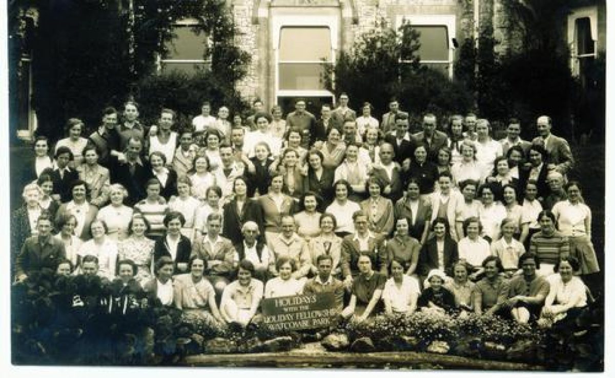
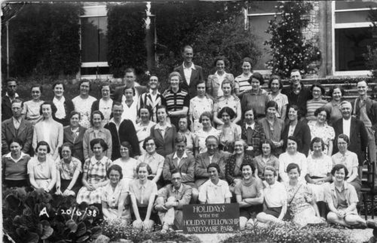
In 1932, the Christian Holiday Fellowship purchased Watcombe, and in the 1950s, the house became known as Brunel Manor. It has been owned by The Woodlands House of Prayer Trust since 1962 and is run as a Christian Holiday and Conference Centre.
Land to the east of the Teignmouth road and north of Watcombe Heights Road, and adjacent to Merevale Close and Kingsgate Close, is in multiple private ownership. Considerable storm damage was sustained in 1990, with many of Brunel's mid 19th century trees being lost. Torquay Borough Council has implemented a management plan which included clearance of damaged trees, replanting using original species where possible, and the reinstatement of paths, steps and seats from the mid 19th century scheme.
Period
- Post Medieval (1540 to 1901)
- Victorian (1837-1901)
- Associated People
- Features & Designations
Designations
The National Heritage List for England: Register of Parks and Gardens
- Reference: GD1038
- Grade: II
Features
- House (featured building)
- Description: Foundations were laid in 1854, but the house was not built until after 1873.
- Earliest Date:
- Parkland
- Gardens
- Shelter Belt
- Woodland
- Key Information
Type
Garden
Purpose
Ornamental
Principal Building
Parks, Gardens And Urban Spaces
Period
Post Medieval (1540 to 1901)
Survival
Extant
Hectares
27
Open to the public
Yes
- References
References
- {English Heritage Register of Parks and Gardens of Special Historic Interest} (Swindon: English Heritage 2008) [on CD-ROM] Historic England Register of Parks and Gardens of Special Historic Interest
- Elliott, B {Victorian Gardens} (London: Batsford, 1986) 94 Victorian Gardens
- Gray, T {The Garden History of Devon} (Exeter: Exeter University Press, 1995) 228-9 The Garden History of Devon
- Tudor, G {Brunel?s Hidden Kingdom - (his landscaping achievement at Watcombe, Torquay)} (Devon, 2006) Brunel's Hidden Kingdom (his landscaping achievement at Watcombe, Torquay)
Contributors
Geoff Tudor
- Related Documents
-
CLS 1/219/3
Watcombe Park: A Survey of the Landscape Part 1: History and Proposals - Hard copy
Debois Landscape Survey Group - 1990
-
CLS 1/219/5
Watcombe Park: A Survey of the Landscape Part 2: Photocopies and Maps - Hard copy
Debois Landscape Survey Group - 1990
-
CLS 1/219/4
3 Maps for CLS 1/219/2: 1. Plants and Field Archaeology. 2. Proposals. 3. Views Seats and Paths - Hard copy
Debois Landscape Survey Group - 1990
-
CLS 1/219/3