Introduction
The site has an 18th-century park and river landscape around a medieval castle. The grounds occupy about 280 hectares. The gardens were largely remodeled in the 19th and 20th centuries, and feature the Peacock topiary garden, a Victorian rose garden, and a glasshouse.
Terrain
To the west and north-east of the River Avon the site is generally level and forms the flood plain of the river. To the north the ground rises steeply above the river to the Castle, while Temple Hill rises about 530 metres south-east of the Castle.www.historicengland.org.uk/listing/the-list
Mid C18 park and pleasure grounds landscaped by Lancelot Brown, with late C18 picturesque additions, together with mid C19 gardens designed by Robert Marnock and an early C20 garden by Harold Peto, associated with a medieval fortress.
DESCRIPTION
LOCATION, AREA, BOUNDARIES, LANDFORM, SETTING
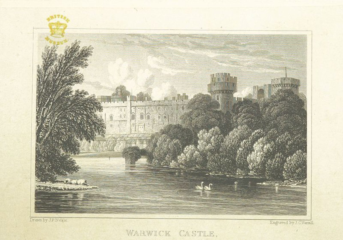
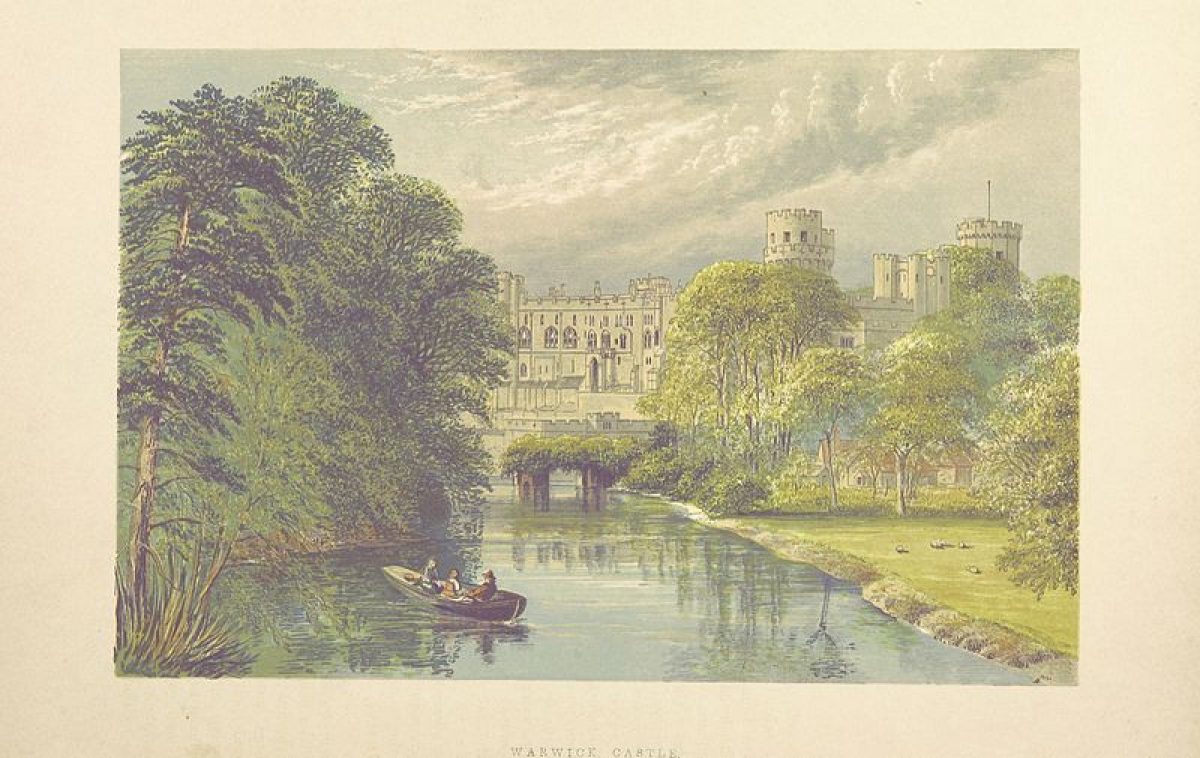
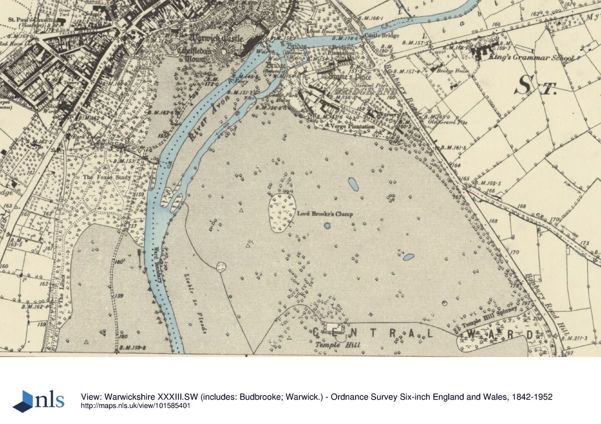
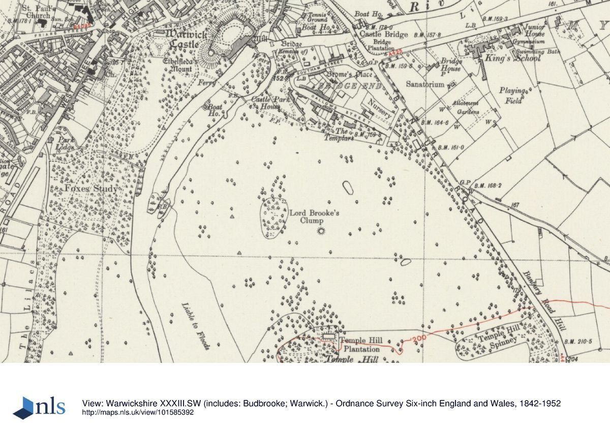
Warwick Castle is situated c 250m south-east of the centre of Warwick, to the north-west of the River Avon. The c 280ha site comprises some 23ha of gardens and pleasure grounds, and c 257ha of parkland. The site is bounded to the north-west by Castle Lane from which it is separated by a late C18 stone wall (listed grade II) c 3m high, and by domestic premises in Castle Close. To the north-north-east the boundary is formed by a late C18 stone wall (listed grade II*) which separates the grounds from domestic properties on the west side of Mill Street, and by the river frontage of properties on the east side of Mill Street up to and including the late C18 Castle Bridge (listed grade II*). The north-east boundary is marked by Park House, Greville House, and other properties on the west side of Bridge End, while the east boundary is formed by the A425 Banbury Road, from which the park is separated by timber fences. To the south-east the site is bounded by the B4462 road which leads south-west to Barford, and to the south the boundary is formed by a late C20 cutting accommodating the A452 and M40 roads. The south-west boundary adjoins agricultural land, while to the west the site adjoins agricultural land, light industrial premises, and mid C20 domestic properties to the east of the A429 Stratford Road, Leyfields Crescent, and Temple Grove. The River Avon flows in a serpentine course through the site from north to south-west, while the Tach or Ram Brook enters the site from the east and flows to its confluence with the River Avon c 1.2km south-south-east of the Castle; the Tach Brook is dammed to form a lake, the New Waters, which extends east to the Banbury Road. To the west and north-east of the River Avon the site is generally level and forms the flood plain of the river. To the north the ground rises steeply above the river to the Castle, while Temple Hill rises c 530m south-east of the Castle and c 400m east of the river. Temple Hill is separated from further rising ground at the south-east corner of the site by New Waters, while to the south of the river, c 1.5km south of the Castle, the ground rises steeply to a level plateau which extends to the south and south-east boundary of the site. There is a complex system of vistas within the site with particularly significant reciprocal views of the Castle from Spiers Lodge and Temple Hill. There are also important views of the town from Spiers Lodge; this view was painted by Paul Sandby in 1776 (WCRO). From Castle Bridge on Banbury Road there are significant designed views south-west down the river to the Castle and the ruins of the medieval bridge which are framed by gardens attached to properties in Mill Street and Bridge End; there is a reciprocal view of the river, gardens, and bridges from within the Castle. From the walls and towers of the Castle there are extensive views in all directions, and particularly across the Castle Park to surrounding agricultural land and late C20 commercial development at Heathcote.
ENTRANCES AND APPROACHES
Warwick Castle is approached from the A425 Banbury Road to the north-east, where the entrance is marked by a late C18 lodge (listed grade II). This structure comprises a crenellated, single-storey stone block with a central gothic carriage arch closed by a pair of timber doors; the lodge was built in 1796(7 by Samuel Muddiman and John Williams as part of the second Earl's improvements. The lodge leads to a tarmac drive which sweeps west and south for c 100m through a cutting in the sandstone bedrock. This picturesque approach was constructed by the second Earl in 1797 when existing properties in Back Hill were demolished. The drive emerges from the cutting and passes through C19 cast-iron gates to reveal a wide panorama of the north-east facade of the Castle. Sweeping south-east between areas of lawn for c 100m the drive passes across a dry moat on a mid C17 stone bridge to reach the mid C15 barbican and gatehouse. The south-east section of the drive was constructed by the second Earl in the late C18 when the stables and forecourt constructed north-east of the Castle in 1664 were cleared away. The second Earl's picturesque drive was praised by Prince Puckler-Muskau in 1826 (Butler 1927), but was criticised as resembling a 'drift way to a mine' by J C Loudon in 1831 (Gardener's Mag).
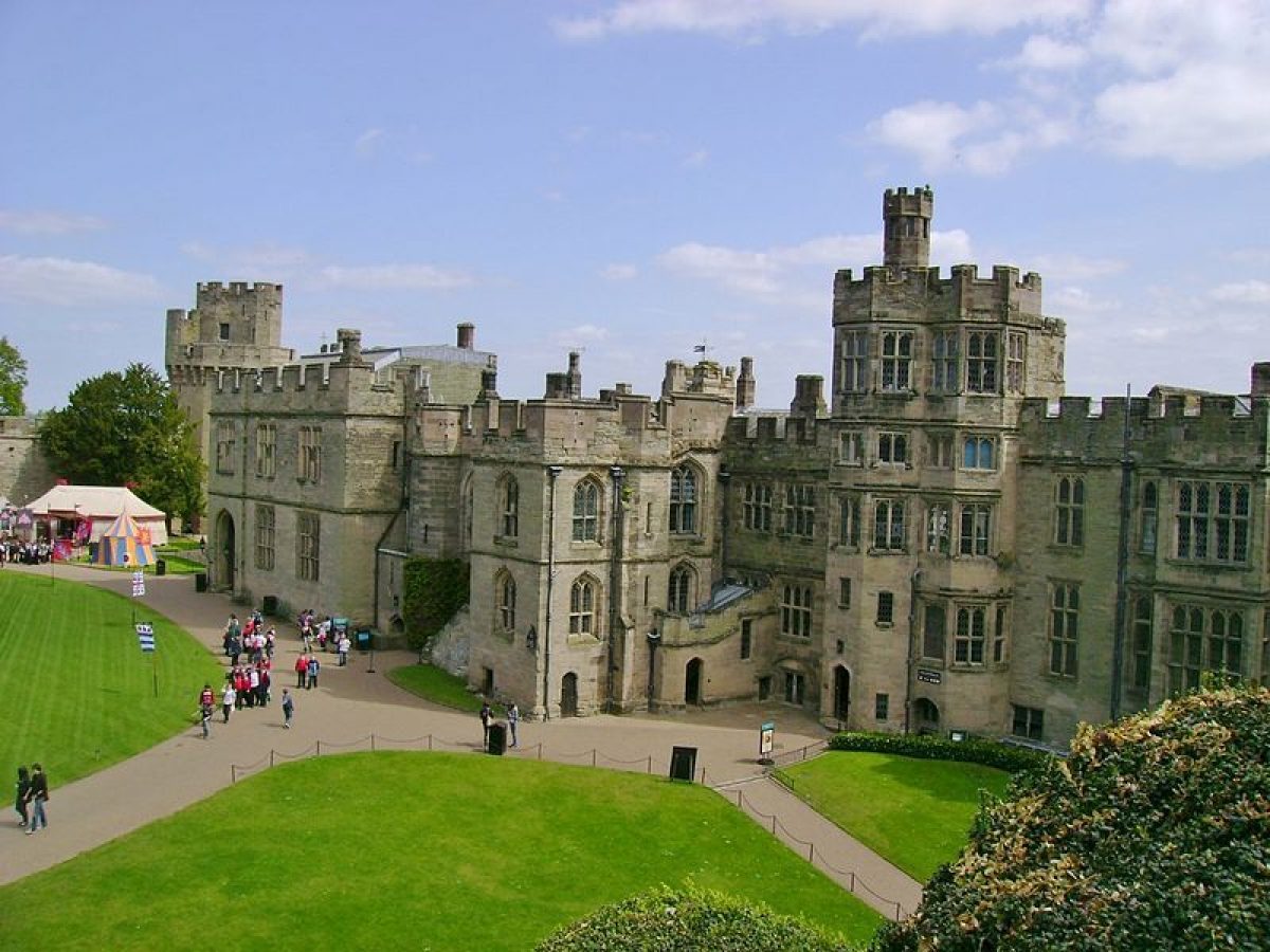
Within the Castle the courtyard is laid out with a gravel carriage turn enclosing an elliptical-shaped lawn. To the south the courtyard adjoins the Mount which is planted with evergreen shrubbery and specimen trees, while to the west and north of the carriage turn there are further areas of lawn planted with mature specimen pines. A gateway in the western curtain wall, flanked by two low late C15 towers, the Clarence and Bear Towers, leads to the pleasure grounds, while a further gateway at the south-west corner of the courtyard leads to a carriage drive which passes through the pleasure grounds to Castle Park. A further gateway in the C14 Watergate Tower at the south-east end of the courtyard leads to the river and pleasure grounds; in the late C16 this gate led to the formal gardens. The courtyard was laid out in its present form by Lancelot Brown for Lord Brooke in 1753; the porch and steps ascending from the courtyard to the Great Hall were also constructed to Brown's design in 1753 (Tyack 1994).
Visitors today (2000) approach the Castle from vehicular entrances on Stratford Road c 590m south-west of the Castle, and Castle Lane c 100m north-west of the Castle. A late C20 car park is situated in shrubbery parallel to the north-west boundary, with a further area of mid C20 car parking north of the stables. The mid C18 stables (listed grade II*) c 100m north-north-west of the Castle have been converted in the late C20 to provide the visitors' entrance and facilities. The two-storey, stone and hipped-roof stable blocks are constructed around three sides of a courtyard with a pediment surmounting a carriage arch in the south-east range leading to the pleasure grounds. The stables were constructed c 1768-71 by Job Collins, possibly to a design by Robert Mylne.
PRINCIPAL BUILDING
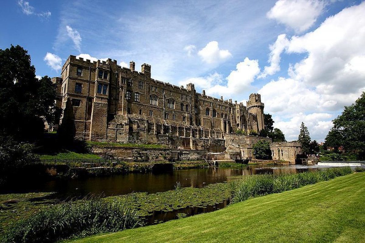
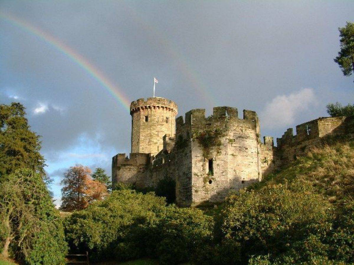
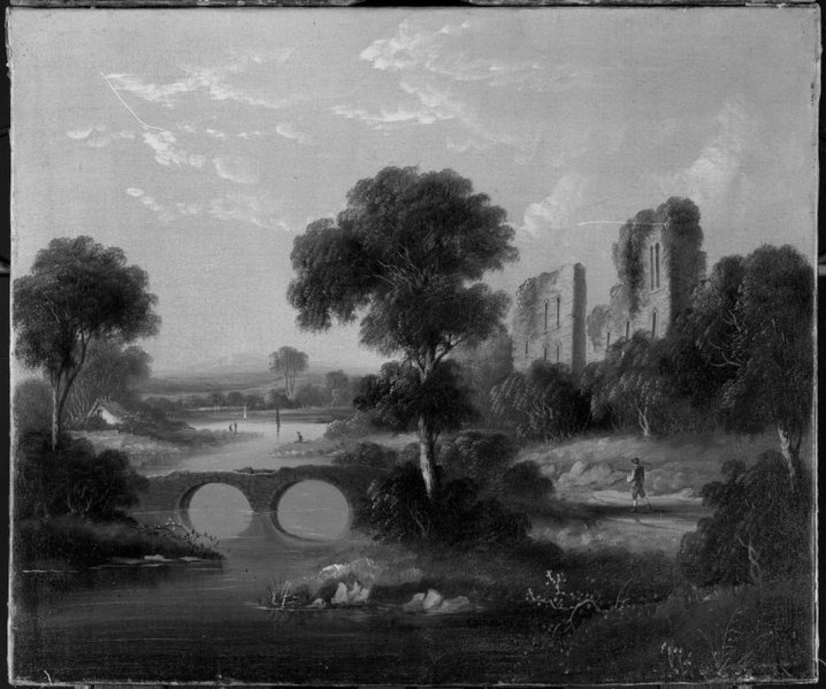
Warwick Castle (listed grade I; part scheduled ancient monument) stands on a bluff of high ground to the north-west of the River Avon, the steep bank of which is encased behind a high C16 retaining wall from which the walls of the state and private apartments rise. The Castle is constructed around an approximately rectangular courtyard, with the mid C11 motte, known as Ethelfleda's Mount, situated to the south-west and the domestic ranges to the south-east. The C14 Watergate Tower connects the domestic ranges to a curtain wall which ascends the east face of the Mount to reach a crenellated wall, gateway, and two turrets on the summit of the Mount. A further curtain wall descends the north face of the Mount to connect with the curtain wall which encloses the west side of the courtyard. A pair of low, octagonal, late C15 towers, the Bear and Clarence Towers flank an entrance in the centre of the west wall; these towers were built by Richard III as part of a keep which remained incomplete in 1485 (guidebook). The north-east or entrance facade of the Castle is dominated by two massive late C14 towers which are connected to a central late C14 gatehouse and barbican by further crenellated curtain walls. The north-west tower, known as Guy's Tower, is twelve-sided on plan and rises some six storeys to a machicolated parapet. The south-east or Caesar's Tower, of slightly earlier construction, has a trilobed plan; the lower section rises some four storeys above a battered basement which is a prominent feature at the southern end of Mill Street. The two-storey upper section rises from a machicolated parapet and is surmounted by a crenellated parapet. A late C17 single-storey range known as the Armoury, but constructed as a laundry and brewhouse, abuts the outer face of the curtain wall between the barbican and Caesar's Tower. The domestic range to the east of the courtyard comprises two-storey private apartments to the north of the two-storey state apartments; a further three-storey range adjoins the state apartments to the south. The domestic ranges were constructed at various dates from the mid C14, with the buildings at the southern end having been rebuilt by Sir Fulke Greville in the early C17. The state apartments retain significant late C17 and mid C18 interiors. The private apartments, which had also been remodelled in the mid C18, were reconstructed by Salvin following a serious fire in 1871.
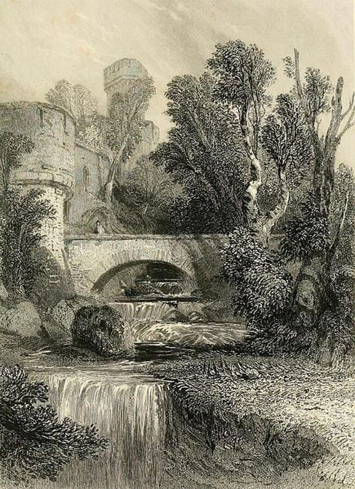
Immediately below and to the south-east of the Castle the single-storey Castle Mill (listed grade II*) adjoins a weir extending across the river. The Mill was rebuilt in Gothic style by Timothy Lightoler in 1767-8, possibly incorporating elements of an earlier mill which had stood on this site since the medieval period. In 1894 a water-driven electric generator was installed in the Mill. Stone walls connected with the water supply to the Mill extend north-east from the building through the garden of 55 Mill Street.
GARDENS AND PLEASURE GROUNDS
Informal pleasure grounds lie to the north, west, and south-west of the Castle, with formal gardens to the north and north-west.
To the north of the Castle the pleasure grounds comprise lawns, specimen trees, and evergreen shrubbery which slope down from the stables to the north-north-west to the moat. The moat is a dry ditch which extends west from Caesar's Tower below the north-east and west walls of the Castle to the Mount. A carriage drive sweeps south from the south-west gateway from the courtyard, passing to the west of the Mount before turning south-west to follow the north-west bank of the River Avon for c 270m, then turning west to cross the south-west end of a lawn known as Pageant Field. This lawn is enclosed to east and west by mature specimen trees and mixed ornamental shrubbery, and descends from the late C19 formal garden to the river. To the south-west of the Pageant Field and to the south of a small stream, an area of mixed specimen trees and shrubbery known as Foxes Study extends c 250m to the boundary between the pleasure grounds and Castle Park, which is marked by a late C20 fence. A footbridge crosses the stream from Pageant Field and leads to a C19 avenue of deodar cedars which passes south-west through Foxes Study to a gate leading to the park. The late C20 Estate Management building and compound is situated at the southern end of Foxes Study.
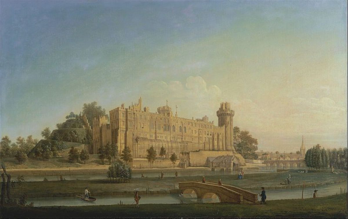
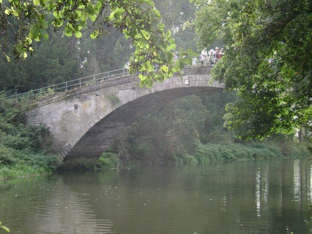
A further drive leads south-east below the Mount to reach a late C20 timber bridge which crosses the river c 80 m south-south-west of the Castle to an island which extends c 650m north-east to south-west below the Castle. There are significant views up river from the bridge and island to the Castle Mill and the remains of the medieval bridge (listed grade I; scheduled ancient monument) c 80m east of the Castle. Stone arches and cut-waters from this C15 bridge survive in three sections, including one section now (2000) in the garden of 55 Mill Street. The bridge, which was until 1788 the main route into Warwick from the south, was retained and deliberately enhanced as a picturesque feature (Dr Hodgetts pers comm, 2000) by the second Earl when he constructed a new bridge, Castle Bridge (listed grade II*), c 350m east of the Castle to designs by David and Robert Saunders in 1788-93; the picturesquely ruined old bridge is shown in a late C18 or early C19 view in the Aylesford Collection (BRLA). Some 160m south-south-west of the Castle, a single-storey timber and thatch-roofed boathouse stands on the north-west bank of the island. This was constructed in 1896 for Lady Warwick, and from 1898 housed an electric launch used to reach Spiers Lodge in Castle Park by river (guidebook); the boathouse was restored in the late C20. A stone bridge c 130m south-east of the Castle leads from the south-east bank of the island across the river channel to Castle Park. In the late C19 and early C20 Lady Warwick used the island to house a menagerie. The trees at the north-east end of the island correspond to a plantation formed by Brown to frame the view of the river and old bridge c 1750 (CL 1979).
A serpentine walk leads north-east from the drive c 20m north-east of the barbican through a series of wrought-iron rose arches to reach a formal rose garden (restored 1984-6) which is situated on a level area of ground enclosed to the north, east, and west by banks planted with evergreen shrubbery and specimen trees. The rose garden comprises a series of box-edged geometric beds cut in panels of lawn separated by gravel walks. The garden is quatrefoil-shaped on plan, and is enclosed by shrub roses and regularly spaced cast-iron pillars supporting further roses. The rose garden was designed in 1868 by Robert Marnock and constructed in 1869 (plans, WCRO). To the west of the rose garden a rock garden incorporating a cascade and pool is set against the enclosing bank. This was constructed in 1900 by James Backhouse and Son of York, in part using artificial stone (guidebook; plan, WCRO). Some 10m south-west of the rose garden two brick-lined icehouses (constructed c 1830, guidebook) are set into the enclosing bank.
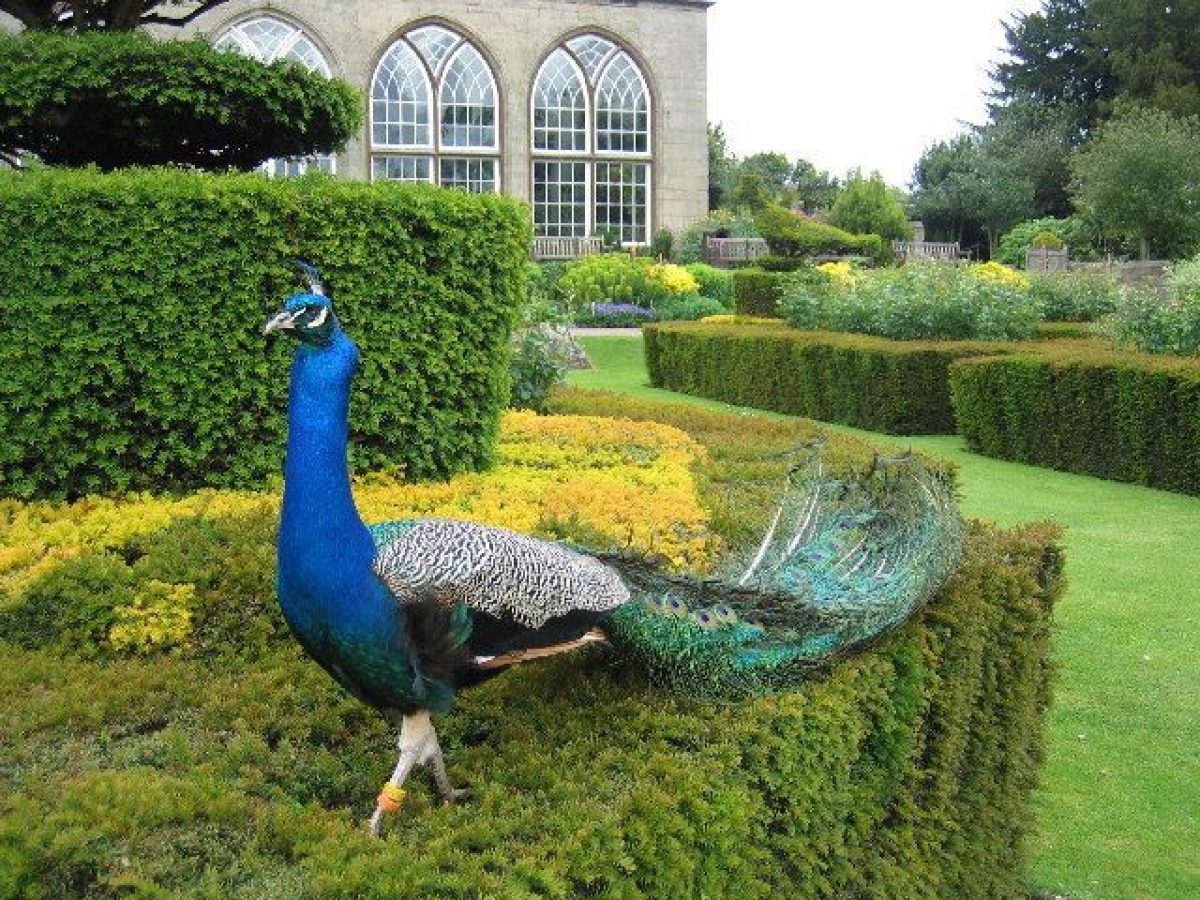
A walk leading north-west from the Bear and Clarence Towers turns south-west for c 130m to form a terrace walk backed by a high yew hedge which runs along the north-west side of the lawn; this walk leads to a formal flower garden c 160m west of the Castle. Known as the Peacock or Italian Garden, the flower garden is hexagonal on plan with geometric yew and box-edged beds arranged on three panels of lawn divided by three gravel walks; the hedges are ornamented with topiary peacocks and the parterre radiates from a central circular stone-edged pool. To the north of the parterre a flight of stone steps ascends to a gravel terrace, above which a further flight of stone steps ascends to a stone-flagged terrace below the late C18 conservatory. The flower garden was laid out to designs by Robert Marnock in 1869 (plans, WCRO); plans for an Italian garden had been provided by William Broderick Thomas (1811-98) in 1865 (WCRO); Bateman's plan of 1845 (WCRO) shows lawns sweeping down to the river. The conservatory (listed grade II*) comprises a single-storey stone structure lit by five tall gothic-arched windows in the south facade under an early C20 glazed roof (replaced late C20). The interior has a stone-flagged floor with inset stone-kerbed planting beds and an apsidal recess to the north. The conservatory was built in 1786-8 to designs by William Eborall to accommodate the Warwick Vase, a monumental C4 Greek marble urn from Hadrian's Villa, Tivoli, which was acquired by the second Earl from Sir William Hamilton in 1774; the Vase was first placed at the centre of the Castle courtyard and is shown in this position in a view in the Aylesford Collection (BRLA). The conservatory was restored in 1989 and today (2000) contains ornamental planting and a late C20 copy of the Warwick Vase, the original having been sold by the seventh Earl to the Burrell Collection, Glasgow in 1978. There is a vista from the conservatory and flower garden south across the Pageant Field to the River Avon.
The pleasure grounds achieved their present form under Francis, Lord Brooke in the mid C18 when Lancelot Brown completed the removal of the formal gardens south and south-east of the Castle, and a hamlet, High Ladsome, which occupied the site of the Pageant Field; the pleasure grounds are shown on a plan of 1776-80 (WCRO) and a plan of 1845 by James Bateman (WCRO). The walled formal gardens are shown on a plan of 1711 by James Fish and Charles Bridgman (WCRO), and comprised several parterres and a large greenhouse which was constructed in 1695. The medieval motte was adapted as a viewing mount with a spiral walk ascending to the summit from the Watergate Tower. The summit was planted in the late C17 with a single pine tree which was noted by Thomas Baskerville c 1678 (VCH). The formal gardens south of the Castle probably originated as the 'Queen's Garden' mentioned in a survey of 1576 (VCH; guidebook) and were described by Leland c 1534 as 'a second Eden ... adorn'd with all kinds of delightful and shady walkes, and Arbours, pleasant Groves, and wildernesses, fruitful Trees, delicious Bowers, oderiferous Herbes, and fragrant Flowers' (Toulmin-Smith 1907-10). In 1634 Dugdale commented that the gardens were 'a place ... [of] extraordinary delight, with most pleasant Gardens, walks and Thickets, such as this part of England can hardly parallel' (Dugdale 1730).
PARK
Castle Park extends south and south-east of the Castle, and lies principally to the east and south of the River Avon which flows through the park from north to south-west. The park is today (2000) in mixed agricultural use with level pasture planted with some scattered specimen trees surviving to the south of the Castle, to both east and west of the river. The park is enclosed to the east by a predominantly deciduous plantation which screens the Banbury Road which was diverted to its present course by the second Earl in 1782-7. To the south-east Nursery Wood is a late C18 mixed plantation on high ground, while a further late C18 boundary plantation screens the B4462 Barford Road which was constructed in 1772-92. Barford Wood bounds the park to the south on land added to the park after the Barford enclosure in 1760, and further plantations known as Ashbeds Wood and The Lilacs screen the western boundary; these plantations are shown on a plan of 1791 (WCRO). There are further plantations within the park, including c 450m south-east of the Castle Lord Brooke's Clump, and Leafield Privet c 1.3km south-south-west of the Castle. Temple Hill Plantation c 900m south-east of the Castle is today (2000) a mid C20 commercial coniferous plantation, while scattered mature specimen trees survive on the west-facing slope of Temple Hill overlooking the river.
Some 1.5km south of the Castle, Spiers Lodge (listed grade II*), a mid C18 gothic hunting lodge stands above a steep north-facing slope above the River Avon. Lodge Wood, a late C18 plantation, extends c 250m south and c 500m from north-east to south-west along the crest of the escarpment, incorporating C17 avenues which were retained by Brown in his mid C18 improvements (plans, 1776-80; 1791, WCRO). Spiers Lodge was rebuilt in Gothic style c 1748, perhaps with the advice of Sanderson Miller (1716-80) (CL 1979), on the site of a lodge which had been associated with a medieval warren. The warren existed by 1268, while a warrener was appointed to keep the warren of 'Whitlogge' in 1460 (VCH). In the mid C16 the lodge and associated land was let, and it gained its name from a subsequent, early C17 tenant; by 1745 the lodge was no longer let (ibid). In the early C20 the lodge was renovated as a private retreat for Lady Warwick and provided with formal gardens designed by Harold Peto (plans, c 1905, WCRO). The gardens comprise topiary yew peacocks flanking a stone-flagged walk which leads from an early C20 wrought-iron gate to the entrance in the south facade of the house. To the east of the house a rose garden is divided into quarters by stone-flagged walks which pass under a timber pergola (reconstructed late C20); the centre of the garden is marked by a stone baluster sundial. A rectangular bowling green lies to the north and below the rose garden. It is enclosed to the north by a yew hedge and terminates to the east in a semicircular flagged, stone-walled recess and seat. A gothic-arched loggia attached to the north facade of the lodge is approached from a stone-flagged terrace by flights of steps to the east and west; there are extensive views across the park to the Castle and town. An early C20 wrought-iron gate leads from the terrace to a path which descends through shrubbery to a landing-stage on the river. To the west of the lodge there is an area of lawn planted with mature specimen trees including C18 cedars. Outside the formal gardens, some 50m east of the lodge, the tiled base and other fragments of an early C20 timber summerhouse (vandalised 1999) survive in the woodland; the summerhouse commands an extensive view across the park to the Castle. A flight of steps descends from the summerhouse to a landing-stage. These structures formed part of Peto's early C20 scheme for the Countess of Warwick.
Some 1.3km south-east of the Castle, New Waters forms a serpentine, approximately rectangular lake which extends c 800m from the Banbury Road (east) boundary to a substantial stone and earth dam above the River Avon to the west; the park circuit carriage drive is carried across the dam. The eastern end of the lake is framed by Temple Hill Wood to the north, and Nursery Wood to the south. A tributary stream which flows into the lake from the south is dammed to form a chain of three ponds known as The Stews. New Waters was created in 1789 when a canal constructed by Brown in 1761 (plan, 1776-80, WCRO) was enlarged and extended to the east following the diversion of the Banbury Road (plan, 1791, WCRO). The late C18 earth dam failed in 1809, and was replaced by the present stone structure. From New Waters the mid C18 carriage drive survives, ascending c 370m south-west through Lodge Wood before turning west for c 270m and passing south of Spiers Lodge. The drive then descends the escarpment, sweeping south-west and north, to cross the river on the late C18 Leafield Bridge (listed grade II). This single-arched stone bridge, ornamented with Coade stone keystones and medallions, and with fluted balustrades (mostly removed, 2000), was constructed in 1772-6 to a design by Robert Mylne; it replaced a timber bridge constructed by Brown in 1758. From the bridge there are significant views up river across the park towards the Castle. The carriage drive continues for c 930m north of Leafield Bridge to re-enter the pleasure grounds at the southern end of Foxes Study, c 640m south-west of the Castle. To the west of the carriage drive, c 270m north of Leafield Bridge, Leafield Barn is a group of C19 and C20 agricultural buildings; a further group of early C19 brick cottages and barns, Barford Sheds, stand c 480m south-south-east of Spiers Lodge; Barford Sheds were converted to domestic use in 1999.
Castle Park, originally known as Temple Park, was first enclosed by Francis, Lord Brooke (later first Earl) in 1743 from agricultural land to the south of the Castle which had been associated with the Castle since the C14. In the early C17 Fulke Greville had planted avenues across this land to Temple Hill, creating a vista from the Mount and Castle (James Fish, 1690); the principal north/south avenue was 'broken' by Brown c 1755 as part of his improvements carried out for the first Earl (plans, 1743; 1776-80, WCRO). Other avenues were retained by Brown, but were subsequently removed or altered in the late C18 by the first or second Earls (CL 1979). The Leafield was incorporated into Temple Park c 1745 (VCH), and land associated with houses in Bridge End demolished in 1755(60 was also added to the park. Further expansion to the south took place at the enclosure of Barford parish in 1760; the incorporation of this land was Brown's last work at Warwick. The final expansion of the park took place in 1782-7 when the Banbury Road was diverted c 400m east of its previous course. The second Earl planted new boundary plantations along the road, replacing those planted along the former road boundary by Brown in the mid C18. The final form of the park is shown on a plan of 1791 (WCRO) and a survey by William James of 1806 (WCRO). In the late C18 parts of the park were used for agricultural purposes (estate accounts; VCH).
The medieval Earls of Warwick held an extensive deer park of C13 origin (VCH) at Wedgnock, c 3km north-west of Warwick; this park included the manor of Goodrest. In 1597 Sir Fulke Greville was appointed Ranger of Wedgnock Park by the Crown. In 1743 many of the deer were transferred from Wedgnock to the new Temple Park, but as late as 1910 a small enclosure containing deer survived at Wedgnock. The farmland enclosed from the park in the mid C18 was sold by the Estate in 1959 (ibid). Wedgnock Park is not included in the site here registered.
KITCHEN GARDEN
The late C18 kitchen garden was situated c 400m west-south-west of the Castle. The site was developed with domestic properties, Castle Close, in the mid and late C20. The garden is shown on the 1st edition 1" OS map of 1834 and Bateman's plan of 1845.
The kitchen garden was constructed c 1790 to replace the garden known as the Vineyard. The Vineyard was situated adjacent to Castle Lane, approximately on the site of the mid C18 stables, the construction of which truncated the garden in 1767. The remainder of the garden was taken into the pleasure grounds c 1790 (VCH). A vineyard had been associated with the Castle estate since as early as 1268 and provided herbage in the medieval period (ibid). A house associated with the vineyard existed by the late C16 when the vineyard was described as comprising an orchard and garden of 4 1/2 acres (c 1.8ha) within a stone wall (ibid). The garden is shown on Fish and Bridgman's plan of 1711 (WCRO), and a plan of 1788 by Matthias Baker (WCRO).
REFERENCES
W Dugdale, The Antiquities of Warwickshire (2nd edn 1730)
Country Life, 1 (30 January 1897), pp 112-14; (6 February 1897), pp 126-8; 35 (30 May 1914), pp 792-800; (6 June 1914), pp 842-51; 165 (22 February 1979), pp 474-6; 180 (7 August 1986), p 426
L Toulmin-Smith (ed), J Leland, Itinerary Through England and Wales 1535-43 (1907-10)
E M Butler (ed), A Regency Visitor (1927), pp 119-28
N Pevsner and A Wedgewood, The Buildings of England: Warwickshire (1966), pp 452-6
Victoria History of the County of Warwickshire VIII, (1969), pp 452-75
D Stroud, Capability Brown (1975), pp 33, 47, 221-2
D Jacques, Georgian Gardens (1983), p 68
Warwick Castle, guidebook, (Warwick Castle 1990)
Warwick Castle Grounds & Gardens, guidebook, (Warwick Castle 1991)
G Tyack, Warwickshire Country Houses (1994), pp 200-8
Warwickshire Gardens Trust, Lancelot (Capability) Brown: Warwickshire Commissions (1994), pp 4-8
Warwick Castle, guidebook, (Warwick Castle 1997)
Maps [all held at the Warwickshire County Record Office]
J Fish, A Survey of the Leafields, Temple Grounds, Spiers Lodg ... being the Lands of the Right honble Fulke Ld Brooke Baron of Beauchamp's Court, 1690 (CR1886/M6)
J Fish and C Bridgeman, Plan of the Gardens at Warwick Castle, 1711 (CR1886/M26/2(2))
W Sutton, A Survey and Plot of the Right Hand Temple's ... belonging to the Rt Honble Francis Lord Brook, 1743 (CR1886/M279)
G Salmon, Plan of the Lordship of Barford, 1760 (CR1886/M18)
M Baker, Plan of the Borough of Warwick, 1788 (CR1886/M24)
E Sale, Castle Park, 1791 (CR1886/M22)
W James, Plan of Castle Park, 1806 (CR1886/M34A)
W Yates and Sons, Map of Warwickshire, surveyed 1787-9, published 1793
J Bateman, Plan of the Lawns Pleasure Grounds Shrubberies Garden and Plantations Belonging to Warwick Castle ..., 1845 (CR1886/M343)
W Broderick Thomas, Plan of proposed garden, 1865 (CR1886/M813)
R Marnock, Plan of Castle gardens, 1868 (CR1886/M286)
R Marnock, Plan of parterre garden, 1868 (CR1886/M626)
J Backhouse and Sons, Plans for rockwork in the garden and conservatory, 1900 (CR1886/M50)
H Peto, Plans for gardens at Spiers Lodge, c 1905 (CR1886/M327)
OS Old Series 1" to 1 mile, published 1834
OS 6" to 1 mile:
1st edition published 1886-7
2nd edition published 1905-6
3rd edition published 1926
1938 edition
OS 25" to 1 mile:
1st edition published 1886
2nd edition published 1905
3rd edition published 1925
Illustrations
Engraving, A View of Warwick Castle [from the south-east], c 1745 (PV War Cas 45), (Warwickshire County Record Office)
A Canaletto, Warwick Castle from the south-east, c 1749 (Paul Mellon Collection)
F Harding, Warwick Castle from the south-east, c 1764 (National Gallery of Ireland)
P Sandby, Warwick Castle from the Lodge Hill, 1776 (351/633A), (Warwickshire County Record Office)
Watercolour views, Warwick Castle from the Park; Inner Court Warwick Castle; Remains of Warwick Bridge as it appears from the Great Hall in the Castle, c 1800 (Aylesford Collection), (Birmingham Reference Library Archive)
J D Harding, Warwick Castle, Warwickshire, c 1840 (PV War Cas 36), (Warwickshire County Record Office)
C Holme, Gardens of England in the Midland and Eastern Counties (1908), pl 123
Photographs of Castle Park, Spiers Lodge and pleasure grounds, c 1900 (PH143), (Warwickshire County Record Office)
Aerial photograph, Warwick from the south-east, 1949 (reproduced in VCH)
Photograph, summerhouse by Harold Peto near Spiers Lodge, Castle Park, 1995 (private collection)
Archival items
The Warwick Castle and Greville family archive, which includes estate accounts, plans, private accounts, and correspondence, is held at the Warwickshire County Record Office (CR1886).
Description written: May 2000 Amended: September 2000, May 2001
Register Inspector: JML
Edited: May 2001
- Visitor Access, Directions & Contacts
Website
https://www.warwick-castle.comAccess contact details
The site is open daily except Christmas Day. Core opening hours are 10am to 5pm.
Directions
Centre of Warwick.
Owners
Madame Tussauds
- History
The following is from the Register of Parks and Gardens of Special Historic Interest. For the most up-to-date Register entry, please visit the The National Heritage List for England (NHLE):
www.historicengland.org.uk/listing/the-list
HISTORIC DEVELOPMENT
The town of Warwick was laid out as a fortified burgh in AD 914 by Ethelfleda, 'Lady of the Mercians', and in 1068 William I built a motte and bailey castle between the town and the north side of the River Avon. Henry de Beaumont (d 1119), also known as de Newburgh, was appointed Constable of the royal castle, and was succeeded by six members of his family until the death of Thomas de Newburgh, Earl of Warwick in 1242. In 1268 the Castle and earldom passed by inheritance to William de Beauchamp, ninth Earl (d 1298). The eleventh Earl, who came of age in 1329, began a programme of rebuilding which was continued by his son, also Thomas, who inherited in 1369. The thirteenth Earl, Richard, who inherited in 1401, served as Captain of Calais under Henry V, while his son Henry, who succeeded as fourteenth Earl in 1439, was created Duke of Warwick in 1445. The Duke died at the age of twenty in 1446 leaving a young daughter who died in 1449; the title and estates then passed to the late Duke's sister, Anne, wife of Richard Neville. Neville, known as 'The Kingmaker', played a prominent role in the Wars of the Roses, and was killed at the Battle of Barnet in 1471. Neville was succeeded by his son-in-law, George Plantagenet, Duke of Clarence, who was executed for treason in 1478; his son, although styled Earl of Warwick, spent most of his life in prison, until executed by Henry VII in 1499. Richard III, husband of Neville's second daughter, spent time at Warwick and made alterations to the buildings.
Under Henry VII and Henry VIII the Castle remained royal property. Edward VI granted the Castle to John Dudley, Earl of Warwick and subsequently Duke of Northumberland, in 1547; he was executed by Mary I in 1553, and was succeeded after the accession of Queen Elizabeth by his son, Ambrose, created Earl of Warwick in 1561. The Queen visited Warwick Castle on her progress to Kenilworth Castle (qv) in 1572. When Ambrose Dudley died without surviving issue in 1590, the Castle reverted to the Crown. James I separated the earldom from the Castle when in 1604 he granted the Castle to Sir Fulke Greville, and in 1618 created Robert Rich Earl of Warwick. Having seats at Holland House, London (qv) and Leighs Priory, Essex the Rich family did not maintain a residence at Warwick.
Sir Fulke Greville, Treasurer of the Navy (1599-1604) and Chancellor of the Exchequer (1614-21), spent some £20,000 restoring the Castle and laying out new gardens; it was visited by James I in 1617. Greville was created Baron Brooke in 1621, but in 1628 was murdered by one of his servants. The estate passed to his cousin, Robert Greville, second Lord Brooke, who supported Parliament in the Civil War and was killed at Lichfield in 1643, the same year that the Castle was besieged by Royalist forces for two weeks. The fourth Lord Brooke, who inherited in 1658, undertook a major programme of restoration and improvement between 1669 and 1678. Few changes were then made to the Castle until Francis, eighth Lord Brooke succeeded in 1727 (created Earl of Warwick in 1759). Lord Brooke made alterations to the Castle from the mid 1740s, and in 1749 called in Lancelot Brown (1716-83), then still gardener at Stowe, Buckinghamshire (qv) to complete the removal of the formal gardens; this process is shown in one of Canaletto's paintings of the Castle of c 1749 (Paul Mellon Collection). Brown made further changes to the pleasure grounds in 1753, and from 1755 began to landscape Castle Park which was extended in 1760 by the enclosure of land in Barford parish. Warwick Castle is one of a group of sites in Warwickshire at which Brown advised in the mid and late C18; it includes Charlecote Park (qv), Combe Abbey (qv), Compton Verney (qv), Newnham Paddox (qv), Packington Hall (qv), and Ragley Hall (qv).
The first Earl died in 1773 and was succeeded as second Earl by his son, George (d 1816), who in 1786 extended Castle Park by diverting the Banbury Road. In 1802 the Earl was declared bankrupt, and while solvency was gradually restored few changes took place until the mid C19. The fourth Earl, who succeeded in 1853, employed Anthony Salvin (1799-1881) to make improvements to the private apartments, while in 1868-9 Robert Marnock (1800-89) was commissioned to design new formal gardens. The Castle was seriously damaged by fire in 1871, but was restored by Salvin. The fourth Earl died in 1893, when he was succeeded as fifth Earl by Francis Richard, who was married to the heiress Frances Maynard, owner in her own right of Easton Lodge, Essex (qv). Frances, known as Daisy, was an intimate of Edward VII, both as Prince of Wales and King; he was a frequent visitor to the Castle. Following the death of the fifth Earl in 1924 the Castle remained in the Greville family until November 1978 when the buildings, contents, and pleasure grounds were sold by the seventh Earl (d 1984) to Madame Tussaud's; Castle Park was sold to a separate commercial purchaser. Plans for the development of the Park with two golf courses and an hotel were dismissed at public enquiry in 1991. Today (2000), the site remains in divided commercial ownership.
- Associated People
- Features & Designations
Designations
The National Heritage List for England: Register of Parks and Gardens
- Reference: GD1348
- Grade: I
Features
- Topiary
- Specimen Tree
- Lawn
- Fountain
- Pool
- Glasshouse
- Icehouse
- Boundary Wall
- Description: A late-18th-century stone wall about three metres high.
- Earliest Date:
- Latest Date:
- Boundary Wall
- Description: To the north-north-east the boundary is formed by a late 18th-century stone wall.
- River
- Description: The River Avon flows in a serpentine course through the site from north to south-west.
- Brook
- Description: The Tach or Ram Brook enters the site from the east and flows to its confluence with the River Avon.
- Lake
- Description: The Tach Brook is dammed to form a lake, the New Waters, which extends east to the Banbury Road.
- Key Information
Type
Park
Purpose
Ornamental
Principal Building
Domestic / Residential
Survival
Extant
Hectares
280
Open to the public
Yes
Civil Parish
Warwick
- References
References
- {English Heritage Register of Parks and Gardens of Special Historic Interest}, (Swindon: English Heritage, 2008) [on CD-ROM] Historic England Register of Parks and Gardens of Special Historic Interest
- Stroud, D., {Capability Brown} (London: Faber, 1975), pp. 33, 47, 221-2 Capability Brown
- Pevsner, N. and A. Wedgwood, {The Buildings of England: Warwickshire} (Harmondsworth: Penguin Books, 1966), pp. 452-6 The Buildings of England: Warwickshire
- Tyack, G., {Warwickshire Country Houses} (Chichester: Phillimore, 1994), pp. 200-8 Warwickshire Country Houses
- Stephens, W.B. {Victoria County History: Warwick, Volume 8} (Oxford: Oxford University Press, 1969), pp. 452-75 Victoria County History: Warwick, Volume 8