Introduction
Hill Close Gardens are a group of 27 small hedged plots occupying a 1.25 hectare east-facing site to the south of Linen Street in Warwick. These are Victorian pleasure gardens with lawns, borders and vegetables. Some small brick summerhouses survive.
Terrain
West-facing slope which falls from the eastern boundary to the Common Brook.The following is from the Register of Parks and Gardens of Special Historic Interest. For the most up-to-date Register entry, please visit The National Heritage List for England (NHLE):
Location, Area, Boundaries, Landform and Setting
A group of mid-19th-century detached urban pleasure gardens which retain several 19th-century summerhouses.
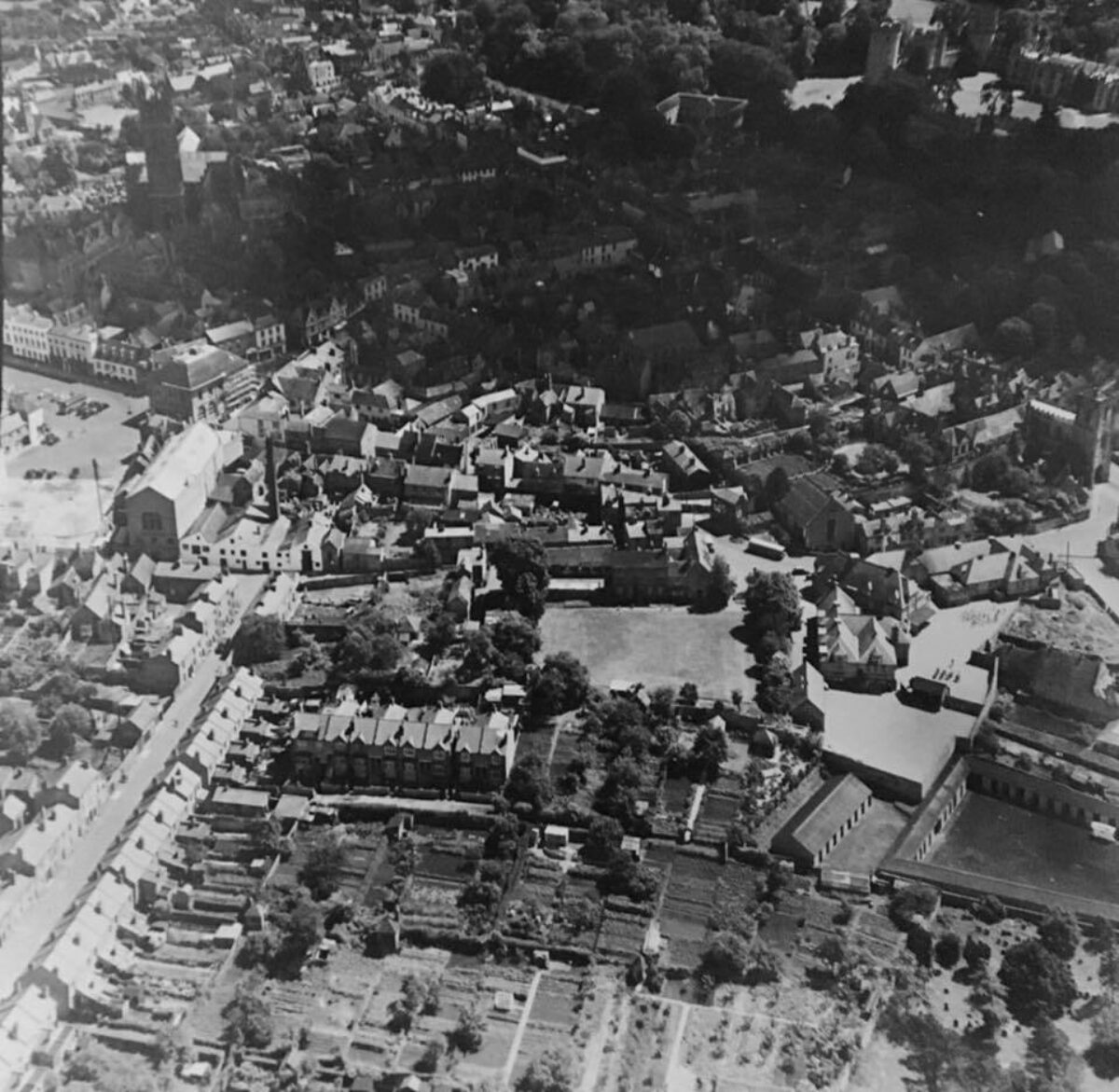
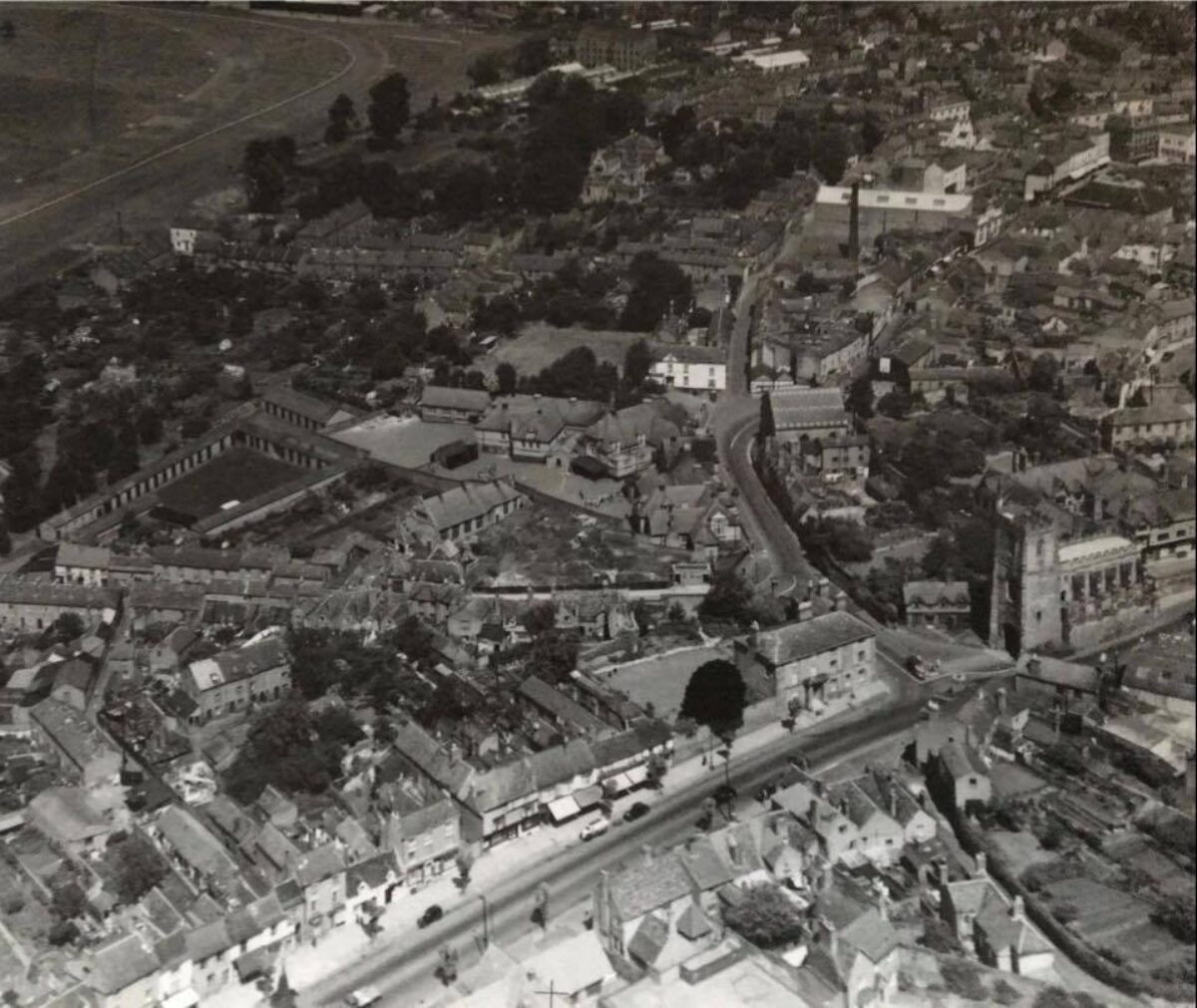
Hill Close Gardens are situated c 160m south-west of the centre of Warwick, to the south of Linen Street, an early C20 residential street which leads west from Bowling Green Street to Warwick Race Course on Lammas Field. The c 1.25ha site comprises nineteen individual plots containing an average of 500 square metres which are now (2000) divided by hedges of hawthorn, holly and privet, brick walls and iron railings. It is likely that all plots were originally enclosed by hedges, although individual ownership from the 1860s led to a greater diversity of boundary treatment. Today the majority of the site is enclosed by green-painted metal security fencing c 3m high.
The eastern plots which remain in separate ownership are enclosed to the north by a property in St Paul's Terrace, and to the south by the race course stables. To the east, these plots are today enclosed by temporary fences which separate them from the Westgate Hotel which is the subject of redevelopment. The site occupies a west-facing slope which falls from the eastern boundary to the Common Brook which forms the western boundary. From the higher, eastern plots there are extensive westerly views across the race course and properties in Linen Street to agricultural land west of Warwick.
Entrances and Approaches
The site is today (2000) approached from a service lane which leads c 50m south from Linen Street at a point c 30m east of its junction with St Paul's Terrace to reach a pair of wide, late C20 green-painted metal gates. Similar late C20 metal gates lead into the opposite end of the service lane from an area of open space, Bread and Meat Close, to the north-west of St Paul's church, which is approached from Friars Street (the A4189 road) c 130m south of the site. There is a further passage leading from Linen Street to a pedestrian gate in the perimeter fence at a point opposite the junction of Linen Street with Cocksparrow Street. A pedestrian gate from St Paul's Close gives access to the plots in the north-east corner of the site, while the eastern plots which remain in separate ownership from the remainder of the site are approached from a gate at the southern end of St Paul's Close. This leads to a service lane which extends c 40m south on the axis of St Paul's Close.
Gardens and Pleasure Grounds
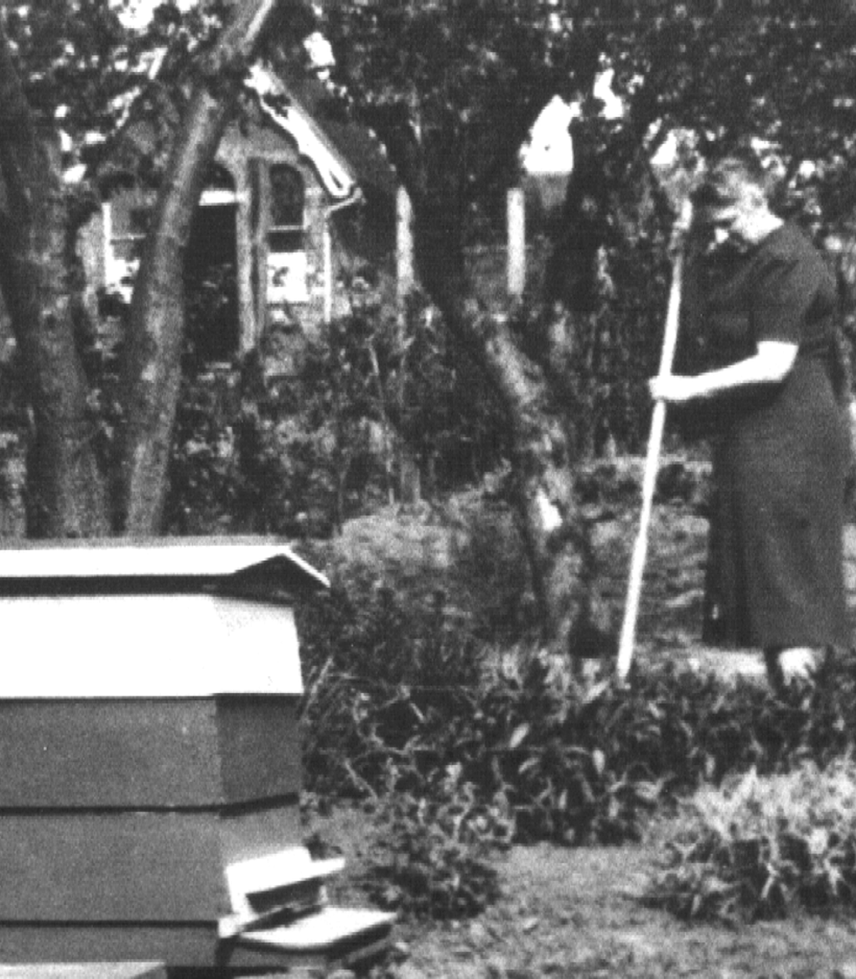
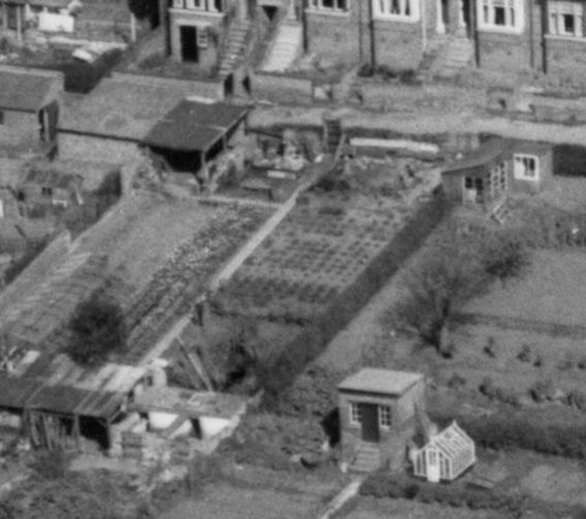
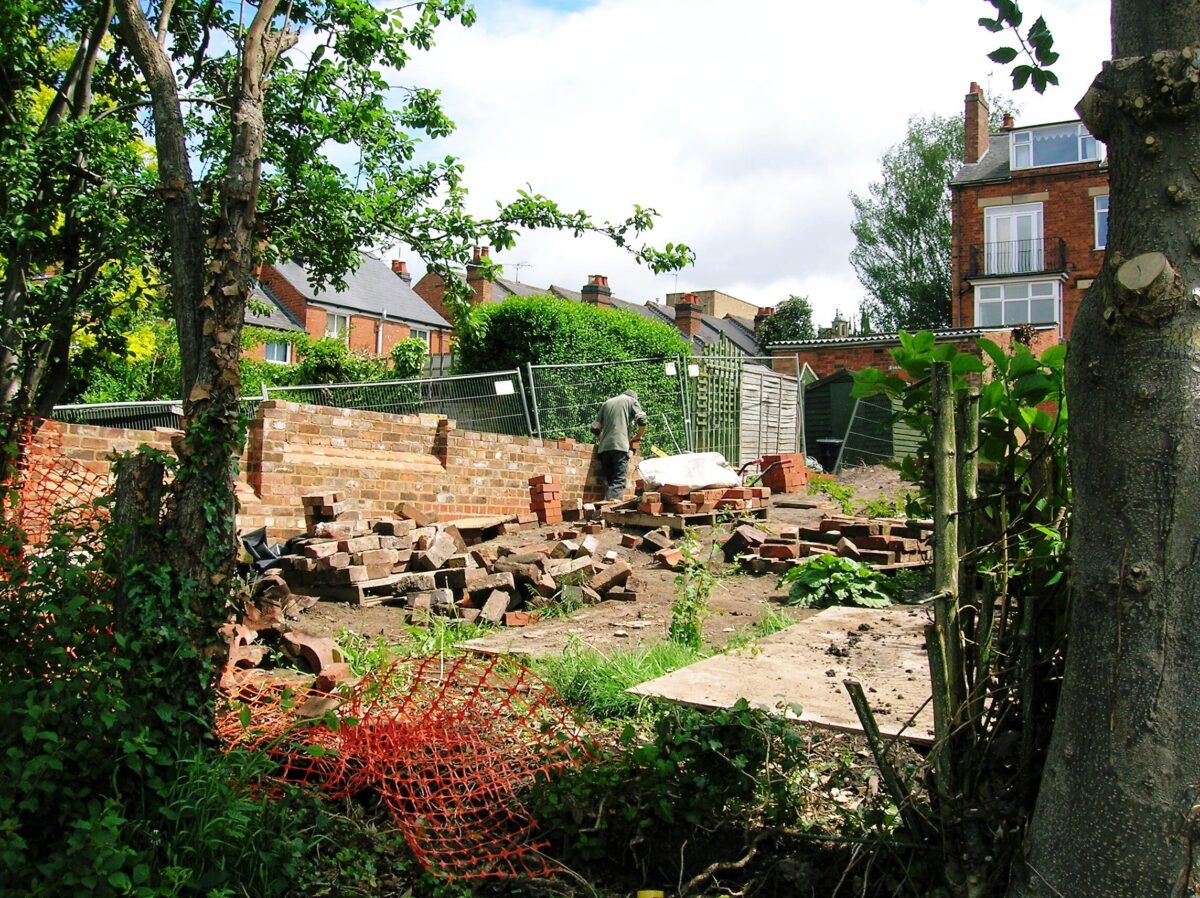
The garden plots are arranged in five blocks of various length which run from north to south. Service lanes or paths separate the three western blocks, while a further service lane runs between the two most easterly blocks. Plots in the second and third blocks from the east share a common boundary, and are not separated by a path. Late C20 clearance of undergrowth on the site has revealed many of the boundary hedges of hawthorn, privet and holly which enclosed the gardens, together with a C19 brick wall to the east of plot 25 and C19 spiked iron railings to the north of plot 12. The gardens retain a collection of mature standard fruit trees, some of which are of C19 origin, while some new fruit trees have been planted (late C20) on cleared plots in the positions of trees indicated on the 1886 OS map. A large mature vine is trained on metal posts and wires parallel to the southern boundary of plot 25.
Clearance has revealed the late C19 path layout in some gardens (plots 17, 18), while elsewhere the late C19 path layout is now (2000) in the process of reinstatement. The southern half of plot 19, adjacent to the southern boundary of the site, is today used as a nursery area, with the remains of a late C19 or early C20 range of brick and timber glasshouses and frames surviving on the west side of the plot. Some10m south-west of the western entrance to the site from Linen Street, a mid C20 metal and timber shed is today used as a garden office, while further mid and late C20 sheds stand on plots 23 and 24 which have remained in continuous cultivation to the present day. Today only the most western group of gardens, plots 29(31, remain in an overgrown condition.
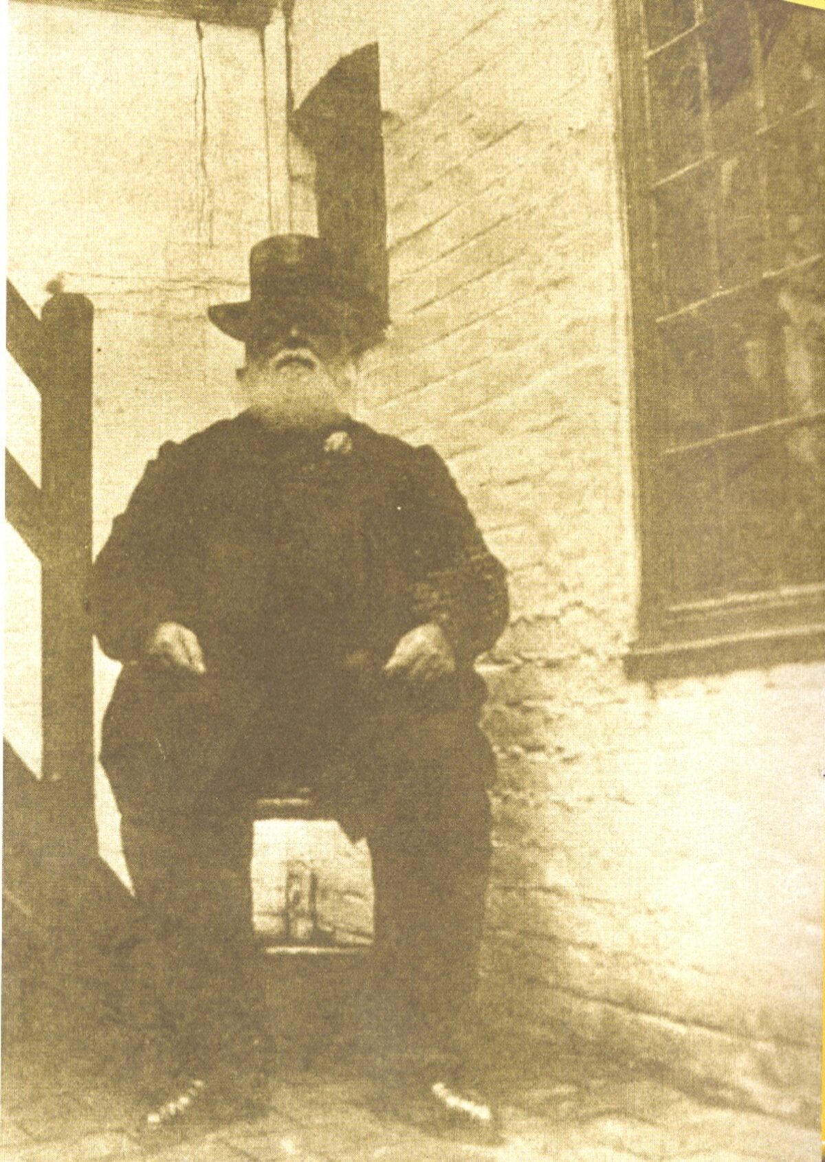
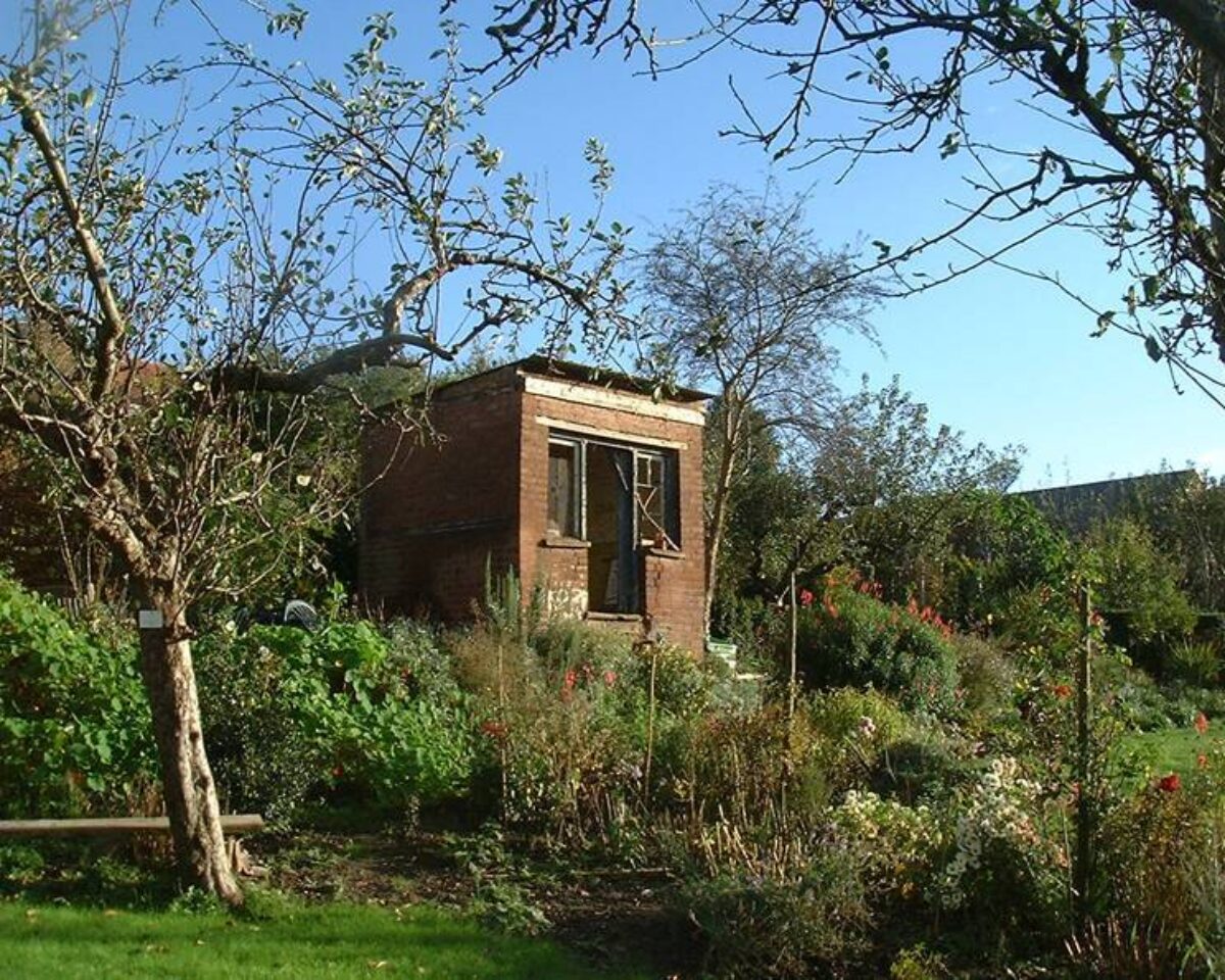
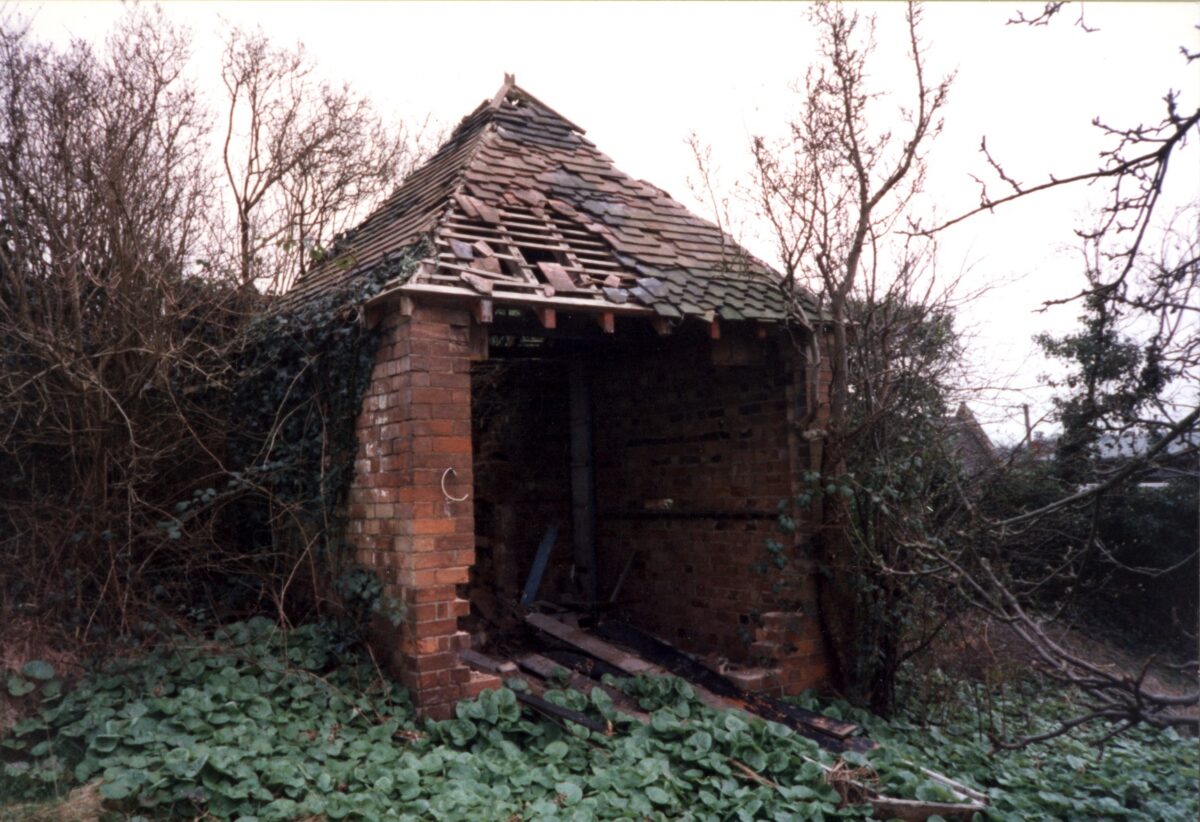
Eight brick-built summerhouses of various designs survive on the site. Of these, that on plot 18 dates from before 1851 (Board of Health map), and four on plots 7, 17, 19 and 25 from before 1866 (plan annexed to 1866 deed; three are listed grade II). Two further late C19 summerhouses are shown on the 1886 OS map (that on plot 5 listed grade II), while a further building was constructed c 1900. All the summerhouses occupy sites at the eastern end of their plot, so exploiting views across the race course and Common. The summerhouses were decorative buildings, equipped variously with fireplaces, stoves, gas lights, and, in one case, a 'patent earth commode'. The remains of two other buildings survive comprising a mid C19 brick bothy and a late C19 or early C20 brick-built pig-sty on plot 16.
Two C19 inventories show that the Hill Close Gardens had a recreational as well as a productive role, and this continued into the 1920s, although during the early C20 the growing of vegetables had increased in importance. This process was encouraged by the Dig for Victory campaign during the Second World War, and austerity during the 1940s and early 1950s. Today (2000) the gardens as revealed through late C20 clearance and reclamation closely reflect the layout shown on the 1886 OS map with summerhouses of various designs, mature fruit trees, complex path systems and terraces.
Maps
- Warwick Castle Estate Plan, 1786 (Warwickshire County Record Office)
- Warwick Castle Estate Plan, 1806 (Warwickshire County Record Office)
- Board of Health Map for Warwick, 1851 (Warwickshire County Record Office)
- Plan annexed to Deed of 1866 (CR2818), (Warwickshire County Record Office)
- Preliminary Masterplan for Hill Close Gardens, (Plinke Landscape 1998)
- OS 6" to 1 mile: 1st edition published 1887; 2nd edition published 1905; 3rd edition published 1926; 1938 edition
- OS 25" to 1 mile: 1st edition published 1886; 2nd edition published 1905; 3rd edition published 1925
Archival items
- Valuations of gardens and associated fittings and fixtures at Hill Close Gardens, 1878(1920 (CR2433/31), (Warwickshire County Record Office)
- Photograph, aerial view of Hill Close Gardens from the south-west, 1927 (private collection)
Description written: January 2000
Amended: May 2000
Edited: December 2000, March 2022
- Visitor Access, Directions & Contacts
Telephone
01926 493339Website
http://hillclosegardens.comAccess contact details
Opening Times
Winter opening hours
November to March
Gardens – Open Mon – Fri,
11 am – 4 pm
Last Gardens entry, 3.30 pm
Closed Sat – Sun
Tearoom – Closed
Summer opening hours
April to October
Open Every Day
11 am – 5 pm
Last Gardens entry, 4.30 pm
Tearoom – Open Weekends and Bank HolidaysFor more detailed information visit the Hill Close Gardens website or call 01926 493339 (Centre Manager).
Directions
Through the main Racecourse gate, off Friar Street in Warwick. Parking signposted.
- History
The following is from the Register of Parks and Gardens of Special Historic Interest. For the most up-to-date Register entry, please visit The National Heritage List for England (NHLE):
18th - 19th Century
In the late 18th and early 19th century, many larger towns had groups of small rented gardens forming a ring around the densely developed town centre. These pleasure garden plots were typically subdivided by hedges into individual gardens of between an eighth and a sixth of an acre. The gardens were laid out for ornament and the comfort of the owner and were used to grow a mixture of productive and ornamental plants (Lambert 1994). The expansion of towns in the 19th century destroyed the majority of the 18th-century rented garden sites, but a number of gardens of similar size and function were laid out in the first half of the 19th century, including Westbourne Road Leisure Gardens, Edgbaston, Birmingham (see description of this site elsewhere in the Register). A national survey (Lambert 1994) has indicated that very few of these sites survive either in their original form or, indeed, at all.
In the early 19th century Warwick was hemmed in by Warwick Castle and Castle Park (see description of this site elsewhere in the Register) to the south, the Common to the west, the grounds of Warwick Priory to the north, and St Nicholas' Meadow to the east, which restricted the expansion of the town. This resulted in much in-filling of the town centre and consequently a need for gardens on the edge of the town for those able to afford the roughly £100 (£50 for the freehold and about the same sum for fittings left by the previous owner) needed to acquire such an amenity. The addresses of the occupants of the Hill Close Gardens in the 19th century are predominantly in the part of the town where the degree of in-filling was greatest (Hodgetts 1994).
Before its development as gardens, the site was a field, Hilly Close, on Linen Hill, bounded on the north by Linen Lane (now, 2000, Linen Street), on the east by the gardens of houses in Cocksparrow (now Bowling Green Street), and on the west by the Common Brook, with further fields to the south. In the later 18th century it seems to have belonged to William Wilson. The Close was first divided into gardens in 1845, by Edward Wilson of Exhall, making it one of several similar plots of gardens around the town.
By 1851 the site has been named Hill Close Gardens, and the eastern side had been laid out with a service lane running south from Linen Street, off the eastern side of which were nine plots, and to the west, in two rows a further four plots, making a total of thirteen plots. The west side of the Close was still pasture but the fields to the south had become gardens and the churchyard of St Paul's church. The Common Brook had been realigned a little to the west, along its present course, although a small stream still ran at the foot of the hill (Hodgetts 1994).
In the 1860s, the whole Close was put on the market. An advertisement in the Warwick Advertiser (14 July 1864) refers to the sale by John Margetts of 'highly valuable building or garden land ... subdivided and let in 35 lots as garden ground, the whole 4a 3r 2p'. Through the sale, the land came into the ownership of Mark Philips of Welcombe, Stratford-upon-Avon. By this date the division of the gardens was complete, making a total of thirty-two plots surrounding the churchyard on three sides. This had involved the construction of two further lanes running south off Linen Street, parallel and to the west of the original access lane. Following the sale, most of the gardens were sold off as individual units until by 1877, only six still belonged to the Welcombe estate. This division of freehold made development of the site difficult (same source as above.
20th century
The basic layout of the site remained unchanged until the early 20th century when some housing development, St Paul's Close and St Paul's Terrace, encroached. This resulted in the loss of eight plots along the northern edge of the site, the previous layout of the gardens being reflected in the development. Additional stabling for the race course replaced the two plots in the south-east corner of the site in the mid-20th century, and caused a slight modification of the boundary of the adjacent garden to the north. This reduced the number of plots to the nineteen which exist today (2022).
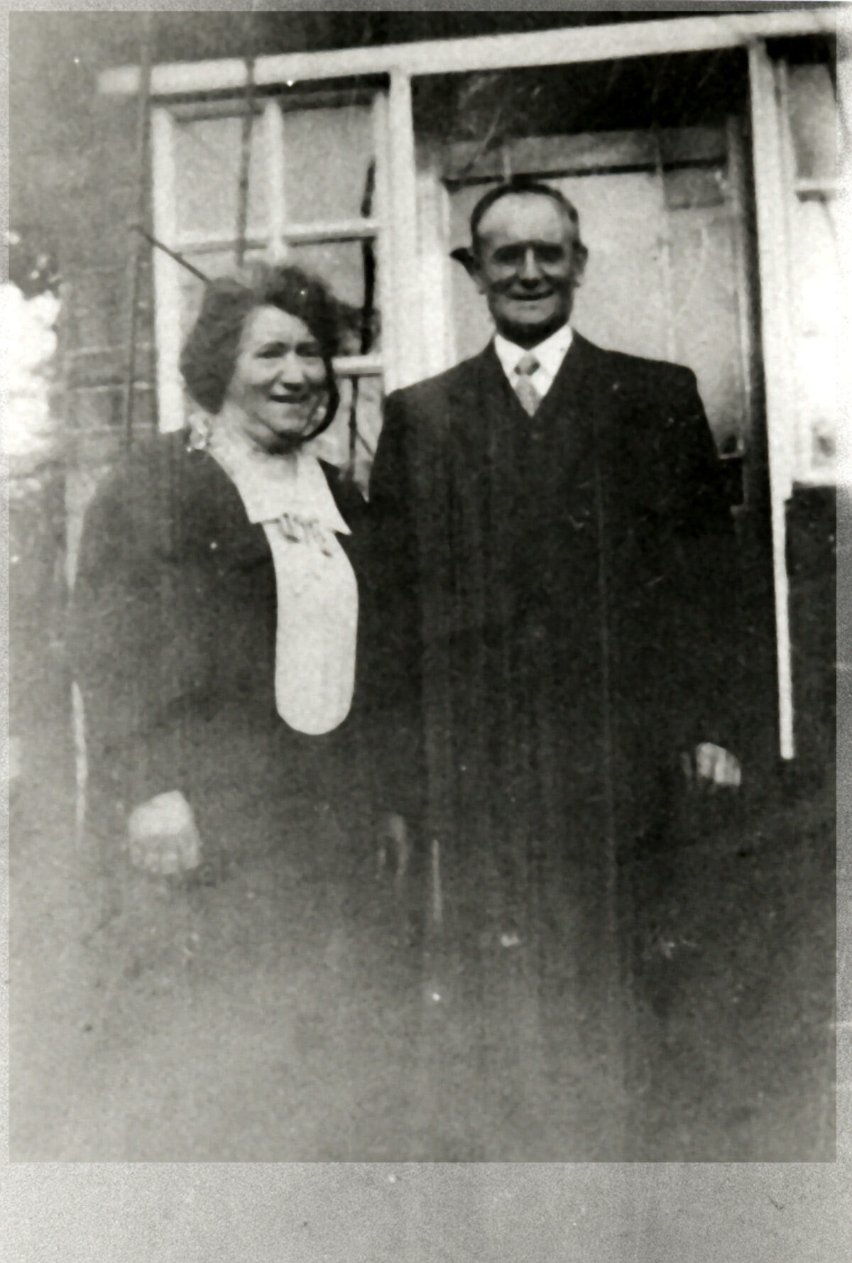
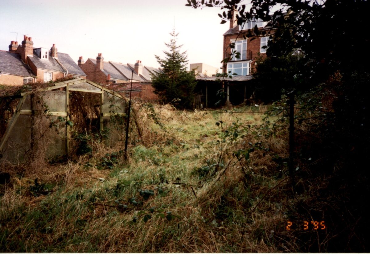
In the 1970s the freehold of the gardens, with the exception of the three eastern plots adjacent to the Bowling Green Hotel (later the Westgate Hotel), was gradually acquired by Warwick District Council for a housing and car-parking scheme; the gardens became almost entirely uncultivated. Planning consent for the housing lapsed in 1994 and, as a result of community interest, the District Council encouraged volunteers to undertake the clearance of the site, and a restoration plan was commissioned in 1997-8. One of the plots and a summerhouse adjacent to the former Westgate Hotel was restored for a television programme in 1999.
21st century
Today (2022) the site remains in divided ownership, the majority belonging to the local authority.
The survival rate for this type of site is extremely low, with most examples having disappeared under built development. Where they do survive, it is generally as allotment sites with hedges and buildings removed.
Period
- Post Medieval (1540 to 1901)
- Victorian (1837-1901)
- Features & Designations
Designations
The National Heritage List for England: Register of Parks and Gardens
- Reference: GD2307
- Grade: II*
The National Heritage List for England: Listed Building
- Reference: 3 (pre 1866) & 2 (pre 1886) summerhouses
- Grade: II
Features
- Hedge
- Description: Hedges of hawthorn, holly and privet.
- Lawn
- Summerhouse
- Description: Five summerhouses
- Latest Date:
- Key Information
Type
Garden
Purpose
Recreational/sport
Period
Post Medieval (1540 to 1901)
Survival
Extant
Hectares
1.25
Open to the public
Yes
- References
References
- {English Heritage Register of Parks and Gardens of Special Historic Interest}, (Swindon: English Heritage, 2008) [on CD-ROM] Historic England Register of Parks and Gardens of Special Historic Interest
- Warwickshire Gardens Trust preliminary report (1993) Hill Close Gardens, Linen Street, Warwick
- Hodgetts, C., (unpublished historical report 1994) Hill Close Gardens, Linen Street, Warwick (Historical report)
- Lambert, D., (English Heritage theme study 1994) Detached Town Gardens
- Garden History 24, no 2 (1996), pp 237-54 Garden History
- 14 July 1866; 5 January 1878; 16 March 1878; 30 March 1878 Warwick Advertiser