
Introduction
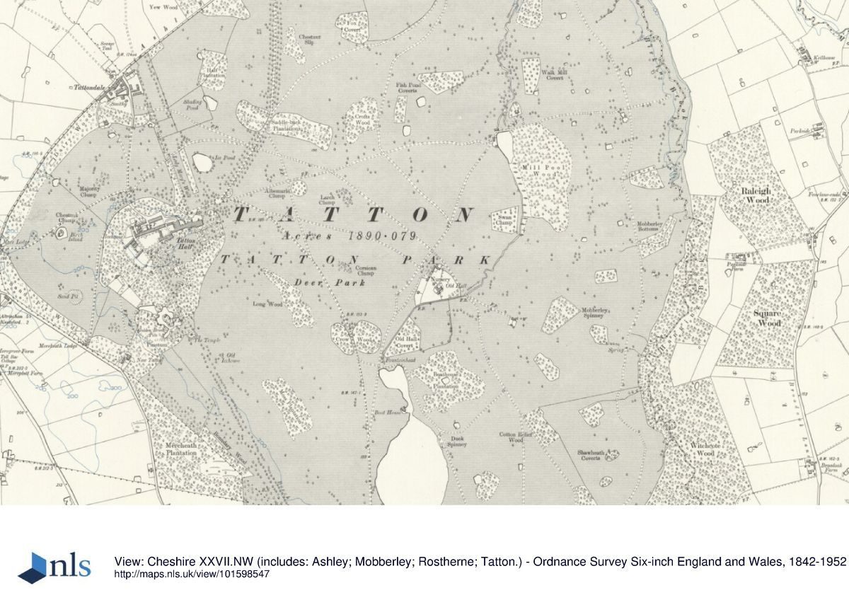
Tatton Park is an 18th-century landscape park which was originally a deer park. Within a total area of about 1000 hectares the site includes formal and informal gardens of the 19th and 20th centuries. These include the topiary garden, 'Charlotte's Lawn', an Italian garden, a rose garden and an arboretum. There is also the Walled Garden, the Japanese Garden, the Old Hall and the farm.
The following is from the Register of Parks and Gardens of Special Historic Interest. For the most up-to-date Register entry, please visit the The National Heritage List for England (NHLE):
www.historicengland.org.uk/listing/the-list
18th century and later gardens and an extensive landscape park associated with a country house; designers who worked here included Humphry Repton, John Webb, Lewis Wyatt and Joseph Paxton.
DESCRIPTION
LOCATION, AREA, BOUNDARIES, LANDFORM, SETTING
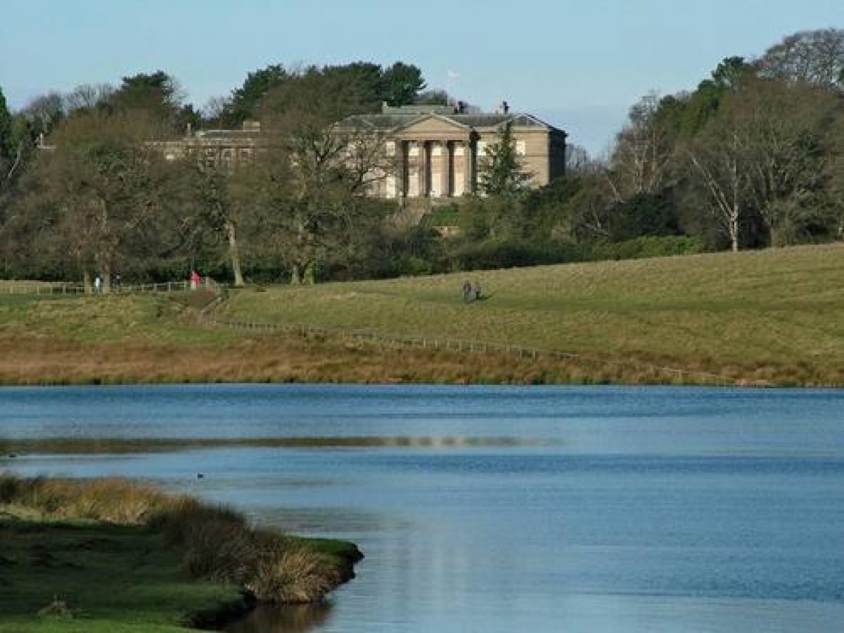
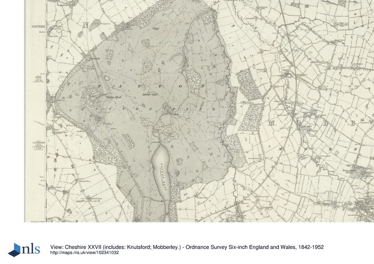
Tatton Hall lies 3km north of Knutsford, and the westernmost point of the park touches on the A50 from Knutsford to Altrincham and Manchester. To the south of this a section of the west park boundary, which here is walled, follows Mereheath Lane, which runs parallel with the A50. The long north-western boundary of the park follows Ashley Road, the minor road from the A50 to Ashley. For the most part the east boundary of the park follows a line just east of the Birkin Brook. The area here registered is c 1000ha.
ENTRANCES AND APPROACHES
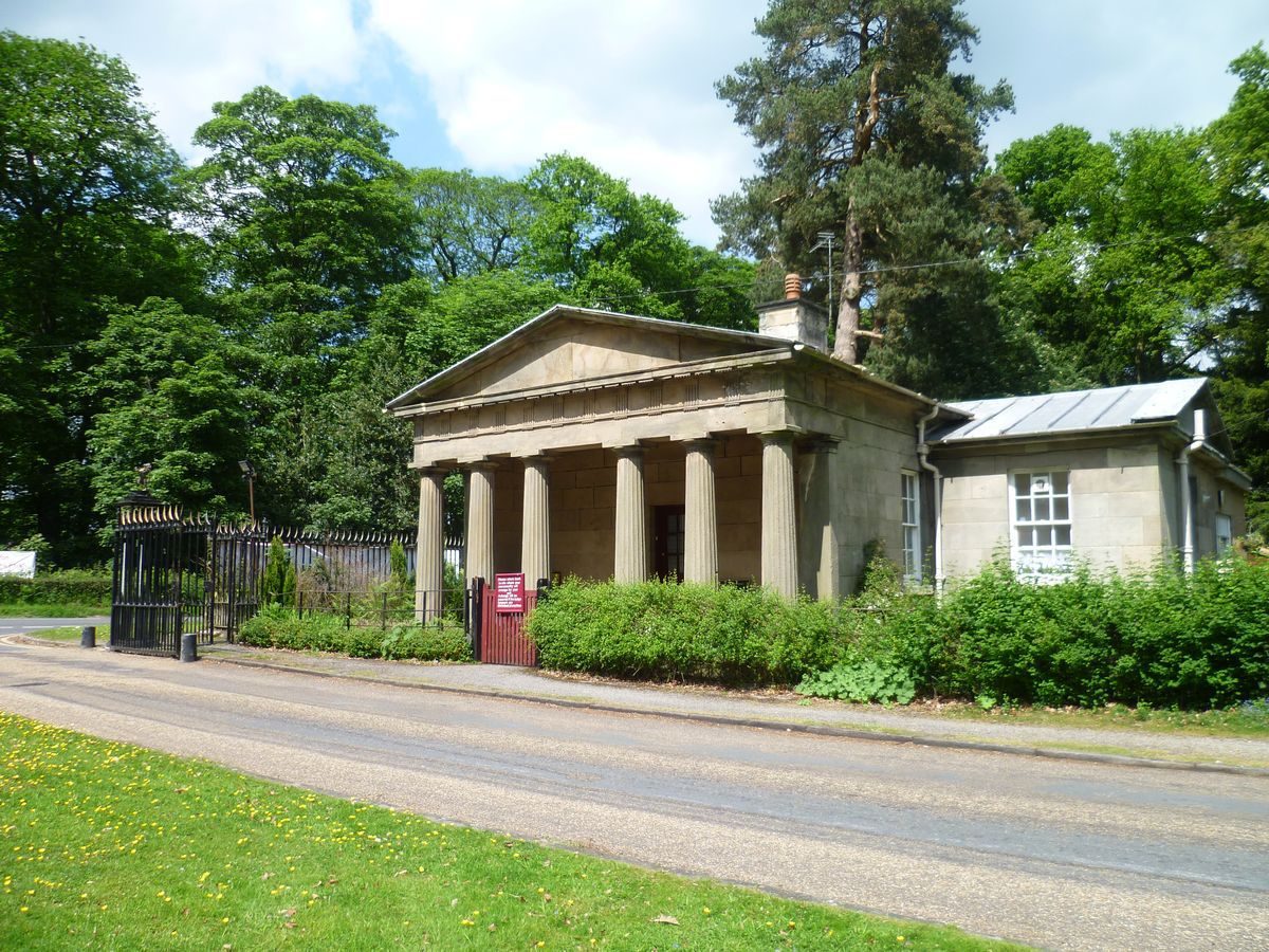
The main approach to the Hall in the late C20 is from the north, via the tree-lined Rostherne Drive (planted c 1883) which leads to car parks north-west of the Hall. Rostherne Lodge (listed grade II), at the north end of the drive, was built in 1835 to a design by James Hakewill. It is a single-storey ashlar building with a hexastyle Greek Doric portico. West of the Hall are two other lodges. Mere Lodge (listed grade II), a two-storey octagonal building of ashlar and rendered brick, was designed in 1822 by Lewis Wyatt (1777-1853). Mereheath Lodge, 500m to the south on Mereheath Lane, is an early or mid C19 brick and stucco building with an angled facade towards the drive. The main exit from Tatton in the later C20 is south through the park via the 3km long Knutsford drive, down the west side of Tatton Mere. Knutsford Lodge (listed grade II*) at the south end of the drive, which incorporates a Doric triumphal arch, was added by Lewis Wyatt in 1811 following a suggestion by Humphry Repton and an initial sketch by Wyatt?s uncle Samuel Wyatt. The Knutsford drive replaced that which ran up the Broad Walk, which was probably established in the early C18 when the Hall was rebuilt. In 1787 Lady Mary?s Walk served as a drive approaching the Hall from the north.
PRINCIPAL BUILDING
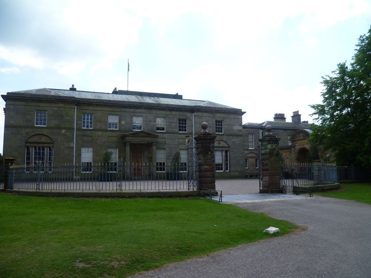
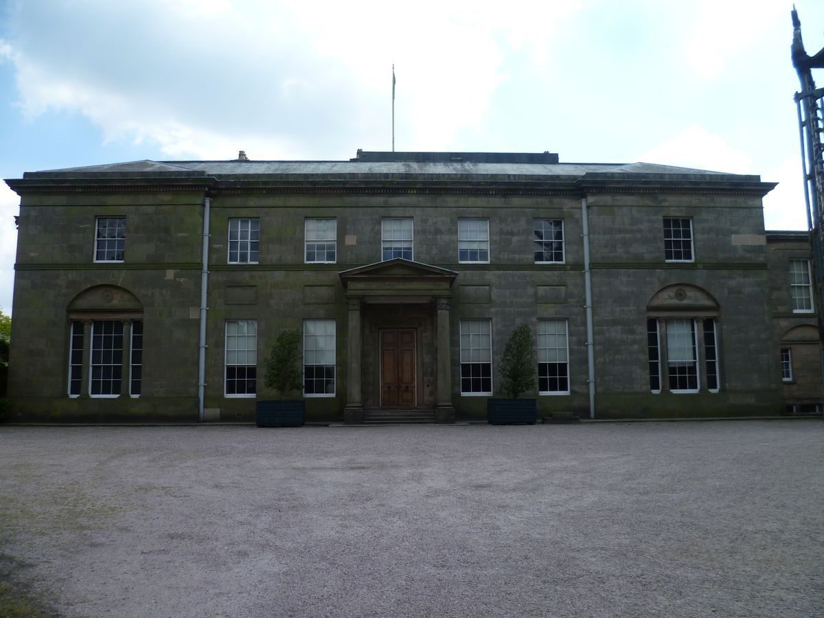
When John Egerton came to live at Tatton a new house, nearing completion in 1715, was built to a design of John Barker (d 1727). It stood on a low hill with views south-east across the park 1km west of the Old Hall. Its cellar survives in the present house, as do parts of the additions made to that house c 1760 by T F Pritchard (d 1777). As seen today however Tatton Hall (listed grade I) - a two-storey ashlar house with a seven-bay south front, five-bay east side and seven-bay colonnaded west wing - dates largely from the period after 1780 when Samuel Wyatt began to rebuild the house in the neo-classical manner. The work came to a halt in 1791 but between 1806 and c 1813 the main block was completed, on a reduced scale, by Samuel Wyatt's nephew Lewis Wyatt. In 1860 the second storey was added to the west, family wing by Joseph Paxton?s son-in-law G H Stokes. Other additions were made in the 1880s.
North-west of the Hall, and north of the kitchen gardens, is the tall brick stable block (listed grade II) designed in the late C18 by Samuel Wyatt.
Tatton Old Hall (listed grade II*) lies adjacent to Tatton Brook. It is a timber-framed building of c 1520 with later extensions encased in brick c 1700. Adjoining the Old Hall is a C16 cruck barn (listed grade II) moved here in the later C20 from Woodhouse Farm, near Frodsham, Cheshire. Immediately north of the Old Hall are the earthworks of the deserted village of Tatton Green.
GARDENS AND PLEASURE GROUNDS
Extending north-west for c 300m from the new Hall's railed north forecourt is an avenue, Lady Mary's Walk, present by 1750. This frames a vista from the house to Winter Hill on the horizon. East of the Hall is a croquet lawn.
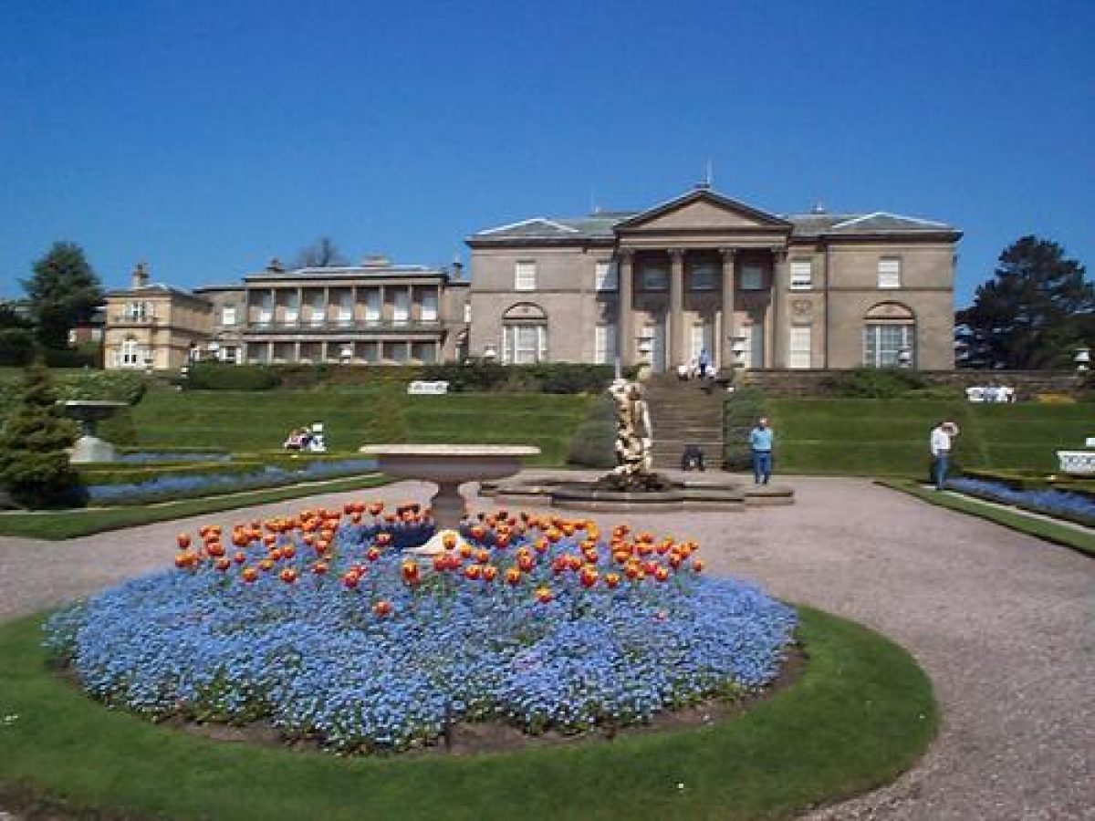
The main formal garden (elements listed grade II) lies below the grass terrace along the south front; a terraced Italianate Garden it has a balustraded demi-lune at the end of the main north/south axial path, urns, and elaborate parterres. A square pool in the lower terrace contains a statue of Triton. Although possibly designed in the later 1850s by Joseph Paxton (1803-65), the garden was apparently not built until the early 1880s. The terracotta balustrades may have been manufactured in 1887 by the Ruabon Terra Cotta Works. The garden was restored in 1986.
The pleasure grounds stretch south-east of the Italianate Garden for c 200m, and comprise shrubberies and specimen trees with walks as well as a number of discrete, named, individual gardens. In the shrubbery 30m south of the bottom of the Italianate Garden is the small Mercury Pool; a second small pool, the Leech Pool, lies 70m to the south-west. The Leech Pool has a fountain. Some 20m north of the Leech Pool is a beech maze, already established by 1795.
Some 150m to the west of the Italianate Garden, to the south of the kitchen gardens, is a lawn with shrubs. In the centre is Lady Charlotte?s Fountain (listed grade II) of c 1860, and 150m to the south-west Lady Charlotte's Arbour, a treillage seat designed by Lewis Wyatt in 1814. These are the surviving elements of a kidney-shaped flower garden designed in 1814 by Lewis Wyatt, possibly in association with John Webb (1854-1828). In 1818 Wyatt added the tall, seven-bay, sandstone Conservatory (listed grade II) on the north-east side of the garden. In 1859 the tall, red-brick, L-plan Fernery (listed grade II*) was built immediately to its north-west to a design by Joseph Paxton, possibly with G H Stokes. A small aviary originally lay between these two buildings. Enclosing lawns to the immediate south and west of the Fernery, and north of Wyatt's garden of 1814, are the L-Borders, flower beds divided by broad yew buttresses into deep bays each with its own colour scheme.
To the south-west of the L-Borders, on the south side of the kitchen gardens, is the Rose Garden, a formal enclosed courtyard with a pergola, statuary, a sunken plunge pool and, on its north side, a tea house. This garden was laid out c 1913 for Lady Anna Egerton. To its south it connects with the Tower Garden, a compartment probably created in the 1930s using yew hedges and brick walls around a crenellated two-storey tower of the mid C18, probably a park eyecatcher. A seat with a tiled roof is built across one corner of the garden. Running past the east side of these two compartments is the north end of the Broad Walk, a straight 150m long gravel path at the south end of which is a copy on a reduced scale of the Choragic Monument of Lysicrates in Athens (listed grade II), erected between 1830 and 1834 by William Cole to commemorate Wilbraham Egerton's Grand Tour. South of the monument, and across the ha-ha which surrounds the pleasure grounds, the line of the Broad Walk continues south through the park as the Beech Avenue. Within the gardens and midway down the east side of the Broad Walk is the African Hut, a round thatched shelter, probably erected for the fourth Baron.
On the west side of the southern end of the Broad Walk is Golden Brooks Pit, an irregular ornamental pool c 30m in diameter, with arms to the north-west and south-west. This, originating as a pit for brick clay and present by 1750, was landscaped and planted in the later C19. In 1910 the southern section was transformed into the Japanese Gardens by the third Baron Egerton, who brought over Japanese workmen to undertake the design and layout. Structures include stone lanterns, bridges, a thatched tea house, and an imported C19 Shinto shrine (listed grade II). To the west of the Japanese Garden is a Pinetum or Arboretum, probably developed from the early C19.
PARK
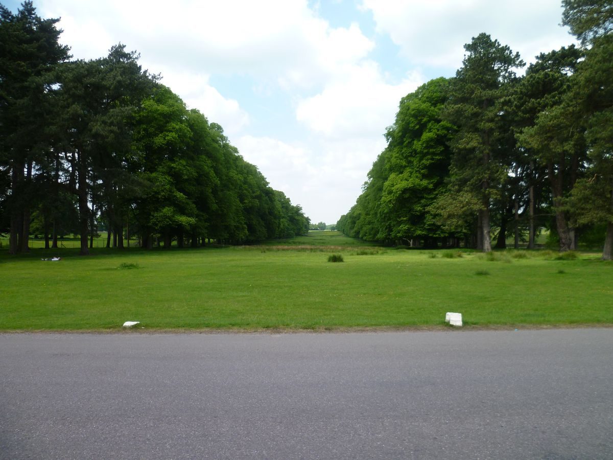
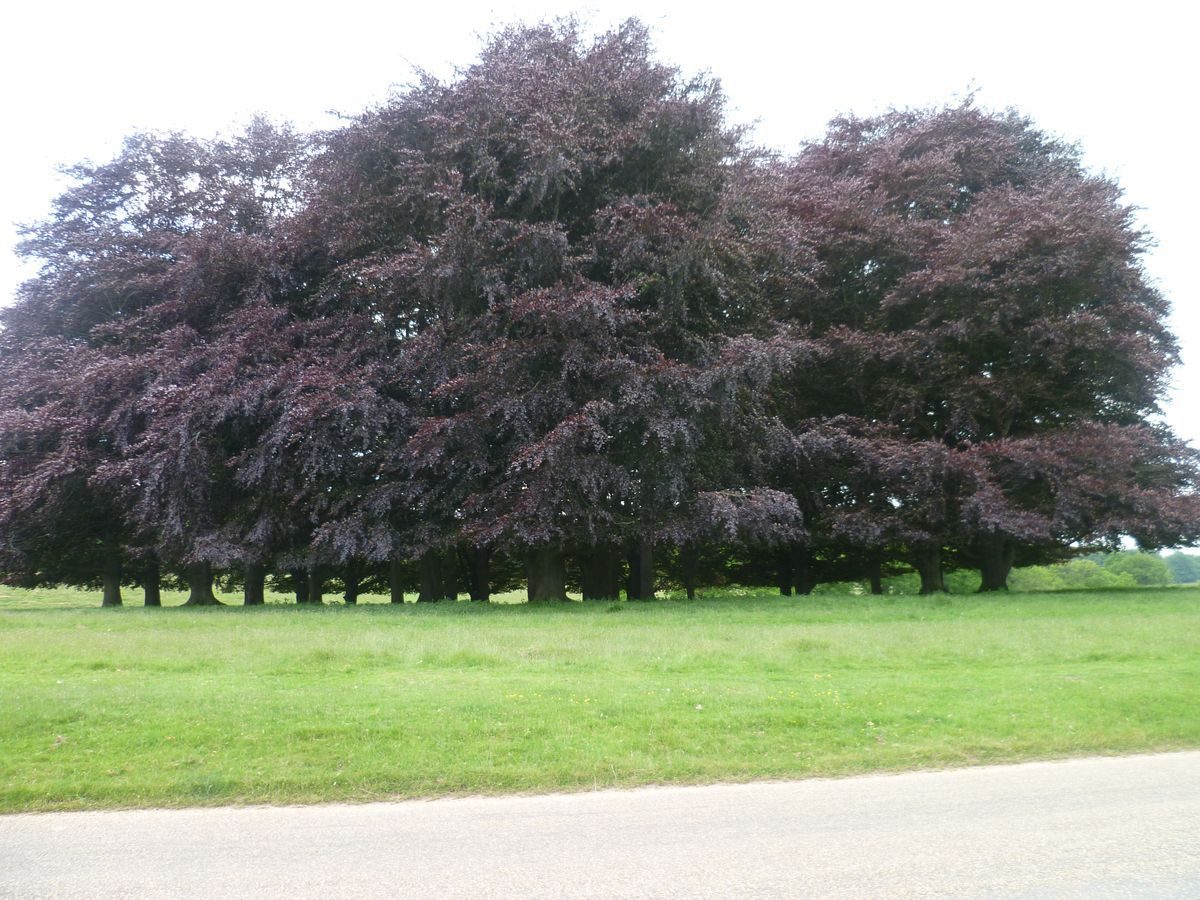
Tatton Hall lies towards the western edge of an extensive park, some 5km from north to south and over 3km from east to west. Most of the park remains as permanent pasture with many mature specimen trees, although a 500m wide strip down its eastern side, east of the Tatton Brook, is divided into fields and farmed. Much of the perimeter is planted with woodland. The earliest feature of the park's designed landscape is the Broad Walk or Beech Avenue which runs up the west side of the southern half of the park. Originally of alternate beech and Scots pine this was perhaps planted in 1737. It was certainly present by 1740.
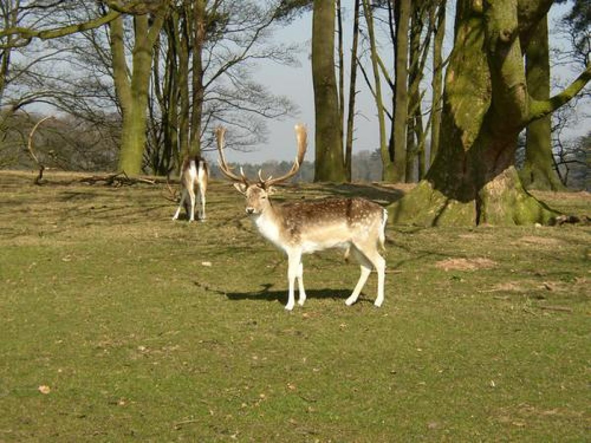
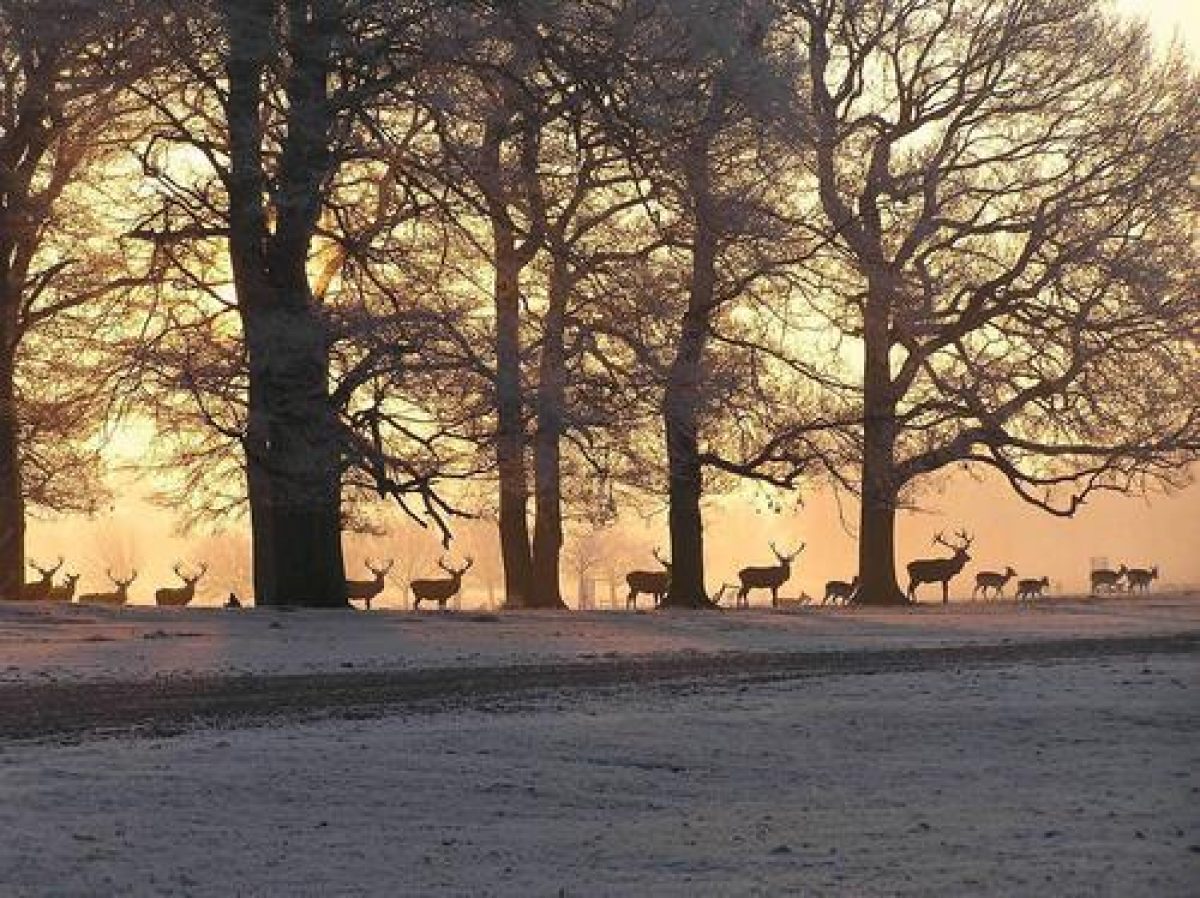
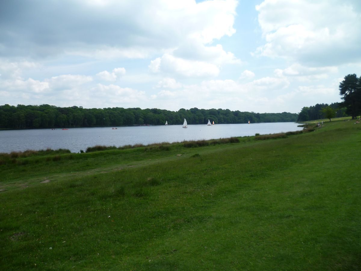
The main features of the southern half of the park are the two meres: Melchett Mere, and to its south the 1.6km long Tatton Mere. Midway down the east bank of the latter is a sailing centre. The main area of open grassland in the park lies 1km east of the Hall; this was the area used in the early 1940s as the drop zone by the Parachute Training School. To the north-east of this is the fenced deer sanctuary. The park wall cuts off the northernmost 500m of the modern park, which was presumably added to it at a later date. The park contains numerous ponds, mostly small. The largest, c 150m in diameter, is the Ice Pond 300m north of the Hall.
The late C18 brick-built Home Farm complex lies c 500m north of the Hall on the south side of Ashley Road. Several of the buildings are listed grade II. In the 1990s Home Farm housed a working farm museum.
In the later Middle Ages and early modern period there was a deer park at Tatton north-east of the Old Hall. The Egertons began to take land in hand in order to create a landscape park in the later 1740s, and the process continued through the 1750s and 1760s. In 1757 and 1759 Lancelot Brown (1716-83) was in correspondence with Samuel Egerton, although there is no evidence he worked on the park here. Similarly, although William Emes prepared a scheme in 1768 there is again no evidence anything was done. Humphry Repton (1752-1818) visited Tatton in late 1791, and soon afterwards presented his improvement proposals in a Red Book. His implemented proposals included replacing the drive up the Broad Walk with one from an architecturally emphasised lodge at the Knutsford entrance, and planting the tree screen to conceal the stables, kitchen garden and service courtyard. He also recommended extending the two meres in the park and planting around them to give the impression of a single sheet of water when viewed from the Hall. Turn Mere, nearer the Hall, was drained in 1816 under the direction of John Webb, who in 1818 was credited with 'improvements' at Tatton (National Trust 1978, 39).The modern upper mere, slightly south of the earlier one, formed in 1922 following subsidence caused by brine extraction and is continuing to grow. It was named Melchett Mere by Lord Egerton after Lord Melchett, the chairman of the firm responsible. During the Second World War Tatton park housed a dispersal airfield and No 1 Parachute Training School. Among those trained were 10,000 SOE agents. Structures of the 1939-45 period include low concrete bridge parapets on aircraft dispersal tracks and balloon mooring rings.
Licence to establish a deer park at Tatton was granted in 1290.
KITCHEN GARDEN
The walled kitchen gardens lie west of the Hall, and occupy three compartments. The main walled garden lies west of the Hall, and overall is c 140m long from east to west and c 70m wide at its west end, which is c 20m wider than the east end. The Fernery by Paxton is built along the inside of its south wall, with the Lewis Wyatt Conservatory outside the garden to its east. Against the northern wall of that compartment is the C19 Head Gardener's Cottage, two C19 adjoining lean-to glasshouses, and the bothy. There is evidence of other structures within this compartment, including an Orchid House by Samuel Hemmer. Adjoining that garden to the west are two further compartments, overall c 75m east/west by c 120m north/south. Here there are mid C19 pit houses and a range of fig houses or vinery.
In the 1750s there was a single long wall running west from the Hall with gardens to either side. It is believed (Thoday 1994) that the gardens were developed into their present form c 1818-19, at the time when Lewis Wyatt?s flower garden was under construction to the south of the kitchen garden.
REFERENCES
G Ormerod, The History of Cheshire i, (1816-19), pp 344-8
Country Life, 19 (24 March 1906), pp 414-21; 136 (16 July 1964), pp 162-5; (30 July 1964), pp 292-6; 159 (8 April 1976), pp 884-6
Tatton Park, guidebook, (National Trust 1978)
Tatton Park, (Manpower Services Commission nd (1980s))
L Cantor, The Medieval Parks of England: A Gazetteer (1983), p 17
P de Figueiredo and J Treuherz, Cheshire Country Houses (1988), pp 166-71
Tatton Park: The Gardens, guidebook, (National Trust 1988)
N Higham and P Aylett, A Short History of Tatton, (typescript nd, c 1990) (copy held by NT at Tatton)
Wartime Tatton 1939-45: Full Story and Trail Guide, (nd, c 1990)
G Jackson-Stops, An English Arcadia 1600-1900 (1992), pp 118-20
The Restoration of Tatton Hall Walled Garden, (Thoday Associates 1994)
Restoration Plan for Walled Garden (Submission to HLF 1999)
Maps
OS 6" to 1 mile: Cheshire sheet 18, 1st edition published 1882
Cheshire sheet 27, 1st edition published 1882
OS 25" to 1 mile: Cheshire sheet 27.5, 2nd edition published 1898
Archival items
The National Trust holds copies of various documents at Tatton, including:
William Emes, A Plan of Intended Improvements at Tatton Park ...1768
J Earl, A Map of Tatton Hall ...1787
An important collection of survey drawings held at Tatton are currently (1999) being catalogued by Tim Knox.
(Information from J R Gibbs, National Trust)
Description written: September 1997
Register Inspector: PAS
Edited: April 1999
- Visitor Access, Directions & Contacts
Telephone
01625 374400Access contact details
Owners
The National Trust
Heelis, Kemble Drive, Swindon, SN2 2NA
- History
The site was originally a deer park, which dated from 1290. A new house was built in 1716 and Humphry Repton redesigned the park during the 18th century. It was during this time that the walled garden and first glasshouses were created.
The first formal garden to be created was 'Charlottes Lawn'. It was designed by Lewis Wyatt in 1814. Other gardens included the Italian garden designed by Joseph Paxton at the front of the house and the rose garden which was created in 1913.
In 1958 the last remaining family member bequeathed the estate to the National Trust. In 1960 a lease was drawn up with Cheshire County Council. The Council continue to manage and finance the site on behalf of the National Trust. Since the 1960s the Council and the Tatton Park Trust have systematically restored various parts of the gardens including the walled garden and glasshouses and the Japanese garden.
The following is from the Register of Parks and Gardens of Special Historic Interest. For the most up-to-date Register entry, please visit the The National Heritage List for England (NHLE):
www.historicengland.org.uk/listing/the-list
CHRONOLOGY OF HISTORIC DEVELOPMENT
In 1598 Tatton was bought by Sir Thomas Egerton, Lord Chancellor of England, created Viscount Brackley by James I. His grandson Thomas, the second Earl of Bridgewater, settled Tatton on his third son Thomas, although not until the time of Thomas's son John Egerton (1679-1724) did the family reside here, in a new house built in the first quarter of the 18th century. John's son and heir died in 1738, leaving the family fortunes much depleted. In 1758 however the enormous fortune of Samuel Hill, the brother of John Egerton's wife Elizabeth, passed to Samuel (d 1780), their second son. It was that legacy which provided the wherewithal for the later 18th century rebuilding of Tatton. Most of the work was done for William Egerton (d 1806) and his son Wilbraham (d 1856). In 1791 Humphry Repton (1752-1818) advised on landscaping the park. Wilbraham Egerton was succeeded by his son William (d 1883); he, like his father and Samuel Egerton, served as MP, and in 1859 was created Baron Egerton of Tatton. His heir was his son Wilbraham, the second Baron, on whose death in 1909 Tatton passed to his younger brother Alan de Tatton Egerton (d 1920), under whom the Japanese garden was created. On the death of his son Maurice, the fourth Baron, the Barony of Egerton became extinct and in 1958 Tatton passed to the National Trust. It is now (1997) financed and managed by Cheshire County Council on behalf of the National Trust.
Period
18th Century (1701 to 1800)
- Associated People
- Features & Designations
Designations
The National Heritage List for England: Register of Parks and Gardens
- Reference: GD1477
- Grade: II*
Features
- Hedge
- Maze
- Topiary
- Prospect Tower
- Description: Located in the Tower Garden. It was used to watch over the sheep in the adjacent parkland.
- Tea House
- Description: Located in the rose garden.
- Walk
- Description: The Broad Walk.
- Temple
- Description: The Choragic Monument.
- Garden Building
- Description: An African hut which was built in the early-20th century to remind Maurice Egerton of his estate in Kenya.
- Lake
- Great House (featured building)
- Earliest Date:
- Latest Date:
- Key Information
Type
Estate
Purpose
Ornamental
Principal Building
Domestic / Residential
Period
18th Century (1701 to 1800)
Survival
Extant
Hectares
1000
Open to the public
Yes
Civil Parish
Knutsford
- References
References
- {English Heritage Register of Parks and Gardens of Special Historic Interest} (Swindon: English Heritage 2008) [on CD-ROM] Historic England Register of Parks and Gardens of Special Historic Interest
- Davies, J. {Landscape Gardening in Ormerod's 'History of Cheshire'} (Cheshire Gardens Trust, 2011) Landscape Gardening in Ormerod's 'History of Cheshire'
- Ormerod, G {The History of the County Palatine and City of Chester ... incorporated with a republication of King's Vale, Royal, and Leycester's Cheshire Antiquities. L.P} (London: Lackington, 1819) The History of the County Palatine and City of Chester ... incorporated with a republication of King's Vale, Royal, and Leycester's Cheshire Antiquities. L.P