Introduction
Rushton Hall has early 20th-century formal terraced gardens designed by Thomas Mawson. The house is currently (2008) a hotel and sits in wider parkland, under separate ownership, with features dating back to the 16th century and later. The 16th-century Triangular Lodge in the former parkland is owned by English Heritage and is open to the public.
Terrain
Undulating.
The following is from the Register of Parks and Gardens of Special Historic Interest. For the most up-to-date Register entry, please visit the The National Heritage List for England (NHLE):
www.historicengland.org.uk/lis...
Early 20th-century formal gardens designed by Thomas Mawson, together with pleasure grounds and a park of 16th-century origin, which retain features dating from the 16th to the 19th century.
LOCATION, AREA, BOUNDARIES, LANDFORM, SETTING
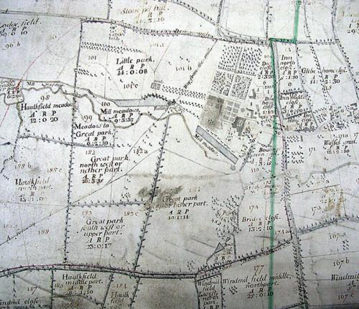
Rushton Hall is situated c 4km north-west of Kettering, and c 0.5km west of Rushton. The c 92ha site which comprises c 12ha of formal gardens, pleasure grounds, and kitchen gardens, and c 80ha of park, is bounded to the north, east, and south by early C19 stone walls which separate it from minor roads, while to the west if adjoins agricultural land from which it is divided by similar C19 stone walls. The undulating site is crossed by the River Ise, which flows from west to east c 400m south of the Hall. The river flows through a shallow valley from which the ground rises towards the northern and southern boundaries. There are extensive views west and south-west from high ground in the pleasure grounds near the northern boundary of the park, while from the Triangular Lodge at the north-west corner of the park there are views east-south-east towards the Hall and gardens.
The C16 park extended beyond the present western boundary, which was established in the early C19, and included the site of Sir Thomas Tresham's Hawkfield Tower which is believed to correspond to the site of the C19 Park Cottage (outside the site here registered) (D Pain pers comm, 2002). The present south and east boundaries of the park were established as the result of early C19 road diversions promoted by William Hope.
ENTRANCES AND APPROACHES
Rushton Hall is approached from Desborough Road, which forms the eastern boundary of the site, at a point c 120m south of the junction of Desborough Road and High Street. The entrance comprises a pair of early C19 wrought-iron carriage gates with spear-head finials which are supported by a pair of square stone piers, the faces of which are ornamented with blind tracery arches under crocketted finials. Sections of similar railings extend north and south to a further pair of stone piers with square caps, which immediately adjoin a pair of single-storey Gothic-style lodges (all listed grade II). The lodges are constructed in ironstone ashlar with limestone dressings and gothic ornaments including pilasters, pinnacles, and a gothic frieze. The facade of each lodge fronting the drive has a full-width pediment with a centrally placed tracery roundel placed above the central, recessed gothic-arched porch. Each lodge is adjoined by stone quadrant walls which extend to the park wall which forms the boundary with Desborough Road.
From the entrance, the tarmac drive sweeps west, south-west, and north-west through pleasure grounds comprising lawns, evergreen shrubbery, and specimen trees to approach the carriage turn below the east facade of the Hall. Some 110m west of the lodges, a service drive leads north from the main drive to pass to the west of the Dower House (listed grade II*), an early C18 brick and stone house. Today (2002) the service drive provides access to two late C20 car parks, but formerly continued west to reach the early C19 stables (converted to domestic use late C20, listed grade II), with a further branch leading east to the early C19 farm buildings. A C16 square-plan dovecote of stone construction (listed grade II) stands c 20m east of the stables. The early C19 stables and farm buildings replace a group of C17 structures which are shown in Winstanley¿s mid C18 drawing standing immediately north-east of the Hall; these were demolished c 1790 when the walled forecourt shown by Winstanley was removed and the present lawns laid out. The entrance, lodges, and drives were constructed in the early C19 for William Hope following the diversion of Desborough Road from its earlier course which lay c 120m west. Thomas Mawson's early C20 proposal for a formal approach from the east was not implemented (Mawson 1926).
PRINCIPAL BUILDING
Rushton Hall (listed grade I) stands towards the centre of the site on an artificially levelled terrace to the north of the River Ise. The Hall is constructed in limestone ashlar under Collyweston stone slate roofs and encloses a central courtyard, with two-storey gabled wings to the south, west, and north and a single-storey loggia to the east. The loggia has a flat roof enclosed by a parapet ornamented with Gothic-style quatrefoil balustrades, and a centrally placed arched doorway. To north and south the loggia is flanked by two-storey mullion and transom canted bay windows placed beneath pinnacled gables which terminate the north and south wings. The north, west, and south wings are lit by mullion and transom windows, while attic windows are placed in elaborate pinnacled dormer gables.
The Hall was developed in the late C16 and early C17 from an existing early C16 house which stood on a site at the south-west corner of the present building (RCHME 1996). The C17 house followed the plan of the present mansion, but in the early and mid C19 William Hope made extensive alterations to the south range in order to create two new drawing rooms behind a new garden facade. A major programme of restoration, repair, and improvement was undertaken for J J van Alen in the early C20 by J A Gotch (CL 1909; Mawson 1926).
GARDENS AND PLEASURE GROUNDS
The formal gardens are situated to the south and west of the Hall, and within the central courtyard, while informal pleasure grounds are situated to the east and north-west. A further area of pleasure grounds extends south-east into the park c 400m south-east of the Hall.
From the carriage turn below the east facade of the Hall, a tarmac terrace walk flanked by lawns and mixed borders returns below the south facade. This terrace is supported by a coursed stone wall broken at regular intervals by ashlar piers. The retaining wall is terminated to east and west by a flight of stone-flagged steps (formerly edged with balustrades, CL 1909) which descend to a south-facing gently sloping lawn, which is itself retained to the south-west by a further stone wall. From the lawn further, similar flights of stone steps, aligned with those descending from the upper terrace, descend south to reach a walk extending along the north-east bank of a rectangular canal which forms the boundary between the gardens and the park. The bank of the canal is planted with mature specimen London planes, together with more recent trees which obscure the view of the water from the terraces and Hall. The south terrace, retaining walls, and steps form part of the formal gardens designed c 1900 by Thomas Mawson (Mawson 1926); these occupy the site of C17 formal walled gardens and kitchen gardens which are shown on Winstanley's mid C18 view of Rushton. The canal, which extends c 300m from north-west to south-east, appears to be of C16 or C17 construction and is also shown in its present form on the Winstanley view. Mawson's proposals for remodelling the canal and constructing a water pavilion were not implemented (ibid).
The south terrace is terminated to the west by balustrades and a flight of balustraded stone steps which descend to an approximately rectangular area enclosed to the north and south by yew hedges, and to the west by a further, semicircular yew hedge. Two changes in level within the enclosure are marked by retaining walls and simple flights of stone steps. The area is planted with regularly spaced conifers and Irish yews which survive from an early C20 formal rose walk which was laid out by Mawson (ibid). The site of the rose walk corresponds approximately to a rectangular hedged enclosure planted with a formal arrangement of trees shown on Winstanley's mid C18 drawing.
The south terrace returns below the west facade of the Hall to form a deep terrace with panels of lawn divided by tarmac walks. The terrace is retained by a coursed stone wall broken at regular intervals by ashlar piers, while a centrally placed flight of semicircular stone steps descends to a large rectangular lawn which is enclosed to the south and west by yew hedges, and to the north by a raised walk retained by a low stone wall. This walk is today (2002) occupied by a range of late C20 prefabricated classrooms. A mature beech grows at the south-west corner of the lawn, while on the same axis as the steps descending from the upper terrace, a double flight of concave and convex semicircular steps descends to a lower lawn. The upper lawn is retained by a coursed rubble-stone retaining wall, while the lower lawn is enclosed to the south and west by yew hedges, that to the west breaking forward in a centrally placed semicircle. To the north the lawn is enclosed by a further section of the raised walk, which is here retained by stone walls surmounted by a yew hedge. The raised walk, which forms a northern terrace, extends c 300m west from the north-west corner of the Hall and is terminated to the west by a semicircular stone bench seat flanked by short sections of balustrade. This seat would formerly have allowed views west and north-west across the park towards the Triangular Lodge, but these are today largely obscured by vegetation. The formal gardens are separated from the park to the west by a ha-ha, while walks lead south from the stone seat, parallel to the ha-ha, to reach the walk which extends along the north-east bank of the canal, and thence east and south-east to the informal pleasure grounds. The western terraces, lawns, hedges, and the raised walk and seat form part of the formal gardens laid out by Thomas Mawson c 1900 (ibid). These features occupy the site of formal terraced gardens shown in Winstanley's drawing (1741). The C20 tarmac walks in the formal gardens replace the early C20 stone-flagged walks laid by Mawson which incorporated spaces for planting; it was these which resulted in van Alen's claim for compensation against the landscape architect (ibid; Mawson 1927).
The central courtyard of the Hall is laid out with raised, stone-flagged perimeter walks retained by low stone walls which overlook a central rectangular lawn with a central circular pool and lead fountain in the form of a cherub (dry, 2002); the basin replaces an octagonal lawn planted with specimen topiary shown in early C20 photographs (CL 1909). The lawn is approached by semicircular flights of stone steps placed centrally on each side of the courtyard; these formerly led to stone-flagged walks enclosing the central octagonal panel of lawn and topiary (ibid). Mid C20 quadrant-shaped flower beds are placed in each corner of the lawn. The present layout of the courtyard broadly corresponds to that planned by Thomas Mawson c 1900 (Mawson 1926). Winstanley's view (1741) shows a simple arrangement of lawns divided by straight walks linking the various doors of the Hall.
The informal pleasure grounds are situated to the north-west, east, and south-east of the Hall. The pleasure grounds to the north-west, known as The Wilderness, comprise an approximately rectangular area enclosed to the east by the kitchen garden, to the north by the boundary wall, and to the west by a ha-ha allowing views across the park. To the south, metal estate fences separate the pleasure grounds from a track leading west from the home farm to the park. The Wilderness is today (2002) an area of specimen trees and conifers underplanted with predominantly evergreen shrubbery. To the east, a broad grass walk known as Dryden¿s Walk is flanked by an avenue of mature yews (many rejuvenated following late C20 storm damage). Some 50m north of the gate leading to Dryden¿s Walk from the farm track, a stone urn set on a pedestal bears an inscription recording the composition of the poem The Hind and the Panther at Rushton by John Dryden (1631-1700) in 1685; this urn was originally situated c 15m further north at the point at which the gently sloping walk reaches a level, and was moved to its present position in the mid C20. Dryden¿s Walk ascends c 200m north to join a further walk which extends parallel to the northern boundary of the pleasure grounds, and which leads c 250m west to reach a mounded bastion on which stands the Naseby Seat, a crenellated Gothic-style arbour with open arches on three sides, allowing wide views south-west across the park towards the site of the Battle of Naseby (1645), some 12km to the west-south-west of Rushton. The Naseby Seat appears to have assumed its present form in the early C19, but is of earlier origin; it was restored in the late C20. From the Naseby Seat a carriage drive leads west through the remnants of a boundary plantation parallel to the northern boundary of the park, to reach the Triangular Lodge at the north-west corner of the park. A further formal walk, the Lime Walk, leads south from the Naseby Seat following the ha-ha which forms the western boundary of the pleasure grounds. This walk is planted with an avenue of mature limes. Another walk (partly overgrown, 2002) leads south-east from the Naseby Seat and follows a curving course through The Wilderness to join the farm track which forms a link between the southern ends of the Lime Walk and Dryden's Walk near the remains of a bee house (D Pain pers comm, 2002). The Wilderness corresponds to the formal wilderness shown to the north-west of the Hall in Winstanley's mid C18 view of Rushton. Dryden's Walk, the Lime Walk, the north and south walks, and the walk leading south-east from the Naseby Seat survive from the C17 or early C18 wilderness, together with a formal arrangements of tree forming a labyrinth in the south-west quarter of the pleasure ground, and scattered mature specimen trees in other areas (D Pain pers comm, 2002).
To the east of the Hall, lawns extend c 50m to a belt of shrubbery and specimen trees planted on a mound which serves to screen the service drive from the Hall. The principal drive sweeps round the southern boundary of the lawn, and is bordered to the south by further shrubbery and grass which is retained by a stone ha-ha; this would formerly have allowed views south from the drive across the lake to the pleasure grounds to the south-east, but these views are now (2002) obscured by scrub and young trees, among which stands a late C20 swimming pool building. To the east and south-east of the service drive, which corresponds approximately to the former course of Desborough Road, the pleasure grounds are more densely planted with trees and evergreen shrubbery, among which, c 20m south-west of the southern entrance lodge, is situated an early C19 icehouse with an arched tunnel entrance of stone construction. The eastern pleasure grounds were developed in the early and mid C19 in connection with the closure of the old Desborough Road and the formation of a new east drive.
The pleasure grounds to the south-east of the Hall are approached by a walk or light carriage drive leading south-east from the southern end of the canal. The walk crosses the River Ise on a cast-iron bridge with ornamental wrought-iron balustrades which is dated 1852 (listed grade II). A further drive, corresponding to the former Desborough Road, leads south from the principal or east drive at a point opposite the service drive to cross the River Ise on a C17 stone bridge which leads to a dam which retains an informal lake (reconstructed 1990). The lake corresponds approximately to that shown on the late C19 and early C20 OS maps which was constructed by William Hope c 1829, but allows for an independent course for the River Ise to its north. A chain of three informal pools ascends from the south-west corner of the lake, where a cascade marks the dam retaining the lowest pool. The carriage drive crosses this dam, forming a carriage splash. The cascade is flanked by shrubbery, while stone shelves in the lake below the dam may have supported sculptures (D Pain pers comm, 2002). The two upper pools are similarly surrounded by ornamental shrubbery and specimen trees, while to the west of the second pool there is a C17 bath house (listed grade II) and a spring, known as St Peter's Spring. The bath house comprises a rectangular stone and brick-paved spring-fed pool which is enclosed within a rectangular rubble-stone structure which is open to the sky. Each facade of the enclosure has a centrally placed ogival gable, beneath which are round-headed niches. The east facade has a vacant pedestal in the central niche, which stands above a lead water spout which feeds a stone trough. The bath house is entered through wrought-iron gates set in an arch in the north facade, which on the inner side is flanked by a pair of deep recesses forming dressing areas. The internal east and west walls are ornamented with niches, while a centrally placed arched recess in the south wall contains a recumbent figure of a nymph, above which is a stone plaque bearing a Latin inscription. Until the late C19 the arched recess in the south wall was open, allowing a view from within the bath house to St Peter's Spring to the south which comprises a small pool and ornamental rockwork surrounded by mature yews; the figure of the nymph was formerly placed adjacent to the spring. The bath house was originally constructed in the C17, and was altered in the C19 when a glass roof was constructed. The building was extensively restored in 2000. In the late C19 a circular thatched summerhouse stood to the south-east of the upper pool, while a view of the Hall could be obtained from the dam retaining the pool; this view is now (2002) partly obscured by trees. The chain of ponds was developed in the early and mid C19 for William Hope as a picturesque pleasure ground, making use of two medieval ponds shown on an estate plan of 1732. A further rectangular pond of medieval origin survives in the park to the south-west of the pleasure grounds.
PARK
The park is situated on the north- and south-facing slopes of the valley of the River Ise, and lies to the north-west, west, and south of the Hall. The park remains predominantly pasture with scattered specimen trees and ornamental conifers, together with several plantations including The Privet, Birch Spinney, New Plantation, and Hovel Spinney to the west and south-west of the Hall. A further area of plantation immediately adjoining the south-west corner of the gardens contains the remains of a C16 or C17 fulling mill, and is extensively underplanted with mature box. The park is enclosed to the north and south by early or mid C19 stone walls, which are screened by boundary plantation. Further plantations extend along the western boundary of the park. A carriage drive passes round the perimeter of the park within the boundary plantations, allowing views across the park which are framed by the various plantations and other boundary plantations. The carriage drive enters the park immediately west of the Naseby Seat at the north-west corner of the pleasure grounds and extends along the northern boundary of the park to reach the Triangular Lodge (scheduled ancient monument; listed grade I), which stands within a C20 fenced enclosure at the north-west corner of the park. The Triangular Lodge was constructed in 1594-7 by Sir Thomas Tresham (d 1605) as a warrener's lodge which was also intended to symbolise the Holy Trinity (guidebook). The three gabled facades of the two-storey lodge are lavishly decorated with symbols, initials, and dates. The C20 fenced enclosure surrounding the lodge is laid to grass, while beyond, specimen trees including a group of monkey puzzles survive from the C19 boundary plantation.
The carriage drive turns south adjacent to the Triangular Lodge and continues parallel to the western boundary of the park, crossing the River Ise on a C19 two-arched stone bridge known as Abbey Bridge. The drive continues parallel to the southern boundary of the park before turning north to follow the eastern boundary, passing across the dam of the lake south-east of the Hall and returning to the principal drive c 150m south-east of the Hall.
The park was initially enclosed by Sir Thomas Tresham in the late C16 and assumed its present form in the early and mid C19 when William Hope developed the boundary and other plantations and constructed the carriage drive.
KITCHEN GARDEN
The kitchen garden is situated c 150m north-east of the Hall, immediately north-east of the stables and c 80m north-west of the home farm. The garden is approximately triangular-shaped on plan with its blunt apex to the north and is enclosed by ironstone walls lined on the inner side with brick (listed grade II). The garden is entered through a centrally placed arched gateway set on the south wall, while there are further doors leading from Dryden's Walk to the west. The garden is divided into two sections by a lateral wall and a pair of early C20 brick garden cottages. The garden is no longer in productive cultivation and is now (2002) used as a vehicle store and domestic gardens. A further C19 stone cottage (listed grade II), formerly occupied by the head gardener, stands in gardens and pleasure grounds north of the kitchen garden and north-east of Dryden's Walk, to which it is linked by a C19 ornamental wrought-iron gate. An area of paddock to the east of the kitchen garden, which is bounded to the east by the stone boundary wall fronting Desborough Road, is included in the area here registered, as is an area of orchard to the south of the kitchen garden.
The kitchen garden was constructed in 1846 for William Hope following the removal of existing garden enclosures to the south of the Hall.
REFERENCES
Country Life, 26 (2 October 1909), pp 454-61; (9 October 1909), pp 490-8
T H Mawson, The Art and Craft of Garden Making (5th edn 1926), pp 421-4
T H Mawson, The Life and Work of an English Landscape Architect (1927), pp 122-4
N Pevsner, The Buildings of England: Northamptonshire (2nd edn 1973), pp 397-402
Rushton Triangular Lodge, guidebook, (English Heritage 1986)
RCHME, The Country Houses of Northamptonshire (1996), pp 298-306
English Heritage Register Review: Northamptonshire (1996)
Maps
Estate survey, 1732 (private collection)
OS 6" to 1 mile: 1927 edition
Illustrations
W Winstanley, view of Rushton Hall from the east, 1741 (reproduced in RCHME 1996)
T H Mawson, isometric view of scheme proposed for J J van Alen, Rushton Hall Northamptonshire, Plan shewing The Wilderness, Old Kitchen garden & also the recently constructed Terrace Gardens designed for J J Van Allan Esq (published in Mawson 1926, fig 514)
Archival items
Tresham family papers including estate and building accounts and plans for the Triangular Lodge and Hawkfield Tower, (British Library Add MS 39832)
King West, Sale particulars for Rushton Hall, 2002 (copy on EH file)
Northamptonshire Gardens Trust, Survey and recording of Rushton Hall, nd (Northamptonshire Record Office)
Late C19 and early C20 photographs of Rushton Hall (private collection)
Early C20 photographs of Rushton Hall including the formal gardens and park published in Country Life (1909)
Description written: October 2002 Amended: May 2004
Register Inspector: JML
Edited: June 2004
- Visitor Access, Directions & Contacts
Telephone
01536 713001Website
https://www.rushtonhall.comAccess contact details
The Triangular Lodge is open from 11 am, Thursdays to Sundays, between April and October. Other parts of the site may not be accessible.
- History
The following is from the Register of Parks and Gardens of Special Historic Interest. For the most up-to-date Register entry, please visit the The National Heritage List for England (NHLE):
www.historicengland.org.uk/lis...
HISTORIC DEVELOPMENT
The manor of Westhall, in Rushton St Peter, was acquired in 1438 by William Tresham, a Northamptonshire lawyer, who later became Attorney General and Speaker of the House of Commons. His son was attainted in 1471, but in 1485 the estate was restored to his son, John Tresham (died 1521), who probably began the surviving mansion (RCHME 1996). The estate was inherited by John Tresham's grandson, Sir Thomas Tresham (died 1559), who consolidated the Rushton estate and extended the house. He was in turn succeeded by his grandson, also Thomas (knighted 1577), who in the 1580s incurred heavy fines and imprisonment for recusancy. Sir Thomas enclosed the park, and constructed the surviving Triangular Lodge (1594-7) and the Hawkfield Tower (1593-8) which does not survive. He also made alterations to the house, and began the construction of Lyvedon New Bield (see description of this site elsewhere in the Register) with its extensive formal gardens, about 15 kilometres east-north-east of Rushton. Tresham may also have developed formal gardens at Rushton which formed the basis of those shown in a drawing of 1741 by William Winstanley.
When Sir Thomas Tresham died in 1605, the estate passed to his son Francis, who died in the Tower of London later the same year while under investigation for his part in the Gunpowder Plot; it then passed to his younger son, Lewis (1578-1639; created Baronet 1611). Sir Lewis transferred the family seat to Lyveden and sold Rushton to William Cockayne, a London merchant and Lord Mayor, in 1619. Cockayne's son, Charles (1602-61), made Rushton his principal residence and enlarged the house between 1626 and approximatelry 1631; he was created Viscount Cullen in 1642. Rushton descended in the Cullen family until the death of the last Viscount in 1792. The trustees of the estate sold it in 1828 to William W Hope (died 1854), a member of the London and Amsterdam banking family and relation of Thomas Hope (1769-1831) of The Deepdene, Surrey (see description of this site elsewhere in the Register). Winstanley's drawing of 1741 shows that during the 18th century the Cullens developed extensive formal gardens, probably making use of existing 16th-century features. These comprised walled gardens to the south of the house descending to a rectangular canal, while to the west and north-west of the house, Winstanley shows further terraced gardens with a wilderness extending to the north-west. To the north of the house a substantial mount is shown, with a spiral walk ascending to a monumental statue of Hercules on its summit.
William Hope was apparently only an occasional visitor to the house, but nevertheless extensive works were undertaken in the house and gardens. Already, in 1799, the parish church, which Winstanley shows to the south-east of the house, had been demolished, while in the early 19th century, accounts show that the formal gardens were removed and the mount levelled. A road to the east of the house was diverted in 1829 to a course further east and new lodges were constructed, and in the park, Hope formed a lake and developed existing medieval ponds into a chain of pools linked by picturesque cascades. New walls enclosing the park and a carriage circuit were also constructed.
Following William Hope's death in 1854, the estate was sold to Clara Thornhill, who on her marriage assumed the name Clarke-Thornhill. Mrs Clarke-Thornhill died in 1865, and the estate was subsequently let to a variety of tenants. In 1905 the house was let to an American, J J van Alen, who commissioned J A Gotch to renovate it, and Thomas Mawson (1861-1933) to design formal gardens and restore the park. Mawson described this commission in The Art and Craft of Garden Making (1926), using it as an example of providing 'a proper setting and base to the mansion' while at the same time forming 'the wilderness and later landscape part into a well-connected and harmonious whole' (Mawson 1926). Much of Mawson's scheme was implemented, his brother Robert Mawson, of Lakeland Nurseries, serving as contractor (Mawson 1927), but Mawson's account of this commission reveals that client and landscape architect did not enjoy an harmonious relationship, van Alen finally pursuing Mawson for the cost of what he mistakenly regarded as poor workmanship (Mawson 1927). Mawson's formal terraced gardens follow closely the lines of the gardens shown in Winstanley's mid-18th-century drawing, and Mawson records that during the construction of the new gardens, foundations and other remains of the earlier gardens were discovered. Mawson's accounts do not indicate that he was aware of the Winstanley drawing, which may, nevertheless, have been his inspiration. Photographs showing the newly completed gardens were published by Country Life in 1909.
The estate was sold in 1931, and in 1957 it was divided, the hall and gardens being sold for use as a school, and the pleasure grounds, park, and kitchen garden remaining in separate, private ownership. The Triangular Lodge was vested in the care of the Ministry of Works and is now in the guardianship of English Heritage.
Period
- Post Medieval (1540 to 1901)
- Tudor (1485-1603)
- Associated People
- Features & Designations
Designations
The National Heritage List for England: Register of Parks and Gardens
- Reference: GD5180
- Grade: II*
Features
- Building
- Description: Rushton Triangular Lodge, built by Sir Thomas Tresham.
- Earliest Date:
- Latest Date:
- Hall (featured building)
- Now Hotel
- Earliest Date:
- Latest Date:
- River
- Description: River Ise.
- Kitchen Garden
- Key Information
Type
Park
Purpose
Ornamental
Principal Building
Commercial
Period
Post Medieval (1540 to 1901)
Survival
Extant
Hectares
92
Open to the public
Yes
Civil Parish
Rushton
- References
References
- Mawson, Thomas {The Art and Craft of Garden Making} (1912) 421-4 The Art and Craft of Garden Making
- {English Heritage Register of Parks and Gardens of Special Historic Interest}, (Swindon: English Heritage, 2008) [on CD-ROM] Historic England Register of Parks and Gardens of Special Historic Interest
- Mawson, T. H., {The Life and Work of an English Landscape Architect} (London: Richards Press, 1927), pp. 122-4 The Life and Work of an English Landscape Architect
- Pevsner, N. and B. Cherry, {The Buildings of England: Northamptonshire} (Harmondsworth: Penguin, 1973), pp. 397-402 The Buildings of England: Northamptonshire