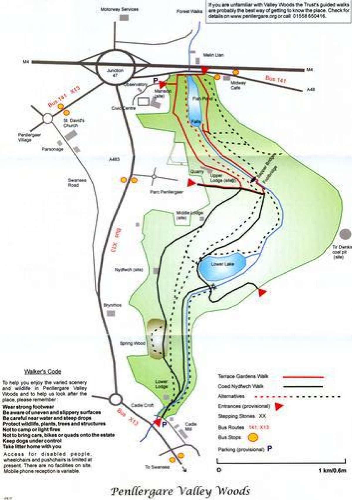
Introduction
Penllergare is a partially surviving 19th-century Picturesque and Romantic landscape created by John Dillwyn Llewelyn, a nationally important figure in horticulture.There are numerous contemporary photographs of the site, taken by Llewelyn, who was also a pioneer of photography. Although much of his exotic planting has gone, the structure of his landscaping remains, as do the ruins of his pioneering orchideous house in the walled garden.
Terrain
Steeply sloping valley sides.Together with its walled gardens and equatorial observatory, Penllergare is now recognised as being of special importance to the national heritage. It is described by CADW as being the partial survivor of a very important Picturesque and Romantic landscape of the mid-19th century and is listed Grade II.
The equatorial observatory is the second oldest astronomical observatory in Wales and of national historic and scientific importance. John Dillwyn Llewelyn's pioneering orchideous house has been described as the saddest Welsh loss among hothouses. Both are (or are about to become) Scheduled Ancient Monuments.
Despite decades of neglect, dereliction, damage and encroachment of 20th-century urban development, the core layout of this very important Picturesque and Romantic landscape survives in its essential features and retains its special qualities of seclusion, surprise and charm. However, up to now the legal limbo effectively debarred the measures now increasingly needed to conserve those features and qualities, and to protect the site from further encroachment, through the active support of the public sector and local people.
There are five areas of special significance in John Dillwyn Llewelyn's landscape design, all melding form and function:
- the arena centred on the upper lake (fishpond).
- the conjoined arena of the waterfall (the dam for the upper lake), together with the former stone arched bridge.
- the walled garden complex.
- the lower lake and its setting of woodland and pasture.
- the drive and its views out.
- Visitor Access, Directions & Contacts
Telephone
01443 336000Website
http://www.cadw.wales.gov.uk/Access contact details
The site has some areas of public access.
Directions
The site is off the M4 at junction 47.
Owners
City of Swansea
- History
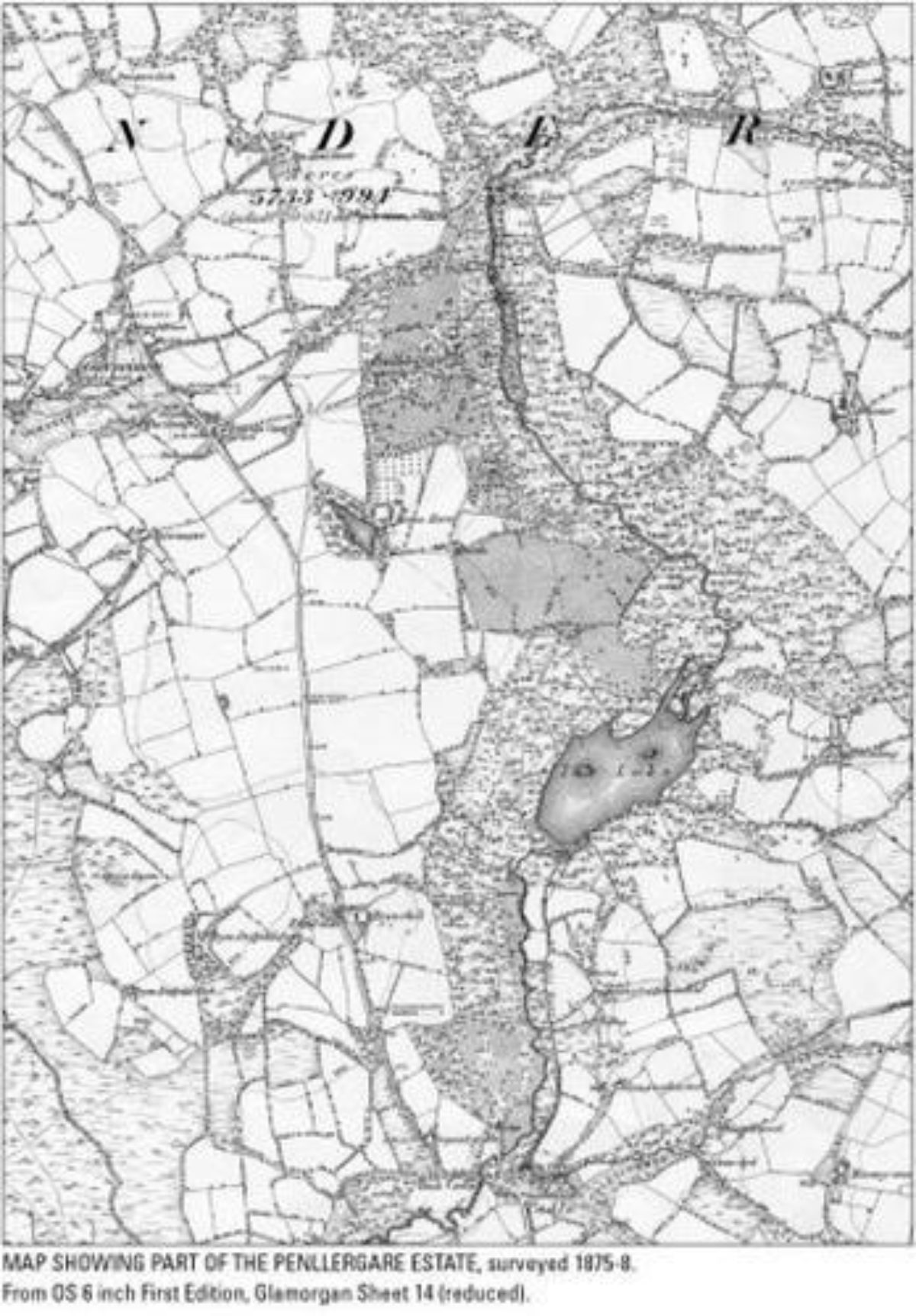
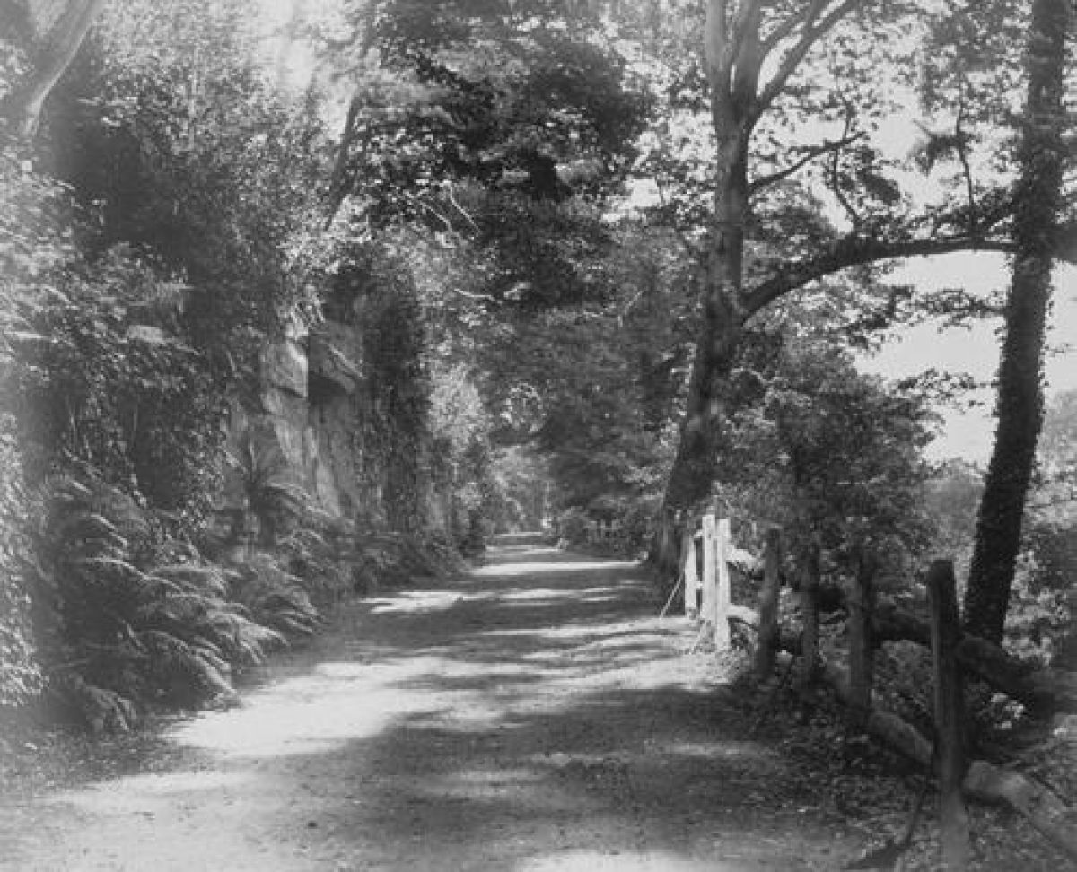
Following his father's lead, John Dillwyn Llewelyn's genius was to appreciate the dramatic and functional potential of what was already a very pleasing place in a relatively small compass. The craggy confinement of the Upper Valley was re-modelled in the Romantic Picturesque style, in heightened contrast with the wooded pastures of the former Nydfwch estate below. Both contained perfectly contrived lakes and the whole was unified by the bold sweeps of his new drive.
The outcome was an essentially simple, yet highly sophisticated design, laid out in a manner which contrasted magnificence and intimacy, drama and serenity. Much of the immediate Penllergare estate is sited on designated ancient woodland. Its mature trees and woodland were favourite subjects for John Dillwyn Llewelyn's camera. He and his father were energetic planters of trees, later including exotics.
John Dillwyn Llewelyn's son, John, himself a noted plantsman, followed suit and it was during his tenure that Penllergare became nationally acclaimed for its woodlands and particularly for its rhododendrons. There are significant (if endangered through lack of care) survivors of the exotic and native plantings that testify to Penllergare's national arboricultural and horticultural standing during its heyday. The family continued to take an active interest in forestry and horticulture. For example, the Llysdinam Field Centre, sponsored by the Llysdinam Trust, is run by the School of Biosciences at the University of Cardiff.
Period
- Post Medieval (1540 to 1901)
- Victorian (1837-1901)
- Associated People
- Features & Designations
Designations
CADW Register of Landscapes Parks and Gardens of Special Historic Interest in Wales
- Reference: PGW(Gm)54(SWA)
- Grade: II
Scheduled Ancient Monument
- Reference: Observatory (Gm 410)
Style
Picturesque
Features
- Specimen Tree
- Description: Chamaecyparis obtusa cf `Filicoides`. The Conservation Plan notes this as 'probably the rarest tree at Penllergare, and possibly the largest specimen in Britain.'
- River
- Description: The River Llan runs through the site. Cleaner now, after years of industrial pollution, the Afon Llan once more supports fish and other aquatic wildlife and birds, some uncommon.
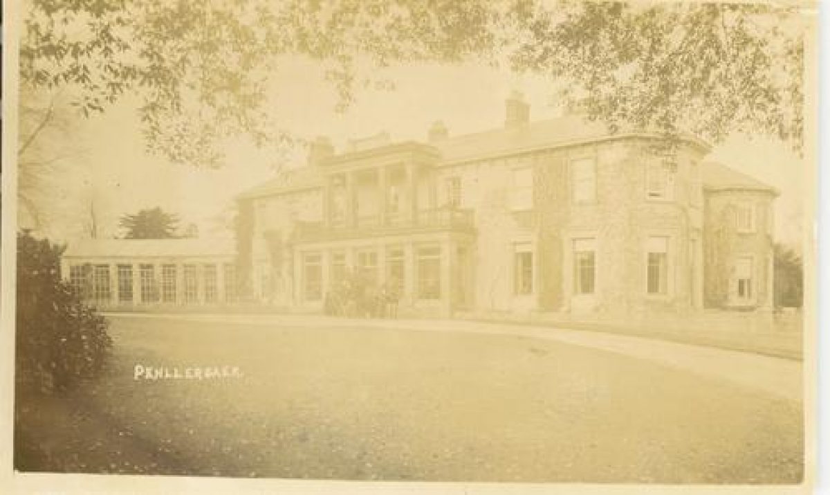
- Office (featured building)
- Description: The former mansion was blown up in 1961. Council offices were subsequently built on the site.
- Earliest Date:
- Latest Date:
- Garden Building
- Description: This is the second oldest astronomical observatory in Wales and now a Scheduled Ancient Monument. It was partially restored by Lliw Valley Borough Council, using modern techniques and materials. The internal fittings, including the telescope, were stripped out when the contents of the house were sold in 1936.The Observatory is now in disrepair, suffering from inadequate maintenance, made worse by the ingress of damp and over-arching trees. The use of inappropriate materials during previous works is adding to the problem.
- Earliest Date:
- Latest Date:
- Designed Route
- Description: This feature is the plateway. One of John Dillwyn Llewelyn's photographs depicts what might be a plate or tramway laid along the western (home) bank of the Upper Lake. The 1st Edition of the 25" Ordnance Survey indicates a track running from the boathouse, northwards to the Melin Llan road bridge, and it would be logical to assume an extension beyond to a coal pit also shown on the plan. Other than a faint terrace between the M4 and Melin Llan bridges (the latter of which has a small arch on the same line) there is now no other trace of this enigmatic feature.
- Earliest Date:
- Latest Date:
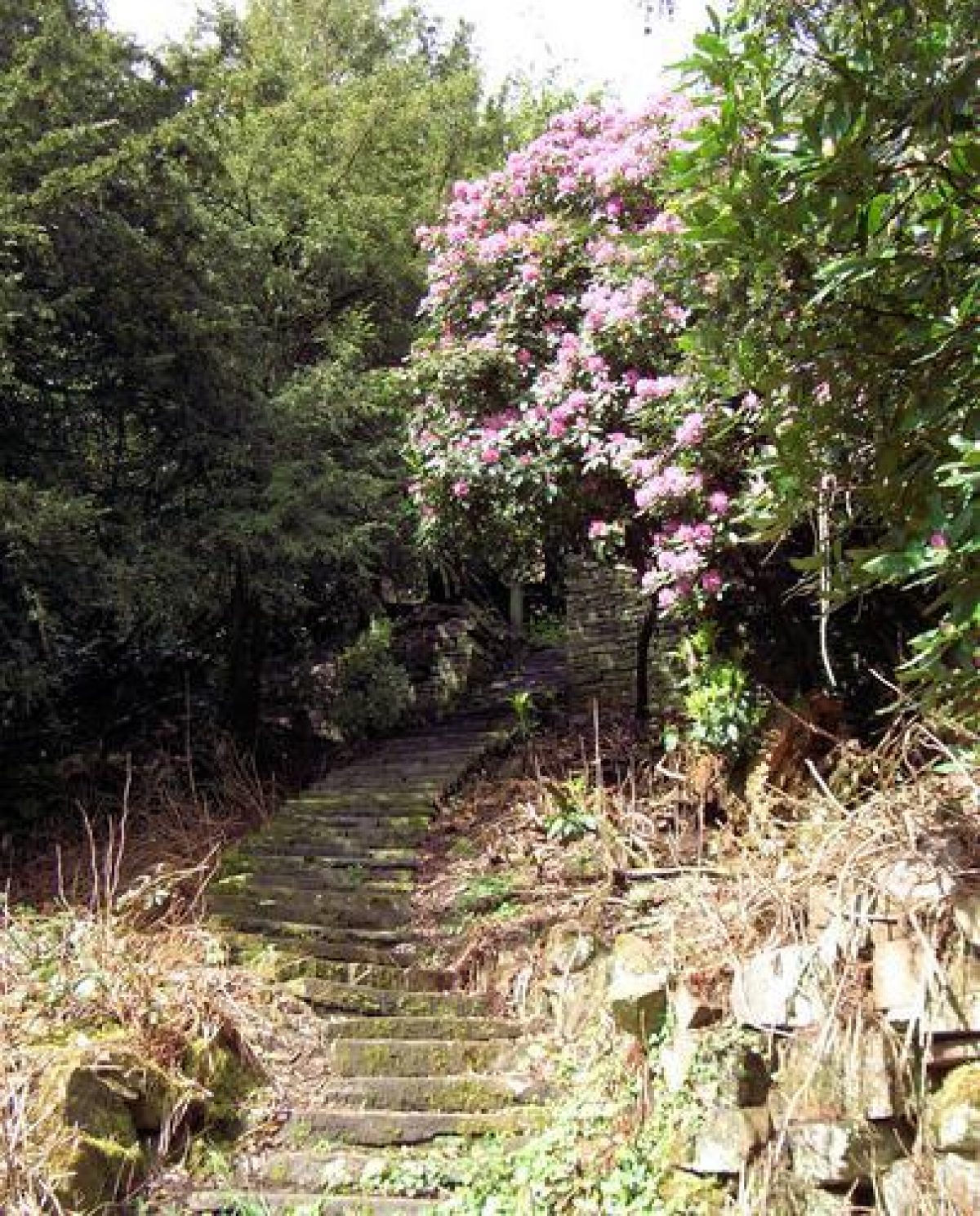
- Garden Terrace
- Description: This feature is the east terraces. These consist of paths, terraces and steps on the east flank. John Dillwyn Llewelyn's photographs show little evidence of formal plantings, mature native trees being the dominant feature. As with the western side, the quarried faces (some undoubtedly providing viewing platforms) add to the picturesque design, echoed by the upper lake. On both sides, lightly modified rivulets are important features. The terraces and steps remain serviceable in the main but collapses have occurred in many places, largely accelerated by the ingress of vegetation, including substantial trees. All require systematic inspection and refurbishment.
- Earliest Date:
- Latest Date:
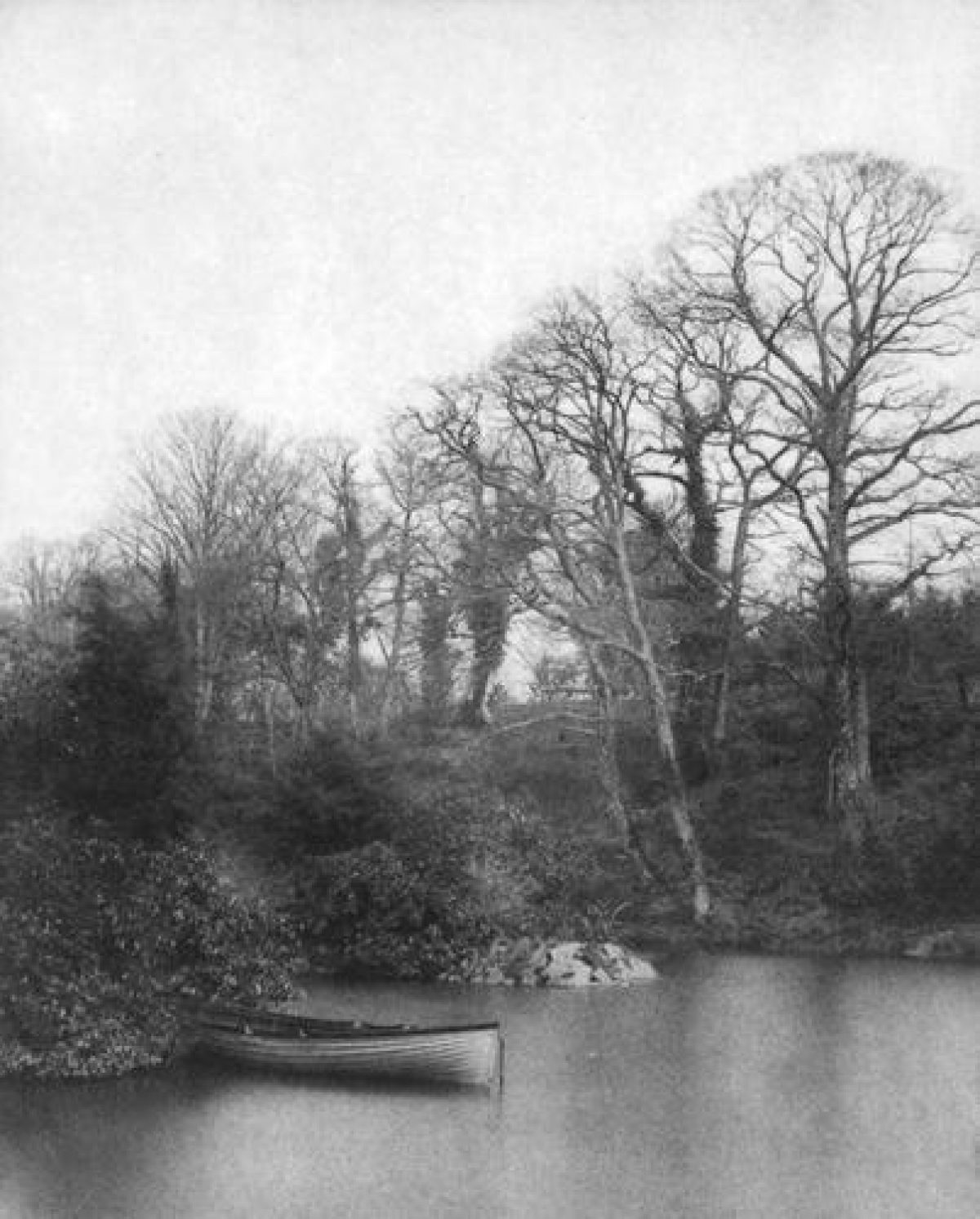
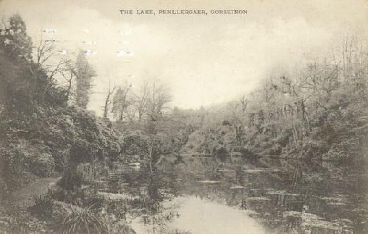
- Lake
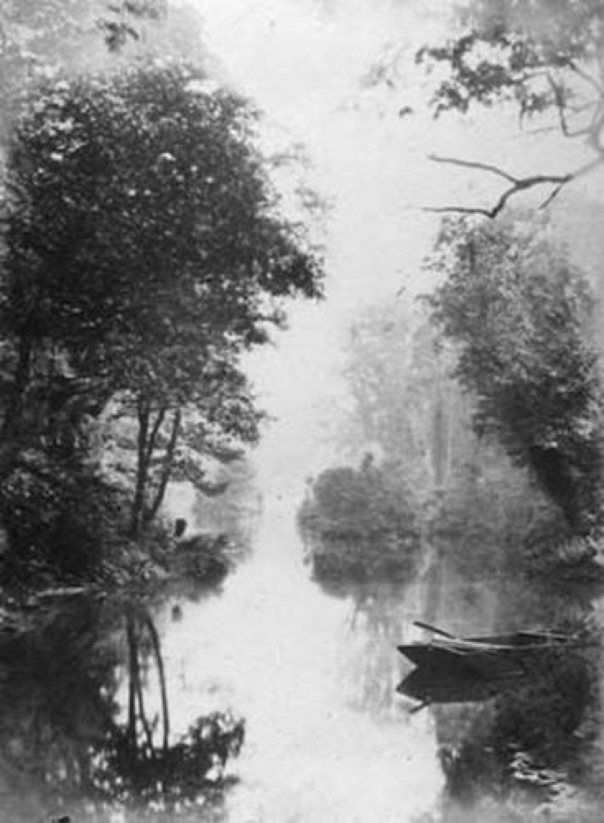
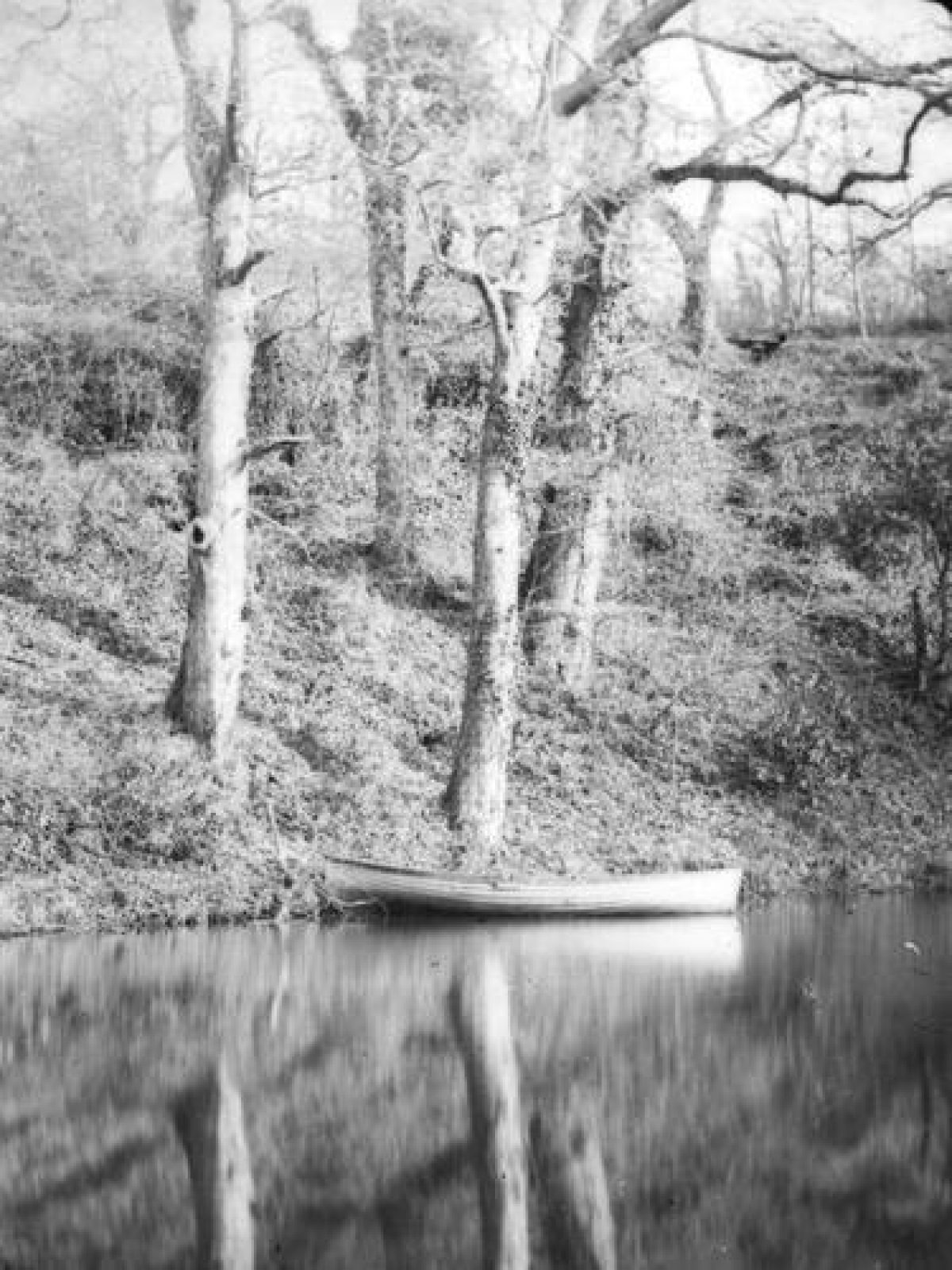
- Description: This feature is the Upper Lake (fishpond). Chronologically, this is possibly the last phase of John Dillwyn Llewelyn's major works. It is an impounded body of water covering some 1.3 hectares. It was probably John Dillwyn Llewelyn's favourite location and mirrored the rugged picturesqueness of the steeply sloping valley and diversity of planting on both sides. A boathouse, (otherwise known as the Shanty or Fairyland) was situated on the west bank, along which ran a wide, smoothly gravelled path. Today the valley has been top-sliced by the M4 and A48 and the Llan is carried under by a very large, visually-intrusive culvert. The basin itself was roughly dredged in the early-1990s, but has now suffered severe silting and encroachment by vegetation. The path has been replaced by a rough track over a foul-water sewer. Even so, the magical qualities depicted in John Dillwyn Llewelyn's photographs are still discernible. This feature is heavily silted and is barely functional: dredging to reinstate its intended design and function would be a priority task.
- Earliest Date:
- Latest Date:
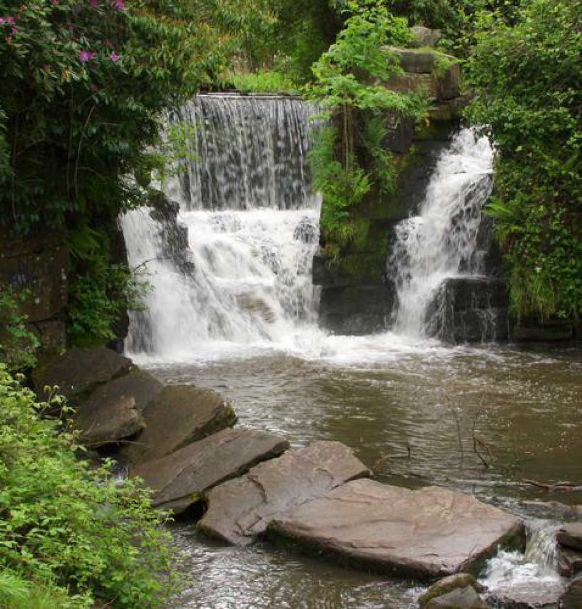
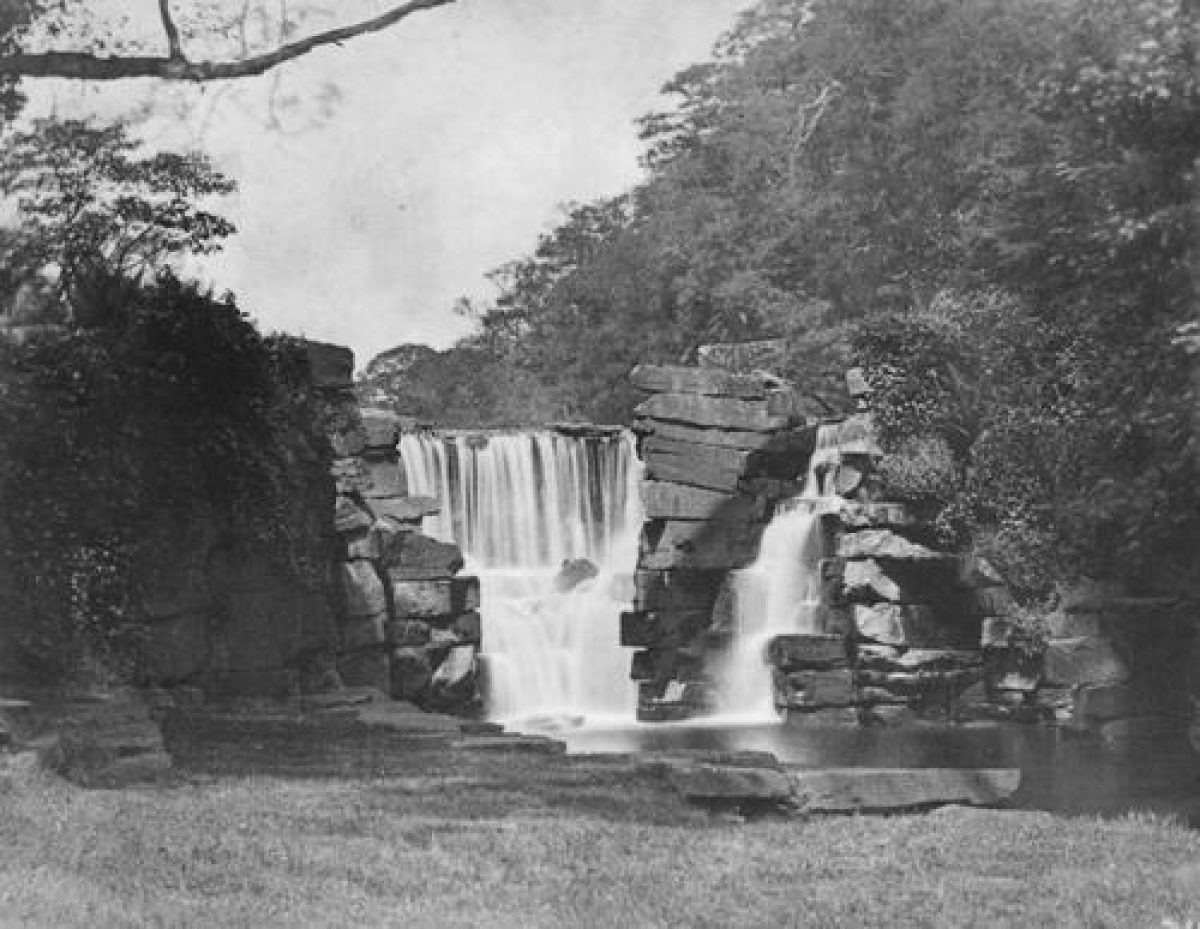
- Waterfall
- Description: Since the destruction of the mansion, the waterfall is now the best-known feature in the Penllergare landscape. Built by John Dillwyn Llewelyn, using sandstone from the Quarry (see below), this structure combines utility as a dam for the Upper Lake, (incorporating regulatory and discharging mechanisms, a viewing platform and fish-passes), and a spectacle where the construction is artfully contrived so that the three streams fragment and dash spectacularly into the pool beneath. It was one of John Dillwyn Llewelyn's frequently used photographic subjects and for visitors today it is the most popular destination in Valley Woods. The waterfall has suffered a minor collapse of a wing wall and needs urgent attention.
- Earliest Date:
- Latest Date:
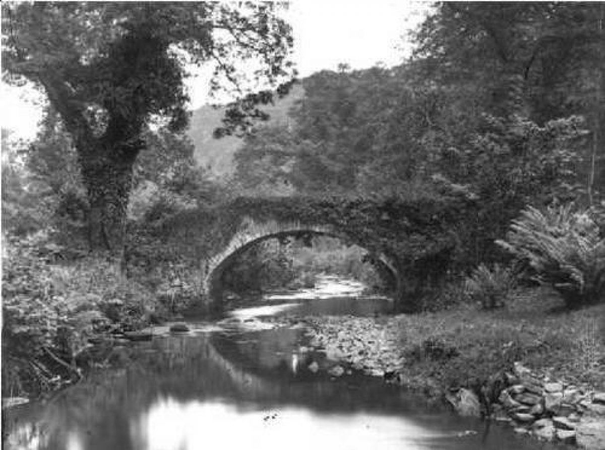
- Ornamental Bridge
- Description: This feature is the stone-arched bridge, which is probably an older construction than the waterfall. Apart from the footings, which partially support a modern, derelict bridge whose chief function is to carry a foul-water sewer, the original structure has been demolished. With paths converging on it from both flanks this bridge was the main river crossing in the Upper Valley and its picturesque, rubble-built, construction near the waterfall made it another favourite subject for John Dillwyn Llewelyn's camera.
- Earliest Date:
- Latest Date:
- Ruin
- Description: This building is the former mill. The remains of the mill recorded in the Tithe Survey may have been retained by John Dillwyn Llewelyn as a picturesque ruin. Now only remnants survive and await further investigation. Melin Llan and Melin Cadle are now outwith the demesne, although the leat for the latter is easily discernible on the east flank of the Llan, below the Lower Lake.
- Drive
- Description: Presaged by his father but executed by John Dillwyn Llewelyn in 1833 the drive provided a bold, unifying baseline for his re-modelled landscape. It is also an important feature in its own right, starting as a country road but abruptly transforming into a rocky ledge carved into a precipitous slope, before ending with a flourish at the mansion, previously hidden. It is deduced that the building of this drive in 1833 permitted the abandonment of the previous one and thus enabled the extension of the Quarry as well as the Walled Gardens enclosure, both significant developments in the landscape design and functionality.Although curtailed by the modern development of the Civic Centre, the 1833 drive is largely intact, despite neglect, collapses of revetments and encroachment of vegetation. Even if not used as a vehicular route its restoration to its former importance as a means of viewing the landscape in the manner envisaged by John Dillwyn Llewelyn would be completely practicable. The surface is largely serviceable.
- Earliest Date:
- Latest Date:
- Gate Lodge
- Description: Of the original four lodges, North and Lower are now outwith the demesne and privately owned. Upper and Lower Lodges, marking the perimeters of the former parkland where crossed by the drive, have been effectively reduced to footings.
- Earliest Date:
- Latest Date:
- Earthwork
- Description: This feature is the quarry. With an engineered cascade in its north-west corner, above which stood a summer-house looking across the valley, the Quarry was contrived in the picturesque style by John Dillwyn Llewelyn as a fleeting view out from the stone-arched Drive bridge. The now-abandoned Quarry is in fair but over-grown condition and the cascade is intermittent. It provides an important opportunity for restoration in the picturesque style, particularly so in association with the Bridge. Modern water channels - particularly in this very significant setting - are visually displeasing, ineffective and unnecessary but could be obliterated without much difficulty.
- Earliest Date:
- Latest Date:
- Lake
- Description: This feature is the Lower Lake. As already noted John Dillwyn Llewelyn's lake was of great importance as a place of beauty and utility. Following draining in the 1960s the former bed developed as a rhos-type habitat. The off-line, current lake, provided as part of 1990s planning gain, is a somewhat meagre and inadequate reflection of the original. Although its contours are softening and wildlife is reclaiming it, the engineering detailing is still obtrusive and jarring.Despite being much modified the setting of the lake is of importance as a wildlife habitat. The new Lower Lake is probably adequate in terms of its value to wildlife but it lacks the size necessary to replicate the visual impact of its predecessor. The possibility of enlargement is under investigation, including returning the river to an approximation of its original course, and thereby bringing the cascade back into operation.
- Earliest Date:
- Latest Date:
- Cascade
- Description: The cascade, (angled to be visible from the drive) together with the complex of weirs and water management features, are now derelict and abandoned having been bypassed by the river which now flows through a breach in the middle of the earth dam.
- Earliest Date:
- Latest Date:
- Boat House
- Description: The boathouse on the north-west shore was much valued by the family. Today little more than the footings remain and they are no longer on the shore-line. Other former boathouses and landing stages have been lost, although a former stone jetty to the north of the current lake marks the former shore-line. Most of the historic paths and tracks have been obliterated but modern routes have been devised round the present lake.
- Earliest Date:
- Latest Date:
- Ruin
- Description: What is believed to be the site of the former mansion is represented by little more than broken ground with some remnants of walling. The house was blown up in 1961. This area is to be surveyed topographically in 2007, including the viewing platforms. In the wider landscape there are remains of field boundaries, drainage and track-ways that are probably best interpreted as originating with the Nydfwch estate and may be of some antiquity.
- Earliest Date:
- Latest Date:
- Structure
- Description: This feature relates to the surface workings of the former Tirdonkin mine, which have been landscaped and the shafts capped. There are associated, derelict structures and water features, as yet un-investigated. An adit or level is situated in Coed Nydfwch.
- Ornamental Bridge
- Description: This feature is the Quarry Bridge. This was a bold visual statement as well as functionally necessary to enable stone blocks - including probably those to construct the waterfall - to be manoeuvred underneath, and lowered into the valley by an inclined ropeway, remnants of which have been found. Traces of the previous drive have also been found on the top of one of the internal walls. If the carriage had paused at this point the visitor would also have had a view into the valley, almost certainly equally well contrived.
- Earliest Date:
- Latest Date:
- Garden Terrace
- Description: This feature is the West Terrace Gardens. On the west flank, below the formal gardens and largely submerged in undergrowth and volunteer trees, there remains a complex of terraces. Features include revetments, paths, steps, walls, a possible well, rockeries and enigmatic buttress/stub walls. These may be of some antiquity and it is likely they were modified and adapted from time to time. Further investigation and clearance of undergrowth may reveal more viewing platforms. Surprisingly there is no evidence as yet of an icehouse.
- Earliest Date:
- Latest Date:
- Key Information
Type
Estate
Purpose
Ornamental
Principal Building
Civil
Period
Post Medieval (1540 to 1901)
Survival
Part: standing remains
Open to the public
Yes
Civil Parish
Penllergaer
- References
References
- CADW, {Register of Landscapes, Parks and Gardens of Special Historic Interest in Wales: Glamorgan} (Cardiff: CADW, 2000) 180 Register of Landscapes, Parks and Gardens of Special Historic Interest in Wales: Glamorgan
- Lloyd, T., {The lost houses of Wales} (SAVE Britain's Heritage, 1986) 81 The lost houses of Wales
- The Penllergare Trust {Penllergare Cultural, Archaeological and Historic Landscape Database} Penllergare Cultural, Archaeological and Historic Landscape Database
- Morris, R., {Penllergare - a Victorian Paradise} (Llandeilo: The Friends of Penllergare, 1999) Penllergare : a Victorian paradise
- The Penllergare Trust {Penllergare Valley Woods Draft Conservation Plan} (2008) Penllergare Valley Woods Draft Conservation Plan
- John Brown and Co. {Penllergare Heritage Landscape} (1993) Penllergare Heritage Landscape
- Nicholas Pearson Associates {Penllergare Conservation Management Plan} (2008) Penllergare Conservation Management Plan
Contributors
The Penllergare Trust