
Introduction
Packington Hall has a landscape park with lakes, occupying about 275 hectares, surrounding Packington Hall and Packington Old Hall. The park was landscaped by Lancelot Brown from 1751. The present house dates from the late-17th century with 18th-century alterations.
Terrain
The site is generally level with a shallow valley running from east to west to the south of the Hall.www.historicengland.org.uk/listing/the-list
An early C17 park remodelled in the mid C18 after a scheme by Lancelot Brown, with late C18 and early C19 picturesque elements.
DESCRIPTION
LOCATION, AREA, BOUNDARIES, LANDFORM, SETTING
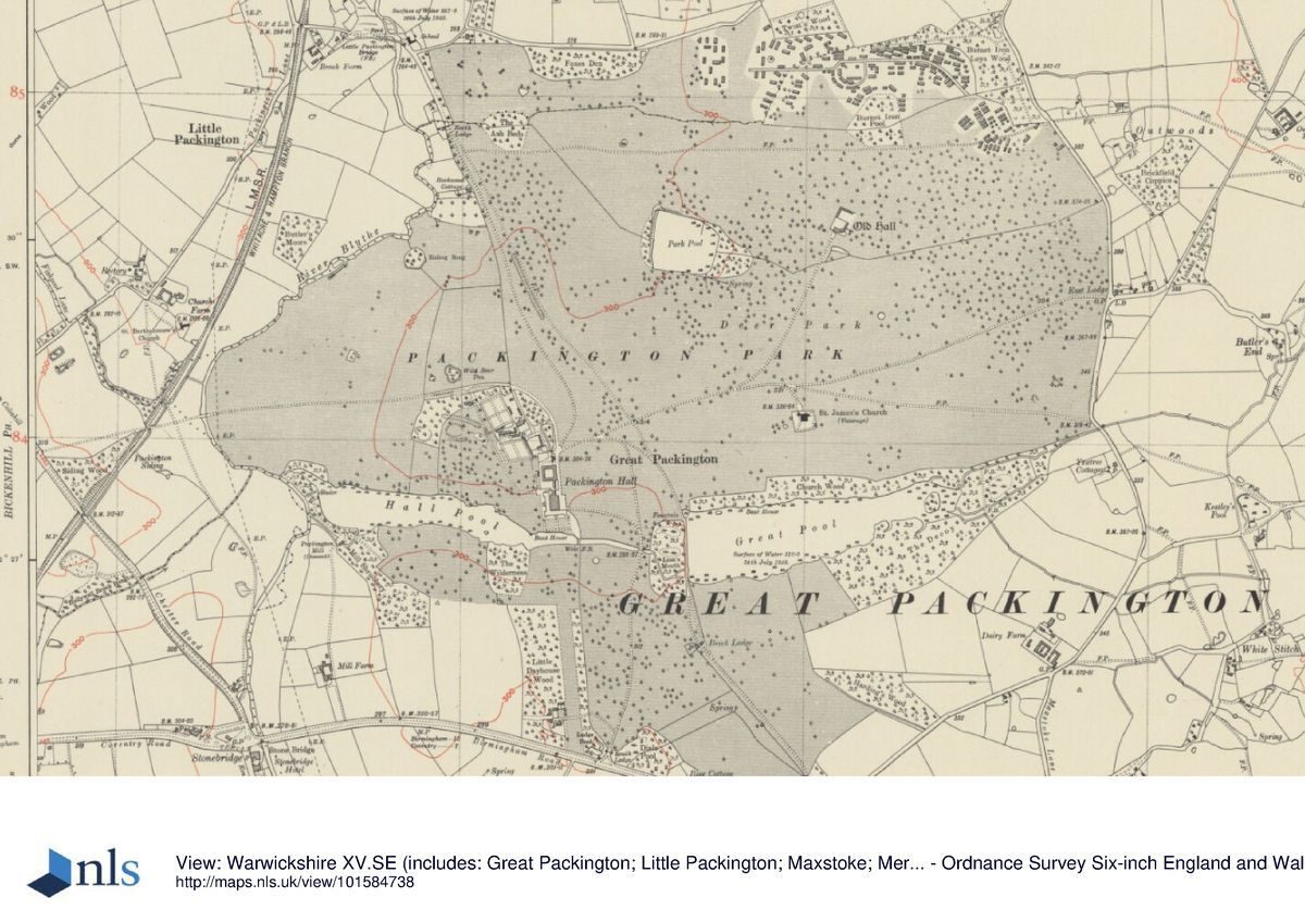
Packington Hall is situated c 10km west of Coventry and c 2km north-west of the village of Meriden, on the north side of the A45 Birmingham Road. The c 275ha site comprises some 12ha of pleasure grounds and walled gardens, and c 263ha of parkland. The site is bounded to the south by the A45 Birmingham Road, and to the east by a minor road, Maxstoke Lane. To the north the site adjoins agricultural land, some of which has been reclaimed from mid C20 mineral workings. To the south-east it adjoins agricultural land associated with the late C18 or early C19 Dairy Farm. To the north-west the site is bounded by Long Meadow, an area of agricultural land which was developed in the C19 as parkland adjoining a drive leading to Little Packington; Long Meadow has been in agricultural use throughout the C20. To the south-west the boundary is formed by agricultural land associated with Mill Farm. The site is generally level with a shallow valley running from east to west to the south of the Hall. A stream running through this valley has been dammed to form the Great Pool to the east, and Hall Pool to the west. Hall Pool discharges into the River Blythe which flows from south to north through a wide shallow valley immediately to the west of the site. The River Blythe here forms the boundary between Warwickshire and the Metropolitan District of Solihull. The site has significant internal vistas, but due to the predominantly level surroundings, there are few views beyond the site. From the pleasure grounds and Hall Pool there are views west across Long Meadow towards Little Packington, and there are further views south-east across the Monument Field towards the A45 road and Packington Lane; to the east there are views from the park to surrounding agricultural land and woodland, Close Wood, on high ground c 3km to the east.
ENTRANCES AND APPROACHES
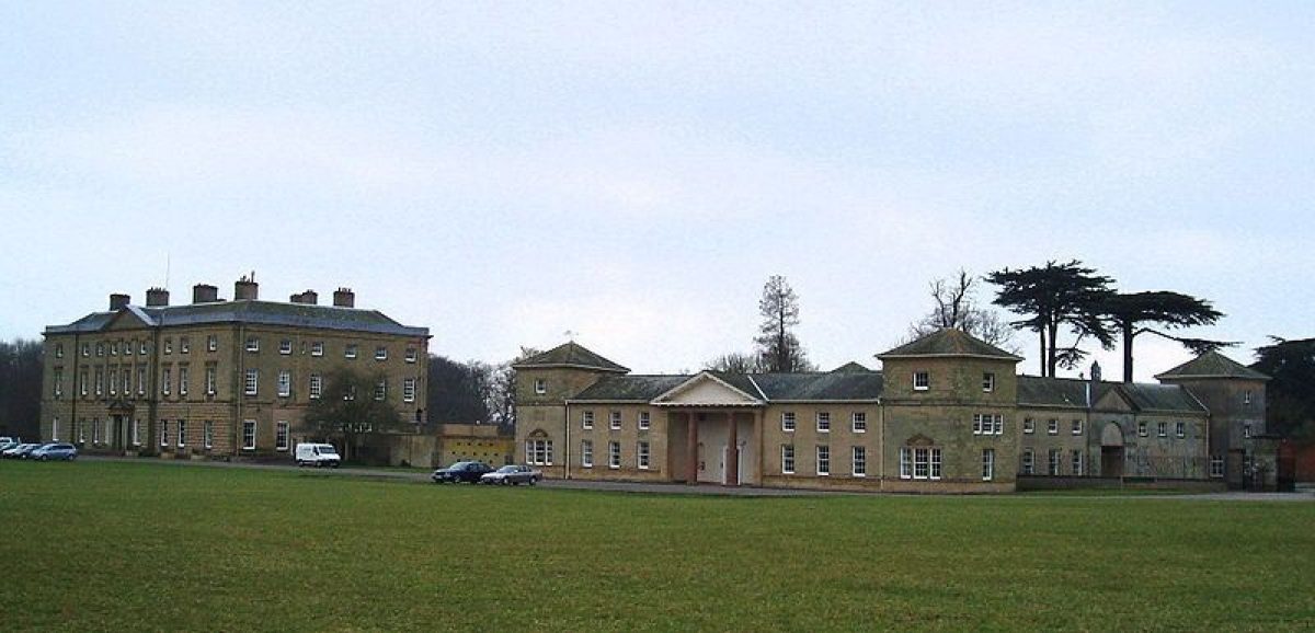
Packington Hall is approached from the A45 Birmingham Road to the south. The entrance is set back from the road, and is flanked by quadrant plantings of evergreen shrubs set behind simple fences. A pair of rendered, rusticated, rectangular-section piers support a pair of wrought-iron gates dated 1935, and are flanked by a pair of late C18 single-storey, square-plan stuccoed pavilions (listed grade II) surmounted by pyramid roofs, the design of which is attributed to Matthew Brettingham. Immediately to the north-east of the entrance and within the park stands a mid C20 two-storey lodge of rendered brick construction. The tarmac drive extends c 650m north through the park, dropping gently to cross the eastern end of Hall Pool on a mid C18 sandstone two-arched bridge (listed grade II) possibly designed by Lancelot Brown c 1750. Some 50m north of the bridge, the south drive reaches a junction and sweeps west for c 200m through the park to approach the gravelled carriage turn below the east facade of the Hall. The carriage turn, described as the east terrace, was levelled in 1787 (estate accounts, private collection). A further drive extends north from the junction north of the bridge for c 200m, enclosing the east side of an area of level grass and specimen trees east of the Hall. Sweeping west and south-west for c 200m, this drive approaches the mid C18 stable block north of the Hall from the north-east. The stable court (listed grade II) was constructed in 1756-8 by David Hiorn, possibly following a design by Sanderson Miller or Lancelot Brown (Tyack 1994; Warwicks Hist 1997), and comprise four ranges with Palladian corner towers and a Tuscan pediment on the east facade. Brown's sketch plan of the park made c 1750 (private collection) shows the drive approaching the Hall on an axis with the south facade along the south avenue from a pair of lodges, with a further approach along an avenue leading from the Holyhead road to the east of the Hall. The Holyhead road was diverted to the south and west c 1760 (plan, WCRO), and the present arrangement of the south drive was achieved c 1785 when land on Meriden Heath adjoining the park was enclosed.
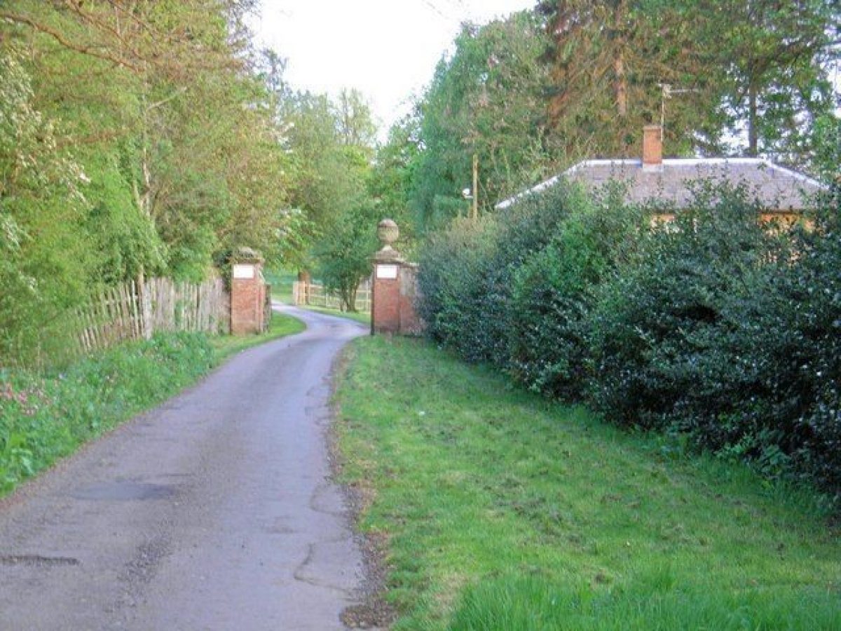
Further drives approach from the north, east, west, and south-east. The north drive enters the site from a minor lane south-east of Little Packington Bridge c 1km north-north-west of the Hall. The entrance is marked by a pair of square-section brick piers which support a pair of massive carved stone ball finials (that to the east fallen, 2000). The piers are flanked by stone-coped brick wing walls, while to the south-west of the entrance a late C18 or early C19 two-storey lodge with an ornamental porch on the east facade stands within the park. The north drive leads c 900m south-south-east across the park, revealing views east across the park to Park Pool, and south-east to the parish church. The drive turns south-south-west for c 100m to approach the stables and farm buildings from the north-east. An approach from the north is shown on Brown's sketch plan of c 1750. The east drive enters the site from Maxstoke Lane c 1.5km east-north-east of the Hall. A pair of mid C19 Tudor-gothic gabled brick cottages known as East Lodge stand on the east side of Maxstoke Lane, opposite the entrance to the site. The east drive follows an approximately level and straight course across the park, passing to the north of the parish church c 700m north-east of the Hall; there are significant views north from the east drive across the park and to the Old Hall (listed grade II*), a substantial late C17 and early C18 red-brick house which stands c 1.2km north-east of the Hall. The east drive joins the north and south drives immediately to the north-east of the stables. The east drive was in part developed from an existing road (Beighton, 1730) which extended east from the stables to the Holyhead road, and thence along the southern boundary of the park to Maxstoke Lane (Brown, c 1750, 1751), and assumed its present form after the diversion of the Holyhead road c 1760 and the incorporation of glebe land into the park c 1780 (Warwicks Hist 1997).
The south-east drive is today (2000) a track which approaches the site from the A45 Birmingham Road to the south-east, passing through the Monument Field. Some 300m north-west of the Birmingham Road the drive passes a late C18 monument (listed grade II) in the form of a classical, stone, square-section pier surmounted by a pediment. The pier bears a weathered inscription on its south-west face recording the death of William Cawssey of London by a lightning bolt in that location in 1789 (White 1850), and is ornamented with carved crossed bolts of lightning. The Monument is partly enclosed by C19 spiked railings and stands immediately north-west of a picturesquely gnarled veteran oak. The south-east drive enters the park at Beech or East Lodge (listed grade II) c 570m south-east of the Hall. The late C18 lodge comprises a square, stone, two-storey house under a pyramid roof to the west of the entrance, and a similar single-storey, pyramid-roofed lodge (listed grade II) to the east; the lodges are linked by late C20 metal gates. Beyond East Lodge, the south-east drive extends north for c 400m, crossing the dam at the west end of the Great Pool and sweeping north-west across the park for c 300m before joining the south drive c 270m north-east of the Hall. The south-east drive formerly led to the village of Meriden and to Forest Hall, designed for the fourth Earl by Joseph Bonomi as the headquarters of the Woodmen of Arden, an archery club co-founded by the Earl (Tyack 1994). The south-east drive was constructed under the supervision of John Wedge in 1787, and included alterations to the dam at the west end of the Great Pool; it superseded a plan of 1776 for a drive leading east from Beech Lodge to Maxstoke Lane (Lord Aylesford pers comm, 2000).
The west drive is today (2000) an agricultural track which crosses Long Meadow to the west of the pleasure grounds. It enters the site c 450m north-west of the Hall and passes through Garden Spinney to the north of the pleasure grounds and sweeps south-east to reach the farm and service buildings north of the stables and east of the kitchen garden. The approach from the west is indicated on a plan of the park c 1780 (private collection), and was improved in the late C18 by John Wedge.
PRINCIPAL BUILDING
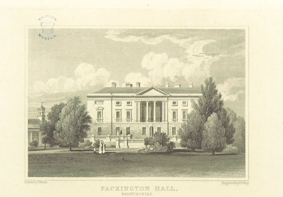
Packington Hall (listed grade II*) stands on a level site to the north of the mid C18 Hall Pool in the south-west quarter of the site. The Hall is constructed in grey sandstone ashlar and comprises a principal block which is rectangular on plan. Of two storeys and an attic, with a basement concealed behind early C19 terraces to the west and south, the ground floor of the Hall is rusticated. The entrance or east facade has a central pediment which surmounts an Ionic portal, while the south facade is relatively plain. The garden or west facade has slightly projecting bays to the north and south which flank a pediment supported by attached Ionic columns; this feature was constructed in 1766 by Matthew Brettingham as an open loggia and was infilled by Henry Hakewill in 1828. The service range stands to the north-east of the principal block, with a late C20 conservatory to the north-west partially occupying the site of a mid C19 conservatory by William Burn, which itself replaced an early C19 structure, probably by Hakewill. The present mansion incorporates the house built by Sir Clement Fisher in 1693 (inscription on Hall roof), which in turn replaced a C16 or C17 house on the same site. The late C17 mansion was remodelled for the third Earl by Matthew Brettingham from 1766, the work continuing after Brettingham's death in 1769 under Henry Couchman (Tyack 1994; Warwicks Hist 1997). The interiors were completed for the fourth Earl from 1782 by Joseph Bonomi. The Hall was restored following damage by fire in 1979.
GARDENS AND PLEASURE GROUNDS
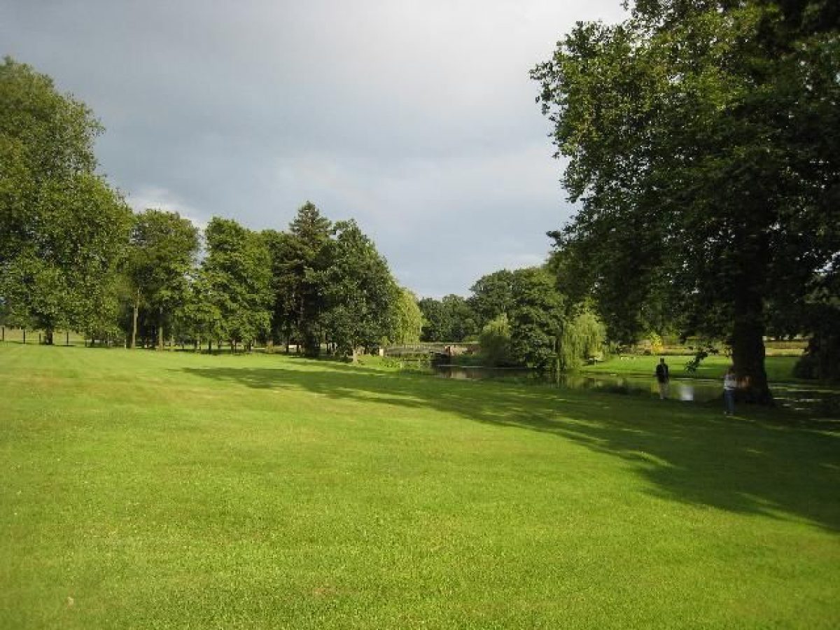
The informal pleasure grounds lie principally to the south and west of the Hall. The south side of the east terrace or carriage turn is closed by a low stone wall surmounted by mid C18 spear-headed railings. These flank a pair of similar, centrally placed gates supported by a pair of rectangular stone piers, the upper faces of which are ornamented with carved swags; to the west there is a single pedestrian gate. The design of the gates, railings, and piers (all listed grade II) is attributed to Brettingham. The gates lead to the gravelled south terrace which extends below the south facade; the terrace is also approached by stone steps from the Hall. There are views from the terrace south across Hall Pool to the south avenue and the park. The terrace (listed grade II) is retained by sandstone ashlar walls with a low parapet ornamented with urns. A flight of centrally placed, wide, stone-flagged steps descends from the upper gravelled terrace to a lower grass terrace, similarly retained by a stone wall and planted to the north with herbaceous borders. A further axial flight of stone steps descends to a lawn which slopes gently down to Hall Pool. This lawn bears traces of a mid C19 formal parterre which was removed in the early C20. The designer of this parterre has not been identified, but W A Nesfield worked for the sixth Earl at Offchurch Bury, Warwickshire before his succession in 1859 (Tooley 1994), and C19 photographs (private collection) show this scheme to have been in Nesfield's style. Some 100m south-east of the Hall, a mid C19 single-span footbridge (listed grade II) with ornamental scrolled and part-gilded rails and rusticated piers crosses a low cascade at the east end of Hall Pool to reach an area of mown grass and specimen trees on the south bank of the lake; from here there are views north to the Hall and pleasure grounds. This area of pleasure ground to the south of Hall Pool is bounded to the east by a traditional split-timber park pale, and to the south by a sunk fence; to the west the area is bounded by a mixed plantation, The Wilderness. The upper, gravelled south terrace returns below the west facade of the Hall. The central section of the terrace, below the portico, is recessed where a wide double flight of stone-flagged steps descends to the pleasure grounds. The steps are flanked by balustrades which return at the lower level to the south-west and north-west (all listed grade II). To the north and south of the central steps the upper terrace is ornamented by a pair of geometric box- and stone-edged parterres planted with roses. At the north end of the terrace a wide flight of stone steps (now, 2000, closed by a low wall) ascends to the site of the west range of the mid C19 conservatory. The site of this structure is now (2000) occupied by a late C20 swimming pool. The south and west terraces were constructed to the design of Henry Hakewill in 1812, replacing terraces indicated by Brown (1751).
Herbaceous borders are planted below the retaining wall of the west terrace, beyond which lawns planted with groups of specimen trees and shrubs slope gently west and south towards Hall Pool which forms the southern boundary of the pleasure grounds. Hall Pool extends c 850m west-north-west from the footbridge south-east of the Hall, and was created from 1752 (Sir Roger Newdigate's diary, WCRO) as part of Brown's mid C18 improvements. It was formed from an existing mill pool and a chain of ornamental fishponds separated by a series of cascades; remains of these cascades survive, submerged in the lake (Lord Aylesford pers comm, 2000). To the north-west of the Hall a gravel walk leads west and north-west through the pleasure grounds, and is bordered by mixed specimen trees, including mature cedars which survive from Brown's mid C18 scheme. The south-west-facing slope above this walk is bounded to the north by the kitchen garden wall, while to the east it is enclosed by the wall of the service courts and a C19 single-storey cottage with an ornamentally tiled west facade; to the north-west a hard tennis court is terraced into the slope. This area is today (2000) lawn with mixed borders below the kitchen garden walls. In the late C18 it was laid out as a flower garden (plan, 1789, private collection) which incorporated a small Doric temple designed by the fourth Earl (CL 1971; Warwicks Hist 1997); this structure does not survive. The late C18 pleasure grounds replaced a mid C18 walk 'adorned with shrubs' laid out by Brown (1751). This walk, with views across lawns to Hall Pool, led north-west from the Hall for c 350m to 'the Scots Fir clump', a square plantation whose outline survives within the pleasure grounds. To the west and north-west of the kitchen garden the pleasure grounds are characterised by C19 specimen conifers and evergreen shrubs. Earthworks in this area including two pronounced ditches and an approximately circular depression c 320m north-west of the Hall are relics of a system of culverts and leats used to flood Long Meadow (Lord Aylesford pers comm, 2000). Some 200m north-west of the Hall the gravel walk becomes a grass path which leads c 200m north-west parallel to the west wall of the kitchen garden through an area of standard apple trees, to reach a single-storey cottage of late C18 or early C19 appearance (but of earlier origin - Lord Aylesford pers comm, 2000) adjacent to the west drive, which here forms the northern boundary of the pleasure grounds. The pleasure grounds are separated from Long Meadow to the south-west by a late C20 timber fence; the boundary has been extended c 15m west since 1904 (OS).
PARK
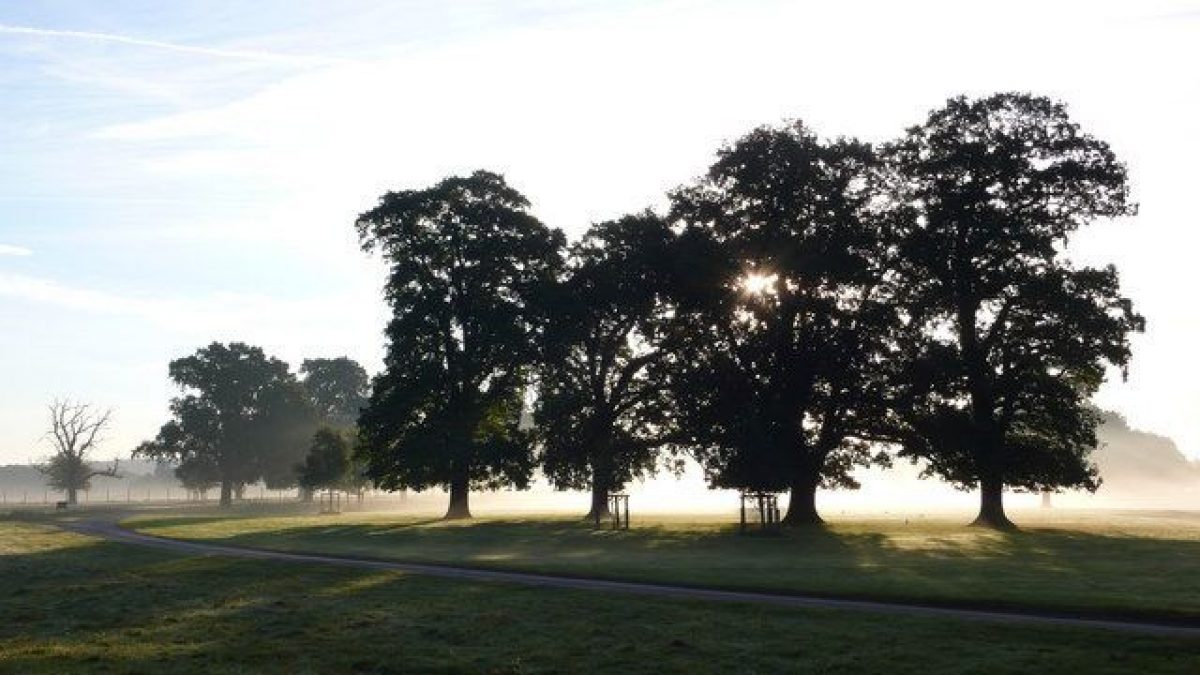
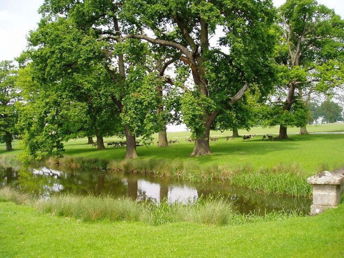
The park lies to the south-west, south, north, and east of the Hall, and today (2000) remains pasture. The park to the east of the Hall retains a deer herd. A late C20 golf course has been developed in the north-east corner of the park, adjacent to Maxstoke Lane, an area which retains many mature oaks.
The south and south-west park lies to the south of Hall Pool (The Stew), and is separated from the east park by a deer fence which extends from the footbridge south-east of the Hall to the south lodge. The vista aligned on the south facade of the Hall is framed by mixed deciduous trees which create the effect of an avenue; this feature may relate to the early C18 formal landscape around the late C17 mansion (Warwicks Hist 1997). To the south-south-west of the Hall, Little Dayhouse Wood extends parallel to the south avenue to the A45 Birmingham Road; the mid C18 kennels (listed grade II) stand in this plantation c 600m south of the Hall. The south-west park is planted with scattered deciduous trees and a group of Wellingtonias c 450m south-west of the Hall. The park is enclosed to the east by a mixed plantation, The Wilderness, and to the west and south-west by a further mixed plantation, Mill Shrubbery. An C18 carriage drive leads from the south-west park through Mill Shrubbery, passing the remains of Packington Mill c 600m south-west of the Hall. Continuing below the dam at the west end of Hall Pool, which is planted with mature beech and evergreen shrubs, the carriage drive reveals views west across the River Blythe and meadows, before emerging into Long Meadow c 770m west of the Hall. The disposition of the south-west park relates to the scheme proposed by Brown in 1751, which included boundary plantations to the south and south-west with seats looking over the park and Hall Pool. The carriage drive was to be carried across the west end of the Pool on a wooden bridge; neither this, nor Brown's proposal to break-up the south avenue, appears to have been implemented.
The east park is generally level and characterised by scattered mature oaks. To the north-east the ground falls towards Park Pool, an approximately square pool retained to the west by an earth dam. The north, east, and west banks of the Pool are planted with mixed woodland. A shallow valley extends north-west from Park Pool towards North Lodge, and enclosures north-east of North Lodge, today (2000) in arable cultivation, retain groups of C19 ornamental conifers. To the east of Park Pool, and c 1.1km north-east of the Hall, the late C17 Packington Old Hall (listed grade II*) stands in gardens enclosed by late C17 brick walls (listed grade II*). Some 20m south-west of the Old Hall the gardens are bounded by the late C18 brick Venison House (listed grade II); to the north-west of the Old Hall a late C17 dovecote (listed grade II), rectangular on plan, stands adjacent to late C17 stables. Approximately 130m south-east of the Old Hall the earthwork remains of a medieval moated enclosure survive (Lord Aylesford pers comm, 2000). A pool c 20m south-east of the Old Hall feeds the Park Pool to the west. The north-east park represents the area enclosed from the Outwoods by Sir Clement Fisher in the early C17 (Dugdale 1730). By the early C18, this park extended west to the old Holyhead road, and south to a track on the line of the east drive (Beighton, 1730); it was not included in Brown's 1751 scheme of improvements.
To the south-east of Packington Hall the outflow from the Great Pool is canalised and retained by a cascade associated with the footbridge c 100m south-east of the Hall. The Great Pool, known in the late C18 as the 'New River', was created in the mid C18 and corresponds to Brown's proposals of 1751. Some 400m south-east of the Hall the Pool is retained to the west by a high earth dam. The Pool, of early C17 origin (Dugdale 1730), extends c 800m east, with a small island towards the eastern end. The east end was developed as a decoy, which was remodelled as three decoys in the late C18 by Wedge (plans, private collection); at the same time the C17 rectangular pool was remodelled in a more naturalistic form, as initially proposed by Brown in 1751. In the late C17 Sir Clement Fisher rebuilt 'the House in the middle of the Great Pool', and more recently a duck-keeper's cottage stood on the island; neither structure survives today. The outflow at the south-west end of the dam of the Great Pool, known as the Lion's Mouth, comprises a mid C18 brick-lined tunnel with a rusticated stone opening (listed grade II); this was altered in the late C18 by John Wedge when the eastern end of the 'New River' was remodelled and a series of small pools linked by cascades was constructed below the outflow (plan, private collection). The west-facing slope of the dam retaining the Great Pool is planted with mixed woodland: this reflects the arrangement shown by Brown (1751), Wedge (c 1780), and the late C19 OS map. To the north of this plantation, c 290m south-east of the Hall, a spring, fed through a lion-mask spout, is enclosed within a mid C18 stone structure (listed grade II) which comprises a round-headed opening to the west set beneath a pediment. In the mid C18 the Great Pool was separated from the Hall and its immediate grounds by the Holyhead road which ran from south-east to north-west c 250m east of the Hall; this road was diverted beyond the park c 1760.
The parish church of St James (listed grade I) stands in the park c 750m east-north-east of the Hall within a churchyard enclosed by late C18 rubble-stone walls and wrought-iron arrow-head railings supported on square wrought-iron piers surmounted by urn finials (all listed grade II). The churchyard is planted with mature Irish yews, while a single-storey barn with an arched entrance stands at the south-east corner. The church was rebuilt in a dramatically austere Neoclassical style for the fourth Earl by Bonomi in 1789; its four symmetrical domed corner towers serve as eyecatchers from the north and east park. The church is framed by a group of oaks and Scots pines outside the south-west corner of the churchyard; an early C19 view shows similar picturesque planting around the church (BRLA). Land to the west and south of the church and north of Church Wood, a mixed plantation on the north bank of the Great Pool, is today (2000) in arable cultivation. This land, together with ground extending c 160m south of the Great Pool, formed part of the Packington Glebe and was not incorporated into the park until c 1770 as part of a scheme of improvements overseen by John Wedge after the diversion of the Holyhead road. In 1751 Brown proposed a woodland pleasure ground to the south and south-west of the church; neither this, nor 'My Lady's Lodge' in The Decoy c 130m south-east of the Great Pool were implemented.
Some 570m south-east of the Hall and to the south of the Great Pool, the Monument Field is today (2000) pasture with scattered mature oaks, some of which survive from C18 hedgerows. This area formed part of the glebe land which was developed as a picturesque setting for the south-east drive by John Wedge c 1770.
KITCHEN GARDEN
Lying c 130m north-west of the Hall and immediately to the north of the pleasure grounds, the kitchen garden is enclosed by C18 brick walls c 3m high and surmounted by stone copings (listed grade II). A panelled timber door is set in the south wall; there are further doors in the west wall. The garden is approximately rectangular on plan and is divided into three sections by lateral walls running from east to west. The two southern sections are of approximately equal area and are laid to grass with remains of late C19 or early C20 timber-framed glasshouses surviving in the central section. The larger northern compartment is today (2000) planted as an orchard with standard apple trees. Further fruit trees survive against the inner face of the south wall of the south compartment. The kitchen garden occupies the site identified for it in Brown's scheme of 1751. This in turn relates to the position of the kitchen garden shown on his earlier sketch plan (c 1750). Brown's scheme proposed a single compartment divided into quarters, and this may relate to the two southern sections of the present garden; the mid C18 garden was extended to the north in the late C18 (plan, private collection). A hothouse and vinery were built in 1802, with a further vinery, peach house, and mushroom house being constructed in 1813-19 (Warwicks Hist 1997; Steward's accounts, private collection). Neither these structures, nor further late C19 and early C20 glasshouses at the southern end of the garden survive (2000).
REFERENCES
W Dugdale, The Antiquities of Warwickshire (2nd edn 1730), pp 988-9
R Jago, Edge Hill (1767) J Britton, The Beauties of England and Wales XV no 2, (1814)
J P Neale, Views of the Seats of Noblemen and Gentlemen ... IV, (1821)
F White, History, Gazetteer, and Description of Warwickshire (1850), p 875
The Garden, i (1872), pp 647-8 Country Life, 2 (31 July 1897), pp 98-100; 148 (9 July 1970), pp 102-6; (16 July 1970), pp 162-6; (23 July 1970), pp 226-9; 150 (8 July 1971), pp 111-15
Victoria History of the County of Warwickshire IV, (1947), pp 180-2
N Pevsner and A Wedgewood, The Buildings of England: Warwickshire (1966), pp 297-9
D Stroud, Capability Brown (1975), pp 56, 235
M Tooley (ed), William Andrews Nesfield 1794-1881 (1994), p 29
G Tyack, Warwickshire Country Houses (1994), pp 152-7
Warwickshire History X, no 4 (1997), pp 130-44
Maps
H Beighton, A Mapp of Warwickshire, surveyed 1725-8, published 1728
H Beighton, A Map of Hemlingford Hundred, surveyed 1725, published 1730
L Brown, Sketch plan of the grounds at Packington Hall, c 1750 (private collection) [copy at Warwickshire County Record Office: Z293/1L]
L Brown, A Plan for the Disposition of the Ground at Great Packington the Seat of the Rt Honorable The Lord Guernsey, 1751 (private collection) [copy at Warwickshire County Record Office: Z143L]
J Tomlinson, Roads leading from Coleshill Guide post to the Guide post on Mereden Heath in the County of Warwick, 1760 (CR699/Box 4), (Warwickshire County Record Office)
Plan of Packington Park, c 1770 (private collection) [copy at Warwickshire County Record Office: Z170L]
(?) J Wedge, Plan of glebe land taken into Packington Park, 1777 (private collection) [copy at Warwickshire County Record Office: Z301/1u)
J Wedge, Plans for decoys, Great Pool and stew ponds, 1775-82 (private collection) [copies at Warwickshire County Record Office: Z300/1(19)
(?) J Wedge, Plan for south-east drive, late C18 (private collection) [copy at Warwickshire County Record Office: Z301/2u]
Plans for flower garden, extension to kitchen garden and sunk fence north-east of Hall, late C18 (private collection) [copies at Warwickshire County Record Office: Z301/3(6u]
W Yates and Sons, Map of Warwickshire, surveyed 1787-9, published 1793
Plan of lands in the parishes of Great Packington and Meriden, early C19 (private collection) [copy at Warwickshire County Record Office: Z308u]
Tithe map for the parish of Great Packington, 1843 (DR158/17), (Warwickshire County Record Office)
OS Old Series 1" to 1 mile, published 1834
OS 6" to 1 mile:
1st edition published 1887
3rd edition published 1921
1937 edition
OS 25" to 1 mile:
1st edition published 1886
2nd edition published 1904
1937 edition
Illustrations
L Brown, Elevations for proposed landscape structures included on plan, 1751 (private collection) [copy at Warwickshire County Record Office: Z143L]
Bird's-eye view of Packington Hall from the west, c 1765-70 (private collection) [copy at Warwickshire County Record Office: Z488]
Views of Packington Hall and church, early C19 (Aylesford Collection, Birmingham Reference Library Archive)
Archival items
Diary of Sir Roger Newdigate, mid C18 (CR136/A6(8), (Warwickshire County Record Office)
Steward's accounts, 1792-1816 (private collection) [copy at Warwickshire County Record Office: MI 279]
Typescript calendar of C18 and early C19 documents formerly at Packington Hall, destroyed by fire 1979 (Z489sm), (Warwickshire County Record Office)
Photographs of the formal south gardens, mid C19 (private collection)
Personal communication from the Rt Hon the Earl of Aylesford
Description written: June 2000 Amended: July 2000, September 2000, October 2000
Register Inspector: JML
Edited: September 2001
- Visitor Access, Directions & Contacts
Telephone
01676 522020Directions
North of the A45 to the north-east of Hampton-in-Arden.
- History
The following is from the Register of Parks and Gardens of Special Historic Interest. For the most up-to-date Register entry, please visit the The National Heritage List for England (NHLE):
www.historicengland.org.uk/listing/the-list
HISTORIC DEVELOPMENT
The manor of Packington belonged to Kenilworth Priory in the medieval period. At the Dissolution in the mid C16 it was purchased by the Priory's tenant, John Fisher, Gentleman Pensioner to Henry VIII and Steward to Ambrose Dudley, Earl of Warwick. Fisher built a new house at Packington, probably on or near the site of the present mansion (Dugdale 1730; Tyack 1994). John Fisher was succeeded by his son, Clement, who was knighted in the early C17 and who enclosed the nucleus of the park. Sir Clement's son, Robert, who inherited Packington in 1619 and was created a baronet in 1622, improved the grounds by creating the Great Pool and 'other places of delight' (Dugdale 1730). The estate was plundered by Parliamentary troops in 1642, seven years before Sir Robert's death (1649). Sir Clement, second baronet, made further improvements to the property, including the laying out of formal gardens in the mid 1660s and the expansion of the park in 1674 (Tyack 1994). Sir Clement died in 1683 and was succeeded by his nephew, also Sir Clement, who rebuilt the C16 house in 1693 (inscription); this late C17 building forms the core of the present mansion. At the same time the grounds were laid out with 'Statues, Canals, Visto's and other suitable Ornaments' (Dugdale 1730). At Sir Clement's death in 1729, Packington passed through his only daughter to Heneage Finch, second Earl of Aylesford, who made the estate over to his eldest son, Lord Guernsey. In 1750 Lord Guernsey married the daughter of the Duke of Somerset, who brought a dowry of £50,000. Lord Guernsey was associated with the mid C18 Warwickshire virtuosi including Sanderson Miller of Radway Grange (qv) and Sir Roger Newdigate of Arbury Hall (qv). In 1746 Lord Guernsey consulted Miller over a proposed gothic building at Packington, and again in 1748-50 sought advice from both Miller and Sir Roger Newdigate on alterations to the Pool and the construction of a cascade. Packington is one of a group of sites in Warwickshire at which Miller advised on the development of the landscape, including Alscot Park (qv), Arbury Hall (qv), Farnborough Hall (qv), and Honington Hall (qv). In 1748 Lord Guernsey wrote to Lancelot Brown (1716-83) who was already working at neighbouring Newnham Paddox (qv) and Warwick Castle (qv), and a sketch plan (private collection) for Packington was produced c 1750 (Warwicks Hist 1997; Stroud 1975). A second plan of 1751 (private collection) shows the formation of a new lake, Hall Pool, from earlier fish and mill ponds, the remodelling of the Great Pool, and elevations for proposed gates, a lodge in the park, a triple-arched bridge, and a grotto. The plan was implemented piecemeal over a period of years, and many of the proposed buildings remained unbuilt (Warwicks Hist 1997). Following the death of the second Earl in 1757, Lord Guernsey, now the third Earl of Aylesford, rebuilt and enlarged the late C17 house, using Matthew Brettingham as his architect. The landscape was completed and expanded in the 1760s and 1770s under the supervision of the third Earl's agent, John Wedge (plans, private colletion), and the old London to Holyhead road which ran to the east of the Hall was diverted outside the park c 1760 (plan, WCRO). The third Earl's improvements were noted by Richard Jago in his poem Edge Hill (1767). The third Earl died in 1777 and was succeeded as fourth Earl by his son, a noted amateur artist, connoisseur, and patron of the arts, who commissioned Joseph Bonomi to make alterations to the Hall, and in 1789, to rebuild the parish church in the park. A friend of Sir Uvedale Price, the fourth Earl developed the park and pleasure grounds in a picturesque style with 'an air of wildness' (Britton 1814); late C18 and early C19 plans for the pleasure grounds and other features survive (private collection). The fourth Earl died in 1812 and his son, the fifth Earl, retained Henry Hakewill, who also worked at Farnborough Hall (qv), to construct the south and west terraces; further changes were made by William Burn in the mid C19. The estate has descended in the Aylesford family in the C19 and C20, and today (2000) remains in private ownership.
Packington Hall is one of a group of sites in Warwickshire at which Lancelot Brown advised in the mid and late C18. These include Charlecote Park (qv), Compton Verney (qv), Combe Abbey (qv), Newnham Paddox (qv), and Warwick Castle (qv).
- Associated People
- Features & Designations
Designations
The National Heritage List for England: Register of Parks and Gardens
- Reference: GD2198
- Grade: II*
Features
- Ornamental Bridge
- Lawn
- Specimen Tree
- Pool
- Description: The Great Pool to the east, and Hall Pool to the west.
- Stream
- Description: A stream running through this valley has been dammed.
- House (featured building)
- Description: The house was re-built after 1757, and Joseph Bonomi made alterations in the 1770s.
- Earliest Date:
- Latest Date:
- Key Information
Type
Park
Purpose
Ornamental
Principal Building
Domestic / Residential
Survival
Extant
Hectares
275
Open to the public
Yes
Civil Parish
Great Packington
- References
References
- {English Heritage Register of Parks and Gardens of Special Historic Interest}, (Swindon: English Heritage, 2008) [on CD-ROM] Historic England Register of Parks and Gardens of Special Historic Interest
- Stroud, D., {Capability Brown} (London: Faber, 1975), pp. 56, 235 Capability Brown
- Pevsner, N. and A. Wedgwood, {The Buildings of England: Warwickshire} (Harmondsworth: Penguin Books, 1966), pp. 297-9 The Buildings of England: Warwickshire
- Tyack, G., {Warwickshire Country Houses} (Chichester: Phillimore, 1994), pp. 152-7 Warwickshire Country Houses
- Saltzman, L.F. {Victoria County History: Warwick, Volume 4} (London: Oxford University Press, 1947), pp. 180-2 Victoria County History: Warwick, Volume 4