
Introduction
Nymans is the work of three generations of the Messel family, started between 1885 and 1916 by Ludwig Messel and continued until 1953 by Leonard Messel. It is a plantsman and collector's garden. The site is described by The National Trust as one of the great gardens of the Sussex Weald, internationally known for its beauty, atmosphere and collection of rare and important plants.
Terrain
The site lies along the level crest and on the steeply falling slopes of a north to south ridge of the Sussex Weald.
The following is from the Register of Parks and Gardens of Special Historic Interest. For the most up-to-date Register entry, please visit the The National Heritage List for England (NHLE):
www.historicengland.org.uk/listing/the-list
A late 19th- and early to mid-20th-century informal and ornamental plantsman's garden, laid out by the Messel family.
DESCRIPTION
LOCATION, AREA, BOUNDARIES, LANDFORM, SETTING
Nymans lies on the B2114 on the southern edge of Handcross village and immediately south-east of the junction of the B2114 with the B2110 and the main A23 London to Brighton road. The c 26ha site, comprising c 17ha of gardens and ornamental woodland and 8ha of parkland, lies along the level crest and on the steeply falling slopes of a north to south ridge of the Sussex Weald, with garden land to both west and east of the B2114. There are extensive, distant views eastwards towards Ashdown Forest and south to the South Downs. The boundaries with the B2114 are lined with clipped hedges, the site being otherwise enclosed by timber or wire agricultural fencing. A public footpath with a screen of trees runs along a short stretch of the northern boundary beyond which are village houses and gardens while to the east, south and west, the site's parkland and woodland merge into a surrounding landscape of well-wooded farmland.
ENTRANCES AND APPROACHES
The public entrance is from the B2114 at the north end of the site, some 180m south of Handcross High Street. Entrance gates open eastwards onto a short drive with a car park on the north side and the Tea Garden on the south side. Nymans was approached in the C19 by the entrance at South Lodge, some 350m further south along the B2114. North Lodge (170m south of the present entrance) and its drive were built by 1909 and until 1954 were used as the main entrance for garden visitors, this being transferred to the present entrance from 1954. The Tea Garden was developed in 1971 (with buildings designed by Lord Snowdon) and extended in 1993.
PRINCIPAL BUILDING
Nymans (listed grade II) sits on the level crest of the ridge and towards the southern end of its gardens. It is a largely two-storey building of Somerset stone, with projecting wings to the south-east, south-west and north-west and with walled entrance courtyards on the east and west fronts. A medieval house existed on the site, some portions of which survive within the present building, but the house was largely rebuilt in 1839. In the 1890s it was enlarged by the architect Ernest George (with a tower on the south-east corner and a massive conservatory along the west front). Rebuilt again in 1925-30 in the Cotswold Manor House style by the architects Norman Evill and Walter Tapper (the latter designed the Great Hall), on the same plan but with the principal entrance moved from the west to the east side, much of the house was destroyed by fire in 1947. The southern half is now preserved as a roofless ruin while the north-east wing, repaired after the fire as a home for the Messels, was restored in 1997 and opened to the public.
GARDENS AND PLEASURE GROUNDS
The north-east front of the house opens onto a walled and paved courtyard and steps leading north-eastwards down into the Laurel Walk, which runs both north-west and south-east from the courtyard and terminates in statuary at each end. South-east of the courtyard steps, and on a vista line north-eastwards from the main lawn (opposite a break in the Laurel Walk hedge), an early C20 balustraded bastion, known as the Prospect, overlooks the park.
The ruined south-east front of the house, abundantly planted with wall shrubs and climbers, opens onto a gravelled path lined with four topiary yews. South-westwards along this front, yew hedging topped with clipped finials extends around the projecting south-west wing to form an enclosed courtyard which contains a square, box-edged knot garden, laid out in 1996. North-west of the knot garden, the south-west front opens onto a walled forecourt, restored in 1996 to its appearance in 1932 (CL photographs) with a grass plat quartered by stone paths and planted with four bay trees and aromatic plants. A stone dovecote is built into the wall in the north-west corner. Beyond the house to the south-east and south-west is the main lawn which is dotted with conifers, largely replanted after the 1987 storm. On the north-east side of the lawn, some 40m south-east of the south-east wing of the house (the Great Hall), a camellia shrubbery encloses the Sunk Garden which is laid to lawn with a circular bedding display centred on a marble urn and is overlooked from the east side by a triple-arched stone loggia, built in the 1920s as a summerhouse.
South-east of the Sunk Garden, the former Tennis Lawn is now laid out to lawn surrounded by mixed shrubberies while to the south of the Main Lawn is the Heather Garden, its narrow grass paths winding between and around large island beds of heaths and rhododendron. Laid out for Ludwig Messel in 1903-4 as one of the first of its type, possibly by James Pulham (1873-1957; Head Gardener pers comm, 1997), it contains stock grown from the seed collections made by George Forrest, Frank Kingdon-Ward and Joseph Rock. The garden is centred on a mound embellished with rockery stone and crowned by a square timber pergola structure built around a tree (structure and tree replaced 1980) from which there are fine views over the garden and distant landscape. South-west of the Heather Garden is the Croquet Lawn which is enclosed from the Main Lawn on its north-west side by shrubberies and along its south-west side, running parallel to the road, by a c 50m long, climber-covered pergola. Built in 1903 and restored after storm damage in 1989(90, it is constructed of coursed stone and rustic timber piers, with rustic timber horizontals.
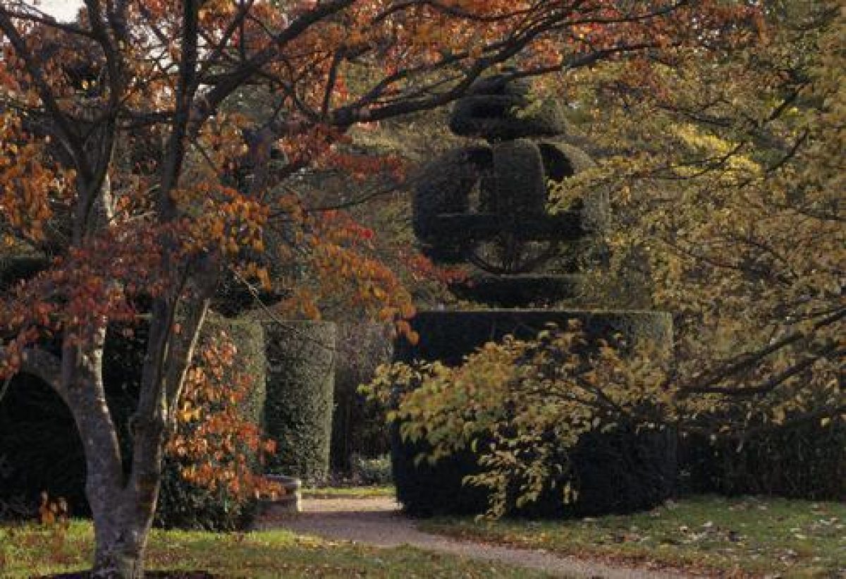
On the north-west side of the house and Main Lawn is the c 0.65ha Wall Garden which is enclosed on its north-east, north-west and south-west perimeters by castellated brick walls. It is laid to lawns dotted with specimen trees and is quartered by paths, the 80m long main, north-west to south-east path flanked by flower borders. The central crossing point of the paths features a marble fountain and basin (which had replaced a former sundial by 1909) framed by four topiary yew orbs. North-west of the Wall Garden the main path, lined by mixed summer borders, continues on a straight course, passing on its north-east side the circular, yew-hedge-enclosed Rose Garden. Laid out in 1989, on the site of Maud Messel's rose garden of the 1920s, it is quartered by gravel paths and embellished with pergola arches and a central fountain. North of the Rose Garden and laid out in the form of an east-facing horseshoe on the crest and eastern slopes of the ridge is the Pinetum which, planted by Ludwig Messel from 1895, has been almost completely replanted since its destruction in the storm of 1987. A path running around the western and northern perimeter of the Pinetum (with a small temple designed by Alfred Messel in 1917) returns along the eastern boundary of the gardens (towards the house) where it runs along the Lime Walk, the present trees planted in the early C20 on the line of a walk or drive shown established in 1874 (OS 1st edition). South-west of the Pinetum and enclosed from it and from the Tea Garden to the north-west by tall, clipped holly hedges is the Top Garden which, begun by Ludwig Messel in the early C20, is planted with specimen trees and shrubs.
On the south-west side of the B2114 an area of former semi-natural woodland, from which there are extensive views to the South Downs, is planted with conifers and an understorey of shrubs including rhododendrons. Now (1997) the Wild Garden, the woodland was planted up in the mid C20 by Colonel Messel as trial areas and nursery beds and was known as The Rough.
PARK
The park lies below the gardens on the steep, east-facing slopes of the ridge and on the continuation of its crest to the south-east of the gardens. The upper slopes are open in character with a few isolated mature oaks and a few clumps, some of these, at the south-east end, planted after the 1987 storm. On the lower slopes and merging with the adjacent woodland, the present loose scatter of trees forms part of Ludwig Messel's collection of exotics planted in the early C20.
KITCHEN GARDEN
The kitchen garden lies at the extreme south-east end of the site and forms a c 40 x 50m stone- and brick-walled enclosure, with a gardener's cottage built into the south-west wall and with remnants of a glasshouse on the outer side of the south-east wall. Shown established in 1874 (OS 1st edition), it is now (1997) leased as separate, domestic accommodation.
REFERENCES
Country Life, 72 (10 September 1932), pp 292-7; (17 September 1932), pp 320-5; (24 September 1932), pp 346-52
P Coats, Great Gardens of Britain (1963), pp 119-21
I Nairn and N Pevsner, The Buildings of England: Sussex (1965), p 479
T Wright, Gardens of Britain 4, (1978), pp 163-70
Nymans, Storm Damage Grant Aid Report, (National Trust 1987; 1991)
Nymans, guidebook, (National Trust 1992; 1997)
Maps
OS 6" to 1 mile: 1st edition surveyed 1874, published 1879; 2nd edition published 1899; 3rd edition published 1912
OS 25" to 1 mile: 3rd edition published 1911
Description written: January 1998
Edited: June 2000
- Visitor Access, Directions & Contacts
- History
The following is from the Register of Parks and Gardens of Special Historic Interest. For the most up-to-date Register entry, please visit the The National Heritage List for England (NHLE):
www.historicengland.org.uk/listing/the-list
HISTORIC DEVELOPMENT
Nymans probably took its name from the family of Robert le Nynweman or Nyman in the early 14th century. The land was bought by William Portyer in 1323-4 then, from 1597 until the end of the 17th century, it was owned by the Gatland family who built on the site of the present house. In 1799 the estate was inherited by Elizabeth Ellyat, subsequently passing through the hands of several owners including, from 1839 to 1852, those of George Harrington who largely rebuilt the house, considerably enlarged the estate and began planting shelter belts of trees and shrubs. In 1890, Nymans was purchased by Ludwig Messel, who extended the house and, influenced by Sir Edmund Loder at Leonardslee and William Robinson at Gravetye (see description of both these sites elsewhere in the Register), laid out the structure of the present gardens. On his death in 1916, Nymans was inherited by his son, Colonel Leonard Messel and his wife Maud, who again rebuilt the house and further developed the gardens with a wide range of newly introduced plants, particularly those from the southern continents brought back by Harold Comber (the son of Ludwig Messel's head gardener, James Comber). On Colonel Messel's death in 1953, Nymans became the home of his daughter Anne, Countess of Rosse and her husband and in 1954, Lord Rosse conveyed Nymans to the National Trust although continuing to direct and develop the gardens. Lord Rosse died in 1979, and since the death of the Countess of Rosse in 1992 the gardens have been managed by the Trust.
- Associated People
- Features & Designations
Designations
The National Heritage List for England: Register of Parks and Gardens
- Reference: GD1057
- Grade: II*
Features
- Ruin
- Lake
- Walk
- Tree Avenue
- House (featured building)
- Description: The house was re-built after 1916.
- Earliest Date:
- Rose Garden
- Planting
- Description: Heather garden.
- Planting
- Description: Roack garden.
- Tree Feature
- Description: Arboretum
- Border
- Description: Summer border.
- Temple
- Gardens
- Key Information
Type
Garden
Purpose
Ornamental
Principal Building
Domestic / Residential
Survival
Extant
Hectares
26
Open to the public
Yes
Civil Parish
Cuckfield Rural
- References
References
- {English Heritage Register of Parks and Gardens of Special Historic Interest}, (Swindon: English Heritage, 2008) [on CD-ROM] Historic England Register of Parks and Gardens of Special Historic Interest
- Nairn, I. and N. Pevsner, {The Buildings of England: Sussex} (Harmondsworth: Penguin Books, 1965), p. 479 The Buildings of England: Sussex
- Wright, T., {The Gardens of Britain 4: Kent, East & West Sussex and Surrey} (London: Batsford, 1978), pp.163-70 The Gardens of Britain 4: Kent, East & West Sussex and Surrey
- Landscape Agency (Cotter Craig, Sarah) {Nymans: Conservation Management Plan} (2010) Nymans: Conservation Management Plan
- Related Documents
-
CLS 1/455
Archaeological and Historic Landscape Survey - Hard copy
Richard James and Christopher Whittick, on behalf of Archaeology South-East - 2008
-
CLS 1/456
Archaeological and Historic Landscape Survey: Appendices 1 -21 and Illustrations - Hard copy
Richard James and Christopher Whittick, on behalf of Archaeology South-East - 2008
-
CLS 1/457
Conservation Management Plan - Hard copy
The Landscape Agency - 2008
-
CLS 1/192/1
1987
-
CLS 1/1190
Conservation Management Plan (extracts) - Digital Copy
The Landscape Agency - 2009
-
CLS 1/455