Introduction
Mowbray Park is a public park laid out by the borough council in the 1850s.
Terrain
A rectangular site in a densely residential area.
The following is from the Register of Parks and Gardens of Special Historic Interest. For the most up-to-date Register entry, please visit The National Heritage List for England (NHLE):
A municipal park laid out by the Borough in the 1850s, opened in 1857 and extended in the 1860s.
Location, Area, Boundaries, Landform and Setting
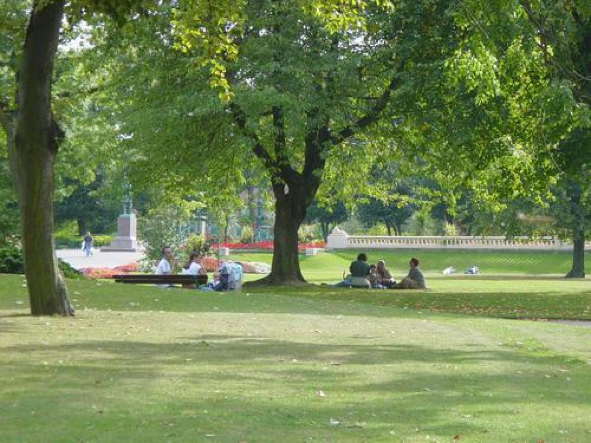
Mowbray Park occupies a 7 ha, approximately rectangular site in a densely residential area close to Sunderland town centre. It is divided by the railway cutting it into two halves: Mowbray Extension Park to the north, and Mowbray Park to the south. The Extension Park extends south from the museum and library building and the Mowbray Park Hotel on Borough Road (both outside the area here registered); Mowbray Park occupies the area south from the railway to Park Road. The west and east boundaries of the whole park are formed by Burdon Road and Toward Road respectively.
Entrances and Approaches
he main entrance to Mowbray Park adjoins the lodge on Toward Road, at the south-east corner of the site. A stretch of park boundary railings (c 1856, listed grade II) c 100m in length survives, extending from here north to the railway, fronting the former nursery area which occupies the north-east section of the park. A further lodge has been built (mid C20) within the park, 20 m to the north-west of the original.
A second entrance is now (1999) provided via the mid C20 bridge over Burdon Road which links the park to the Civic Centre to the west. This gives access at the north-west quarter of the site where the ground is landscaped into a series of undulating mounds. This landscaping was achieved through the use of spoil resulting from the excavation of a railway tunnel which runs south-east to north-west under the park.
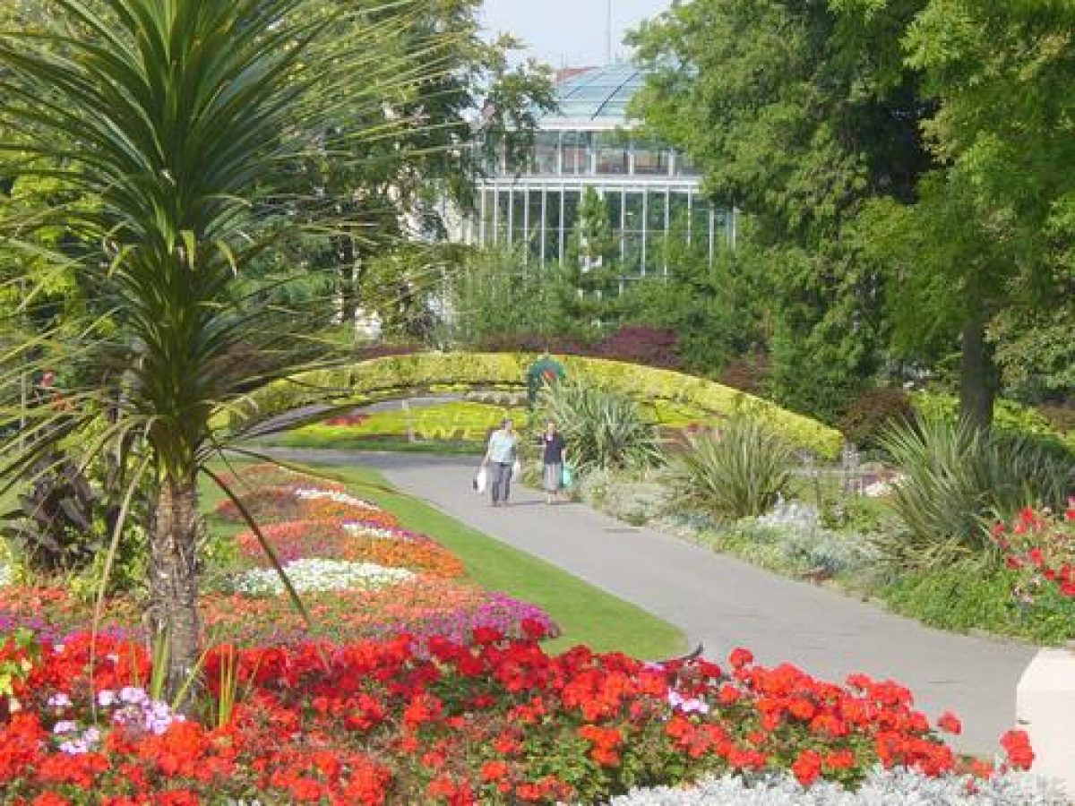
A balustraded terrace walk forms the northern boundary of the Extension Park, entrances to it leading in from the public street at both west and east ends. The park formerly extended further north from the terrace walk, surrounding the museum and library and it was here that the former Winter Garden stood (OS 1897). Immediately to the south of the balustrade along the southern edge of the terrace walk lies a serpentine lake with three small islands. Paths at either end of the terrace lead south past the east and west ends of the lake into the park, across lawns planted with trees and shrubs.
Gardens and Pleasure Grounds
At the centre of Mowbray Extension Park, backed to the north by a raised display bed, stands a cast-iron drinking fountain (dated 1878, listed grade II), manufactured by Glenfield & Kennedy Ltd, Kilmarnock and presented by the Manchester Unity of Oddfellows in 1878 as a memorial to William Hall, one of their members. Close by lies a bowling green with pavilion, adjacent and to the west of which is a tennis court. The Central Avenue leads south from the drinking fountain, bisecting the lawns, to a bronze statue of John Candlish (1815(74), MP for Sunderland, which stands on a granite plinth (Charles Bacon, listed grade II) and was erected in 1875. This stands to the north side of a raised, balustraded walk (the original balusters have been replaced). The walk, terminated by stone dogs at either end, runs parallel to the railway, joining the paths along the west and east sides of the Park.
In Mowbray Park a network of paths runs through the mounds which increase in height towards the south end of the site and continue in a band across to the south-east quarter of the park. A feature is made out of a portion of medieval arch (listed grade II) thought to have been removed from the courtyard of Bishopwearmouth Rectory (demolished 1856). The ground rises steeply towards the south-west corner of the park to form a rocky cliff. On the summit, from where there are extensive views, is a statue (listed grade II) of General Henry Havelock (1775-1857) by Behnes, 1861. The land falls steeply as a grass slope, Building Hill, from the cliff south to Park Road.
On top of the highest point at the north-west corner of Mowbray Park stands a bronze statue (listed grade II) by Percy Wood of Jack Crawford (1775-1831), Hero of Camperdown (11 October 1797). Commissioned in 1889 and paid for by public subscription, it was unveiled in 1890. A War Memorial designed by R A Ray and erected in 1922 stands set back from Burdon Road on the west side of the park.
The two halves of the Park are linked by a cast- and wrought-iron footbridge (listed grade II) erected over the railway cutting in 1866.
Maps
- OS 6" to 1 mile: 2nd edition published 1897
Description written: November 1999
Edited: July 2000
- Visitor Access, Directions & Contacts
Access contact details
This is a municipal park for general public use.
Owners
Sunderland City Council
Civic Centre, Burdon Road, Sunderland, SR2 7DN
- History
The following is from the Register of Parks and Gardens of Special Historic Interest. For the most up-to-date Register entry, please visit the The National Heritage List for England (NHLE):
www.historicengland.org.uk/listing/the-list
HISTORIC DEVELOPMENT
The original site, at first known as People's Park, was acquired by the Borough in 1854/5 as part of the development of the railway; a grant of £750 was obtained towards the cost of the land, part of the Building Hill site, which was secured in 1854. The gardener to Lord Londonderry, Mr Lawson, and Joseph Smith who had worked at Chatsworth were responsible for laying out the park, which opened in 1857 and was later renamed Mowbray Park.
In the 1860s, land north of the railway was identified as suitable for an extension to the park, but although the council agreed to the purchase, many ratepayers were unhappy about the expense. The government sent Robert Rawlinson, who had been responsible for a Public Health enquiry in 1849, and it was on his recommendation that the land was purchased. Following a competition, the park was extended northwards towards the town by James Lindsay (who had not submitted a design), the new addition being known as Mowbray Extension Park. It was opened in July 1866.
Formerly, the Extension Park was overlooked by a vast Winter Garden built and opened in 1879, which stood at the north-west corner of the site, to the south of the museum and library, on the site of the present library (1960s). It was damaged by wartime bombing in 1941 and demolished the following year.
The park remains (1999) in public use and ownership.
Period
- Post Medieval (1540 to 1901)
- Victorian (1837-1901)
- Associated People
- Features & Designations
Designations
The National Heritage List for England: Register of Parks and Gardens
- Reference: GD2391
- Grade: II
The National Heritage List for England: Listed Building
- Reference: Cast iron drinking fountain
- Grade: II
The National Heritage List for England: Listed Building
- Reference: medieval arch
- Grade: II
The National Heritage List for England: Listed Building
- Reference: Park railings
- Grade: II
The National Heritage List for England: Listed Building
- Reference: statue of General Havelock (Behnes)
- Grade: II
The National Heritage List for England: Listed Building
- Reference: statue of Jack Crawford (Percy Wood)
- Grade: II
Features
- Gate
- Lake
- Description: a serpentine lake with three small islands
- Cascade
- Drinking Fountain
- Description: cast-iron drinking fountain (dated 1878, listed grade II)
- Earliest Date:
- Bandstand
- Description: Replica of the 1883 bandstand.
- War Memorial
- Description: War memorial with a winged figure of Victory on top of a tall polished Tuscan column.
- Earliest Date:
- Latest Date:
- Statue
- Description: Statue (listed grade II) of General Henry Havelock (1775-1857)
- lodges
- Description: Lodge by the main entrance and a lodge (mid C20) within the park.
- Statue
- Description: Statue of Jack Crawford (1775-1831), Hero of Camperdown (11 October 1797)
- Arch
- Description: portion of medieval arch (listed grade II) thought to have been removed from the courtyard of Bishopwearmouth Rectory (demolished 1856)
- War Memorial
- Description: Memorial erected in 1922
- Gardens
- Pavilion, Leisure and sport facilities
- Description: a bowling green with pavilion, and a tennis court
- Bridge
- Description: Cast- and wrought-iron footbridge (listed grade II)
- Key Information
Type
Park
Purpose
Recreational/sport
Principal Building
Parks, Gardens And Urban Spaces
Period
Post Medieval (1540 to 1901)
Survival
Extant
Hectares
7
Open to the public
Yes
- References
References
- {English Heritage Register of Parks and Gardens of Special Historic Interest}, (Swindon: English Heritage, 2008) [on CD-ROM] Historic England Register of Parks and Gardens of Special Historic Interest
- Conway, H., {People's Parks: The Design and Development of Victorian Parks} (Cambridge: Cambridge University Press, 1991), pp. 94, 96, 140, 156, 158, 177, 230 People's Parks: The Design and Development of Victorian Parks in Britain
- History of Sunderland (1919)
- History of Sunderland (1973)
- Wearmouth Heritage
- Discovering Sunderland
- The Opening of the New Park, Sunderland, Tuesday July 10, 1866
- (1991), pp 94, 96, 140, 156, 158, 177, 230 People's Parks
- (Tyne and Wear Specialist Conservation Team 1995), pp 35-6 A Guide to the Historic Parks and Gardens of Tyne and Wear,