Introduction
Lytham Hall is set within an 18th-century landscape park and woodland, on a site that dates back to the medieval period. At its most extensive the estate covered about 200 hectares, but is now reduced to about 31 hectares. It is now undergoing restoration.
Terrain
The park is situated in level, slightly rolling land.www.historicengland.org.uk/listing/the-list
Gardens and pleasure grounds with elements dating from the mid- to late 18th century or earlier, and from the early 19th century; parkland of the 19th century.
DESCRIPTION
LOCATION, AREA, BOUNDARIES, LANDFORM, SETTING
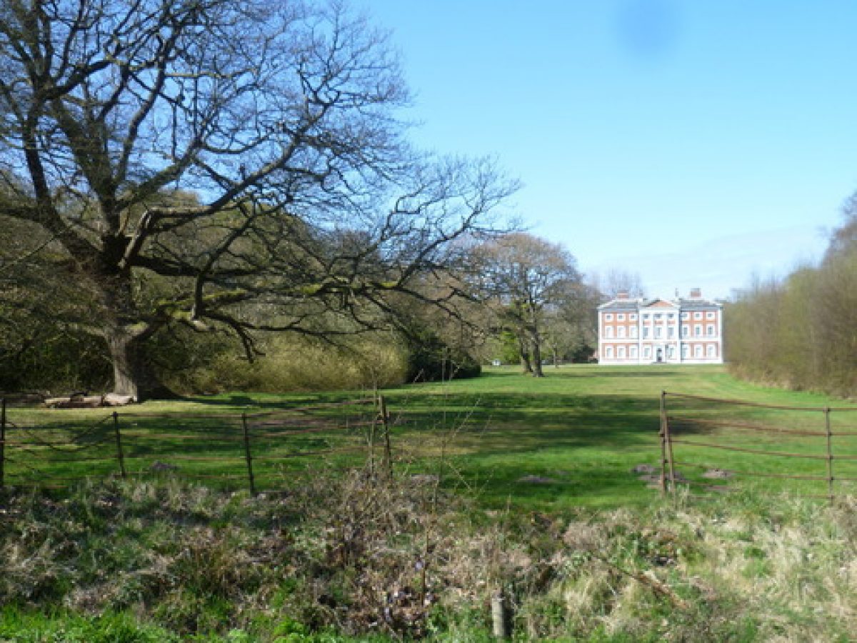
Lytham Hall is situated on the north side of Lytham, c 1km north-west of Lytham Station. The site is bounded by residential areas on the south side, tree belts around a golf course on the west side and fencing on the line of the Liggard Brook on the north and north-east sides. The park is situated in level, slightly rolling land. The boundary was originally formed by a cobble wall which extends north-east for c 600m from the main entrance. Traces of the wall can be seen along the old line of the boundary on the south side of the site, but housing estates have encroached within the parkland on the south and west sides and are divided from the park by C20 fencing.
ENTRANCES AND APPROACHES
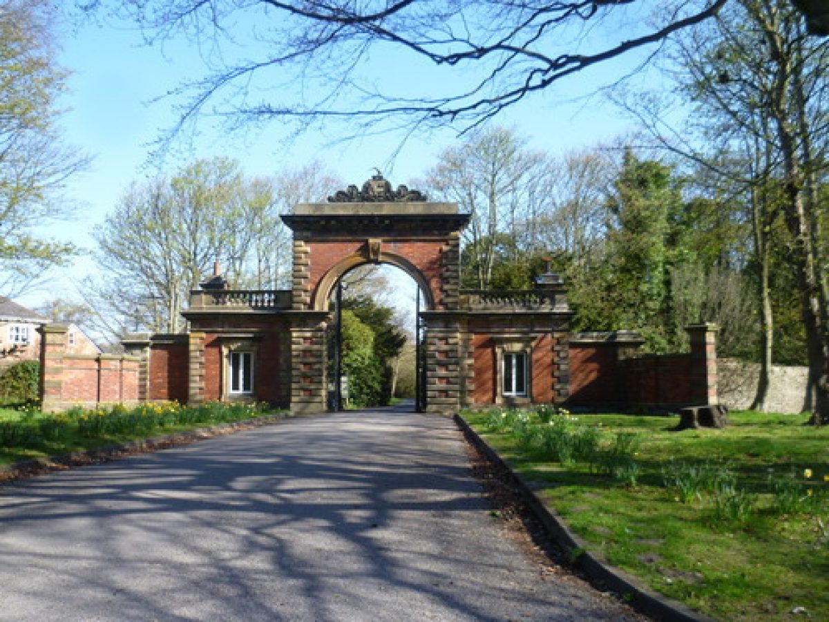
The principal entrance to the site is from Ballam Road, c 100m north-east of Lytham Station. A drive branches north-west from Ballam Road and leads to an entrance archway with lodges (listed grade II), which were moved to this position following the construction of the Blackpool & Lytham Railway in 1861-3. This leads to a curving drive which runs north-west to ornamental iron gates with primary and secondary ironwork piers flanked by railings (early C19, listed grade II) which are situated c 300m south-east of the Hall. Immediately south of this secondary entrance is the site of Hull Lodge, which has been replaced by a late C20 building. The drive continues to the Hall; this is the only access to the Hall now in use. The entrance and drive were laid out by Edward Kemp (1817-91) and he described them in the third edition of How to Lay Out a Garden, published in 1864.
There are a number of entrances to the parkland. The route which formed the main approach to the Hall and farm is shown on Yates? county map of 1786, when it was the main route to Higher Ballam. The lane ran northwards from Lytham passing within 200m of the principal, east front of the Hall. The line of the route is marked by a ditch running east of the Hall, but there is no other trace of it in the southern part of the park. Some 400m north-east of the Hall it is present in the form of a farm track which leads north from Watchwood Drive c 100m west of the home farm. It continues northwards and crosses the Liggard Brook c 1.4km north of the Hall. This was the site of Bowgrave Lodge which is marked on the large-scale OS map surveyed 1891 but not on the 1st edition surveyed 1844.
The other main route through the park, also shown on the 1786 county map and the 1844 OS map, divided from the old Ballam road just outside Lytham and ran north-west to the junction of Blackpool Road and Regent Road, c 1.3km north-west of the Hall. This route has largely disappeared, but the remains of a lodge, called Shepherd?s Lodge, survive in Big Wood c 600m north-west of the Hall. The lodge can be reached via a path from the rear of the Hall which appears to follow the line of a track shown on the 1844 OS map. A lodge in this position is shown on Greenwood's county map of 1818, but not on the 1844 map. Another lodge, called Church Lodge (listed grade II), is situated at a former entrance to the park, c 800m south of the Hall in an area now outside the registered site. This drive formerly gave access to St Cuthber'?s church and it survives as a track running south from the Hall to the present park boundary c 320m to the south.
The former home farm, situated c 400m north-east of the Hall, is reached from Watchwood Drive which runs west from Ballam Road to the farm and on through a disused gated entrance to approach the Hall from the north-east. There is a lodge at the head of the drive off Ballam Road which is a gabled building probably of mid or later C19 date. This approach and the lodge are not shown on the 1844 OS map.
The change in the pattern of drives probably relates to the construction of both the railway, shown as a projected line on the 1844 OS map, and the new road to Ballam which is shown on the same map.
PRINCIPAL BUILDING
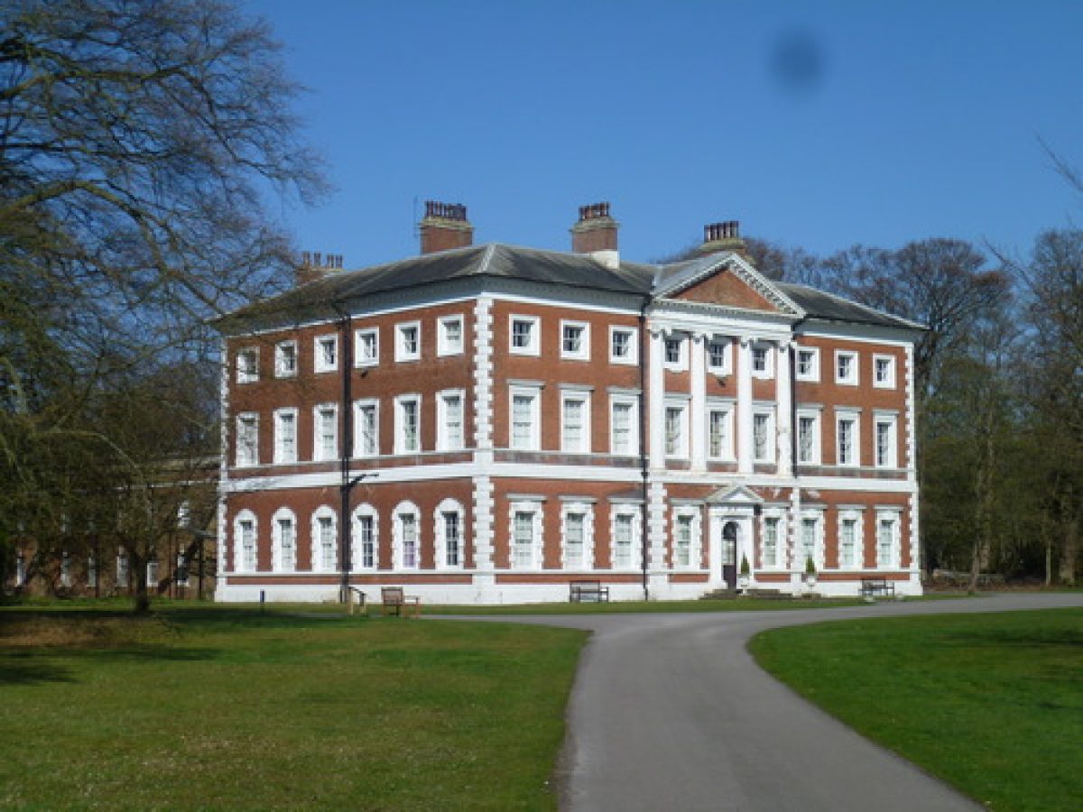
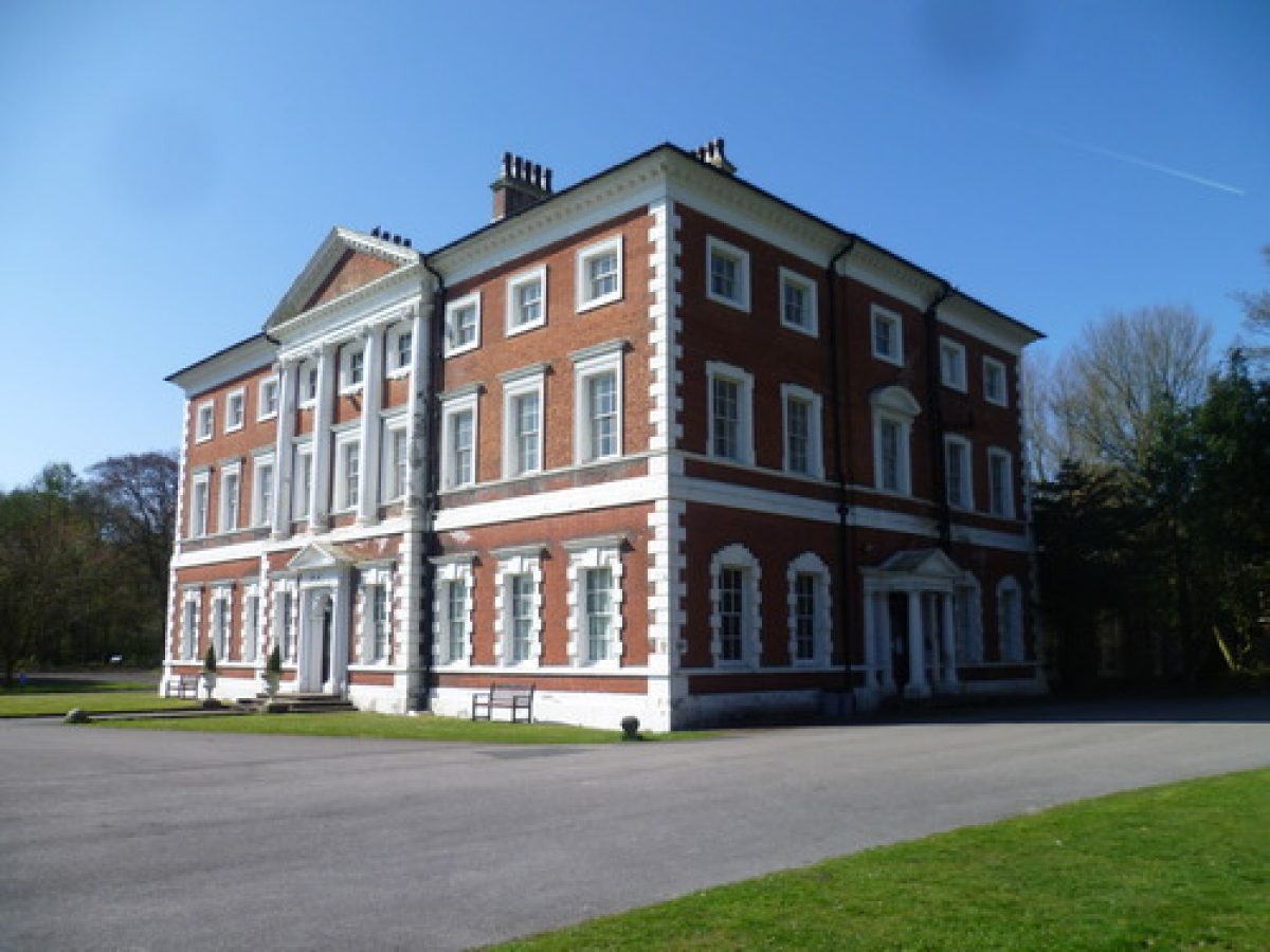
A gabled manor house is shown in a drawing which probably dates from the early C17 (CL 1960, 131). This was replaced when John Carr (1723-1807) built a new house for Thomas Clifton 1757-64, incorporating some elements of the previous building. Lytham Hall (listed grade I) is notable as an early example of John Carr?s work and for its very fine interior and plasterwork. A stable block (1758, listed grade II) is situated c 40m north-west of the Hall and a dovecote (c 1757, listed grade II*) is situated in woodland c 30m north of the stables.
GARDENS AND PLEASURE GROUNDS
The principal, east front of the Hall overlooks a broad lawn which stretches for c 200m to a point at which there is a cast-iron fence and immediately beyond this a sunken water course. This arrangement gives views over parkland beyond. The watercourse is on the line of the old road to Ballam. An estate map of 1789 shows that immediately west of the lane there was a canal with a central semicircular bow aligned with the front of the Hall. The 1840 Tithe map also shows this feature, but subsequent maps do not. On each side of the grassy strip there is woodland. The 1840 map shows that there were two rectangular ponds, one on each side of the vista, but the 1789 map does not include this area. On the north side of the Hall a swathe is cut through woodland to give views of a small lake some 200m distant; the remains of a boathouse shown on the 1891 OS map which is aligned with the north front of the Hall forms the termination of the vista. On the south side of the Hall there is grassland with scattered mature trees. A rectangular car park is situated c 20m south of the Hall. This area was the site of a formal parterre which is shown on the 1891 OS map and in a painting dated 1957 (private collection). It had a pattern of triangular, diamond-shaped and circular beds.
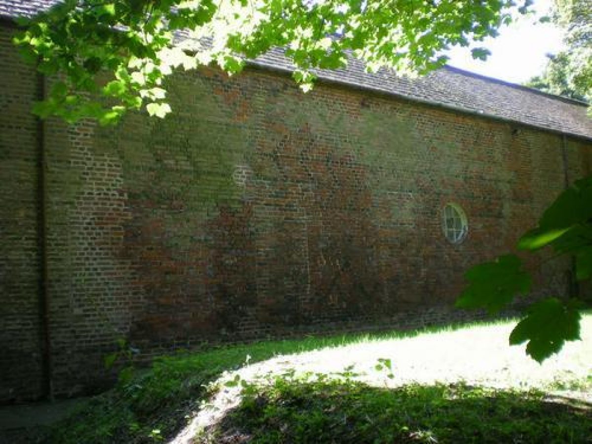
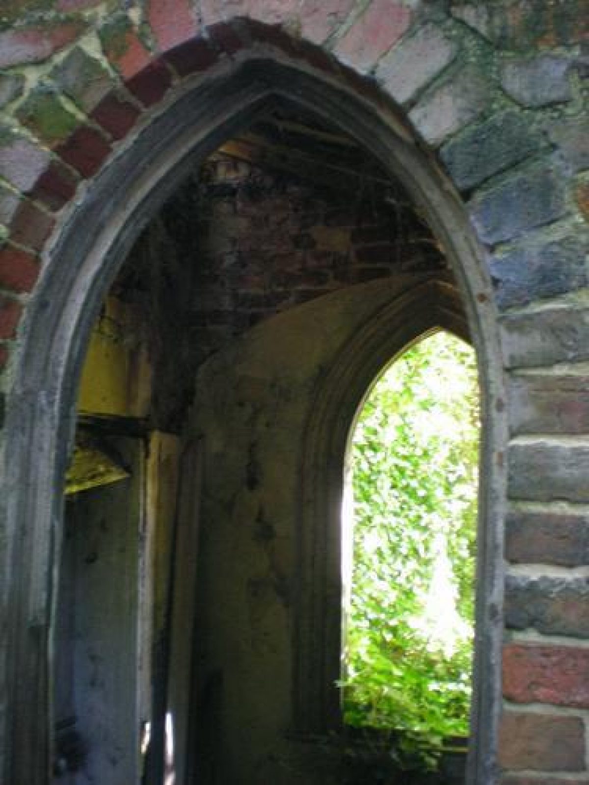
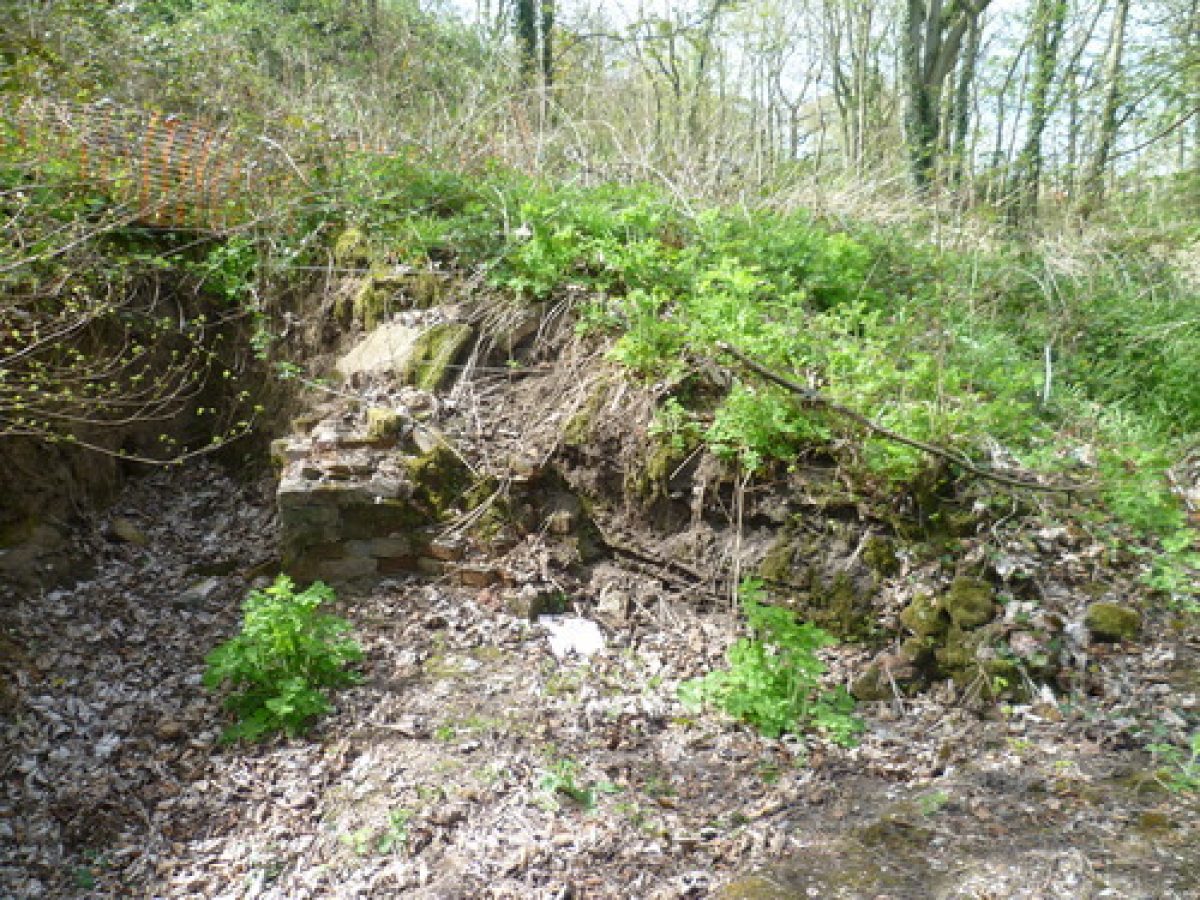
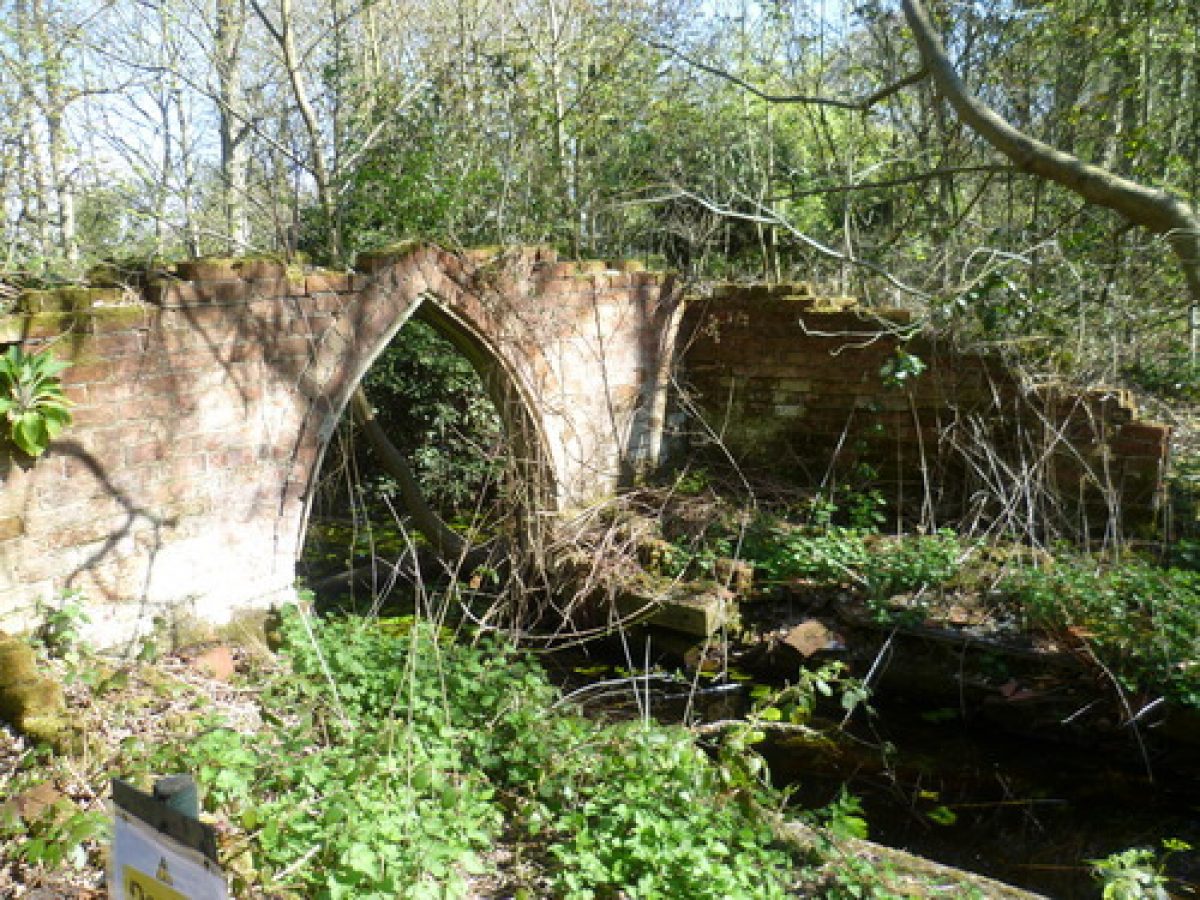
A screen wall (listed grade II), probably of C17 and C18 date, is attached to the south-west rear wing of the Hall and this feature runs southwards for c 60m. Known as Monk?s Walk, it has stepped and triangular buttresses, and attached to the rear (west side) there is a small cottage of C18 date and a privy. The 1844 OS map suggests that the wall continued further south at that time, as far as a high earthen mound called The Mount, which is situated in woodland c 100m south of the Hall. An icehouse is marked on the Hall side of the mound on the 1844 OS map, which also shows a wall or other boundary running around the mound and continuing at right angles eastwards. Traces of the line of this boundary are shown as a scarp on the 1891 OS map. This raises the possibility that the screen wall is the remains of a large walled garden. The Mount is shown on Yates' map of 1786. Some 50m west of it there is a large, almost circular pond, called Curtains Pond.
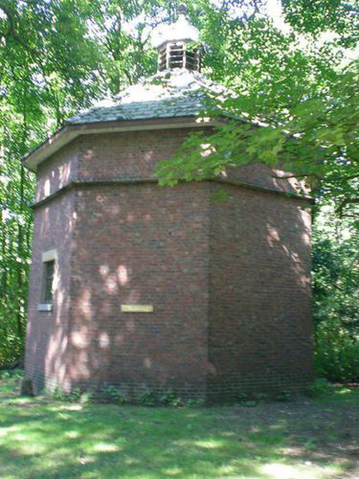
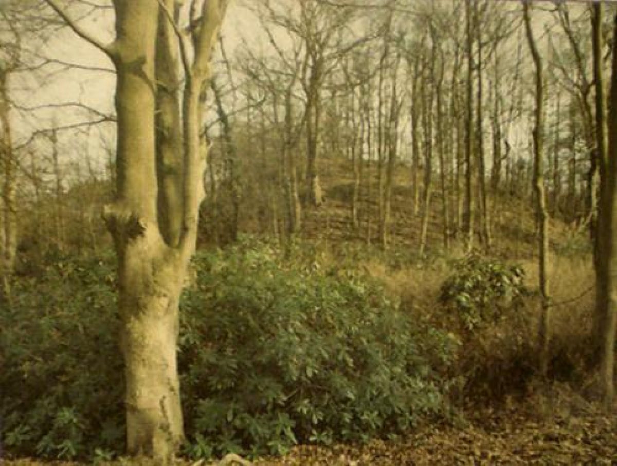
The remaining pleasure grounds, to the west and north of the Hall, consist of woodland with sinuous paths leading through it. Greenwood's map of 1818 shows woodland around the Hall. A dovecote (later C18, listed grade II*) is situated in woodland c 70m north-west of the Hall.
PARK
The parkland on the east side of the Hall consists of open grassland, used for pasture, with some drifts and clumps of trees, much as shown on the 1844 OS map. The 1840 Tithe map shows this area as enclosed fields. To the west Fairhaven Golf Course, formed during the 1930s, is protected by shelterbelts along its perimeter. Land to the north and east as far as Ballam Road and the Liggard Brook is now (1997) in use as arable land and for pasture. The boundaries and some of the planting are shown on the 1891 OS map.
An undated map entitled 'Plan of Intended Improvements at Lytham Hall the Property of John Clifton Esq.' shows the park boundaries and perimeter planting much as they are shown on the 1891 OS map, but the pattern of driveways is different. John Clifton died in 1832, but the 1844 OS map shows that the plans for imparkment had not been fully executed as enclosed fields are shown to the north of the former line of Watchwood Drive and to the south of the approach from Lytham. The park was probably formed during the mid C19.
KITCHEN GARDEN
The kitchen garden, which was situated immediately north of the home farm, c 400m north-east of the Hall, has disappeared apart from a short section of wall which is said to survive amongst late C20 farm buildings (Lytham Town Trust). It is shown on the 1891 OS map but not on the 1844 map, at which time a kitchen garden or orchard was situated c 600m south-east of the Hall.
REFERENCES
E Kemp, How to Lay Out a Garden (3rd edition 1864), pp 340-3
C J Holme, Gardens of England in Northern Counties (1911), plates 94-5
Country Life, 127 (21 July 1960), pp 131-3; (28 July 1960), pp 188-91
N Pevsner, The Buildings of England: North Lancashire (1969), p 174
Maps
W Yates, The County Palatine of Lancaster, 1786
R Parkinson, Lytham in the County Palatine of Lancaster?[illegible], 1789 (DDCL 1/232/2, box 106), (Lancashire Record Office)
C Greenwood, The County Palatine of Lancaster, 1818
A Plan of the Intended Improvements at Lytham Hall the Property of John Clifton Esq., no date (pre 1832) (DDCL 1/253/3, box 106), (Lancashire Record Office)
Tithe map for Lytham, 1840
OS 6" to 1 mile: 1st edition surveyed 1844
OS 25" to 1 mile: surveyed 1891; 1932 edition
Description written: June 1997
Amended: August 1998
Edited: March 1999
- Visitor Access, Directions & Contacts
Telephone
44 1253 736652Website
https://www.lythamhall.org.ukAccess contact details
The grounds are open on three days per week between Easter and October. Group visits can be arranged throughout the year. Please see: http://www.lythamhall.org.uk/
Directions
North of Lytham, on the Fylde coast.
Owners
Lytham Town Trust
- History
The following is from the Register of Parks and Gardens of Special Historic Interest. For the most up-to-date Register entry, please visit the The National Heritage List for England (NHLE):
www.historicengland.org.uk/listing/the-list
HISTORIC DEVELOPMENT
Lytham Hall was the site of a Benedictine foundation of around 1189. Following the Reformation it changed hands several times until it passed to Sir Cuthbert Clifton, who was a member of a prominent local land-owning family associated with the area since the mid-12th century. The estate remained in the Clifton Family until the later 20th century when it was sold and the Hall was subsequently used as offices. The site passed to the Lytham Town Trust in 1996.
- Associated People
- Features & Designations
Designations
The National Heritage List for England: Register of Parks and Gardens
- Reference: GD1947
- Grade: II
Features
- Lawn
- Specimen Tree
- Ornamental Pond
- Dovecote
- Description: The dovecote has 850 nesting boxes and a revolving ladder to aid the collection of eggs.
- Entrance
- Statue
- House (featured building)
- Description: The house was built for Thomas Clifton.
- Earliest Date:
- Latest Date:
- Boat House
- Stable Block
- Description: The stable block probably originates in the the 17th century with 18th, 19th and 20th century alterations.
- Earliest Date:
- Mount
- Key Information
Type
Park
Purpose
Ornamental
Principal Building
Domestic / Residential
Survival
Extant
Hectares
31
Open to the public
Yes
Civil Parish
Saint Anne's on
- References
References
- {English Heritage Register of Parks and Gardens of Special Historic Interest}, (Swindon: English Heritage, 2008) [on CD-ROM] Historic England Register of Parks and Gardens of Special Historic Interest
- Holme, C. (ed), {The Gardens of England in the Northern Counties} (London: The Studio, 1911), plates 94-5 The Gardens of England in the Northern Counties
- Hartwell, Clare and Pevsner, Nikolaus {The Buildings of England: Lancashire : North} (London: Yale University Press, 2009) The Buildings of England: Lancashire : North