Introduction
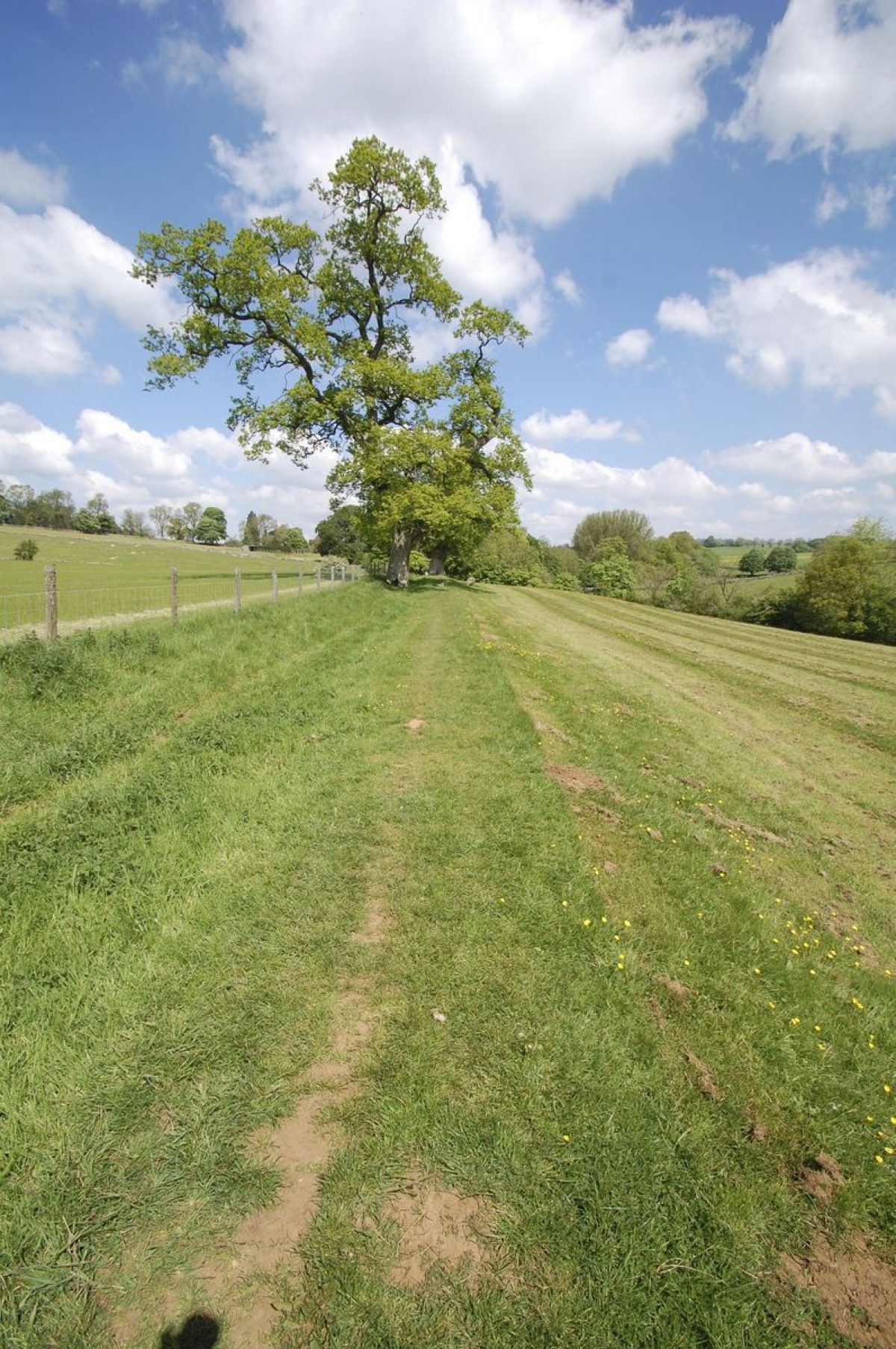
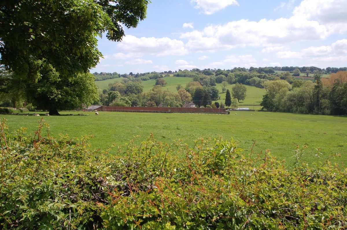
Lower Swell Park was created in the 13th century. Initially it was 200 acres, but it was enlarged by another 50 acres at the end of the century. The park was clearly defined for almost its entire perimeter by roads and this area remains a clear and coherent sweep of land. After Alfred Sartoris bought the park in 1867, he built a new house which he called Abbotswood after the field in which it was built. This is now renowned for its gardens.
- Visitor Access, Directions & Contacts
Access contact details
The site is open twice a year under the National Gardens Scheme.
- History
The creation of a park in Lower Swell was recorded by the jurors giving evidence to the King's commissioners in 1275 on local liberties and the misdeeds of officials, a record subsequently known as the Hundred Rolls; they said that twenty-two years earlier Richard Earl of Cornwall had made a park through the middle of which the King's Highway ran. This dates its creation to 1253. David Royce, a noted antiquarian and historian and vicar of Lower Swell 1850-1902, said that traces of the old road could still be seen ‘in the midst of the park'. The road was re-routed; consequently the park was bounded round nearly the whole perimeter by roads as it is today.
Richard died in 1272. His son, Edmund, gave Hayles abbey 'his park of Swelle by Stowe, with growing wood and all the pasture of the said park', adding to the estate given earlier by his father to the abbey he had founded. At this time it was said to be 200 acres, and another 40 acres was added in 1294. In 1321 'le Parke' was said to be 250 acres (101 ha) of land, meadow, wood and pasture, suggesting that the inclosed area was not one undivided sweep of land. There is no evidence of how the abbey used the park. In 1535 it had 600 sheep pastures in Lower Swell, but these were maintaining the fertility of arable fields; the same number, 600, is later recorded being pastured or feeding on the arable belonging to The Bold in the west of the parish at Murden Leasowe (Swell Wold Farm). When the estate was conveyed to the bishop of London in 1545, following the dissolution in 1539 of Hayles abbey, there was a sheep house in one of the fields in the park, probably in the field called 'Stall Park', the site also of a Roman villa. But the name 'Abbots Wood' was an alternative name for the park in the 17th century, suggesting wood was a prominent characteristic.
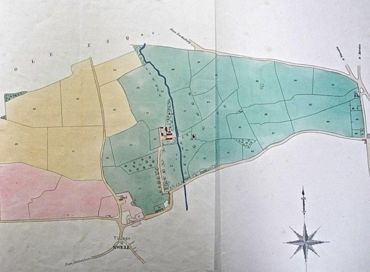
From the time that Sir Robert Atkyns purchased the estate in 1659, leases and a marriage settlement give more information on the field names in the park, and these can be located on the first available map and schedule of 1844 when the estate was sold. Another sale in 1865 reproduced the same map. There is a good correspondence between the early statements about the extent of the park and the deductions which can be made from the map and schedule of fields and their areas. A lease of 1683 indicates the existence of an Upper Park of 100 acres (40 ha); this appears to fit to a fairly marked boundary running north to south across the park. The Upper Park reached to the Fosse Way and the lessee was Joseph Keetch, innkeeper in Stow on the Wold, who was probably at The Unicorn on the other side of the road. He used a small part of the Upper Park to create a bowling green. When the lease was renewed, it referred also to the Middle Park of 25 acres (10 ha), and this corresponds with two fields called The Paddock and Oxleys, where Abbotswood house and gardens are now situated.
Sir Robert Atkyns' son, also called Sir Robert, inherited the Lower Swell estate in 1710. As the author of The ancient and present state of Glostershire (1712), he described it modestly:
‘Sir Robert Atkyns of Saperton is the present Lord of the Mannor, and has a pleasant Seat, situated upon the Bank of a delightful River, and a large Park of rich Ground adjoyning to it.'
But he commissioned an engraving from Johannis Kyp illustrating the house which his father had built, and with its bird's eye view of the surroundings, this, too can be compared with the information on the 1844 map.
The Kyp engraving shows a square Queen Anne-style house, with gardens and a large number of wooded coverts in the surrounding area. There are deer in a field which can be identified as Ladywell. A long, thin garden beside the house corresponds to the Old Orchard, while an orchard, newly-planted in regimented straight lines, can be identified on the far side of the access road. To its south there is Searcham coppice. A tall octagonal building with gothic points at the top of each side looks like the Pigeon house, at the edge of Pigeon House coppice. A bridge over the weir on the Dikler leads to the stable yard, with a coach and horses just arriving. Various barns and outbuildings near to the house, and the bridge across the Dikler, correspond precisely with details in the later map. The one detail missing from the 1844 map is the house. It was apparently demolished and a less pretentious farmhouse built about 1800 adjacent to one of the buildings in the Kyp engraving.
Surveys of the Atkyns' estate made in 1774 and 1786 included field names. The first records the mansion house called The Bold, buildings, barns, stables, gardens, orchard and Lady Well Meadow, the Old Orchard and Mill Hill, in all 25 ½ acres, leased to Thomas Horde, a possible heir to the estate; this block of land clearly formed the curtilege of the house with the park beyond it. The survey named Spring Park, 1 acre, Hill Park, Lower, Middle and Upper Stepstones, the two Sidelong parks, two cowpens, and Searcham and Bromsgrove, about 120 acres, all mowing or pasture ground; and three closes of meadow, Oxleasowe and the Paddock, about 25 acres, where Abbotswood was built. Apart from the Stepstones, all these field names can be located. The Stepstones were probably where there are large stepping stones over the Dikler, and the Sidelongs parks may have skirted the old road. The 40 acres added to the park in 1294 appear to be west of the approach road to The Bold, reaching to the churchyard, and would have rounded off the park, also giving privacy to the house.
The 1865 sale particulars advertised the estate as ‘an excellent farm residence adapted for a hunting box', ‘commanding a picturesque view of the finely timbered Park, with Lawn, Pleasure Grounds, and productive Garden, intersected for a considerable distance by a noted trout Stream'. The park was ‘undulating and richly timbered' and the trout stream was ‘stored with fish'. The owner had exclusive rights of fishing and shooting over the estate. A drawing of the house shows a Georgian building adjacent to an older and more modest house which looks very like part of one of the buildings in the Kyp engraving. The pleasure grounds were laid out in ‘a beautiful lawn, flower beds and shrubberies, with dry gravelled and grass walks, extending to the trout stream, productive kitchen garden, an orchard planted with choice fruit trees in full bearing'. Some of the garden visible in the drawing again corresponds with the Kyp engraving. Most of the area between the Fosse Way to the east and the road between Upper Swell and Lower Swell to the west is coloured green to indicate pasture, 241 acres, and with the Coneygree or rabbit warren, which was probably also in the park, 257 acres (104 ha).
This was the property which Alfred Sartoris decided to leave to the farmer, while he built a new house on the other side of the river. He created a new entrance on the Upper Swell road, built the Lodge, and laid out gardens and woodland walks, including lawned terraces and the sunken tennis lawn. However, in 1901 the estate was sold to Mark Fenwick, a keen gardener, who altered and extended the house and developed the famous Abbotswood gardens.
Sources:
Maps
Glos Arch/D1388/SL3/104, 1844 map, field names and areas listed and matched to map
Glos Arch/SL281, 1865 map, field names and areas listed and matched to map
Archive documents
Glos Arch/D444/T70, Sir Robert Atkyns marriage settlement, 1669
Glos Arch D444/T44, Leases of parts of the park, 1686
Period
Medieval (1066 to 1540)
- Associated People
- Features & Designations
Features
- Garden Building
- Description: The creamery.
- Stable Block
- House (featured building)
- Description: The first house may have been on moated site near Stow road. It was replaced by Farm Place or 'The Bowl' or 'The Bould' in the medieval period. A new mansion was built a little away from the farm by Sir Robert Atkyns in 1671. This was demolished in late-18th century. From 1867 ‘a modern mansion in the tudor style’ (David Royce notes in Bigland) was built called Abbotswood.
- Latest Date:
- Key Information
Type
Park
Purpose
Ornamental
Principal Building
Domestic / Residential
Period
Medieval (1066 to 1540)
Survival
Extant
Hectares
101
Open to the public
Yes
Civil Parish
Swell
- References
References
- Atkyns, Robert {The Ancient and Present State of Gloucestershire} (London: W. Bowyer for Robert Gosling, 1712) p.705-6 The Ancient and Present State of Gloucestershire
- Rudder, Samuel {A new history of Gloucestershire} (Cirencester: S. Rudder, 1779) p. 722 A New History of Gloucestershire
- Bigland, R {Historical, Monumental, and Genealogical Collections relative to the County of Gloucester} (London: Richard Bigland, 1792) Volume 3, p. 1225 Historical, Monumental, and Genealogical Collections relative to the County of Gloucester
- Elrington, C.R. {Victoria County History: Gloucester, Volume 6} (Oxford: Oxford University Press, 1965) p. 165-169 Victoria County History: Gloucester, Volume 6
- Fosbrook, Thomas Dudley {Abstracts of records and manuscripts respecting the county of Gloucester} (Gloucester, 1807) p.400 Abstracts of records and manuscripts respecting the county of Gloucester
Contributors
Anthea Jones