Introduction
Lister Park is a landscaped public park and pleasure grounds. It is located in a primarily residential area of the suburb of Manningham.
Terrain
The roughly triangular area of land slopes down to the east.www.historicengland.org.uk/listing/the-list
A public park laid out between 1870 and 1904 on the site of gardens and a park relating to Manningham Hall probably of late 18th- or early 19th-century date. Lister Park retains a wide range of late 19th- and early 20th-century structures and features including a purpose-built art gallery.
DESCRIPTION
LOCATION, AREA, BOUNDARIES, LANDFORM, SETTING
Lister Park lies c 3km north-west of the centre of Bradford in the suburb of Manningham. The c 22ha site is on land which slopes down to the east in an area which is predominantly residential. The boundaries, which are delineated by a mixture of walling and fences, are formed by Emm Lane to the north, Keighley Road to the east and North Park Road on the west and south-west sides. The roughly triangular area of land conforms in shape with a pattern of holdings shown on a map of 1613.
ENTRANCES AND APPROACHES
On North Park Road there is an entrance with stone gate piers surmounted by urns with wrought-iron gates and secondary iron gate piers (1902-4, listed grade II). The gateway frames a view of the Cartwright Memorial Hall. An entrance with an Italianate lodge (listed grade II) lies at the junction of Keighley Road, North Park Road and Oak Lane, at the southern tip of the site. The entrance has primary and secondary stone gate piers and elaborate wrought-iron gates (listed grade II with the lodge). The gates were erected to commemorate the opening of the Bradford Exhibition in 1904. A path leads north and diverges on each side of a statue of Samuel Lister (listed grade II) which was erected in 1875.
At the north-east corner of the park, at the junction of Emm Lane and Keighley Road, there is a castellated gatehouse (listed grade II) with a central arch flanked by octagonal turrets which are flanked in turn by pedestrian entrances. This structure is called the Norman Arch and was designed by Frank Healey in 1883. A path leading south-west from the entrance diverges on each side of an elaborate pinnacled monument with a statue of Sir Titus Salt (listed grade II) which was erected in front of Bradford Town Hall in 1874 and moved to this position in 1896. There are a number of secondary entrances to the park.
PRINCIPAL BUILDING
The Cartwright Memorial Hall (listed grade II) lies south of the centre of the park. Named after the inventor of the power loom, the Rev Dr Edmund Cartwright, the Hall was designed by Simpson & Allen in 1899 in grand Edwardian Baroque style as an art gallery and museum, in which use it remains (1998). It was opened in 1904 by the Prince and Princess of Wales who also opened an industrial exhibition sited within the park. The building replaced Manningham Hall, the family home of the Listers, which stood immediately east of Cartwright Hall and was demolished to make way for it in 1903. The building replaced one shown some distance to the north-west marked 'William Lister House and Grounds' on the 1613 map.
GARDENS AND PLEASURE GROUNDS
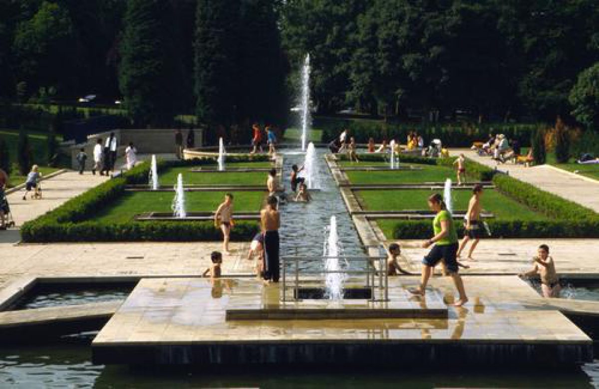
The principal, south front of the Hall overlooks a formal parterre with beds of geometrical shape edged with concrete. The gardens originated with a design published in 1899 by Simpson & Allen which was executed in reduced form. Gradual modifications have changed the shapes of the beds and paths to some extent but the layout does not differ greatly from what is shown on the 1908 OS map. The beds are laid out with carpet bedding (1998) continuing a tradition started in the early years of the C20.
On the west side of the Hall lawns and stone steps lead up to terraced lawns and immediately west of this area is a former nursery with part of a stone wall and some disused ancillary buildings, the glasshouses shown on the 1960 OS map having been demolished. Paths lead from the formal area around the Hall and wind through the park. One of the principal routes running from a secondary entrance on North Park Road and following a slightly curving north-easterly route is close to the line of a road which linked North Park Road (formerly Hesp Road) with Keighley Road. This is shown on the 1850 OS map when it divided an area called Deer Park to the north from Manningham Hall and the southern park and gardens.
Some 120m north-west of the Hall there is a balustraded terrace overlooking the stone base of a bandstand which has steps leading up to the platform and is decorated with stone volutes and wreaths. The bandstand was erected in 1908 replacing one east of Manningham Hall; the canopy was removed during the 1980s because it had become unsafe. Some 200m north-west of the Hall there is a set of three bowling greens with a pavilion which were in place by 1908 and extended during the 1920s. A grassed hollow c 400m north-west of the Hall was the site of a lido demolished in 1980, and immediately north of this is an area called the Botanical Garden, sheltered on its north side by woodland. A pathway leads through an area planted with specimen trees and shrubs, and there are the remains of pathways leading off in a grid pattern. There are some rockery areas and some geological specimens. A stream runs into the area from the west end and divides, with one branch running eastwards along the southern perimeter of the Botanical Garden, and the other running around the west and north sides. A water feature built as a replica of Thornton Force lies at the east end of the garden. The Botanical Garden was laid out to the design of Mr Margerieson and opened in 1903. The aim was to show every family of plants in British flora, later extended to encompass plants from other countries. The geological specimens were arranged to illustrate the geology of the West Riding of Yorkshire starting at the east end of the garden with the earliest rocks. The garden was altered in 1952 and many of the geological specimens were removed during the 1970s.
On the north-east side of the park there is a serpentine lake with four islands which is fed by the stream running around the Botanical Garden which falls as a cascade into the north-west tip of the lake. Perimeter paths lead around the lake and the water flows out as a waterfall at the north-east tip. The lake was one of the first features to be constructed for the municipal park and is shown on a map of 1887/8.
There is a belt of perimeter planting sheltering the park boundaries which probably originated with planting undertaken by Ellis Cunliffe Lister c 1826 though the majority of the trees within the park were planted in the late C19 by Bradford Corporation.
REFERENCES
K Lemmon, The Gardens of Britain 5, (1978), pp 179-80
Lister Park, (Bradford MBC 1998)
Maps
[all reproduced in Bradford MBC 1998]
Map of Manningham, 1613
Map of the Borough of Bradford, 1834
Map of Bradford, 1887-8
OS 6" to 1 mile: 1st edition published 1850
OS 25" to 1 mile: 1st edition published 1889; 2nd edition published 1908
Description written: December 1998
Amended: March 1999
Edited: November 1999
- Visitor Access, Directions & Contacts
Telephone
441274431000Access contact details
This is a municipal park for general public use.
Owners
Bradford Metropolitan District Council
City Hall, Centenary Square, Bradford, BD1 1HY
- History
The following is from the Register of Parks and Gardens of Special Historic Interest. For the most up-to-date Register entry, please visit the The National Heritage List for England (NHLE):
www.historicengland.org.uk/listing/the-list
HISTORIC DEVELOPMENT
The Manningham area was described in a survey of 1311 as a village attached to the township of Bradford. Land in the area was owned by the Lister family in the 15th century who acquired it through marriage to the King family. It remained in family ownership and Ellis Cunliffe Lister settled on the site in 1819. The Listers were prominent industrialists who opened the first of their textile mills in the area in 1838. Samuel Cunliffe Lister inherited in 1853 and he sold the site to Bradford Corporation in 1870 for less than its market value on condition that the land was used to make a public park. Work started in the following year but the basic elements of the layout were not completed until after the erection of the Cartwright Hall in 1904. The site continued as a public park in which use it remained apart from an interval during the Second World War when it was turned to agricultural use. It remains (1998) in the ownership of the City of Bradford Metropolitan District Council.
- Associated People
- Features & Designations
Designations
The National Heritage List for England: Register of Parks and Gardens
- Reference: GD2229
- Grade: II
Features
- Bowling Green
- Lake
- River
- Planting
- Description: Mughal Gardens
- Planting
- Description: Botanical Garden
- Art Gallery (featured building)
- Description: The Cartwright Memorial Hall, a museum and art gallery.
- Earliest Date:
- Latest Date:
- Key Information
Type
Park
Purpose
Recreational/sport
Principal Building
Parks, Gardens And Urban Spaces
Survival
Extant
Hectares
22
Open to the public
Yes
- References
References
- {English Heritage Register of Parks and Gardens of Special Historic Interest}, (Swindon: English Heritage, 2008) [on CD-ROM] Historic England Register of Parks and Gardens of Special Historic Interest
- Lemmon, K., {The Gardens of Britain 5: Yorkshire and Humberside} (London: Batsford, 1978), pp. 179-80 The Gardens of Britain 5: Yorkshire and Humberside